
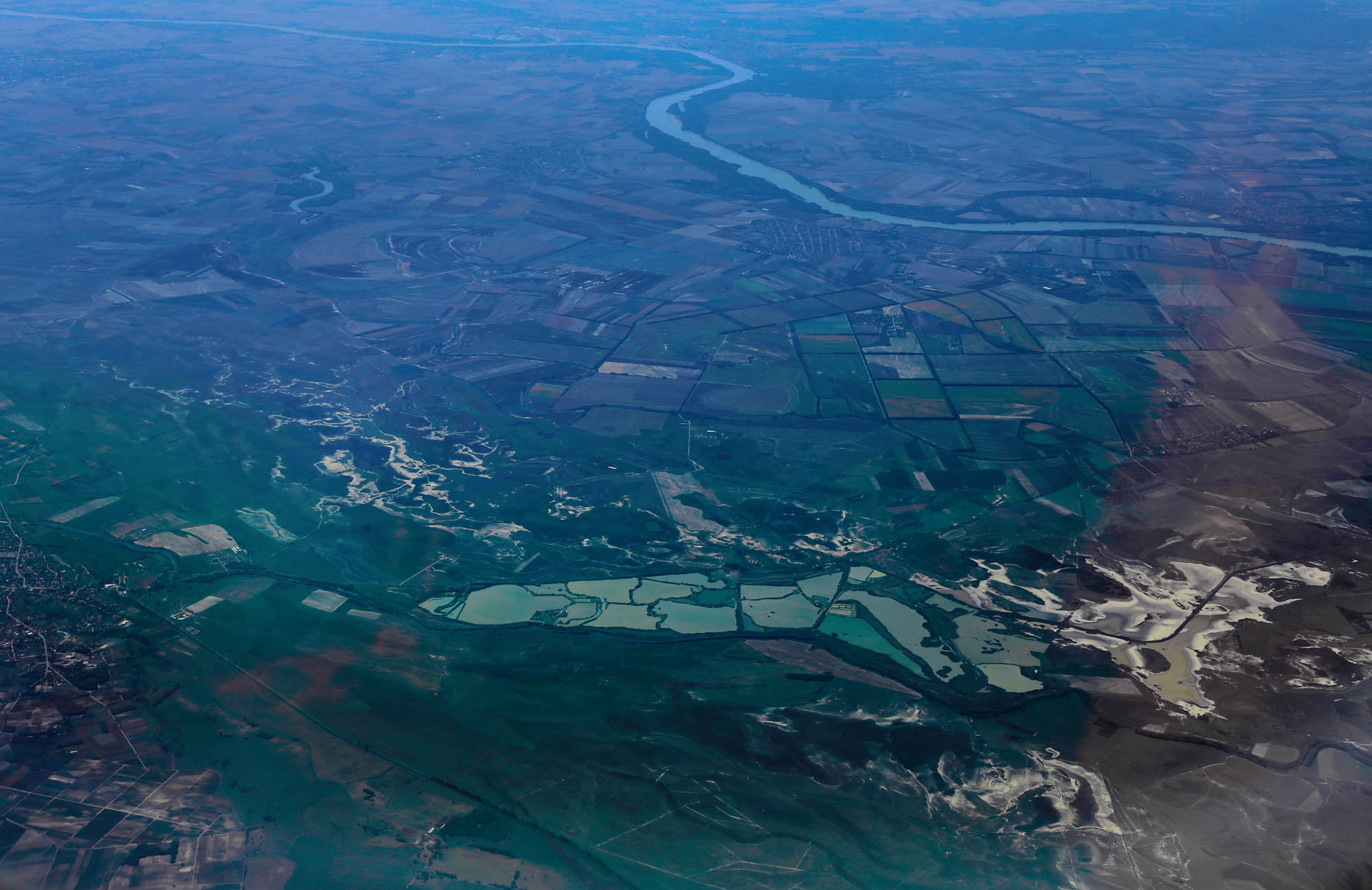
After crossing the Serbian border, the plane soon reaches Vukovar where the Danube, obeying the orders of the old kings, turned to the east, and still outlines the boundaries of a missing country. The plane, before saying goodbye to that country, and continuing its journey south through the long Serbian corridor in front of the crowded rooms of the small Western Balkan peoples, describes an elegant circle above the last river bend, which, along with its three tributaries, draws a complex circuit on the Bačka plain.
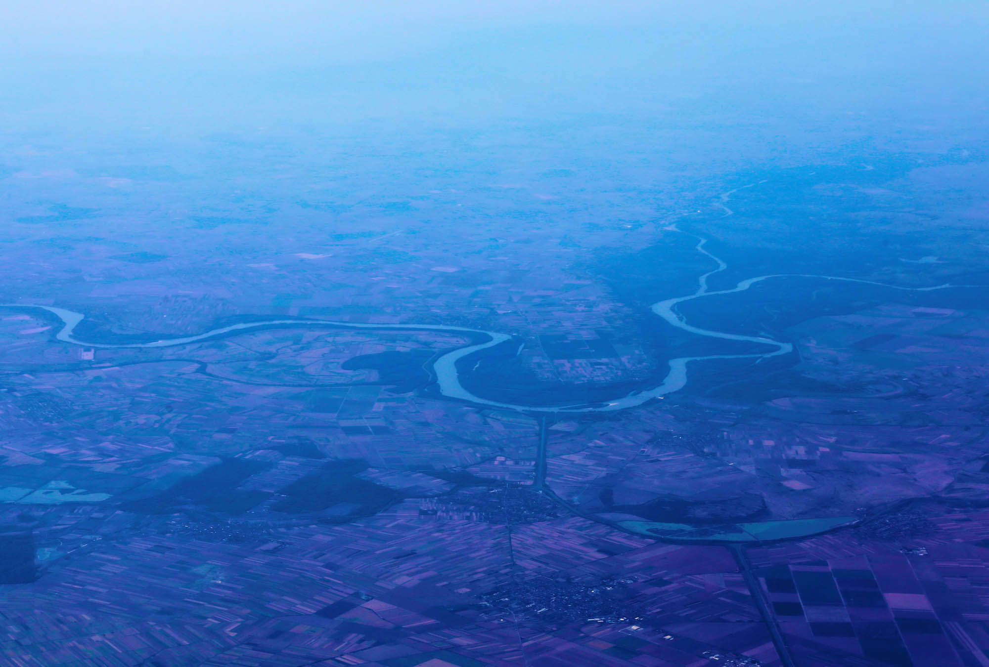
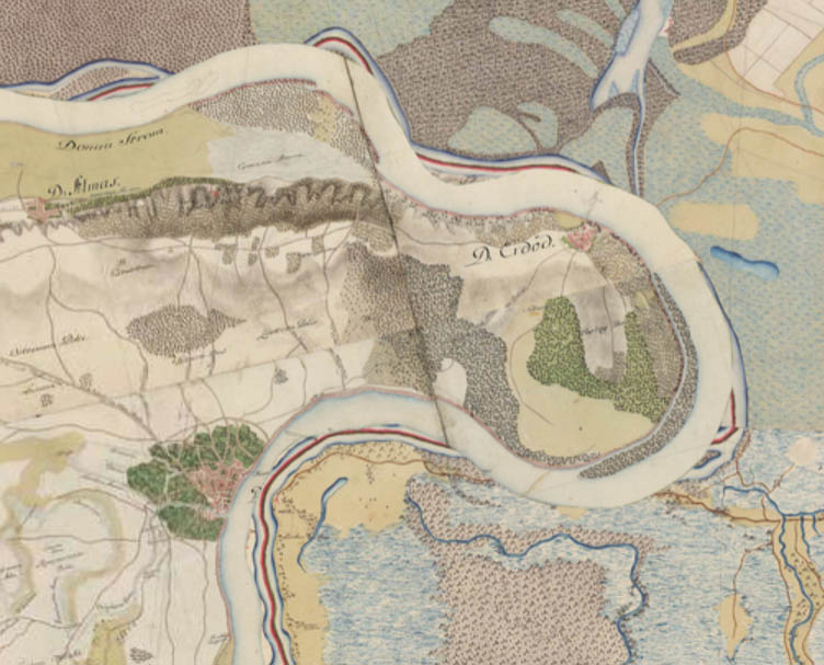
The Erdőd (in Croatian, Erdut) Bend, as the Danubian Islands blog writes, was forced to turn to east by the Erdőd loess range, which rises up to sixty meters above the river. The loess range, extending from Almás to Erdőd, is well visible on the map of the First Military Survey (1763-1787). To the east, at Almás the Drava flows into the Danube, from the south the stream, which the map still calls Weis Graben, and from the north the tiny river of Mostunka. If, on the map of Mapire.eu, you click on Options, and then you set the layer of “First Military Survey” to 0%, you will see that the lake under the former Rácz Millidits and today’s Srpski Miletić, which, in the foreground of the photo, repeats the bend in the shape of a half moon, gathered up from the water of the river.
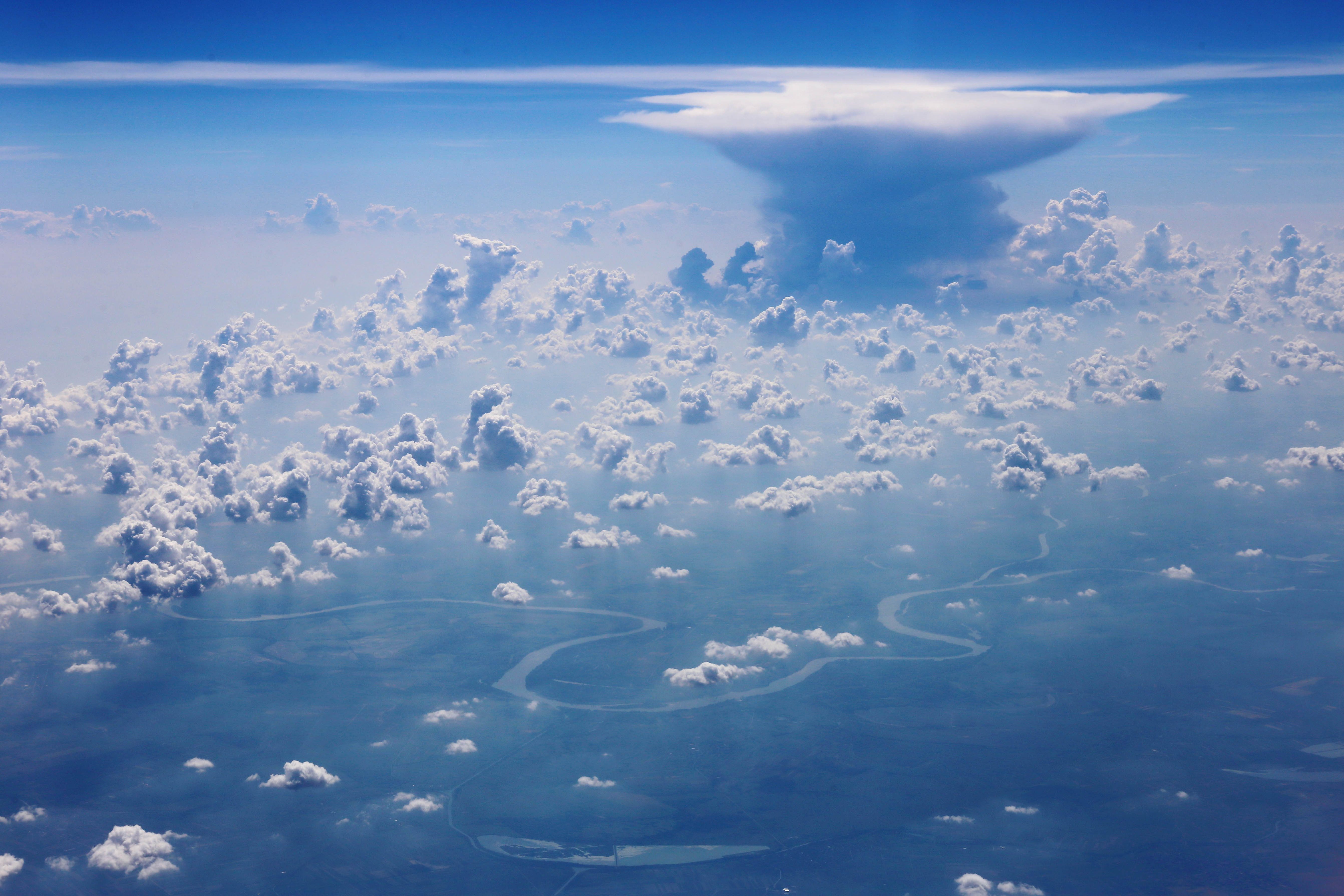
The afternoon vapors have become thicker, and a multitude of tiny clouds rise up from the hot plain, forming a threatening cloud cup. Sometime, when kayaking on the Danube, we used to look up worried, whether it would be poured upon us before we camped. Below, the Danube is the reality, the paddle strikes, the country borders. From below, the clouds floating above the large water belong to it: they are the Danubian clouds. Seen from above, the three-dimensional world of the clouds is realistic and self-contained: they do not belong to anything, least to the tiny strip meandering on the worn cloth of the earth. Nevertheless, they are the same Danubian clouds. This is why I could send this photo to the Danubian clouds photo contest of the Danubian Islands blog, where it won the first prize. The river has been stretched to the sky, “the foundations flew upon high.”
 Tamás Sajó: The cloud looks back


 Come with us to…
 Atlantis
 Bestiary
 Bohemia+Prague
 Books, exhibitions, music, film
 Brave old world
 Caucasus
 Cemeteries
 Crimea
 Get to know the
 Images of the East
 Lightwriting
 Lwów/Lemberg
 Mallorca
 Message on the wall
 The Museum of Propaganda
 Odessa
 Paper Museum
 Persian letters
 The Jewish heritage


No hay comentarios:
Publicar un comentario