
The first and funniest book I read about Catalonia, my country of choice at the time, sixteen years ago, was expat Matthew Tree’s travelogue Un anglès viatja per Catalunya per veure si existeix (An Englishman travels through Catalonia to see if it exists).
I am now embarking on a similar, though I expect a much less fun journey, to see if Northern Mesopotamia, from Gaziantep to the Syriac monasteries of Tur Abdin, still exists after the terrible earthquake in February.
That it exists geographically is confirmed by recent Google Earth photos. But I have to find out what the conditions are there, whether our journey leads to disaster tourism.
After the two highly successful trips to Mesopotamia early last summer, I announced two more trips for the end of May and the beginning of June this year. Every fellow traveler had already bought the not-cheap round-trip flight tickets when the news of the earthquake reached us. Instead of canceling immediately, I wrote around: let’s wait and see what happens in three months, and I will travel the planned route at the end of April, and will report – honestly, leaving all business interests aside – on what’s going on in Mesopotamia, whether it’s worth undertaking the trip.
I am starting this journey now, sitting here in Brussels airport.
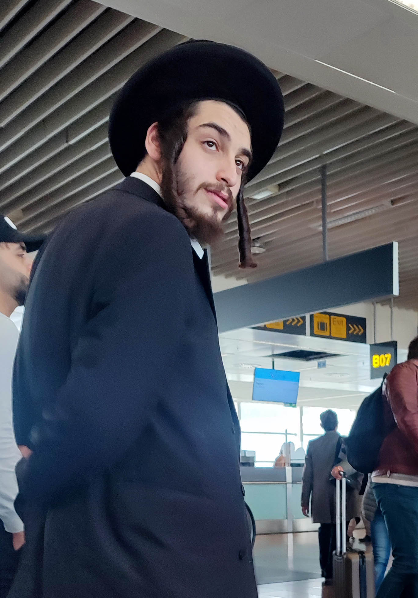
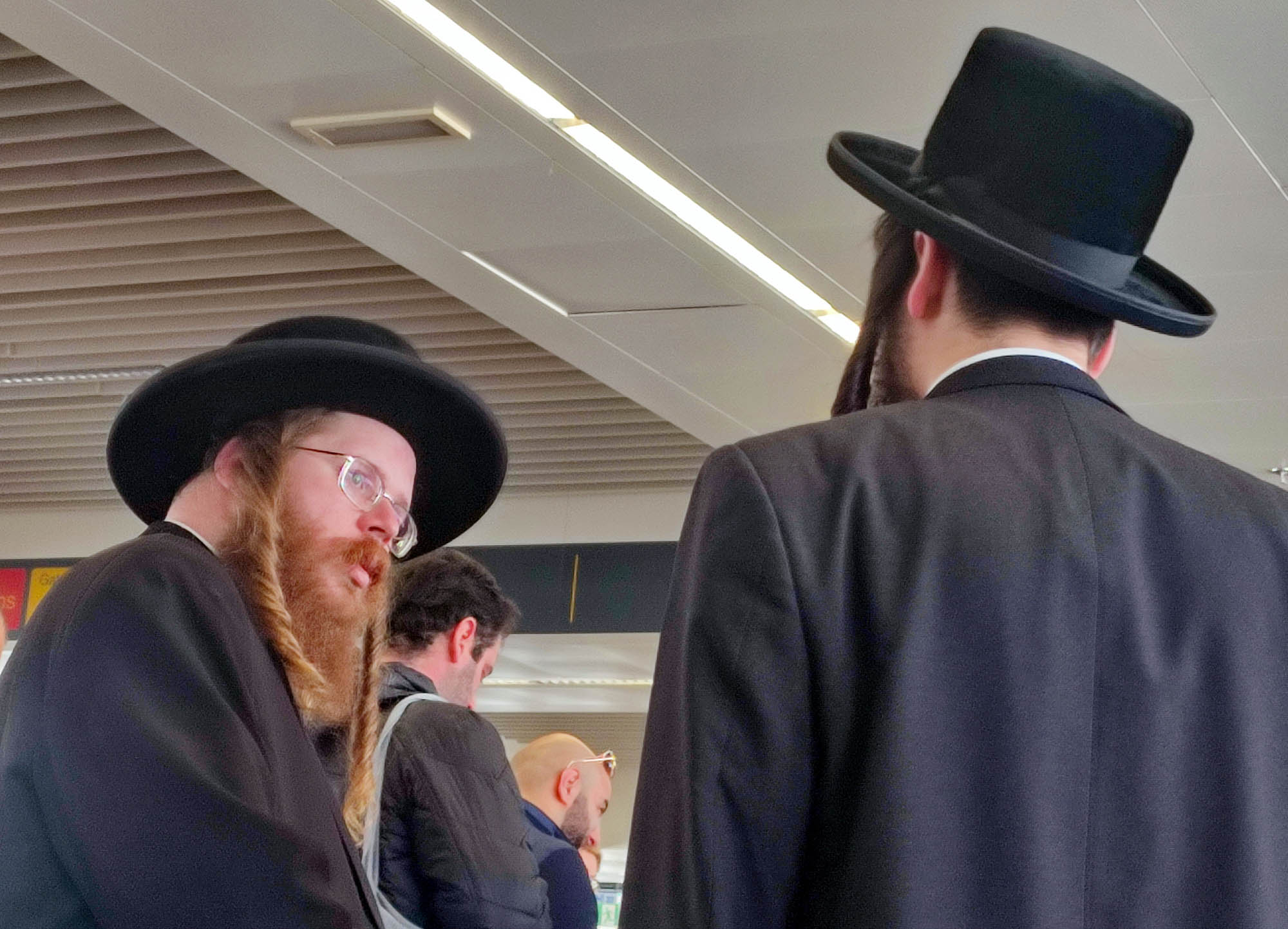
Boarding. It is not chimney sweeps that bring me luck on a plane. Eighty Hasidim cannot be wrong.
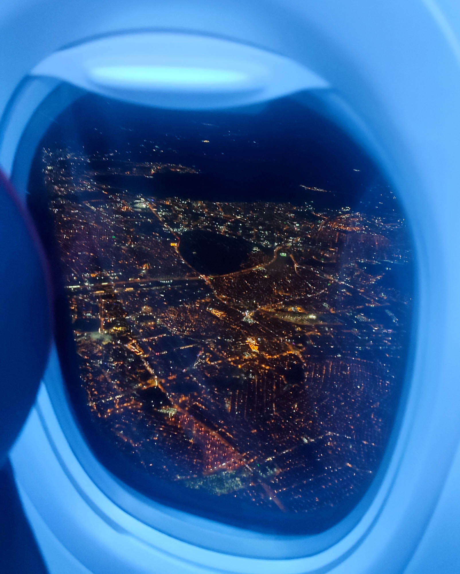
The plane arrives in Gaziantep after ten in the evening. You can see the lights of the old town from the window. It shines with full illumination, like a cool tourist town, where everything is fine.

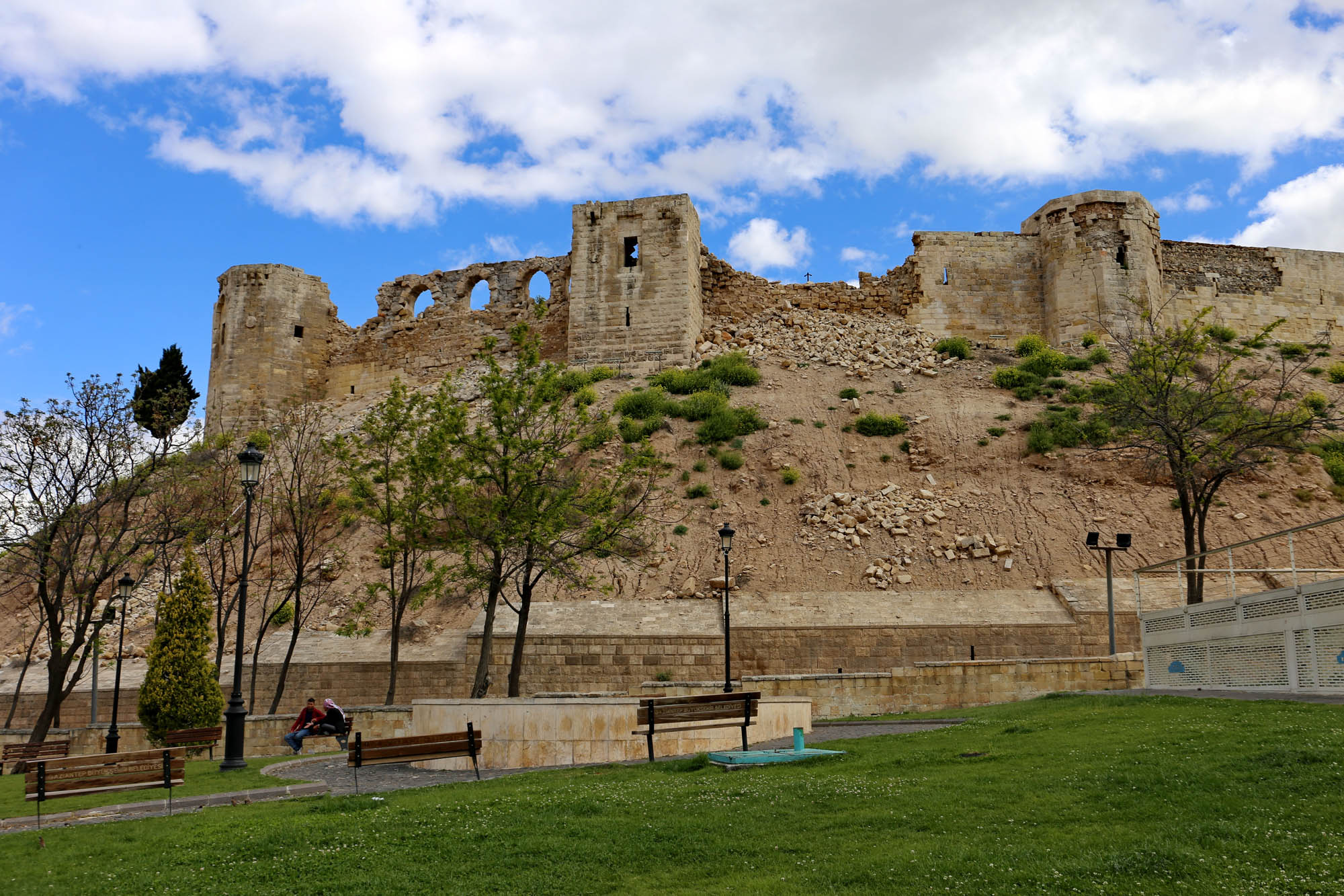
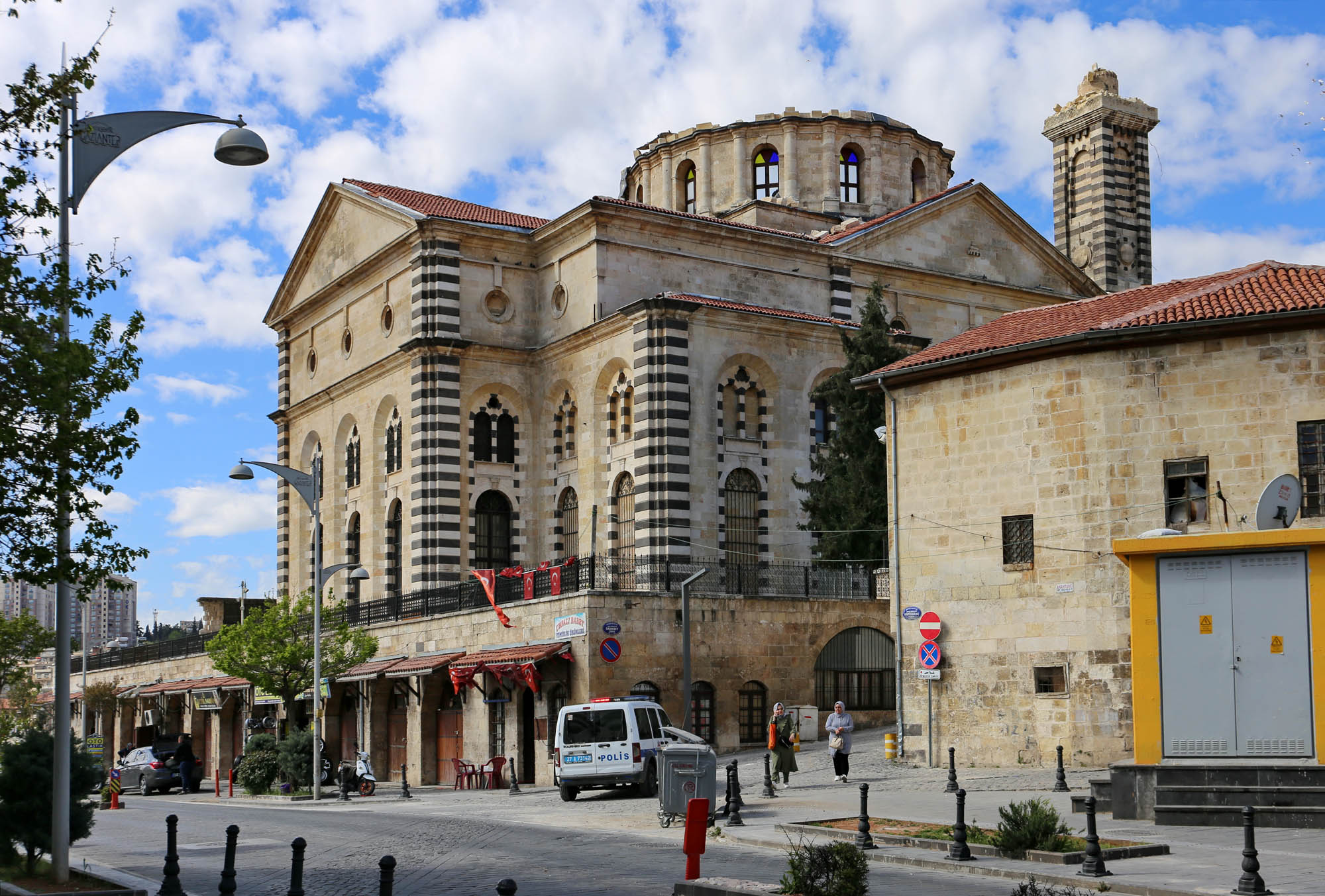
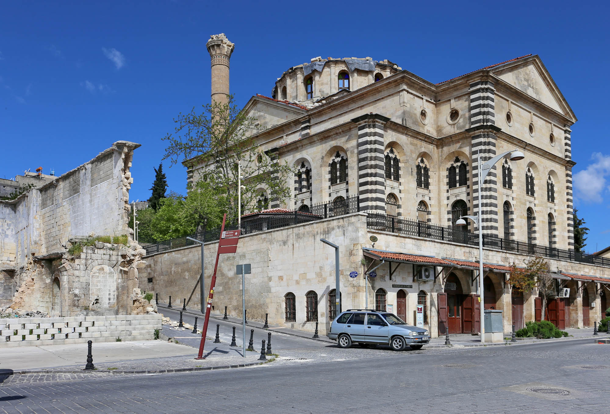
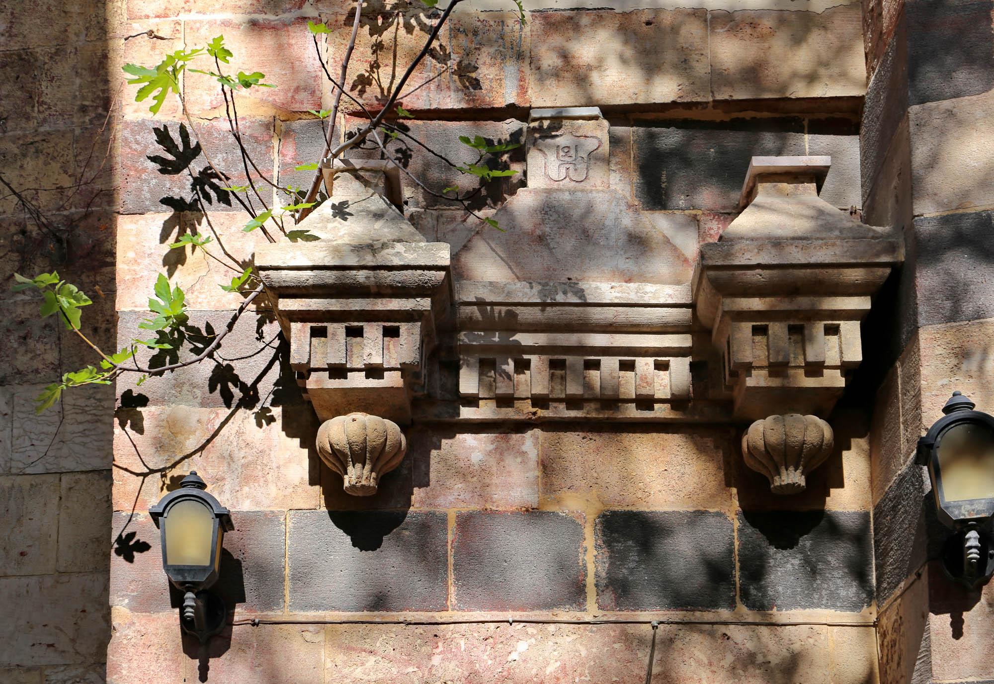
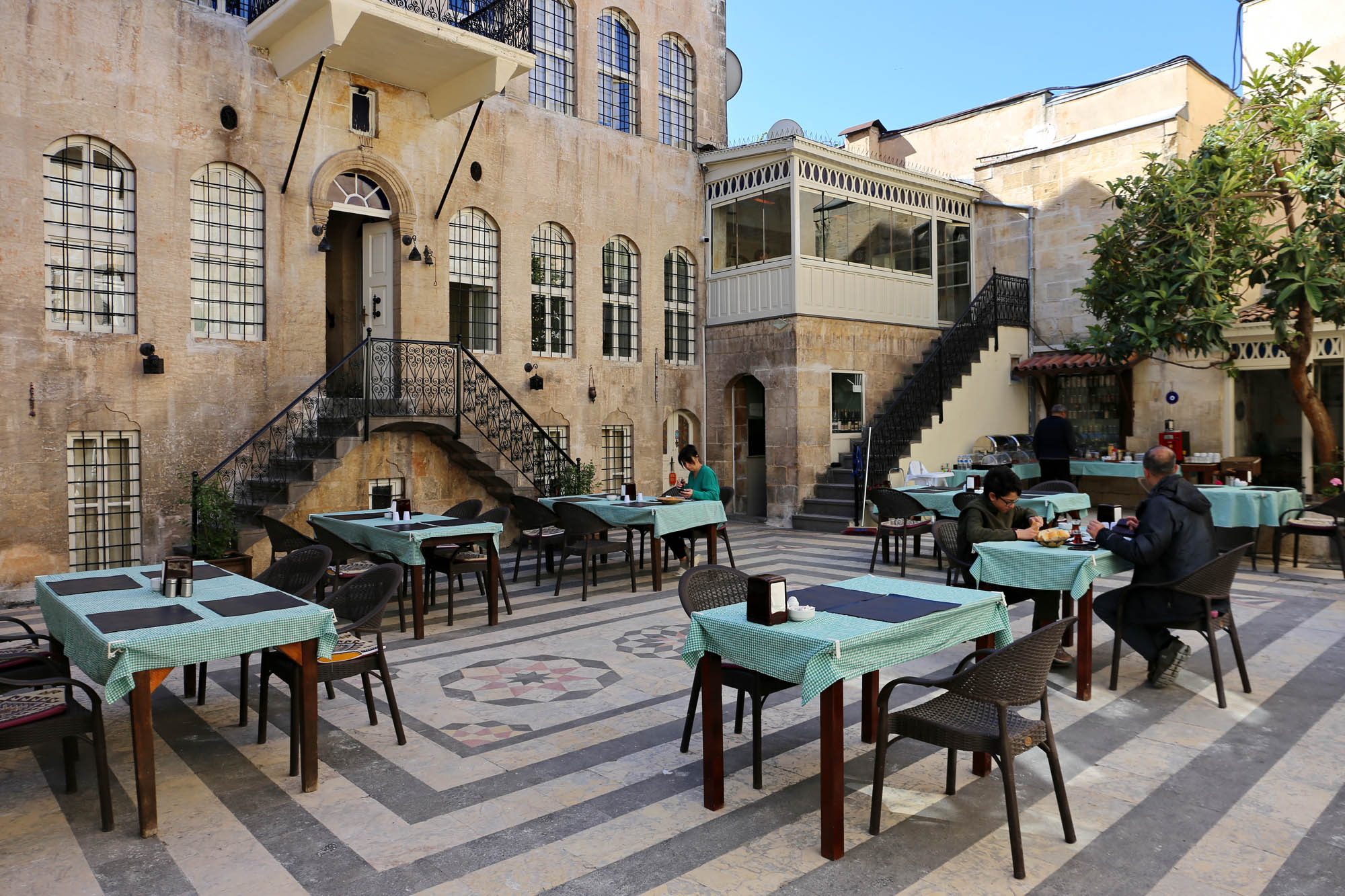
After unpacking at the hotel, we take a short tour of the city center around midnight. In the restaurants, set up in the courtyards of the caravanserais, music is still playing, in some of them there are only the waiters, but the usual evening life has apparently not been broken. Now we see the first damage. The pointed top of Karagöz Mosque’s minaret has fallen, and the building was surrounded by an aluminium screen. And the wall of the castle has collapsed in several places, but as far as you can judge, it was not the original wall but the replacements built onto it during the restoration. Well, if this is the price for definitely closing the hideous exhibition of plastic figures about the heroic Turkish defenders of Gaziantep against the greedy French advisors and their treacherous Armenian helpers, it is not even too much.

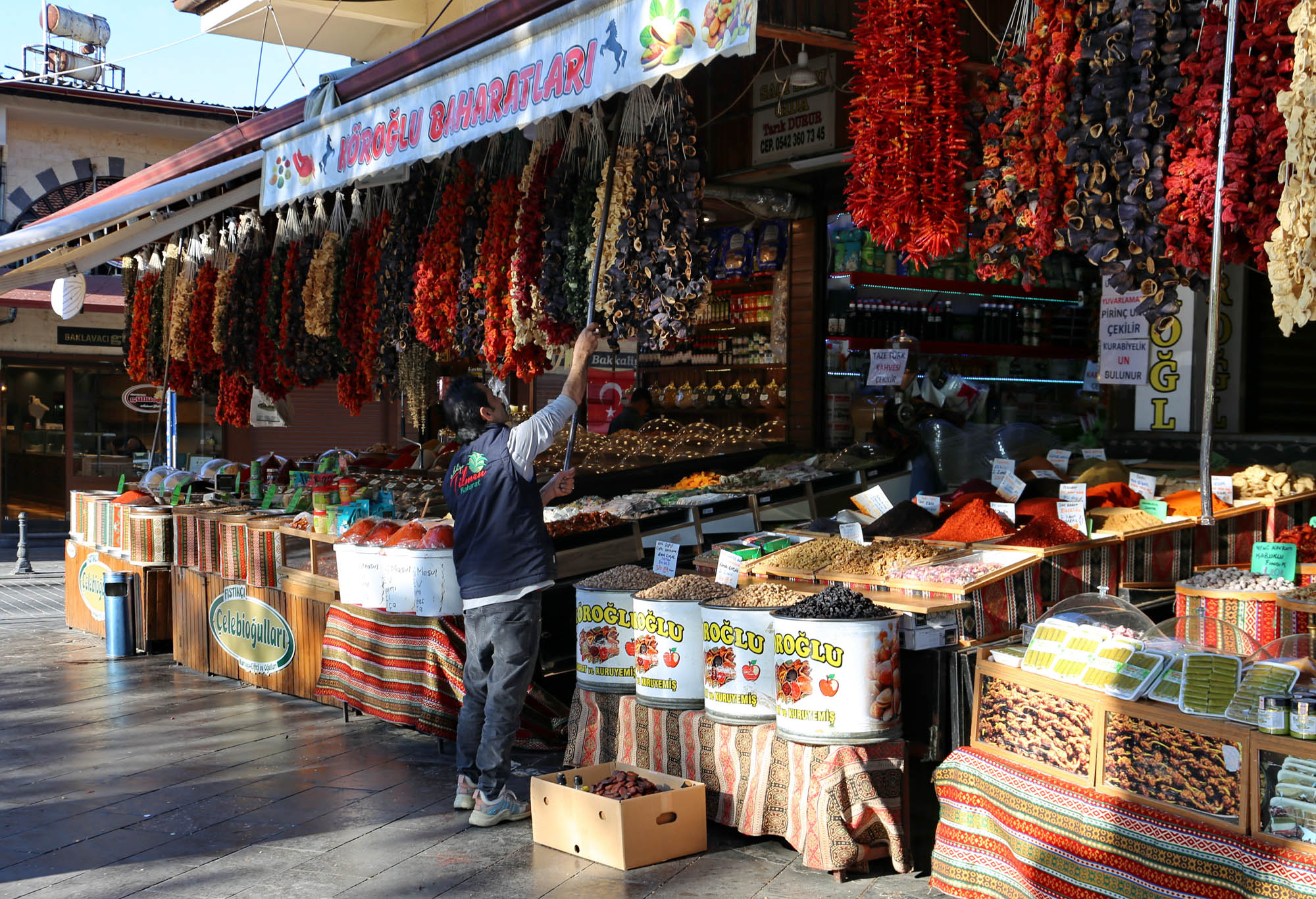
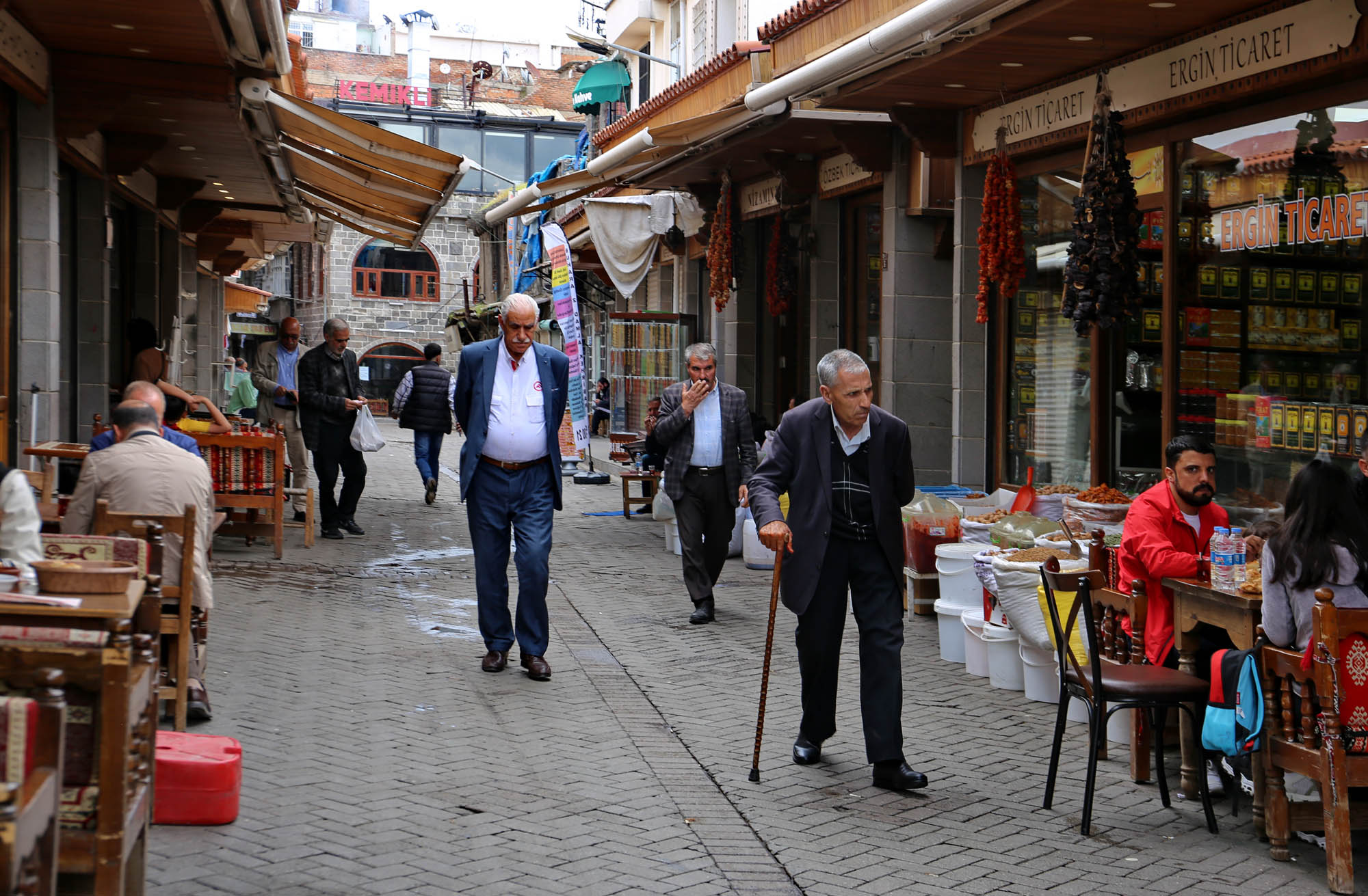
Early in the morning the bazaar is just waking up, the most diligent traders are putting their goods on display, they are eating tripe soup or boiled eggs with tea in front of the small stalls, talking, soaking up the sun like frozen lizards, they don’t even have the strength to call a potential buyer.


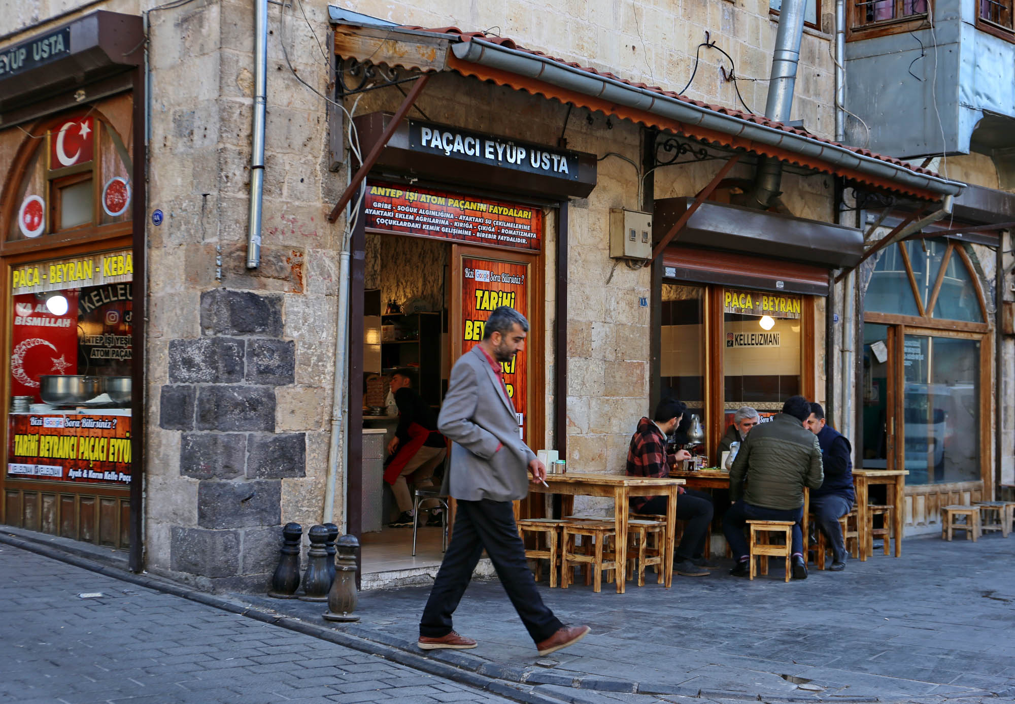

In daylight, we take stock of the damage.
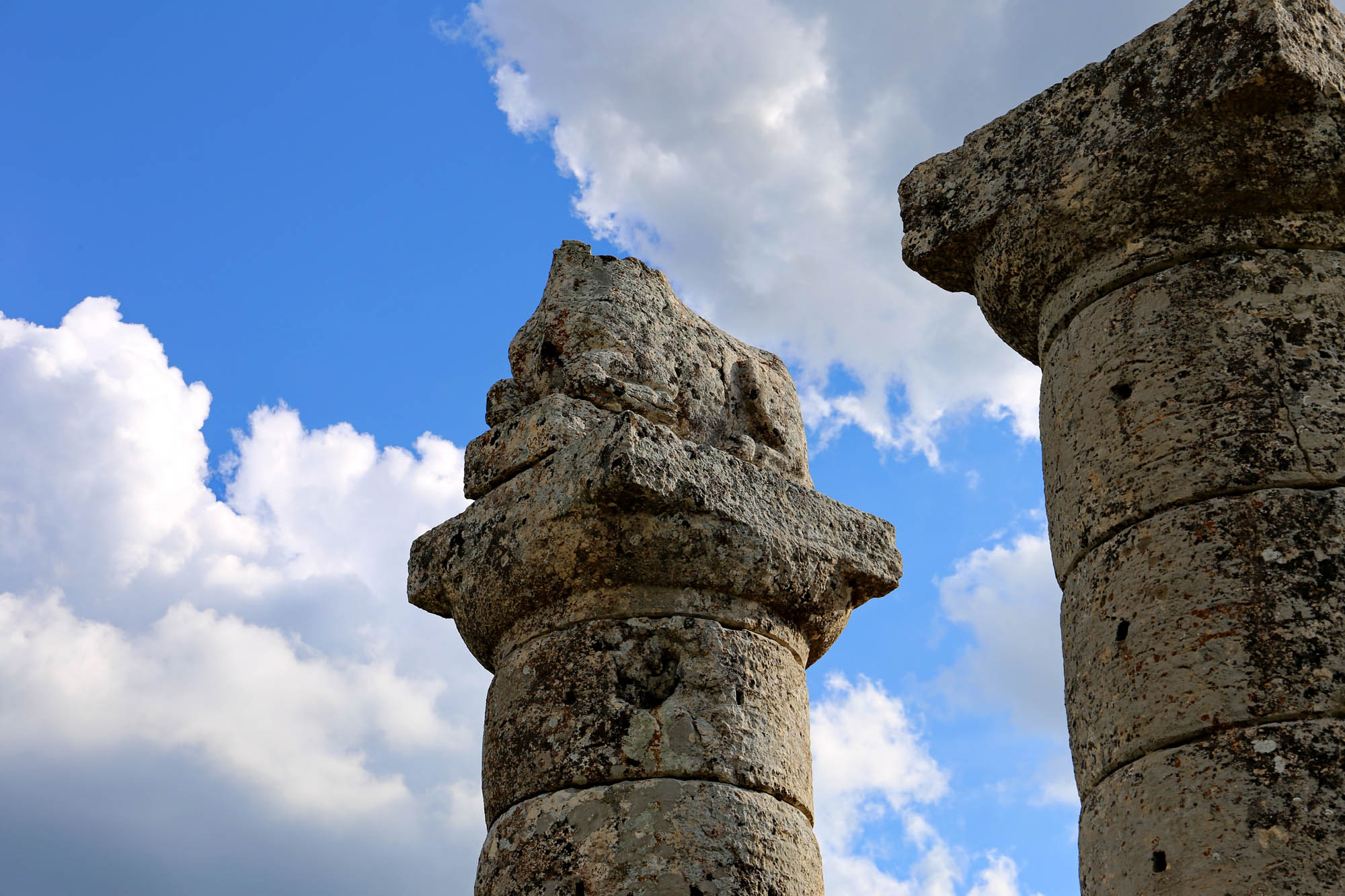
Less, but spectacular, damage was done to some small mosques. Since the Ottoman occupation of the Arab provinces in the 16th century, Gaziantep has been the trading twin of Aleppo, which lies further down the Euphrates, an important stop for caravans before crossing the Syrian desert. For this reason, the old town is full of Ottoman-era caravanserais and 16th and 17th-century mosques, founded out of gratitude for the successful business. One corner of the


Ümit Kurt from Gaziantep, a doctoral student at Harvard University discovered and then revealed in his book The Armenians of Aintab: The economics of genocide in an Ottoman province (2021), how the Young Turks and then the Atatürk government allowed the Turkish elite of Gaziantep to appropriate the property of the local Armenians, thus making them supporters of the genocide and of the subsequent political system. In his book, he also provides an accurate map of the neighborhood, specifying the original Armenian owners and the function of each building, and narrating their history. I can’t wait to have time to tour the neighborhood with this map and publish its current state on an interactive map.


“Here in Gaziantep, there was hardly any damage, and very few deaths,” says Özkan, the receptionist at Anadolu Evleri, one of my best fixers for organizing trips to Anatolia. “And east of here, where you will travel, even less. Not like to the west, towards the coast, where entire cities collapsed.” We list exactly where we are going to travel, to stop, we want to see. We call one after the other the contacts, accommodations, museums and everything else in the itinerary. Everything is open, everything works. Actually, I could go home with the evening flight. Nevertheless, I will travel the full route to see it with my own eyes.

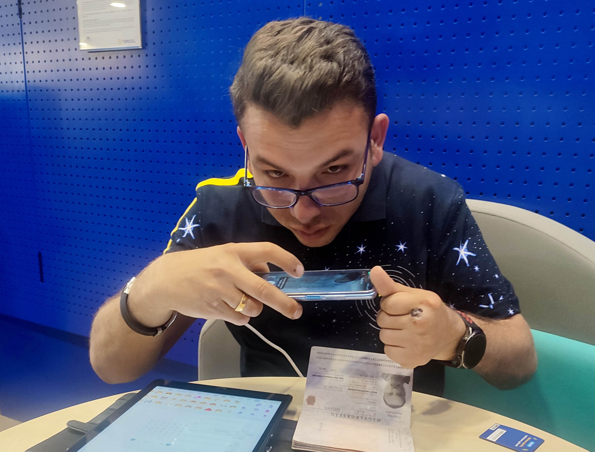
In Turkey, I always buy a phone card at the airport, which is valid for one month, although it needs to be reactivated after two weeks. Don’t ask me why. I won’t ask either, I’ve written it down on a long list of Turkish idiocies. Now, however, Lloyd, with his practical American way of thinking, draws my attention to the fact that the airport price of ca. 50 euro for the card is not much less than the 7 euros per day for 10 days to be paid for the use of on my German card in Turkey. So let’s try it in Gaziantep, it will be definitely cheaper there.
Gaziantep’s Turkcell has probably never seen a foreign client before. For a while, they discuss among themselves what to do in this case, and then they put us in the care of the fool of the store. It would not matter that he can only speak Turkish between clenched teeth, so I can only hear the consonants, as if I were reading a transliteration in Ottoman script, but those twice. But at the threshold of every problem, aggression comes upon him, and he will come across plenty of such in a Hungarian passport. “What month was it issued?” he mumbles on the verge of insanity, or well beyond it. “In December”, I point out in the respective box. “Desember, desember… what is it?” “Oh, aralık”, I recall. He takes photo of the passport at least five times. This is the operation he understands, loves and enjoys. After that, however, he goes into an endless cycle until he finds a way out: to take a photo of the passport.
Finally, a salesgirl without an impediment arrives. She sends the cretin packing, and she takes a photo of my passport. After this, however, she fills in the appropriate boxes on the tablet, and behold a miracle: I have my Turkish card within ten minutes. I pay 590 lira, approx. 30 euro. I have spent an hour with it, so I have worked for twenty euros an hour. Not bad for an hourly wage in Berlin either. And we had a great time.
Lloyd says he’d rather skip this show and share the internet from my card. So we saved forty euros.


Birds in the backyard of Imam Çağdaş Restaurant. Recording by Lloyd Dunn

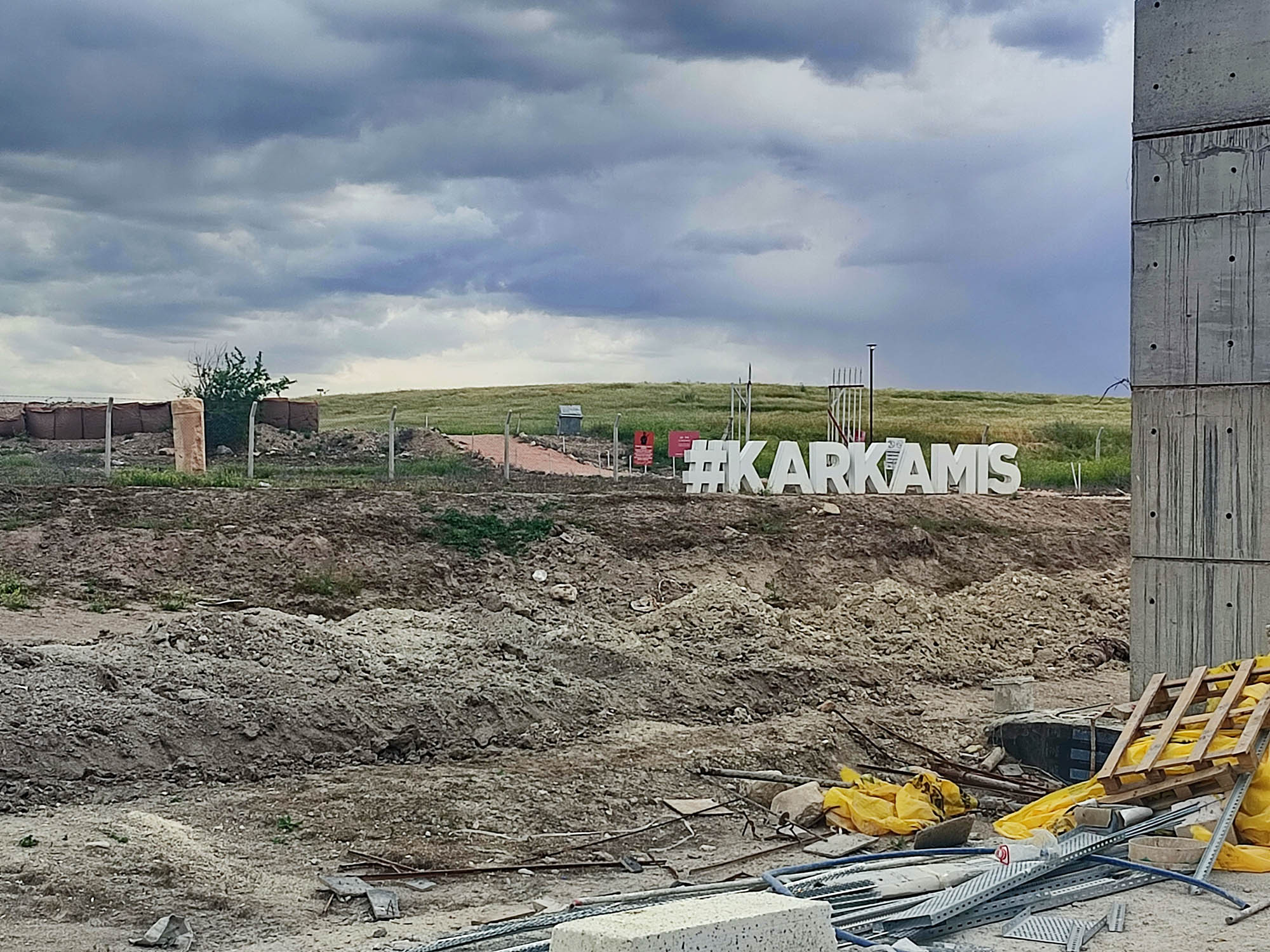
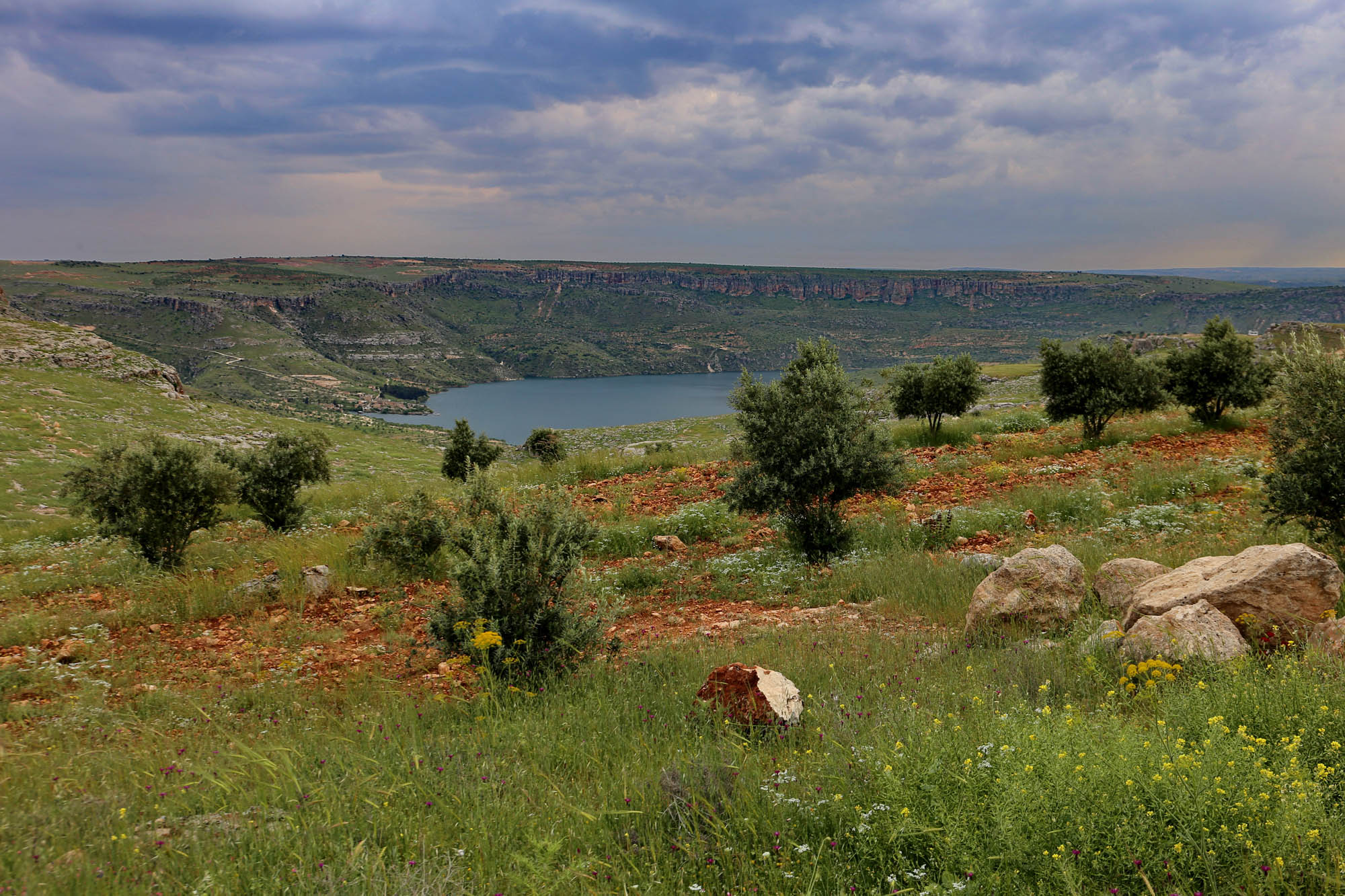
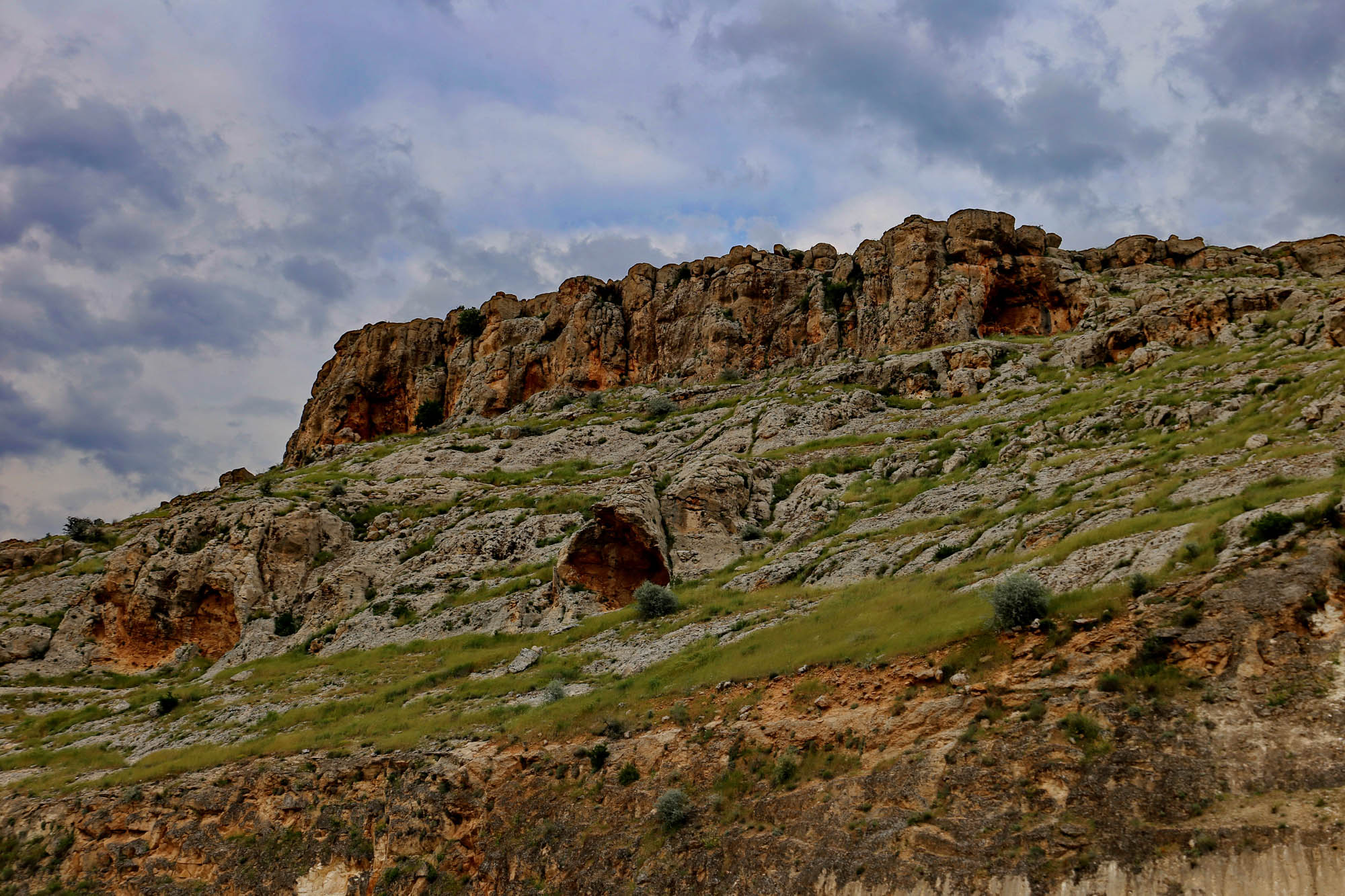
Today, Carchemish lies on the Turkish-Syrian border, along the Euphrates, on the outskirts of the modern city of Karkemiş, seventy kilometers from Gaziantep. From the excavations between the late 19th and early 21th century, several beautiful carvings were included in the museums of Gaziantep and Ankara, for example the “royal photo album”, which I have already written about in detail. The largest carvings, however, are still to be seen outside on the grounds, which, according to the press, were turned into an open-air museum. Trusting in this, we decide to make a small detour on our way to the Euphrates, and visit it.
In the modern city we still see a rusty road sign with the inscription “Karkamiş Antik Kenti”, meaning the ancient city of Carchemish. At that time, we don’t know yet that we won’t see more of it.
When getting close to the point marked by Google Map and Organic Map, we are stopped by a fence with a sign saying that we have reached a military area where entry is prohibited. We ask two men working nearby, they direct us to the town. In the town, they show a road at the end of which there is a military fence. The guard is already coming towards us with a gun ready to fire. We go back to the first place again and stop on a hill next to the cemetery, in front of the fence, from where we can see the whole area. We identify what we see based on the map of the archaeological area.
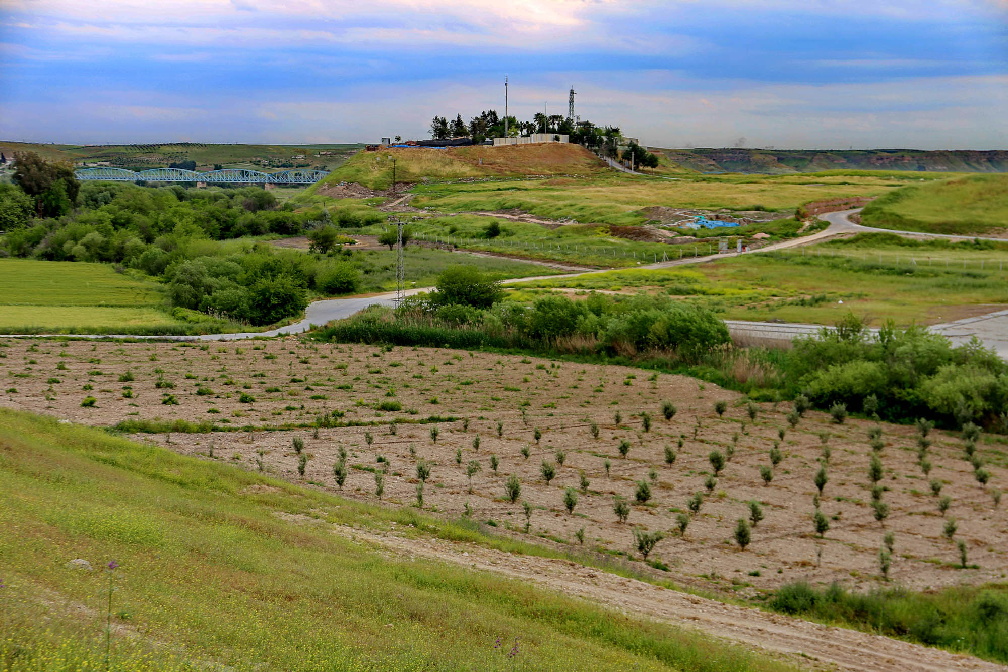
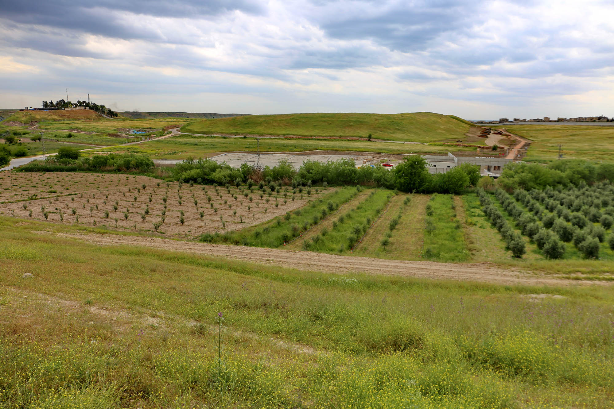
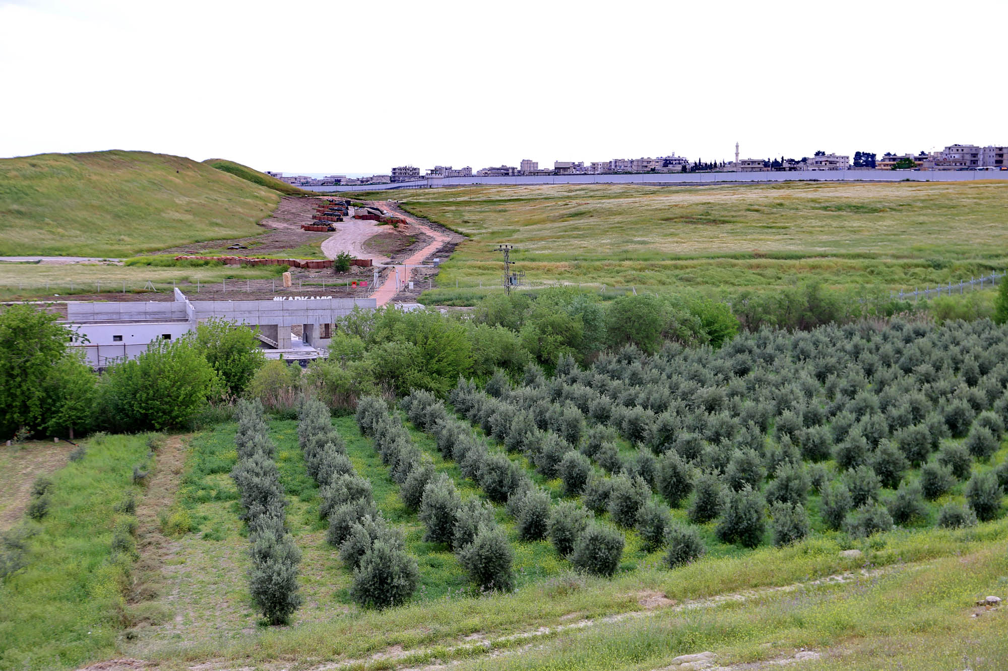
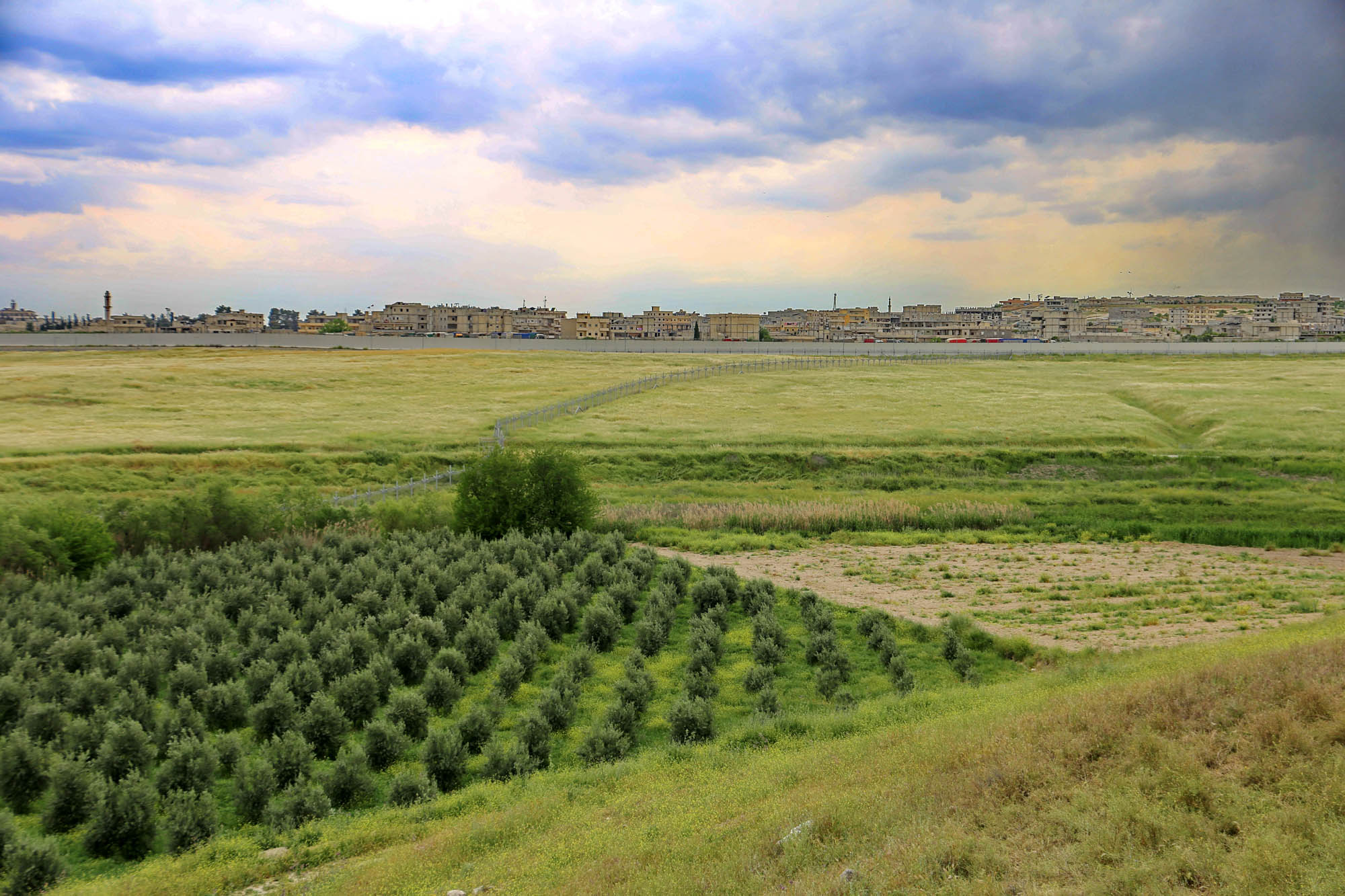
The story probably is that the open-air museum was opened in 2019 indeed, but then Turkey launched an offensive against Kurdish bases in Syria and strengthened the border points with Syria. In this way, the entire archaeological area was taken over by the military. On the map below, I indicate with a red line roughly where the military fence is now. It is clear that the ancient city marked with two amphorae lies deep inside the military area. And although the Turks don’t have the same conflict with Neo-Hittites as they do with the Armenians and the Jews, it’s nevertheless not good to imagine what might happen to the monuments inside.

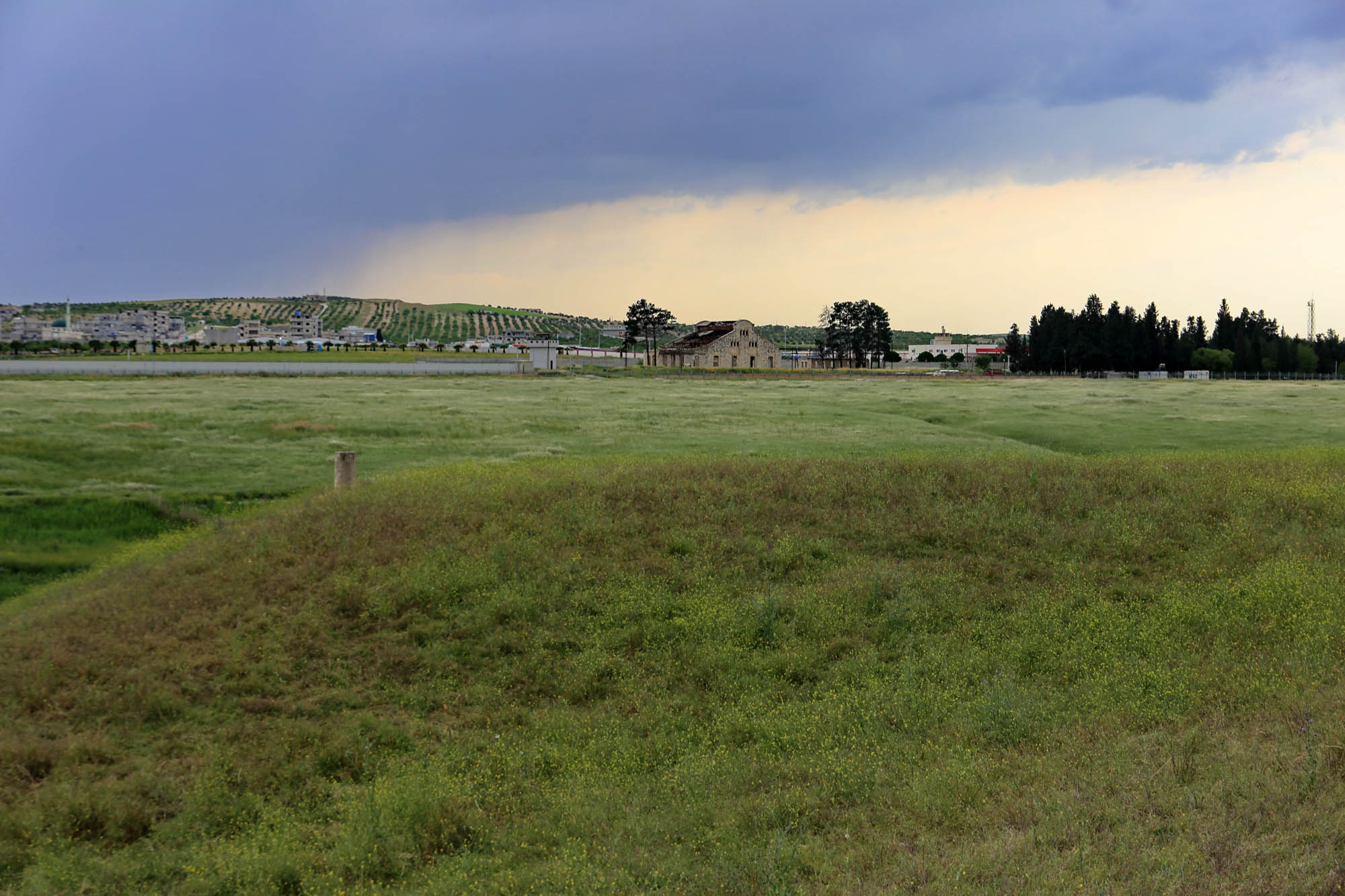
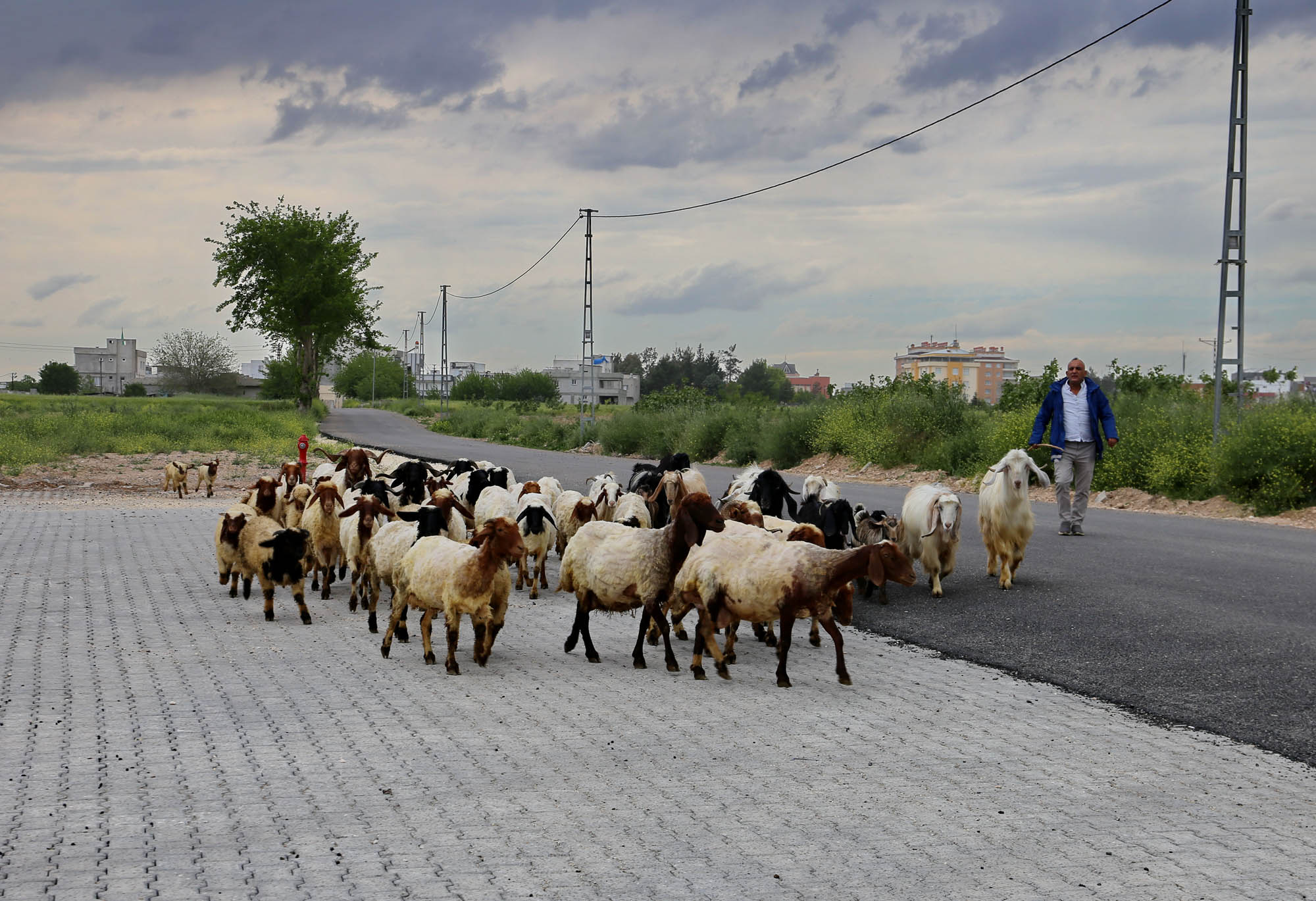
A shepherd approaches from the city. As a counter-test, we also ask him where the ancient city of Carchemish is. He points to the hills. “And how do you get in there?” “I would not attempt it”, he says.
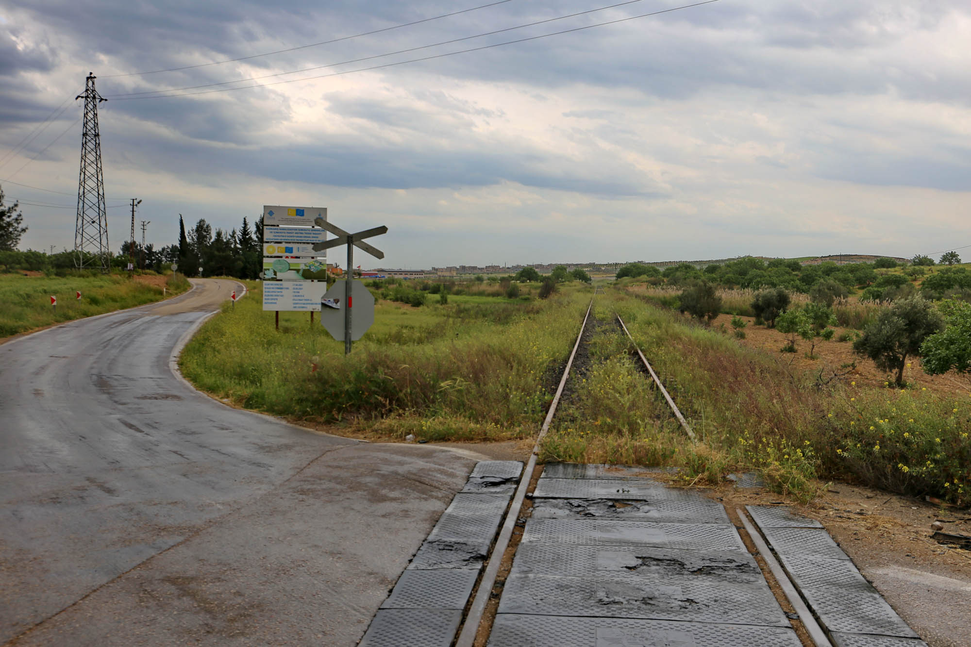
We are heading back. In order to see something of world historical importance, we stop beyond the city at the crossing of the Berlin-Baghdad railway.
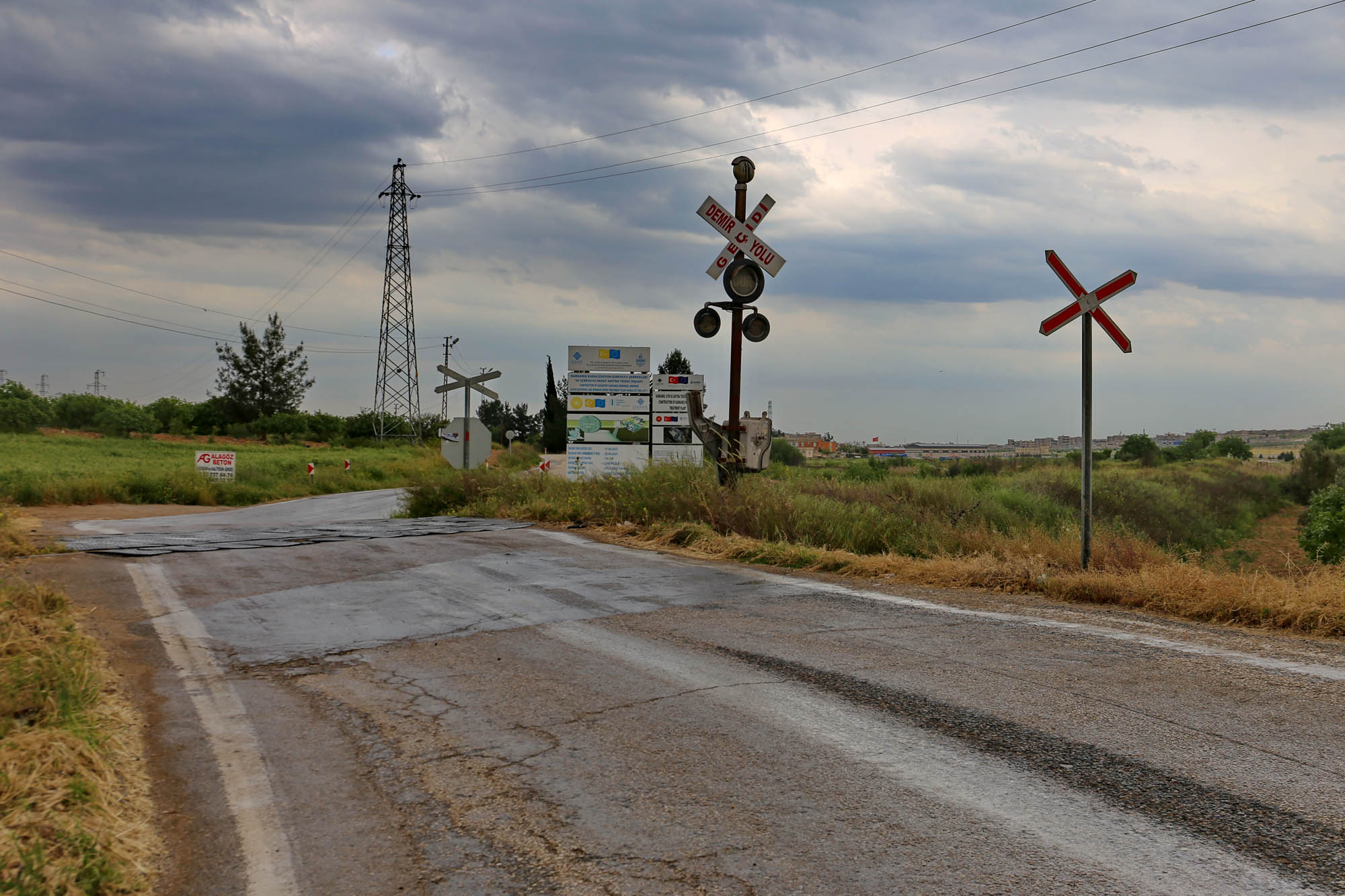
This way is Berlin. After the bend, you could already see the Alexanderturm:
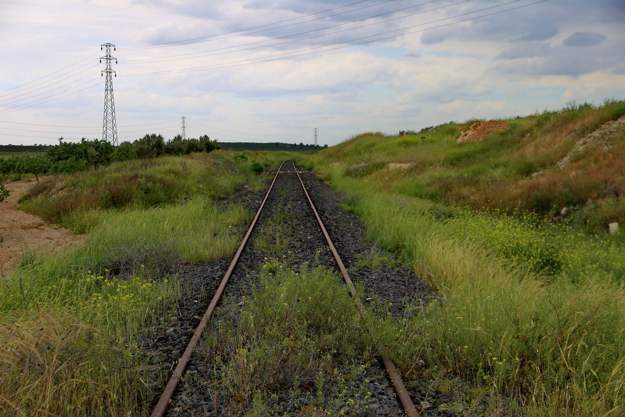
And this way Baghdad. The wind carries here the scent of Semiramis’ hanging gardens:
We continue north along the Euphrates, and now that we have a car, we can finally make a seven-kilometer detour, which is impossible with a minibus on the bad access road. This access road leads to the church of Nuhrut.
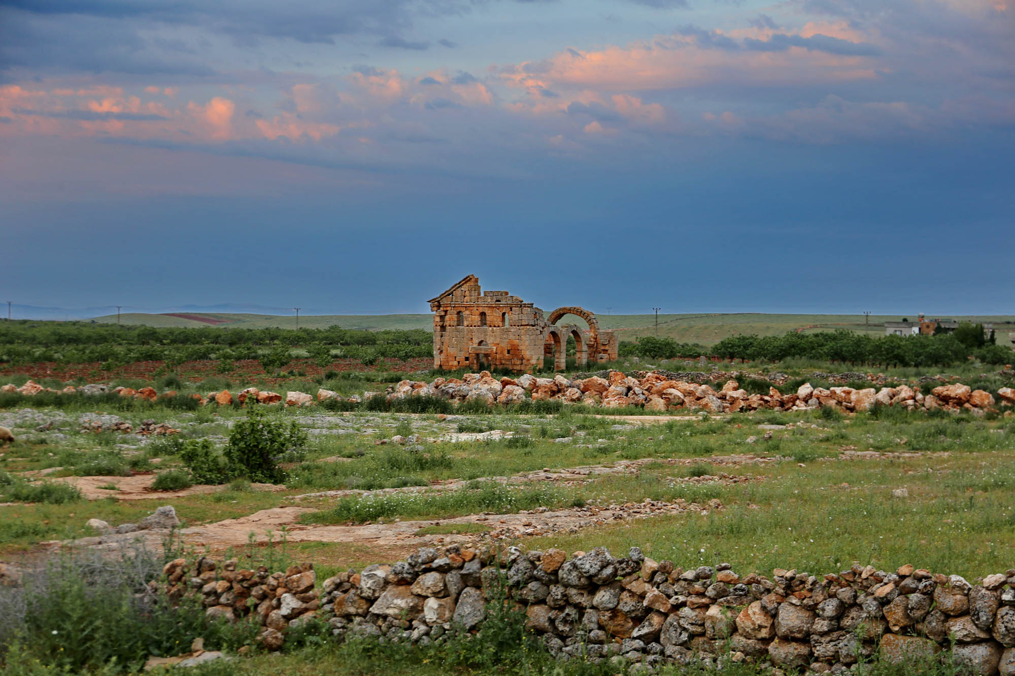

Since the church is so old, and thus not related to the Armenians, but rather to the Romans who lived here before them, and whose heritage the Turkish government gladly claims as its own, therefore the provincial and local administration is pushing for its restoration and inclusion in local tourism. In fact, it badly needs restoration. If anything of this will be realized, it must be begun with the asphalting of the road.
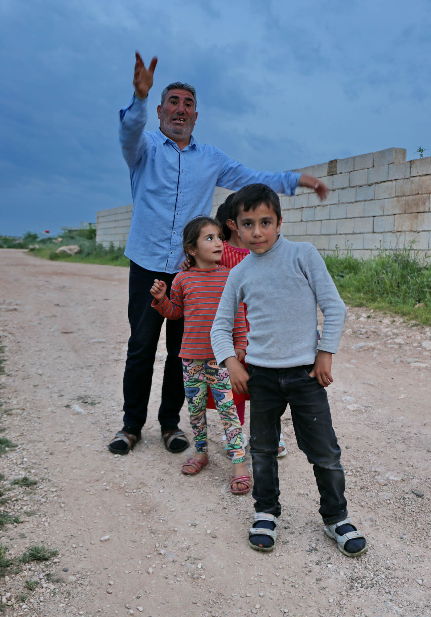
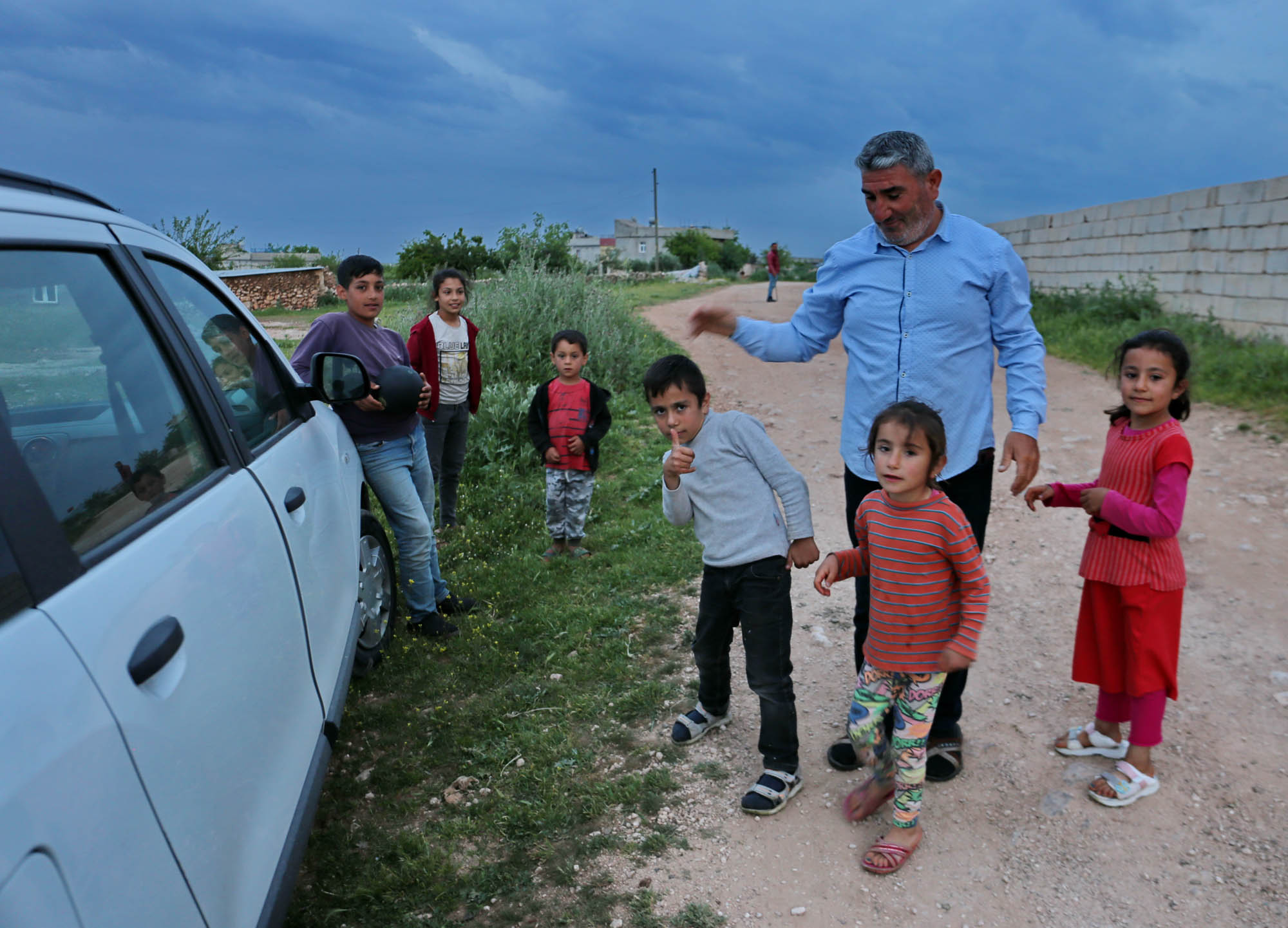
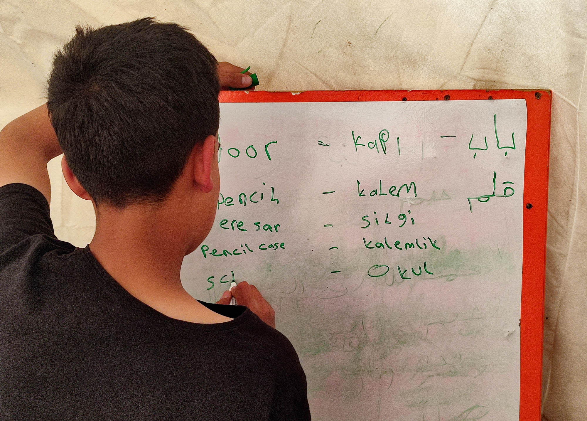
It’s dusk. A large group of children gather around our car, parked at the edge of the village. A big man, their father, keeps order among them in Kurdish. He greets us warmly, invites us to tea and dinner, but we must leave behind the network of bad country roads before dark. He calls his children together for a group photo. I will print it and take it to them next time I go there. The other children are grinning at the car, showing that they are willing to pose for a photo for five lira.

Adıyaman, located north of the Euphrates, is actually outside our planned route. We will only spend one night here before heading to one of the most spectacular regions of our tour, the ancient kingdom of Commagene, about which I have already written a lot in the discovery post of 2019, and since then I have given several lectures about it. As I read more about it, I grow fonder of this strange little kingdom with its exceptional art and imperial aspirations.
Therefore now, that we have time, I finally want to see
The gate of the museum is open, the security guards are having tea in the garden. However, the porter sadly informs us that the exhibition is closed because the museum’s wall was cracked in the earthquake and is now being repaired.
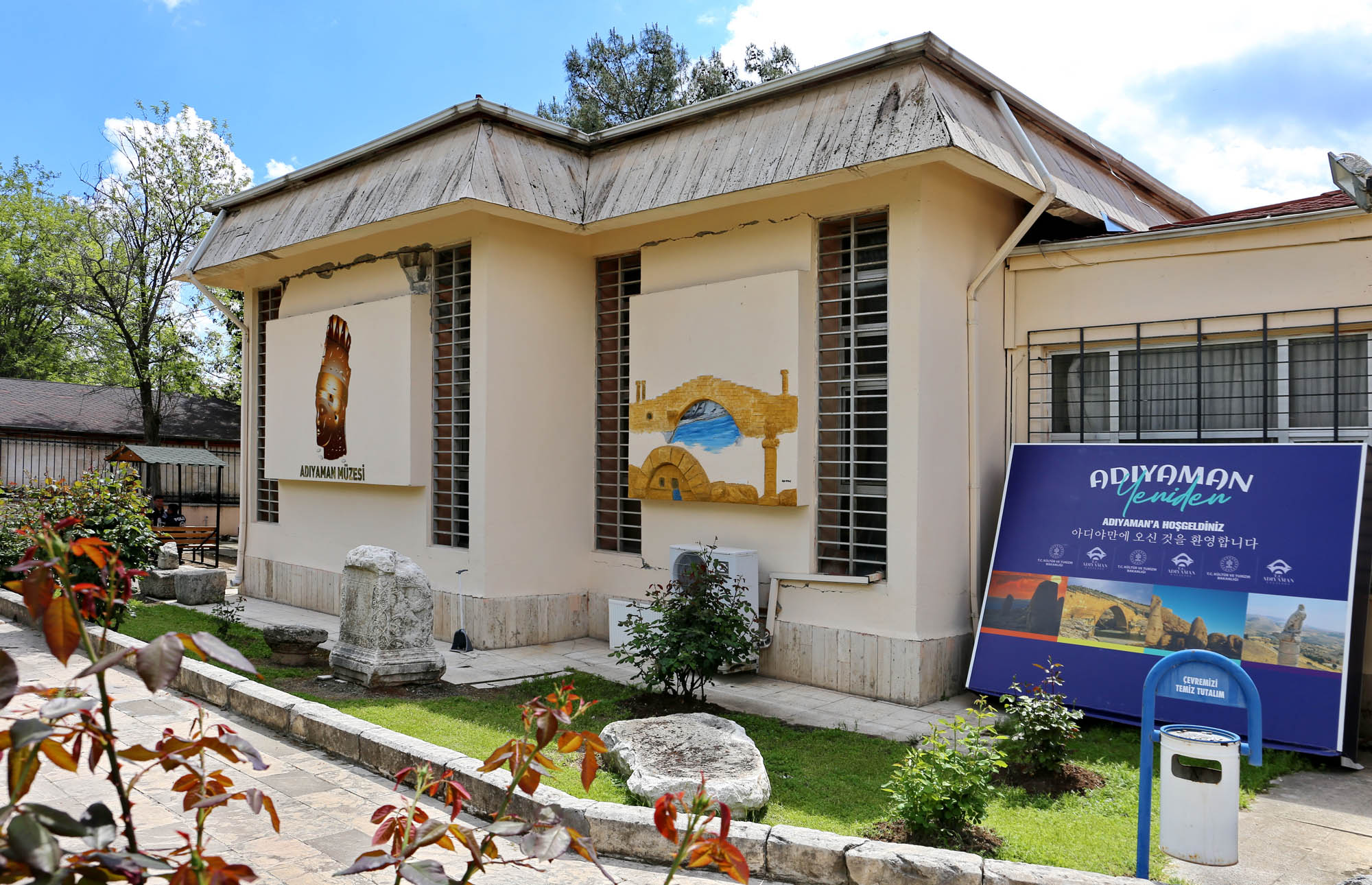
But we can look at and take photos of the sculptures on display in the garden, among the blooming roses. This is also a rich collection, including a Parthian lion, a Greek sarcophagus, and tombstones with Roman, Syriac and Arabic inscriptions. If there is so much out here, what could be in there? We will see next year, inshallah.

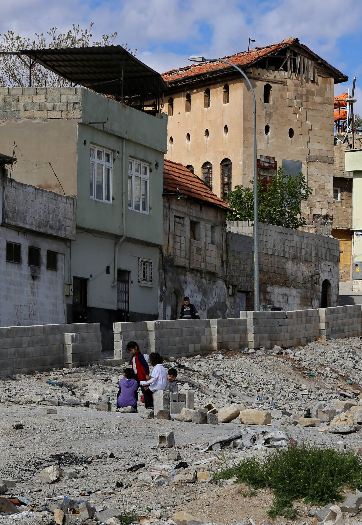
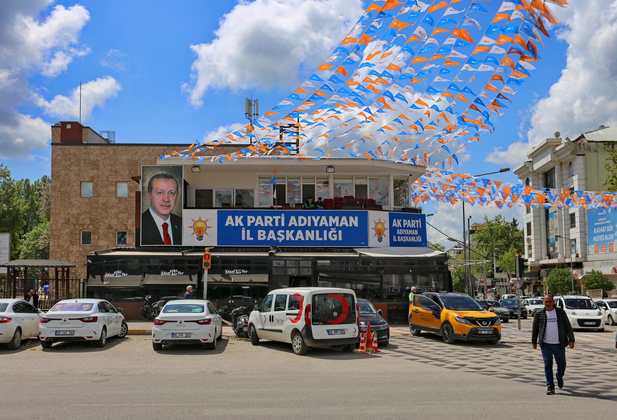
Here, in the center of Adıyaman we encounter serious earthquake damage for the first – and also for the last – time. In the city center, several high-rise buildings cracked or partially collapsed. It is conspicuous that these are all newly built houses. Some of which have not even been moved into. One must know that the town, originally called Semsûr, was swollen up with the populations of hundreds of Kurdish villages swallowed up by the Euphrates after the building of the dams in the past two decades. The Turkish government – and personally Erdoğan – considered the resettlement of the Kurds such a priority that he granted the contractors an exemption from costly earthquake safety regulations. Obviously these houses collapsed first, while the older buildings mostly remained intact. Opposite the museum, the remains of such buildings are just being demolished. From the façade of the neighboring election office, a huge portrait of Erdoğan looks benevolently at the results of his action. In a small park between the houses, dozens of local men are sitting on the benches of the tea house under a multitude of colorful flags of the ruling party, and, ignoring the dust that covers everyting and fills the air, are watching their young downtown disappear around them.

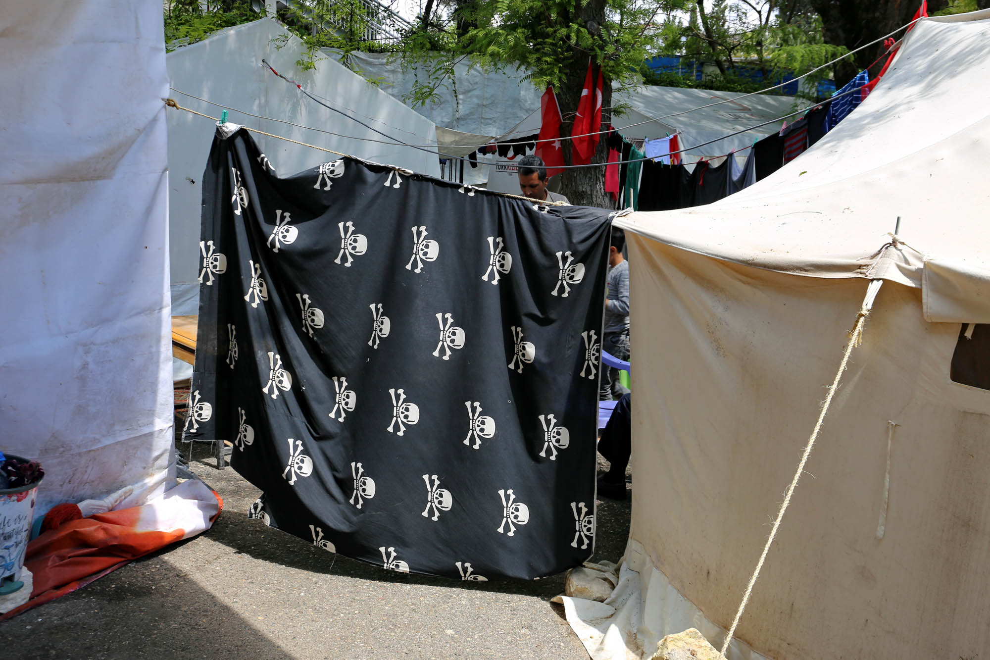
In the schoolyard there is a tent camp of the Turkish Red Crescent for those who are left without homes. As soon as we enter the courtyard, a small man with a handsome and sensitive face invites us into their tent for a tea. Five or six tents surround a small yard, the gate is a large blanket, that of Ahmed is decorated with skulls and bones. Ahmed goes forward to tell the women to cover themselves before the strangers who come in, and them invites us into the guest room.
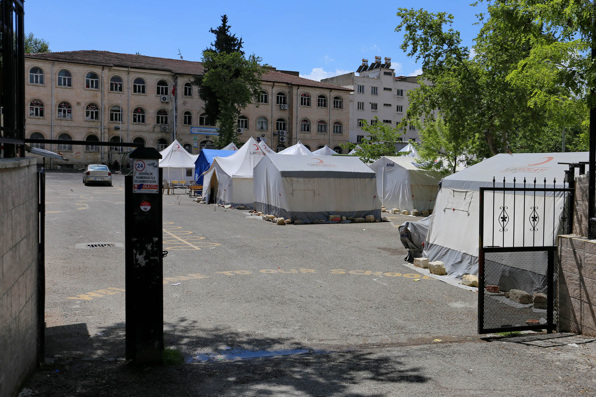
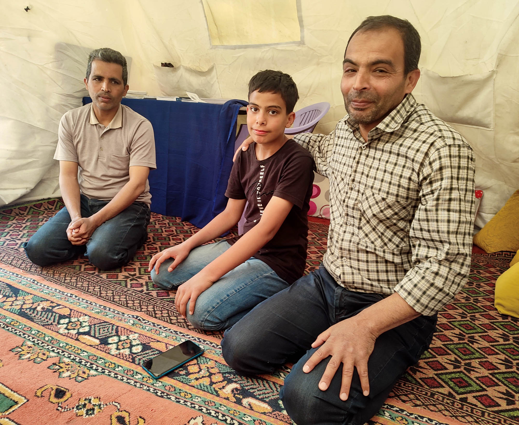
Ahmed fled to Turkey from Aleppo, destroyed by the Russians, with his family: his two brothers and a sister, his wife and five children, his father and mother. Back home he was a history teacher, in Adıyaman he became a baker. They rented an apartment on the third floor of a newly built house. “That day, as always, I went to the bakery at four in the morning. A few minutes before starting the work, the earth shook. I immediately called my brother, but his phone did not answer. I ran home, and for about twenty minutes, I was crying and praying. The side of the house where we lived collapsed. The two apartments below us were crushed, nineteen people died there. Our apartment was hanging in the air. But by the time I got home, everyone was standing on the street, safe and sound.”

What will they do now? “First of all, I have to find a job, because the bakery went bankrupt. Then we have to find an apartment, which is not easy now in Adıyaman, because everyone is looking for one. Turkish citizens are still somewhat taken care of by the state, but I don’t think they will care about us.”
The two boys, Hassan and Hamid also take part in the conversation of the adults. “What will you do when you grow up?” “Hassan wants to be a doctor, but university costs in Turkey, unlike back home in Syria. Six thousand euros a semester, we can’t pay that much. So he’ll learn some kind of paying profession, perhaps he’ll become a computer mechanic.” “And Hamid?” “He is still young, he just started school. I hope that when he’ll grow up, the war will be over and he can go to university back home in Aleppo, inshallah.”

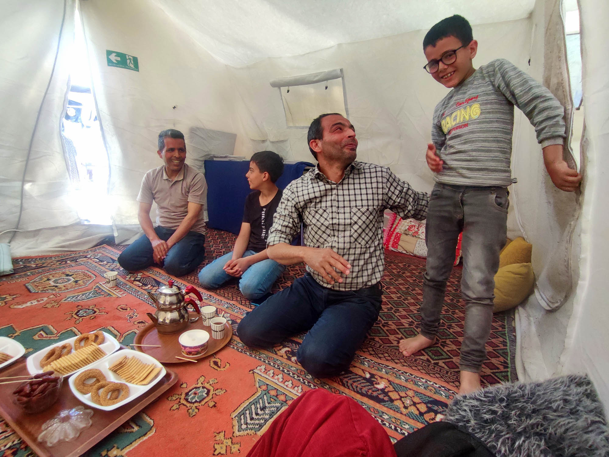
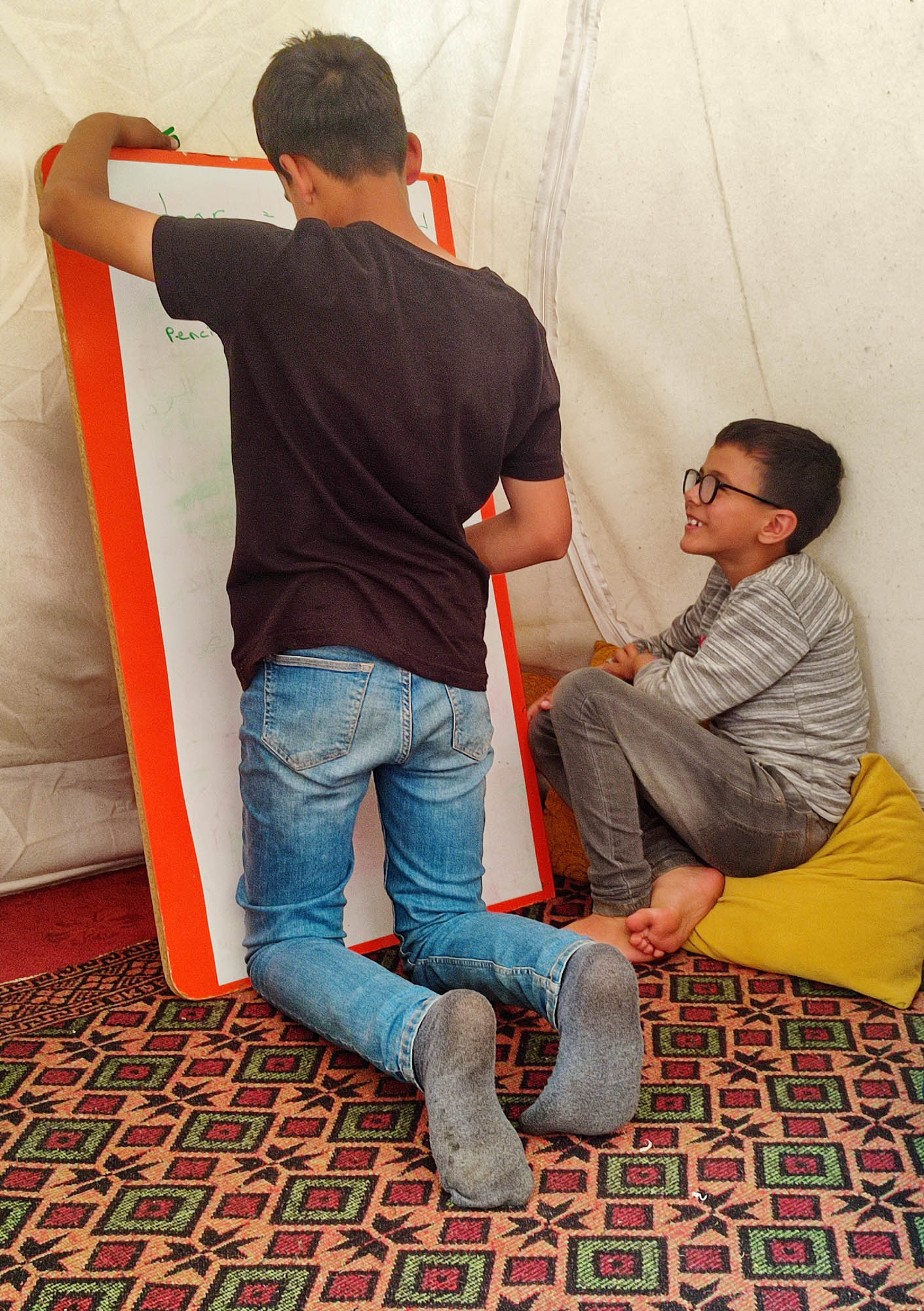
In the school, the children only learn Turkish, but Ahmed holds an evening school for them and teaches them Arabic and English. Both Ahmed’s father and mother are seriously ill, but they don’t know a word in Turkish, so the children have to interpret in the hospital and in the market. “They must be able to read and write in Arabic by when then get home, and also in English, because without it they have no future.” He lets Hassan bring the board, and lets him write twenty words in English, Turkish and Arabic. Hamid looks at his brother’s performance in awe.
The most beautiful thing is how peacefully, with how much love and strength he bears this situation, these many variations of calamity which they have been going through for years. “We would not go far by ourselves, but God always sends good people who help us further.” We exchange phone numbers, I ask him to write if anything changes in their lives. I will come to Adıyaman again at the end of May, and will try to bring some support. If anyone wants to contribute, please do so. Write at wang@studiolum.com.

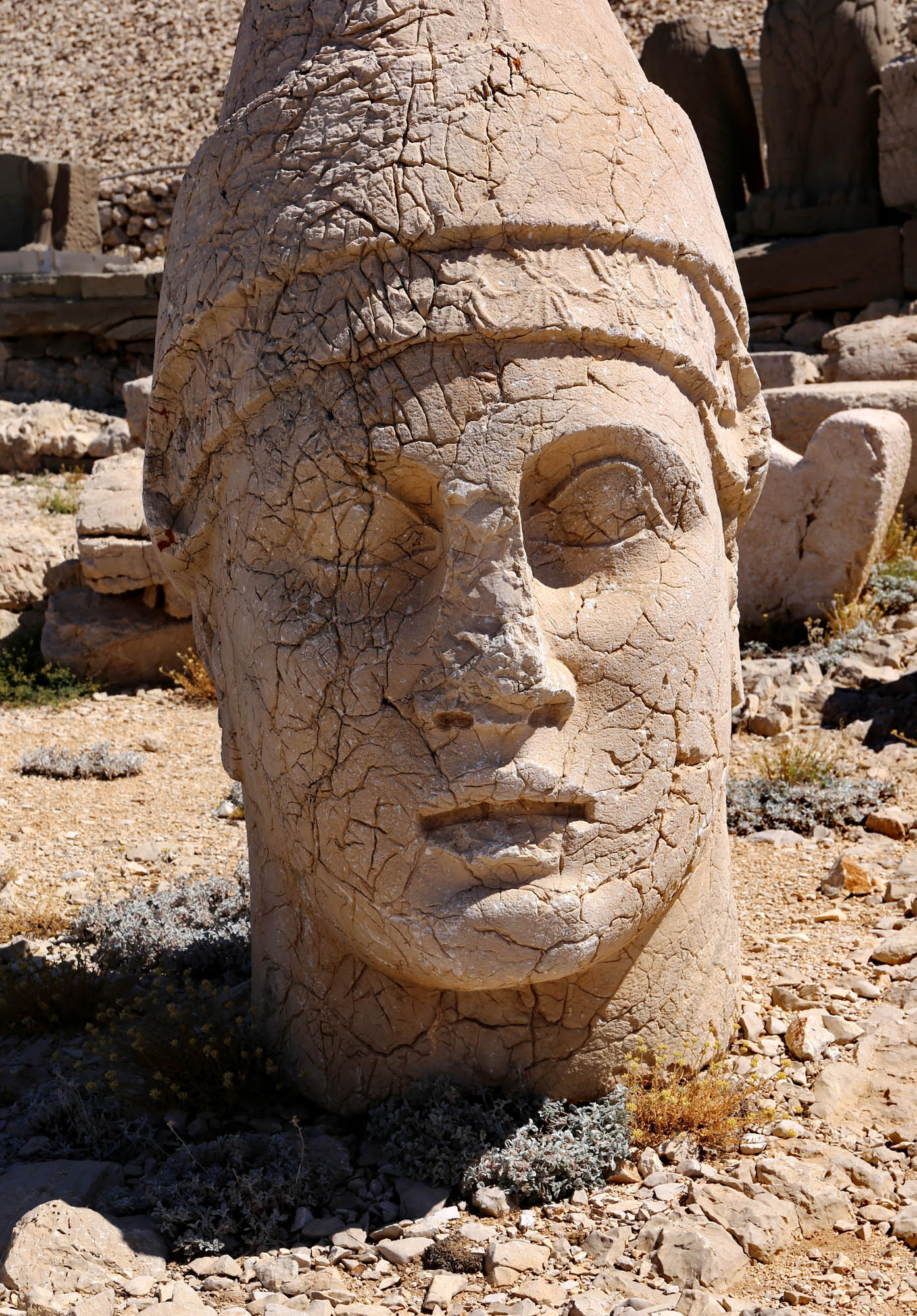
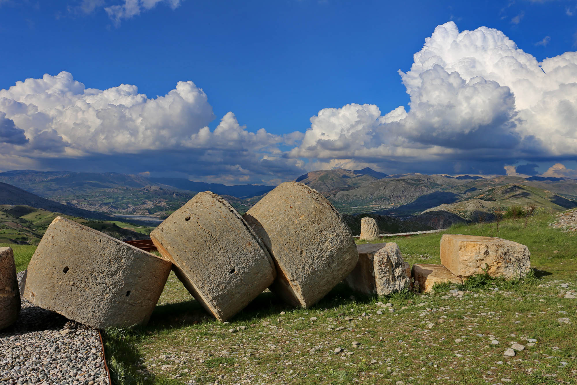
Commagene’s most important historical monuments are Mount Nemrut with its monumental tomb of Antiochus I, the just and excellent god, and the Arsameia hillside, where he shakes hands with his colleagues, the main figures of the Greco-Persian pantheon on several stelae under the pretext of his father’s tomb. I have already written about them in detail, illustrated with several photos. But approaching from Adıyaman, the first monument is the
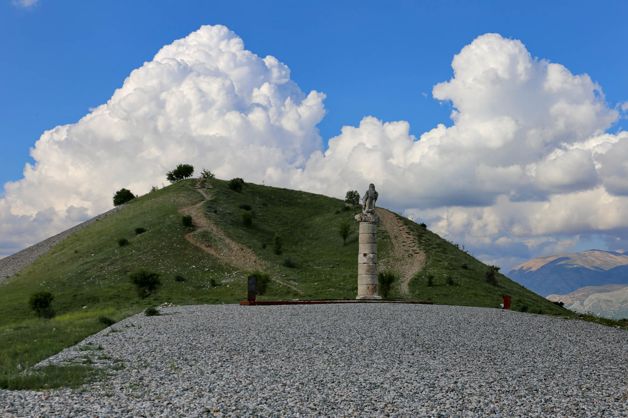

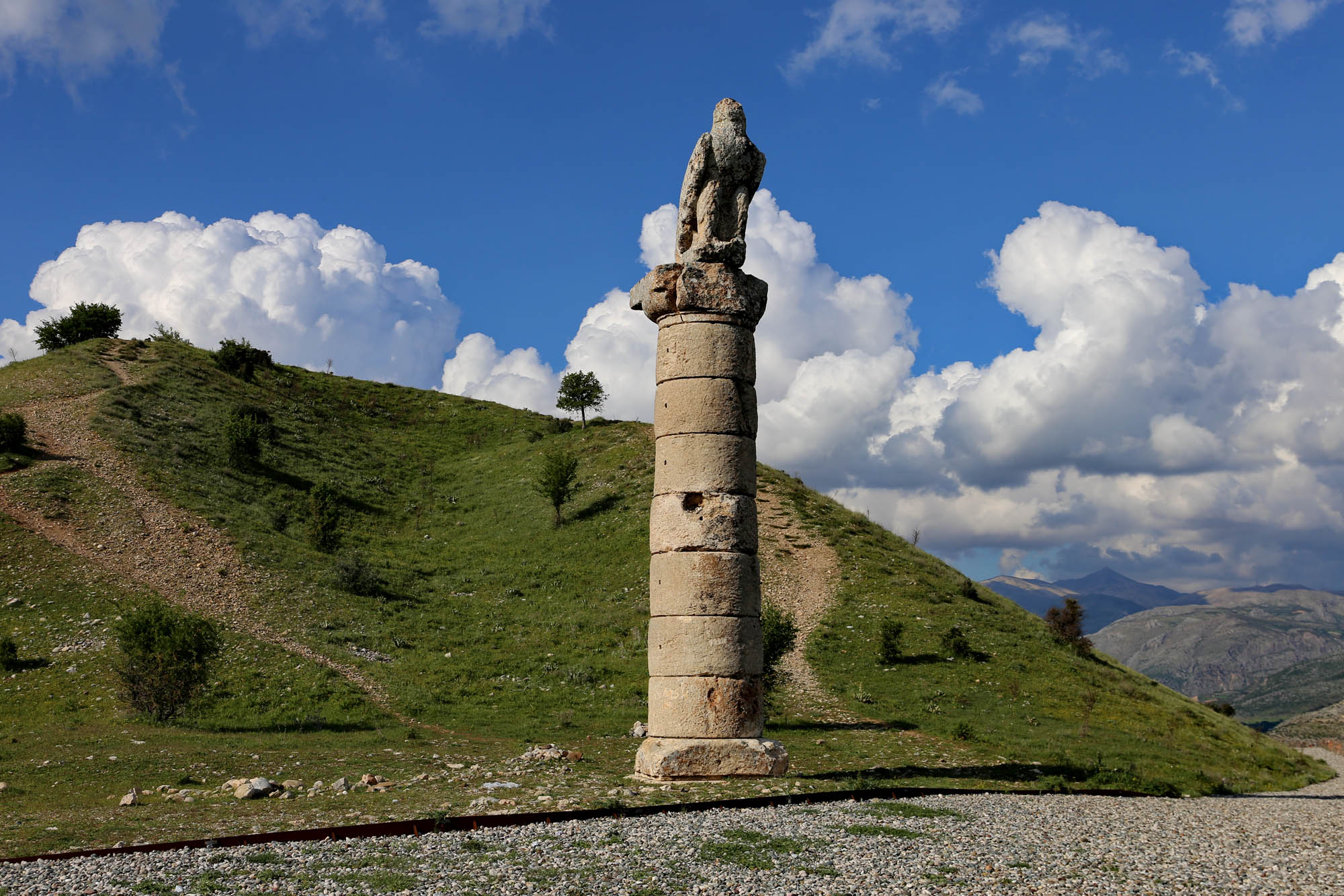
The hill was originally surrounded by three pairs of columns on three sides, but some of them have already collapsed. As we approach on the road, an eagle stands on the remaining pillar of the first pair – this gave the monument the Turkish name Karakuş, “black bird”.

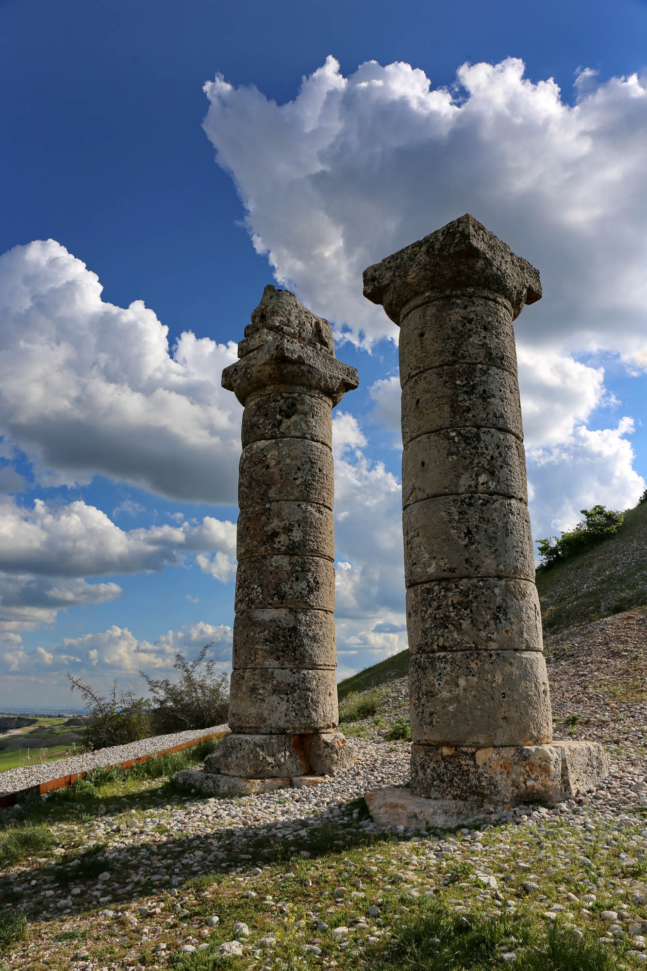
Both columns of the next pair are standing, but only the statue of a reclining bull remains at the top of one
From the third pair one column has long since collapsed, and its stones have also mostly disappeared. Only the head of the lion that once stood on top is still standing on the ground. The other column was still standing last year, with a relief on top, showing Mithridates II and his sister Laodice – the wife of the Parthian general Orodes, who destroyed the Roman army in 53 BC – shake hands. However, this column also collapsed in the recent earthquake, and its rings crosswise block the path around the hill. The lion turns his back on him just as a cat turns his back on the harm he caused. He stares fixedly at the distant Mount Nemrut, as if thinking “it’s good that I got off it in time”.

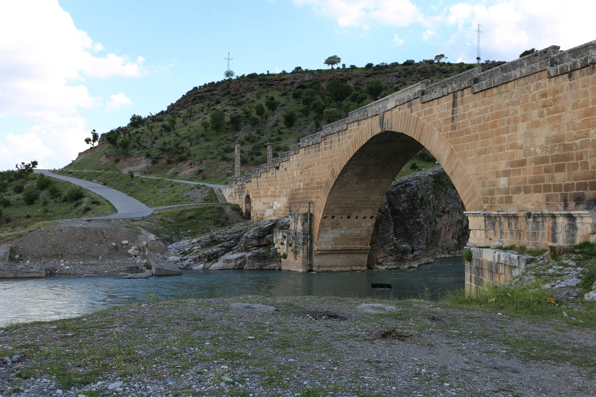
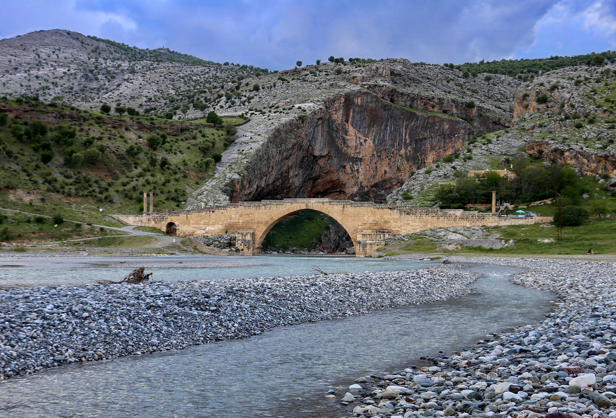
Septimius Severus expertly managed visual communication to represent his family’s unity and power. Originally, two columns at each end of the bridge represented the four members of the imperial family, the emperor and his wife, as well as their two sons, Caracalla and Geta. When Caracalla murdered his younger brother and co-ruler in 211, after their father’s death, he also ordered damnatio memoriae against him, meaning that his image and name should be removed from all public depictions and inscriptions. I already have a small collection of such mutilated monuments, that I will soon publish. One of their most astonishing examples is this very bridge, where the legionnaires did not bother much with sanding off the inscriptions, but instead tore off the entire column of Geta. Since then, the bridge has been asymmetrical, which contradicts the basic principles of Roman aesthetics. But it’s still good like this for the countryside.

At the other three-star attractions of Commagene, Kahta Castle, the Arsameian Via Sacra and Mount Nemrut, we don’t stop now. They are open and we will be able to see them with the group. I mean Arsameia is closed, but Junus, the Kurdish owner of Café Roma, will open it for us.

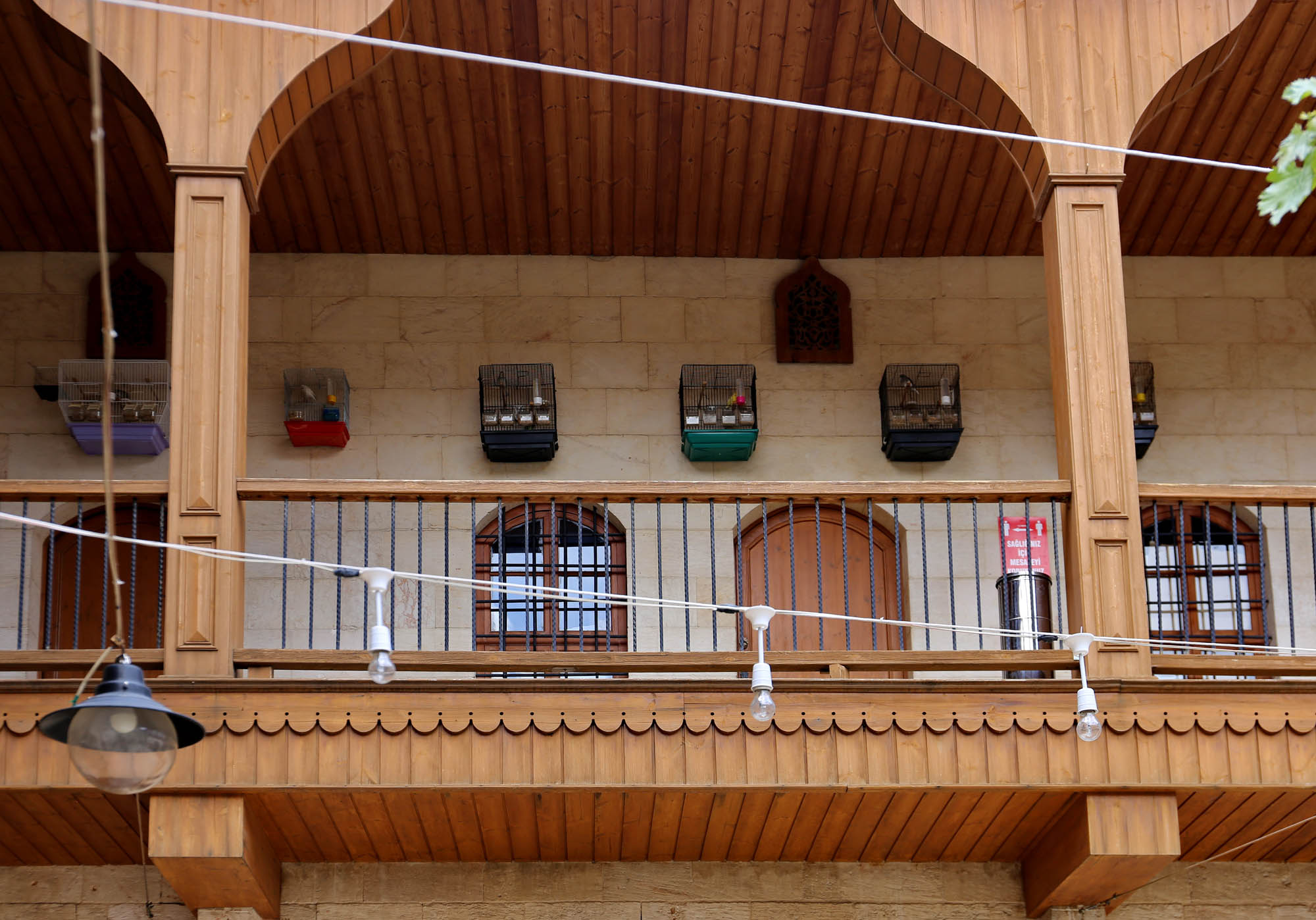
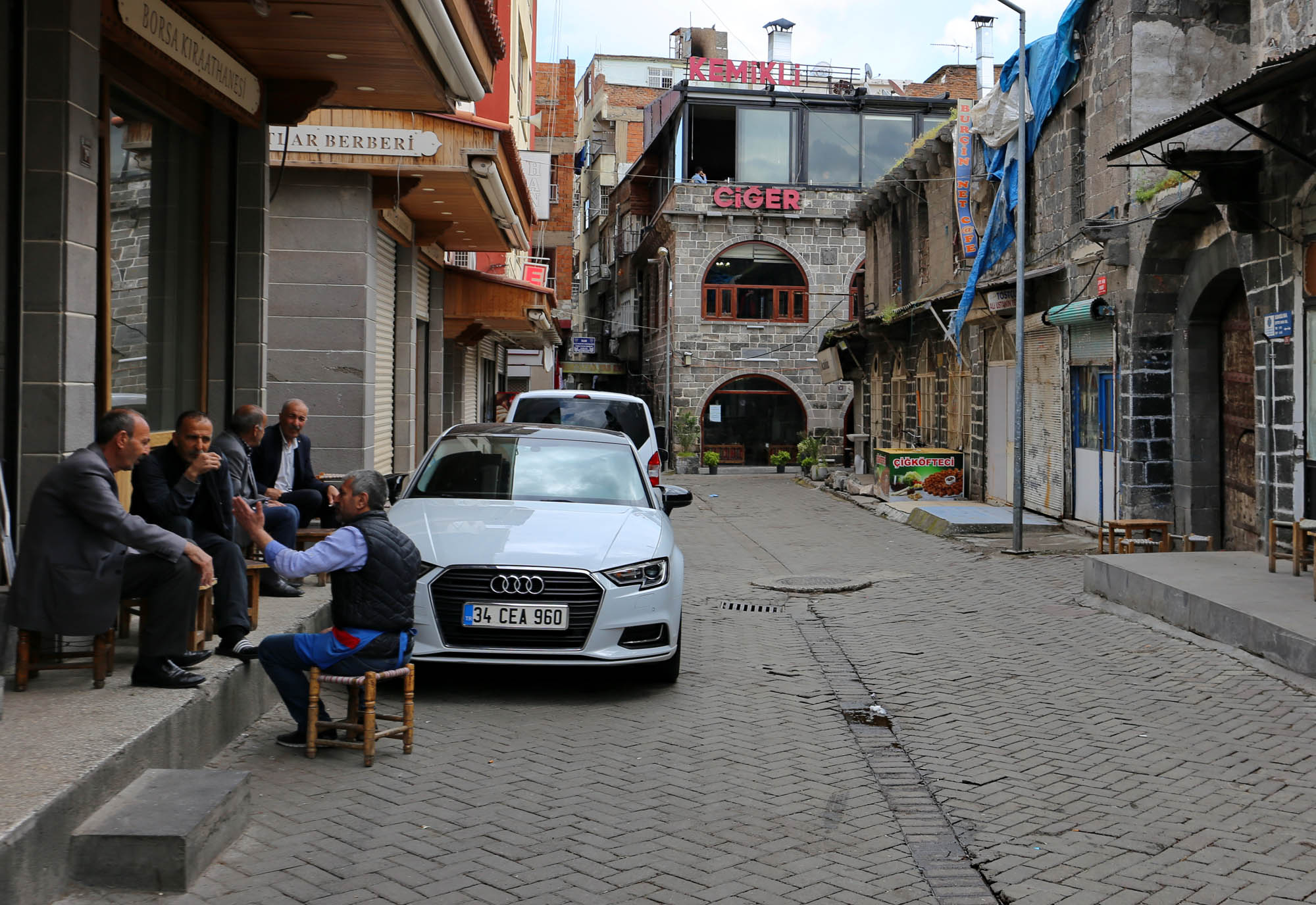
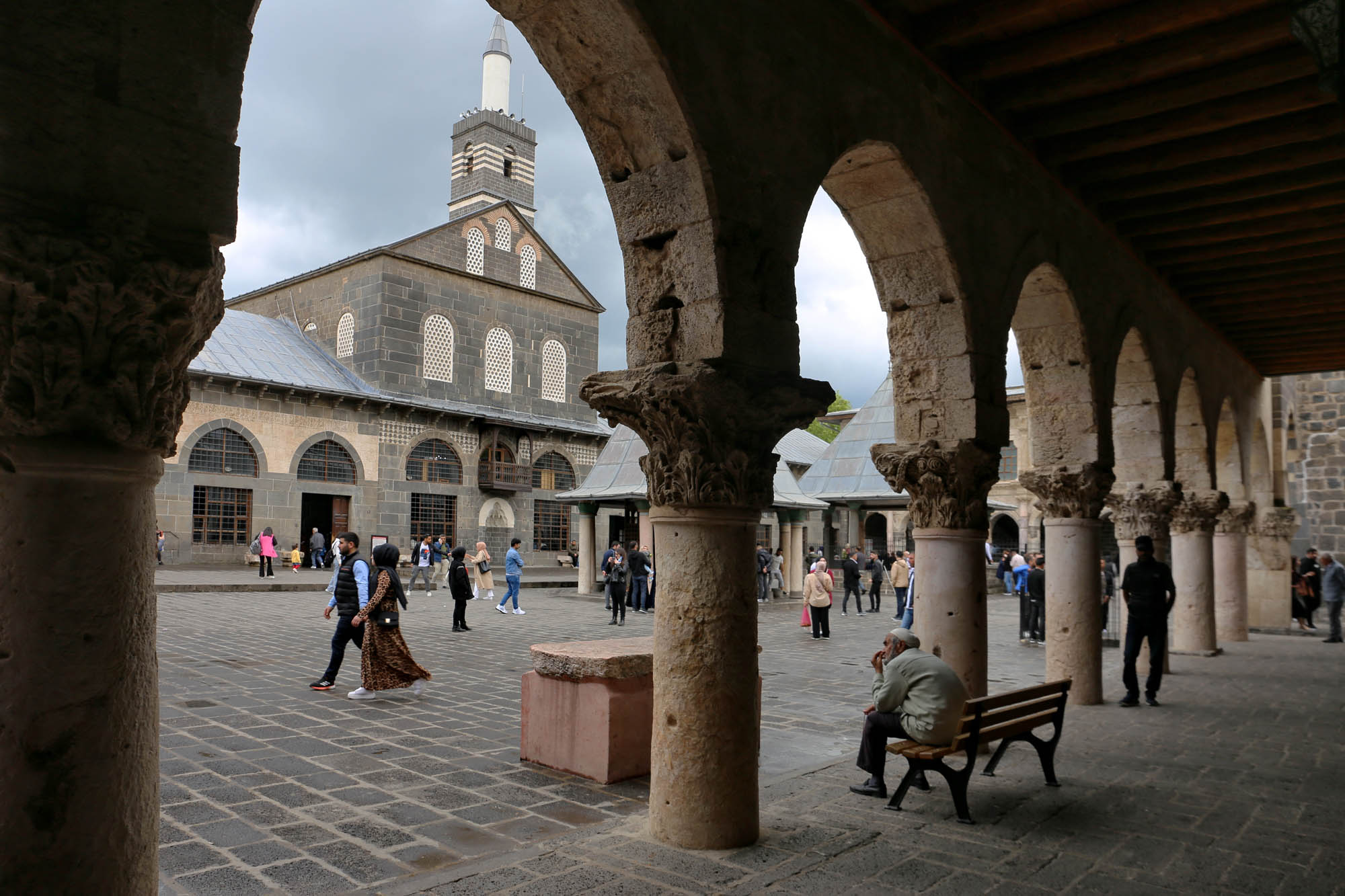
In Diyarbakır, life is great not only in the night, but also in the daytime. The center of the old town, around the Grand Mosque but also everywhere else, is full of teahouses, music cafés, and alternative places. Mainly former Syriac and Armenian merchant houses with large courtyards, whose black tuff walls are decorated with white limestone inlays. But in general, wherever there is a small hole where they can put a table with a few chairs, there are already four or five young Kurdish people sitting together, drinking tea, chatting and playing music. In just a short walk, we saw at least ten concert posters for the month of June alone, and we also sat down for tea at a live music venue. I wonder what life can be here when you are here for at least a week.

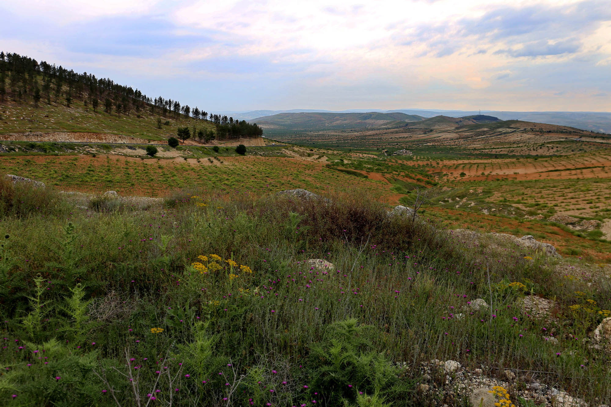
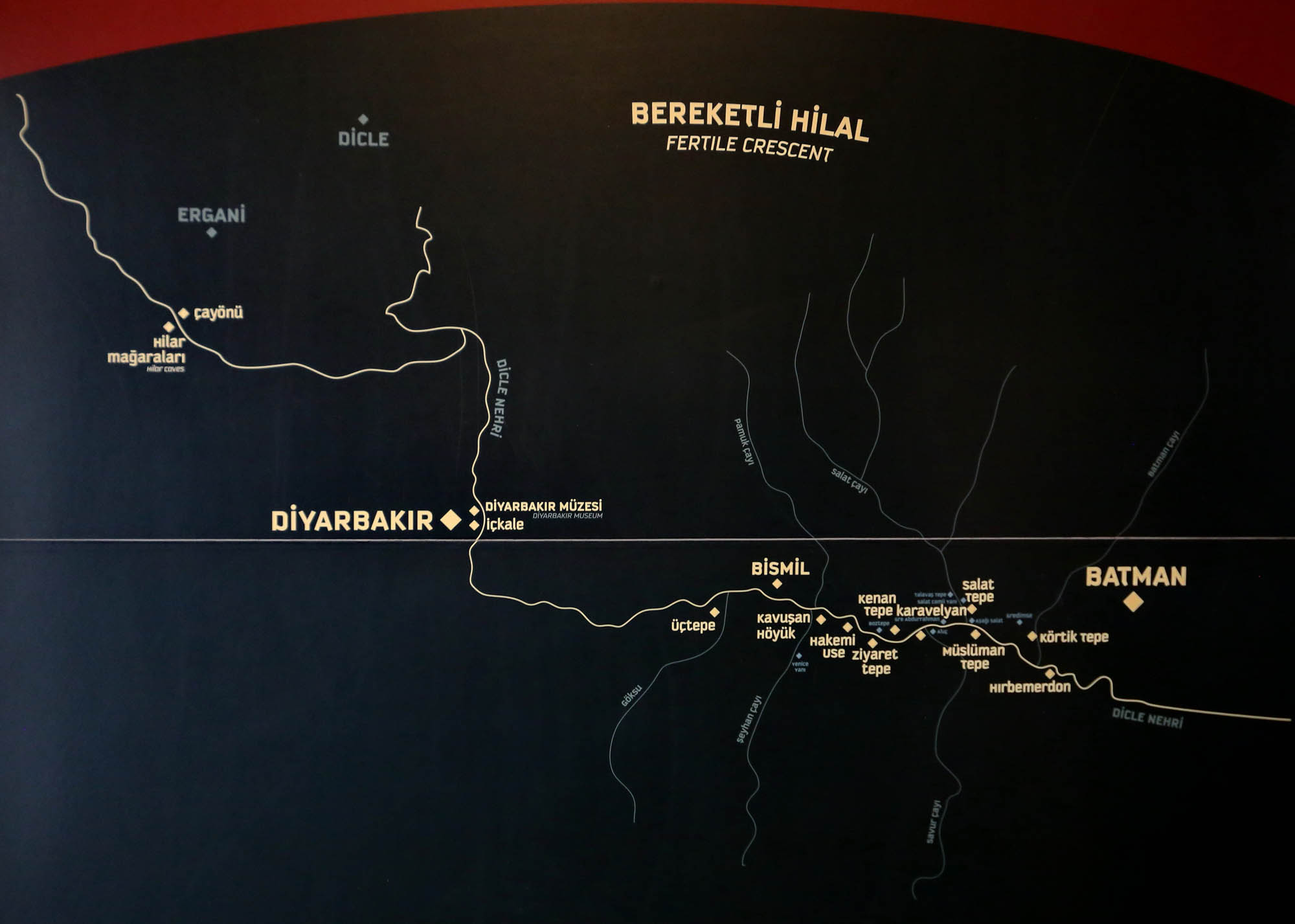
If Mesopotamia is the cradle of civilization, then the upper reaches of the Euphrates and Tigris, the southernmost part of the Anatolian highlands, is the womb that carried it. Here, on the hills along the river valleys, for one reason or another, enough people gathered to create something bigger than the individual. All this from the 11th millennium BC, i.e. at least five thousand years before the birth of agriculture. This means that they were not agricultural communities, but meeting places for hunters and gathereres. According to the latest theories – which try to explain the development of the Göbeklitepe sanctuaries, the largest of such places – it was not farming that made this kind of population concentration possible, but on the contrary, the supply of a large number of people continuously coming together made the invention of agriculture necessary. Either way, these places along the Tigris produced a fascinating stylized figurative art with wonderful fabulous animals (which suggests that storytelling also flourished here), the richest display of which is the

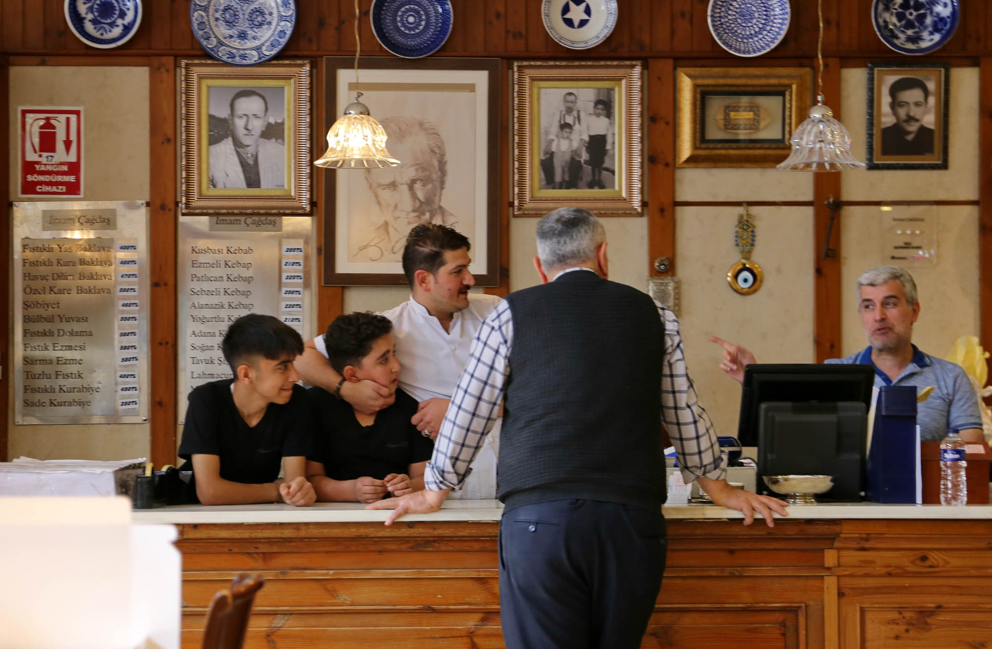
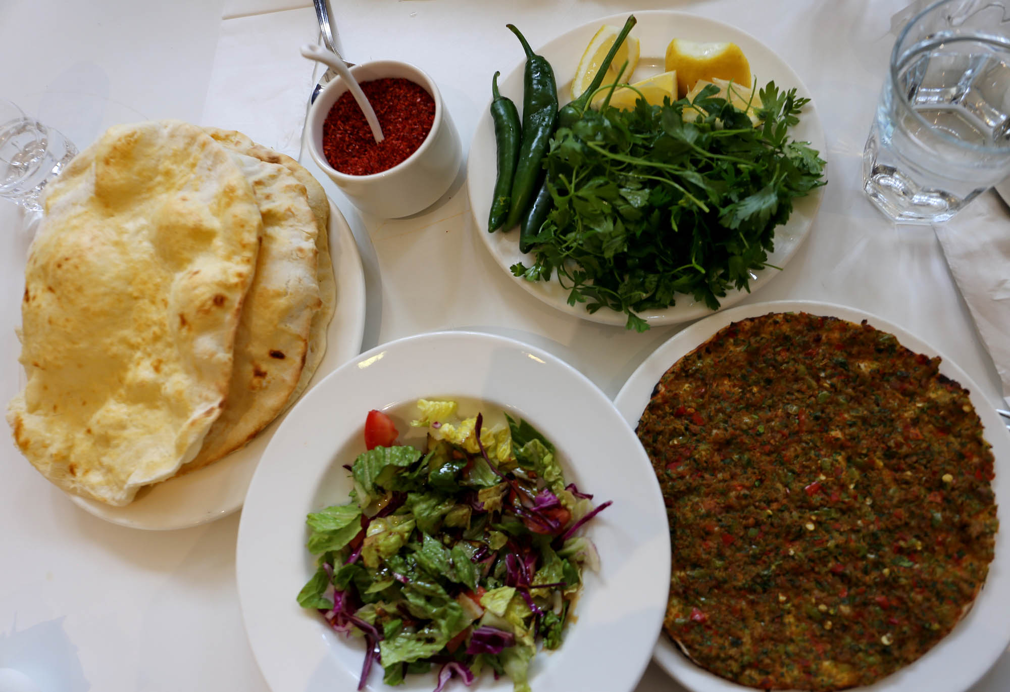
Just as in Erzurum the çorbacis, soup makers, so in Diyarbakır the ciğercis, liver roasters, that is, various meat roasted on skewers, dominate the field. One of the best is
It is worth watching how they prepare the table for a simple kebab. Even before you order, they serve the appetizing sabzi, i.e. green leaves, then the salad with thick pomegranate sauce, then chopped tomatoes, onions sprinkled with sumac, and tomato-cucumber-pepper sauce. And to all this, freshly baked pita in a small wooden box.
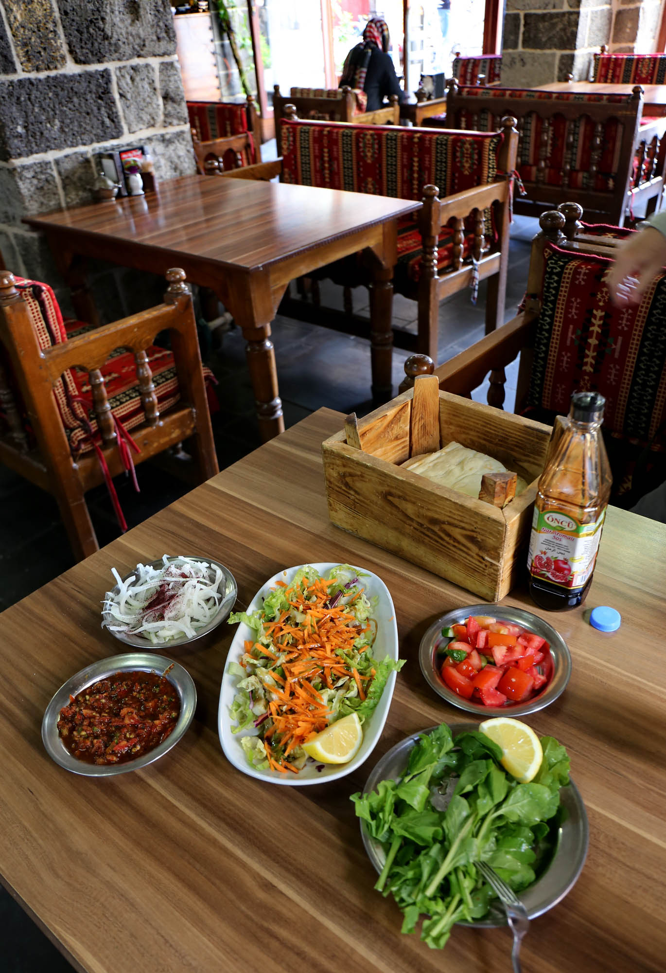
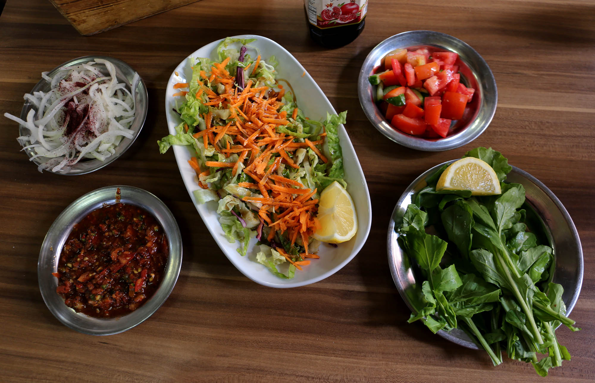
And then comes Adana kebab, minced lamb with pistachios, and etsis, which literally means skewered meat. But et, meat implicitly means lamb meat, what else? Along with it, they add hot – but not too hot – paprika roasted until slightly sooty. What is not visible in the picture is ayran, the thin yogurt juice, and the strong black tea.

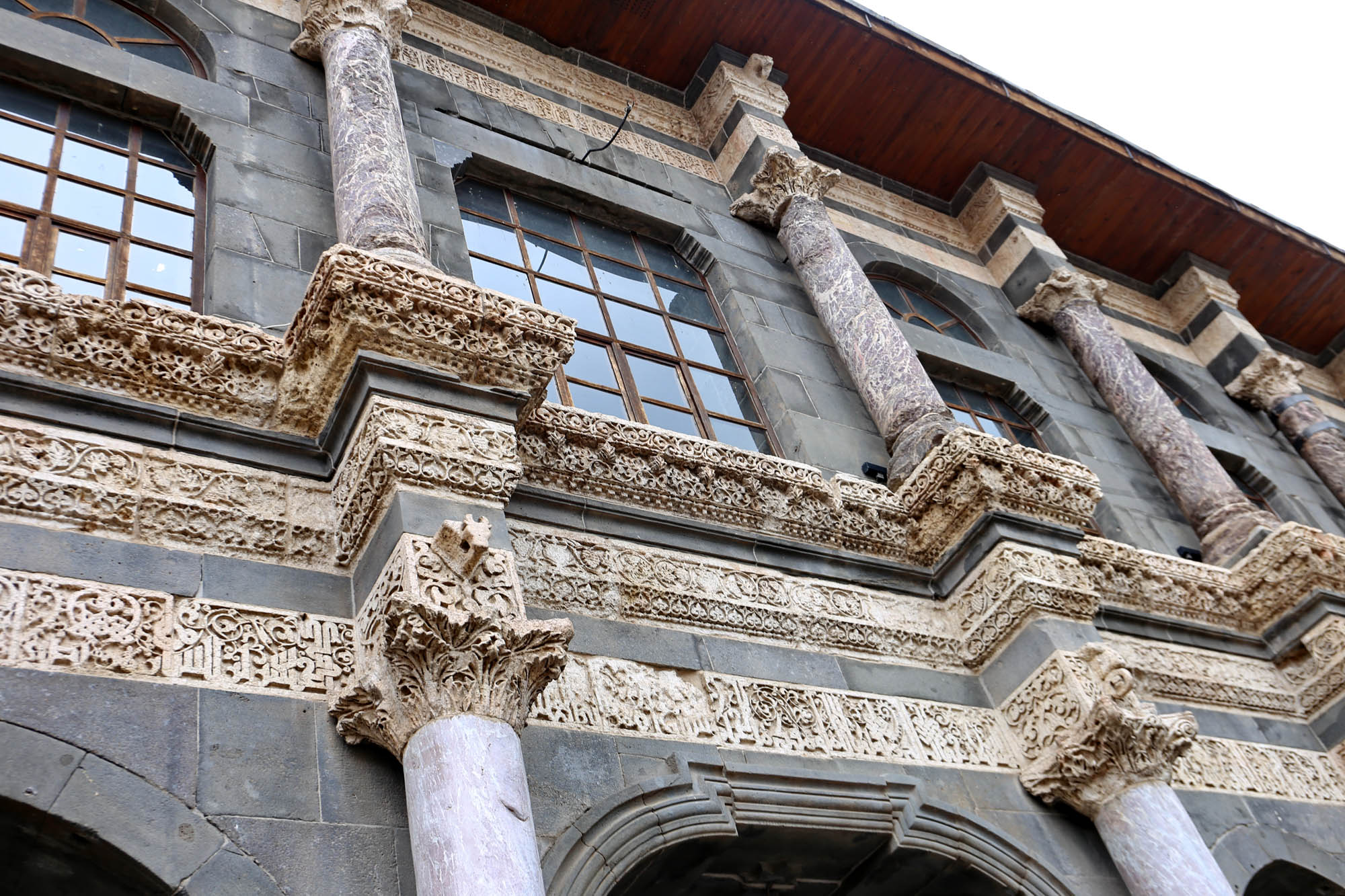

The façade of the mosque still preserves the memory of the Christian church. Inside, however, the former church space was longitudinally extended on the two sides, divided into three naves by two rows of arcaded pillars. However, the focal point of the space is still the former sanctuary, which exceptionally faced south rather than east, so it could easily be transformed into a mihrab, a white marble prayer niche facing Mecca.


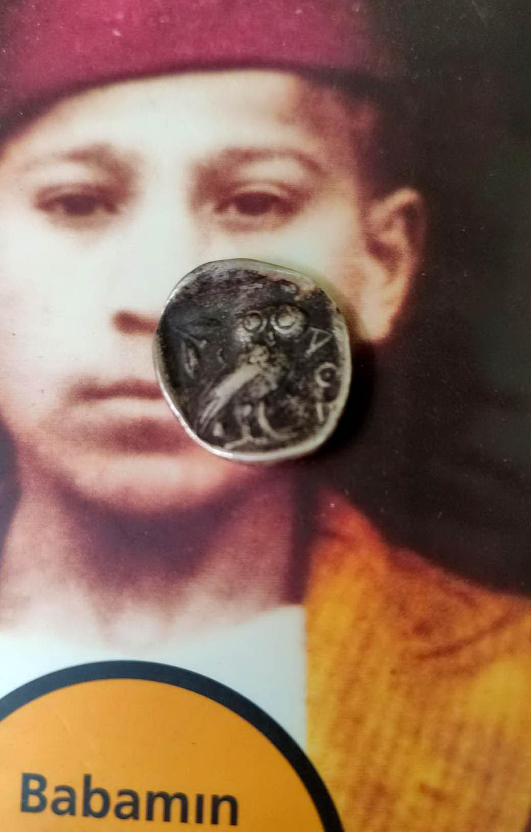
Do you still remember our visit to Hasan Pasa Hanı four years ago? It was then that we saw, in Hüseyn’s upstairs antique shop, the Athenian tetradrachm of Pericles decorated with an owl, the emblematic coin of the golden age of Greek democracy. Lloyd wanted to buy it, but by the time we got back, the store was already closed. Now, after four years, I go there again, and the owl is still there waiting faithfully. So I buy it for Lloyd.
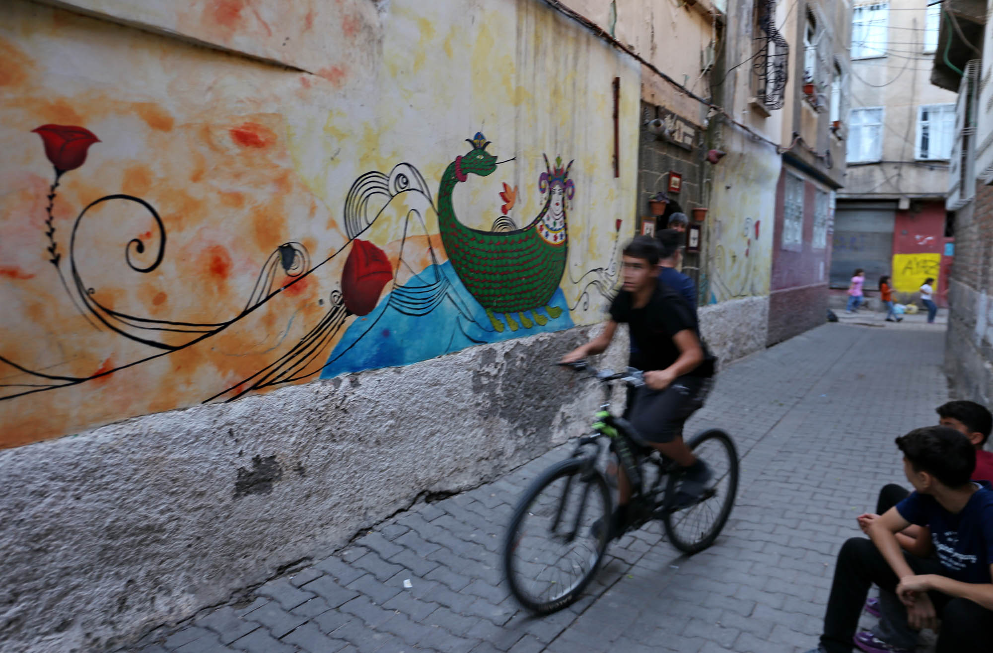
The book on which I photographed it – Babamin Tüfeği’s book about the Kurdish film director Hiner Saleem – was lying on the table of the Kurdish handicraft and book store Ilkiz. This small courtyard is a lovely oasis in the old town, right next to the Dengbêj House. Its young owner is rebuilding it for the second time after the Turkish bombings of the previous years. It sells beautiful handmade clothes, paintings and ceramics with emblematic motifs from Kurdish mythology, such as the Snake Queen or the Zoroastrian Ahura Mazda, as well as world literature in Kurdish translation, such as Ulysses, which is difficult enough to interpret in the original, let alone translate. Here I find Romeo and Juliet in a Kurdish translation, and I ask the owner to read aloud Juliet’s renowned monologue. Then he shows the famous Kurdish Romeo and Juliet on a ceramic. Even in the afternoon, Verona echoes in some Diyarbakır graffiti.

When we did not know yet how good the situation was on the planned route of the tour from Gaziantep to Mardin and back, we planned to set up a B-route as well. If Northern Mesopotamia only offers disaster tourism, we would instead travel around Lake Van, where we have already visited several times. Although fortunately it turned out that everything was in order in the region included in the plan, we had already booked the accommodations near Lake Van for this discovery tour, and anyway we are curious about those sections of the road where we have not been yet.
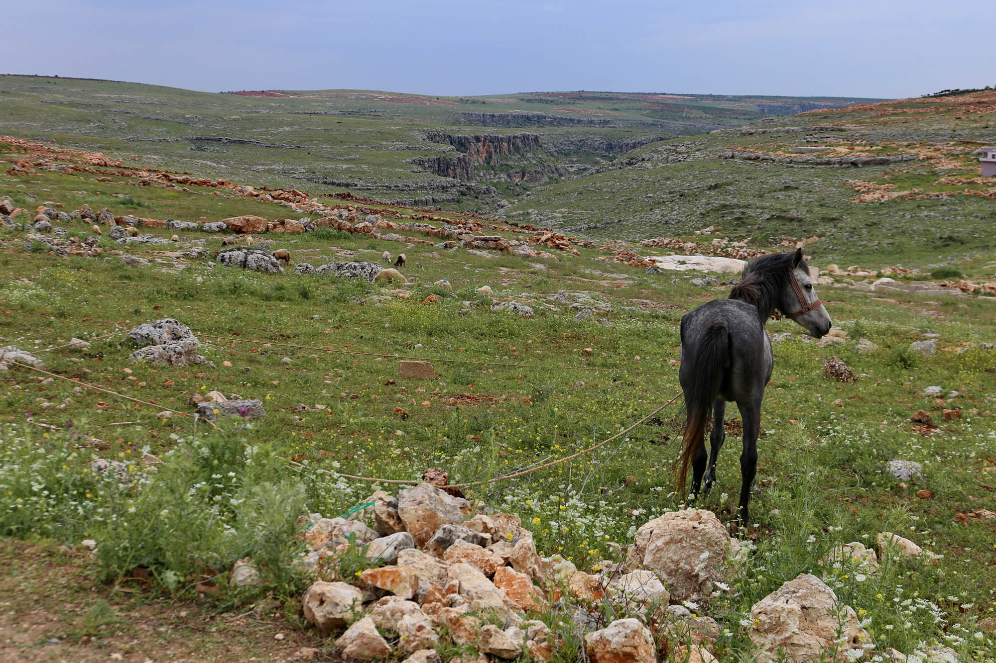
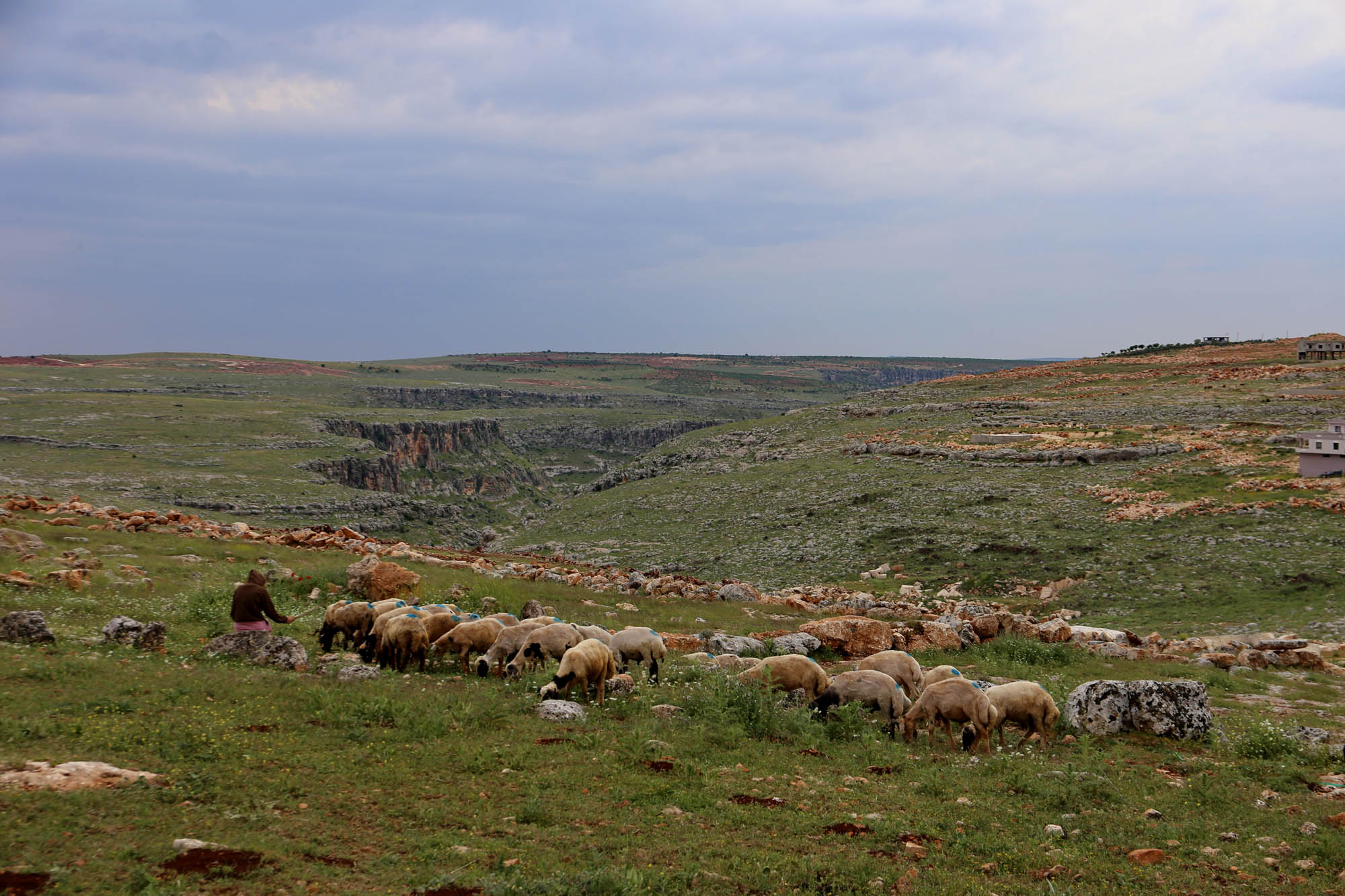
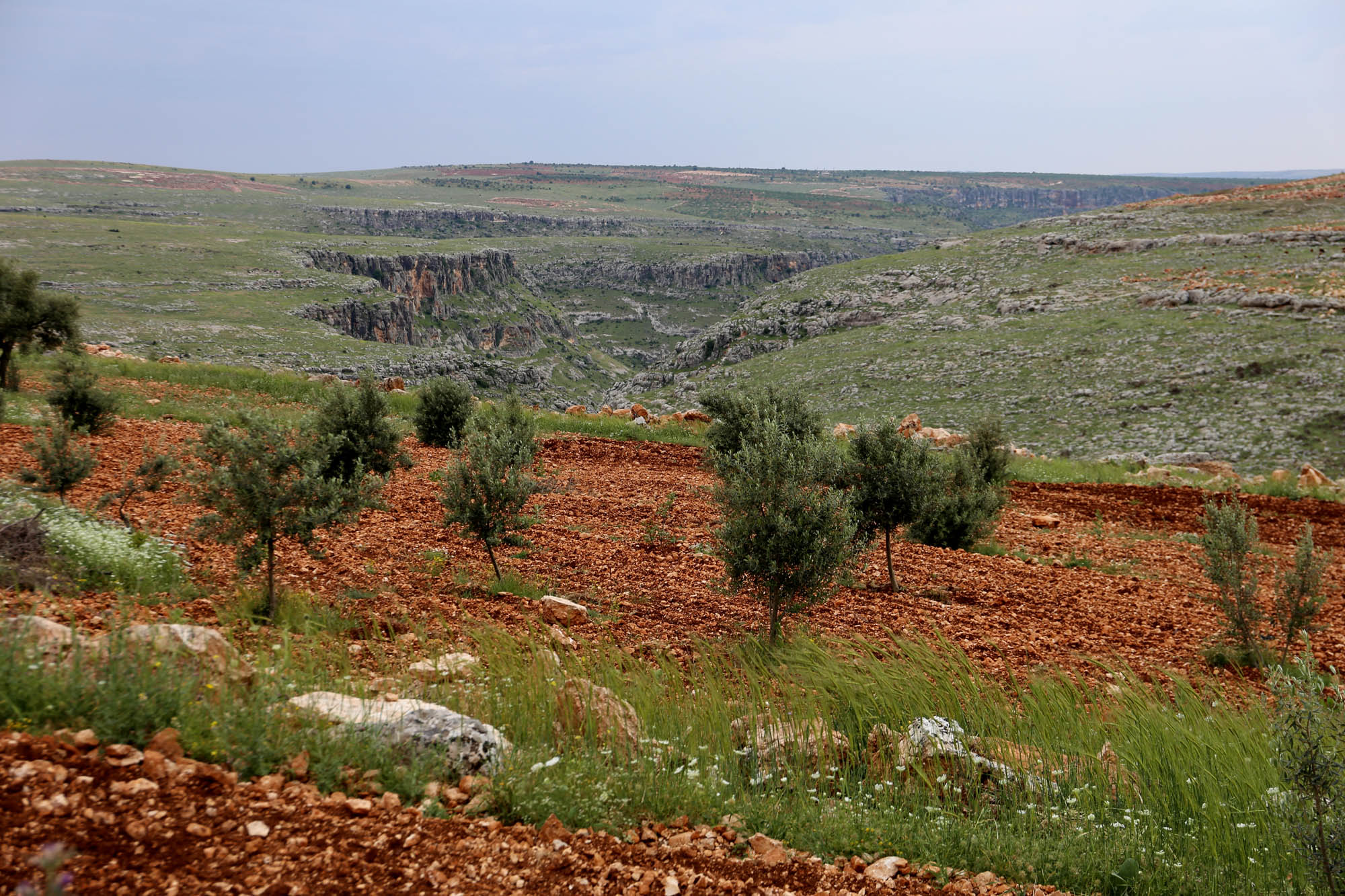
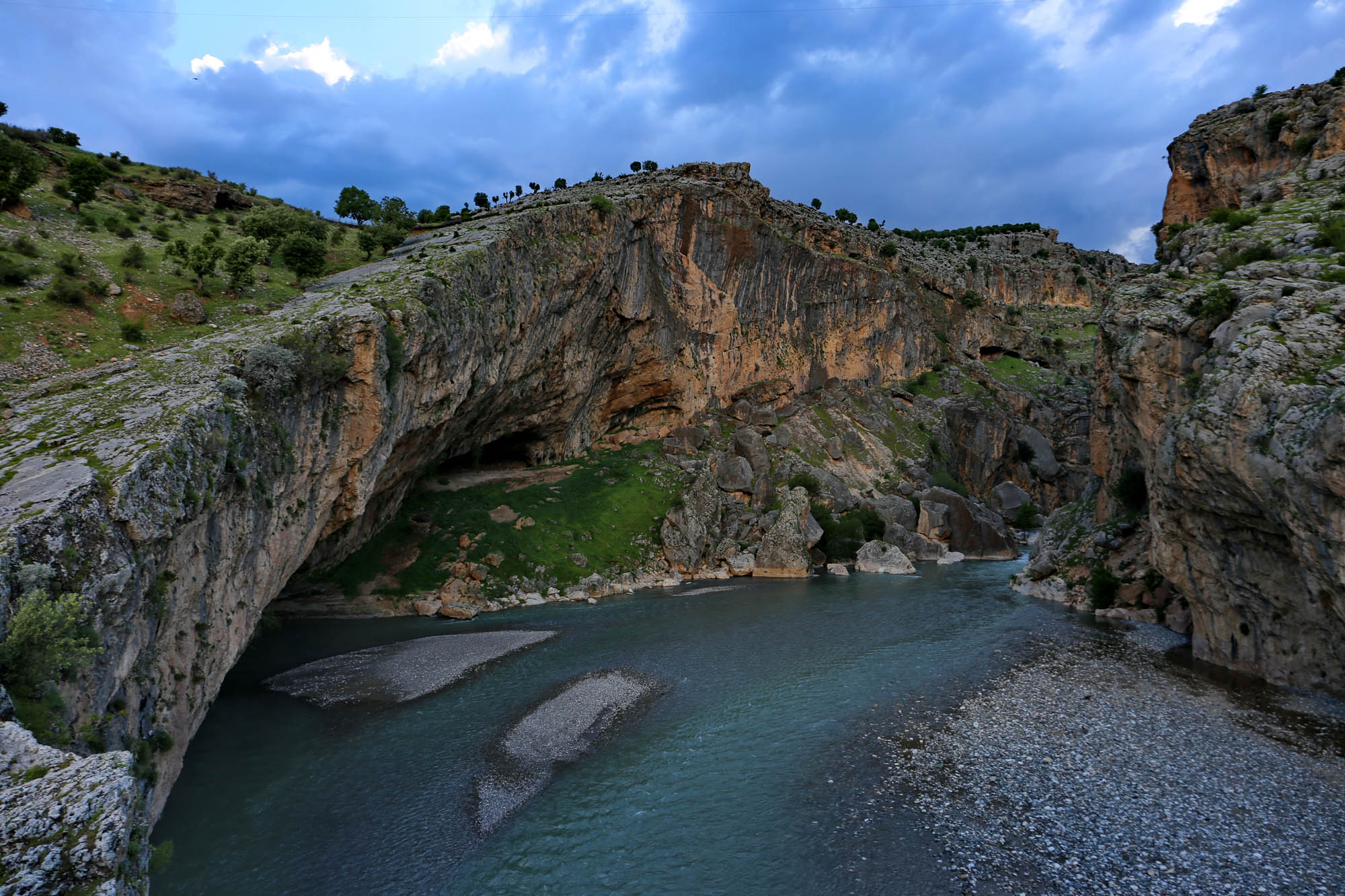
From Diyarbakır, the road leads through an extensive karst region, between soft hills overgrown with green grass, sharp drops, sinkholes and karst streams. Here and there, we veer off the main road for the sake of a more exciting valley. Kurdish shepherds question us first suspiciously, but later become more friendly. Halfway, after Silvan, a huge limestone range rises a little further from the road, and a narrow valley leads to it. Even from the main road, you can see the multitude of man-made rectangular cave openings.


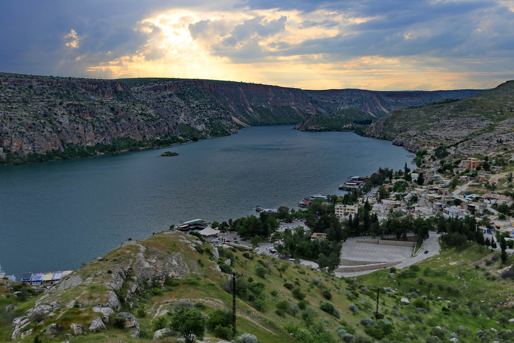
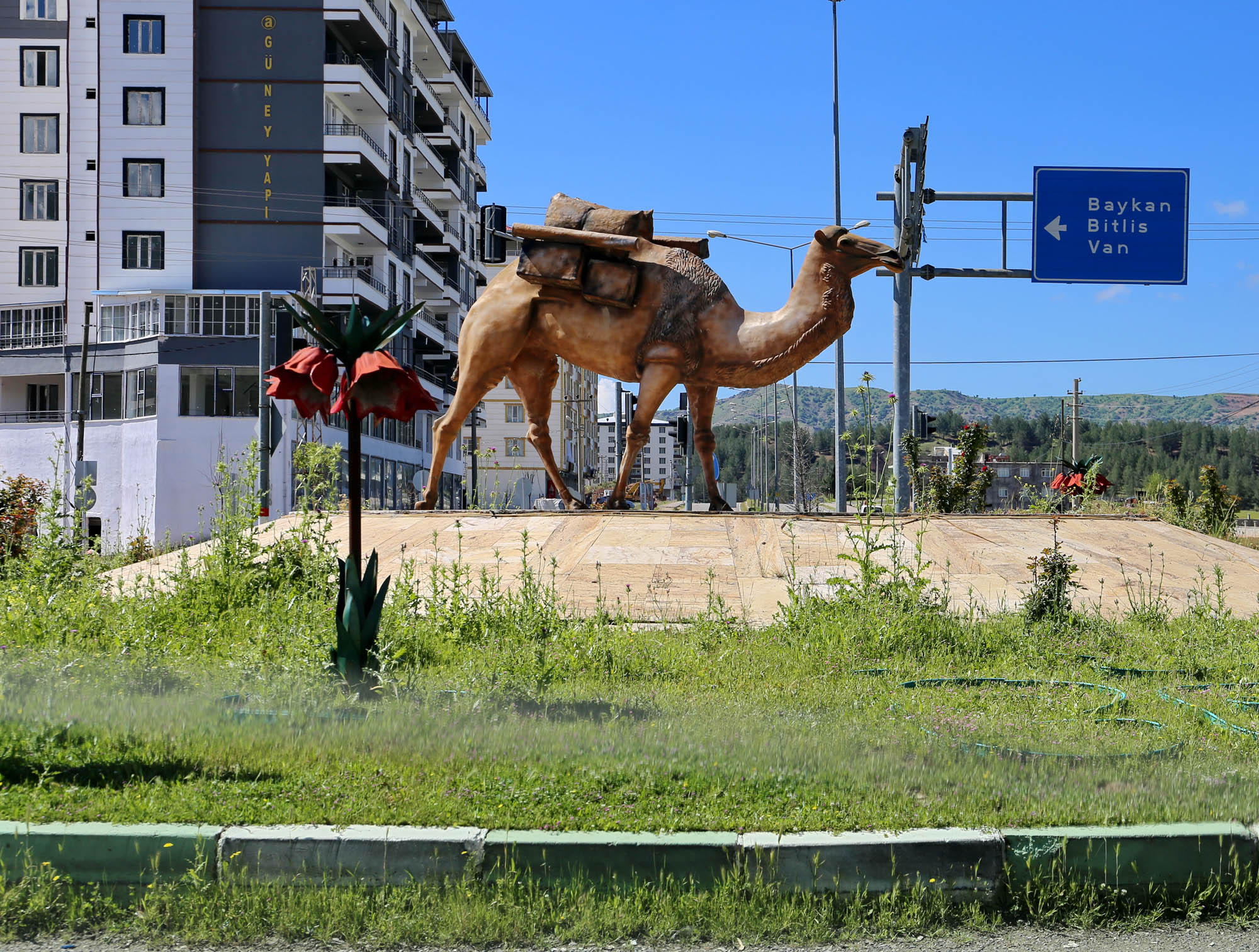
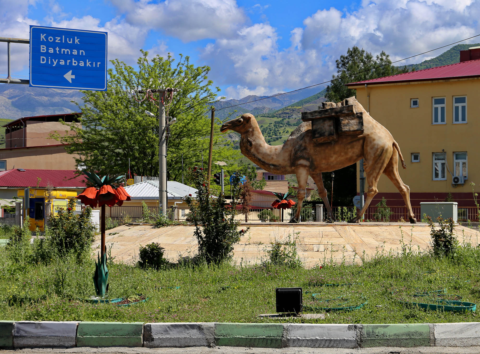
Traveling towards Lake Van, the mountains begin to rise dramatically. You can clearly feel that we have reached the Armenian Plateau. The landscape, the mountains, the geological formations are already the same as in present-day Armenia. The road runs in a deep river bed. Openstreetmap calls the river Başur Çayı, i.e. Southern River, while Google Map the Bitlis River, after the nearby city of Bitlis. The original name of the city, in the languages of its majority Syriac and Armenian inhabitants, exterminated in 1896 and in 1916, was Beth Dlis and Baghesh. But before reaching the city, we see


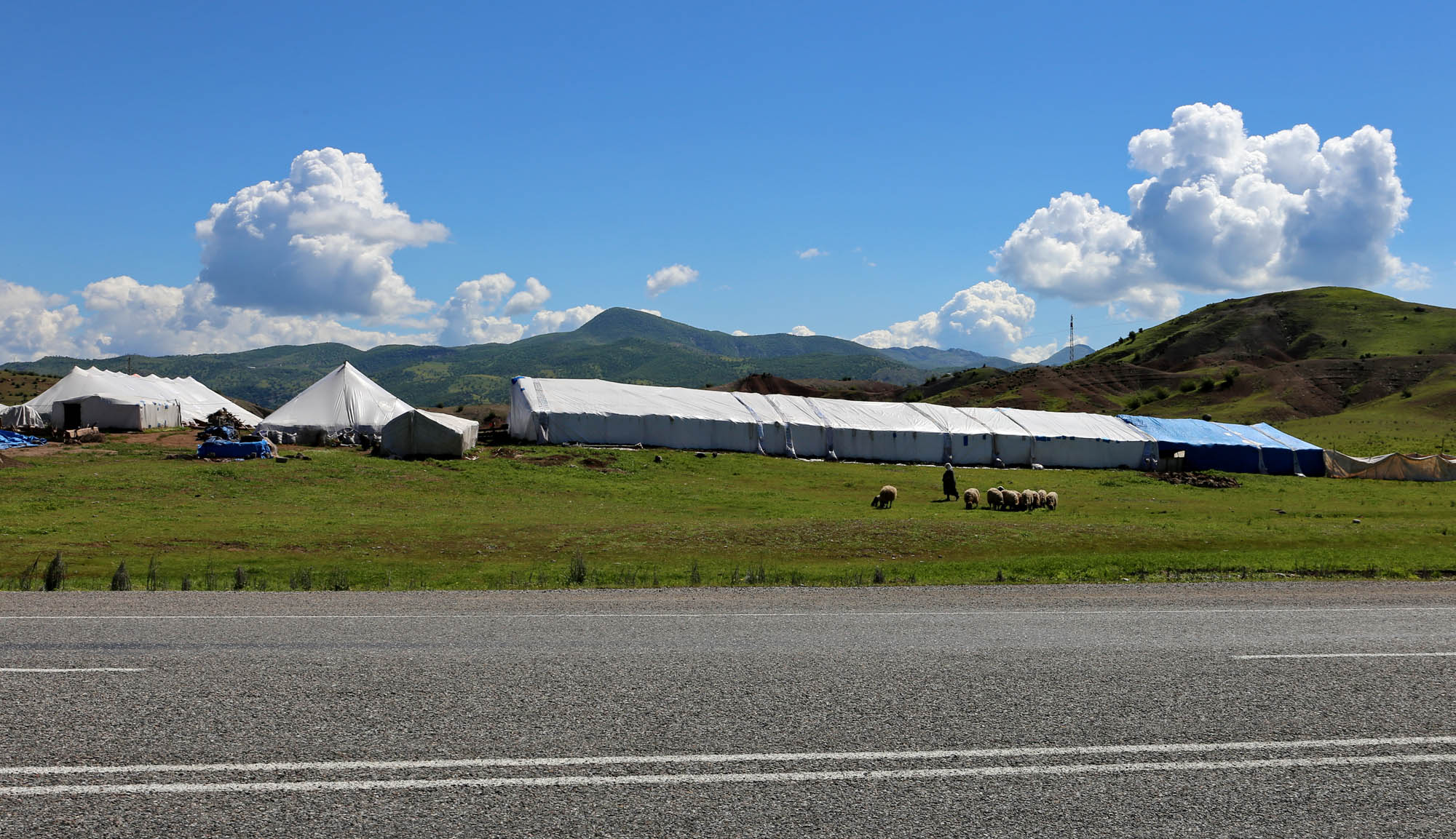
The bridge was really necessary in its time, because this is a section of the Silk Road leading from Persia through the Armenian mountains to Northern Mesopotamia. The roundabout before the nearby town of Ziyaret is a special reminder of this. In the installation, aside from the camel loaded with oriental goods, the large plastic imperial crowns (Fritillaria imperialis) deserve special attention. They proudly announce that this magnificent flower of the European Renaissance and Baroque comes from this mountainous region, as I wrote in detail before. From here on, we see more and more tent camps of Kurdish nomads along the road.


In the city of Van we don’t expect much to see, as we know that it was completely destroyed by the Ottoman army during the Armenian Genocide in 1915. Nevertheless we walk around the impressive fortress rock. And in the swampy pasture south of the castle, on the empty site of the former old town, we come across so many interesting things that the visit, planned for an hour, will take the whole morning. In the same way, the two paragraphs I intended to write about it has turned into such a long description, with more than a hundred selected pictures, that I finally publish it as a separate post: The vanished Van.
• If the interactive map is not visible, replace https with http in the url of this post •
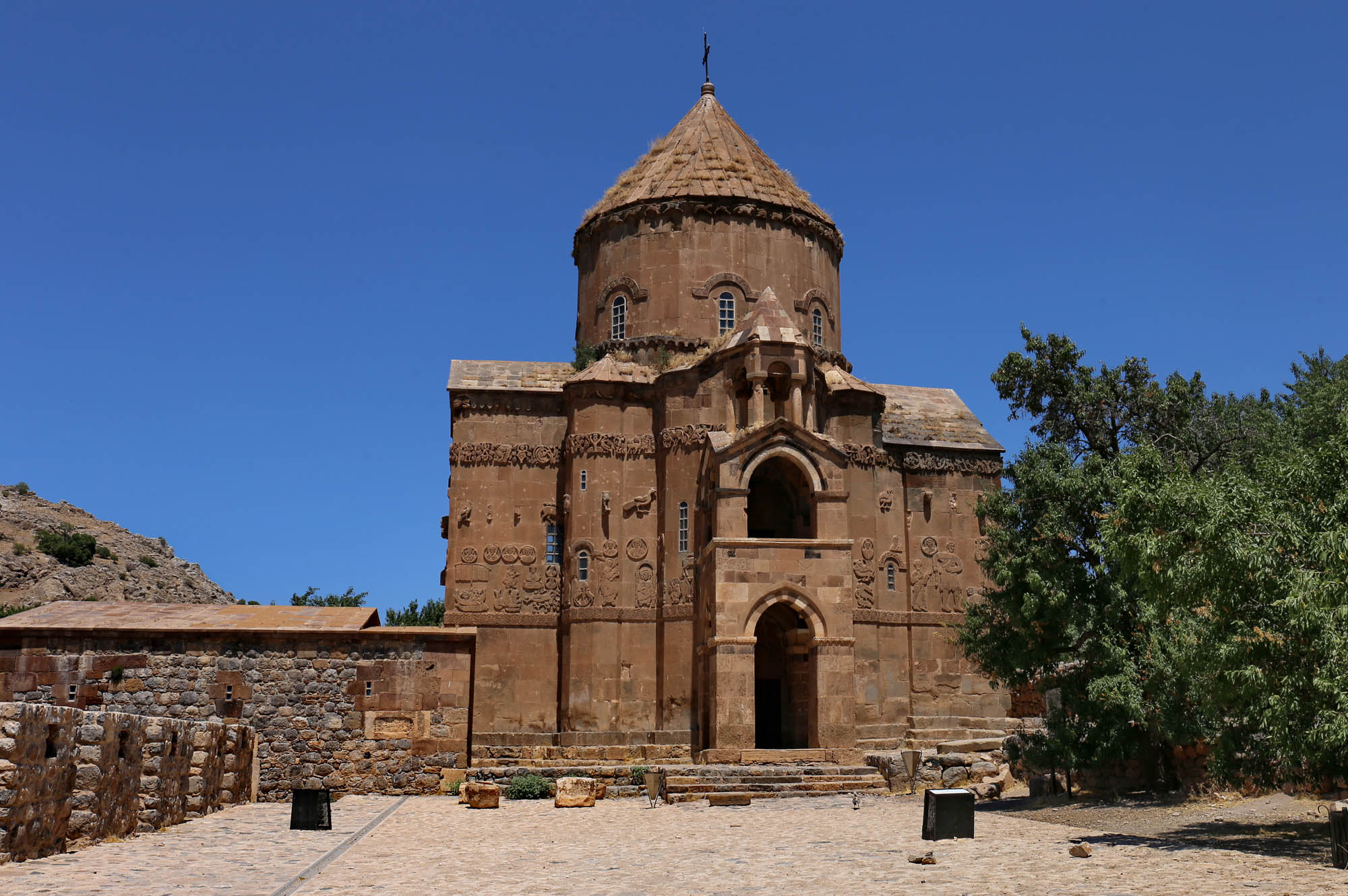
The city of Van and the region of Lake Van have been the central area of Armenian culture for thousands of years. At the end of the 11th century, with the arrival of the Seljuk Turks, the independent Armenian kingdom collapsed, and its provinces tried to survive as separate principalities. The area around Lake Van was the territory of the Principality of Vaspurakan, about which I have written before, including its maps. The hundreds of Armenian villages in the region, together with their hundreds of thousands of inhabitants, were swept away by the 1915 genocide. Their churches were looted, set on fire, and in the following decades their stones were also carried away. Still, the two largest monographs about them, Paolo Cuneo’s two-volume Architettura armena dal quarto al diciannovesimo secolo (1988) and T. A. Sinclair’s four-volume Eastern Turkey: An architectural and archaeological survey (1987) mention more than one hundred and twenty churches in the region, of which at least the memory, photo or sometimes even ruins have survived. Finding and approaching them is, however, not easy. This afternoon we only undertake to visit
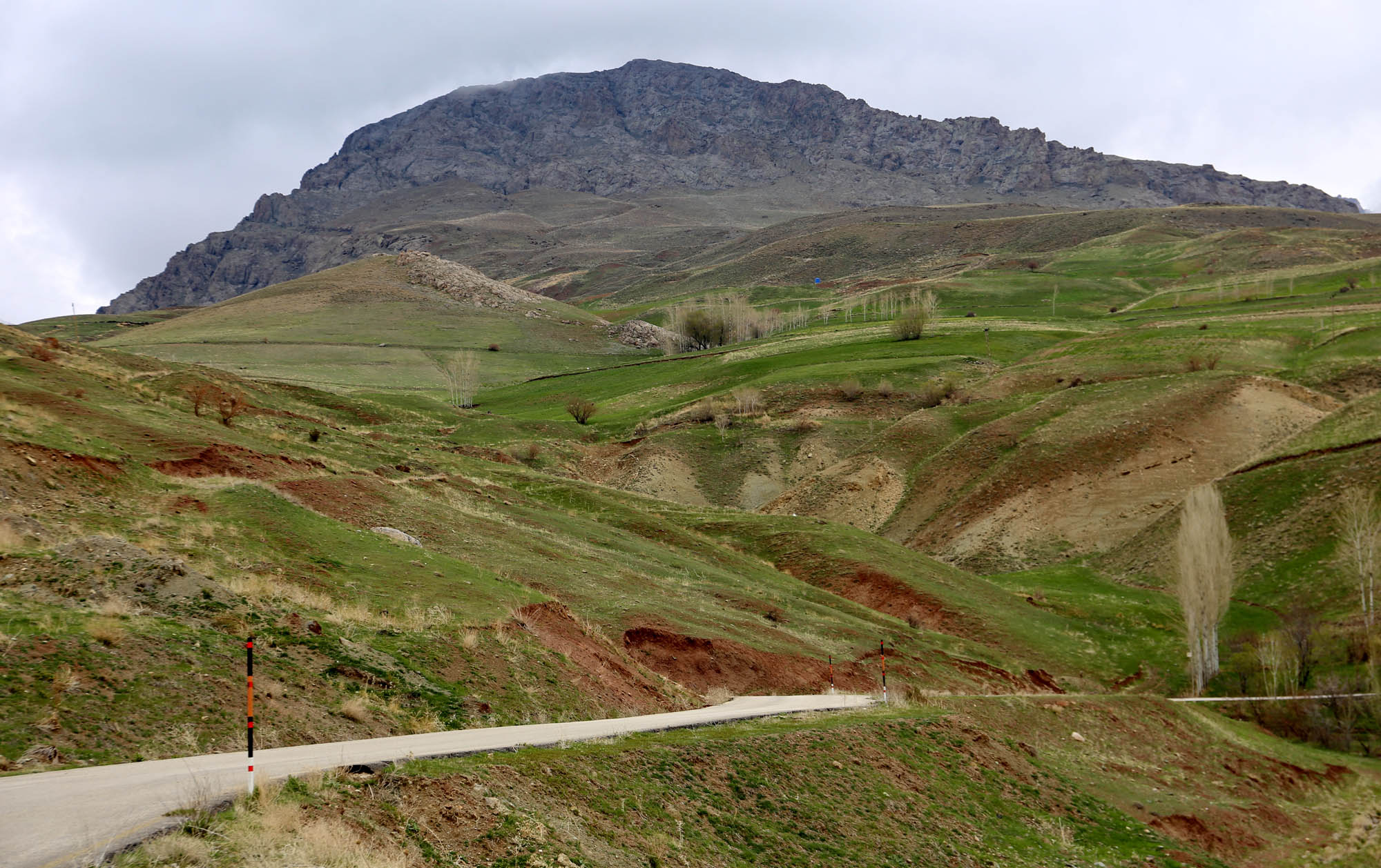
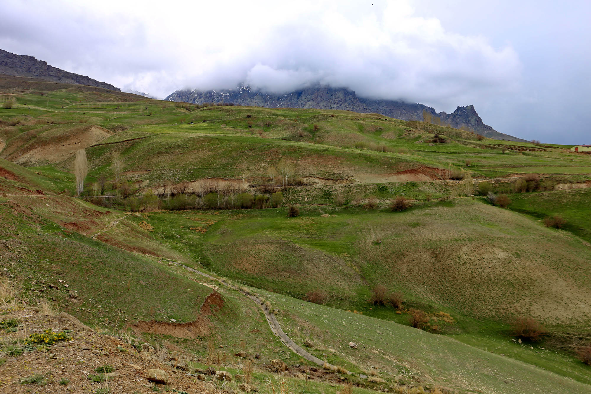
This village is located on the side of the 3,200-meter-high Erek mountain – Varag in Armenian, hence its name Varagavank, i.e. the church of Mount Varag –, low enough that you don’t have to do many serpentines, and that the cloud-covered peak provides a majestic background for the monastery ruins. Height markers along the road show how high the snow can cover the road in winter.

The monastery was built by Senekerim-Hovhannes Artsruni, King of Vaspurakan (1003-1021) as a royal burial church at the place where, according to tradition, the 3rd-century martyr Saint Hripsime brought a piece of the Holy Cross from Rome. In the following centuries, the monastery became Vaspurakan’s ecclesiastical seat, as well as an important center of Armenian monastic life and manuscript copying. Over the centuries, six more churches were built next to the central Church of Our Lady, so that the Turkish and Kurdish population of the area knew it as Yedi Kilise, the Seven Churches.
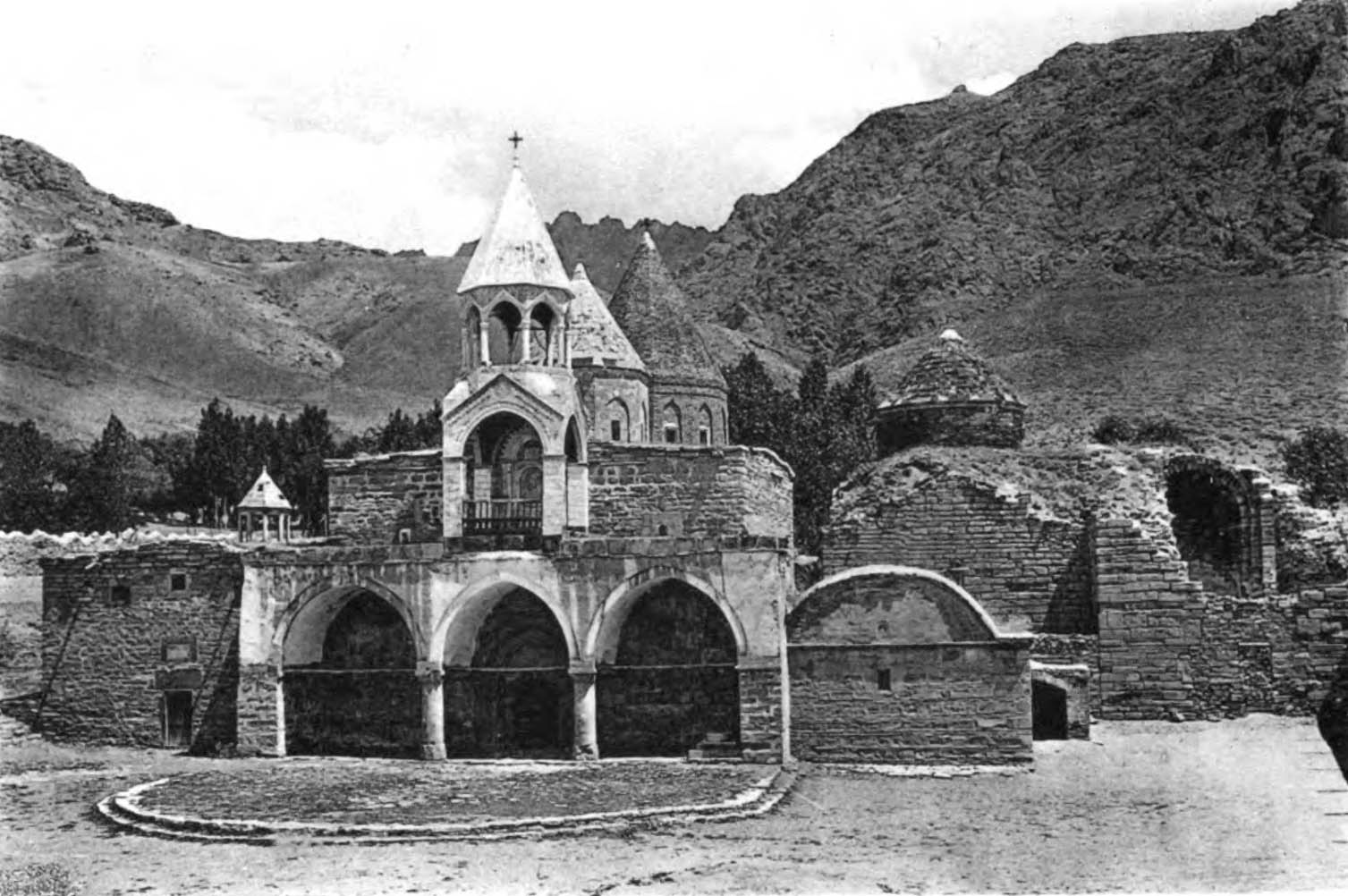
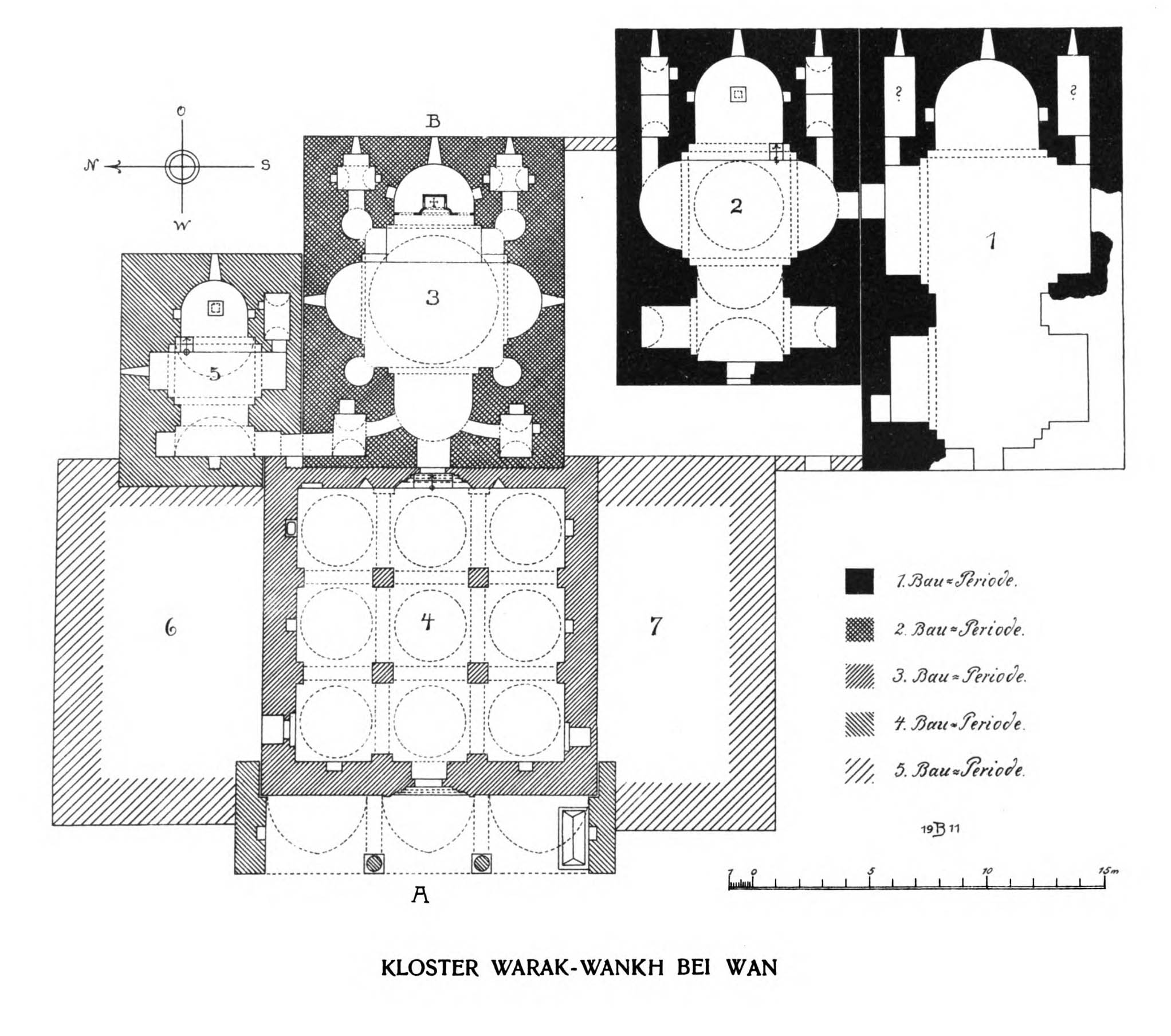
On April 20, 1915, four days before the official start of the Armenian genocide, the troops of Djevdet Pasha invaded the monastery and massacred the monks. After ten days, they retreated, and from then on, six thousand Armenian survivors poured in from the surrounding villages, who also organized armed resistance. Upon hearing this, Djevdet’s soldiers returned and shelled the monastery with cannons, then set fire to it. Most of the remains were demolished in the 1960s.
Upon entering the village, the lower part of the façade of the central St. George Church is immediately noticeable among the poor Kurdish houses. There are allegedly frescoes from 1779 inside, but the gate is locked. The person with the key lives in the house opposite, but he is not at home now, and the neighbors do not know when he will come back. Next time, inshallah. Adjoining the church to the right is a long vaulted square, the former Church of the Holy Cross, which until recently was used as a stable. We can go down into it. And further back, alone, the preserved apse of the former St. Sophia Church.
It is poignant to stand here, in front of the almost only surviving sign of a culture’s greatness and destruction.

As we head back along the north shore of the lake, huge storm clouds arrive from the east, the color of the lake turns an angry green, and a hellish spell of a bad weather breaks out. Dense hail knocks on the windscreen, covering the road in white. The clouds and the lake touch each other, only the still sunlit ridge of the snow-capped mountains shines through from the other side.

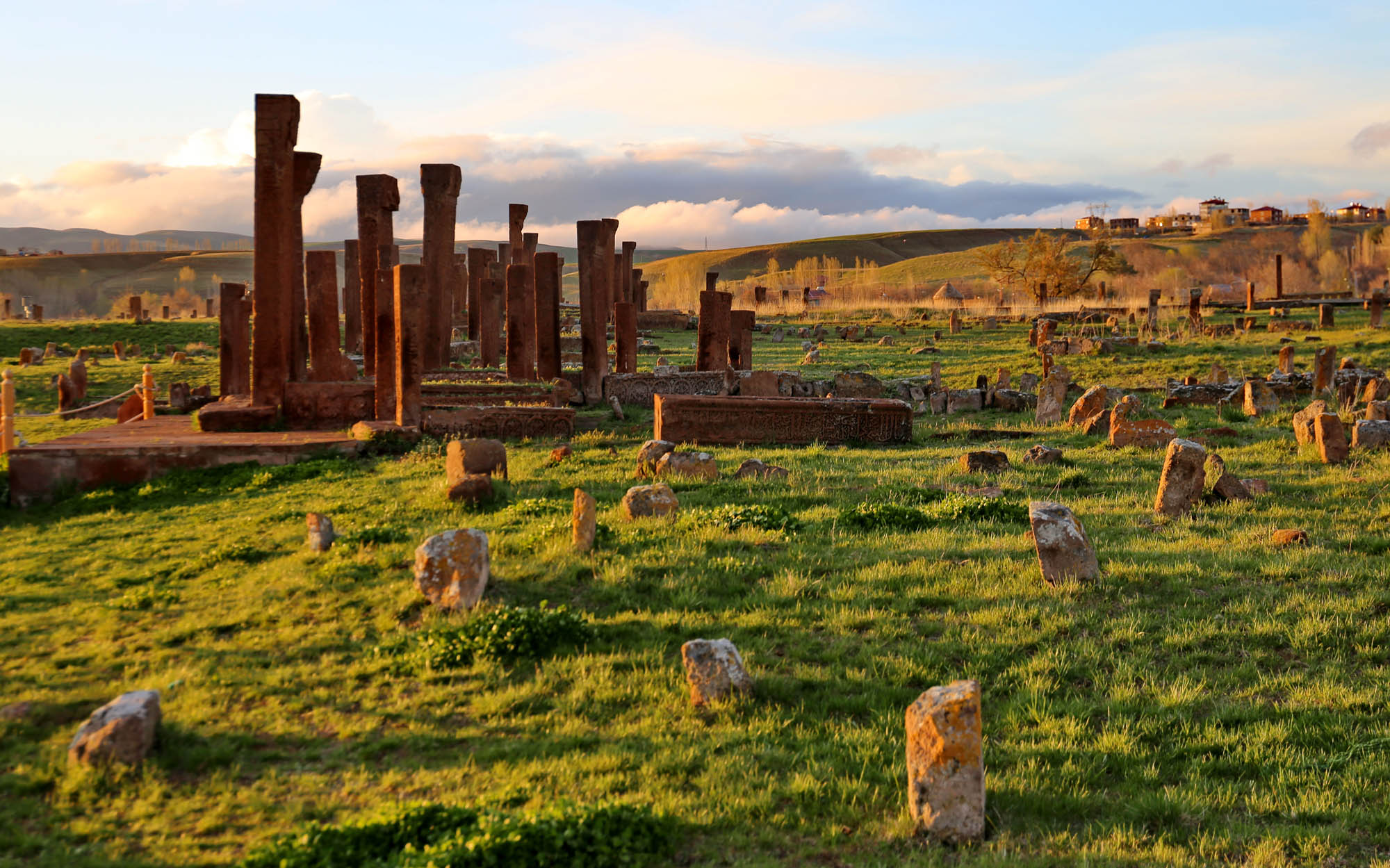
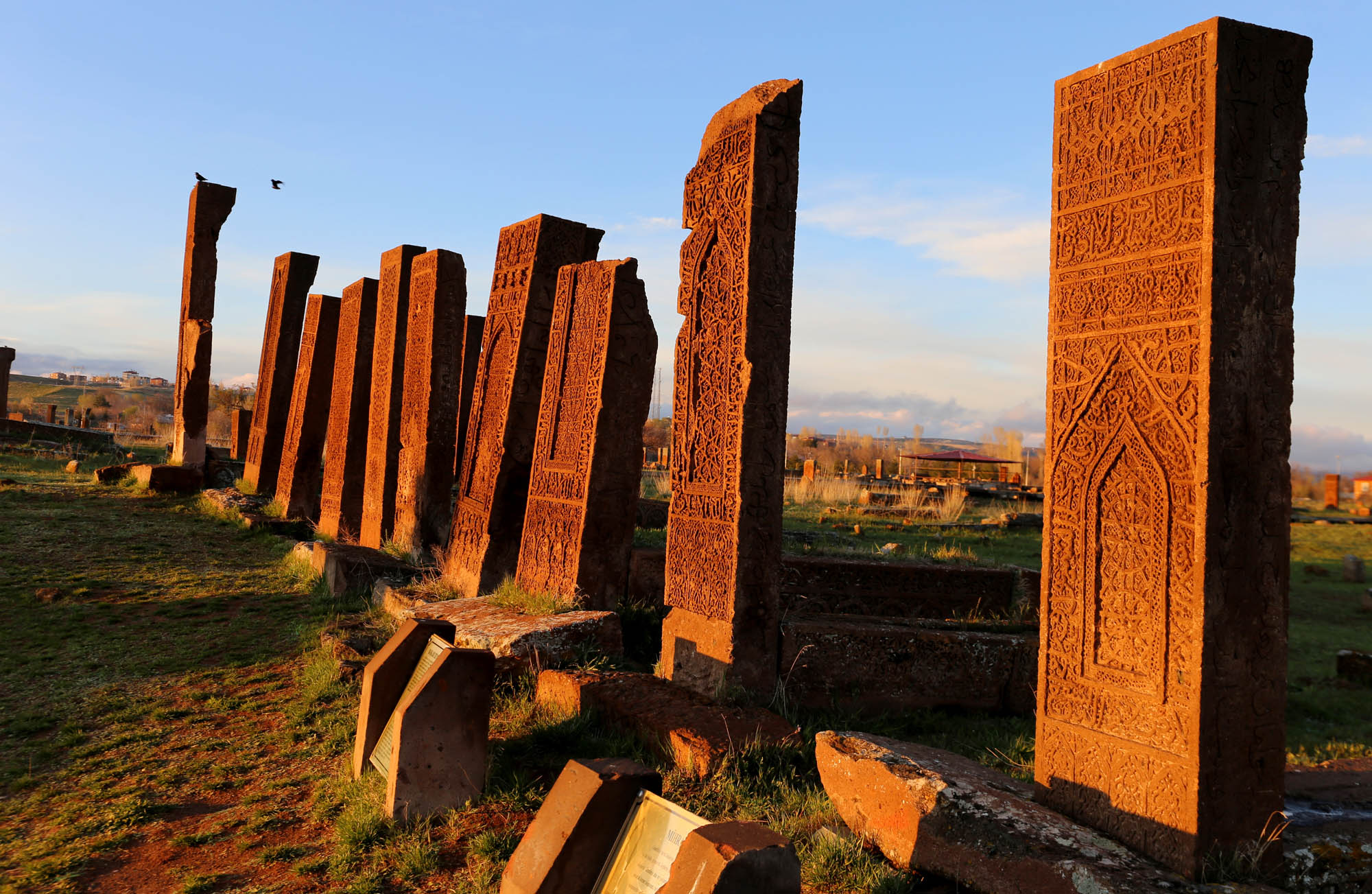
Ahlat (Khlat in Armenian, Xelat in Kurdish) was an important trade center along the Silk Road, on the northern shore of Lake Van. The city a more or less independent princely center from the Armenian kingdom through the Arabs, Kurds, Seljuks, Mongols and Ottomans until as late as the middle of the 19th century. To this it owes its many princely tombs and aristocratic cemeteries.


In August 2019, when Lloyd and I visited Southeast Anatolia for the first time, we had the privilege of being among the last to see Hasankeyf, one of the most important historical cities in the region, the former seat of the Seljuk Artukid and Kurdish Ayyubid dynasties with its Armenian and Syriac cave churches and cave city, its mosques and palaces, and the medieval Artukid Bridge. By now, the Ilisu Dam, built on the Tigris in 2006, has been filled, and has flooded the city. We stop by the road and look down on it from among the houses of the new town. Only the Roman fortress above the old city stands out from the water, everything else has been submerged. “They sacrificed ten thousand years of history for a hydroelectrict power plant operating for fifty years”, as the opposition said a few years ago. Google Map still shows the monuments under water.


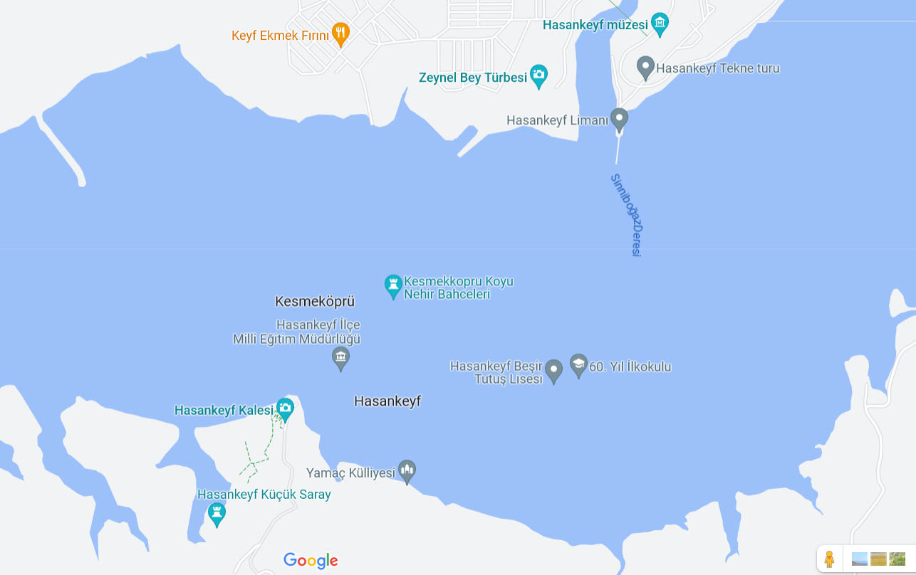
Four years ago, we were terrified at the sight of the bridge, which spanned at an unimaginable height above the valley of the Tigris and the other bridges. Today, the raised water level has brought it to a normal height, and this has remained the only bridge. But life goes on. When the Kurdish shepherds have to drive their flocks to the other side, the traffic on the Van-Diyarbakır highway bridge will stop for half an hour.

To be continued


 Come with us to…
 Atlantis
 Bestiary
 Bohemia+Prague
 Books, exhibitions, music, film
 Brave old world
 Caucasus
 Cemeteries
 Crimea
 Get to know the
 Images of the East
 Lightwriting
 Lwów/Lemberg
 Mallorca
 Message on the wall
 The Museum of Propaganda
 Odessa
 Paper Museum
 Persian letters
 The Jewish heritage


