
Georgia was founded on the run, as were the Caliphate of Córdoba or the Principality of Transylvania. A disinherited ruler flees to the periphery in order to take back from the new center step by step what he lost. There are times in life when you have to start building everything over again somewhere else.

It was a strange but very fruitful coincidence that shortly before Ashot, around 780, another Georgian aristocrat also retired to this province. He was not on the run, but in search of God. His name was Grigol and he belonged to the princely family of Iberia i.e. Western Georgia. Tao-Klarjeti was the only region of the country not controlled by the Arabs, so Christians could freely practice their faith. Grigol therefore founded a monastery in the Khandzta valley, which became the cradle of the rebirth of Christian spirituality in Georgia. The monks enjoyed the support of the Georgian kings, and the province soon became populated with monasteries. As the kingdom expanded ever more eastward, the monasteries of St. Gregory of Khandzta followed to re-Christianize the new conquests.
The period between the foundation in Khandzta and the dispersal of the monks around 1000 was thus one of massive monastery construction in Tao-Klarjeti. Just like the Georgian kingdom and Georgian Christianity, Georgian church architecture also had to be created almost from scratch after the loss of the country and its traditions. Intensive architectural experimentation took place in the province. The intellectual capital was provided by the monasteries, and the financial by the kings. And the architects – monks and civilians – incorporated many international trends and elements into their churches, from Byzantines to Armenians and from Syriacs to Latins. They experimented with various structural solutions and created not only Georgian fresco painting, but also figural sculpture, unknown in Byzantium, with mounted warriors, guardian angels and lions. By the time the Georgian kings and monks were ready to recapture the Georgian principalities, the standards of Georgian architecture had also crystallized in Tao-Klarjeti, to be transplanted to the whole of unified Georgia.
In the 16th century, Tao-Klarjeti was occupied by the Ottoman Empire, and in the 19th century it was retaken by the Russians, the new masters of Georgia, together with the whole of Eastern Georgia. Finally, in 1918, the Bolsheviks let it go. At that time, the countries of the Caucasus enjoyed independence for a short time, and it was not in the interests of the Bolsheviks to shed blood for them, so they renounced the Tsar’s conquests in the peace treaty concluded with Turkey. The Georgian Tao-Klarjeti and Armenian Kars provinces, together with the holiest places of the Georgians and Armenians – the earliest Georgian monasteries, Ararat, and the old Armenian capital of Ani – fell into Turkish hands again, and remain so today. The Armenians were driven out or killed, but the Georgians, who in the previous centuries of Ottoman rule had converted to Islam, could remain. Today, no Christians live here, and the former magnificent church buildings are slowly decaying.
Since I have been visiting Georgia, I have always wanted to go to Tao-Klarjeti, to see the cradle of medieval Georgia, and the models of Georgian churches. While I can. And while I can still get there. We are living in times where countries are closing down one after the other. You have to go there while you can. So, only three weeks after I came home from northern Mesopotamia, I am already in Turkey again, in the valleys of the Caucasus on the Turkish side, at the headwaters of the Chorokhi, the Mtkvari and the Araxes.

The road to Tao-Klarjeti traditionally leads from Erzurum, the easternmost big city of the Ottoman Empire. The Persian traders went up from here, as well as the puntive expeditions of the Mongols or Timur. The city was founded by the Byzantines under the name Theodosiopolis on the Silk Road coming from Tabriz, and it was only later renamed by the Arabs to Arḍ ar-Rūm, the land of Rome, because this was how Byzantium, the heir to the Roman Empire, called itself, of which the eastern extreme began here. From here, the “Georgian silk road”, called the Kartli road, branched off to the north, following the valleys of the Tortum, Chorokhi, and then Mtkvari rivers across the Lesser Caucasus to Akhaltsikhe, and thence to Tbilisi and then to Kakheti. We follow this road to the present-day Georgian border.
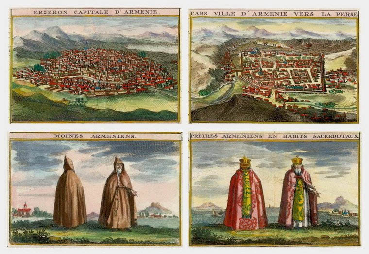
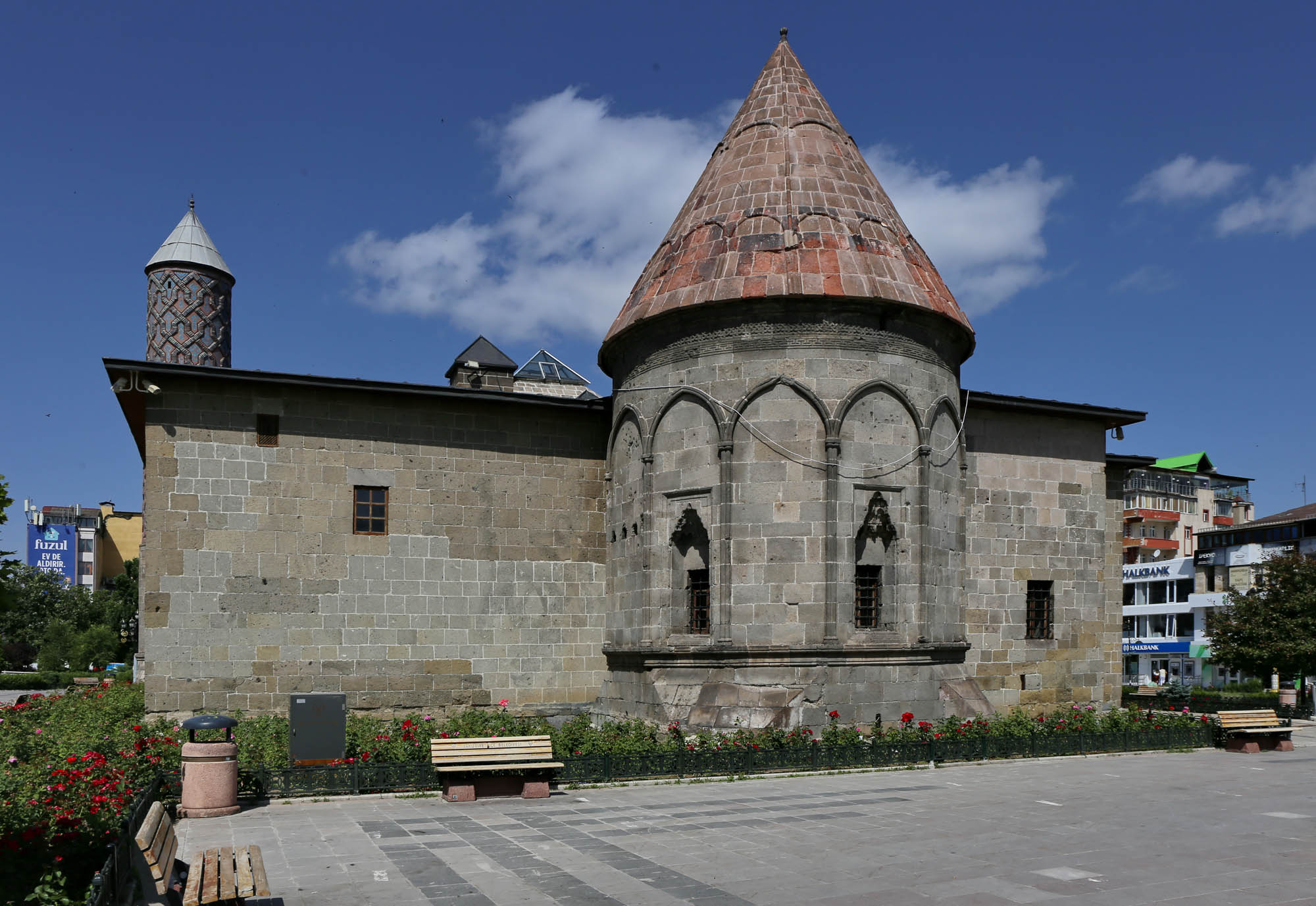
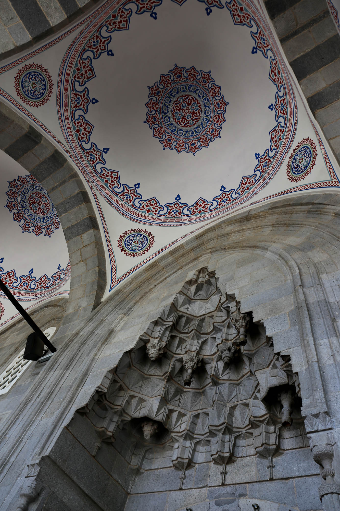
Erzurum was occupied by the Seljuk Turks in 1071, making it one of the first examples of Seljuk architecture. Nevertheless, the skyline of the old town is marked by the characteristic octagonal Armenian towers. No wonder, since the architects of the nomadic Seljuks, and also the later Ottomans, were local Armenians (or Greeks); as was the greatest Ottoman architect, Mimar Sinan. Even in the 16th century, Erzurum was called “the capital of Armenia”, and the local architects obviously designed the church, the mosque and the türbe in the same style, as it pleased the customer.
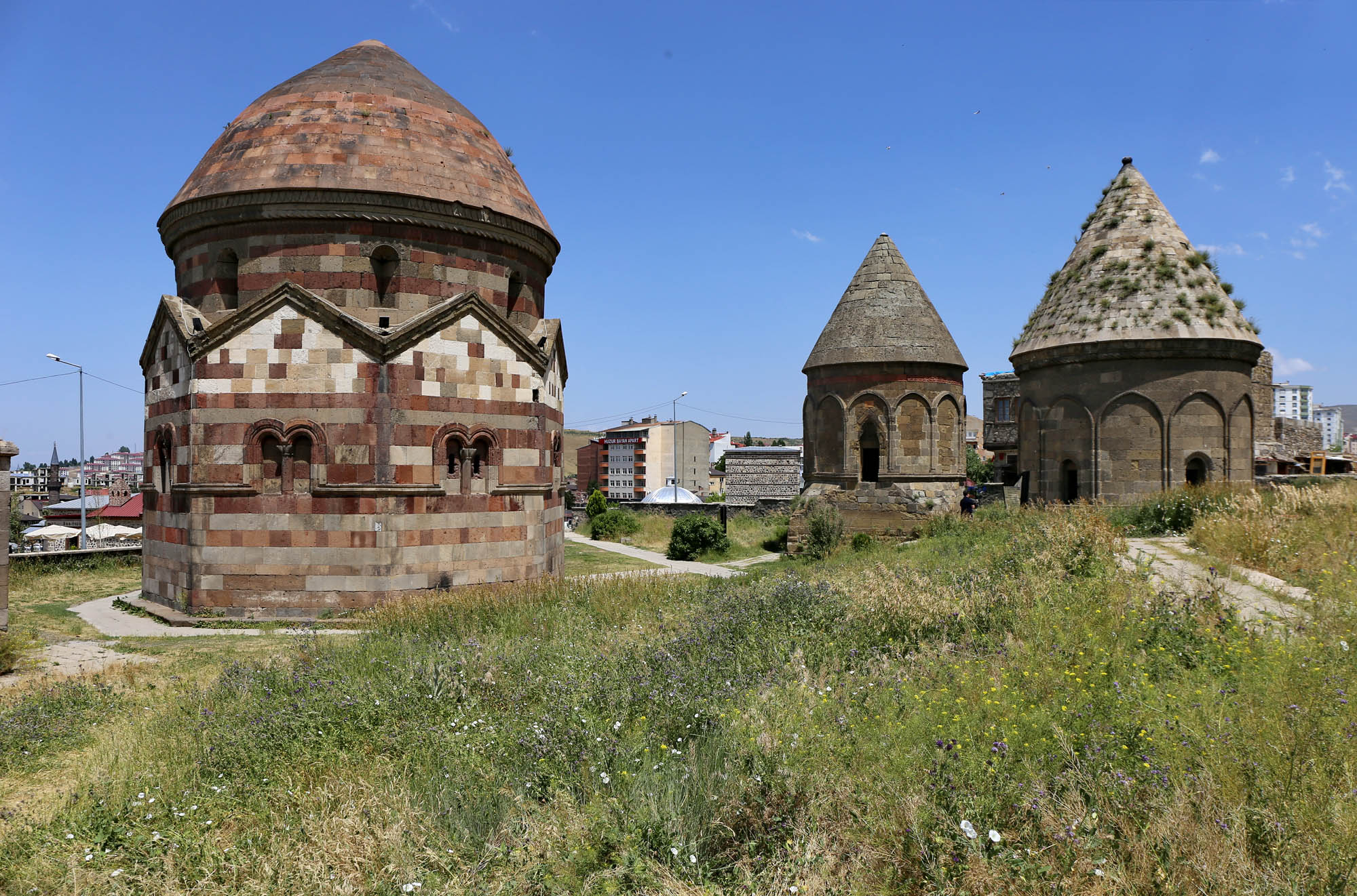
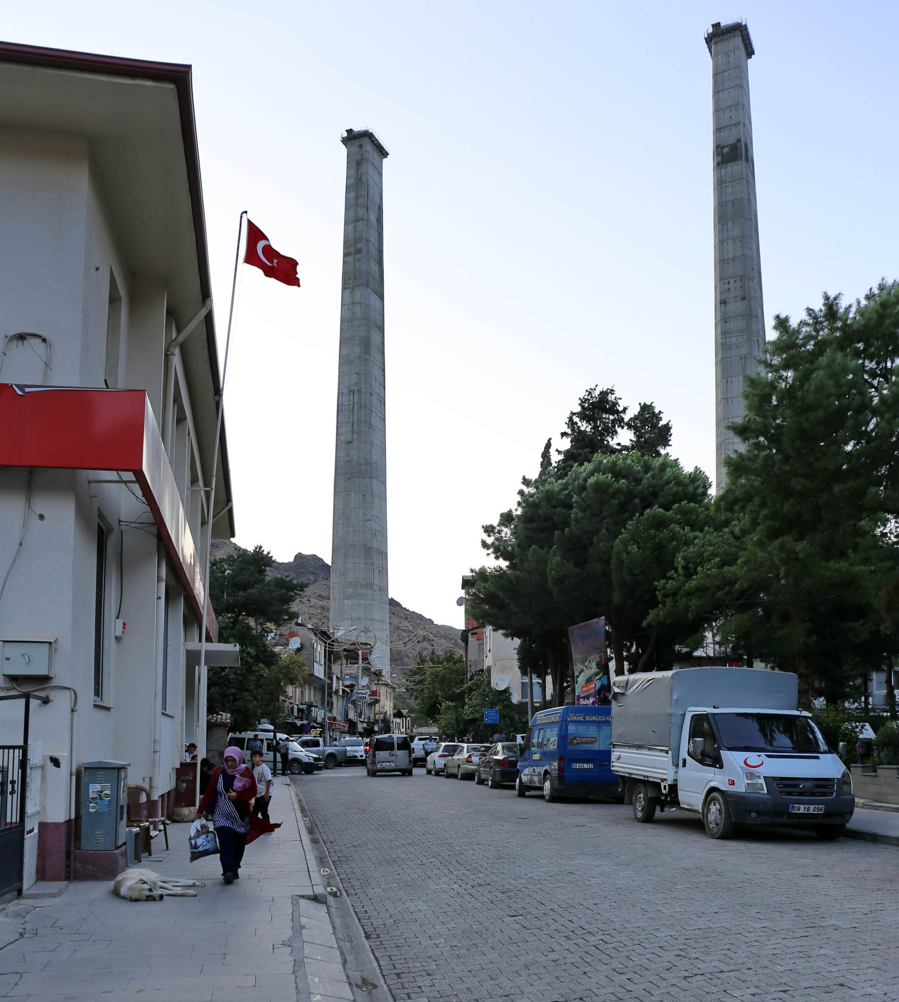
In Erzurum, the most typical monuments of this architecture are the ubiquitous türbes, the tombs of the Seljuk elite, which are nothing more than Armenian church towers cut off at their necks and placed on the ground. Three of them, the 

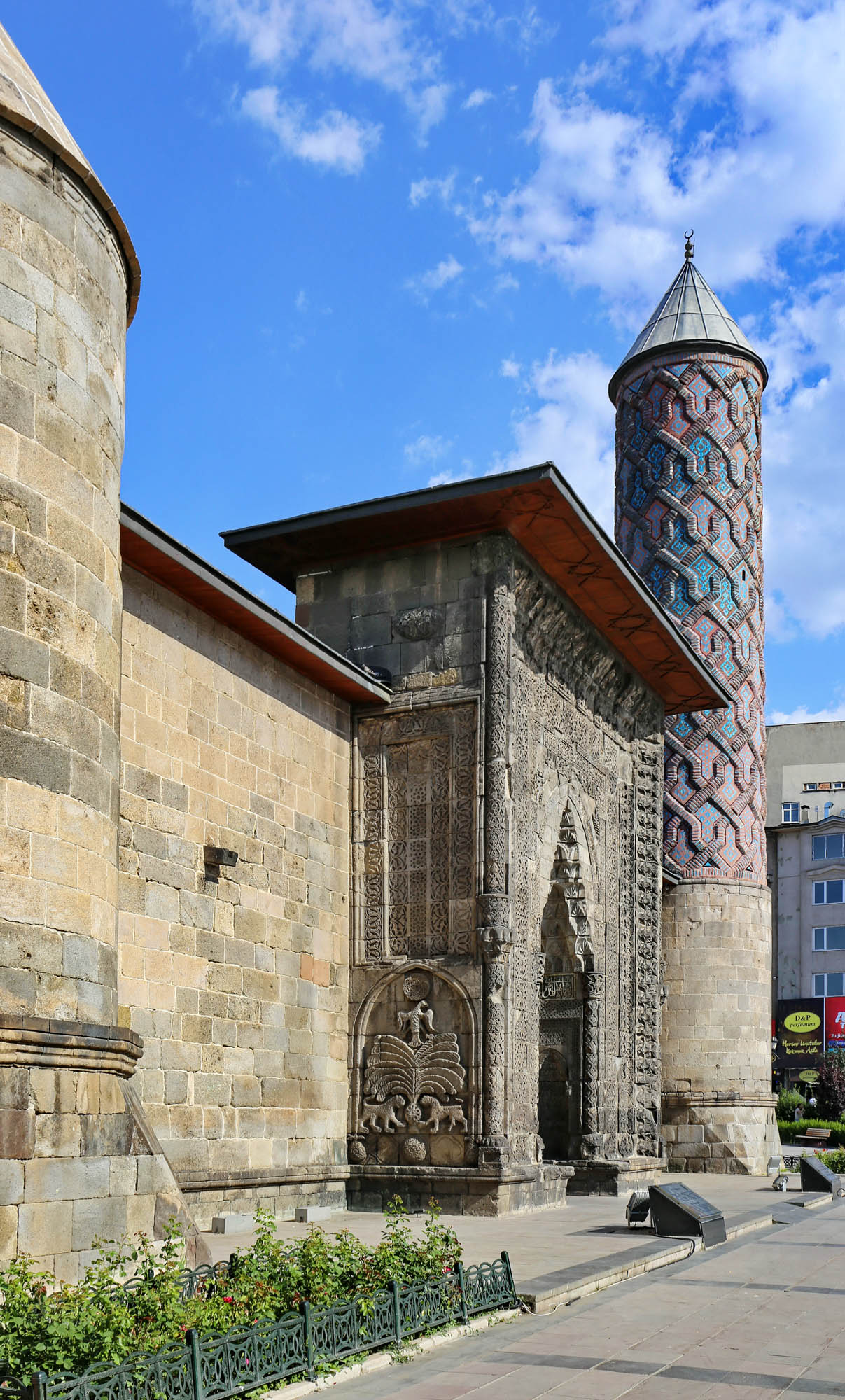
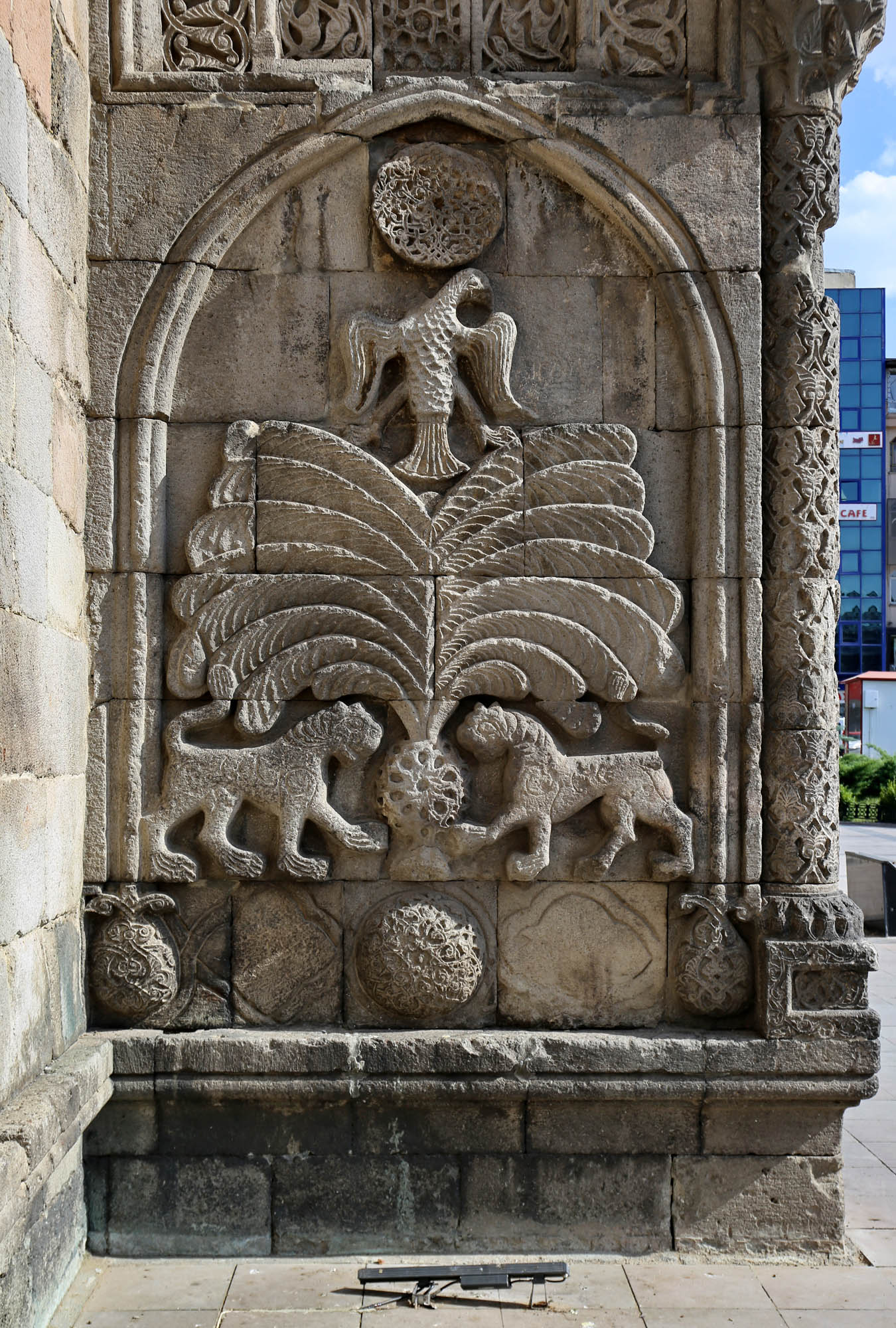
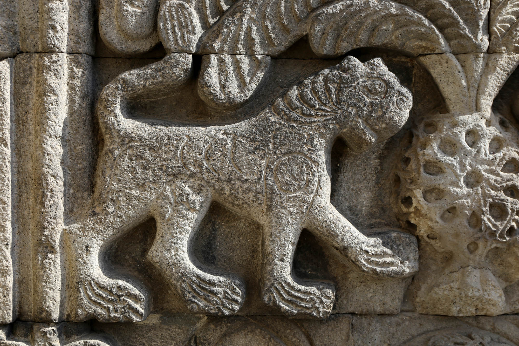
The gate is almost an independent work of art, as is customary in Persian Ilkhanid mosques. Its two narrower sides display one of the most beautiful versions of a motif that is ultimately of Persian origin, but whose best-known example can be found in King Roger II’s Norman palace in Palermo: two lions facing each other under a palm tree, a symbol of power and domination.


The Armenian churches were destroyed long ago in and around Erzurum, not to mention the Armenians themselves. But all this that they built for others testifies to their once prominent presence and the greatness of their civilization.
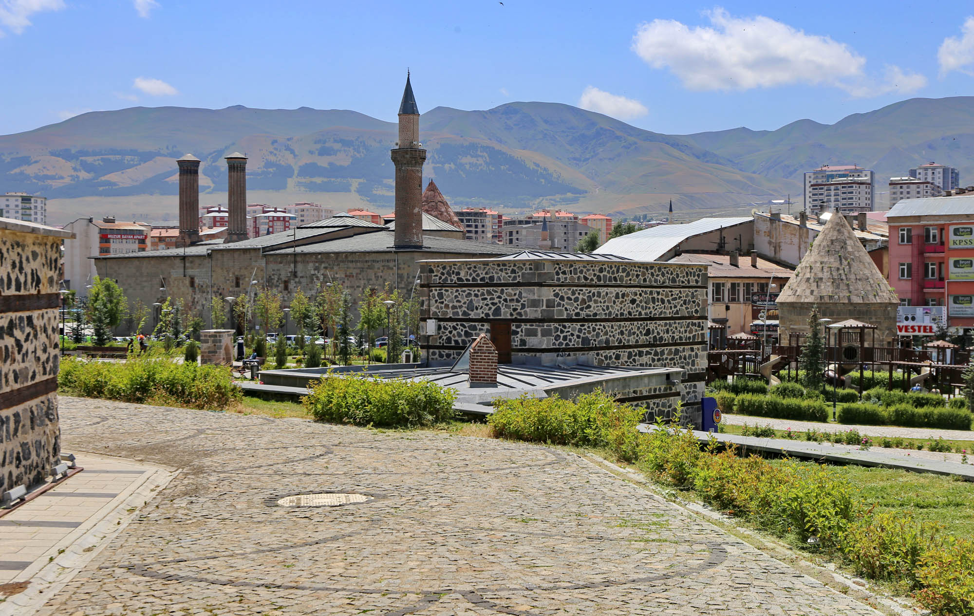
The Twin Minarets is the emblem of Erzurum. The visitors to the city – don’t think of tourist buses; mostly families come here, to the mountains from other Turkish cities to escape the heat – visit this one monument, and pay their tribute to culture and the family album with a photo taken here.


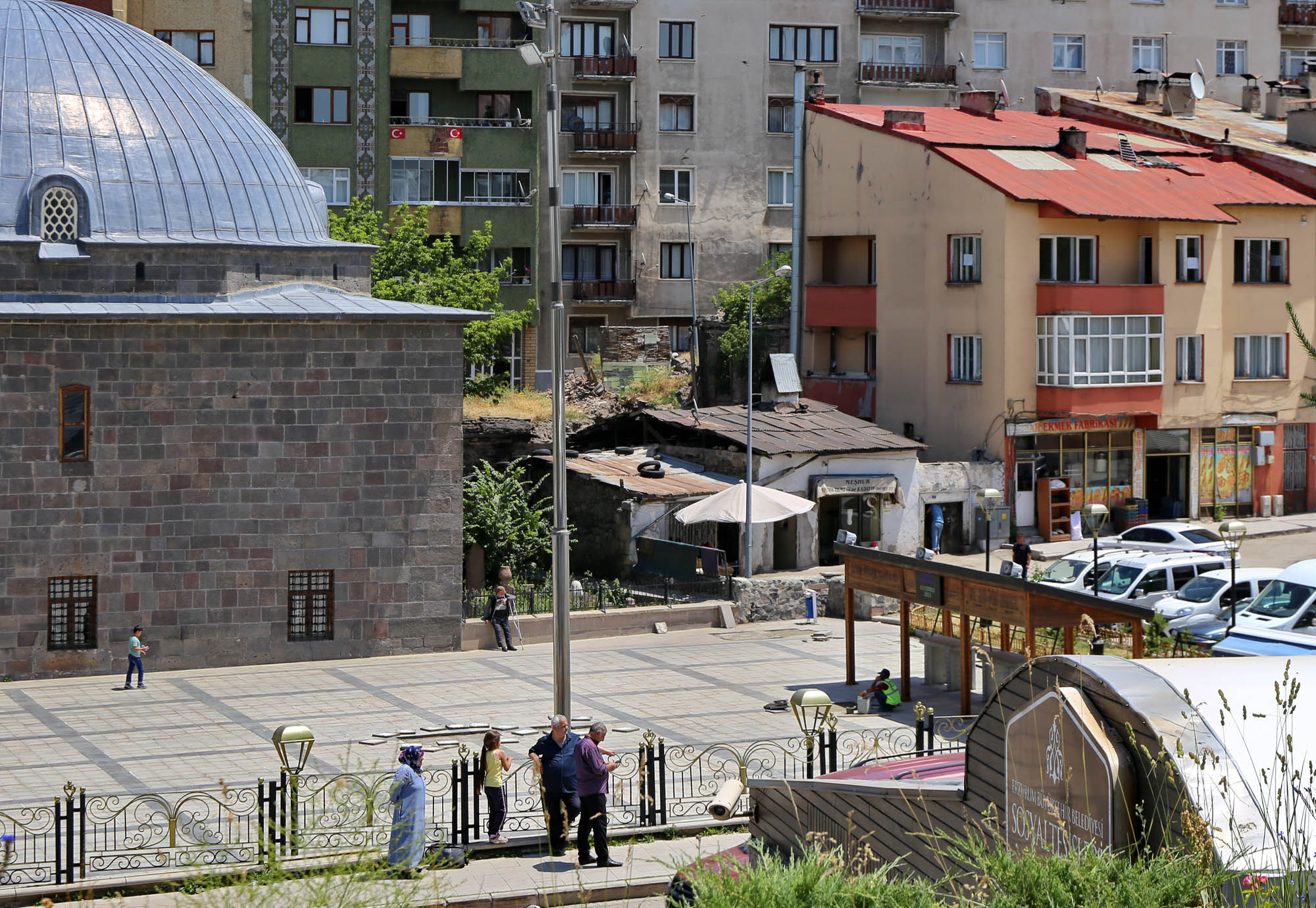

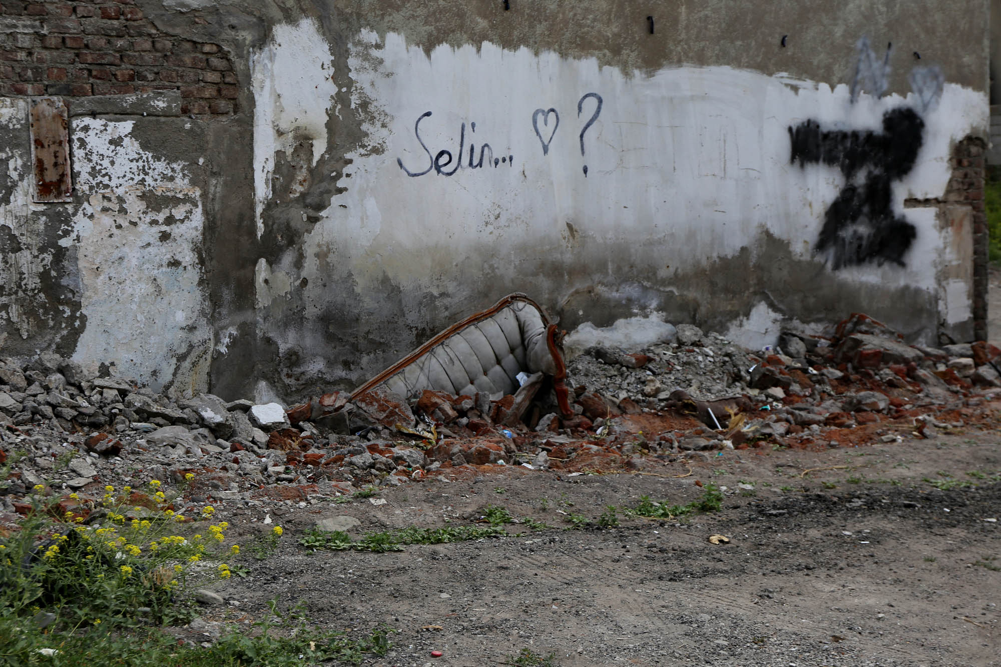
Erzurum may once have been a charming provincial town, but recently it is trying to become a pulsating metropolis. Moden steel and glass palaces grow out of the ground everywhere, I mean in the places of earlier buildings. The super stores and restaurants are open until late, the city is full of life until late at night, unlike in other Turkish cities. Erzurum is also a highly rated university town, with a large modern campus near the airport and lots of students, which is also reflected in the life of the city center. Therefore, the remains of the former charming provincial Erzurum are reduced to ever smaller islands. Among the modern buildings there are still clusters of old ramshackle houses and working-class neighborhoods, familiar communities, wool dried in front of multi-story buildings, horse-drawn carriages. Just like in my childhood district Kőbánya in Budapest. Even if I did not live here, the atmosphere is familiar, and my heart aches for its passing away.


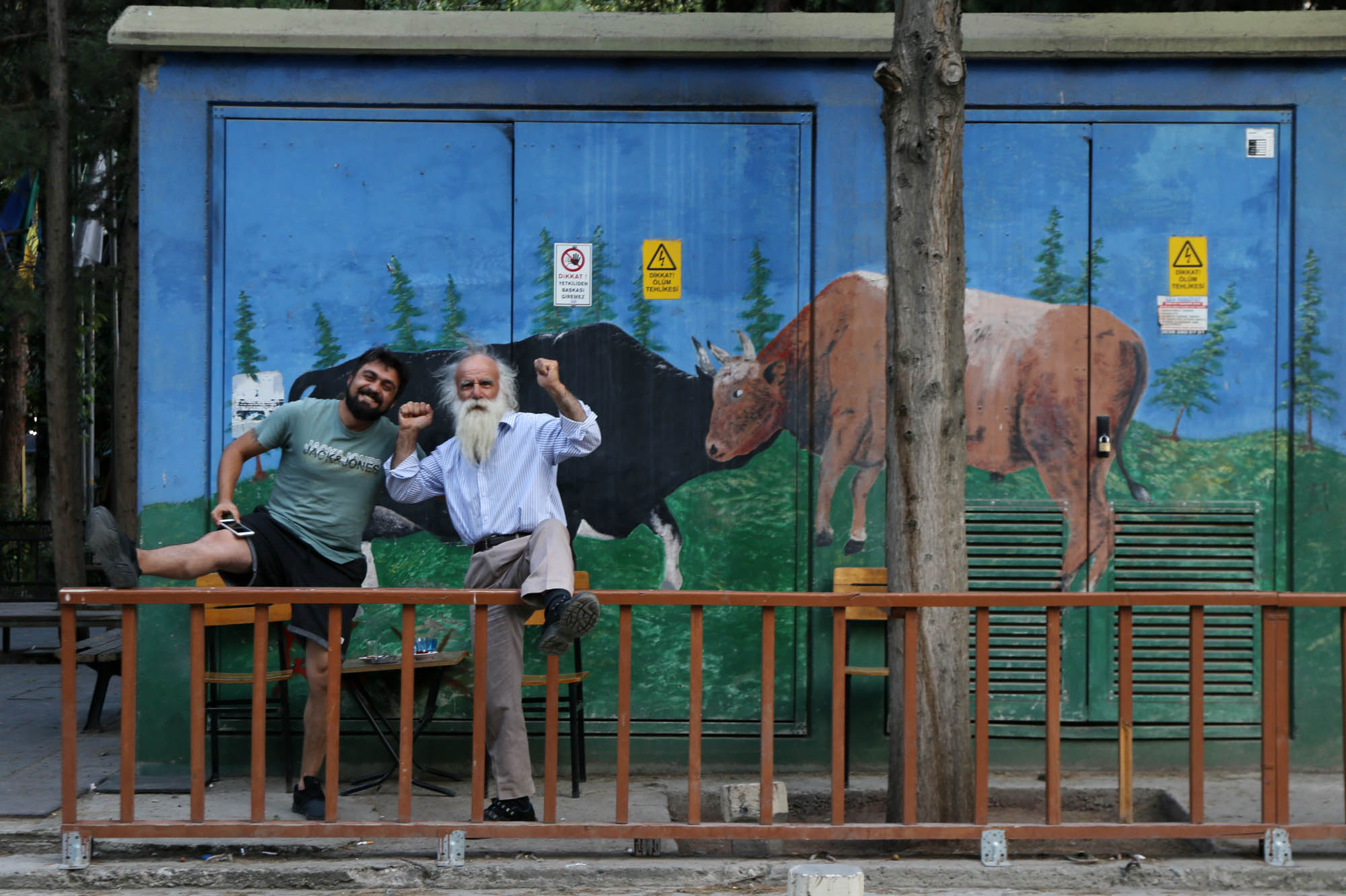
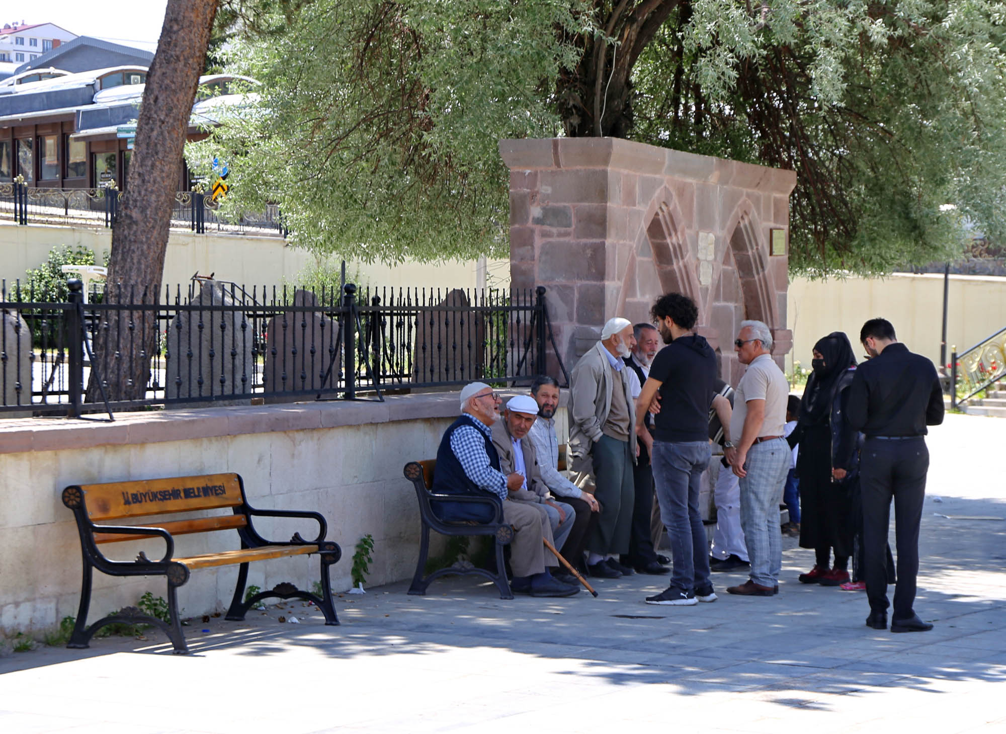
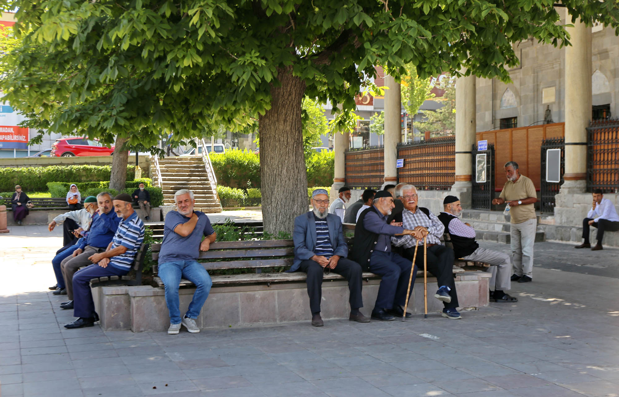
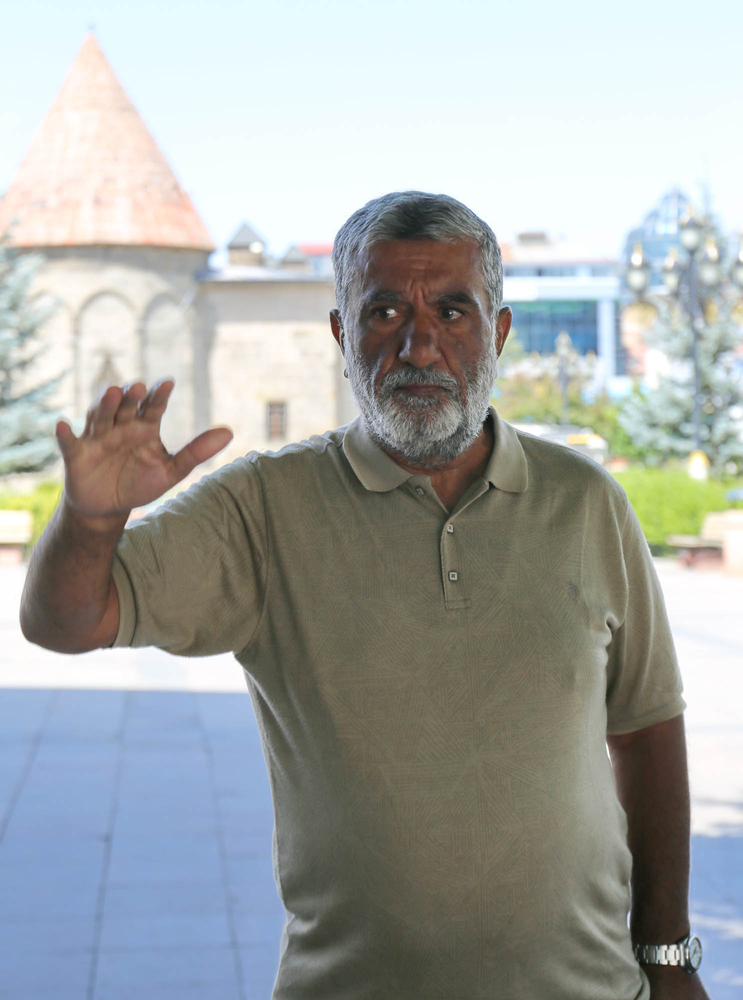
The usual clientele sits in front of the mosque, the aksakals of the mahalle (the white-bearded honorables of the neighborhood). You can hear a local joker entertaining them with occasional poems and jokes from afar. We cannot avoid him either. “Hungary? Turk and Hungarian, two brothers, let Putin stick a finger up his ass.” And upon Lloyd’s introduction, he praises the Democratic presidents, Clinton, Obama, “and what is the name of the current one?” he asks the people. “Yes, Biden.” He is a decidedly liberal stand-up comedian.

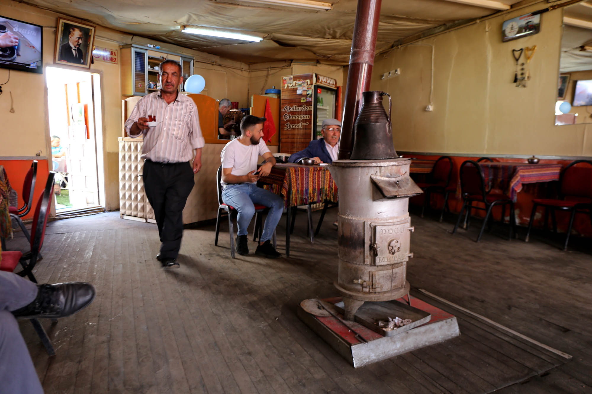
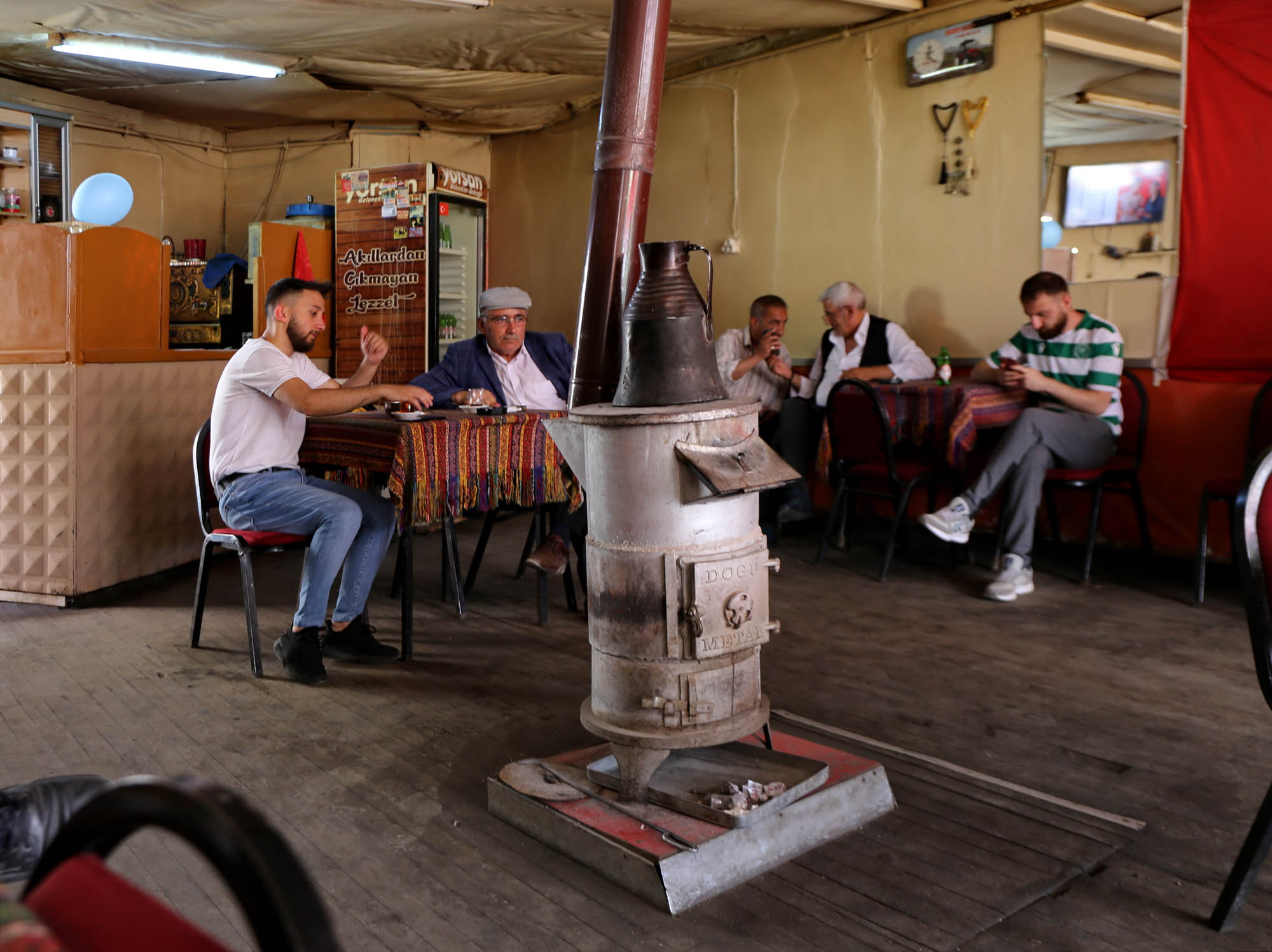
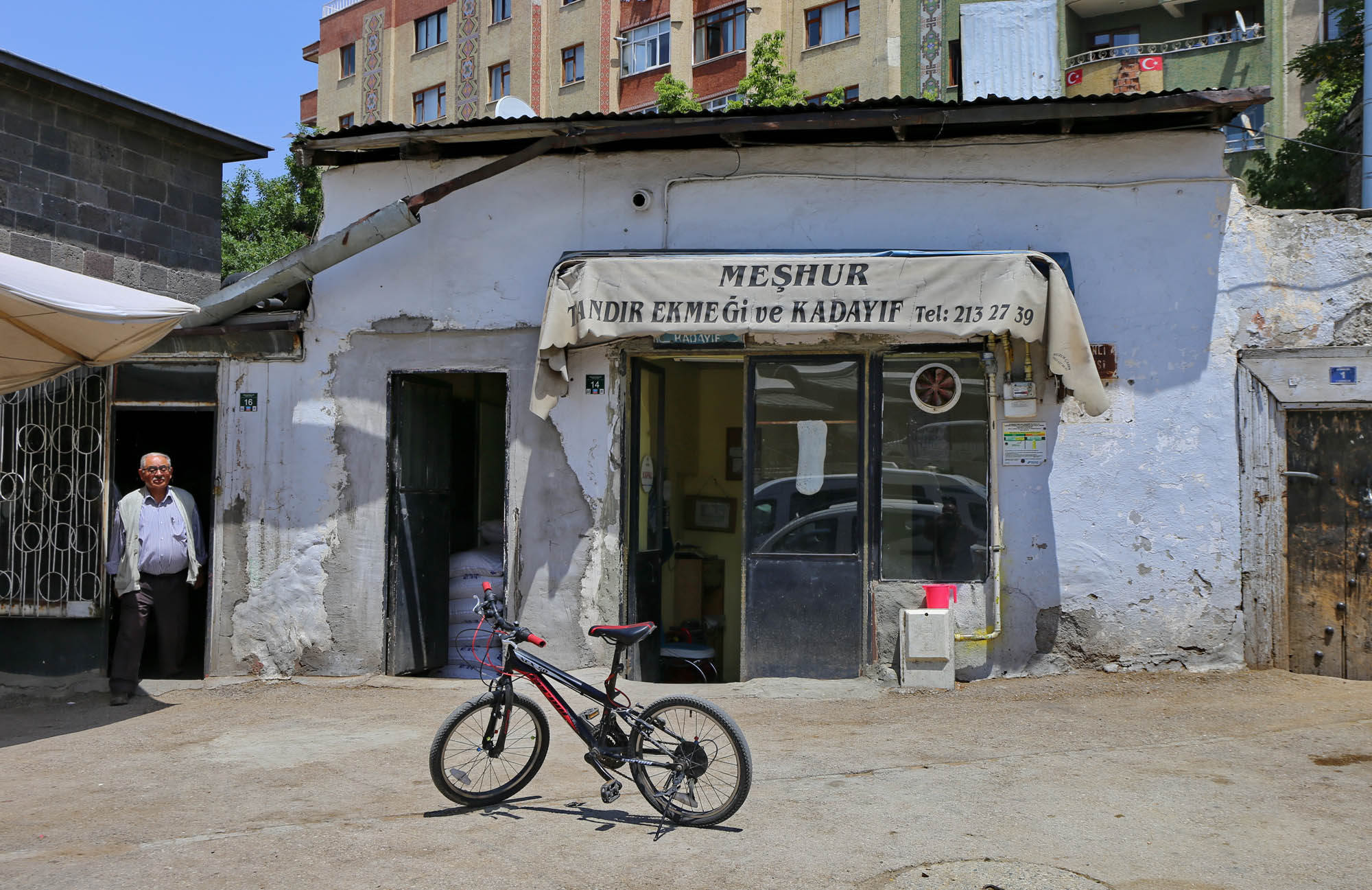
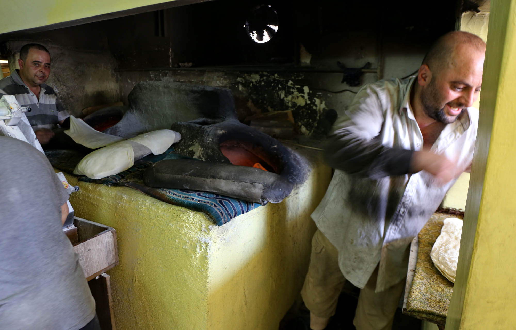
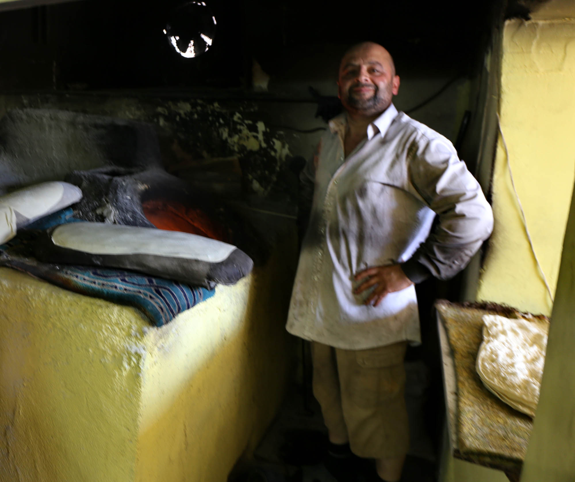
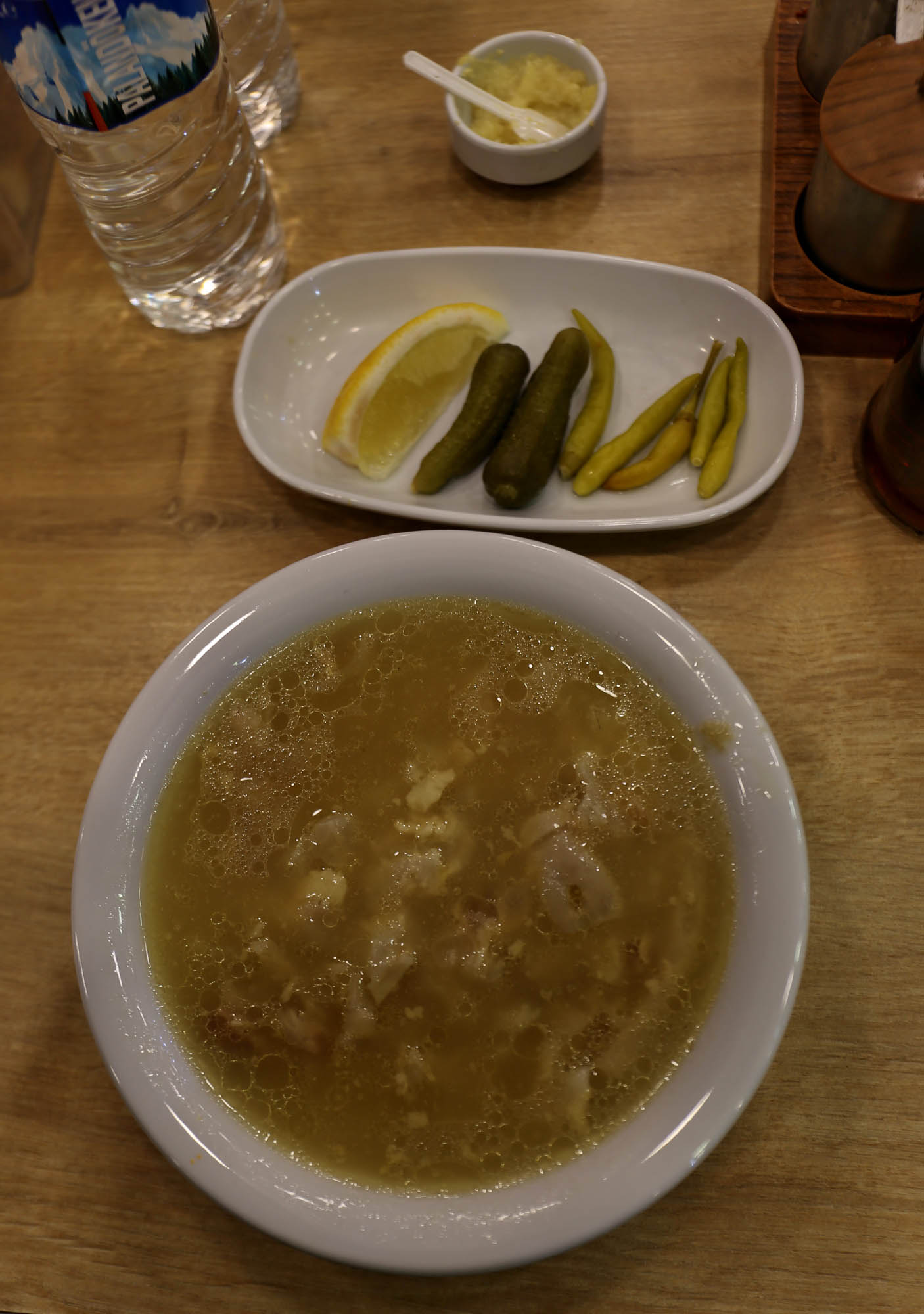
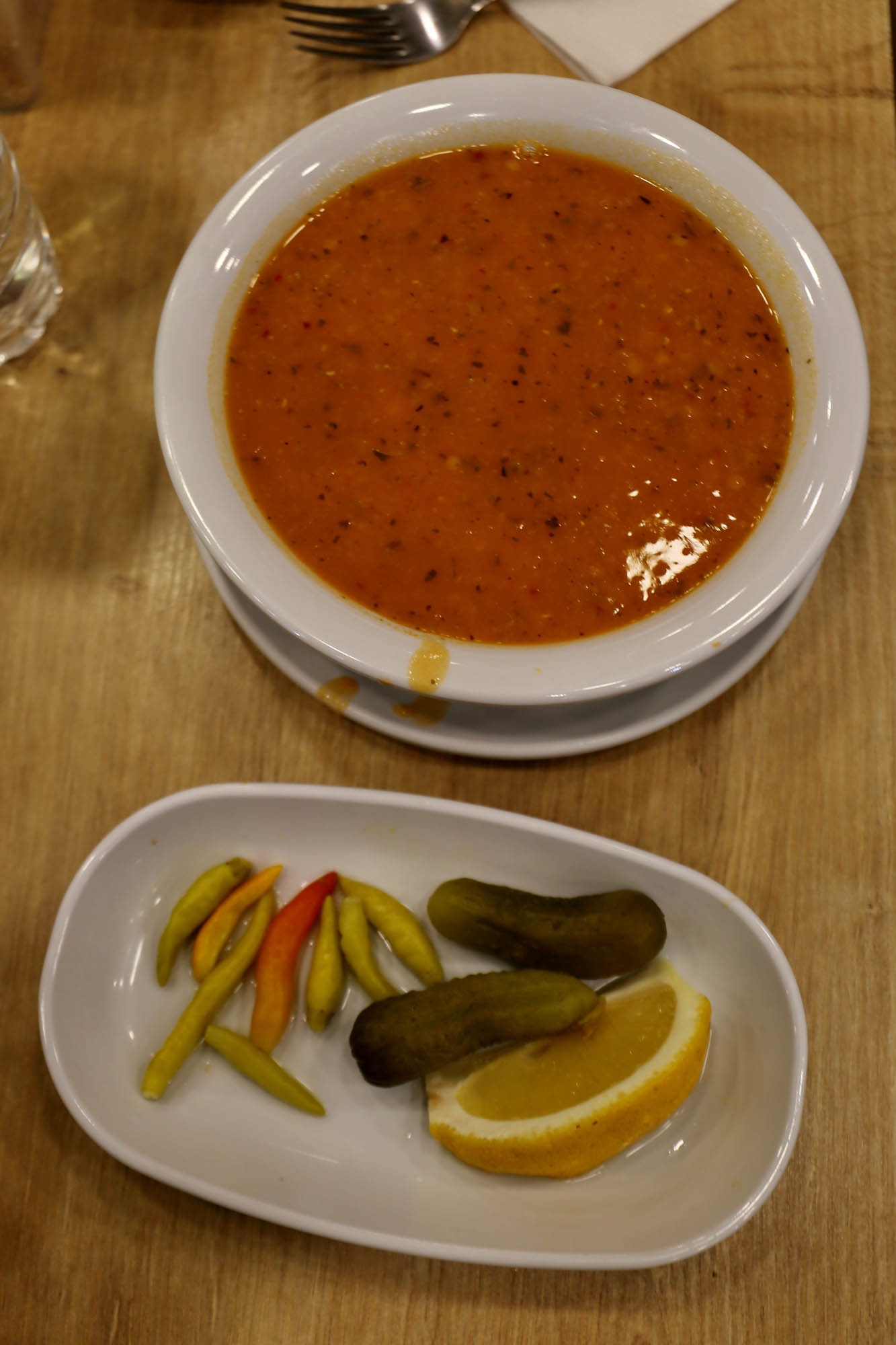
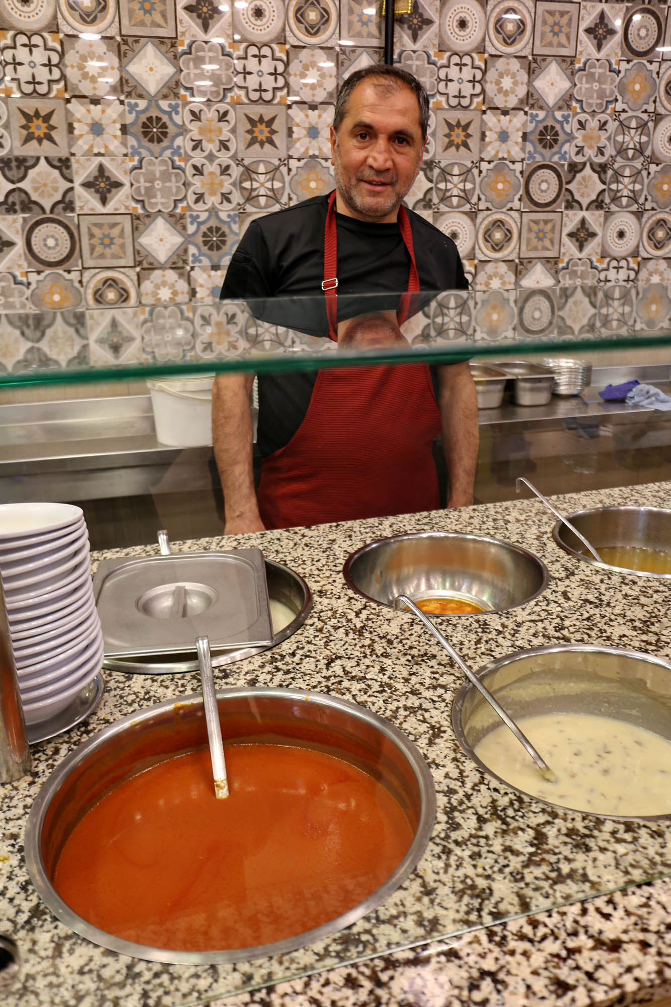
As every city in Turkey, Erzurum has many restaurants and excellent food. But it is different from elsewhere. In contrast to the recently seen northern Mesopotamia, where kebabs dominate, here you can get a variety of soups, and instead of the cigercis, liver grills that fill Diyarbakır, çorbacıs, soup houses dot the city and its surroundings. In addition to the single lentil or yellow pea soup usual in European Turkish restaurants, they also have a dozen others made from various meat and vegetables. My favorite is paça, cooked from sheep’s head and feet. A dense, collagenous, very nutritious, very healthy single dish.
Erzurum
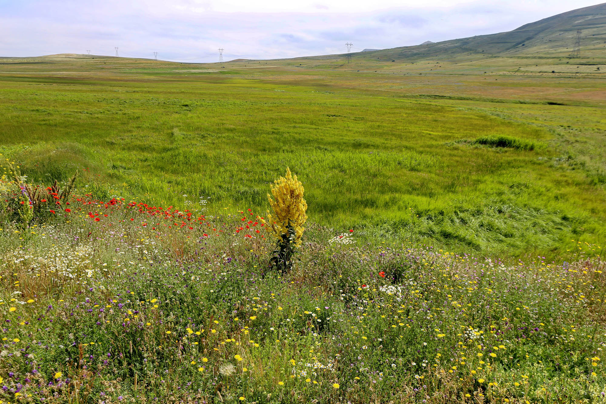
We leave Erzurum through the Gürcükapı, that is the Georgian Gate. Once upon a time, Georgia was much closer to here than it is now, and at the time of David III the Great (966-1001) even Erzurum was part of Georgia. Our road goes uphill in a wide valley full of wildflowers, which begins to narrow after fifty kilometers.

Along the Tortum river we soon reach the town of Tortum, which until the 19th century had a Georgian and Armenian majority. Most of the Georgians fled the violent Islamization for Christian Georgian territory, but the majority of the Armenians converted. They are the Hemshin, the Armenian-speaking Muslims.
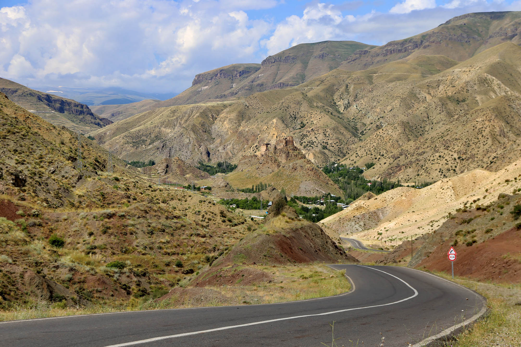
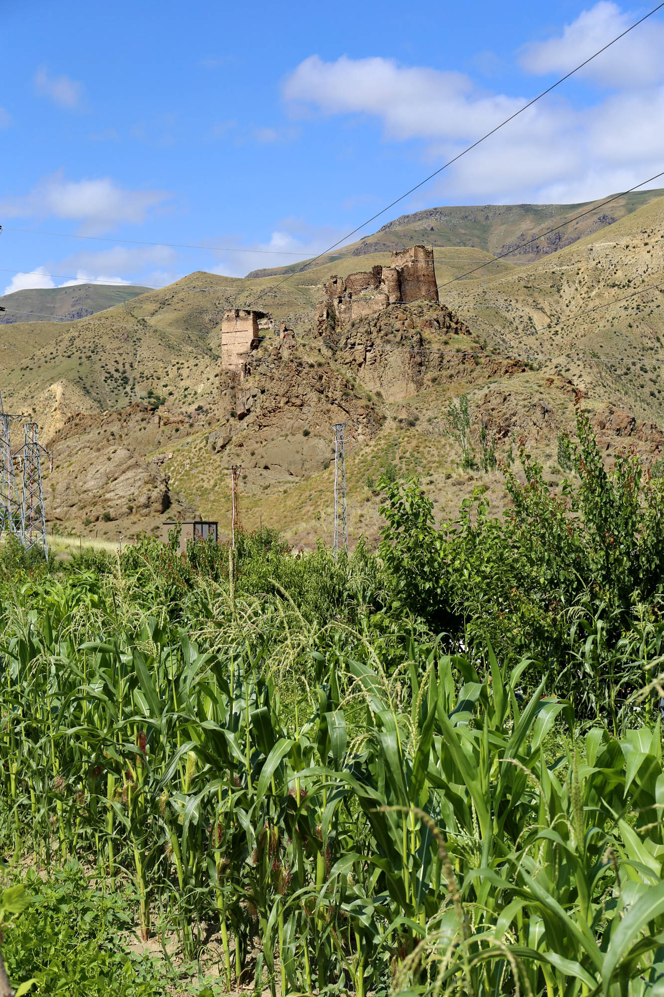
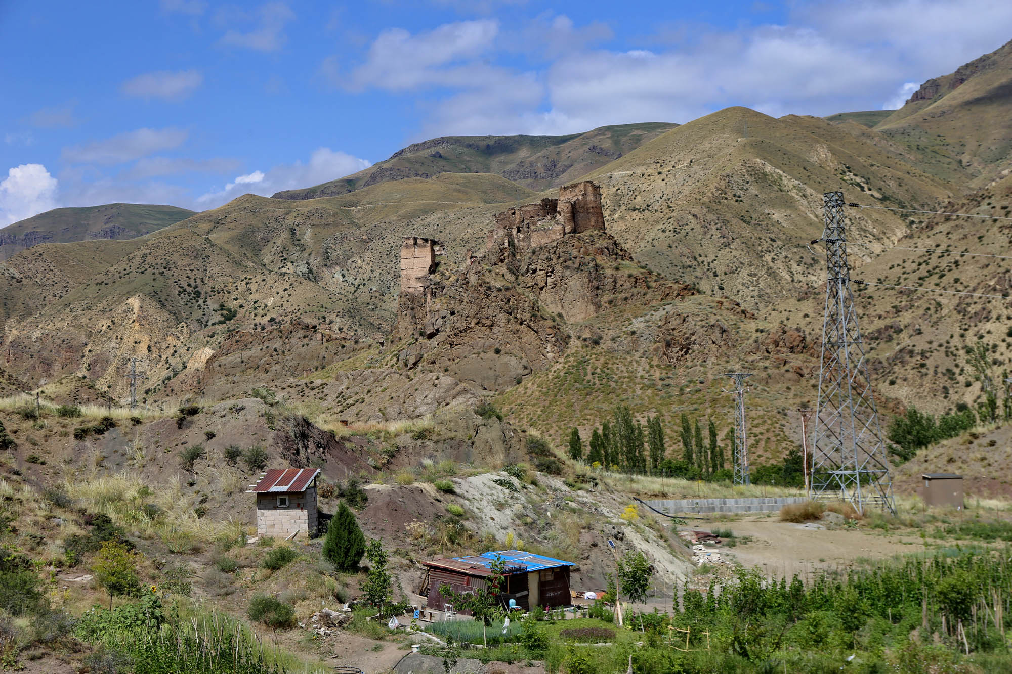
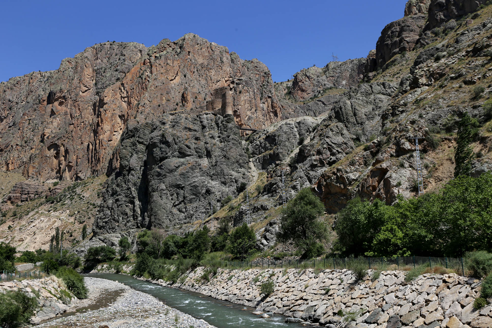
ხახული, Khakhuli, Haho. Ashot I, the founder of Tao-Klarjeti, died around 830. His sons Adarnase and Bagrat shared their father’s estates. Adarnase got Klarjeti, the northern province, with the princely center, the rock castle of Artanuji (Ardanuç), which we will see shortly, and Bagrat got the southern Tao, where he built a castle for himself in Bana. His son Ashot II received the title “King of the Georgians” from the Byzantine emperor in 888. Then in 961, Tao also split in two. The eastern part with Bana as its center (Amier Tao) remained for the royal branch, while in the western part (Imier Tao) the most talented member of the early Bagratids, David III the Great (966-1001) founded a new center in Oltisi (Oltu).
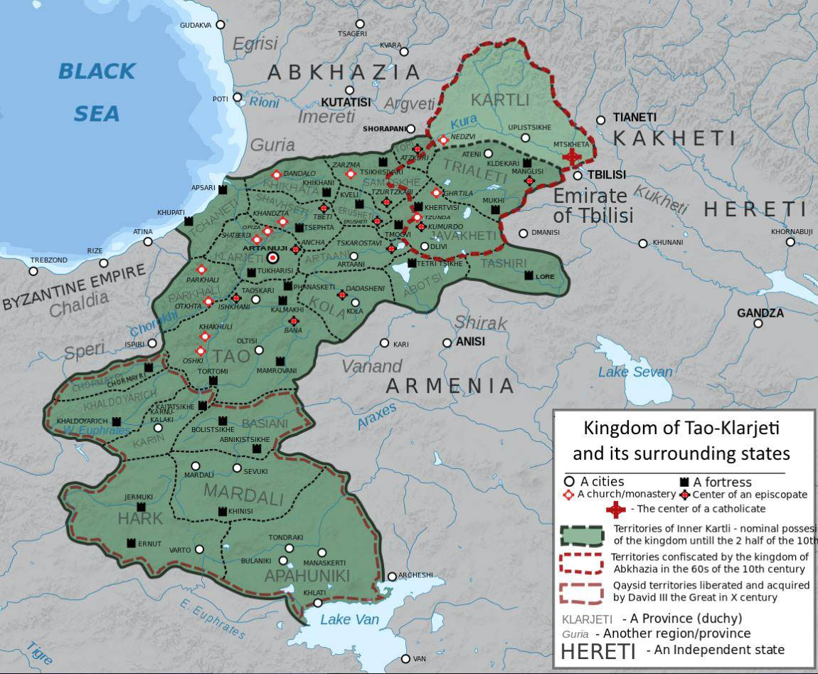
David’s goal was to unify Georgia, which he succeeded in achieving. He gradually recaptured Kartli. He adopted his nephew, Bagrat, the young expectant of the Georgian royal title and of Amier Tao, and crowned him king of all Georgia in Kartli in 975 (although Bagrat’s natural father, Gurgen, the holder of the royal title, did not die until 1008, so the kingdom of Bagrat III and the birth of the united Georgia is counted from that year). At the same time, he persuaded the old and blind Abkhaz King Theodosius III, the brother of Bagrat’s Abkhaz princess mother, to abdicate in favor of his nephew. In 976, as we saw in the history of the Iviron monastery on Mount Athos, he provided military assistance to Emperor Basileios II against the rebel Bardas Skleros, for which the emperor gave him the lands south of Tao, including Theodosiopolis, the future city of Erzurum, for life. And David conquered many provinces from the Muslims even to the south of the new donations. As the map below shows, he “collected” all parts of the later Georgia, with the exception of the hostile Kakheti and the Muslim emirate of Tbilisi (the map does not indicate that Abkhazia and West Georgia it occupied became the property of Bagrat III).
David assigned a major role to the Georgian Church in the unification of the country. He supported the monastic movement in Khandzta, and founded four large monasteries in his Tao estates, at Khakhuli, Oshki, Otkhta and Parkhali. Arriving from Erzurum, we visit these monasteries one after the other along the Road to Kartli, in the valleys of the Tortum and Barhal rivers.
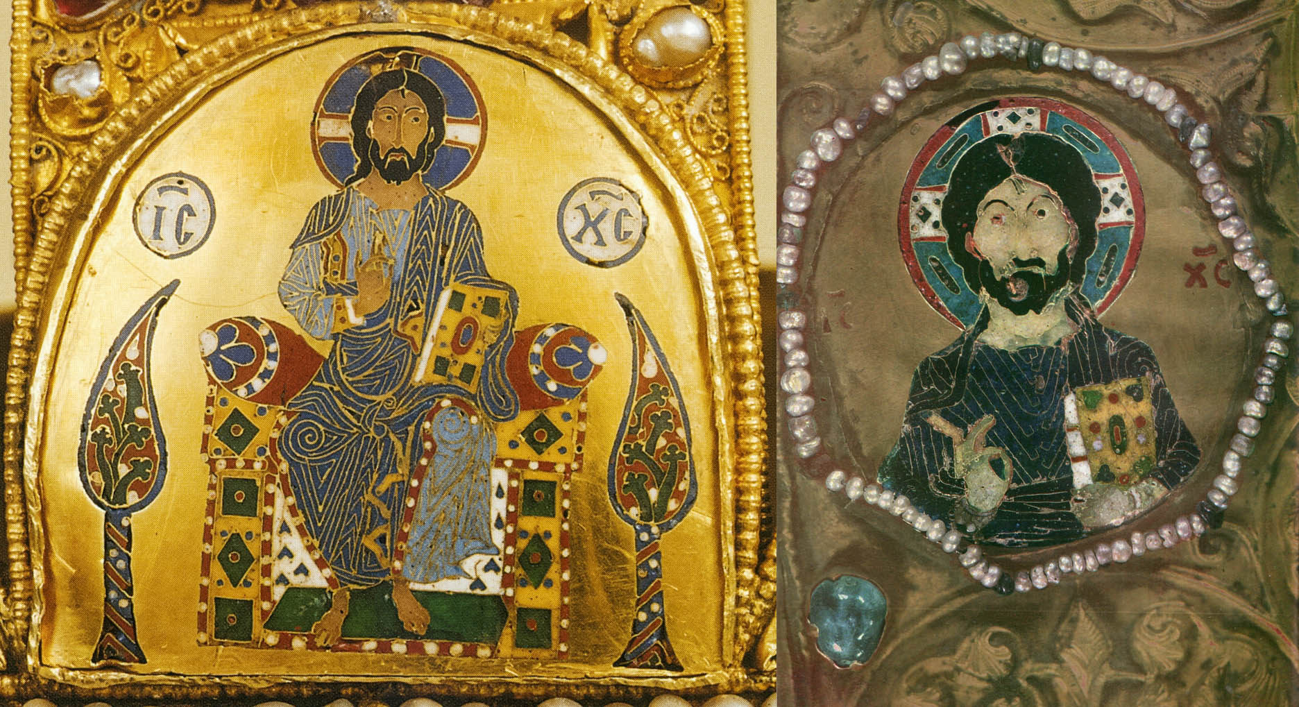
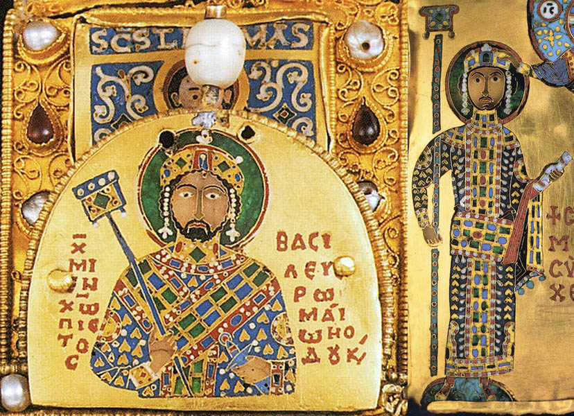
But the most important artifact connected to Khakhuli is the so-called Kakhuli triptych. This huge enamel icon of the Mother of God, which is approx. 1.5 × 2 meters when closed, is the handiwork of medieval Georgian masters, who were also highly regarded in Constantinople. As usual with icons, it was made in several stages between the 8th and 13th centuries. It was originally kept in the Khakhuli monastery, until Demetrios I (1125-1156) transferred it to the monastery of Gelati, founded by his father, David IV the Builder (1089-1125). It was stolen from there in 1859 by the Russian governor of Kutaisi. Many of its gold and precious stone elements were sold in Russia, and the stripped-down icon became the property of painter and art collector Mikhail Botkin. His widow donated it to the Hermitage, from where it was returned to Georgia in 1923 in very bad condition. Today it is in the Tbilisi Art Museum. A reproduction of its nearly one hundred enamel paintings was published by Guram Abramishvili in 1988. As this publication is practically inaccessible, I make public a scanned version of it.
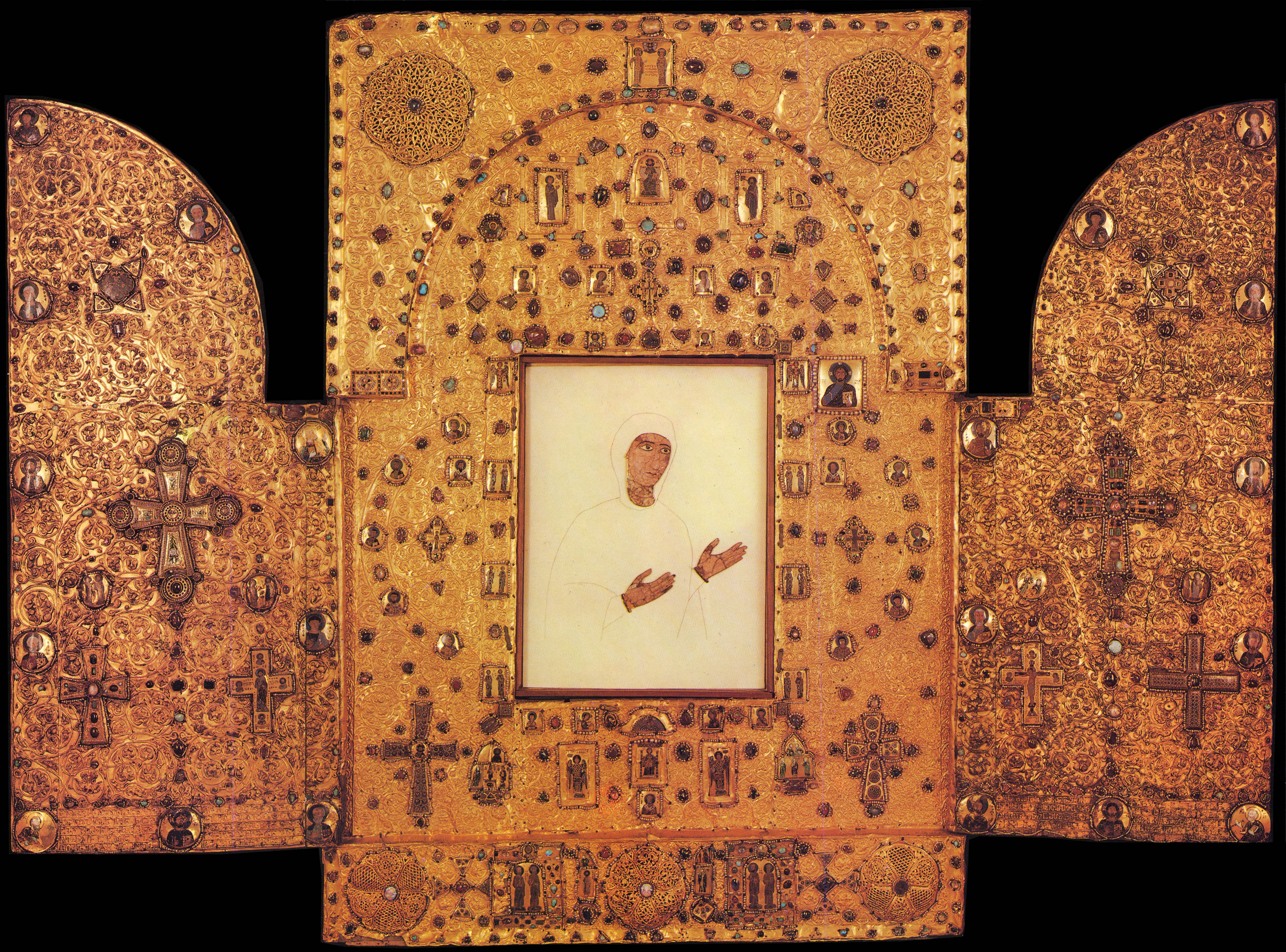
This icon is particularly interesting for us Hungarians. My friend Laci Holler, whose letters attached to our travelogues I have published several times on this blog as cameos, has shown in a study that some of the enamel images of the icon are prototypes for or perhaps even made in the same workshop as some of the images of the Hungarian royal crown.
This reference did not escape Laci Holler’s eagle eyes either. I must quote the most important part of his commentary again, because the experience he tells about describes well the feeling I had when standing in front of the monastery, earlier known to me only from literature:
“Your photos of the church itself, outside, inside, and the carvings! have impressed me. Because until now I had the feeling that maybe there once really existed a settlement called Khakhul, where there was a significant church, but they were swallowed up by the mists of history a long time ago. And it would be a serious challenge even to locate the place of this once-existing building. But the fact that it still exists in the reality in 2022, and I can see your photos taken there a few weeks ago, made my heart skip a beat.”
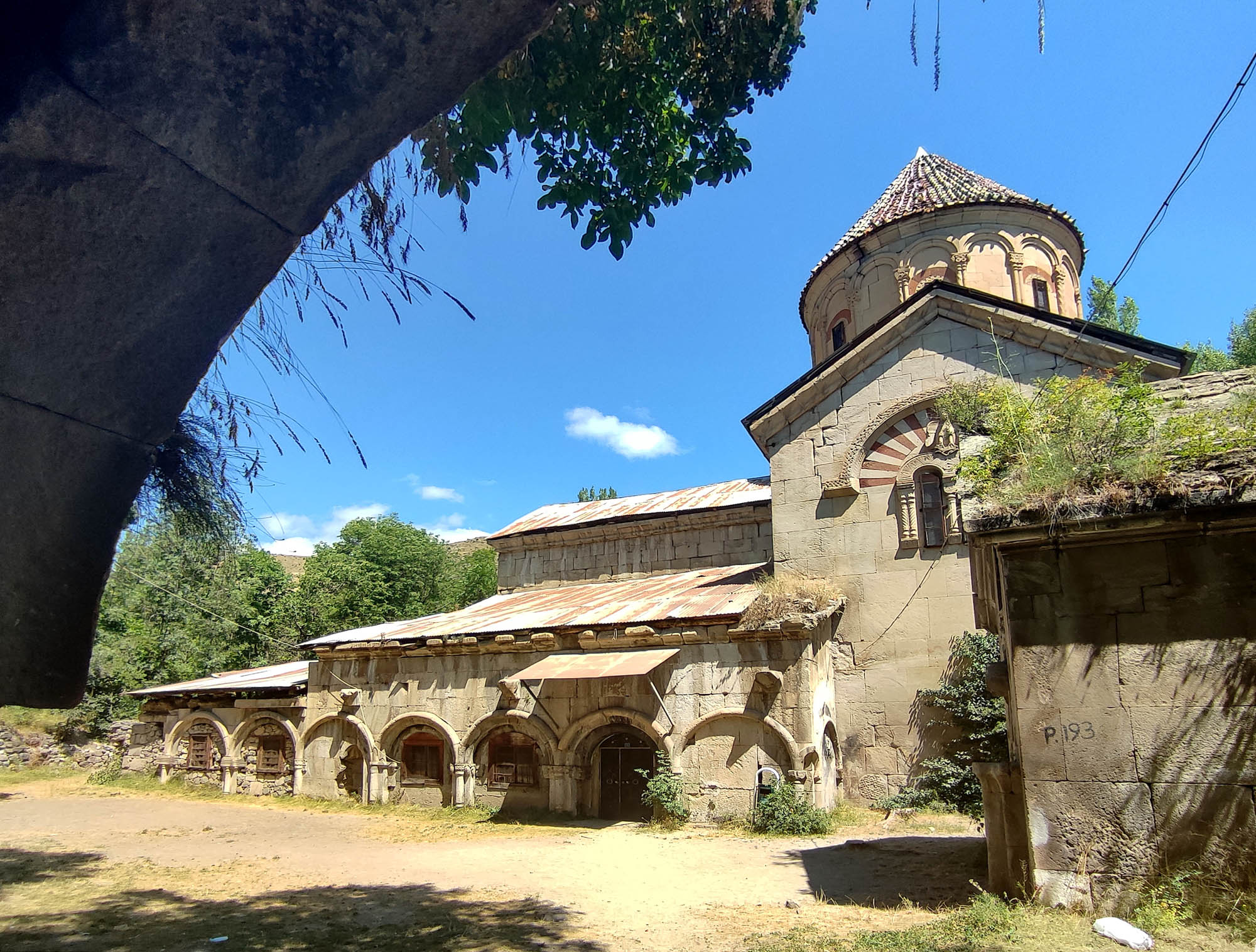
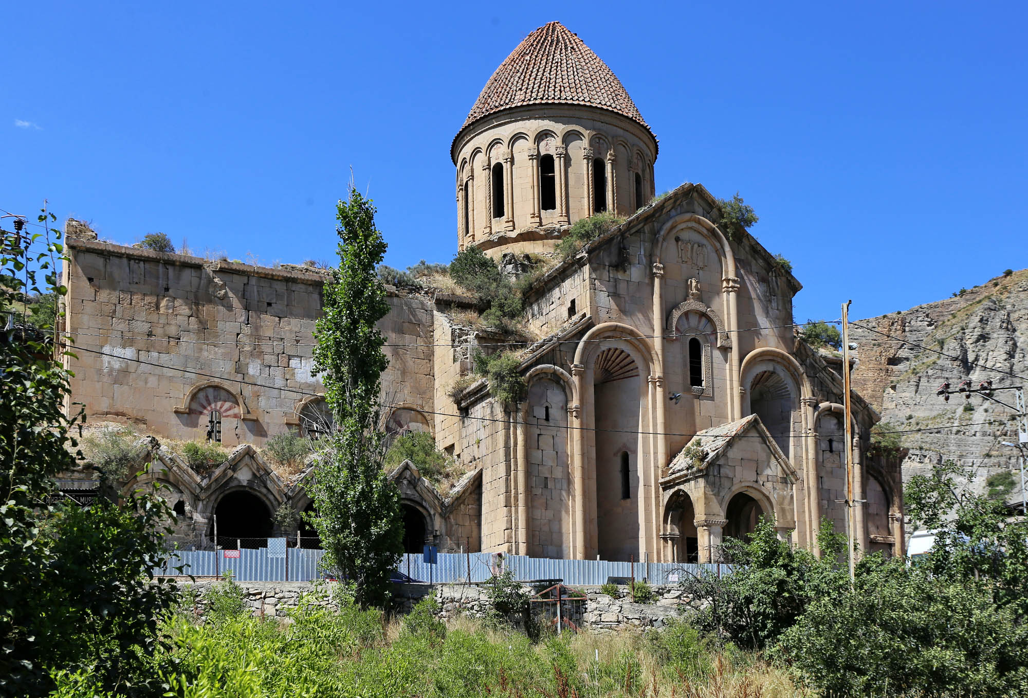
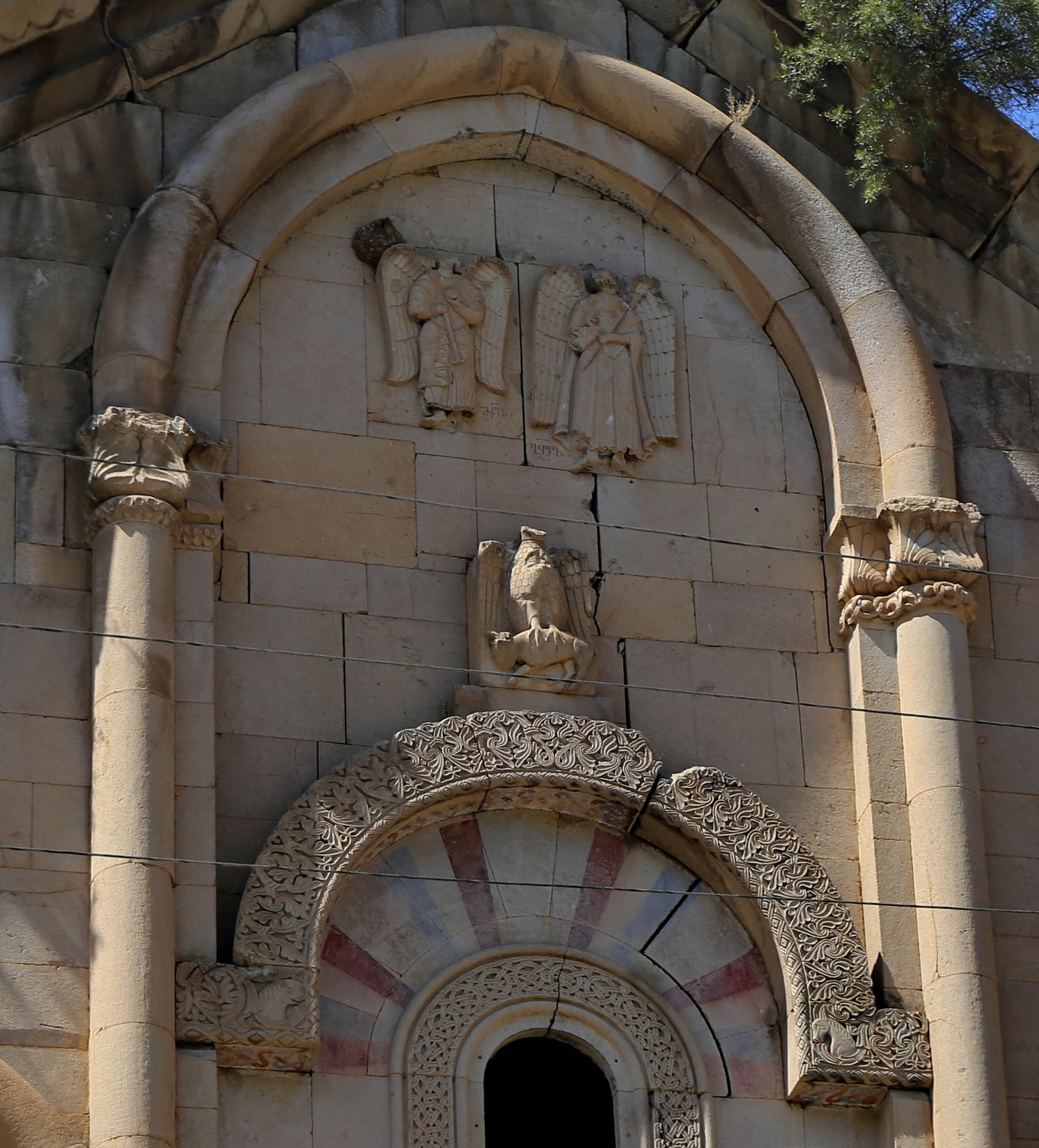
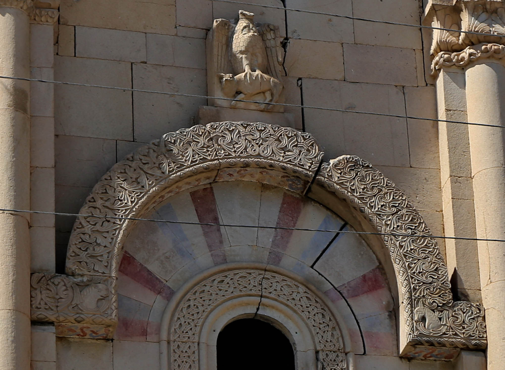
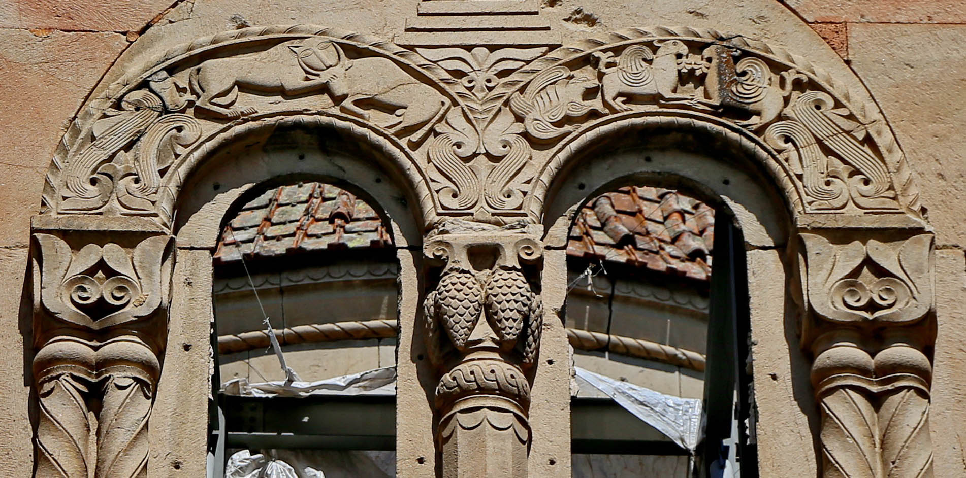
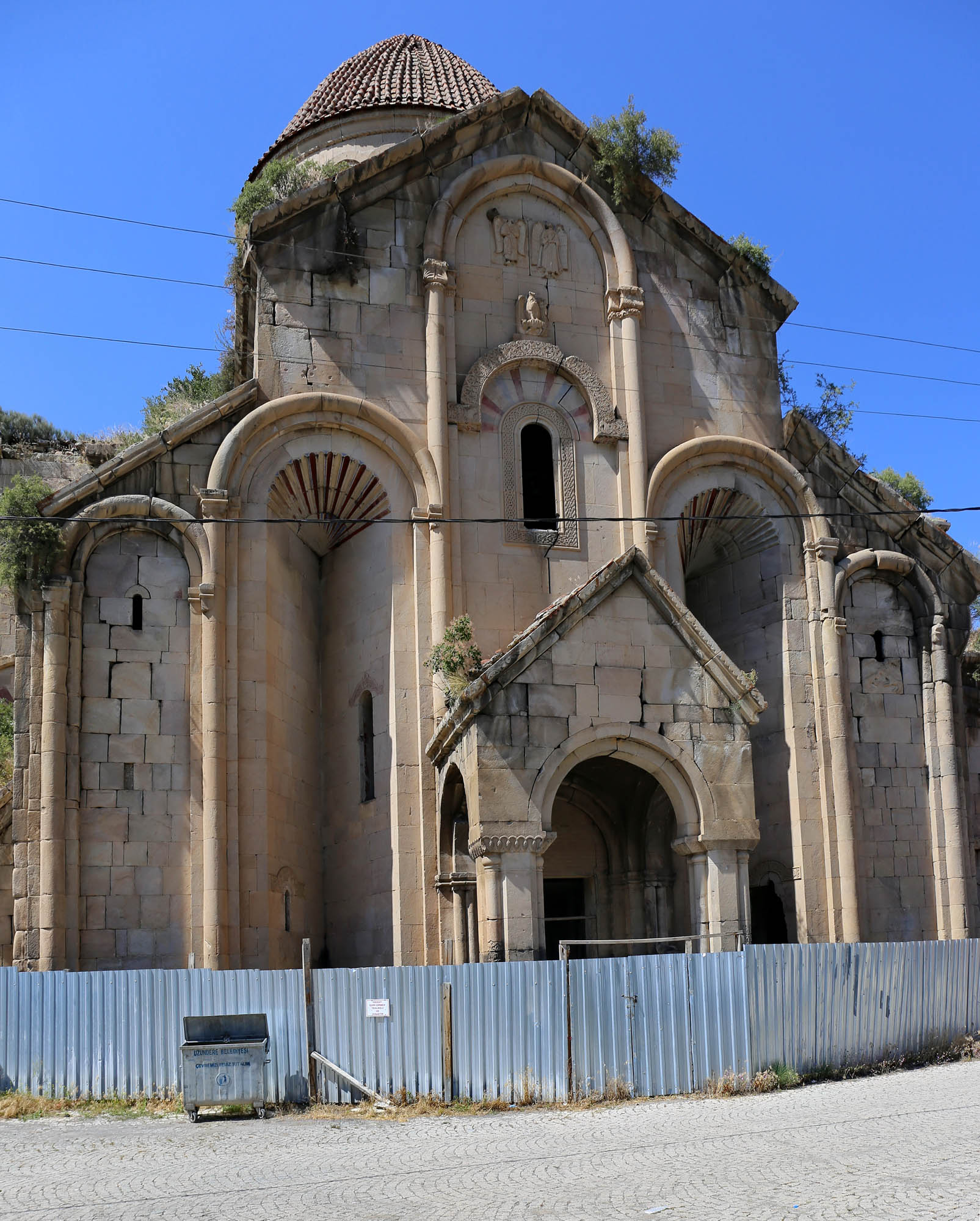
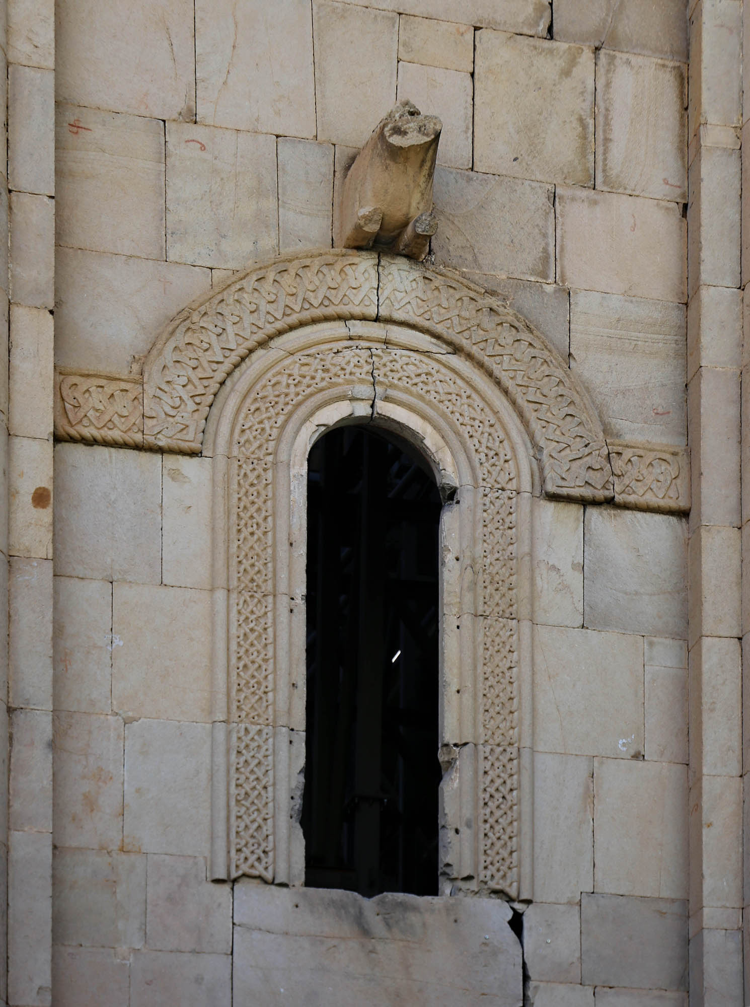
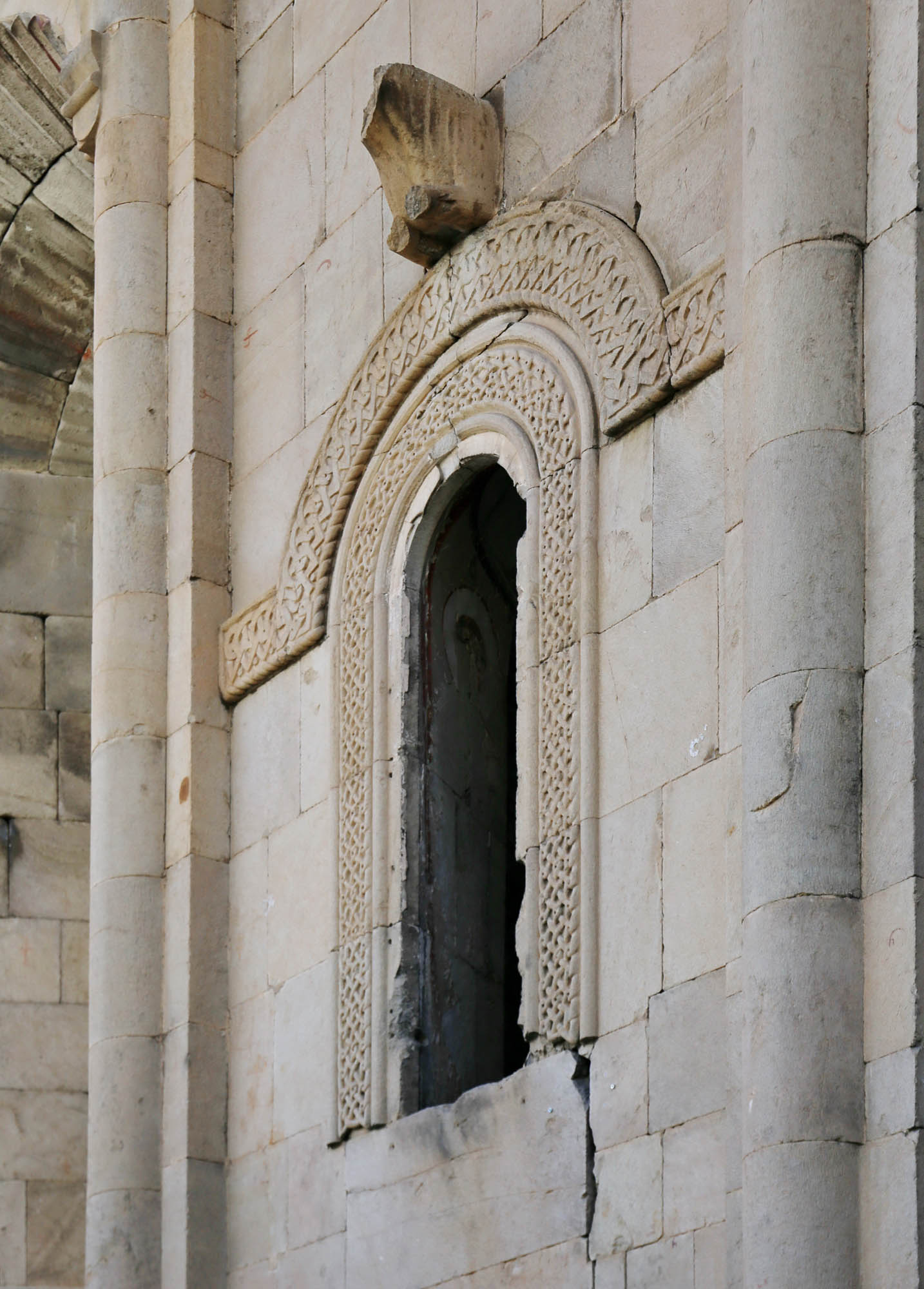
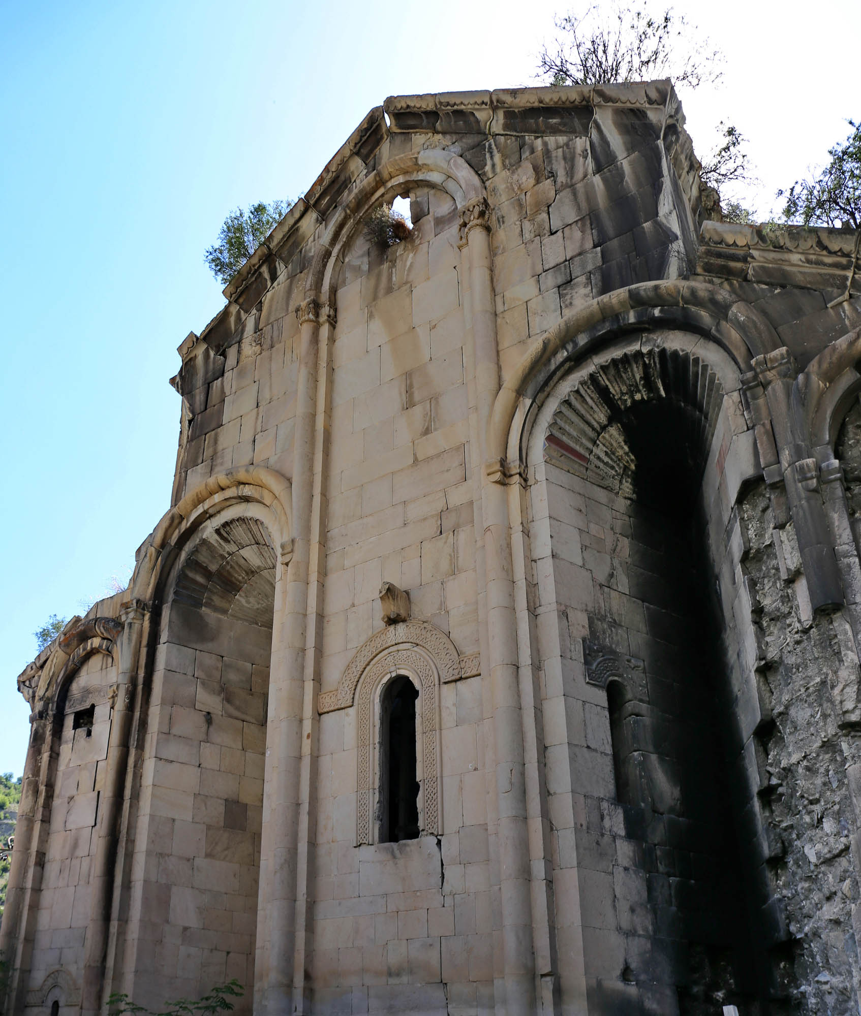
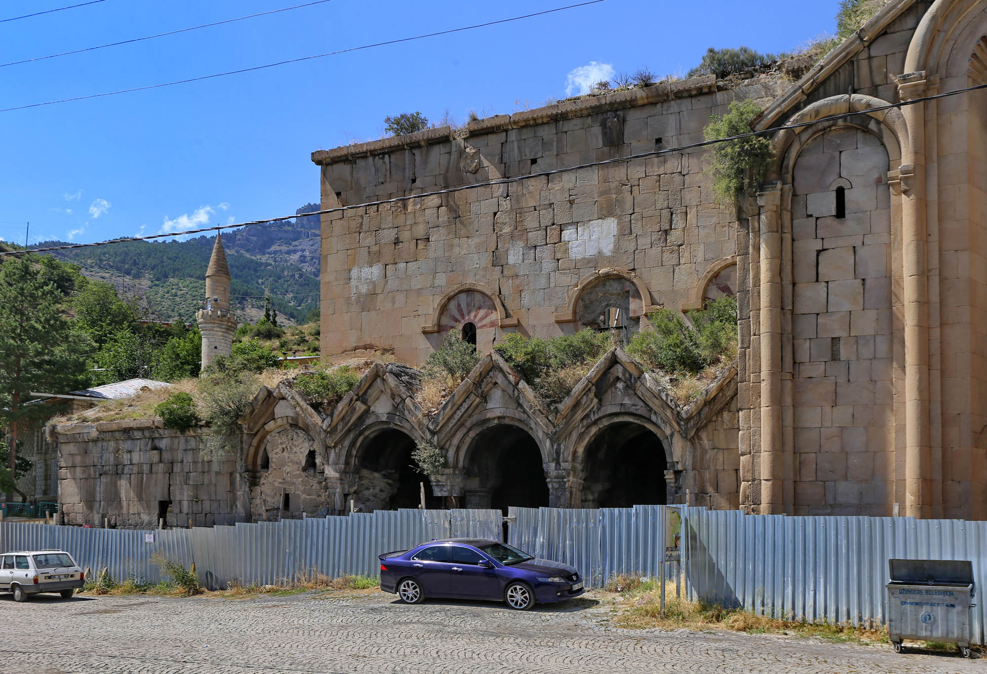
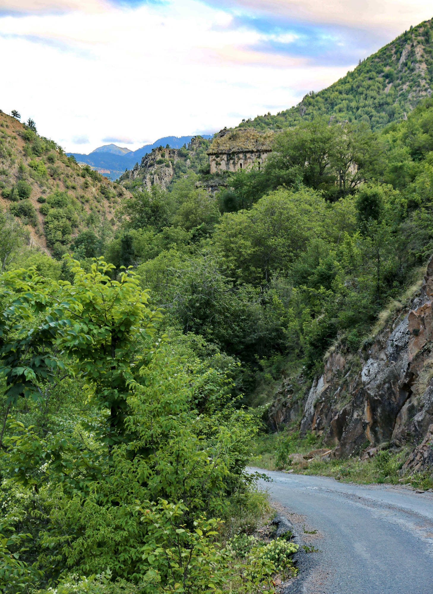
The buildings of the Khakhuli monastery are now in ruins. Only its main church has survived, now used as a mosque, and a small chapel next to it. We reach the surrounding wall of the church on the roadside near Bağbaşi at noon. The entry to the churchyard is still open, but the church is closed. On the façade of the transept, there is a huge arch, decorated with segments of red and white stone in a semicircle. Below it, on the top of a double window, an eagle grasping a calf looks down on us, the symbol of the Bagration dinasty. A similar arch is on the western and eastern façades, but without statues. A low southern vestibule runs parallel to the main nave, its wall is decorated by blind arcades starting from carved capitals. Above them, large statues of three animals – probably a lion, a bull and an eagle – protrude from the façade, but all three have had their heads knocked off. The dome tower is also decorated by semicircular blind arcades with carved column capitals. The chapel has a cross in its tympanum above the entrance, and a carved window frame on its back wall. Stuck by the door and on the capitals are the stubs of candles lit by Christian pilgrims who could not enter the church.

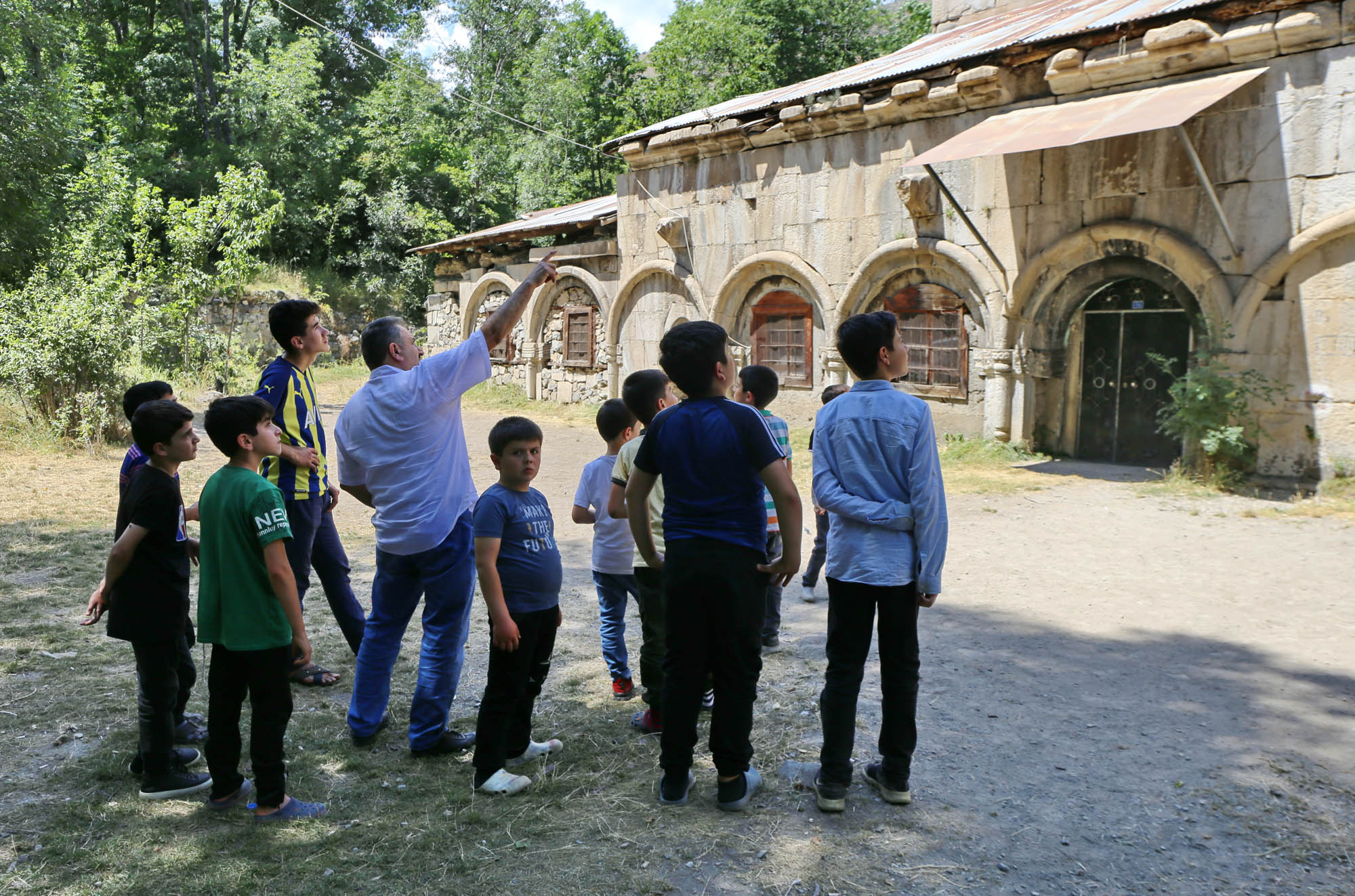
It is a question whether we can enter it. I ask around in the vicinity who has the key. “The haji is about to come for the noon ezan.” Zuhr, the noon prayer time, is at half past one today, so we wait. Meanwhile, I am reading Vakhtang Jobadze’s monograph on the monasteries of Tao-Klarjeti, which will be our good guide along the way. The zuhr comes and passes, the muezzin’s song can be heard from the surrounding mosques, but from the Kakhuli church-mosque no God is being praised at this time. Nevertheless, we keep waiting. Soon a minibus stops in front of the church. A dozen children roll out from its seven seats, and their teacher from the driver’s seat, who enthusiastically explains the history of the church to them in Turkish. He also takes them around the building, and I hope maybe he has a key to the door. But he does not. When they are about to leave, I ask him if he knows who has the key. He takes out his smartphone and opens the prayer time application. “Asr will be at five twenty-five, then it will be definitely open.” I do not want to object that it was not even open at the zuhr. We rather decide to check out the Oshki monastery in the meantime, twenty kilometers away, and then return afterward. It is worth a try.
We in fact visit the Oshki monastery, and then we have a late lunch at a roadside restaurant, where the service is very slow, so we are a bit late. We are five kilometers from Khakhuli when the ezan is sounding. We can only hope that the haji stays to chat a bit with one of the believers and does not leave under our noses.
We arrive at the church at five forty. We enter the churchyard. The church door is open! A middle-aged man stands there and lets us in without saying a word. He just asks inside: “Were you the ones here at noon?” You cannot beat the village news chain. He was obviously waiting for us.
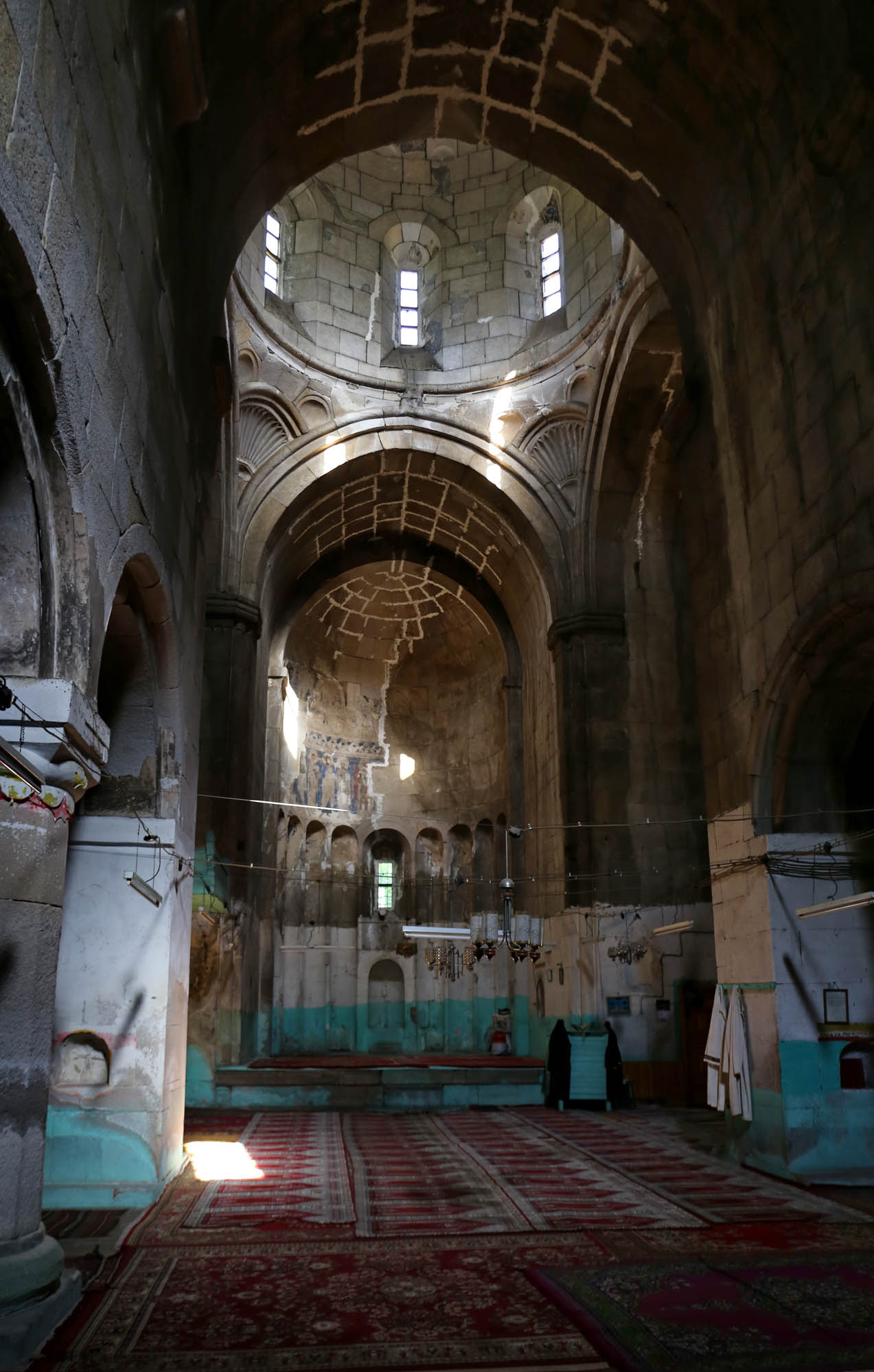
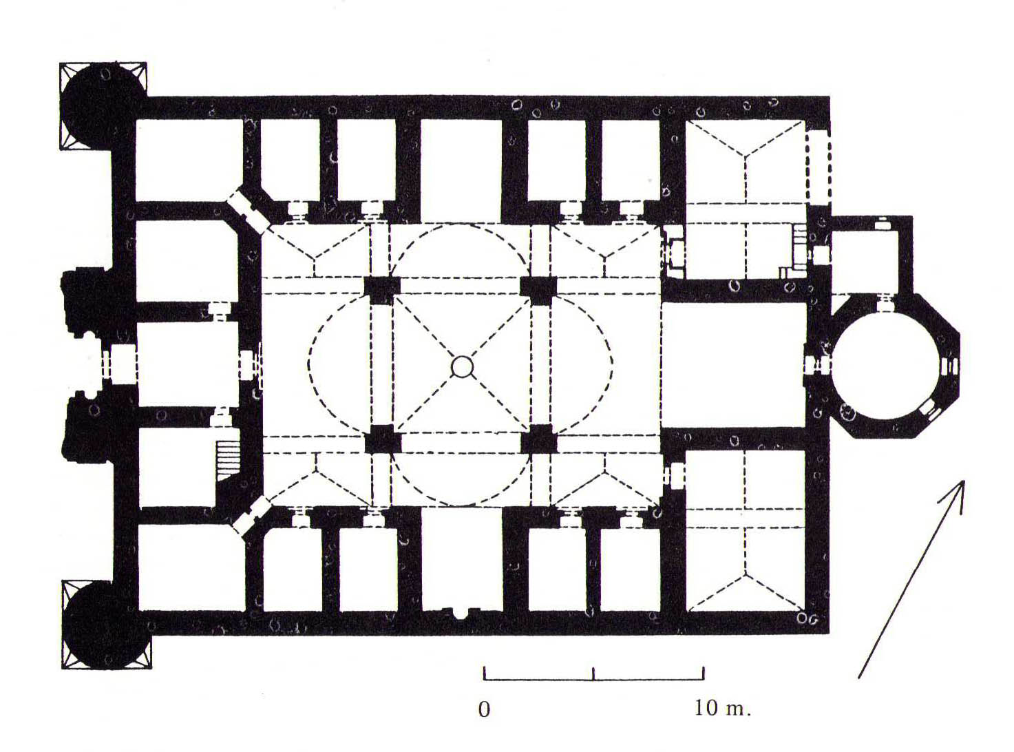
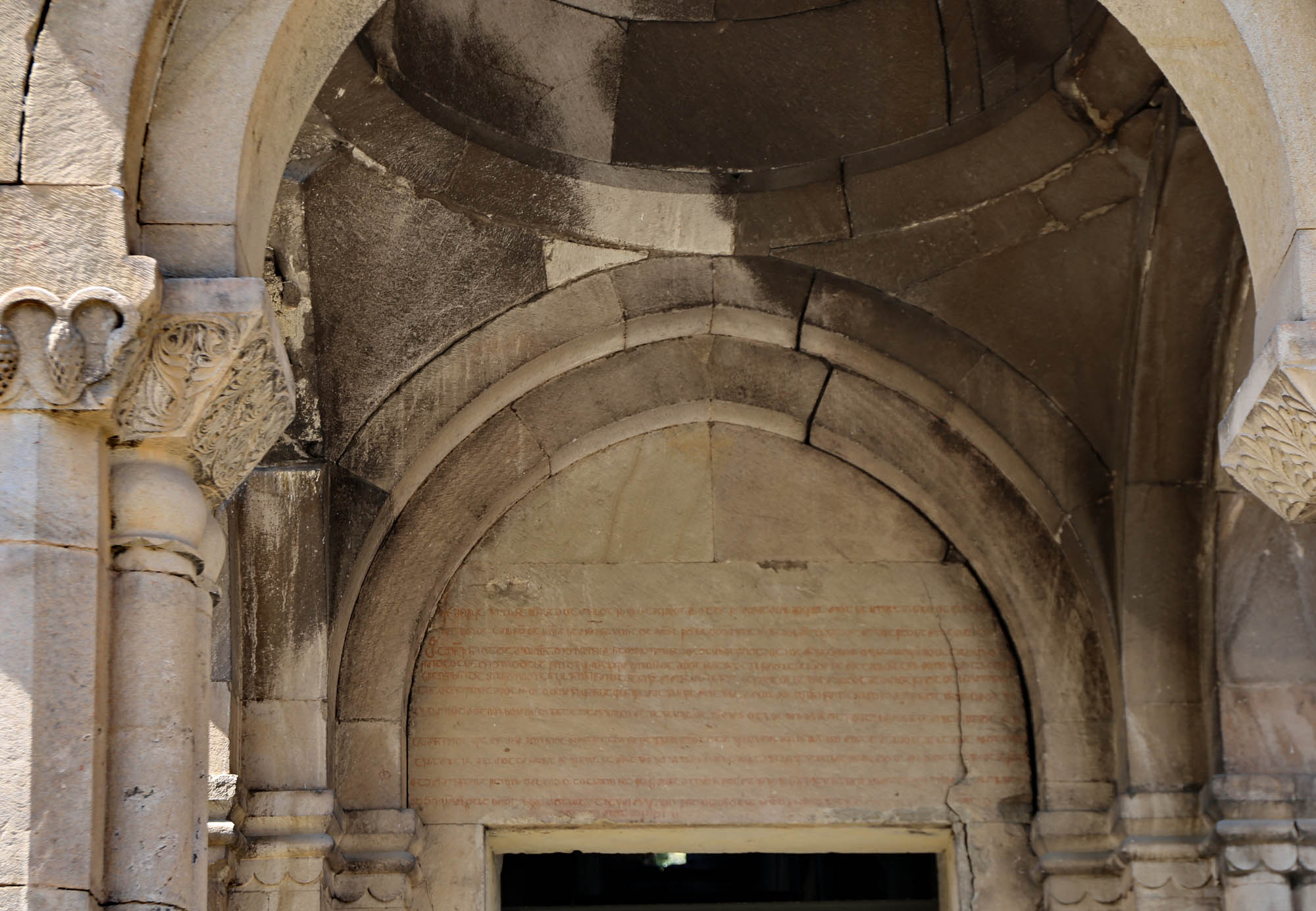
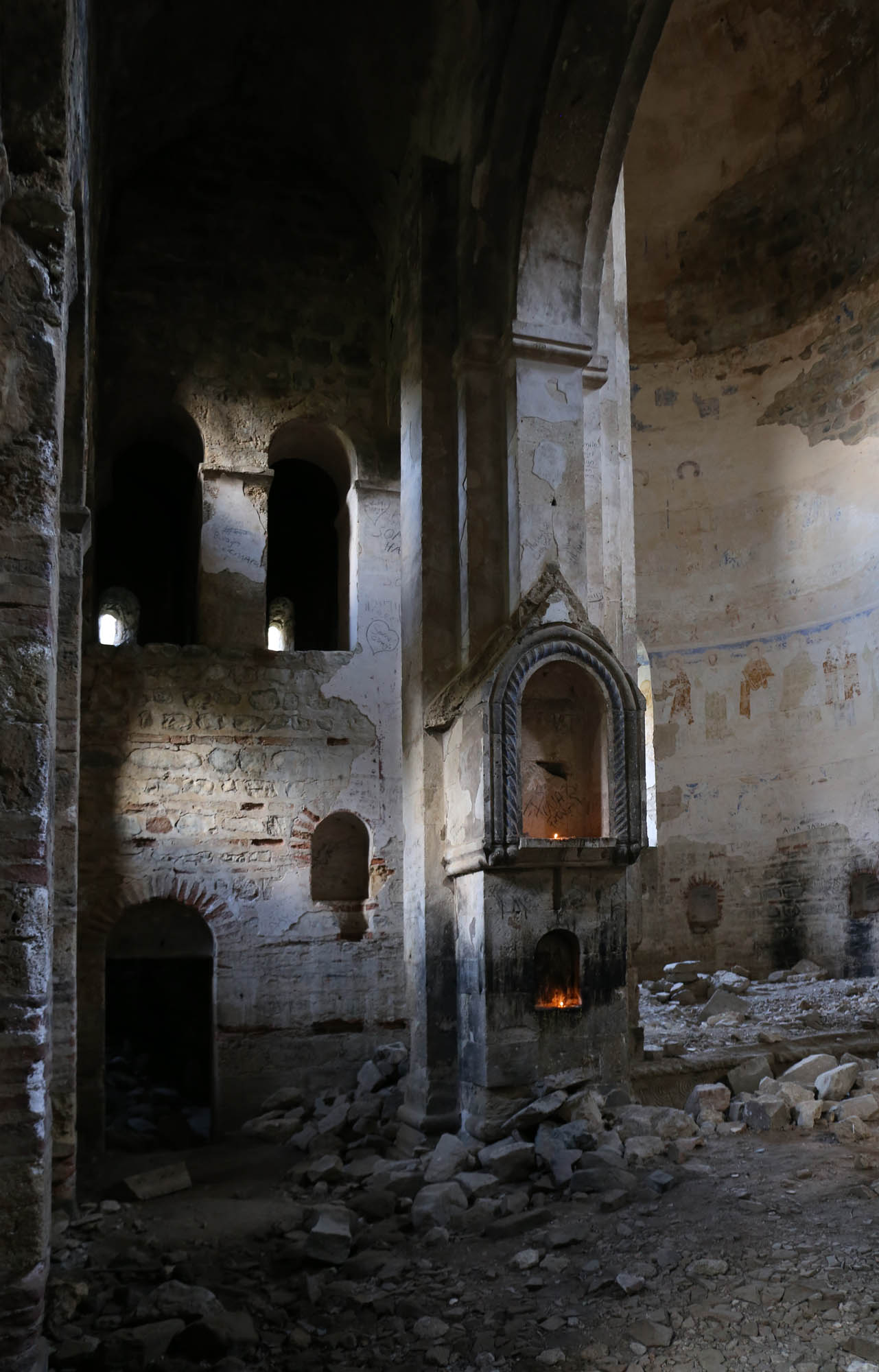
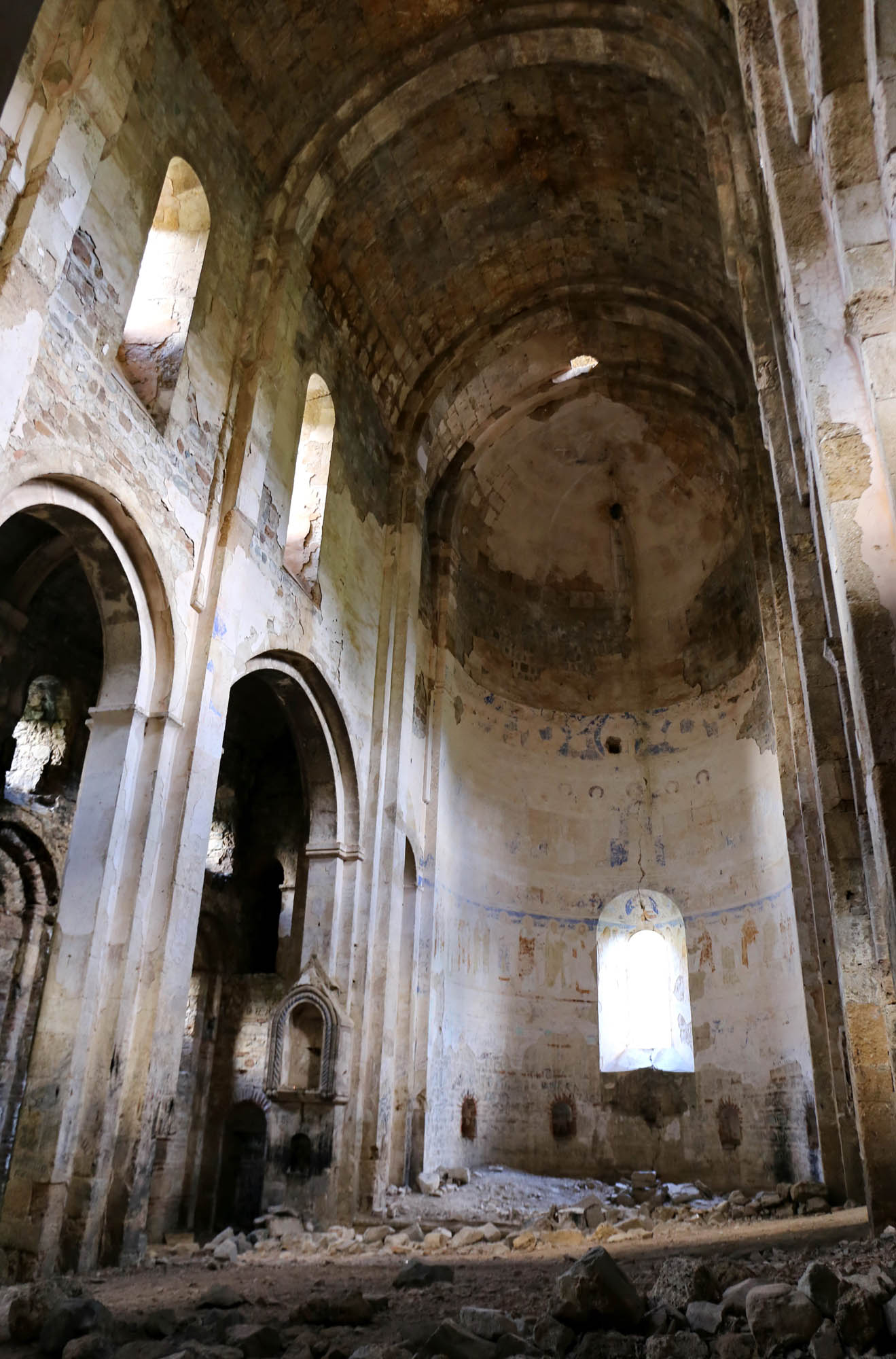
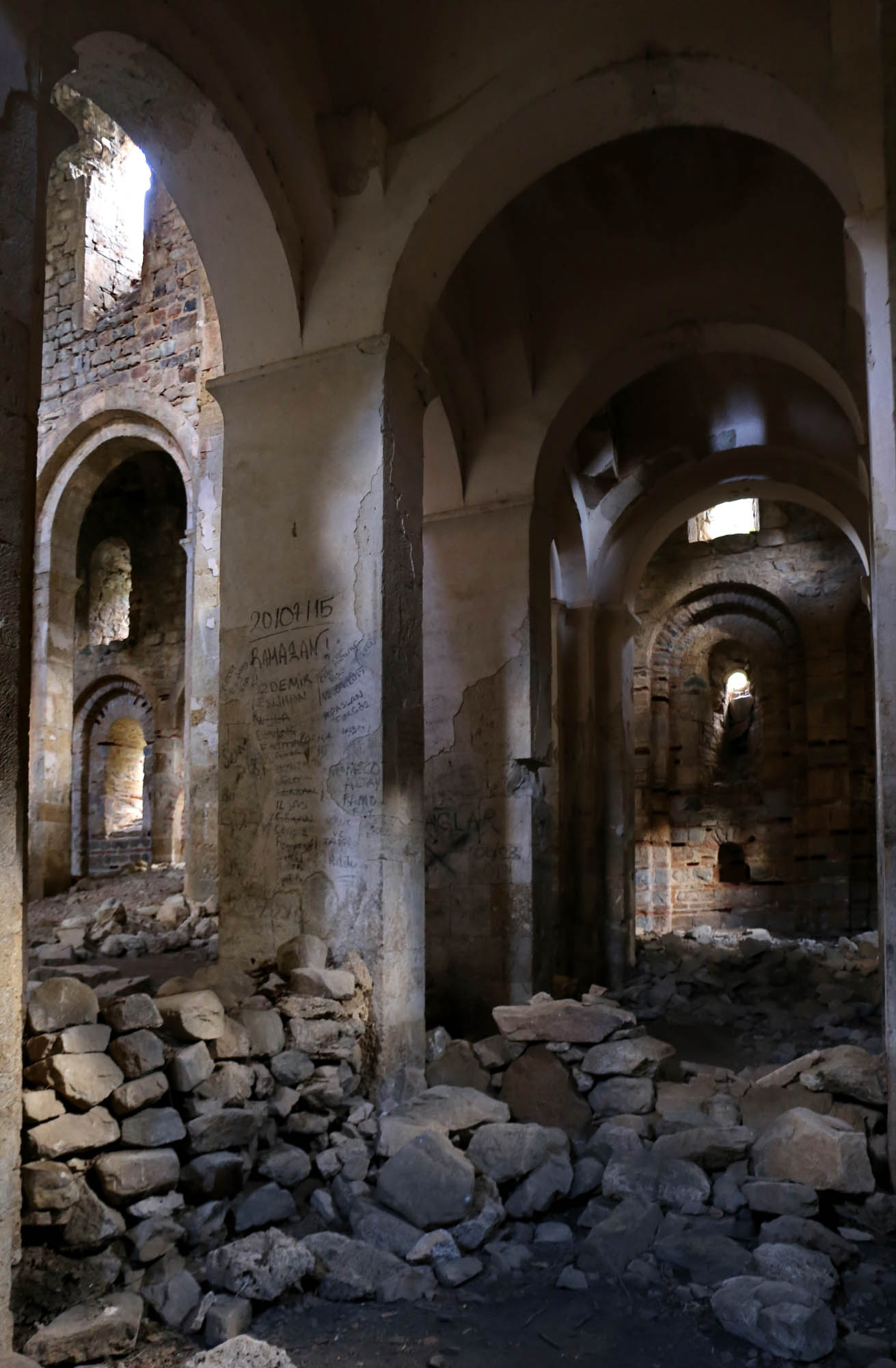
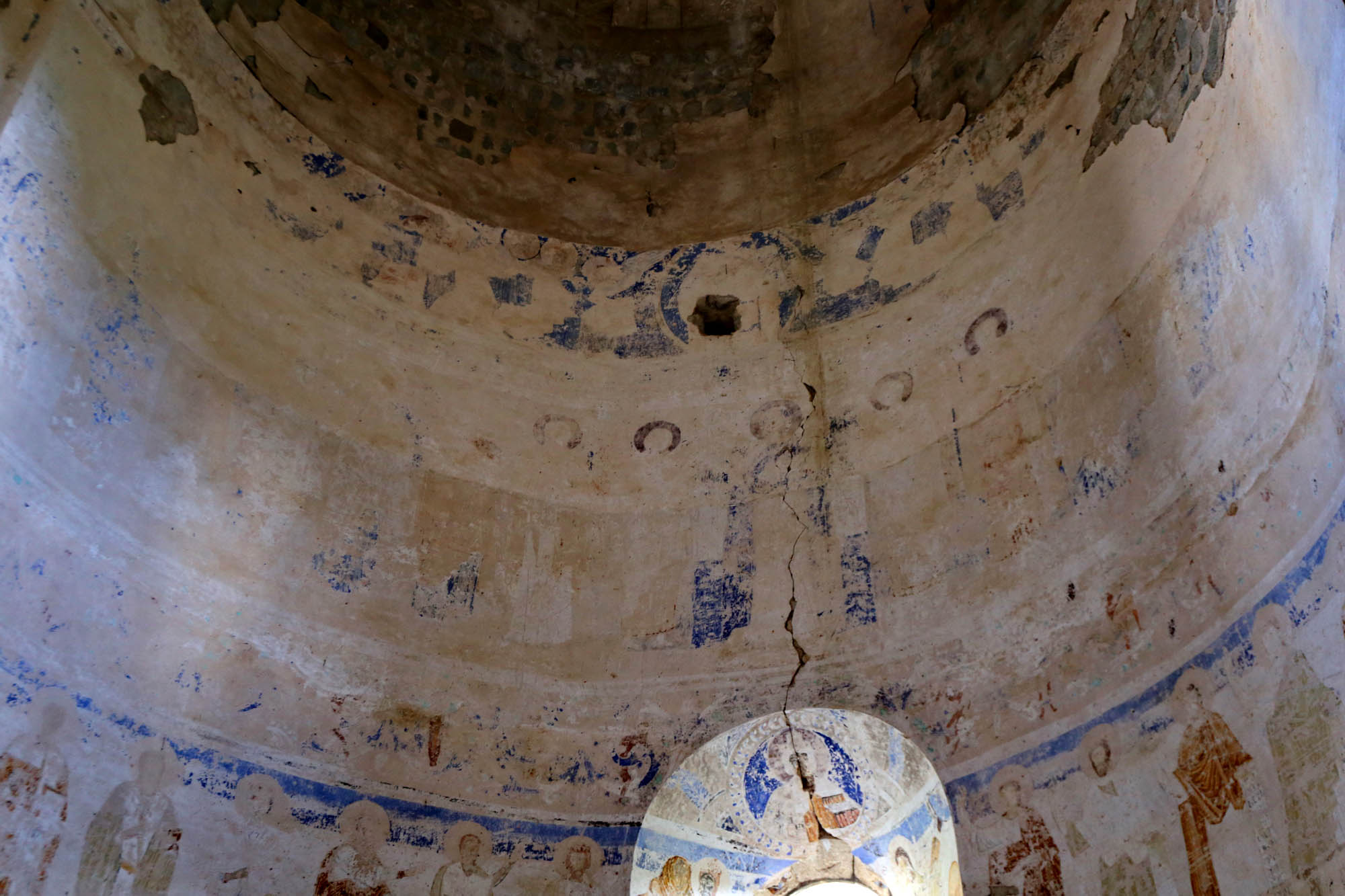
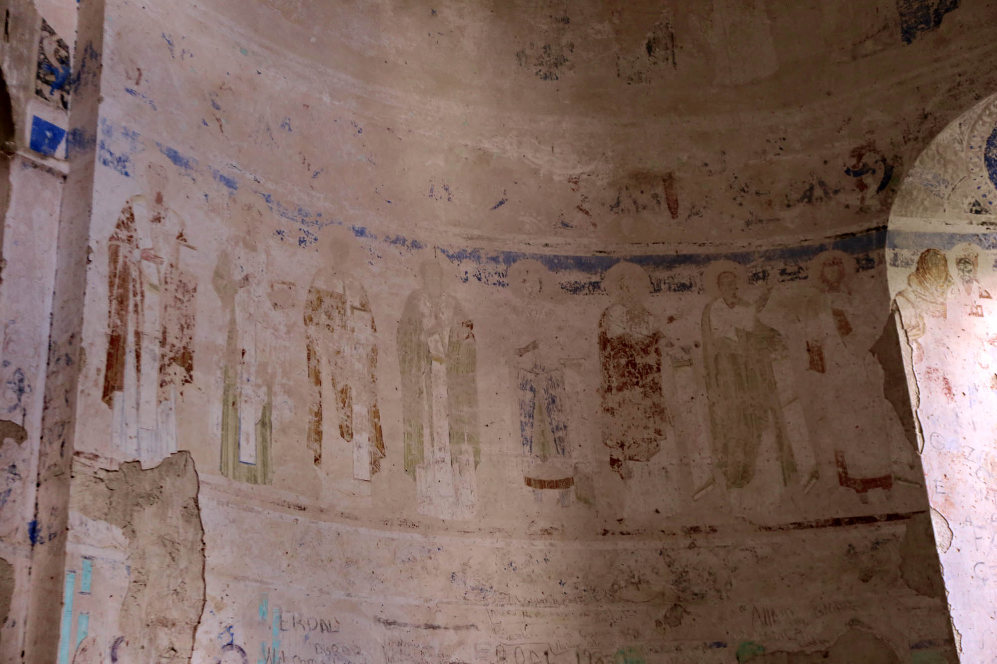
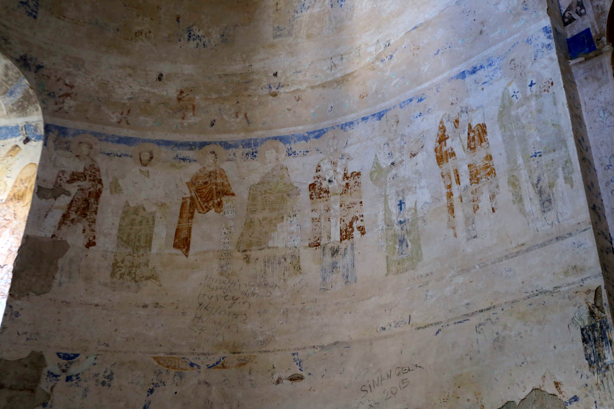
The church has a Latin cross floor plan with a tall nave and apse, a majestic, impressive interior, and a dome over the crossing. Despite its function as a mosque, fragments of medieval frescoes have been preserved in the apse and dome: saints and the apocalyptic cross. The wall of the apse is decorated by a series of high semicircular arches. According to Jobadze, this is a rarity in Caucasian architecture. We will see similar ones only in Ishkhan and the Ani Cathedral. When developing the prototype of the Georgian church, the Georgian masters here experimented with a Syriac solution, which we recently saw in Hah. These worlds are in different boxes only in our heads. During the period, they thought in terms of a unified Christian oikumene.


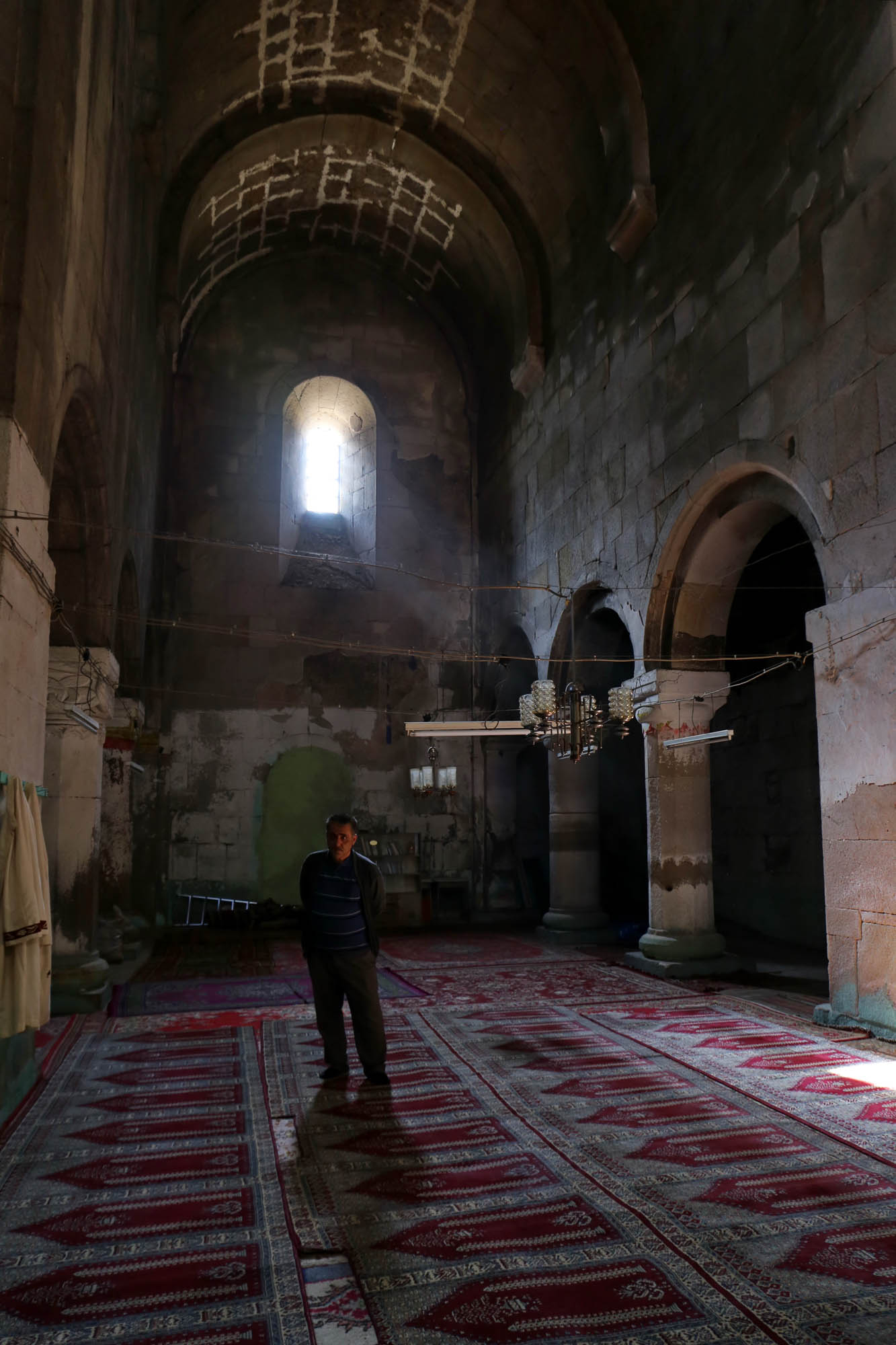
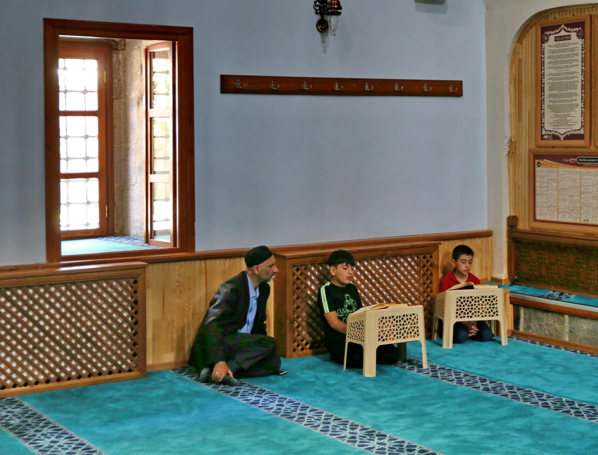
The small entrance hall that runs parallel to the main nave, is furnished as a rudimentary classroom. “How many students do you have?” I ask the haji. “Twenty”, he says proudly. “Mashallah”, I say, he is pleased.
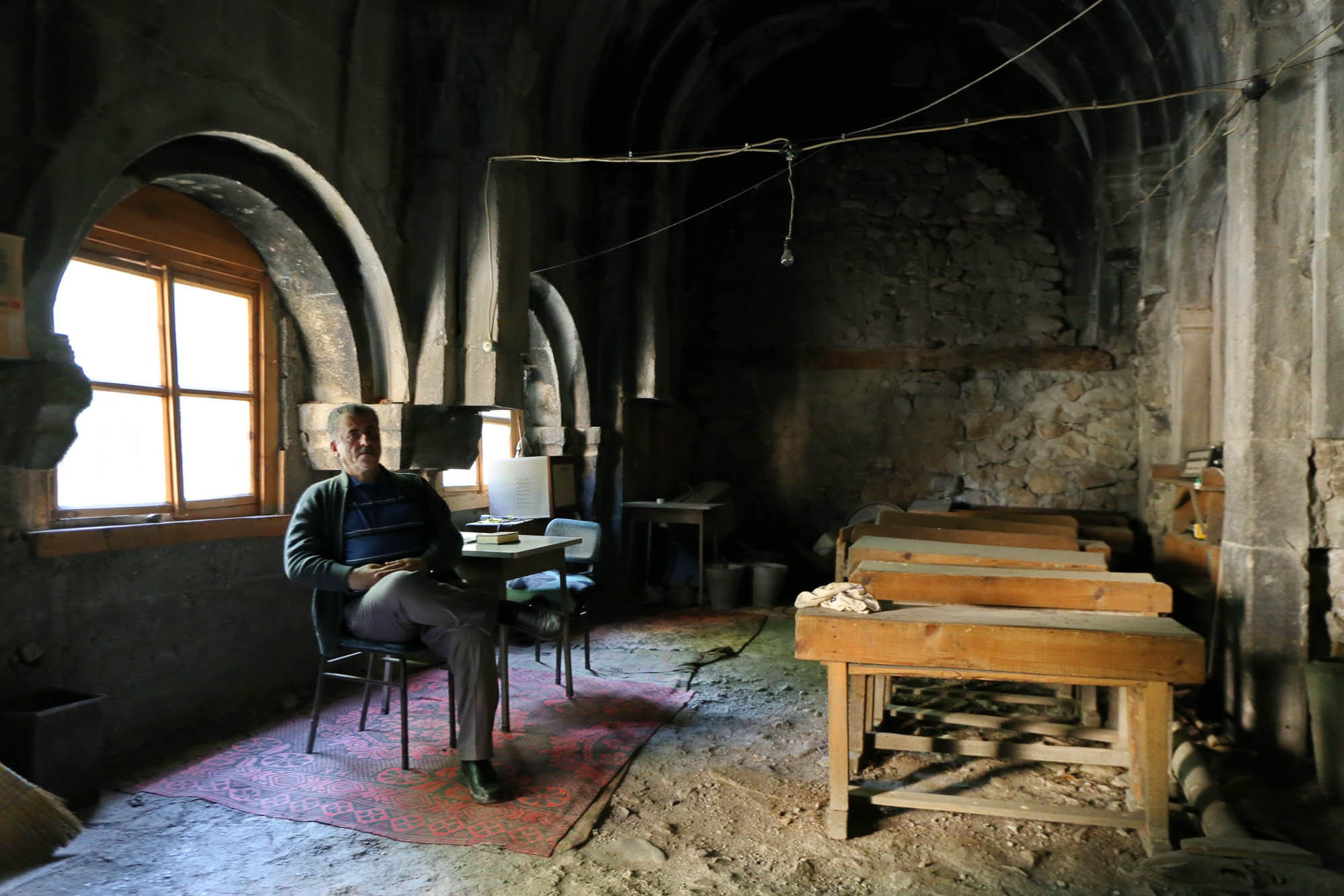
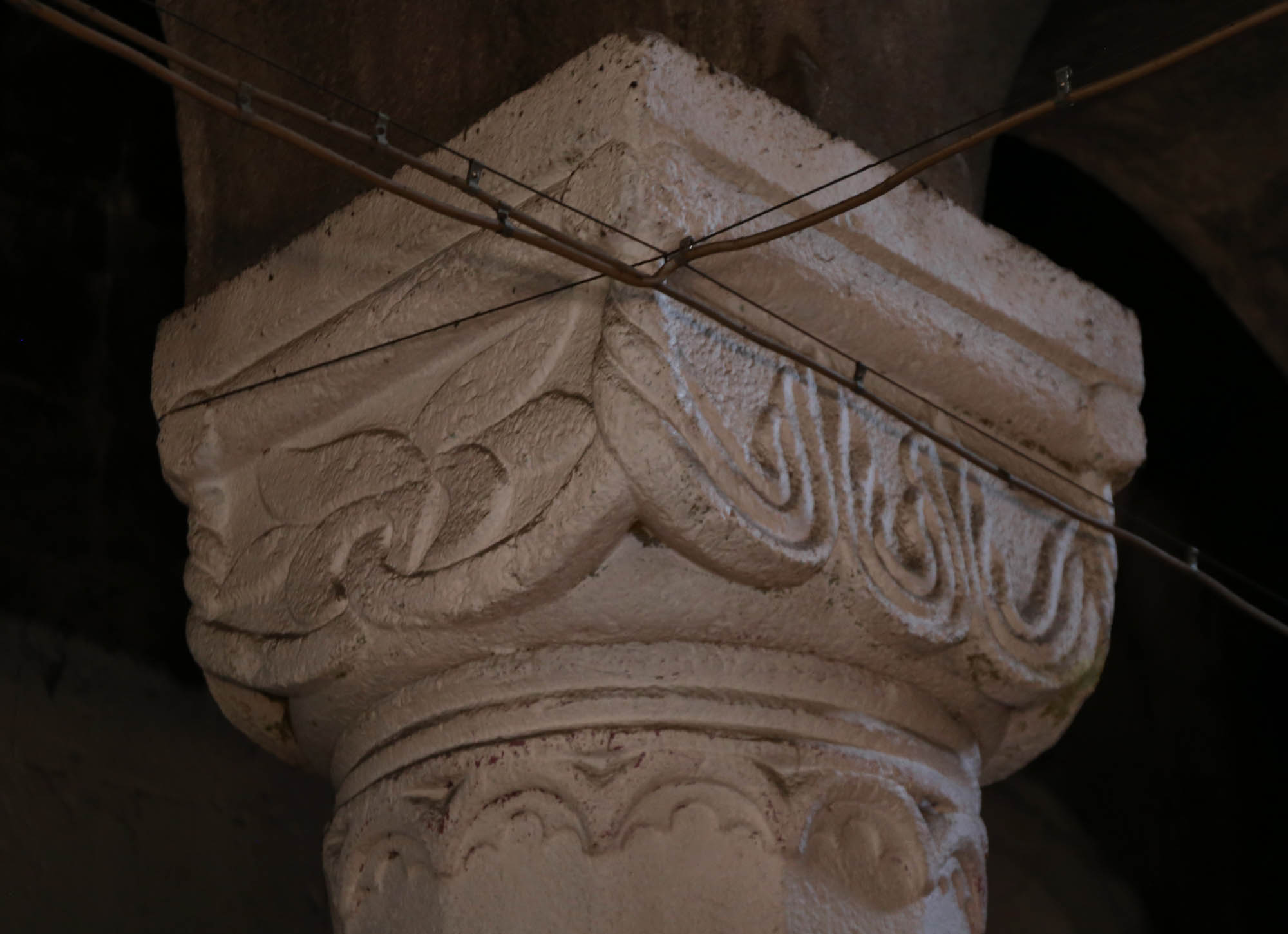
Only when looking back, do I notice one of the most important thing: the carvings of the southern door. Clumsy, folksy figures on both sides of the entrance, partly copied from manuscripts and partly from Persian carvings, but very important, because according to Jobadze, these are the very first Georgian architectural carvings. This is where a genre is born that is completely absent from Byzantine art, and which will be perfected on the façades of the great Georgian churches. From top to bottom on the left, Alexander the Great being carried to the heavens by griffins, a griffin bird and a lion defeating a bull, on the right a prophet, a whale with Jonah in the mouth, a rooster and a lion as animals driving away evil. An apocalyptic cross carried by four angels in the tympanum, a lion hunting a deer on the left capital, and the Virgin with the Child on the wall to the right of the gate. A pictorial theophany thrown together still without grammar.

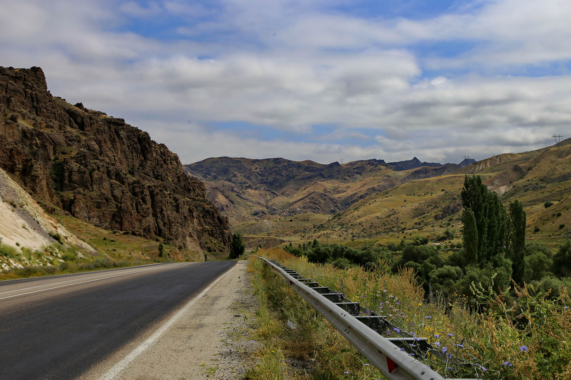
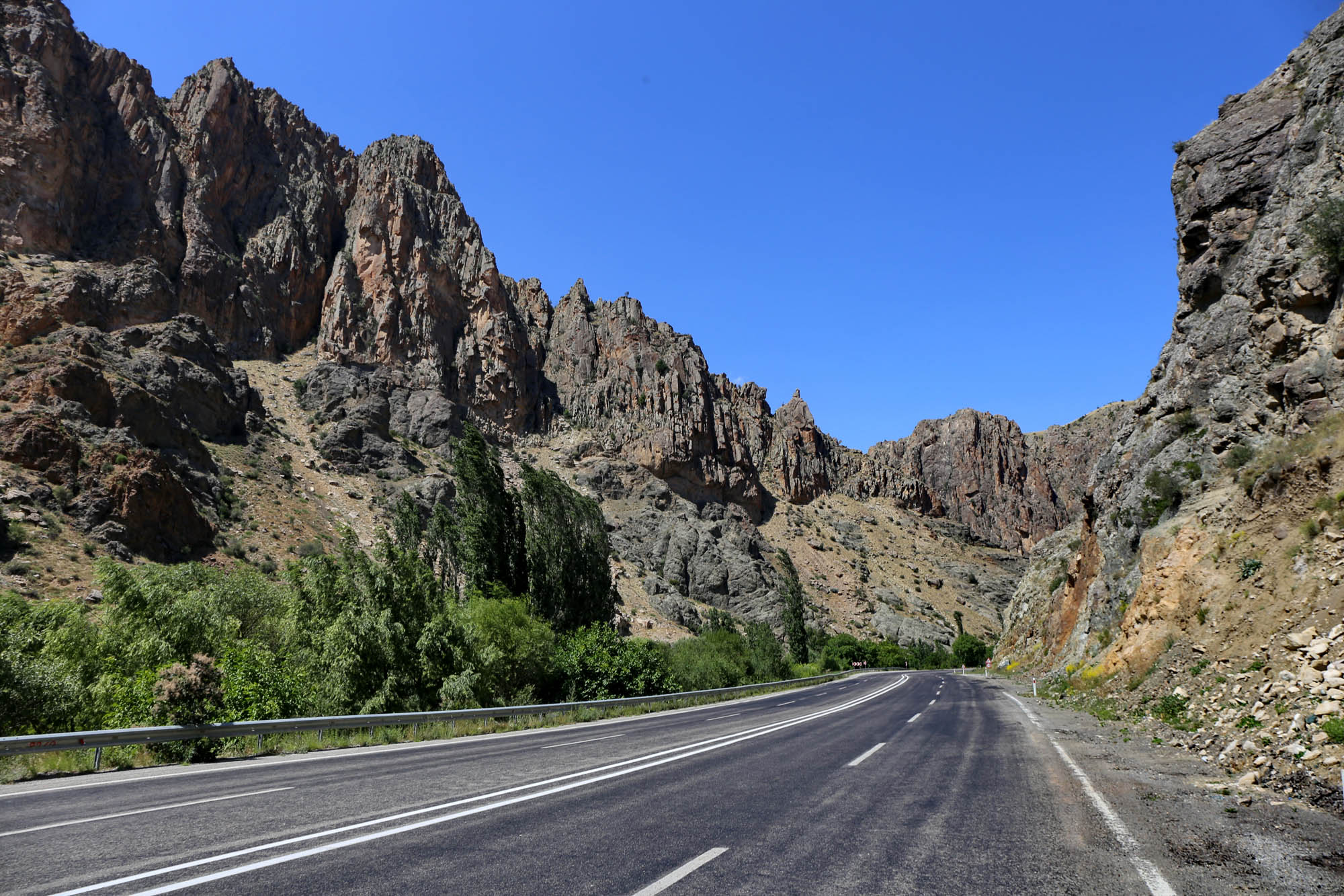
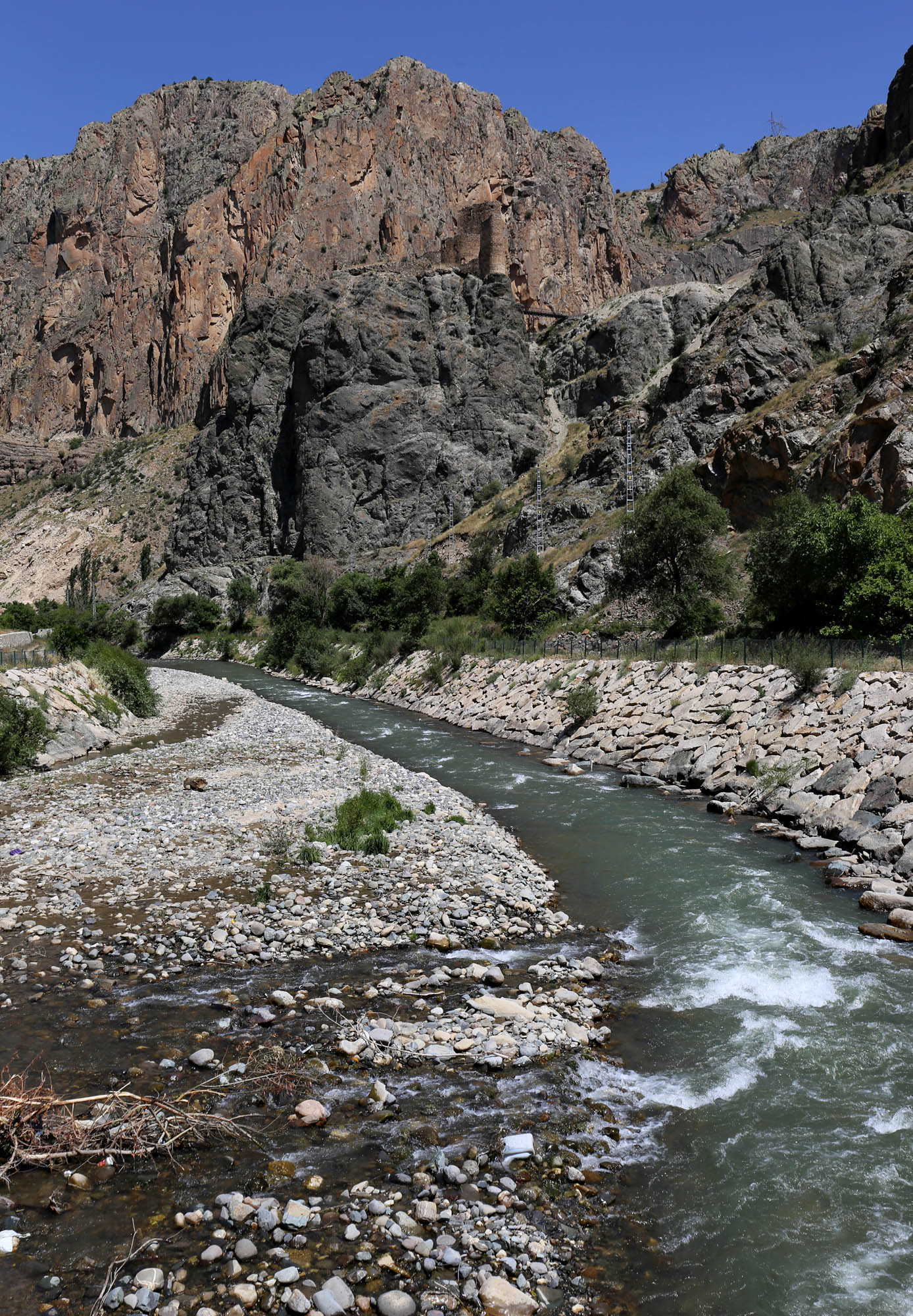
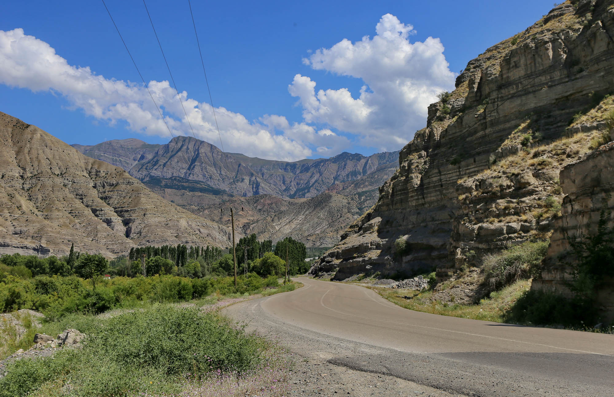
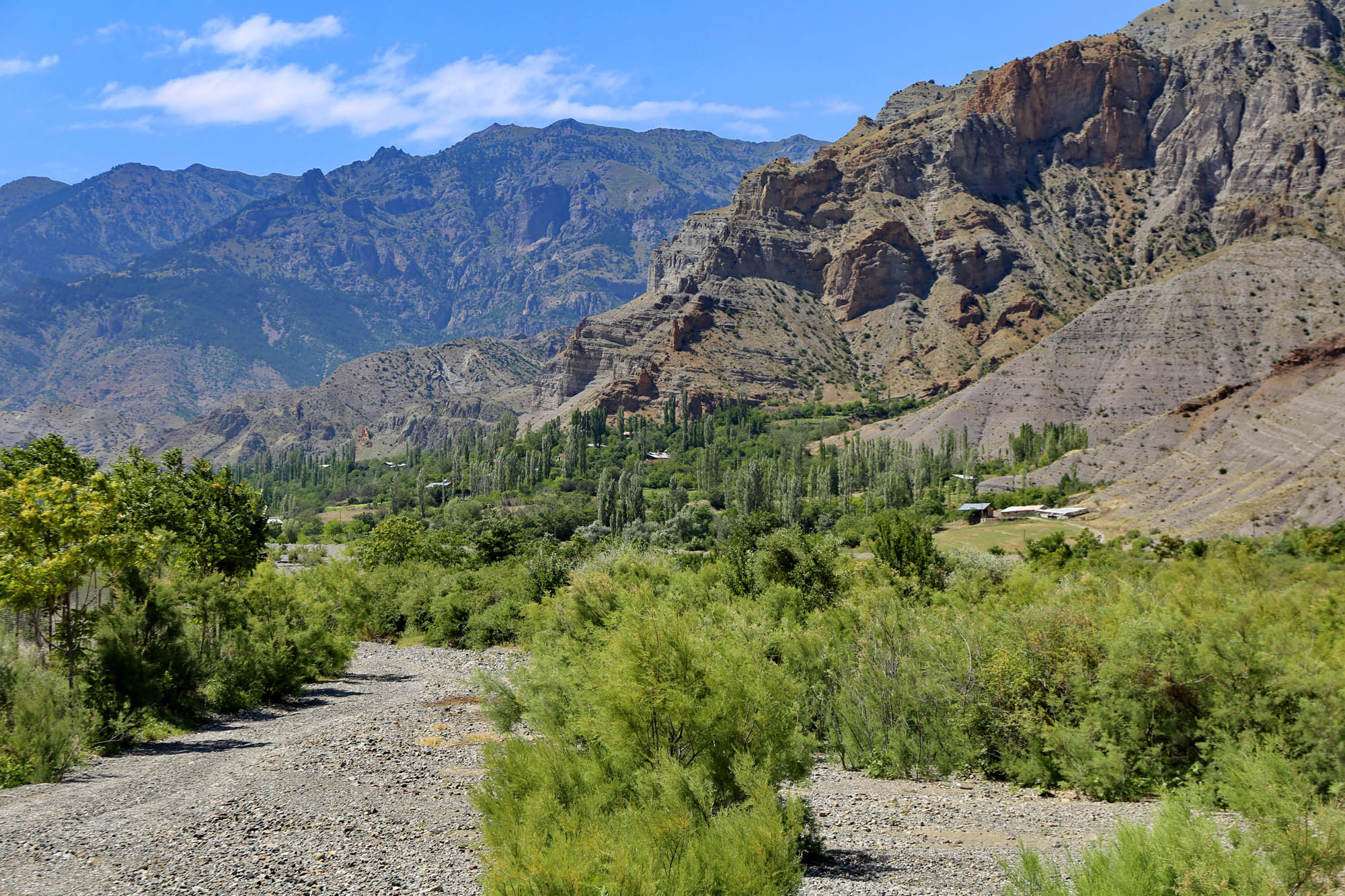
The fact that the road to Oshki Monastery takes you along the bottoms of canyons is not even worth mentioning. In Tao-Klarjeti, characterized by sharp mountain ridges, all the roads run along the rivers, and the rivers cut deep into the mountains. In this way, one travels either at the bottom of a canyon, or on the side of a canyon, if the river has been dammed into a reservoir; or in a tunnel, if there was no longer room for a road above the reservoir.

This church is the largest among the Tao-Klarjeti monastery churches. It has a Latin cross floor plan, with a dome above the crossing. It is currently inaccessible, surrounded by an aluminium palisade, because cracks have appeared that made it life-threatening.

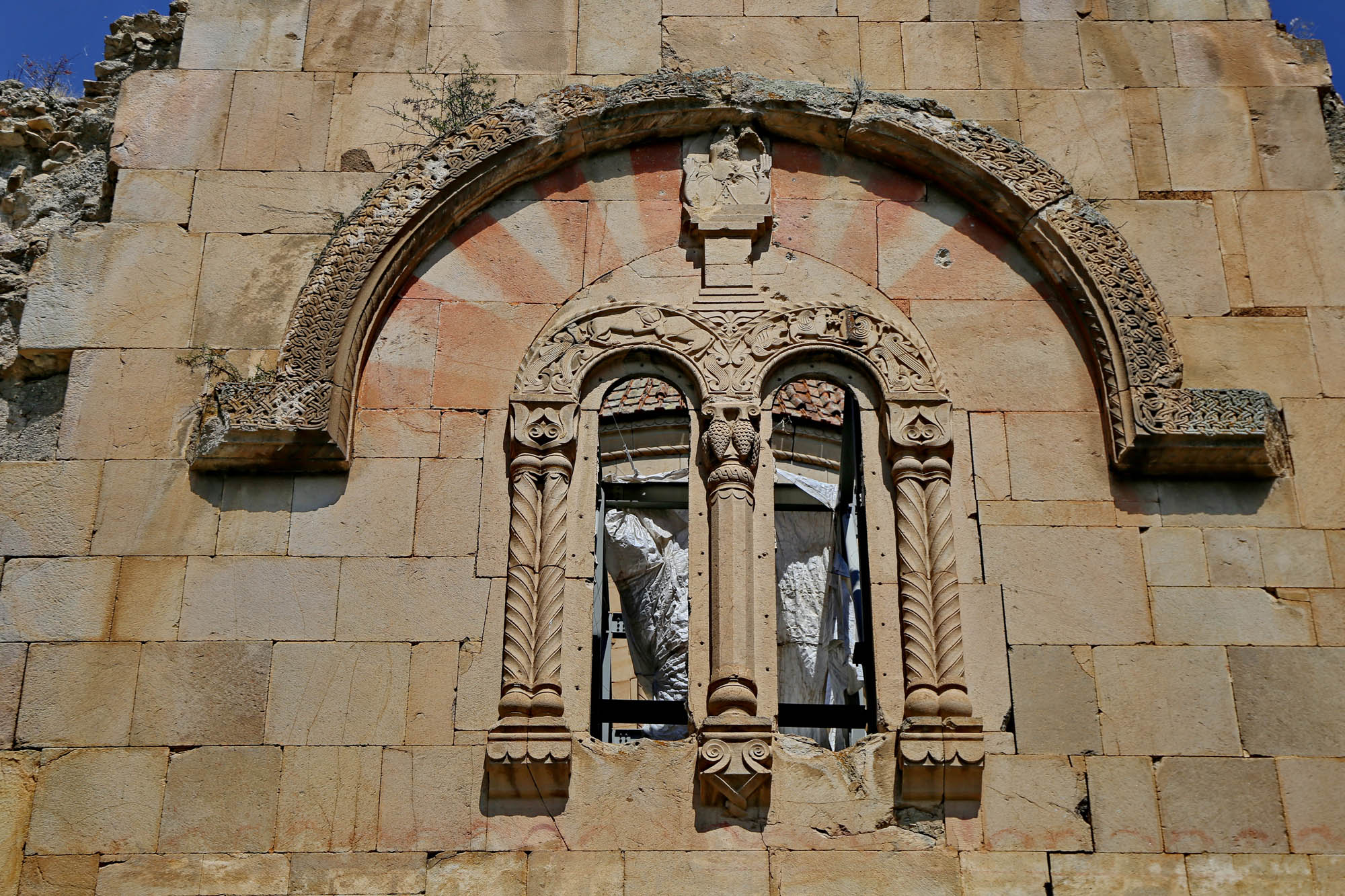
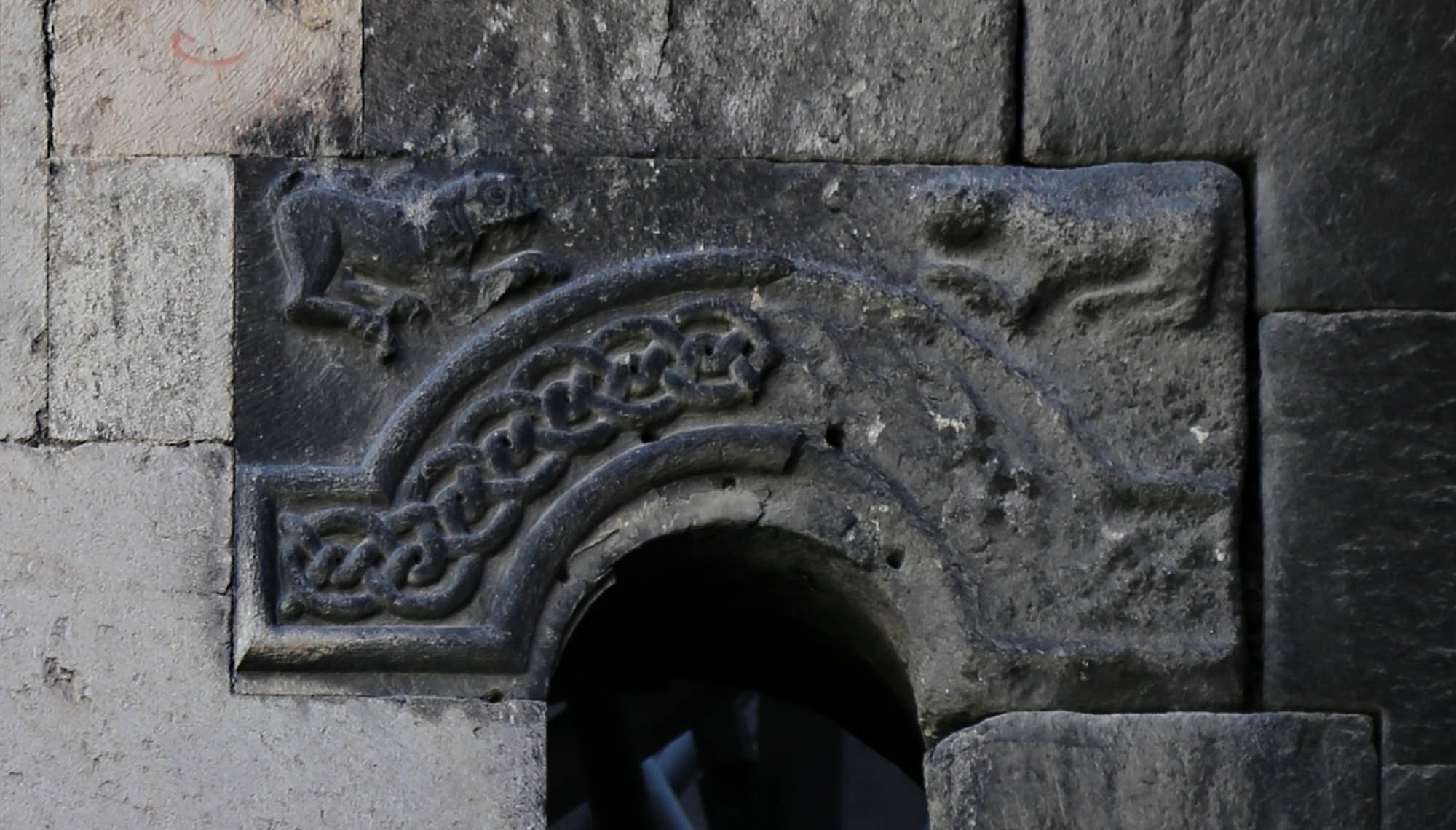
Many of the façade elements that were experimented with in Khakhuli can be seen again. Such are the arches above the windows, and the colorful segments below them, which were obviously not laid out from colored stones, but painted on the blocks. The eagle grasping the calf above the window of the transept (and since the proportions of the Oshki church are higher than of Khakhuli, there was also space above it for the archangels Michael and Gabriel). The blind arcades decorating the wall surfaces, which from then on become a permanent decorative element in Georgian architecture. And two Persian fairy-tale animals also climbed from the southern gate of Khakhuli onto the western twin windows of Oshki: the lion defeating the bull and the winged griffin, doubled, and accompanied by another Persian miracle animal, the simurgh. On the façade of the transept, under the blind arcade to the right, we also see the lion mauling a deer, also doubled for the sake of symmetry. According to Jobadze, such animal fighting scenes in Georgian churches represent the battle of cosmic forces in the same way as their predecessors in Persian art. Above this carving is a hunting scene, which is also adopted in later Georgian churches. In the middle of the scene, two deer are grazing on a tree of life, which is also a Persian motif. A version of this is the palm tree with the two lions seen at the Yakutiye madrasah in Erzurum.
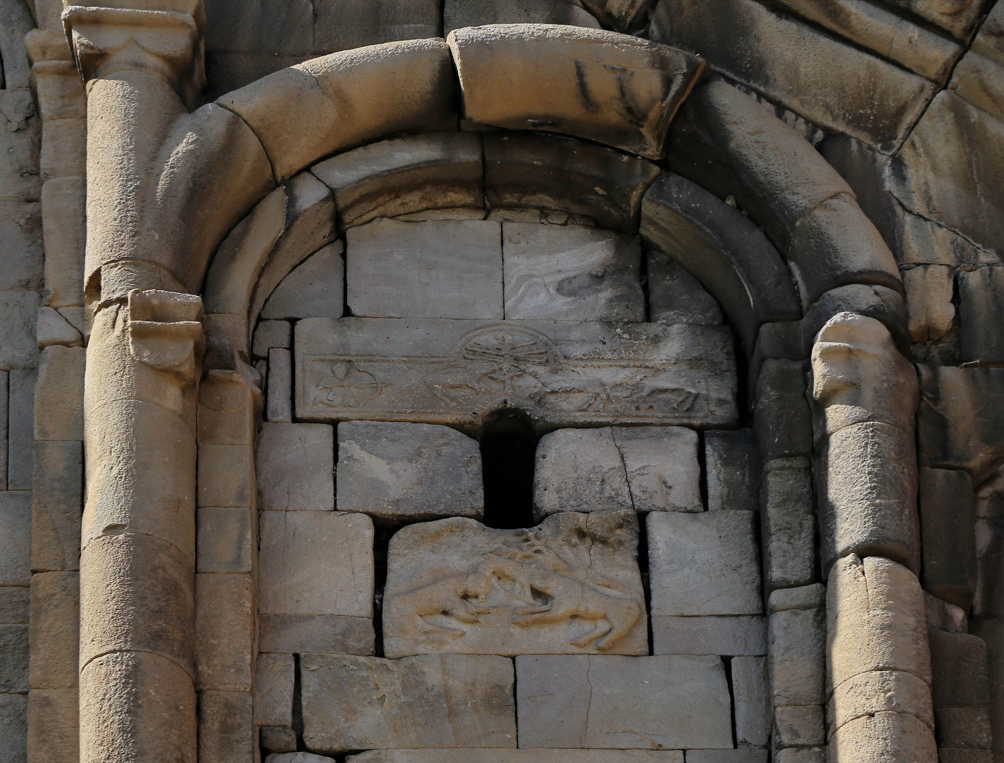
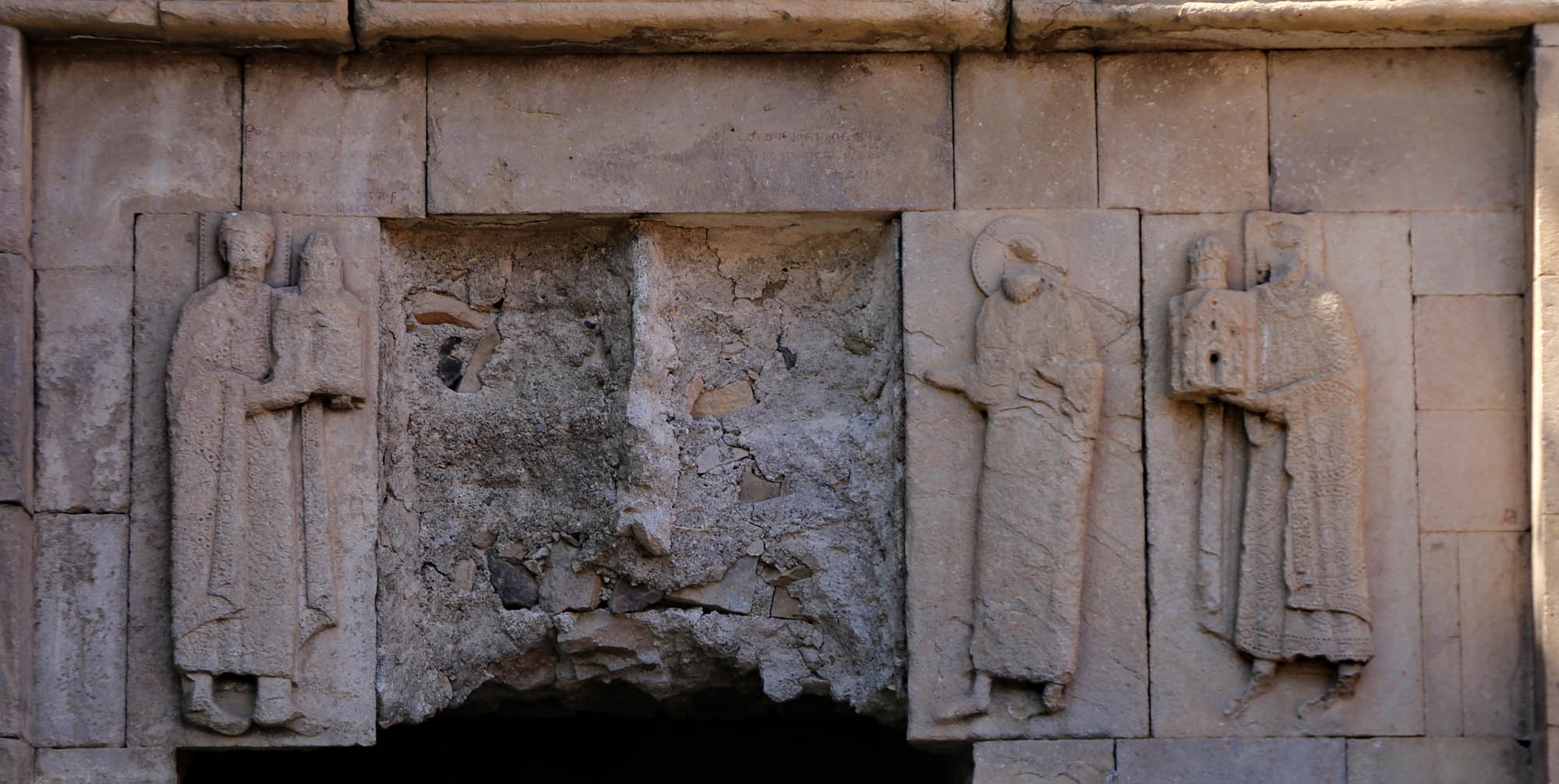
Above the frame of the window of the main apse is a projecting lion statue, as in Khakhuli, also decapitated. The two side windows of the apse also have carved eyebrows. On the left is a sun disc and Solomon’s seal, which, as we have seen earlier, are the insignia of rulers in the Caucasus and among the Kurds. Above them, the inscription actually celebrates the two rulers, Bagrat and David, as the founders of the church. On the right one are two lions facing each other.

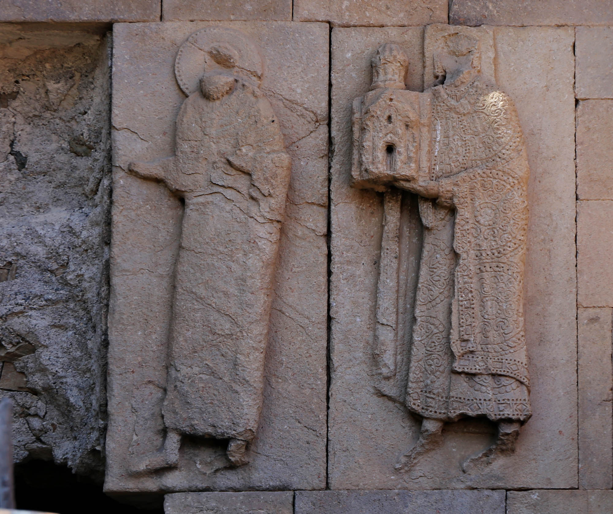
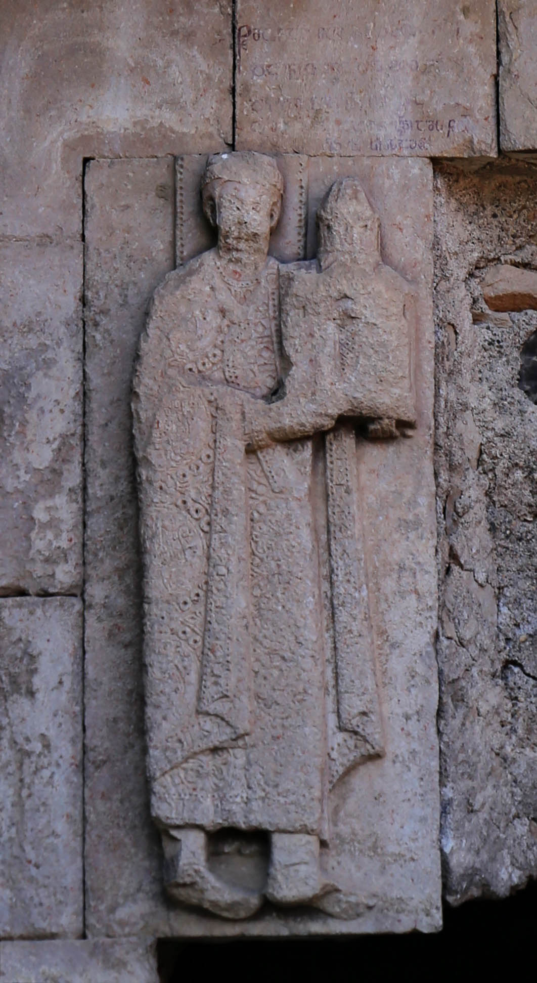
Bagrat and David appear in person on the façade of the church, on the south side of the apse. Here originally stoood a relief of a Deesis group, i.e. Christ with the Virgin Mary on his right and St. John the Baptist on his left, who offered the two donors, Bagrat and David, standing at the two ends of the group, to the patronage of Christ, as the founding inscription on the southern entrance tympanum says:
“Jesus Christ, through the intercession of the holy Mother of God, the holy Saint John the Baptist, the holy Life-giving Tree and all the saints, exalt our kings before you, the builders of this church, Bagrat, the Prince of Princes, and Magister David.”
In 1973, when Jobadze recorded this caption, the figures of Christ and the Virgin Mary were still visible on the façade. Today, these two boards have disappeared. I can only hope that they exist somewhere, but unfortunately I know too many examples of the opposite.
This group is the first known example of a Deesis accompanied by donors. Since the text does not ask for prayers for the founders, they were still alive at the time of its creation. This is also indicated by their square halo. Their dress is typical Byzantine, with Sassanid bird motifs on David to the left.
On the inner side of the main window of the apse, the outline of a figure with a halo attests that the apse is decorated with frescoes. Unfortunately, there was no way to slip in to photograph them. By the way, the frescoes explain an architectural peculiarity that appeared here in Oshki, and later became a common feature of many Georgian churches. On the outer, straight wall of the apses with a semicircular floor plan, two recessed niches with a triangular floor plan cling to the semicircle. One purpose of this is to save on stone material, but the other, more important, is that side windows can also be opened in the apse, which better illuminate the inner wall, mostly decorated with frescoes.
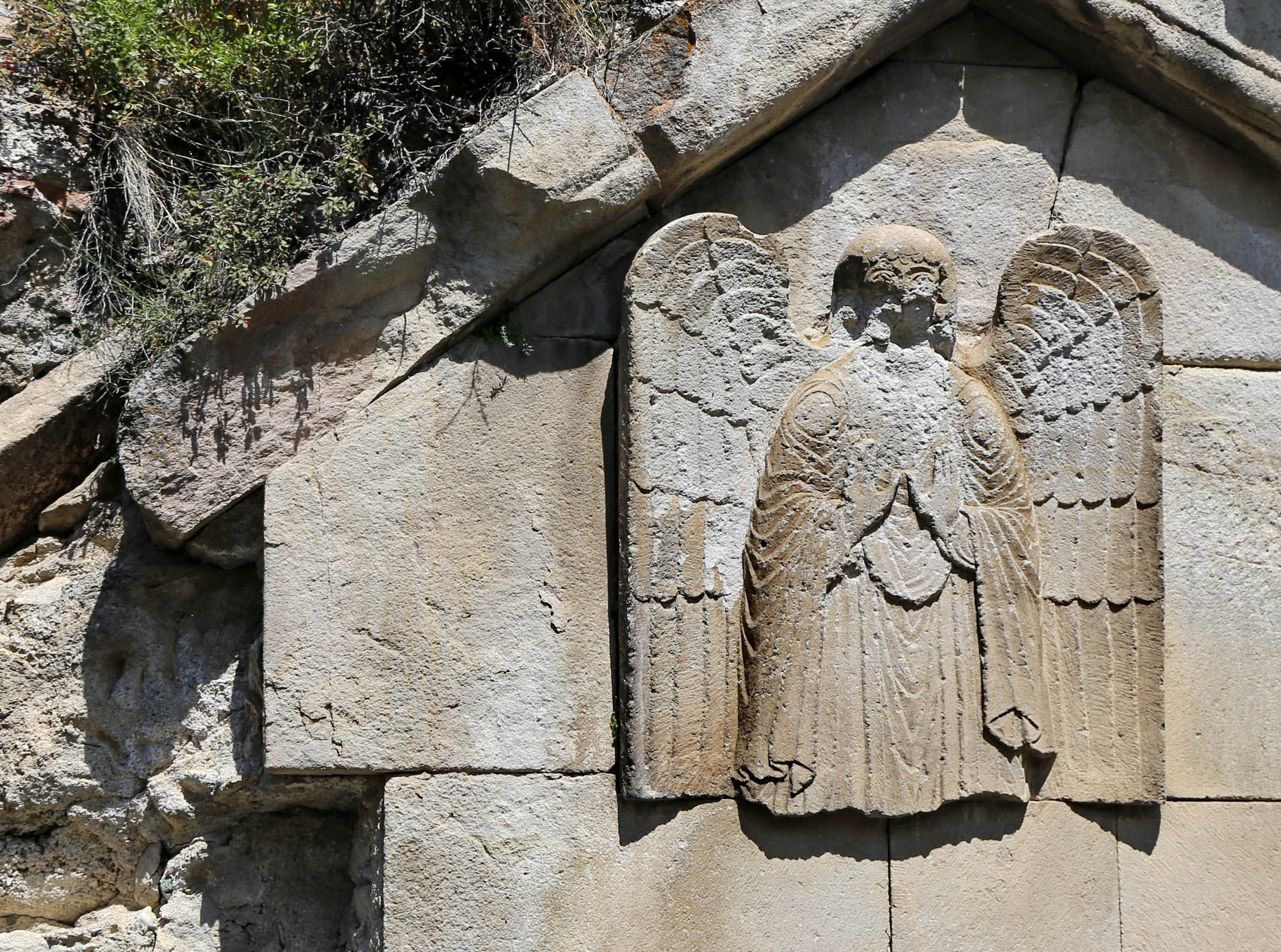
In Oshki, too, a lower vestibule was added to the south side of the main nave. The south vestibule has independent liturgical functions in Georgian churches. Often – as in Khakhuli – it is later built to the church, but in Oshki it may have been built at the same time. This is proven by a relief on its western façade, which is similar to the other reliefs: a lone angel standing guard over the destruction as if it were the angel of Paul Klee and Walter Benjamin:
“His face is turned towards the past. Where we see the appearance of a chain of events, he sees one single catastrophe, which unceasingly piles rubble on top of rubble and hurls it before his feet. He would like to pause for a moment so fair, to awaken the dead and to piece together what has been smashed.” (Walter Benjamin: Angelus Novus)
The monastery was connected to the church from the north. Shanty cottages have been wedged in among its vast ruins, and its block stones have been used to build the surrounding houses. There is even a small tombstone here: the tomb of the local shepherd and famous folk singer Âşık Ümmani Çan (1919-1983), after whom the street of the monastery was named. The new people of the village tried to honor the former great spirits of the monastery with their greatest intellectual figure.

Shortly after Oshki, the Tortum river widens into a reservoir. This is the first in a series of large reservoirs in Tao-Klarjeti, which accompany the Tortum and then the Chorokhi/Çoruh rivers in a string of more than a hundred kilometers from here to Artvin and beyond. As the old road mostly ran down at the river’s edge, with the rise of the water level new roads had to be built. These run almost all the way through tunnels, only occasionally allowing a view of the water of the reservoirs and the surrounding lunar mountains. Almost a hundred kilometers of tunnels from Lake Tortum to Artvin, with a complicated system of roads forking off towards Yusufeli. The tunnels have a speed limit of 50 kmh and a double line painted in the middle of the road, with no acceleration lane or possibility to overtake for a hundred kilometers. This unrealistic regulation naturally leads to civil disobedience. On the otherwise excellent road, everyone roars as fast as he wants, and nonchalantly overtakes in the tunnel. After a while, we also adapt to this habit. I also drove against traffic on a highway for the first time in Turkey, where this was the local custom.
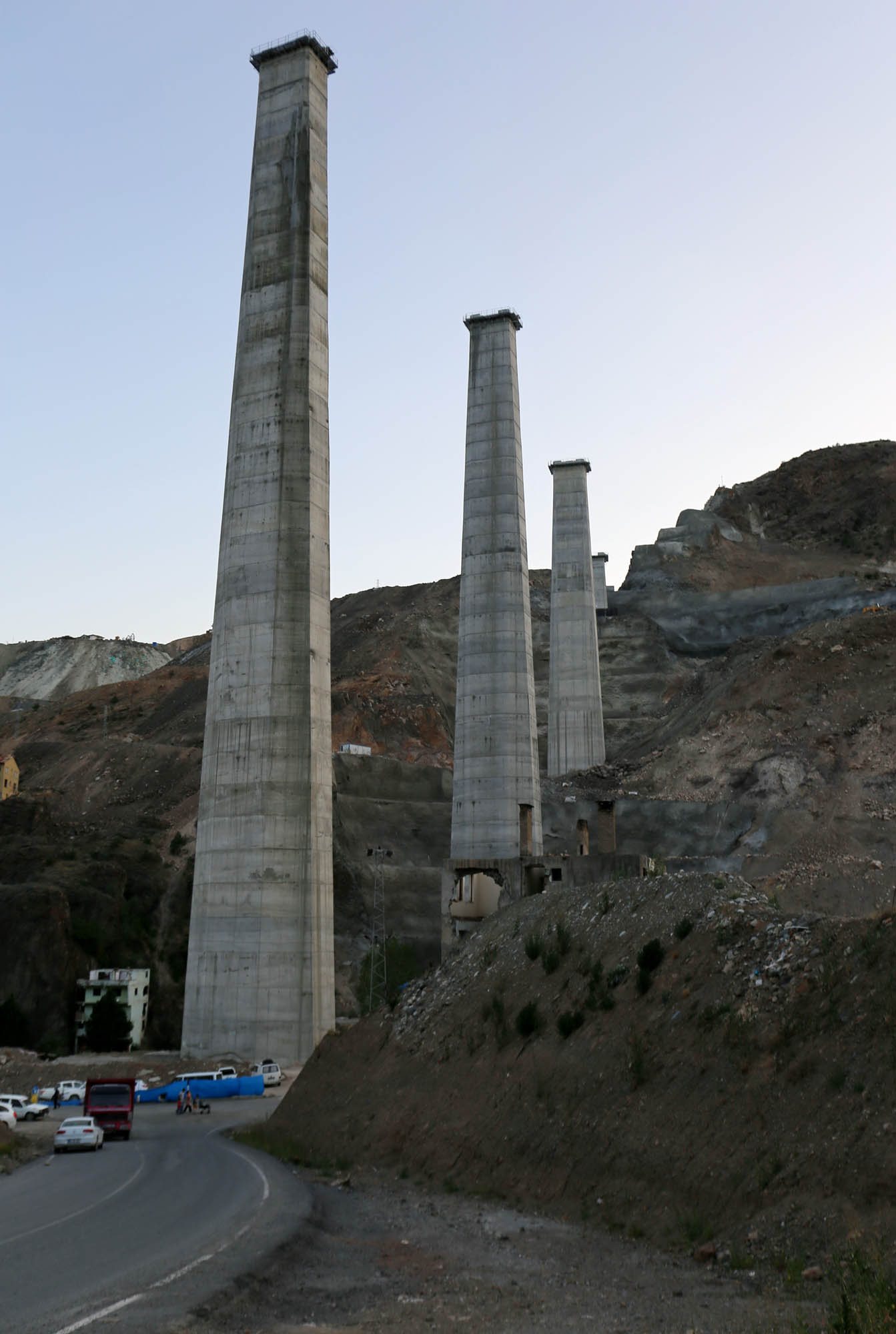
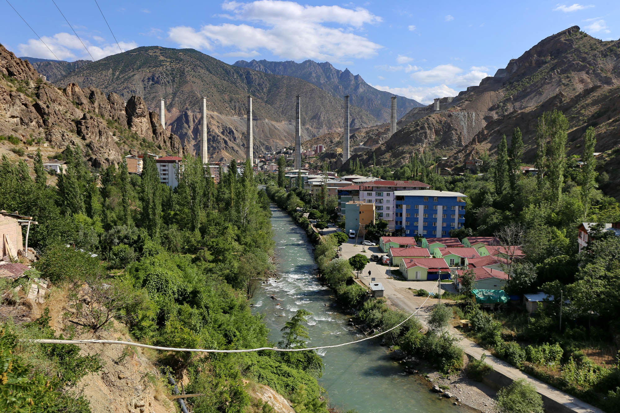
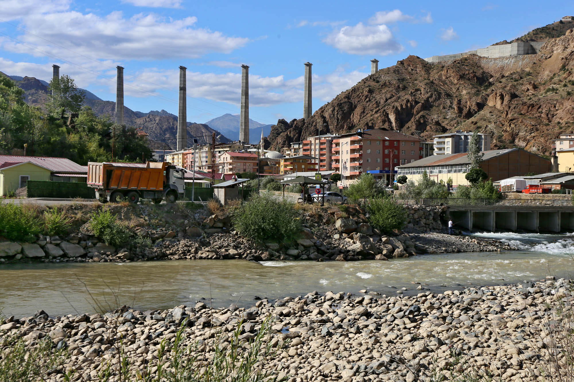
The new highway is still under construction. We experience how difficult and slow the road would be without it when, emerging from the tunnel a few kilometers before Yusufeli, the highway suddenly ends, and we are led down to the old road, which meanders through small villages and descends to the town in the valley. Built at the junction of the Çoruh and Barhal rivers and of several roads, the otherwise jovial small town is now one big construction site, with lots of demolition, temporary concrete mixing plants, trucks, terrible dust, and,
It is not known how the inhabitants of the small town will feel when the cars slip from one mountain to the next in the sky above them. But maybe they won’t experience it at all. In fact, there are plans to build a dam on the Çoruh river just below Yusufeli, and if this is realized, the entire settlement, which has been inhabited for three thousand years, will be under water.


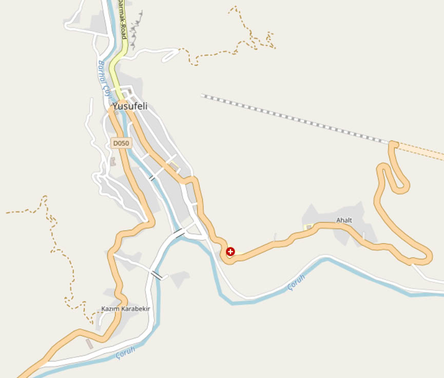
From Yusufeli, we should continue to the other two monasteries founded by David III. But the map also marks a church here, on the southern edge of the city, at the confluence of the Çoruh and Barhal rivers. This is so rare that we must see it.
As far as can be mined from the internet, the church belonged to the former Christian village of Akhalti (Georgian: “new”), before it was absorbed by present-day Yusufeli. Judging by its masonry, it may be from the 10th century. Small traces of frescoes can still be seen in its sanctuary.

We get more reminders of this different kind of history by the presence of a few other similar churches around the city, which are not marked on the map, and can only be found by chance.


ოთხთა, Otkhta, Dörtkilise. David III’s third and fourth monasteries, Otkhta and Parkhali, are so similar that they were likely copied from each other. “From each other” really means back and forth. Otkhta was built earlier, between 961 and 965, with the solutions tested in Khakhuli and Oshki, and the later Parkhali church faithfully follows its structure. However, certain elements – such as the full height blind arcades rhytmically dividing the external walls – were honed to perfection in Parkhali, thus the Otkhta church, modified between 978 and 1001, was elevated to the slender proportion of Parkhali, and the blind arcades were also copied from the Parkhali church.
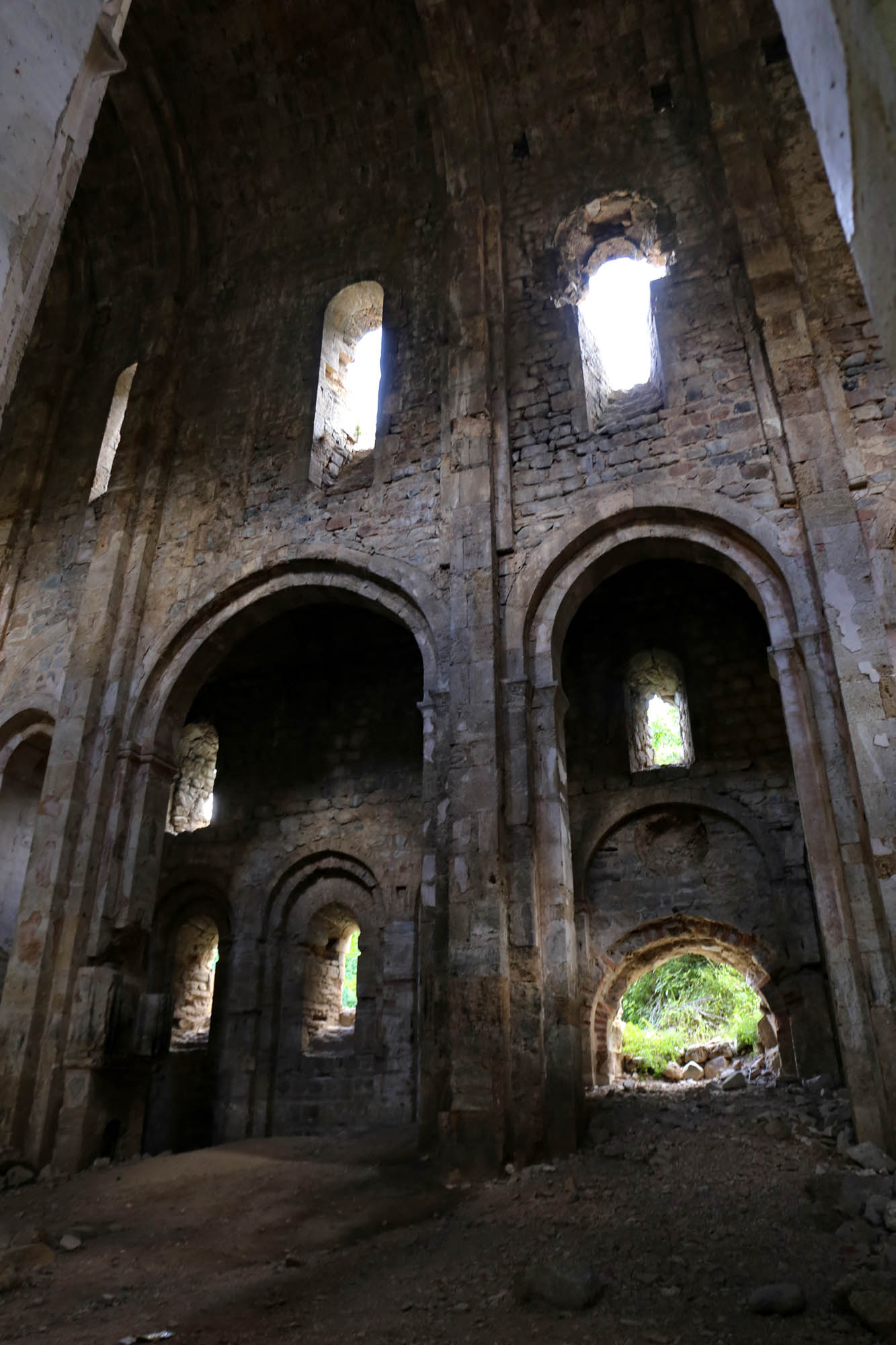
The name of the monastery, Otkhta, means “a group of four” in Georgian, as it originally consisted of four churches, which is the meaning of its modern Turkish name Dörtkilise. The main church is the most intact of the four, but it has also been stripped of its external stone covering, and the soil from the hillside rising above it is pouring in through its ruined north gate, depositing obliquely in the church. The other three chapels next to it, including the two-part chapel linked to it by a vaulted tunnel, have largely collapsed.
The two side walls of the long church are divided by then blind arcades, with two rows of small semicircular windows between them, and with the south and north gates opening in the middle. The window sills still have carvings in many places. Both the eastern and western façades are divided by seven arcades that rise following the line of the gabled roof, but the highest middle arch only reaches the height of the arcades of the side wall. Three round windows open above it.

The church is a three-nave basilica without a dome, with a single main apse in the east and a gallery in the west. On the two apse-side pillars of the apse, two large icon niches face the main nave, in which candles are now burning, obviously lit by the recent Georgian visitors.


The entire height of the apse is decorated with remains of frescoes. Their centerpiece is the painting of the inner side of the main window, in whose upper side a female figure holds an exact model of the Otkhta church. She was formerly considered the founder or a representation of the Church. However, according to Jobadze, she is Zion, the Church of the Old Testament, which was especially revered in the Georgian Church. Under her, the outlines of Moses with the stone tablets unfold, as well as the fire of God descending at the time of the Exodus.

The double chapel to the northwest of the church is the most intact among the other buildings. It was once connected to the main church by a vaulted passage, which is now filled with earth, so that today it is only possible to cross here across its top as a bridge. Today, only two strap arches remain from the vault of the chapel.

As I walk out of the chapel back to the church, an extremely fat man welcomes me. Hoş geldiniz, welcome, he says, hoş bulduk, I’m happy to be here, I reply as I should, curiously waiting for the continuation. A Muslim Georgian, he lives in Altıparmak, ten kilometers away, exactly where we are about to go, to the Parkhali church. For the first time in his life, he decided to come over here to see the twin sister of his village’s church. Two things follow from this. One is that the road to Altıparmak must be terrible. The other is that the church in Parkhali is nevertheless sending us a message to come and visit her anyway.
პარხალი, Parkhali, Barhal/Altıparmak. In the Middle Ages, when people still traveled on foot, on muleback or other less sophisticated means, the length of roads was much more important than their quality. At that time,

To be continued


 Come with us to…
 Atlantis
 Bestiary
 Bohemia+Prague
 Books, exhibitions, music, film
 Brave old world
 Caucasus
 Cemeteries
 Crimea
 Get to know the
 Images of the East
 Lightwriting
 Lwów/Lemberg
 Mallorca
 Message on the wall
 The Museum of Propaganda
 Odessa
 Paper Museum
 Persian letters
 The Jewish heritage


No hay comentarios:
Publicar un comentario