Switch over to our new blog! • ¡Pásese a nuestro nuevo blog!

The renewed version of our blog, with more features, a richer design, and available in nine languages, can be read here: https://wangriver.com

The new version also includes the old posts, often in expanded form. If you are curious about the updated version of this post, replace “riowang.blogspot.com/” in the URL with “riowang.studiolum.com/”, and the new link will most likely lead you there.


La versión renovada de nuestro blog, con más herramientas, un diseño más rico y disponible en nueve idiomas, se puede leer aquí: https://riowang.com

La nueva versión también incluye las publicaciones antiguas, a menudo en una forma ampliada. Si tiene curiosidad por la versión actualizada de esta entrada, sustituya «riowang.blogspot.com/» en la URL por «riowang.studiolum.com/es/», y el nuevo enlace probablemente le llevará allí.

Mostrando entradas con la etiqueta geography. Mostrar todas las entradas

Astrolabes, astronomers, observatories

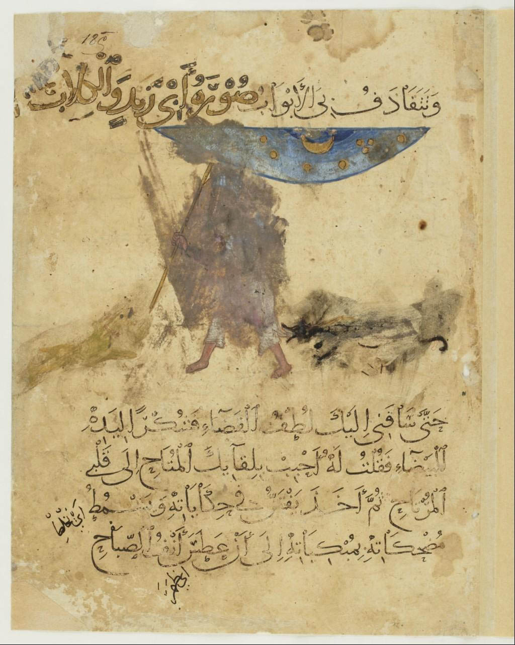
Aboû Moḥammad al-Qâsim ibn ʿAlî al-Ḥarîrî, Maqâmât, 13th century. MS Arab 3929. Paris, Bnf.

With his staff in the hand, he walks under the stars. Somewhere in the yellow desert of the page, two dogs attacked him. This manuscript of Aboû Moḥammad al-Qâsim ibn ʿAlî al-Ḥarîrî’s Maqâmât dates of the thirteenth century, it traveled extensively, has lost many of its pages, and has suffered its fate as a book – being passed from hand to hand and being widely read.

Aboû Moḥammad al-Qâsim ibn ʿAlî al-Ḥarîrî, Maqâmât, 13th century. MS Arab 3929. Paris, Bnf.

Aboû Moḥammad al-Qâsim ibn ʿAlî al-Ḥarîrî, Maqâmât, 13th century. MS Arab 5847. Paris, Bnf.

What I have found about that so discreet meridian of Tonnerre, has ultimately left me with a feeling of incompleteness. All these medieval images, quadrants, astrolabes and the well of Eratosthenes always recall me the same erudite exposition on Arab science, six or seven years ago, in the Institute of the Arab world in Paris – which also left me with a feeling of incompleteness. It was obvious to me that it is impossible to speak about the ancient sciences without making a detour by the Arab-Muslim world – but the knowledge of this world does not easily let itself discover.
It is time to resume whatever we know.

1. Eratosthenes had established a first network of coordinates which made possible the development of cartographic projection techniques. He was not alone: Marinos of Tyre in the late first century AD also sought to measure the Earth, but in drawing his map he relied on measures other than those of Eratosthenes. Fifty years later his map became the model of Ptolemy’s Geography. Both Marinos and Ptolemy started from a prime meridian off West Africa in drawing a network of meridians and parallels of equal distance and forming rectangles, which gave a correct projection at the 36° parallel, that of the island of Rhodes, and around which they organized all the known world from the Atlantic coast to China.
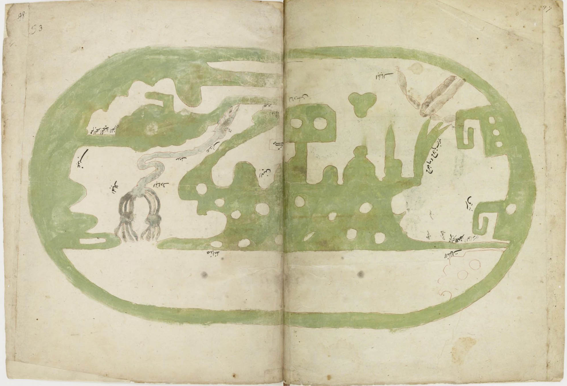
Al-Isthari (?-951), Treatise of geography. 16th-c. MS. Paris, Bnf. The map follows Ptolemy’s projection, north is in the top in this copy.
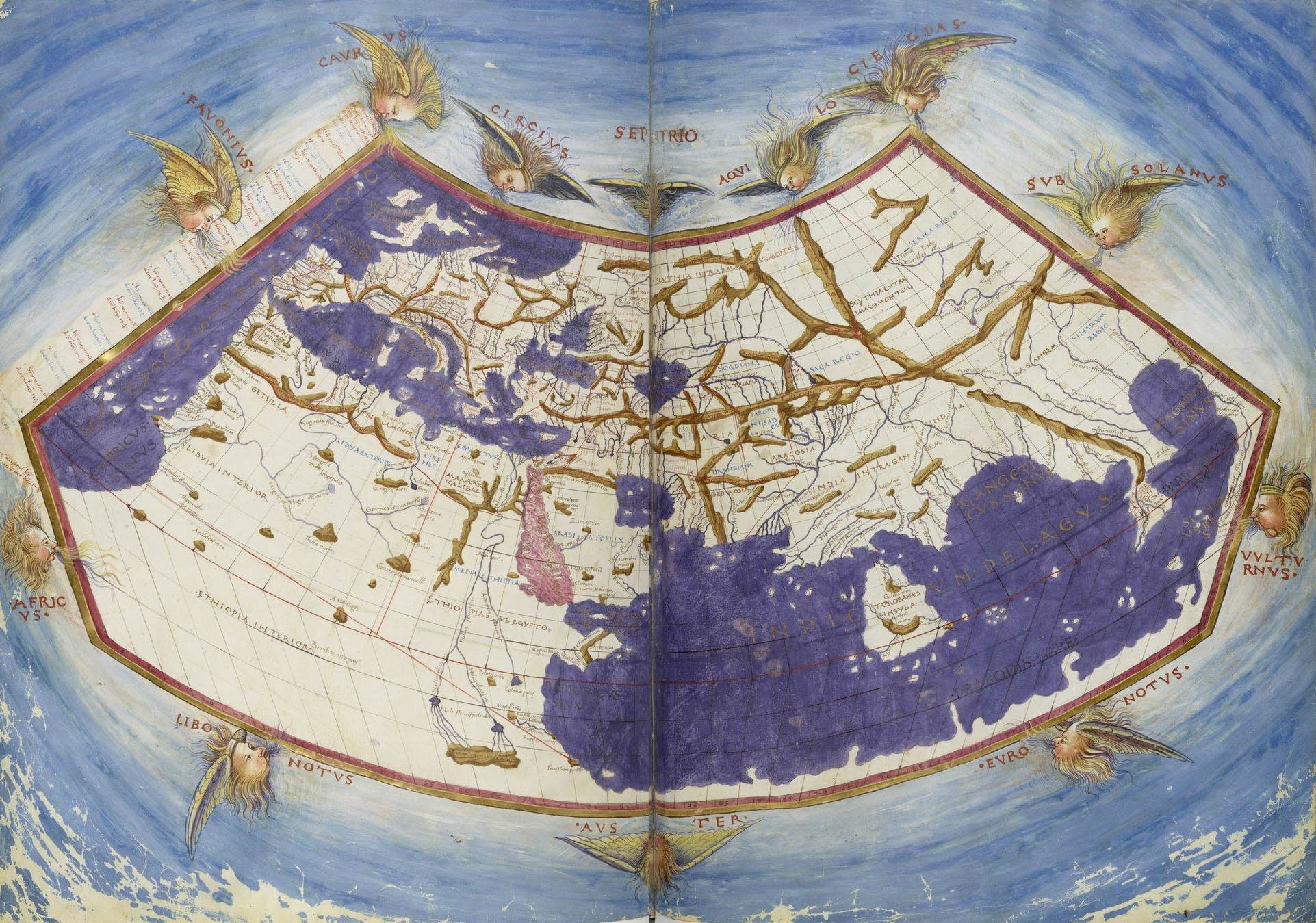
Claudius Ptolemy, Cosmographia, Jacobus Angelus interpres. Paris, Bnf.
This representation of the world according to Ptolemy, designed in Florence between 1451 and 1500, includes a layout of meridians.

2. Both Marinos of Tyre and Ptolemy were repeatedly translated in Arabic from the second half of the 8th century. The work of the latter was rediscovered in Europe in the twelfth century under the name of Almagest. Both were important references of the great 10th-century geographer al-Masûdʿî.
From around the same period, princely book collections and more modest private libraries started to grow alongside the “Houses of Wisdom”, like the one founded by Harun al-Rashid in the late eight century, and the institutions of higher education that will be the madrasas beginning with the Seljuk era.


All these texts, as the Almagest, with their translators and erudite commentators, wandered all over the Muslim world.


3. The Arabic and Persian astronomers made great efforts to measure the Earth and to measure the time.
They drew maps and sometimes also meridians. They criticized Ptolemy’s strategies of observation, and developed the instruments which would then be taken over by our European astronomers: instruments of large dimensions for more precise measurements, and planispheric astrolabes improved as compared to the Greek model, with the purpose, in a Muslim context, to exactly know the direction of the prayer (qibla). The same religious requirements were at the origin of a new discipline, that of measuring the time (ʿilm al-mîqât), which led to the realization of sundials. These developments of observation, as well as the mathematical models they involved, led to the criticism of Greek astronomy, especially of the Almagest, and thereby prepare the Copernican revolution of the sixteenth century.


And finally, we also find, if not the drawing of a meridian on the ground, but that of a sundial, essential to set the time for prayers.

And the meridians?
The society of astronomers, geographers and mathematicians is of a traveling sort. Arabic, Persian, Turkmen, Kurdish, Turkish Mongolian scholars all wander on their ways, from Damascus to Soltaniyeh, from Rey to Samarkand. They travel, they meet, they talk, they observe.
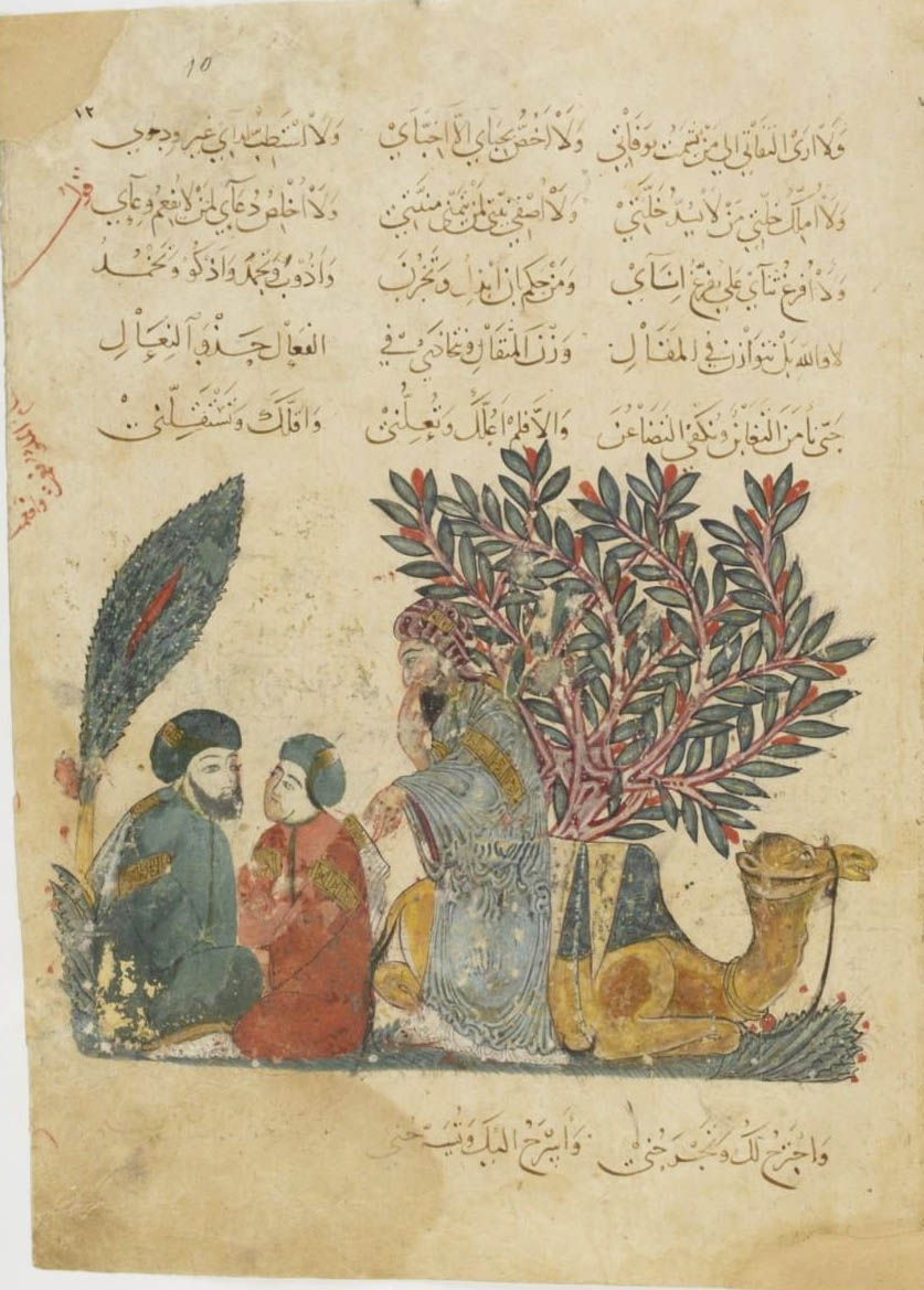
Aboû Moḥammad al-Qâsim ibn ʿAlî al-Ḥarîrî, Maqâmât, 13th century. MS Arab 5847. Paris, Bnf.


To trace a meridian, it is often necessary to start by building an observatory.
Before the use of the camera obscura, the observation of the movement of the stars was made possible by the use of wells. Not as Eratosthenes did, to measure the sun’s shadow, and then to calculate the extent of the meridian, that is, the circumference of the Earth, but in order, say, to observe the movement of the celestial bodies in broad daylight, without being bothered by the light.
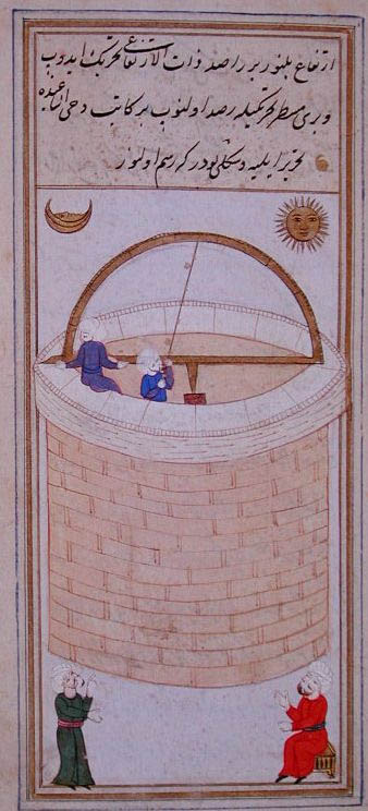
Taqiy al-Din ibn-Maruf, The azymuthal observation well of Istanbul: Instruments of observations for the tables of the Shahinshah, Turkey, 1580. Paris, Bnf.

Ulugh Beg (1394-1449), grandson and second successor of Tamerlane, remained in the historical memory less for his role as a prince of Samarkand than as an astronomer, a mathematician and builder of one of the oldest observatories in the Muslim world.
This observatory was equipped with fixed astronomical instruments, and employed at least sixty, perhaps even a hundred astronomers at one time. Their observations were carried out over a long period, between 1420 and 1437. They defined the exact length of the solar year – 365 days, 6 hours, 10 minutes and 8 seconds –, and established a catalog of 1012 stars.

The grandson of Temur Beg, Ulugh Beg Mirza, built another large building: a three-storey observatory built on the hillside of Kuhak, used for compiling astronomical tables. Thanks to this observatory, Ulugh Beg Mirza designed the Tables of Köregen, which are now in use worldwide. Now they rarely use any other astronomical tables, whereas previously they used the Tables of Ilkhan, designed in Maragha by Khaja Nasir Tusï, under Hülegü Khan, called Ilkhan. They probably did not prepare more than seven or eight astronomical tables in all the world. One of them is the work of Caliph Mamun, called Tables of Mamun. Ptolemy also designed one.
Babur, Memoirs of the events of the year of 903 AH (1498), Babur-Nama

The Samarkand observatory consisted of a monumental cylindrical building of a height of 30 meters and a diameter of 46, with a huge marble sextant, the “Sextant of Fakhri”, of a radius of about 40 meters, allowing a very high precision in the astronomical measurements during the passage of the Sun, the Moon or the planets along the meridian. This arch of 60° included staircases on each side to allow the assistants carrying out the measurements to move.
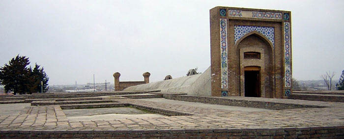
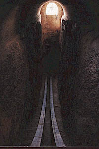
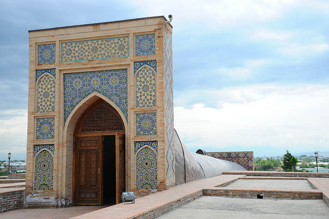

Today partly buried, the sextant is well preserved while the other instruments have disappeared. Ulugh Beg himself was killed by his own son.

For the sake of this world, which passes in five days, he killed such a wise and old man as was his father. The chronogram of Ulugh Beg Mirza’s death is the following:

Ulugh Beg Mirza, ocean of science and wisdom
Who was the support of the world and religion
Tasted by Abbas the honey of martyrdom
These letters are his chronogram: Abbas killed me.


Babur, Memoirs on the events of the year 903 AH (1498), Babur-Nama.

Just one object to finish. This is not an astrolabe, even if its spherical and intersected by a moveable pointer, an alidade. This is a mathematical representation of the Muslim world to identify the great cities and to define one’s position to Mecca. Mecca is in the center, and the positions of the hundred and fifty cities are indicated by their coordinates. By moving the alidade one can determine for each city the direction and distance of Mecca, thanks to the scale around the central piece. A compass was also added at the bottom of the object. The instrument is based on the astronomical tables compiled from the observations of Ulugh Beg in Samarkand. Of this map – since this object is a veritable map – there exist only two copies, the first discovered in 1989 and the second in 1995.
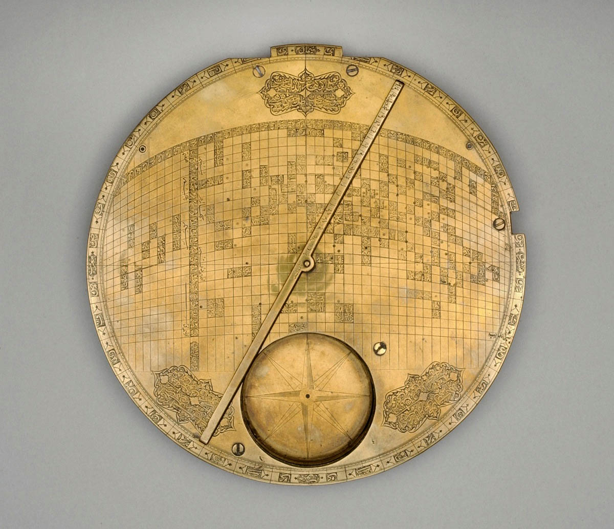
Map of the Muslim world centered on Mecca. Iran, 17th century. Kuwait, al-Sabah Collection, Dar al-Athar al-Islamiyyah.

Astrolabes, astronomes et observatoires

Aboû Moḥammad al-Qâsim ibn ʿAlî al-Ḥarîrî, Maqâmât, XIIIe siècle. Manuscrit arabe 3929. Paris, Bnf.

Son bâton à la main, il chemine sous les étoiles. Quelque part dans le désert jaune de la page, deux chiens l’ont attaqué. Ce manuscrit des Maqâmât d’Aboû Moḥammad al-Qâsim ibn ʿAlî al-Ḥarîrî date du XIIIe siècle, il a beaucoup voyagé lui aussi, il a perdu plusieurs de ses cahiers et souffert son destin de livre — être passé de mains en mains et avoir été beaucoup lu.
Aboû Moḥammad al-Qâsim ibn ʿAlî al-Ḥarîrî, Maqâmât, XIIIe siècle. Manuscrit arabe 3929. Paris, Bnf.

Aboû Moḥammad al-Qâsim ibn ʿAlî al-Ḥarîrî, Maqâmât, XIIIe siècle. Manuscrit arabe 5847. Paris, Bnf.

Tout compte fait, ce que j’avais trouvé à propos de ce si discret méridien de Tonnerre m’avait laissé un goût d’inachevé. Toutes ces images médiévales, ces quadrants et ces astrolabes, tout comme le puits d’Eratosthène, me ramenaient toujours au même souvenir d’une savante exposition sur les sciences arabes, il y a six ou sept ans, à l’Institut du monde arabe à Paris — souvenir au goût d’inachevé lui aussi. Qu’il soit impossible de parler des sciences anciennes sans faire un détour par le monde arabo-musulman, voilà qui me semblait évident — mais ce savoir ne se laissait pas découvrir sans mal.
Il était donc temps de reprendre.

Un — Eratosthène avait établi un premier réseau de coordonnées permettant d’élaborer des techniques de projection cartographique. Il n’est pas seul : Marinos de Tyr, vers la fin du 1er siècle après J.C., chercha lui aussi à mesurer la Terre mais s’appuya sur d’autres mesures que celles d’Eratosthène pour dresser une carte. Celle-ci sera à son tour le modèle de la Géographie de Ptolémée, cinquante ans plus tard. A partir d’un méridien d’origine au large de l’Afrique occidentale, Marinos comme Ptolémée tracent un réseau de méridiens et de parallèles équidistants formant des rectangles donnant une projection correcte au niveau du 36° parallèle, celui de l’île de Rhodes, et autour duquel s’organisent les terres de la côte atlantique jusqu’à la Chine.

Al-Isthari (?-951), Traité de géographie. Manuscrit du XVIe siècle. Paris, Bnf. La carte reprend la projection de Ptolémée, le nord en haut sur cette copie.

Claude Ptolémée , Cosmographia, Jacobus Angelus interpres. Paris, Bnf.
Cette représentation du monde selon Ptolémée, dessinée à Florence entre 1451 et 1500 intègre le tracé des méridiens.

Deux — tout comme Ptolémée, traduit de nombreuses fois en arabe dès la seconde moitié du VIIIe siècle et dont l’œuvre est redécouverte en Europe à partir du XIIe siècle sous le nom d’Almageste, Marinos de Tyr est l’objet de traductions en arabe. Tous deux constituent l’une des références du grand géographe du Xe siècle, al-Masûdʿî.
Les bibliothèques princières comme les plus modestes bibliothèques privées se multiplient parallèlement aux « Maisons de sagesse », telle celle que fonde Hârûn al-Rashid à la fin du VIIIe siècle ou les institutions d’enseignement supérieur que seront les madrasas à partir des Seljoukides.


Ces textes, comme l’Almageste, avec leurs traducteurs et commentateurs, les savants, tous circulent à travers le monde musulman.


Trois — les astronomes arabes et persans, à leur tour, se sont attaqués aux mesures de la Terre et aux mesures du temps.
Ils tracent des cartes et parfois des méridiens. Ils critiquent les stratégies d’observation de Ptolémée et développent ces instruments que reprendront nos astronomes européens : instruments de grande dimension pour des mesures plus précises et astrolabes planisphériques perfectionnées par rapport au modèle grec afin, dans un contexte musulman, de connaître la direction de la prière (qibla). Les mêmes exigences religieuses sont à l’origine d’une nouvelle discipline, celle de la mesure du temps (ʿilm al-mîqât) qui aboutit notamment à la réalisation de cadrans solaires. Ces développements de l’observation comme les modèles mathématiques qu’ils entrainent conduisent à la critique de l’astronomie grecque et en particulier de l’Almageste, et par là, préparent la révolution copernicienne du XVIe siècle.


On retrouve enfin, non pas le tracé d’un méridien sur le sol, mais celui d’un cadran solaire, essentiel pour régler l’heure des prières.

Et les méridiens ?
La compagnie des astronomes, géographes et mathématiciens est voyageuse. Arabes, Perses, Turkmènes, Kurdes, Turcs, Mongols, ils s’en vont sur les routes, de Damas à Soltaniyeh, de Rey à Samarcande. Ils voyagent, ils se rencontrent, ils discutent, ils observent.

Aboû Moḥammad al-Qâsim ibn ʿAlî al-Ḥarîrî, Maqâmât, XIIIe siècle. Manuscrit arabe 5847. Paris, Bnf.


Pour tracer les méridiens, il faut souvent commencer par bâtir un observatoire.
Avant l’usage de la camera obscura, l’observation du mouvement des étoiles a certes pu se faire par l’utilisation des puits, non pas comme le fit Eratosthène pour mesurer l’ombre du soleil et de là, calculer la mesure du méridien donc la circonférence de la Terre, mais afin, dit-on, de pouvoir observer le mouvement des étoiles même en plein jour sans être gêné par la lumière.

Taqiy al-Din ibn-Maruf, Le puits d’observation azimutal d’Istanbul : Instruments d’observation pour les tables de Shâhinshâh, Turquie, 1580. Paris, Bnf.

Ulugh Beg, (1394-1449), petit-fils et second successeur de Tamerlan, est resté dans les mémoires moins pour son rôle comme prince de Samarcande qu’en tant qu’astronome, que mathématicien et bâtisseur de l’un des plus anciens observatoires du monde musulman.
Cet observatoire était équipé d’instruments astronomiques fixes et qui employait pour fonctionner une soixantaine d’astronomes au moins, jusqu’à cent peut-être. Leurs observations furent menées sur une longue période, entre 1420 et 1437. Elles ont défini la durée exacte de l’année solaire — 365 jours, 6 heures, 10 minutes and 8 secondes — et établi un catalogue de 1012 étoiles.

Le petit-fils de Temür Beg, Ulugh Beg Mirza, fit bâtir un autre grand édifice : l’observatoire à trois étages construit sur le flanc de la colline de Kuhak et qui est utilisé pour dresser des tables astronomiques. Grâce à cet observatoire, Ulugh Beg Mirza a dressé les Tables Köregeniennes qui sont maintenant en usage dans le monde entier. On utilise rarement d’autres tables astronomiques. Auparavant, on se servait des Tables Elkhaniennes dressées à Maragha par Khaja Nasir Tusï, sous Hülegü Khan qu’on appelle Elkhan. On n’a probablement pas dressé dans le monde plus de sept ou huit tables astronomiques. L’une d’elles est l’œuvre du Calife Mamun, on les appelle Tables Mamuniennes. Ptolémée en dressa aussi.
Babur, Mémoires des événements de l’année 903 (1498), Babur-Nama,
traduction de J.-L. Bacqué-Grammont.

L’observatoire de Samarcande était constitué d’un bâtiment monumental cylindrique, d’une hauteur de 30 mètres pour un diamètre de 46, équipé d’un sextant gigantesque en marbre, le « Sextant de Fakhri », d’un rayon de près de 40 mètres, permettant une très grande précision dans les mesures astronomiques lors du passage du Soleil, de la Lune ou des planètes dans le méridien. Cet arc de 60° comportait des escaliers de chaque côté pour permettre aux assistants chargés des mesures de se déplacer.


Aujourd’hui en partie enterré, le sextant est bien conservé alors que les autres instruments en revanche ont disparu. Ulugh Beg, quant à lui, fut assassiné par son fils.

Pour ce monde qui passe en cinq jours, il assassina un homme aussi savant et âgé que l’était son père. Le chronogramme de la mort d’Ulugh Beg Mirza est le suivant :

Ulugh Beg Mirza, océan de science et de sagesse
Qui fut le soutien du monde et de la religion
A goûté par Abbas le miel du martyre
Ces lettres sont son chronogramme : Abbas a tué.


Babur, Mémoires des événements de l’année 903 (1498), Babur-Nama.

Juste un objet pour finir. Ce n’est pas un astrolabe même s’il est sphérique et traversé d’une réglette mobile, une alidade. Il s’agit d’une représentation mathématique du monde musulman qui permet de repérer les grandes villes et de situer par rapport à La Mecque. La Mecque est au centre et les positions de cent cinquante villes sont indiquées à partir de leurs coordonnées. Le déplacement de l’alidade permet de fournir directement pour chacune de ces villes la direction de La Mecque grâce aux graduations qui entourent la pièce. La distance entre chaque ville et La Mecque est également marquée. Une boussole a été ajoutée au fond de l’objet. L’ensemble repose sur les tables astronomiques compilées à partir des observations d’Ulugh Beg à Samarcande. Il n’existe que deux exemplaires de ce type de cartes, car cet objet est bien une carte, retrouvées celle-ci en 1989 et la seconde en 1995.

Carte du monde musulman centrée sur la Mecque, Iran, XVIIe siècle. Koweit, collection al-Sabah, Dar al-Athar al-Islamiyyah.

Ars magna lucis et umbrae


I also wanted to add my two cents to the series on meridians launched by Lloyd, and to present that small Italian book on the art of sundials which I bought almost twenty years ago in the Trastevere, in a secluded small shop, where they sold all kinds of self-made time-measuring devices, water hours dripping each second, candles with wick divided per hours, rings with a hole functioning as camera obscura with the inscription Carpe diem. Life, however, hastened to meet me.

Today I started to translate Umberto Eco’s new book: Storia delle terre e dei luoghi leggendari – fabulous lands, legendary places, that’s the working title, but the book adds one more twist to what you would expect. It is not simply about imaginary worlds, as we are used to from Eco, from the Baudolino to The Island of the Day Before, but about how the fanatic readers have taken bloody seriously the fictional literary locations from the antiquity to Dan Brown’s Priorate of Sion. And already in the first, ancient chapter we are greeted by our good friends, the meridians.

Che la terra fosse tonda lo sapeva naturalmente Tolomeo, altrimenti non avrebbe potuto dividerla in trecentosessanta gradi di meridiano, e lo sapeva Eratostene, che nel III secolo avanti Cristo aveva calcolato con una buona approssimazione la lunghezza del meridiano terrestre, considerando la diversa inclinazione del sole, a mezzogiorno del solstizio di primavera, quando si rifletteva nel fondo dei pozzi di Alessandria e di Syene, di cui si sapeva la distanza reciproca.Of course Ptolemy was also aware that the Earth was round, otherwise he would not have divided it into three hundred and sixty degrees; and this was also known to Eratosthenes, who in the third century BC determined the length of the Earth’s meridian with a good approach, taking into account the different angle of incidence of the sunshine at the time of the spring equinox, when at noon it is reflected in the depth of the wells of Alexandria and of Syene, whose distance was well known.

Eco, who in his popular albums published in recent years – The Story of Beauty, The Story of Ugliness, The Infinity of Lists – seductively blends trivia with ingenious problem proposals, is like a super jongleur, who plays with a hundred balls at once, and if he drops five, never mind. The translator, however, must also seek for those five, and dust them off, as if they had not fallen. This is what I try now, too.

If at noon the sun is reflected in the depth of a well, it means that it stays exactly perpendicular above the given location. If it is reflected in two, then there is no difference between the two angles of incidence, so nothing can be calculated from it.

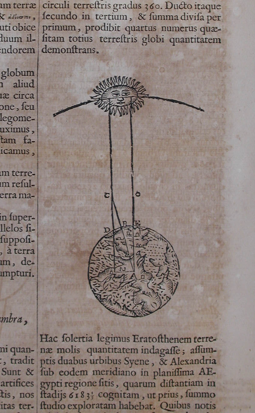
The reality is, that the Alexandrian librarian Eratosthenes learned from a caravan arriving from the southern Syene – today Assuan – that the sun is reflected in the depth of the cistern of the settlement, laying precisely under the Tropic of Cancer, in only one day of the year, on June 21, the summer solstice. He thus measured at the same moment the angle of incidence of the sunlight in Alexandria (7°12'), and found it to be the 1/50th part of a full circle, so he concluded that the length of the complete meridian would be fifty times the known distance of the two cities. The resulting circumference of the Earth – 39,690 km – only slightly differs from the 40 thousand known today.

The story of the measurement is well summarized by an English-language interview with Eratosthenes, including a modern diagram. But for the sake of a greater credibility, I quote it from the eccentric baroque Jesuit scholar, Athanasius Kircher himself (Ars magna lucis et umbrae, Amsterdam 1671, 638-639), whose works, as Eco admits, are preserved all (but one) in his personal library.


Hac solertia legimus Eratosthenem terrenae molis quantitatem indagasse; assumptis duabus urbibus Syene, & Alexandria sub eodem meridiano in planissima Aegypti regione sitis, quarum distantiam in stadijs 6183⅓ cognitam, ut prius, summo studio exploratam habebat. Quibus notis nihil aliud requirebatur, nisi ut eandem distantiâ in gradibus quoque notam haberet, quam ea, qua sequitur solertia invenit. Cùm tempore solstitij Syene urbs sub tropico ♋ immediatè sita, hora meridiana sit ἁσκιη, & umbra in seipsa sine ullo angulo cum gnomone facto consumatur: hoc tanquam cognito, Alexandriae eodem temporis momento dieque gnomonem erexit, diligenter angulum, quem gnomon cum umbra ad verticem faciebat, observando: hic enim erat, ut paulò post demonstrabimus, arcui meridiano inter assumptas urbes aequalis. Sed rem paradigmate demonstremus, etc.Of Eratosthenes we read how insightfully he measured the extension of the earth, taking two cities, Syene and Alexandria, which lay in the flattest region of Egypt, under the same meridian, and whose distance of 6183 and one third stadiums were previously measured by him with the greatest care. Against this background he did not need anything more than the distance between the two cities in degrees, which he determined in the following ingenious manner. As in Syene, lying immediately under the Tropic of Cancer, on the day of the summer solstice the hour of the noon is ἁσκιη, without shadow, that is, the shadow exactly coincides with the vertical gnomon and does not deviate from it to the least angle, by observing in the same moment in Alexndria the angle of the gnomon to the vertical, he calculated, as we will soon point it out, the angular difference between the two cities. But let’s see the demonstration step by step, etc.

On the basis of all the above, my translation changed like this:

…and this was also known to Eratosthenes, who, in the third century BC on the day of the summer solstice at noon, when the sun is reflected in the depth of the well of Syene, determined the length of the Earth’s meridian on the basis of the angle of incidence measured in Alexandria, whose distance from Syene was known to him.

Such corrections, dozens per volume, are of course always sent back to the Italian editor, who always say thank for it, and never introduce it in the new editions. Therefore, as we have long known it, an educated European only reads Eco in Hungarian.


Drawing the time: all a meridian can measure

Calendrier des bergers, printed in Paris by Guy Marchant, 1493. Angers, BM, SA 3390, f 76v- 76r

It was the image of the sunspot falling through the camera obscura on the floor of the Basilica di San Petronio in Bologna, which stopped me.

I have never reflected so far on the concept of the meridian, and even less on the meridians we can draw anywhere on the basis of a light spot at noon.

However, I have known this spot – and quite far from Bologna.

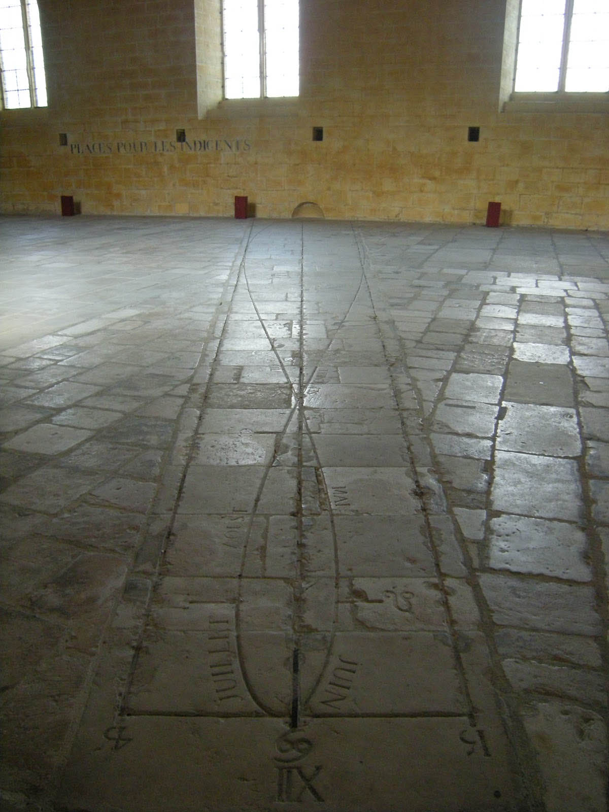
It runs, month after month, on the great meridian of the former hospital in Tonnerre, founded in 1293 by Margaret of Burgundy, widow of Charles of Anjou, King of Sicily.


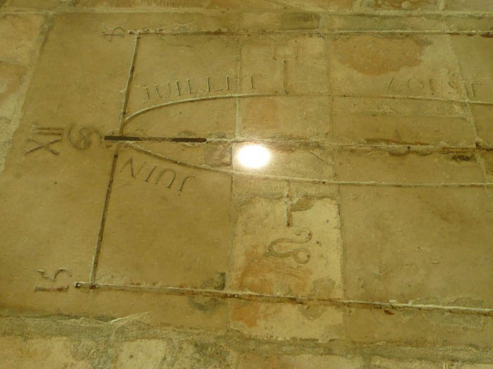
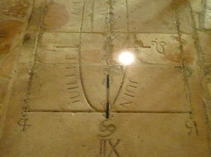
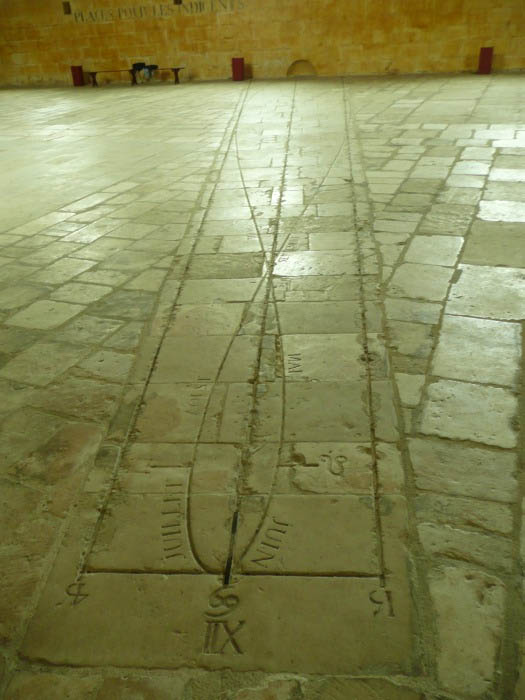
The meridian – called here, probably incorrectly, a gnomon – is 17 meters long. It was drawn in the former hall of patients. Its 8-shaped curve is stretched along a line that crosses the entire width of the room, engraved in the slabs of the floor, and shows the hour of the true as well as the mean solar noon.

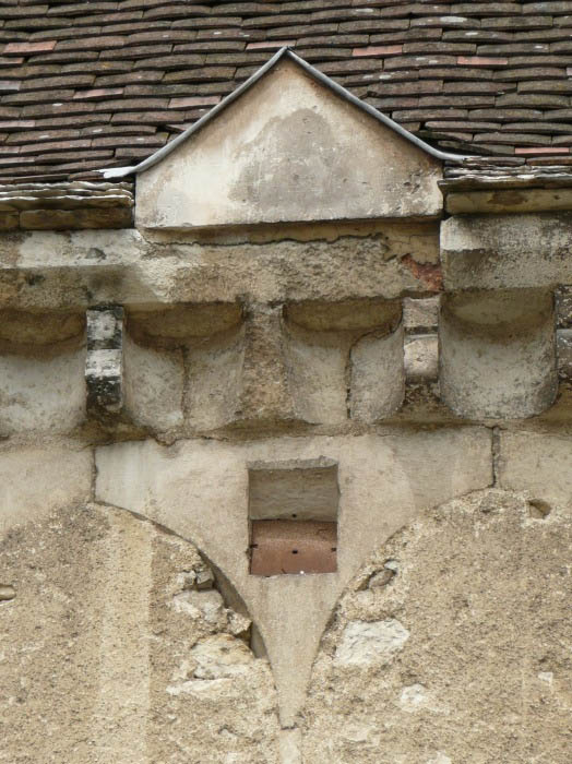
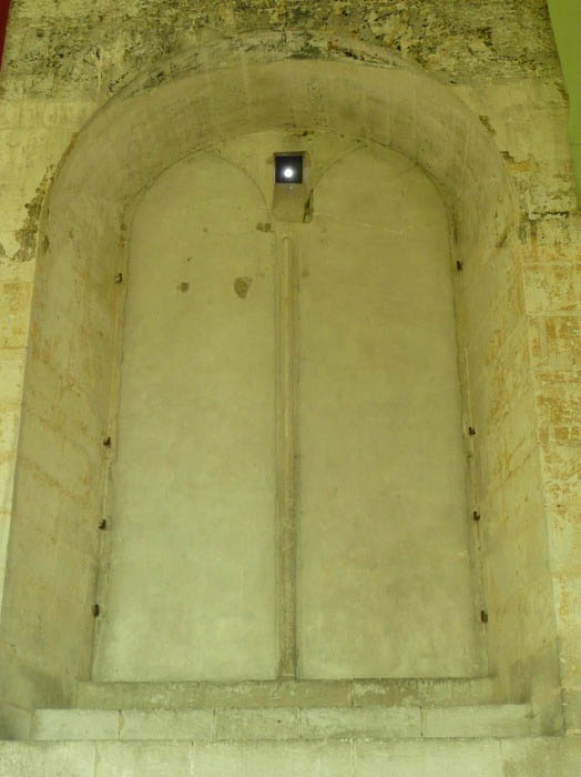
The building has indeed a vast nave, 18 meters wide, 90 long and 27 high. Since the mid-seventeenth century it has ceased to be used as a hospital. After they walled up one of the Gothic windows of the great hall, letting only a thin ray of sunshine to pass through, several observations were necessary to level the horizontality of the floor, to draw the meridian, to mark to the right and left of this axis the position of the sunspot at noon. It was Joseph Lalande, astronomer, encyclopedist, director of the Paris Observatory, member of the Academy of Sciences, and future creator of the Bureau des Longitudes, who realized all the calculations and verifications. The ensemble was inaugurated in October 1786.


Around noon, the sunbeam passing through the hole drilled in a former window of the southern wall, forms a light spot on the ground. It is solar noon when the sunspot reaches the southernmost point of its course. At this moment, the light spot falls exactly on the north-south line drawn on the floor. This line is the intersection of the meridian’s plane and the horizontal plane.

The straight line of the true solar noon is surrounded by an extended 8-shaped curve indicating the mean noon. It thus integrates the shift called equation of time: when it is mean noon, the light spot falls on the 8-shaped curve, which approaches or moves away from the wall, following the apparent height of the sun. In winter, the spot crosses the meridian increasingly farther from the entry point – so far indeed, that the hall was not wide enough, and it was necessary to carve a hole in the opposite wall, to finish drawing the curve. In summer, on the contrary, the light spot is closer and closer to the entry point and the foot of the southern wall. These two extremes correspond to the winter and summer solstices. The line joining them exactly shows the north-south direction, drawing on the floor the local meridian – that is, the meridian of Tonnerre.


The light spot on the meridian on May 25, 2008 at noon

Thus the meridian of Tonnerre translates in an immediately readable way a wealth of cosmographical information, erudite ones on the one hand, worthy of the era of the Enlightenment, and inherited from ancient traditions on the one hand: the orientation of the meridian (the north-south axis), the inclination of the elliptic curve, the true time, the mean time, the solstices and equinoxes (the four times of the year when the real time and mean time coincide), the months, the seasons and the zodiacs.


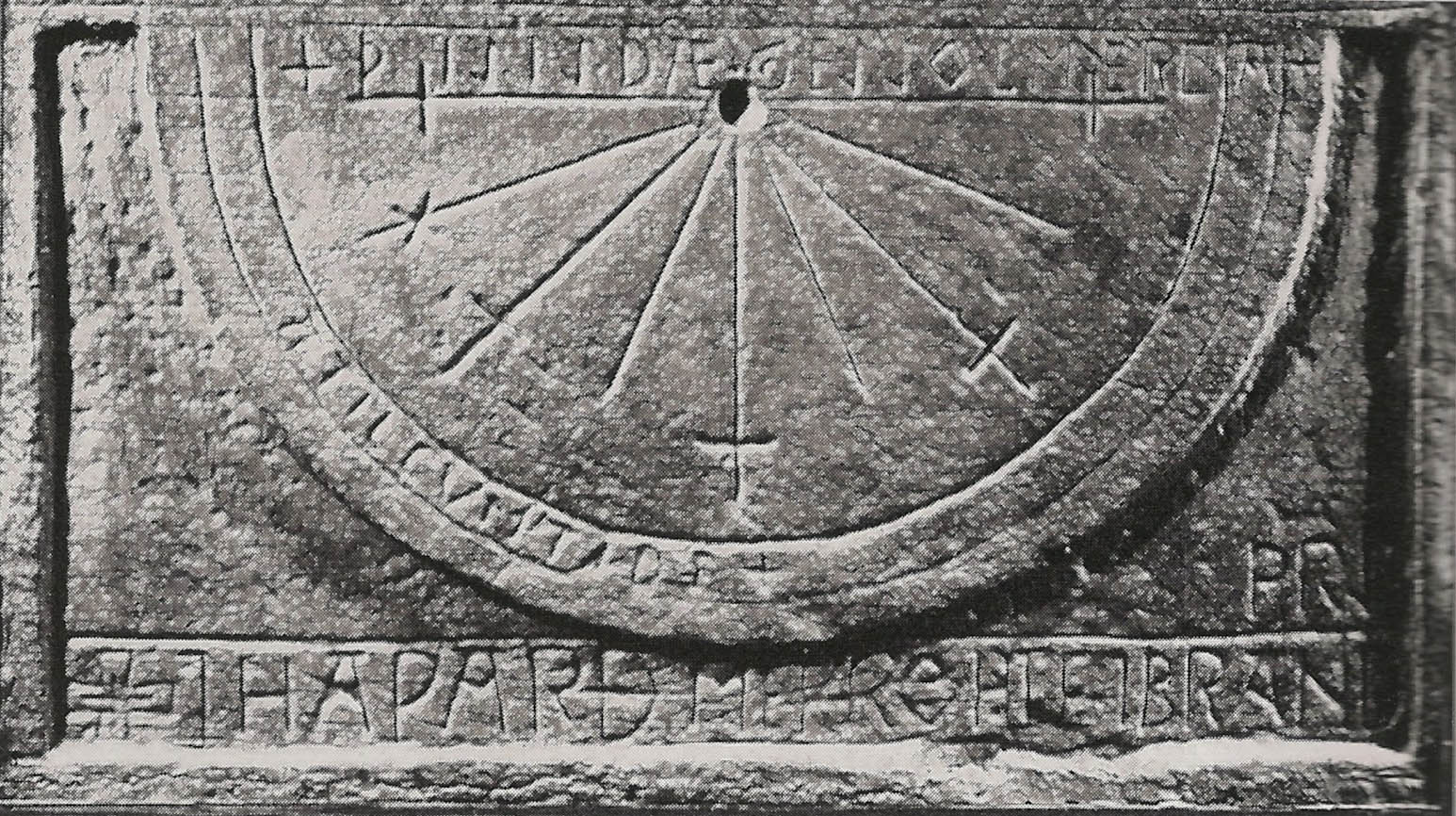
However, as this meridian was drawn in a thirteenth-century building, and when I started to look for its history, I was not aware of its true date of creation, I began to research how they calculated the time in the Midle Ages. After all, there is also a beautiful medieval sundial on the external wall of this hospital. And even if it is far from Cassini and from the meridians, it is not without interest – and neither is irrelevant.

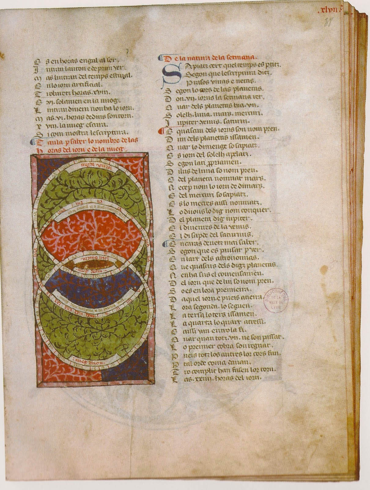
Maître Ermengaud, Bréviaire d’amour, Languedoc, ca. 1430-1440, Lyon, BM, ms. 1351, F. 38

To design a sundial, they had to measure the length of the daylight, divide it in hours, and correct them according to the seasons. The length of the day and of the night, dependent on the seasons and on the latitude, is the subject of the following page of this fifteenth-century Bréviaire d’amour. The three concentric circles reflect the relationship of the division of the hours and the length of the day at the equinox (the central circle) and the solstices (winter in the bottom, and summer in the top).

Angers, BM, ms. 35, f. 241v-241r

Angers, BM, ms. 35, f. 241v-241r (detail)

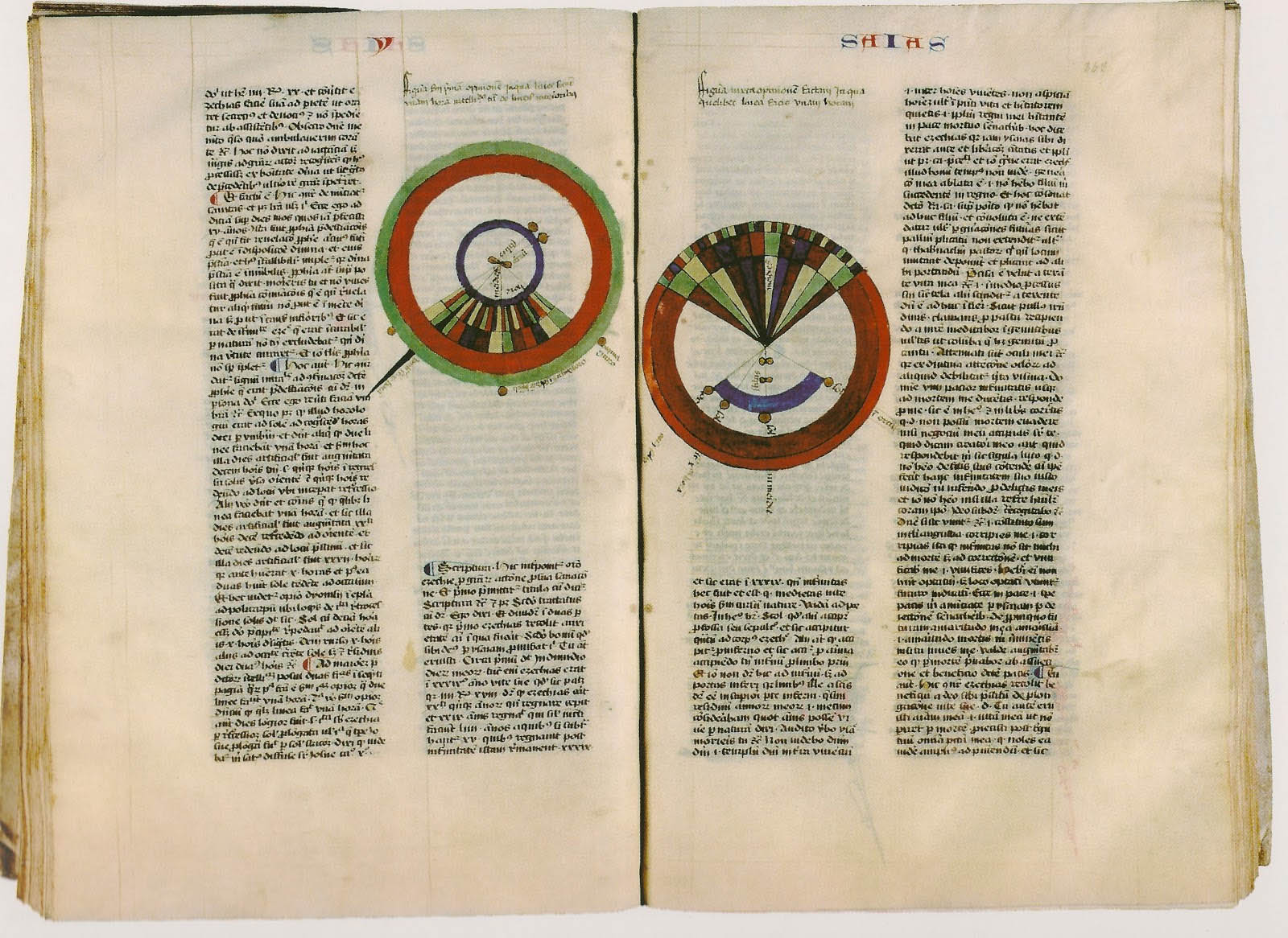
Sometimes the length of the day and of the night assumes apparently absurd proportions – but these are miraculous moments, when God plays with time, and reverses the course of the sun for a short while. The exegete Nicolas of Lyra, in his Postilla super totam Bibliam written in the middle of the fifteenth century offers a concrete illustration to a passage of Isaiah: the shadow of the sun steps back to “the stairs of Achaz” (Is 38:8), and thus then covers – depending on the dial – ten or twenty additional divisions, resulting in a daylight of 22 or even 32 hours. In the illustration, to the left, on the ruler under the hour circle, we see the shadow of the stylus extending by way of a sundial to the tenth hour.

France, 13th century, Paris, Bibliothèque de l'Arsenal, ms. 1186, f. 1v

Bartholomaeus Anglicus, On the properties of things, Eastern France, ca. 1480, Tours, BM, ms. 703, f. 176v

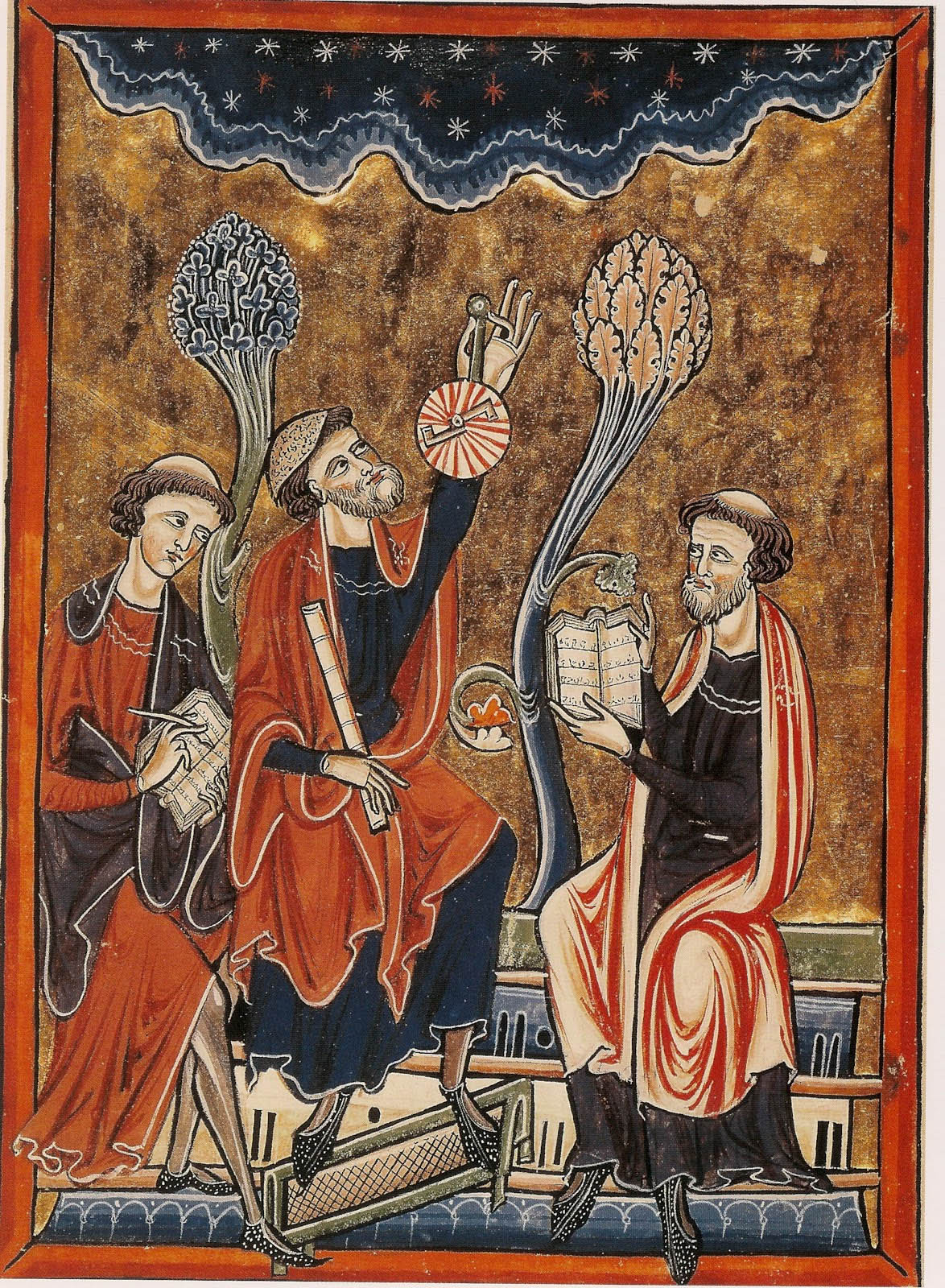
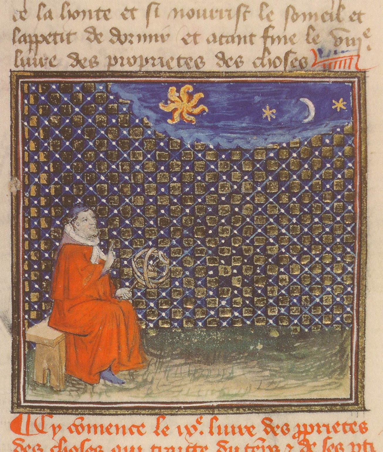
To measure the time by daylight, the observer can use an astrolabe, or elevate to his eyes a so-called “old-style” quadrant, a device which related the height of the sun to the latitude where the observer stood, by way of a quarter of a circle provided with a system of degrees and a plummet, associated with a cursor moving along the degrees, which measured the meridian height of the sun. The following image is disturbing since it combines the observation of the sun at its zenith with a group of stars – but perhaps the instrument could be used either day and night.

Astronomical treatise, Mont Saint-Michel, late 12th century. Avranches, BM, ms. 235, f. 32v

For the hours of the night, they relied on the rotation of the heavens: if they knew the midnight position of a circumpolar star, its various positions allowed to determine the time. The person, lying in such a strange upside down position in the 12th-century manuscript, obviously does not use a telescope, but watches the pole through a tube. Above him, we can identify the Little Bear near the observed star, the computatrix or “calculator”, aligned with the axis of the tube.

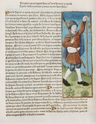
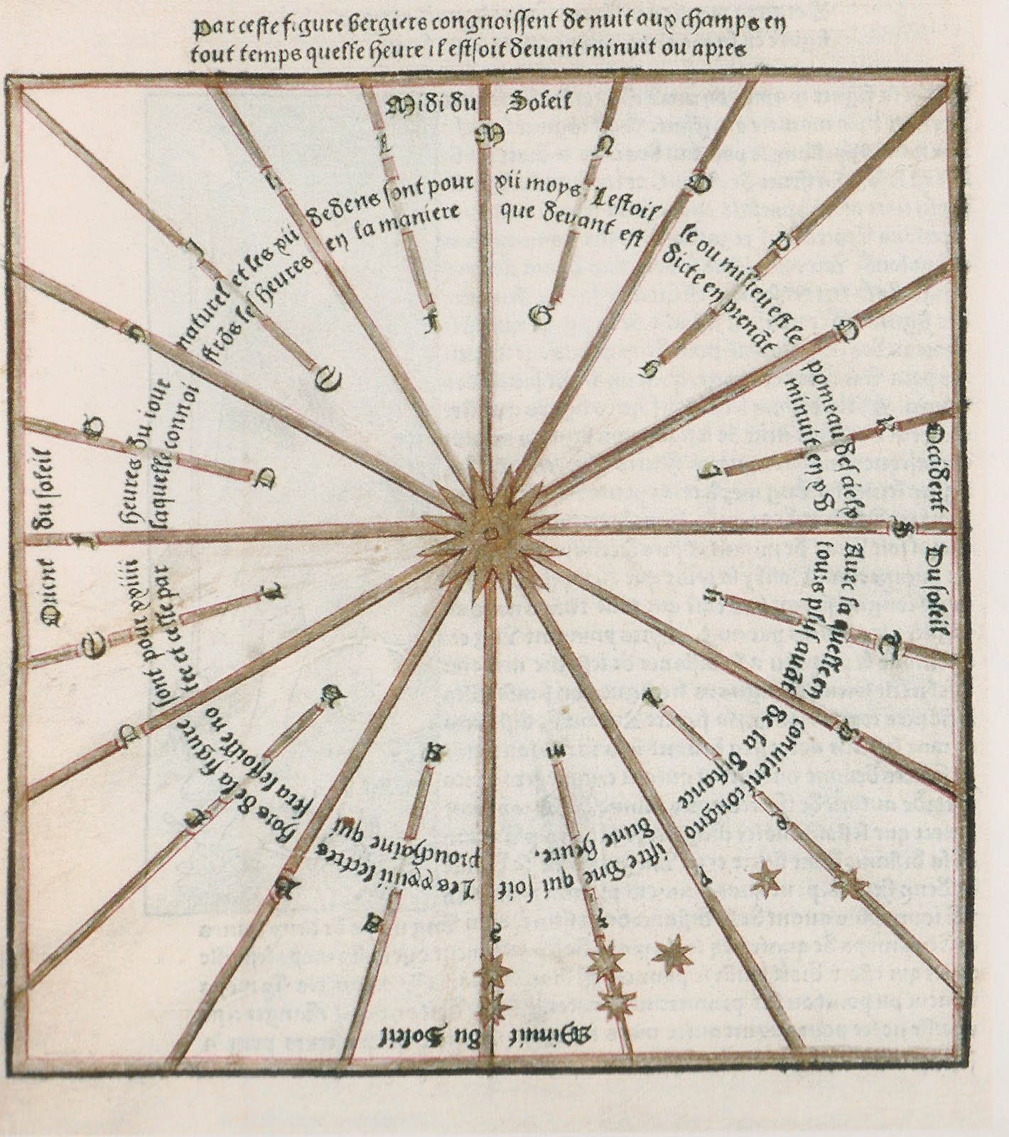
Calendrier des bergers, printed in Paris by Guy Marchant, 1493. Angers, BM, SA 3390, f 76v- 76r

And finally we come to what is beyond my comprehension: to calculate the time at night, by using a simple rope held so that it coincides with the star representing the pole. Parting from this, one imagines a figure centered on this star, and divided into 24 sectors, in which one establishes the position of a star “before” or “after” the rope for the hours before or after midnight. Since sidereal time differs from the solar hour 4 minutes per day (which means a cumulative difference of one hour in 15 days), the 24 lines in the figure serve to adjust the position of the star according to this change (this is the role of the shorter lines). I wonder how many shepherds, walking the dark paths through the night, with a rope in the hand, were able to measure and calcuate the time. Nevertheless, you will find the same figure on the Saxon sundial in Yorkshire below, made around 1060, with its alternating long and short lines.


Bartholomaeus Anglicus, On the properties of things, Paris, before 1416, Reims, BM, ms. 993, f. 130r

Note that besides the quadrant, the observer of the sky could also use an armillary sphere, whose rings and armlets symbolized the remarkable circles of the celestial sphere, by way of a model of the universe. The scaled armillary spheres could adjust the observations to the latitude, mainly for the pedagogical purposes of the memorization of the reference points in the sky, to visualize and solve simple problems related to the apparent movement of the sun or the stars, or, once again, were used to calculate the hours of the day and the night.

“What, then, is time? If no one ask of me, I know; if I wish to explain to him who asks, I know not … But do I thus measure, O my God, and know not what I measure?”
St. Augustine: Confessions XI.