Time loop

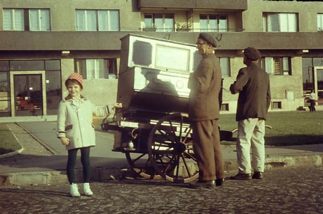
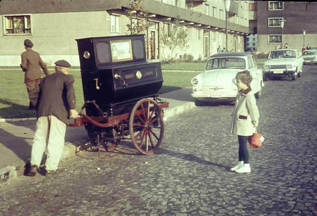
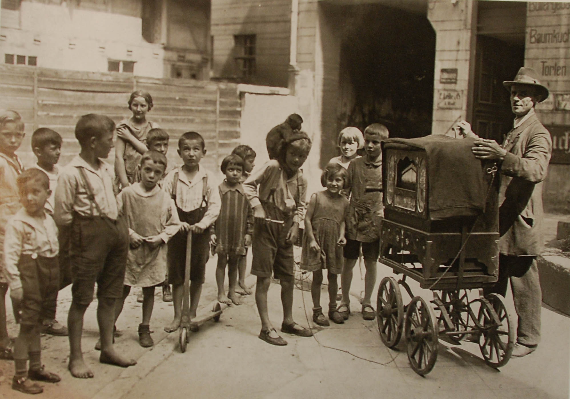
Old man (perhaps Uncle Soma) playing a barrel piano, Tahi Street, Angyalföld district, Budapest, ca. 1963

Our post is published at once here and on the “Plant a Tree” local history blog of Budapest’s Angyalföld district
the organ-grinder, soda man, ice man, tinker,
Uncle Gyula, the lame huckster…

the wax-soft childlike perception, which retains such small moments, easily ignored by the adults.

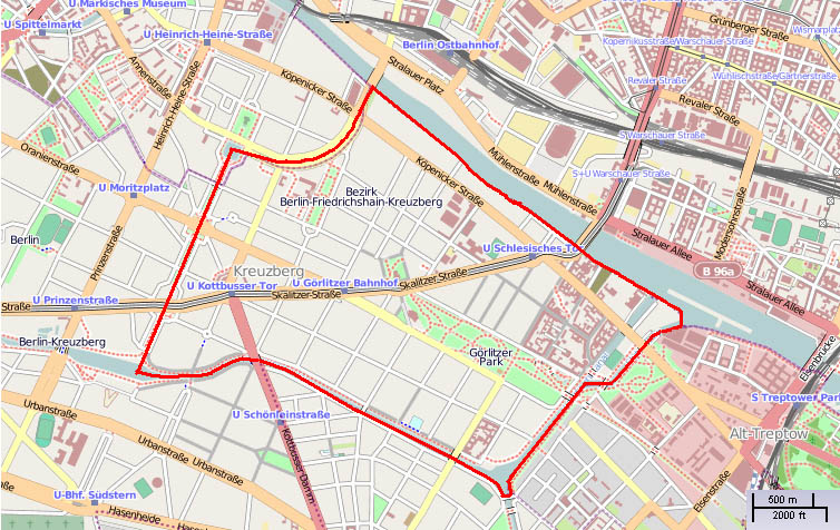
Paths of organ-grinders in Angyalföld (the places mentioned in the post, projected onto the map of the district)
Although the Pallas Great Encyclopedia, published at the turn of the 19th and 20th centuries, mentions somewhat pejoratively the organ-grinders, like who importune the public, and the great poet Dezső Kosztolányi in 1927 wrote about the disappearance of the anachronistic organ-grinders, still in the early sixties a number of people went about the Tahi Street with such a music-box mounted on a two-wheeled cart. The former children, today sixty and older, still happily remember the machine-musicians of the sixties.

For many children in Angyalföld, the organ-grinder’s music was linked to the Sunday lunch. Others for the price of an ice cream helped to push the cart, or to pick up the fifty-filler coins wrapped in newspaper, thrown from the courtyard windows. They remember the punch cards, too, and they say that the organ-grinder did not buy, but he himself made them.

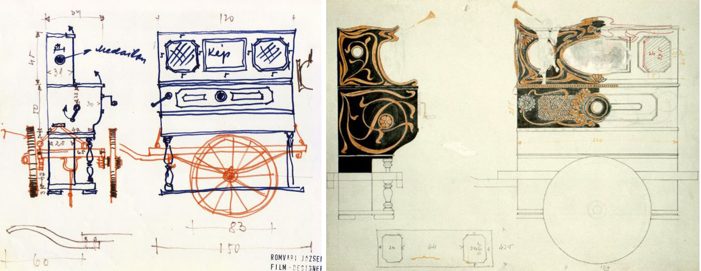
This is an interesting element of the story, because, as far as we know, this type of barrel piano does not use any punch card.

Street music machines have two major types: barrel piano, what we see in the picture, and barrel organ. The latter name is often used for both types. However, in the barrel piano the keys providing the sounds are operated by a cylinder, onto which the melody is coded by nails, similarly to the little music boxes still available in game stores. Of course, the cylinder in the barrel piano can be up to forty times greater, since the length of the piece of music which can be played depends on the diameter. In the case of the barrel piano, the cylinder operates a piano structure.

This plebeian music machine also has an aristocratic brother, the player piano or pianola. At first glance it is a traditional instrument, with keyboard and foot pedals. In this they really use codes set on punch cards, which gives way to a much more finely differentiated playback. The player piano was also one of the first techniques of music recording, which could record the actual performance of a pianist, thus the result was not the machine-replay of a sterile melody line, but of a true artistic interpretation. Such recordings were made, among others, by Scott Joplin, Béla Bartók, or the young Artur Rubinstein.

It is therefore a mystery how the punch card rolls got into the above childhood memories. Perhaps there was another instrument in the neighborhood which worked on that principle, but it is also possible that the old man simply tricked the young girls. I don’t know.

This photo might show Uncle Soma from the northern Újpest district, who usually played in front of the Polgár Pub in Elizabet street, says one of the informants. Others add that an organ-grinder also lived in Petneházy street, who often played in Gyöngyösi street and the poor Tripolisz neighborhood.

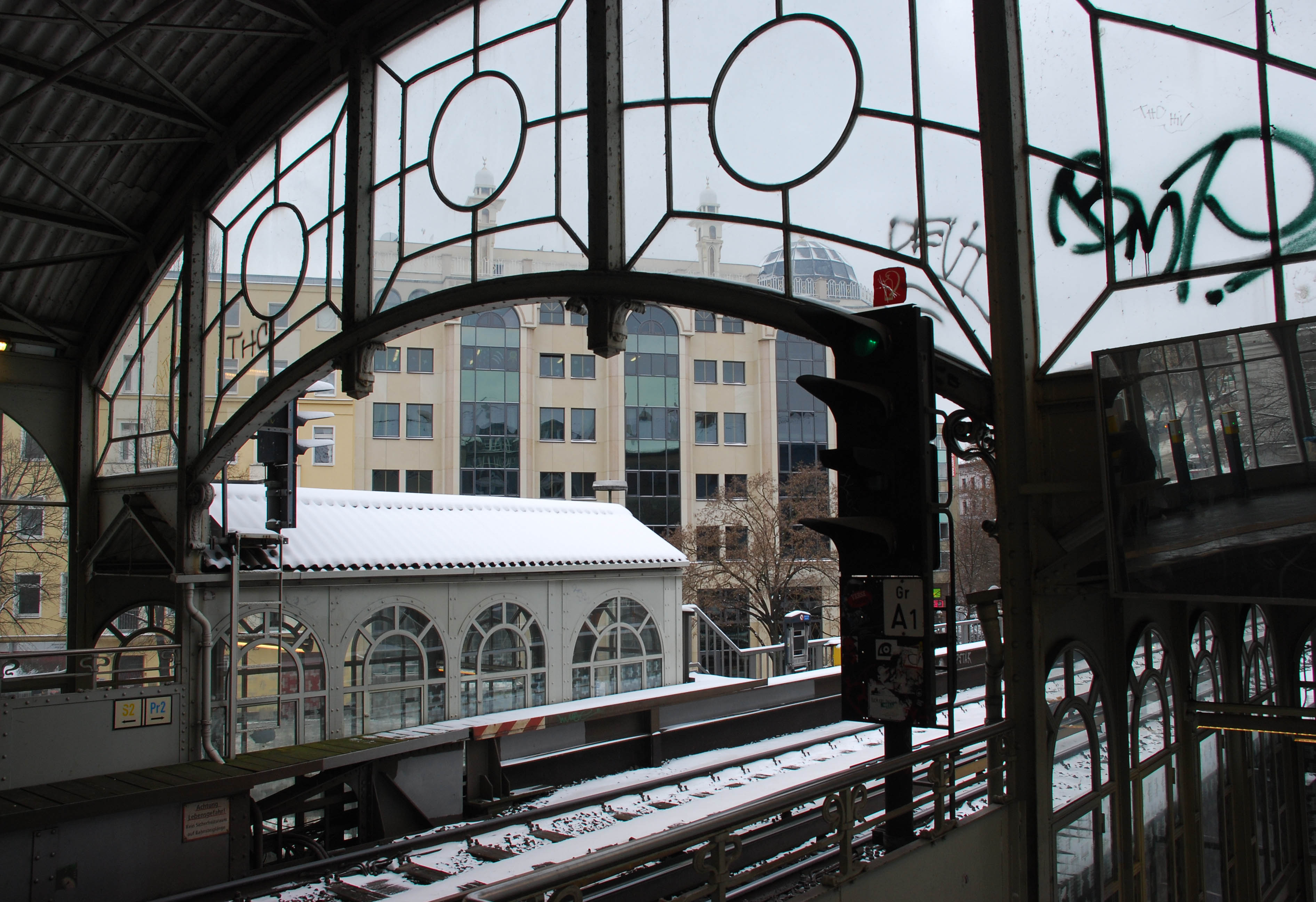
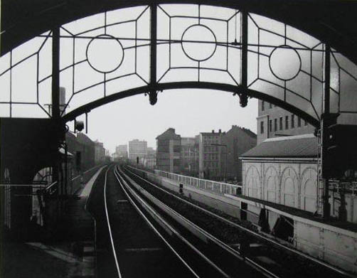
Checking thoroughly the following photo from the 1930s, one thinks that perhaps the same music-machine – just some decades younger – features here in the background. Perhaps the man is also the same in the two pictures?


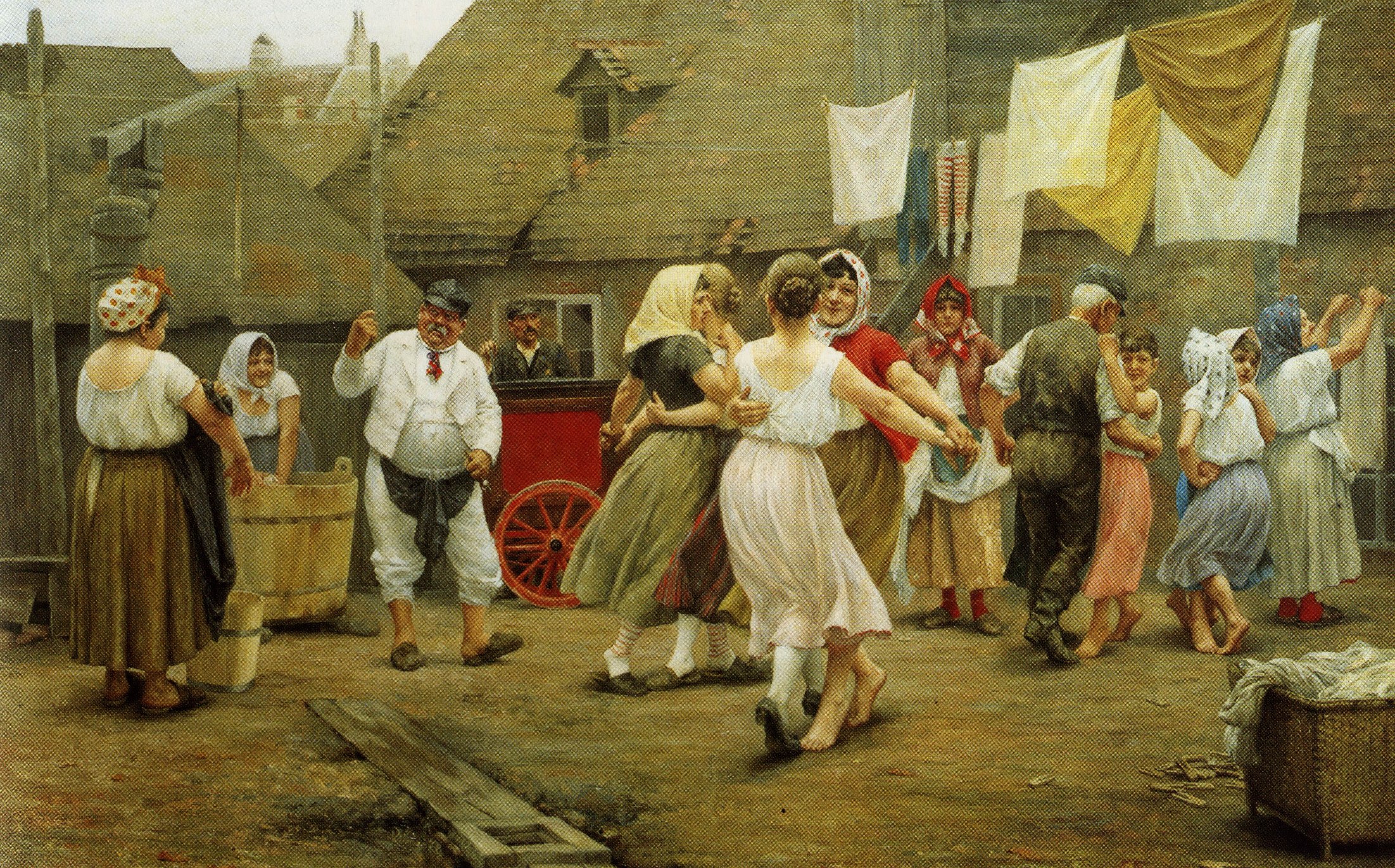
The best use of the opportunities offered by the Werkelmann (as he was called in Viennese German) is shown in Josef Engelhart’s cheerful picture of 1890

And if it is the same instrument, then it is also in the following picture, taken in the thirties? The poor quality and the different perspective make the comparison complicated. The turned feet are perhaps obscured by a scaffolded support, but otherwise the instruments appear similar. However, organ-grinding was typically an one-man-enterprise, and the man with a hat and the one with a worker’s cap are perhaps not identical. Who knows it for sure today?

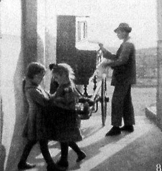
Organ-grinder in the thirties. Photo by Lajos Szabó, in: Fortélyos félelem igazgat, Móra, 1974
According to our informants, taken from the the neighboring flat, at Attila street 150.

But there were also other ambulant performers in the district along the axis of the Váci Street. In the Tripolisz they even remember a singing beggar, such an old man that his voice did not reach the windows. Nevertheless, he also received his emoluments. In addition to the barrel organ peddlers – who often were disabled soldiers or people in need of an easy physical work for other reasons – there was also an important rival group of backyard music service: the Gypsies. They were mainly young people, who linked up the daily practicing with earning bread, going about with their violins, and playing popular hits or Hungarian songs. Angyalföld was the cradle of a good many famous Gypsy musicians, as we will tell about them in a later post.

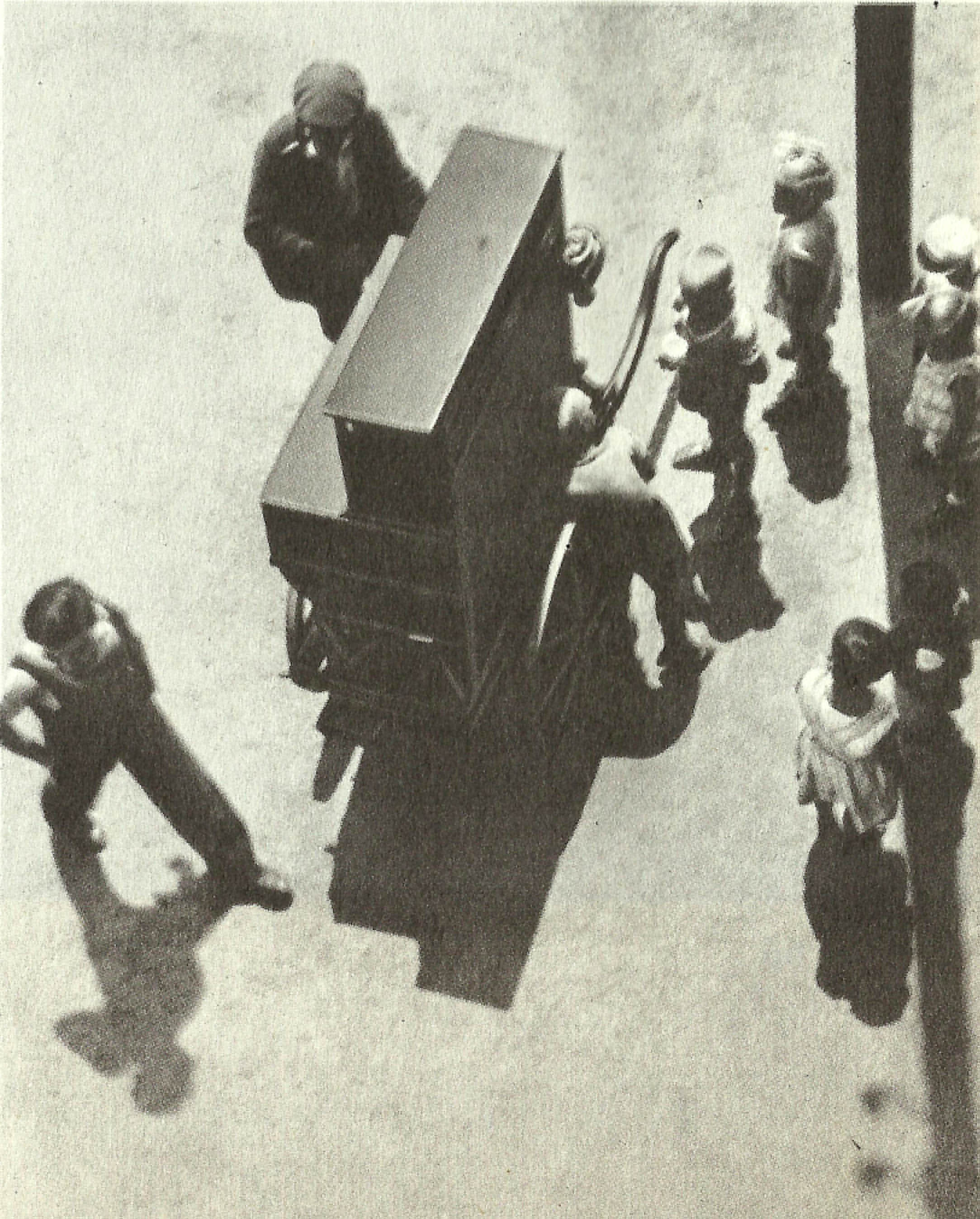
There were also two other old men, Uncle Pista and his brother-in-law or brother… maybe they are in Iván Vydareny’s photos taken in 1960 in Angyalföld, pushing their music-machine in the Visegrádi and Gogol Streets.


And the player piano which accompanied our tour in Angyalföld, unexpectedly shows up again for a last time to tell goodbye, purchased for the scenery of the 1969 film version of Ferenc Molnár’s famous The Boys of Paul Street.


“Exactly at quarter of one, after repeated futile experiments, the tense anticipation was rewarded. Into the colorless flame of a Bunsen burner upon the classroom desk there suddenly burst a flash of bright emerald; the professor’s efforts to demonstrate the fact that the compound, whereof the professor wanted to show that paints the flame green, indeed paints the flame green; say, at quarter of one, in that triumphant minute, a barrel piano resounded in a neighboring courtyard. Whereupon all earnestness and attention instantly fled. The windows were wide open, welcoming the warmth of a March day, while the wings of fresh Spring breezes wafted music into the room. It was a rollicking Magyar melody which issued in march tempo from the barrel piano. It was so utterly hilarious an air, so Viennese in spirit, that the entire class felt tempted to smile; indeed, many among those present did not restrain this urge.”
Ferenc Molnár: The Paul Street Boys, 1.

I only knew such street musicians from a radio tale, but we loved them very much also there. (From the almost fifty-minute long tale, the organ-grinder Zakariás plays only some minutes at the beginning and in the end.)


Every mouse loves cheese. Radio game, 1980.
Zakariás: Károly Kovács – Parrot: Ferenc Háray – Aunt Lidi: Józsa Hacser – Uncle Márton: László Csákányi – Soma: Endre Harkányi – Mummy Szeréna: Éva Schubert – Daddy Albin: Samu Balázs – Fruzsina: Hédi Váradi – Big Cat Magus: Gyula Bodrogi – Chequered mice: Ildikó Meixner, Péter Csepeli – With the collaboration of the ensemble formed from the Symphonic Orchestra of the Hungarian Radio – Music and direction: Lászó Gulyás – Written and arranged: Gyula Urbán
Fogd meg a vízben a csillagot!
Hasztalan, úgysem tudod!
Idelent hiába vallatod,
fönt van a fényes titok.

Csillagba zárták a sorsodat,
csillag a vízben ragyog
Tükrödből nem tudhatsz meg sokat,
fönt van a fényes titok.
Catch the star on the water!
Useless, you cannot do
In vain you interrogate it here:
the bright secret is up there.

Your fate has been closed in the
stars which shine on the water:
but your mirror won’t tell you much:
the bright secret is up there.

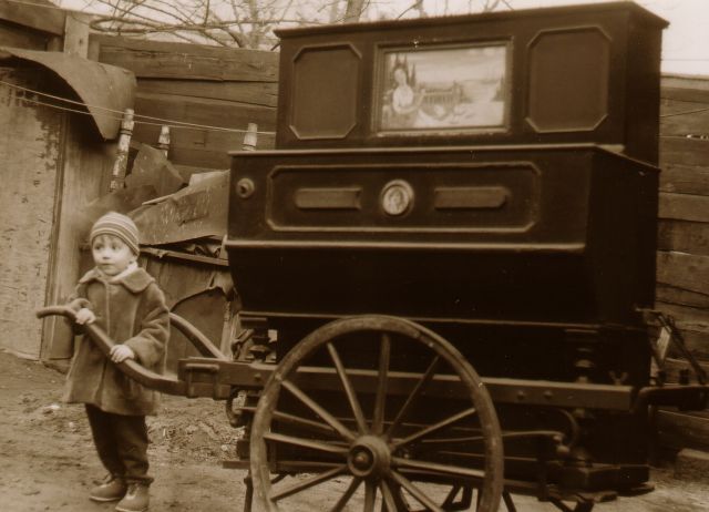
Update: Thanks to the appeal of the district library in the spring of 2013, two new photos have popped up from 1965. For completeness I include them here.


The name of the rose


The name of the Görlitzer Bahnhof has been given to the third stop from the east of the 1st U-Bahn in Berlin, in the middle of Kreuzberg. You travel through it a couple of times, before you realize: but where is the Bahnhof here? The stops of the U-Bahn, as you learn it from the loudspeaker, are called Haltestelle, and where you hear Bahnhof, there is in fact a train station standing next to it. However, in the neighborhood of Haltestelle Görlitzer Bahnhof there is no train station whatsoever.

But the name is the imprint of a former reality. The Oranienstraße stop, established in 1902 along the line then called “Elektrische Hochbahn”, was renamed in 1926 Görlitzer Bahnhof, to warn the passengers: here they have to get out if they want to travel from the nearby train station to Silesia, Görlitz, Breslau, and from there with a change to Vienna.

The U-Bahn stop Görlitzer Bahnhof

The Görlitz Train Station, once standing around the corner, was built in 1865 by the “Railway King” of Berlin, Bethel Henry (originally Baruch Hirsch) Strousberg (1823-1884). He was called the Railway King not as if he devoted all his life to the railway: he traded with anything which benefited him, from machine production through newspaper foundation to living cattle. His fame and fortune was nevertheless linked to the Prussian railway constructions, primarily due to his ingenious financing construction, which allowed a fast realization of a large amount of railways through the involvement of the capital of subcontractors. He did not pay them in cash, but in the shares of the new railway line, which at the time of the industry’s boom brought extraordinary profits to them, while he did not have to spend a cent.

The former building of the Görlitz train station

The Prussian railways were built initially as private enterprises, and only later went over to the possession of the German state. Berlin’s large, representative terminuses were the main stations of private railway construction companies. The Görlitz Train Station united Strousberg’s private railway lines. From here the trains started to Silesia, Berlin’s traditional cultural hinterland – jeder zweite Berliner stammt aus Schlesien, every second person in Berlin comes from Silesia, said the 19th-century proverb –, first to Görlitz, and then changing to the province’s capital Breslau, but the planned end goal was Vienna, so that a direct line would link the two imperial cities. Accordingly, the two streets flanking the station on the north and south were named Görlitzer and Wiener Straße, while the newly opened streets of the area, whose value was increased by the construction, received their names after the cities of Silesia, like Sorau, Oppeln, Lausitz, Liegnitz, Glogau, Ratibor.

The Görlitz Train Station and the surrounding area on the Pharus-Plan of Berlin, around 1905

The first train that left the station on September 13, 1866, carried soldiers to the Austro-Prussian war, which broke out a few months earlier, but whose outcome was already determined by the Königgrätz Battle of July 3. The war ended with the victory of Prussia and of the “Little German solution”, which meant the realization of a German Empire without the participation of Austria. The direct Berlin-Vienna connection lost its importance, and the Görlitz railway was never continued to Vienna. Only the name of the Wiener Straße recalls the old plan to this day.


The plans of the station were made by the great architect of historicist Berlin, August Orth (1828-1901), who at the beginnings of the Prussian railway constructions in the 1850s seized his first practice with one of the greatest railway construction company, developing it further on many railway buildings until the end of the century. He built, next to the Görlitz Train Station, and in an architectural unity with it, the new Lutheran church of the increasingly growing neighborhood, the Emmauskirche (1890-93), which had the largest capacity among Berlin’s churches until 1945, when, shortly before the end of the war, its nave was hit by a bomb. The perilous nave was demolished in 1949, and the tower stands now on the square as a memento for itself.

The Emmauskirche on a postcard sent in 1925 to Austria, with the Hoch- (today U-)Bahn in the foreground. To the right, the Görlitz Train Station just falls behind


The consecration of the Emmauskirche, 1893

The tower of the Emmauskirche today, seen from the Wiener Straße, in the foreground the swimming pool standing at the corner of the former Görlitz Train Station

In 1867 the Railway King commissioned August Orth also with the building of his own palace at Wilhelmstraße 70, at the corner of Brandenburger Tor. The Strousberg Palace, which, due to its perfect realization of the Schinkelian classicism, its stunning interior decoration, and a number of technical achievements first introduced here – such as gas lighting, hot water supply, central washing machine and bathrooms – was called “Berlin’s first palace” even at the turn of the century, was purchased in 1884 by the British Embassy. In 1939 the embassy was closed down, and afterwards the Reichsministerium für Ernährung, the Ministry of Supply moved into the building, which thus became the target of repeated air attacks. Although after the war the protection of monuments classified it among the buildings to be restored, in October 1950 this palace, which fell in the Soviet sector, was simply demolished, together with the legendary Adlon Hotel standing next to it. On the property, vacant for decades, only after the unification of Berlin, in 1998 they built the new building of the British Embassy, which reminds the pre-war palace, beyond its name and function, also with an original iron grid built into the gate.

The British Embassy – the Strousberg Palace  – in the 1920s

The 1998 building of the British Embassy

Sectional view of the Strousberg Palace, August Orth, 1867

The Adlon Hotel, built in 1907, bombed in 1945, demolished in 1984, and rebuilt in 1995-97, and the same seen from the top of the Brandenburg Gate on March 23, 1950 (the Strousberg Palace is in the street behind the hotel)


The Görlitz Train Station was also hit by several bombs during the war. Its fate, however, was sealed not by them, but by the fact that the demarcation line of the zones of occupation made it a kind of a blind street of the Western sector. To the north, east and south, along the channels it was bordered by the Soviet sector, the later East Berlin, and therefore the train has not even left the station, and already reached the border. The state railways, which for a couple of years stood under Eastern control even in the West, sought to limit the railway traffic from West Berlin, and so in 1951 they closed down all the terminuses there. After June 1, 1952 West Berlin citizens were even forbidden to enter the territory of East Berlin. Freight traffic went on for a while – the remains of the GDR customs office and military checkpoints were visible even a few years ago along the rails passing over the channel –, but the building of the station was gradually dismantled by the Berlin Senate between 1961 and 1967, in spite of the protests of the residents of Kreuzberg. The rails were also taken up, and first the building of a new residential area, then that of the southern bypass highway was planned on their place. None of them was realized, but the uncertainty, the enclosure of the quarter, and the lease terminations due to the planned highway led to the fact that this inclusion of Kreuzberg (the infamous Berlin SO 36, as it was called after its postal code) gradually became the neighborhood of squatters, political dissidents and foreign workers, the center of Berlin’s alternative scene. It has preserved this character even after the unification of Berlin, when the quarter rebuilt its relations with the neighboring districts, and the capital with great efforts modernized the neighborhood. The former immigrants are now reminded of by the gigantic Wahhabi Mosque – the Omar ibn al-Khattāb Moschee, named after the great conqueror, or Maschari Center, for German use – facing the U-Bahn stop, on the place of the former Deutsches Haus railway hotel, as well as by the unemployed youth passing their time in the Görlitzer Park established on the place of the taken up rails of the Görlitz Train Station. And in the park itself only the two railway warehouses now functioning as Das Edelweiss Café, and the short rail section visible some hundred meters away, around Treptow, recall the former railway station.

“Berlin SO 36”, that is, the former Eastern inclusion of Kreuzberg (marked in red). The three borders along the channels were also the borders between West and East Berlin

The former Deutsches Haus railway hotel facing the U-Bahn stop, already closed…

…and the Arabic mosque built in its place today…


…as well as the “traditional” Turkish mosque two buildings away along the Wiener Straße.

Looking towards West Berlin from the U-Bahn, on a postcard around 1950

The last two warehouses in the Görlitzer Park

But the rails were taken up not only here, but also from the East Berlin border up as far as to Görlitz. In fact, one of the two rails laid by the Railway King were taken away by the Soviets in 1945 as a war reparation. A section of it was rebuilt after the unification, but most of the Berlin-Görlitz traffic goes on one rail to this day.

The last rails, May 1987

The former German Silesia (with yellow border) and the modern Polish Silesia (in darker red). The territories laying to the north, unmarked here (Lusatia, Eastern Brandenburg, Pomerania) were also allotted in 1945 to Poland.
And indeed, why would two rails be necessary to an unexisting province? After all, Görlitz is not any more what it used to be. Lower Lusatia, of which it was the capital, together with Silesia and all the eastern part of Germany were allotted to Poland by the Yalta winners, thus relieving the remorse of the British government for having dragged Poland into the war with empty warranties in 1939, and then being unable to prevent Lwów’s and the Kresy’s falling into Soviet hands. Georg Thum in his Uprooted: How Breslau became Wrocław during the century of expulsions, published in the last year both in Germany and Poland – about which we will soon write – describes in detail and soberly how the more than four and half million inhabitants of the once almost purely German-populated provinces were expulsed, just like the Polish population of Lwów and the Kresy, during which more than half million people lost their lives. Görlitz was lucky – if it can be called a luck –, as the Odera-Neisse-border left half of it German, only the half over the Neisse bridge became Zgorzelec. Silesia’s other cities, however, after the deportations and settlements, the conscious effacing of the German past and the conscious building up of a Polish past, are today integral parts of the Polish Republic. Breslau is now Wrocław, Sorau Żary, Oppeln Opole, Lausitz Łużyce, Liegnitz Legnica, Glogau Głogów, Ratibor Racibórz. The memory of these German cities is today only preserved by the names of the streets around the repeatedly effaced Görlitz Train Station in Kreuzberg, in the core of Berlin’s bohemian world.

Stat rosa pristina nomine, nomine nuda tenemus.
The ancient rose remains by its name, naked names are all we have.

Dissolving: The organ grinder

Willy Römer, the photographer of everyday life in Berlin between 1905 and 1935: An organ grinder and his monkey amusing the children in the courtyard, 1925

Robert Capa: Organ grinder in Berlin, August 1945

Organ-grinder playing in the courtyard of Berlin, Fasanenstraße 13, 1965

Gerhard Thieme (1928-), the GDR’s official gag sculptor: Memorial to the organ-grinder, 1987.
In Berlin’s Nikolaiviertel, first destroyed and then re-created as a socialist disneyland,

about which we will write more, in the courtyard of the Reinhardt Pub

Franz Schubert, Die Winterreise Op. 89. XXIV: The hurdy-gurdy man (Der Leiermann). Performed by Dietrich Fischer Dieskau

For further organ-grinders and monkeys in pre-war Warsaw and Lwów, the disappeared Bucharest and bombed-out Budapest, America and the Caucasian Georgia, as well as in pre- and post-revolution Russia, paddle back on Río Wang.

Drawing the time: all a meridian can measure

Calendrier des bergers, printed in Paris by Guy Marchant, 1493. Angers, BM, SA 3390, f 76v- 76r

It was the image of the sunspot falling through the camera obscura on the floor of the Basilica di San Petronio in Bologna, which stopped me.

I have never reflected so far on the concept of the meridian, and even less on the meridians we can draw anywhere on the basis of a light spot at noon.

However, I have known this spot – and quite far from Bologna.

It runs, month after month, on the great meridian of the former hospital in Tonnerre, founded in 1293 by Margaret of Burgundy, widow of Charles of Anjou, King of Sicily.


The meridian – called here, probably incorrectly, a gnomon – is 17 meters long. It was drawn in the former hall of patients. Its 8-shaped curve is stretched along a line that crosses the entire width of the room, engraved in the slabs of the floor, and shows the hour of the true as well as the mean solar noon.

The building has indeed a vast nave, 18 meters wide, 90 long and 27 high. Since the mid-seventeenth century it has ceased to be used as a hospital. After they walled up one of the Gothic windows of the great hall, letting only a thin ray of sunshine to pass through, several observations were necessary to level the horizontality of the floor, to draw the meridian, to mark to the right and left of this axis the position of the sunspot at noon. It was Joseph Lalande, astronomer, encyclopedist, director of the Paris Observatory, member of the Academy of Sciences, and future creator of the Bureau des Longitudes, who realized all the calculations and verifications. The ensemble was inaugurated in October 1786.


Around noon, the sunbeam passing through the hole drilled in a former window of the southern wall, forms a light spot on the ground. It is solar noon when the sunspot reaches the southernmost point of its course. At this moment, the light spot falls exactly on the north-south line drawn on the floor. This line is the intersection of the meridian’s plane and the horizontal plane.

The straight line of the true solar noon is surrounded by an extended 8-shaped curve indicating the mean noon. It thus integrates the shift called equation of time: when it is mean noon, the light spot falls on the 8-shaped curve, which approaches or moves away from the wall, following the apparent height of the sun. In winter, the spot crosses the meridian increasingly farther from the entry point – so far indeed, that the hall was not wide enough, and it was necessary to carve a hole in the opposite wall, to finish drawing the curve. In summer, on the contrary, the light spot is closer and closer to the entry point and the foot of the southern wall. These two extremes correspond to the winter and summer solstices. The line joining them exactly shows the north-south direction, drawing on the floor the local meridian – that is, the meridian of Tonnerre.


The light spot on the meridian on May 25, 2008 at noon

Thus the meridian of Tonnerre translates in an immediately readable way a wealth of cosmographical information, erudite ones on the one hand, worthy of the era of the Enlightenment, and inherited from ancient traditions on the one hand: the orientation of the meridian (the north-south axis), the inclination of the elliptic curve, the true time, the mean time, the solstices and equinoxes (the four times of the year when the real time and mean time coincide), the months, the seasons and the zodiacs.


However, as this meridian was drawn in a thirteenth-century building, and when I started to look for its history, I was not aware of its true date of creation, I began to research how they calculated the time in the Midle Ages. After all, there is also a beautiful medieval sundial on the external wall of this hospital. And even if it is far from Cassini and from the meridians, it is not without interest – and neither is irrelevant.

Maître Ermengaud, Bréviaire d’amour, Languedoc, ca. 1430-1440, Lyon, BM, ms. 1351, F. 38

To design a sundial, they had to measure the length of the daylight, divide it in hours, and correct them according to the seasons. The length of the day and of the night, dependent on the seasons and on the latitude, is the subject of the following page of this fifteenth-century Bréviaire d’amour. The three concentric circles reflect the relationship of the division of the hours and the length of the day at the equinox (the central circle) and the solstices (winter in the bottom, and summer in the top).

Angers, BM, ms. 35, f. 241v-241r

Angers, BM, ms. 35, f. 241v-241r (detail)

Sometimes the length of the day and of the night assumes apparently absurd proportions – but these are miraculous moments, when God plays with time, and reverses the course of the sun for a short while. The exegete Nicolas of Lyra, in his Postilla super totam Bibliam written in the middle of the fifteenth century offers a concrete illustration to a passage of Isaiah: the shadow of the sun steps back to “the stairs of Achaz” (Is 38:8), and thus then covers – depending on the dial – ten or twenty additional divisions, resulting in a daylight of 22 or even 32 hours. In the illustration, to the left, on the ruler under the hour circle, we see the shadow of the stylus extending by way of a sundial to the tenth hour.

France, 13th century, Paris, Bibliothèque de l'Arsenal, ms. 1186, f. 1v

Bartholomaeus Anglicus, On the properties of things, Eastern France, ca. 1480, Tours, BM, ms. 703, f. 176v

To measure the time by daylight, the observer can use an astrolabe, or elevate to his eyes a so-called “old-style” quadrant, a device which related the height of the sun to the latitude where the observer stood, by way of a quarter of a circle provided with a system of degrees and a plummet, associated with a cursor moving along the degrees, which measured the meridian height of the sun. The following image is disturbing since it combines the observation of the sun at its zenith with a group of stars – but perhaps the instrument could be used either day and night.

Astronomical treatise, Mont Saint-Michel, late 12th century. Avranches, BM, ms. 235, f. 32v

For the hours of the night, they relied on the rotation of the heavens: if they knew the midnight position of a circumpolar star, its various positions allowed to determine the time. The person, lying in such a strange upside down position in the 12th-century manuscript, obviously does not use a telescope, but watches the pole through a tube. Above him, we can identify the Little Bear near the observed star, the computatrix or “calculator”, aligned with the axis of the tube.

Calendrier des bergers, printed in Paris by Guy Marchant, 1493. Angers, BM, SA 3390, f 76v- 76r

And finally we come to what is beyond my comprehension: to calculate the time at night, by using a simple rope held so that it coincides with the star representing the pole. Parting from this, one imagines a figure centered on this star, and divided into 24 sectors, in which one establishes the position of a star “before” or “after” the rope for the hours before or after midnight. Since sidereal time differs from the solar hour 4 minutes per day (which means a cumulative difference of one hour in 15 days), the 24 lines in the figure serve to adjust the position of the star according to this change (this is the role of the shorter lines). I wonder how many shepherds, walking the dark paths through the night, with a rope in the hand, were able to measure and calcuate the time. Nevertheless, you will find the same figure on the Saxon sundial in Yorkshire below, made around 1060, with its alternating long and short lines.


Bartholomaeus Anglicus, On the properties of things, Paris, before 1416, Reims, BM, ms. 993, f. 130r

Note that besides the quadrant, the observer of the sky could also use an armillary sphere, whose rings and armlets symbolized the remarkable circles of the celestial sphere, by way of a model of the universe. The scaled armillary spheres could adjust the observations to the latitude, mainly for the pedagogical purposes of the memorization of the reference points in the sky, to visualize and solve simple problems related to the apparent movement of the sun or the stars, or, once again, were used to calculate the hours of the day and the night.

“What, then, is time? If no one ask of me, I know; if I wish to explain to him who asks, I know not … But do I thus measure, O my God, and know not what I measure?”
St. Augustine: Confessions XI.