Switch over to our new blog! • ¡Pásese a nuestro nuevo blog!
The renewed version of our blog, with more features, a richer design, and available in nine languages, can be read here: https://wangriver.com
The new version also includes the old posts, often in expanded form. If you are curious about the updated version of this post, replace “riowang.blogspot.com/” in the URL with “riowang.studiolum.com/”, and the new link will most likely lead you there.
La versión renovada de nuestro blog, con más herramientas, un diseño más rico y disponible en nueve idiomas, se puede leer aquí: https://riowang.com
La nueva versión también incluye las publicaciones antiguas, a menudo en una forma ampliada. Si tiene curiosidad por la versión actualizada de esta entrada, sustituya «riowang.blogspot.com/» en la URL por «riowang.studiolum.com/es/», y el nuevo enlace probablemente le llevará allí.
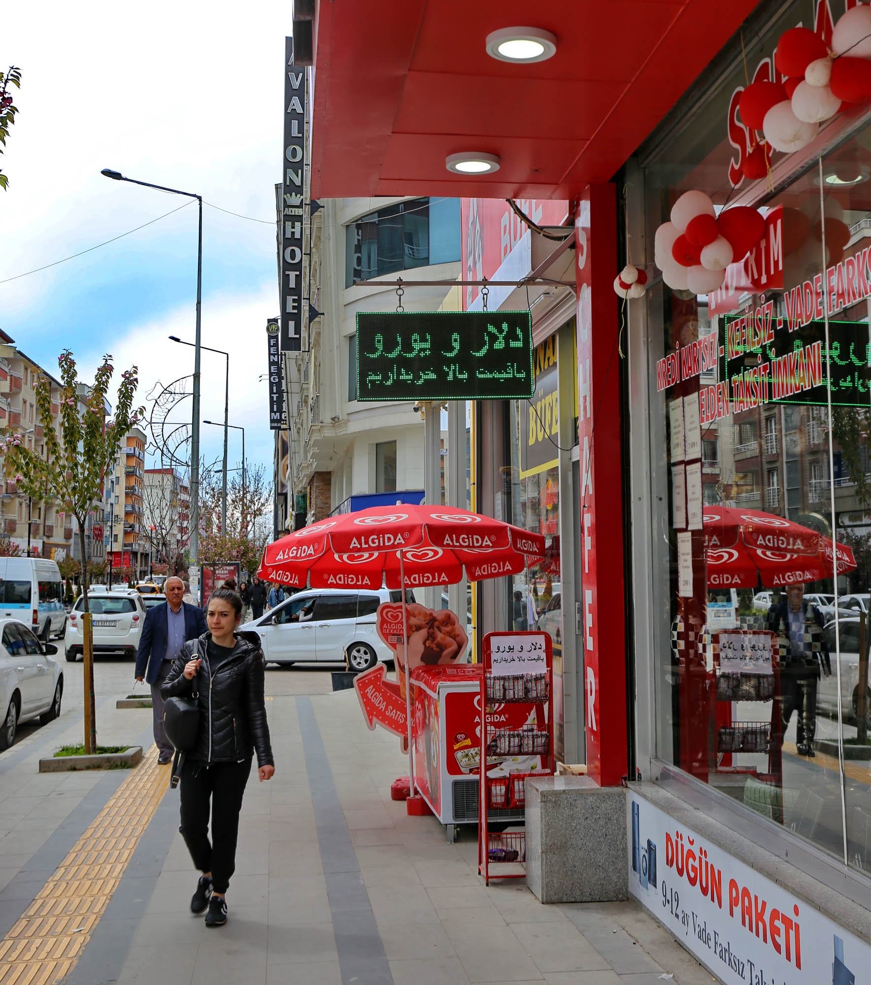
Van’s downtown is large, modern and lively, with a decidedly French atmosphere. Its wealth is partly due to the fact that this is the Turkish city closest to the Persian border, and the people from the other side easily come over for a pinch of freedom. This is often mentioned with awe in Iranian films. And they leave their money here with Persian generosity. In the hotels and on the street, everything is written in Persian as well, and when I accidentally ask in Persian, rather than Turkish, how much the parking will cost for an hour, the parking lot guard easily answers in Persian that it will be twenty liras.
“We buy dollars and euros at a high price” (in slightly faulty Persian). Just imagine at what high price it was bought on the other side of the border, before changing them here.
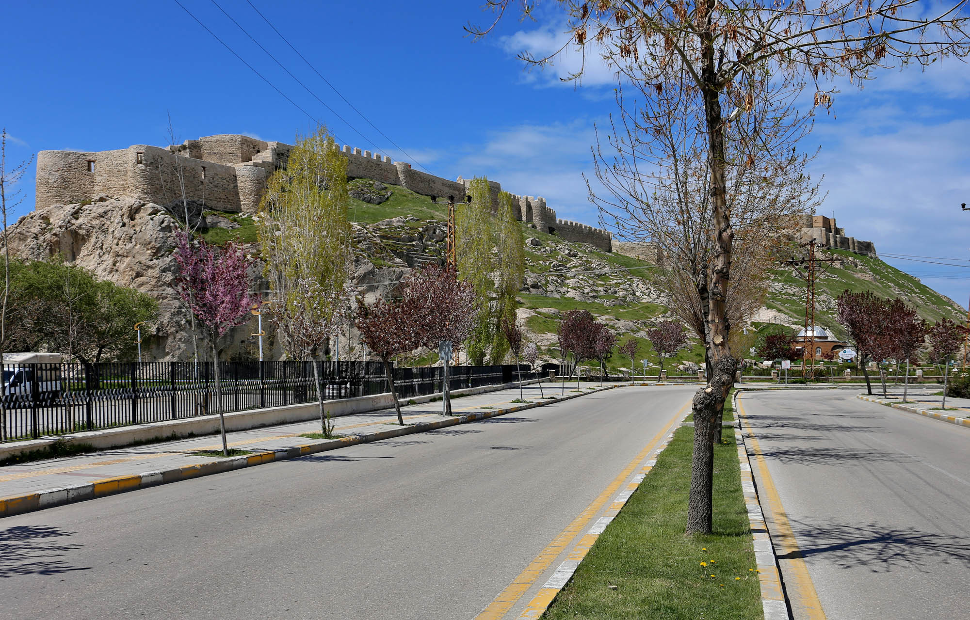
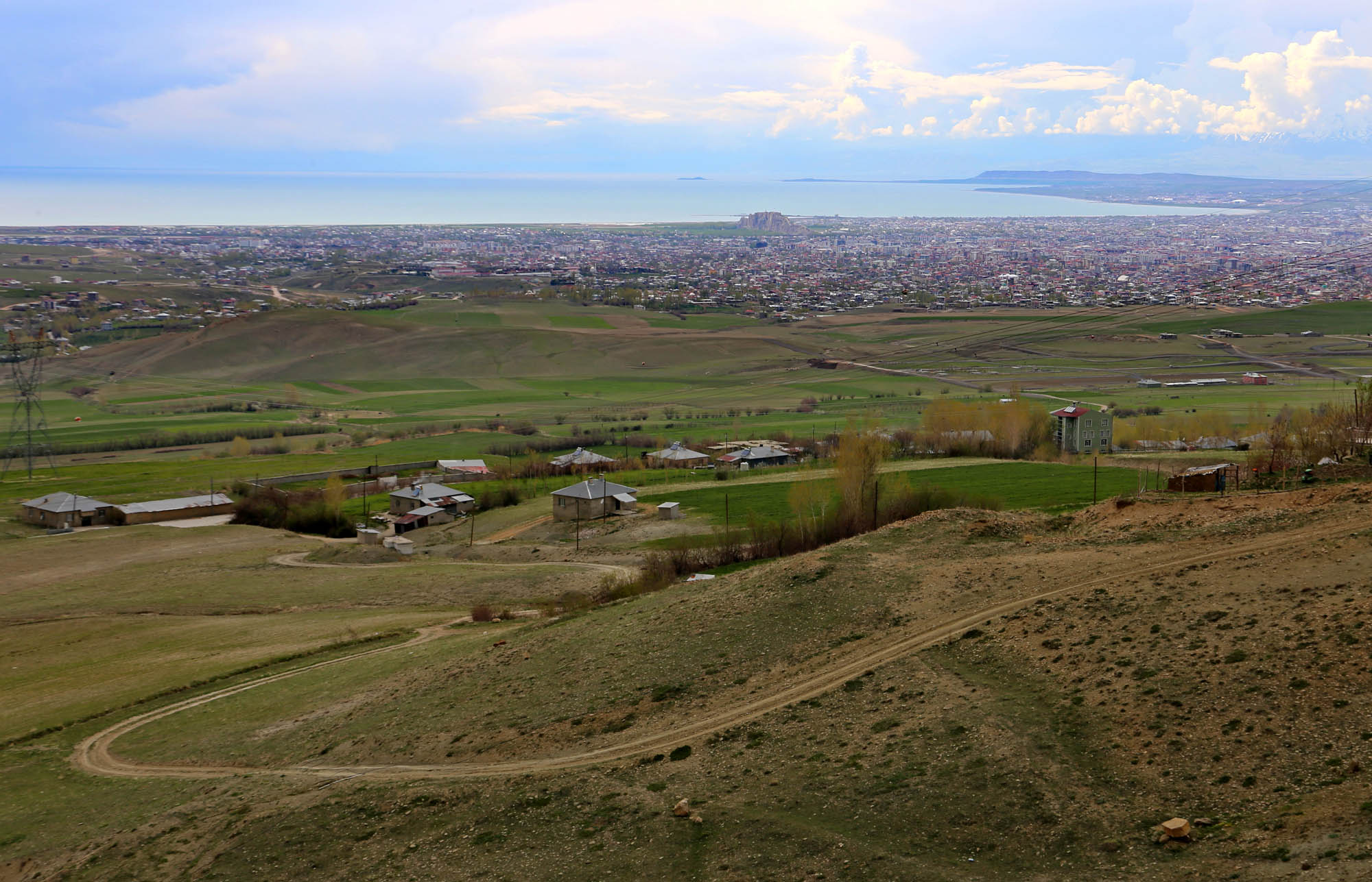
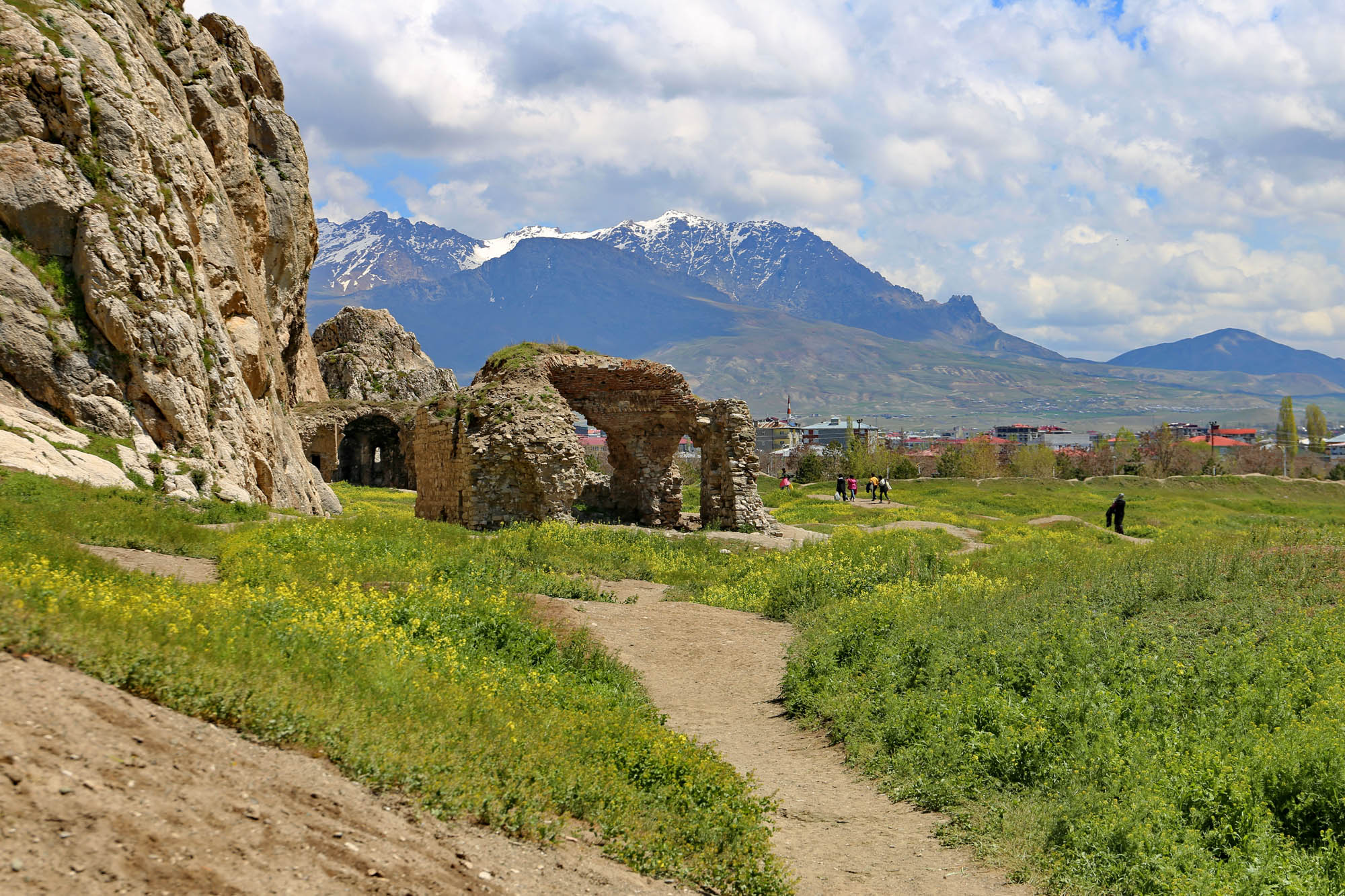
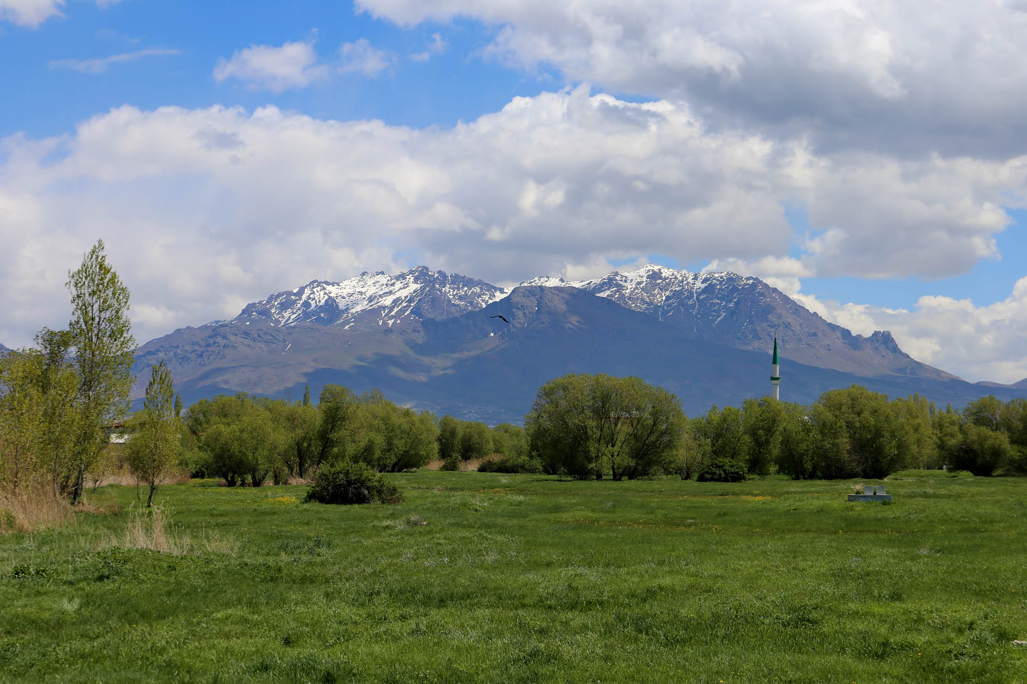
Towards the lake, a huge limestone rock, an upturned geological table, rises one hundred meters and extends one and a half kilometers. Its astonishing height can be clearly seen from Mount Erek, rising to the east of the city. As if it were a beached whale or a primeval being, which it actually is.
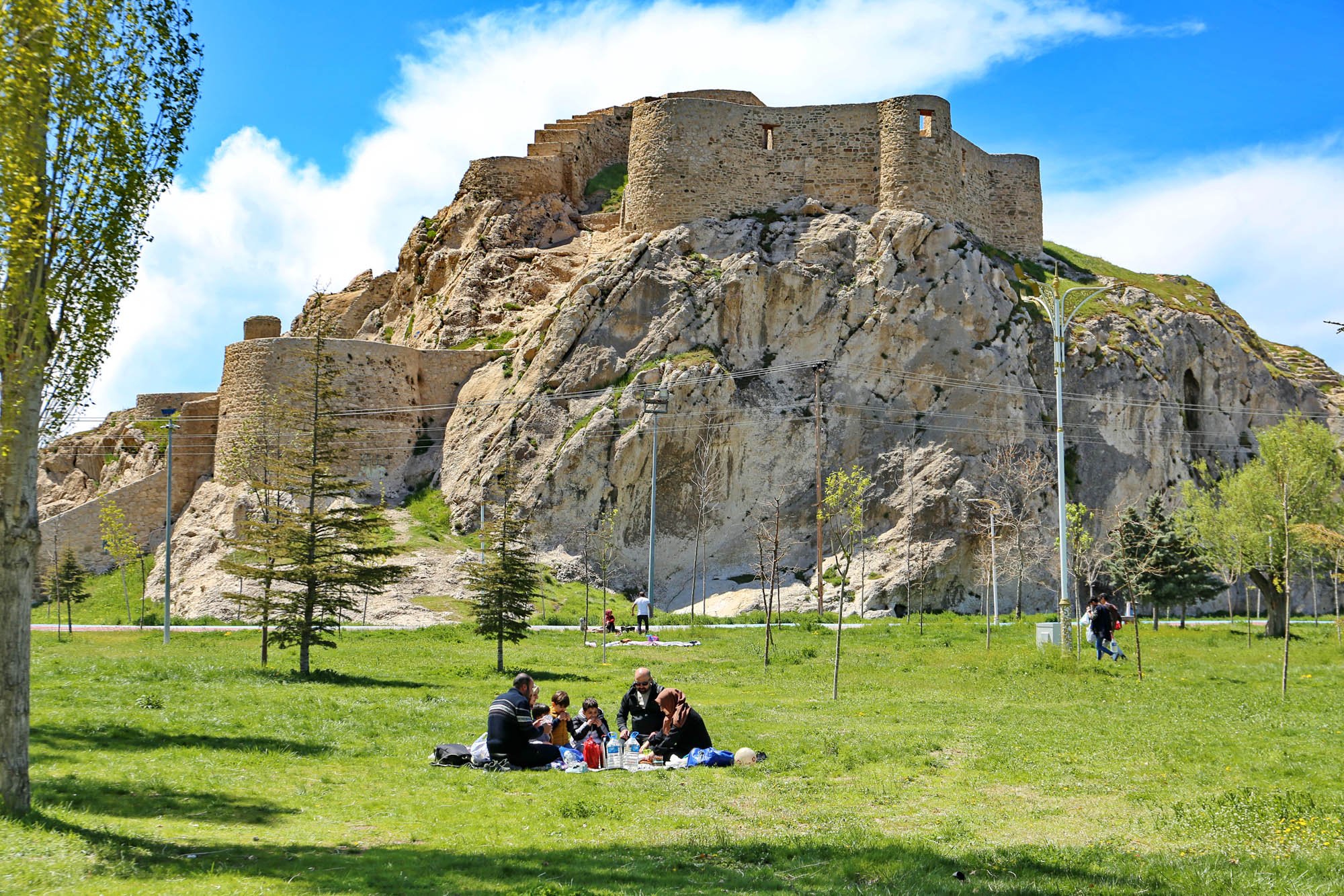
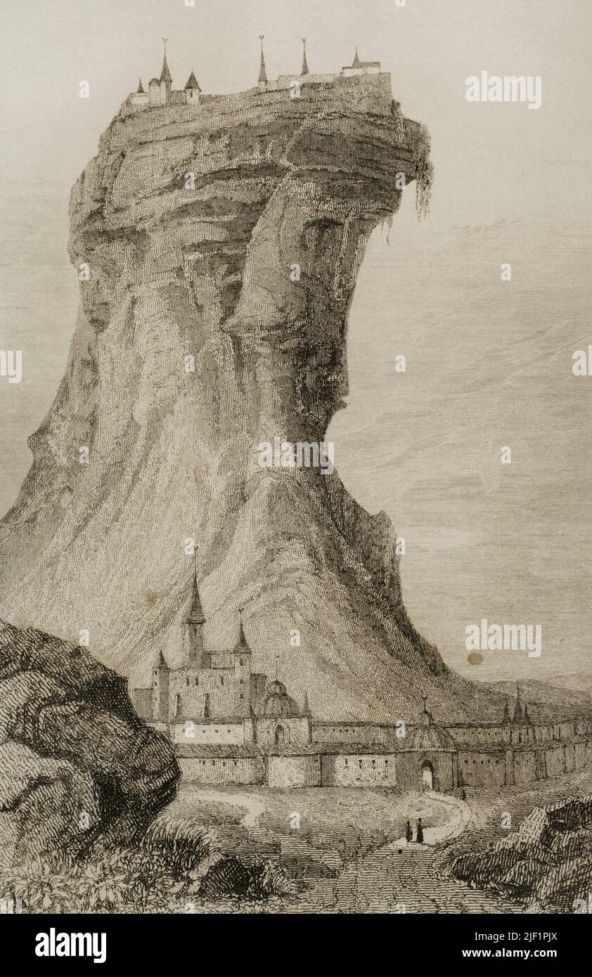
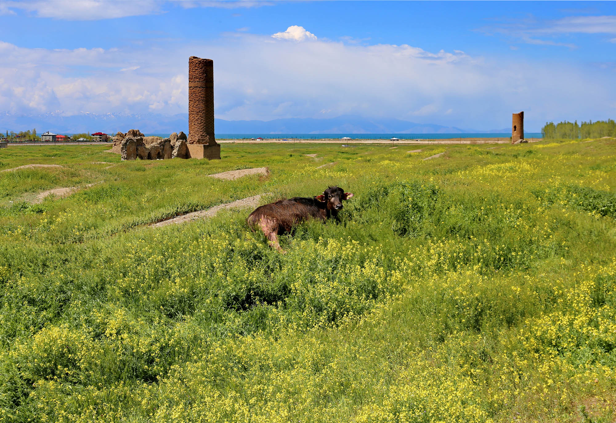
The city ends at the base of the rock, from which a large, slightly swampy green field stretches south. The edge of the field on the city side is cultivated as a park, where families are having picnics today, it being the First of May. But inside its vast interior there are only a few scattered ruins, with cows grazing among them. The remains of a fortress stands on the plateau of the rock. Some of its stones still have Urartian cuneiform writing. According to local Armenian tradition, this was the castle of Semiramis, who was so in love with the Armenian king Ara that, after his death, she tried to revive his corpse. This story was probably taken over by Plato in a narrative of his State, as I have already written. The impressive effect of the rock fortress is also conveyed by engravings of 18th and 19th-century European travelers, with obvious exaggeration.
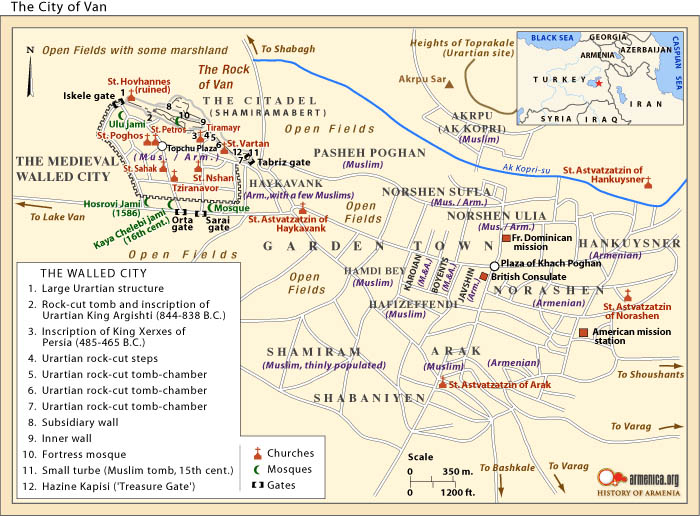
In this 1838 engraving by Eugène Boré, you can also see that the castle was not always a pasture. In his time, there was still a city here, with walls, a citadel, mosques, and churches. This was the old town of Van, founded in the 9th century BC as Tushpa as the capital of the Urartian kingdom. The walled city is also shown on armenica.org’s 1915 map of Van, upper left, at the southern base of the Citadel (Shamiramabert), full of small red Armenian churches. What happened to these, where did they go?
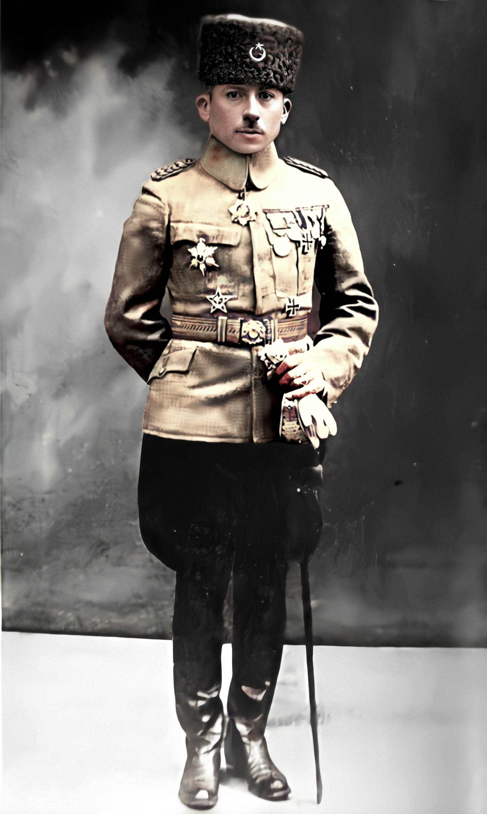
Rafael de Nogales Mendéz, a Venezuelan military officer who served under Djevdet in the Ottoman army, and, in 1925, published a detailed account of the Armenian and Syriac genocide he witnessed
In Van, the Armenian genocide began much earlier than April 24, 1915, or “Bloody Sunday”, which is considered its official starting point. In the summer of 1914, on the eve of the war, local governor Hasan Tahsin, who was sympathetic to the Armenians, was transferred to Erzurum, and the notoriously cruel Albanian Djevdet Pasha, the brother-in-law of Enver Pasha – the Ottoman minister of war, the actual ruler of the empire, and the initiator of the Armenian genocide – was sent to replace him. Djevdet’s Turkish soldiers and the Kurdish irregular troops that joined them ransacked the surrounding Armenian villages in the name of tax collection and in search of hidden weapons, slaughtering thousands of Armenian and Syriac Christians – about 55 thousand of them, according to the American physician Clarence Douglas Ussher practicing here. At the sight of this, the Armenian population of Van built ramparts around the city, and organized armed resistance in case of an eventual attack.
The attack began on April 20, 1915. The government forces put the city under artillery fire. The Armenians defended it for a month until the advancing Russian army drove the Ottoman forces out of the city on May 17. However, in July, the Ottomans launched a counterattack and gradually pushed the Russians out of the region. Van’s Armenian population and the Armenian survivors of the countryside who fled into the city, a total of 250 thousand people, joined the retreating Russians towards Yerevan. In the attacks of the Ottoman army and the Kurdish robbers, 40 thousand of them perished before they could cross the Russian mountain passes.
“Armenian refugees in Van around a public oven, hoping for bread”. An illustration of the diary of Henry Morgenthau, US Ambassador in the Ottoman Empire, published in 1918
Since then, the official Turkish historiography has presented the event as an Armenian rebellion and collaboration with the Russian enemy, which had justified the “displacement” (as they call their massacre) of the Anatolian Armenians. However, the chronology of the events clearly refutes this. Even a few years ago, there was an exhibition on the first floor of Van Museum, that illustrated the genocide allegedly committed by the Armenians against the Turks, in the form of a staged picture with real human skeletons and skulls. Due to international protest, this was first closed and then removed.
The city of Van was completely destroyed during the fighting. The present-day city center to the east of the fortress – the former garden city – has since been rebuilt, but the old town within the historical walls is now a mere pasture, with the ruins of a few buildings, which, however, still hint at the city’s former greatness.
• If the interactive map is not visible, replace https with http in the url of this post •
In the middle of the field are the ruins of two medieval mosques, and the lower parts of their minarets. The western one, built of simple bricks, was the Ulu Jami, the Great Mosque, while the eastern one, decorated with diamond-patterned tiles, was the Red Minaret Mosque. The former was built in the 12th century by the Karakoyunlu Turkic tribe that conquered the city, the latter by the Seljuk Turks in the 13th century.
Near the rock are the ruins of two churches. One, whose vaulted apse is still partially standing, is the 15th-century Surp Vardan (Saint Vardan). On its walls you can still see traces of linear decoration giving off six-pointed stars, perhaps traces of painting. The other, smaller church whose dome collapsed is Surp Stephanos. Farther away, near the former city wall, there is another small church, the Dsirvanarov chapel, which was restored for an unknown purpose, without any Christian signs, but its bottom is now filled with algal water.
In the middle of the former city, roughly where the old map marks “Topchu Plaza”, stands a large ruin with several halls whose vaults, judging from the corbels, were rather low. Through a crack in the wall, I see a young Kurdish man sitting outside, reading his phone. I ask what this building was. “A bath”, he says.
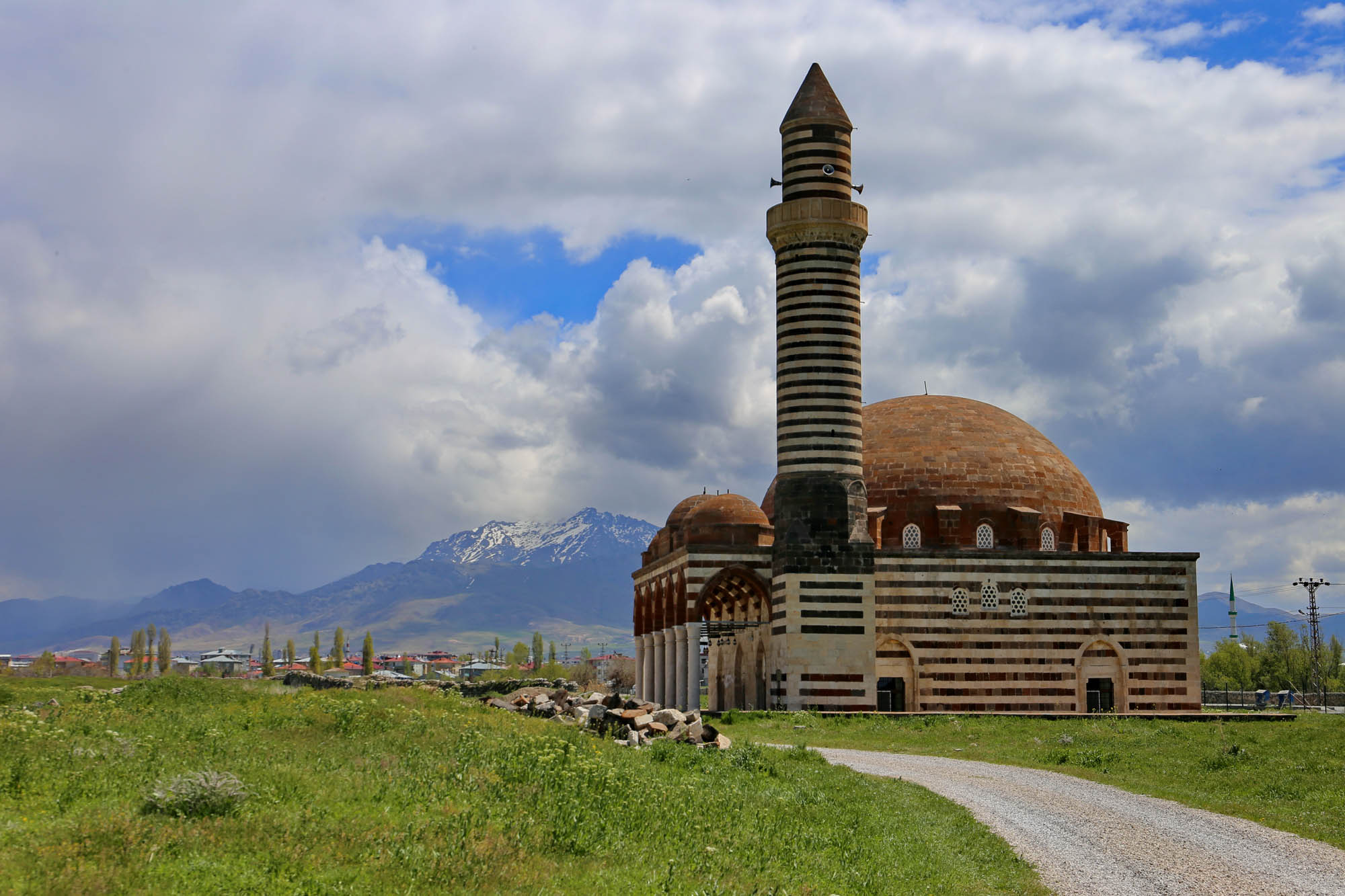
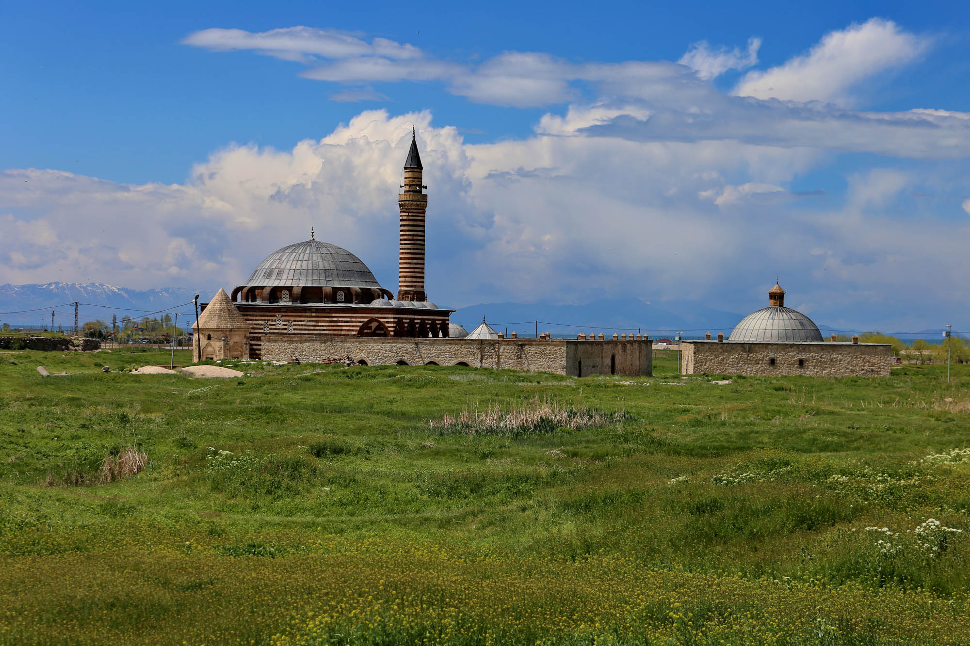
On the southern edge of the field, along the road, there are two intact mosques. They may have been renovated recently, because Openstreetmap still marks both of them as “ruins”. Both were built in the 16th century as typical small Ottoman mosques, with a single dome above a square floor plan, and with an arcaded porch. With the one to the east, the Kaya Çelebi mosque, we are lucky, because the person with the key is just coming and opens it for us.
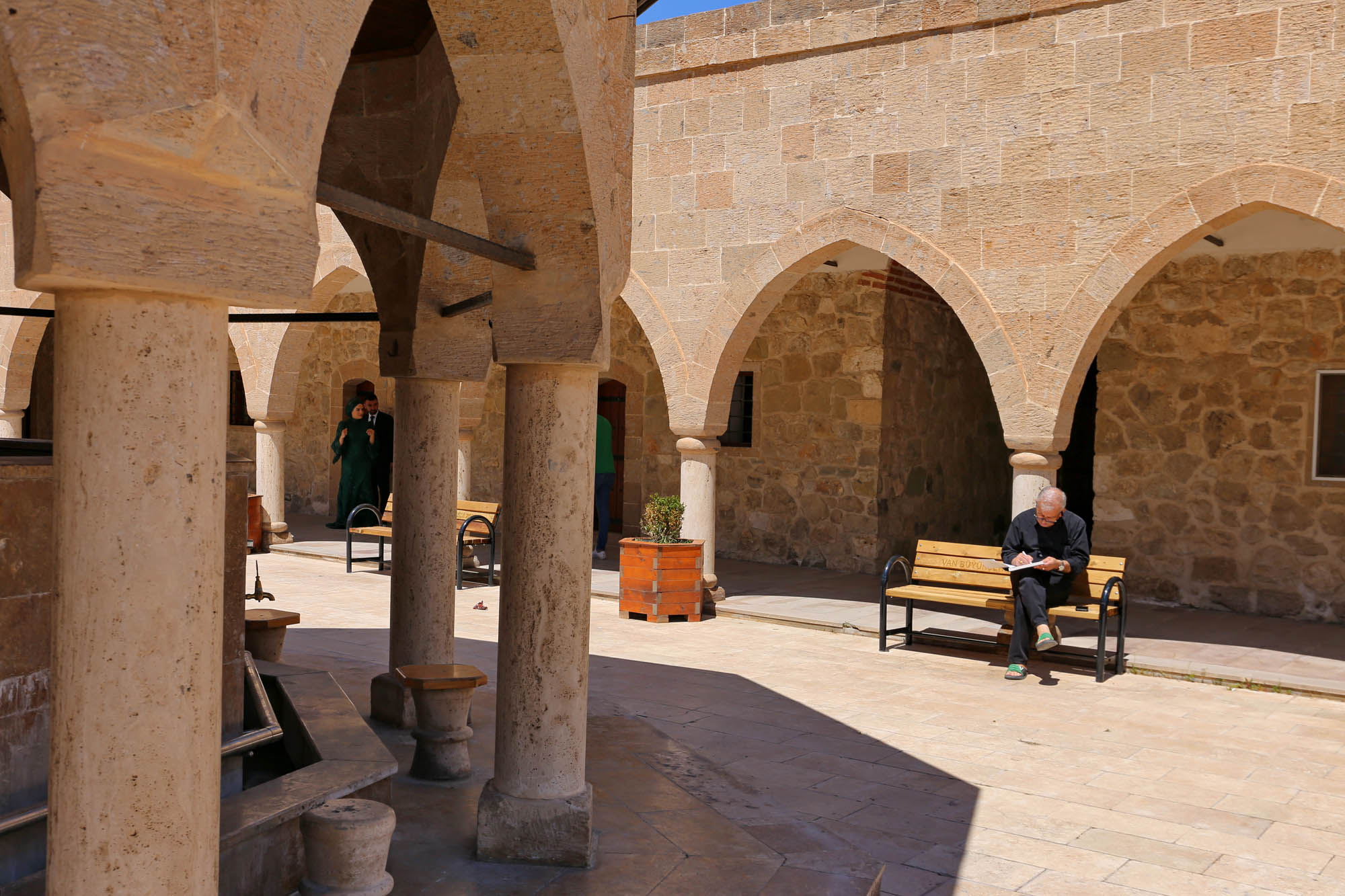
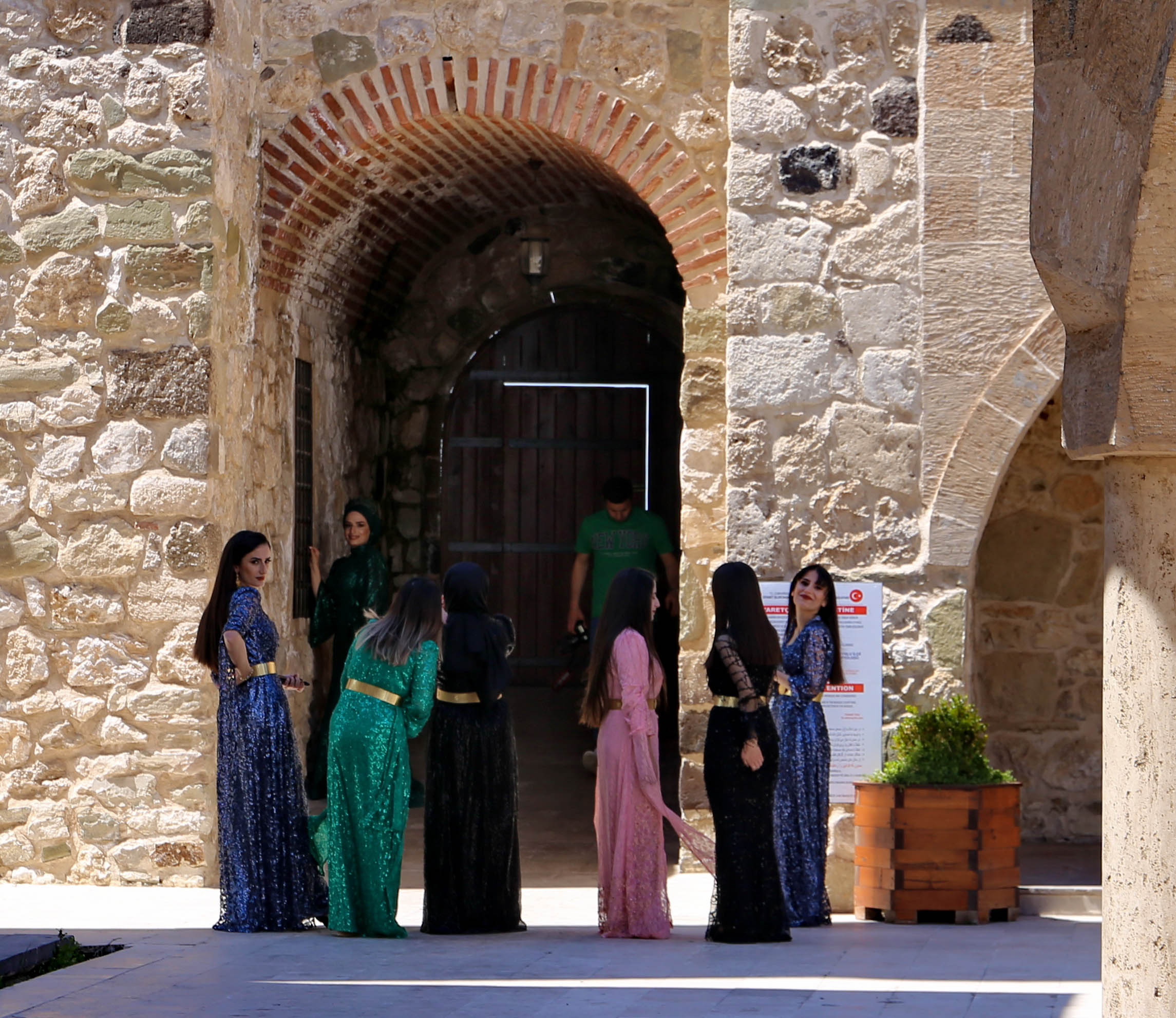
The one to the west, the Khosrow Pasa mosque, is open all the time. This is a larger complex, with a türbe at its corner, probably the tomb of the founding pasha. The courtyard in front of the mosque is surrounded on three sides by a ground-floor building, perhaps a former tekke – a dervish monastery –, and in the middle there is a fountain house for ritual ablution. A wedding photo shoot is taking place in the yard. The bride is surrounded by several beautifully dressed bridesmaids, looking like colorful birds.
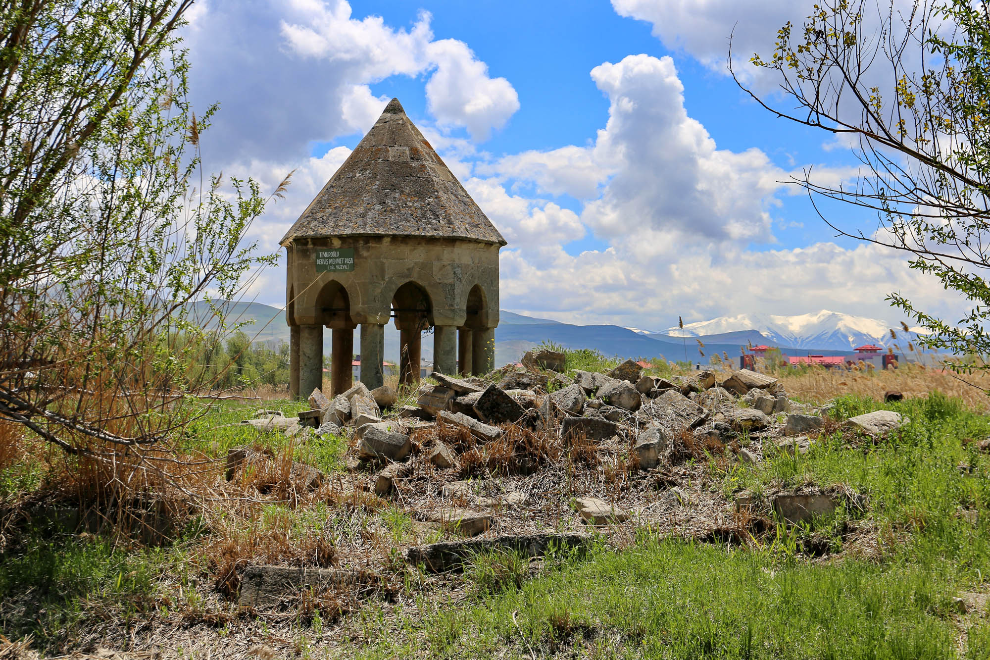
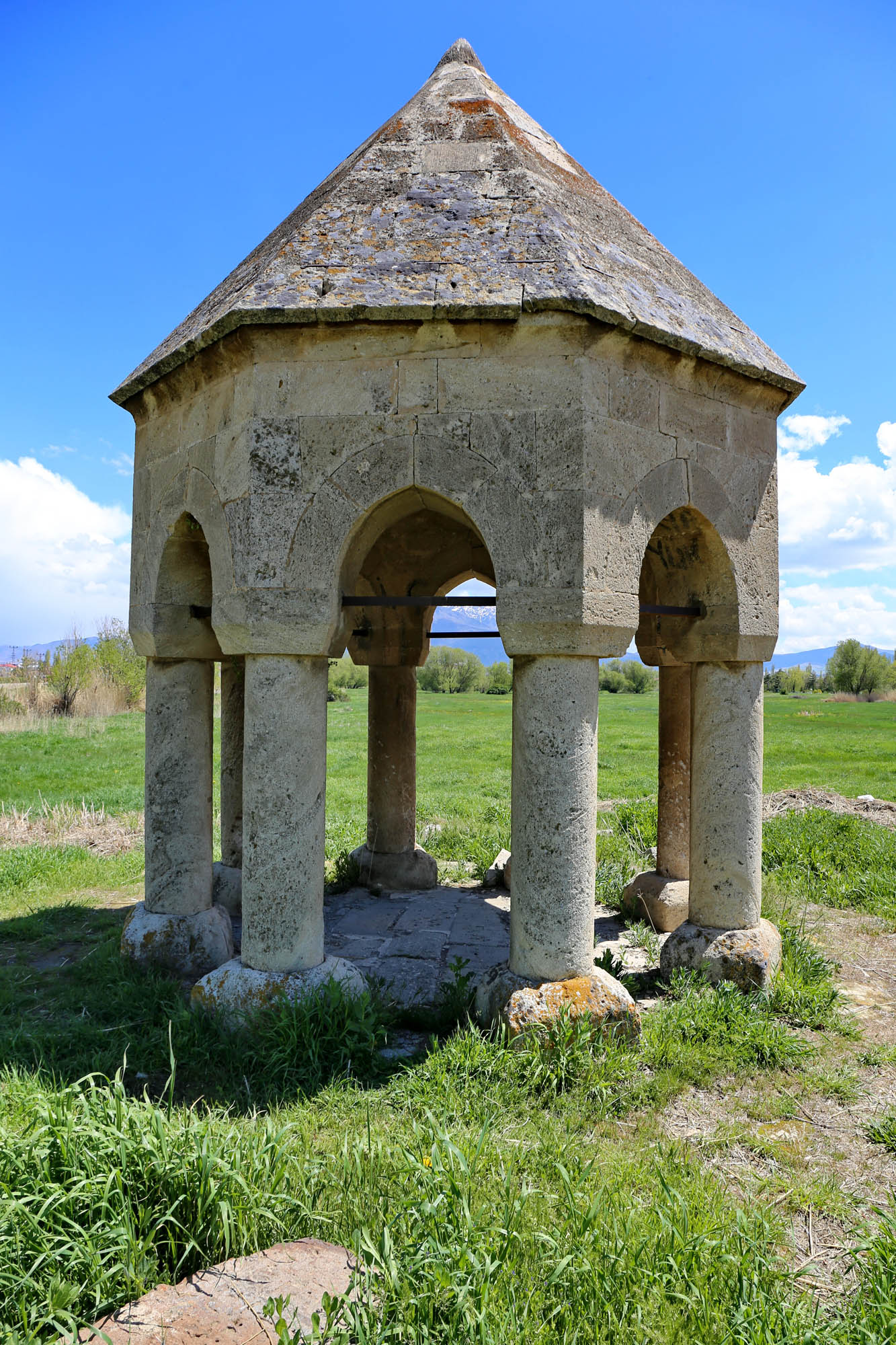
On the other side of the road is a huge field surrounded by a wall. It looks like a former cemetery, although now it has only four graves, of four Turkish military officers from the 1910s. And a small building that totally looks like an Armenian bell tower. Nevertheless, to avoid any confusion, a modern plaque is exposed on it: “Timuroğlu Derviş Mehmet Paşa (18th century)”. Next to it are the ruins of a former stone building, with some carved stones, as well as several standing stones which look like khachkars, Armenian tombstones, but any inscription they once may have had has been effaced.
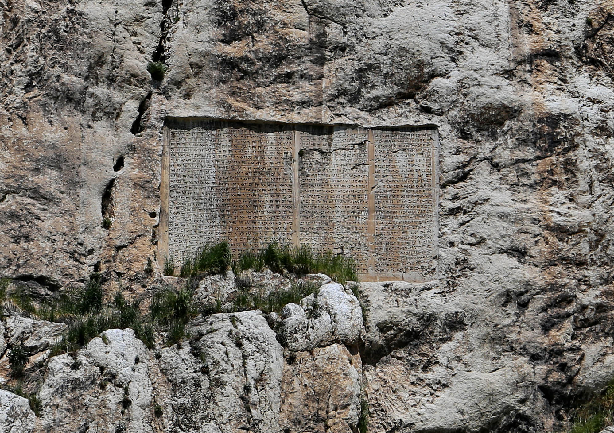
We don’t have the time to go up to the castle now. We can only look up from the field at the rock wall, where the Persian Great King Xerxes left a three-language – Persian, Elamite, Babylonian – cuneiform inscription around 480 BC, in a a frame polished by his father, Darius. The inscription glorifies the Zoroastrian one God, Ahura Mazda, and asks him to bless the king and his kingdom, including Tushpa, present-day Van. It badly needs it.
Hasmik Harutyunyan: Nazani. From the CD Armenia Anthology


 Rafael de Nogales Mendéz, a Venezuelan military officer who served under Djevdet in the Ottoman army, and, in 1925, published a detailed account of the Armenian and Syriac genocide he witnessed
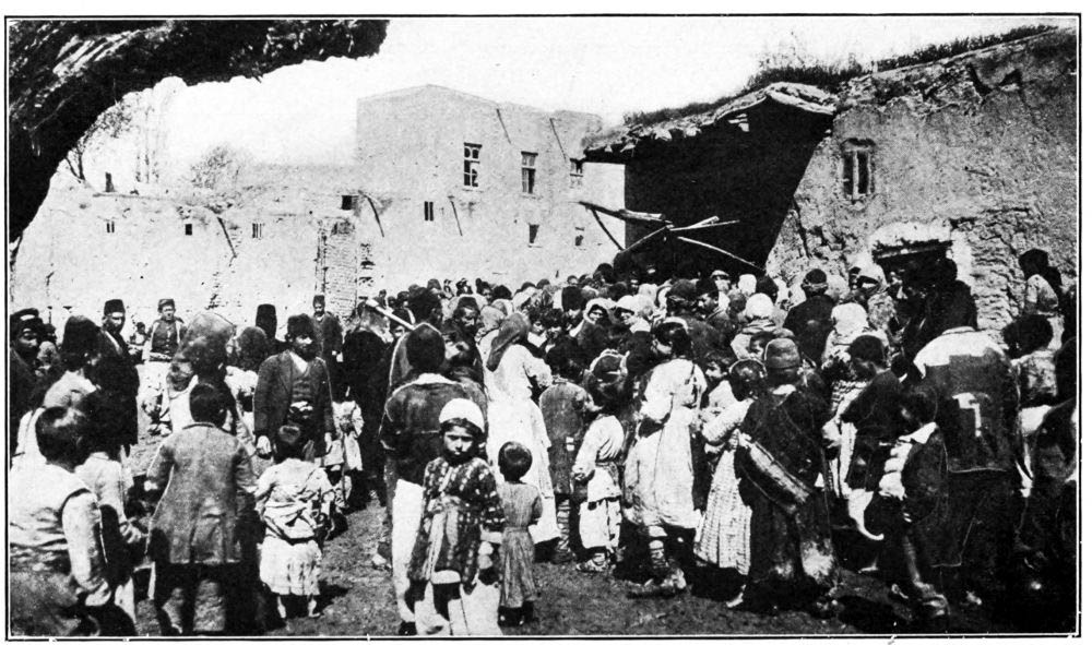


 Come with us to…
 Atlantis
 Bestiary
 Bohemia+Prague
 Books, exhibitions, music, film
 Brave old world
 Caucasus
 Cemeteries
 Crimea
 Get to know the
 Images of the East
 Lightwriting
 Lwów/Lemberg
 Mallorca
 Message on the wall
 The Museum of Propaganda
 Odessa
 Paper Museum
 Persian letters
 The Jewish heritage


No hay comentarios:
Publicar un comentario