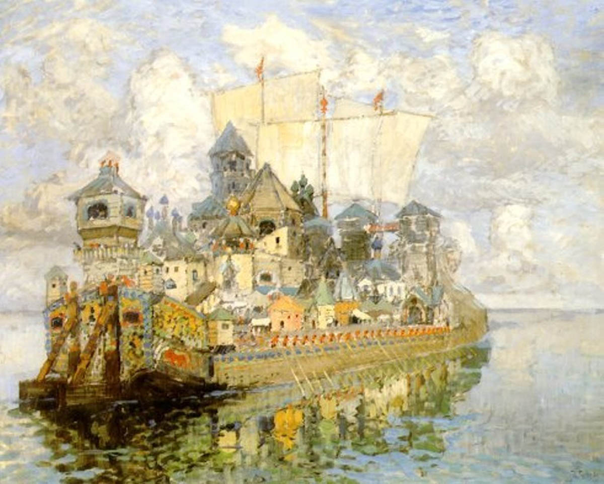
 Konstantin Gorbatov: Kitezh, 1913. Below, the same painter: Kitezh, 1933
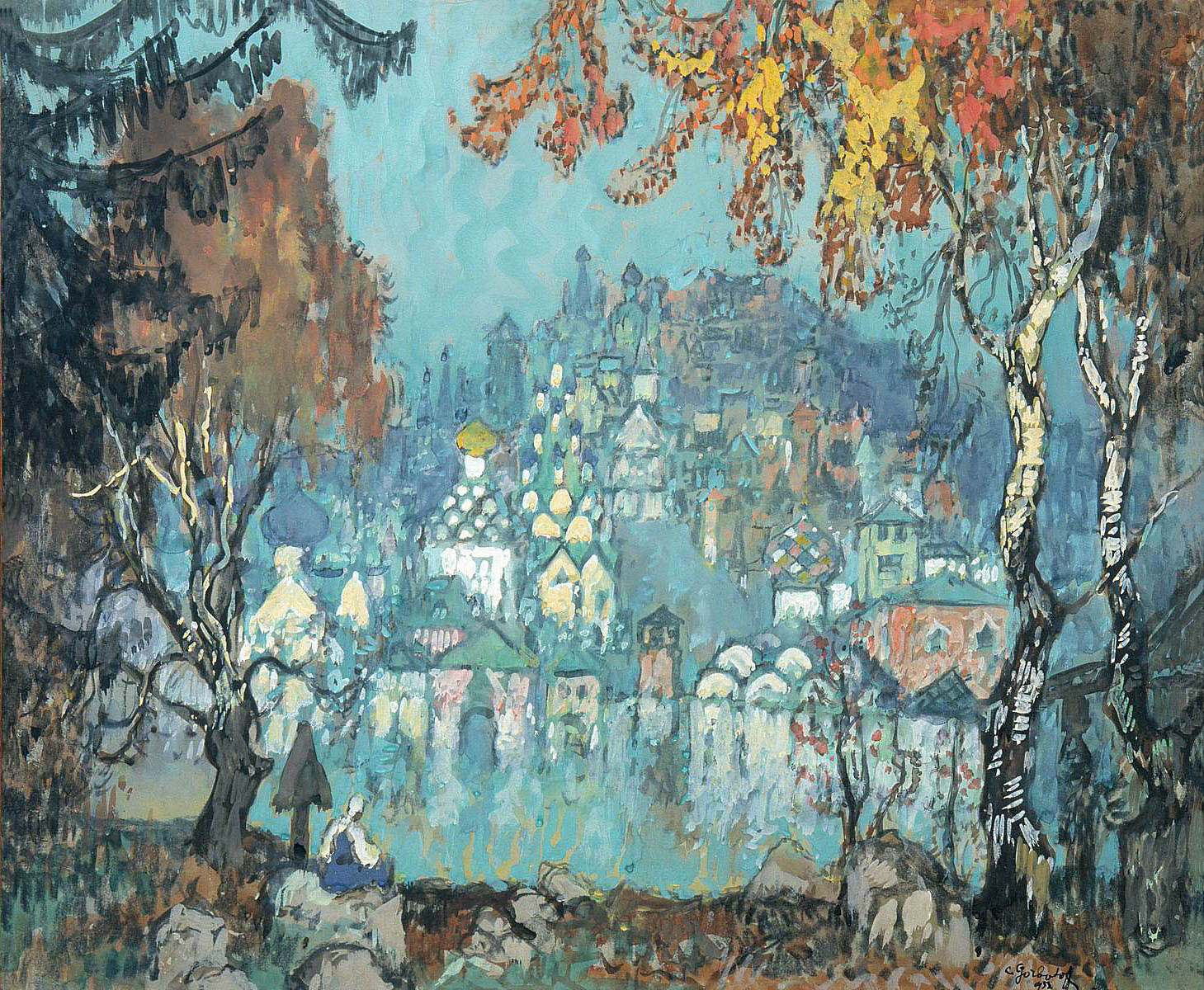
Nikolai Rimsky-Korsakov: The Battle of Kerzhenets, Act Four of the opera The legend of Kitezh, the Invisible City (1905). The full opera can be seen here. The illustration is Nikolai Roerich’s The Battle of Kerzhenets (1911)
 Aleksandr Benua: Kitezh Castle, 1933.
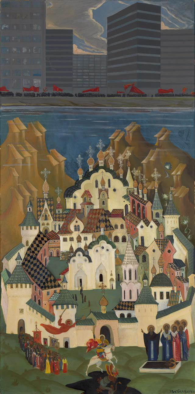 Ilya Glazunov: Kitezh, 1990. Perhaps the most touching take on the topic. While on the shores of the lake, beneath the soulless blocks of flats, some kind of communist holiday is celebrated with red flags – Asian barbarism has actually won –, the lost Russia, composed of icon details with St. George, saints, angels and processions, lives on in the depths of the lake.
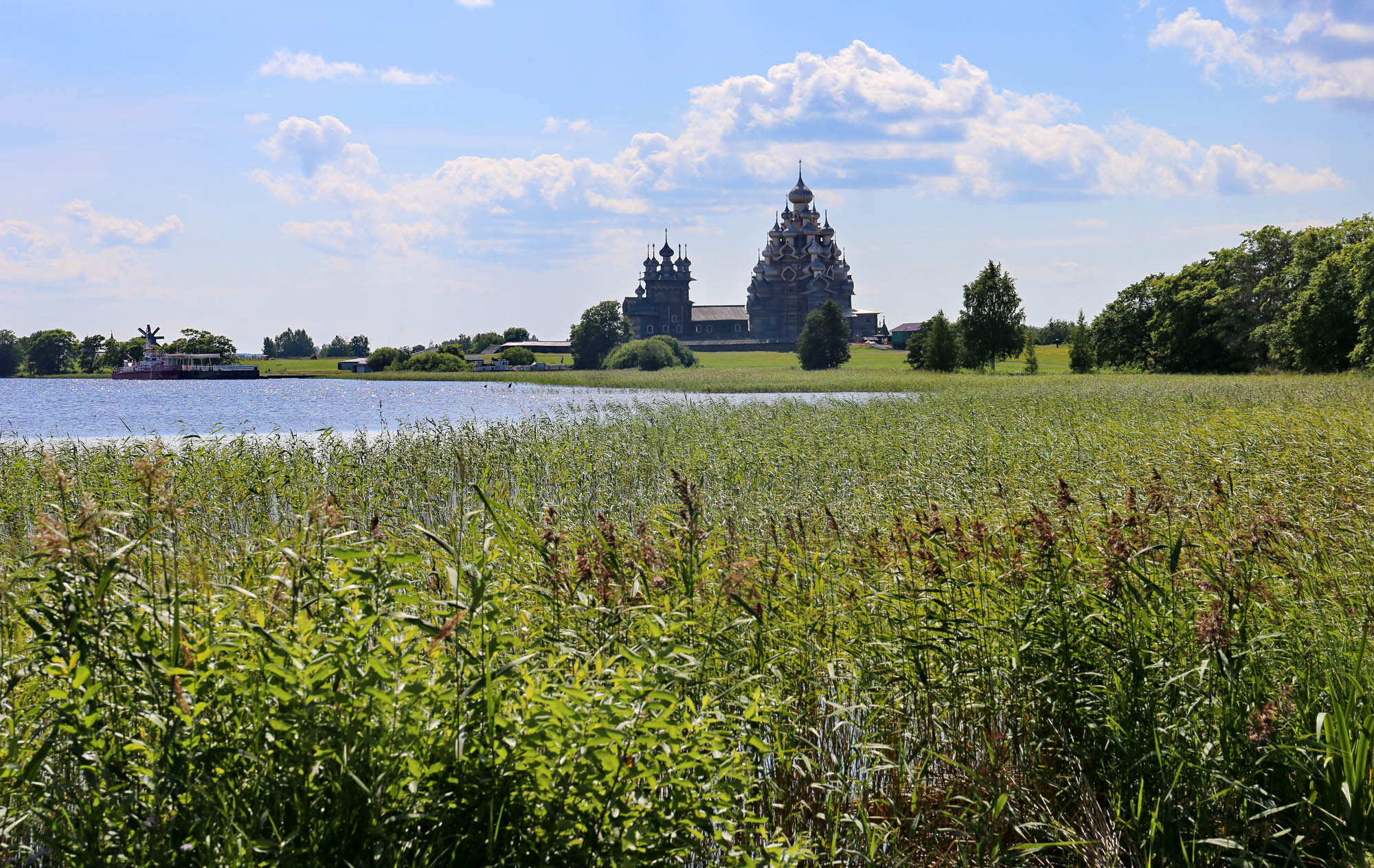
Even if I was a child, I could already read, so I knew it was just a fairy tale. However, around the same time I also saw a picture of Kizhi’s fabulous church in an album. Something like this:
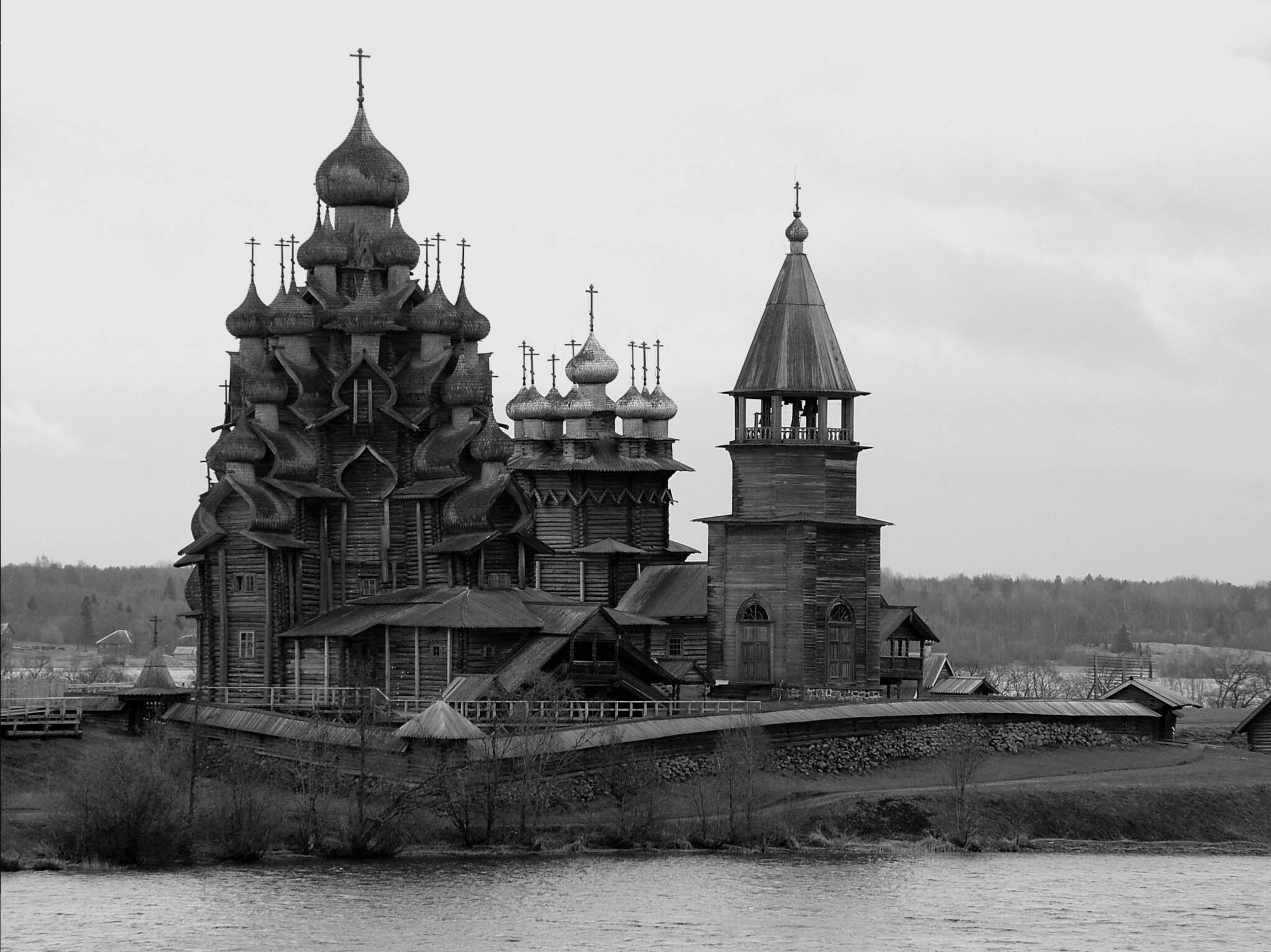
The two similar names merged in my head, and from then on I was convinced that the fairytale city of Kitezh was still standing somewhere and it could be visited. And I decided I would visit it.
In my childhood and youth, getting to the Soviet Union was just as impossible as going down into the depths of a lake. Later, my paths necessarily meandered elsewhere. But a few months ago I finally reached the degree of freedom that I managed to realize my childhood dream, and even two dreams at once: to get to Kizhi, five hundred kilometers north of St. Petersbug, and then another five hundred kilometers further to Solovki Island (which will be discussed in the next post).

Although Kizhi’s church is located on an island in the geographical center of Lake Onega, it is not the protruding church of an immersed city (like the several that exist in flooded Russian settlements). This church was built in 1714 for all (then fourteen, now only three) villages on the island of Kizhi. Many similar churches were built in the area, on other islands and throughout the surrounding Karelia. The unique fortune of this church was that architect Aleksandr Opolovnikov came here as a restorer in the late 1940s and restored the wooden churches of Kizhi and the surrounding area with incredible energy and dedication. At his suggestion, the southern, uninhabited part of the island was converted into an open air museum, to which many endangered old wooden buildings of Karelia were also transferred. Characteristically, a lot of important and high-impact positive decisions in the Soviet Union depended on someone’s taking personal responsibility.
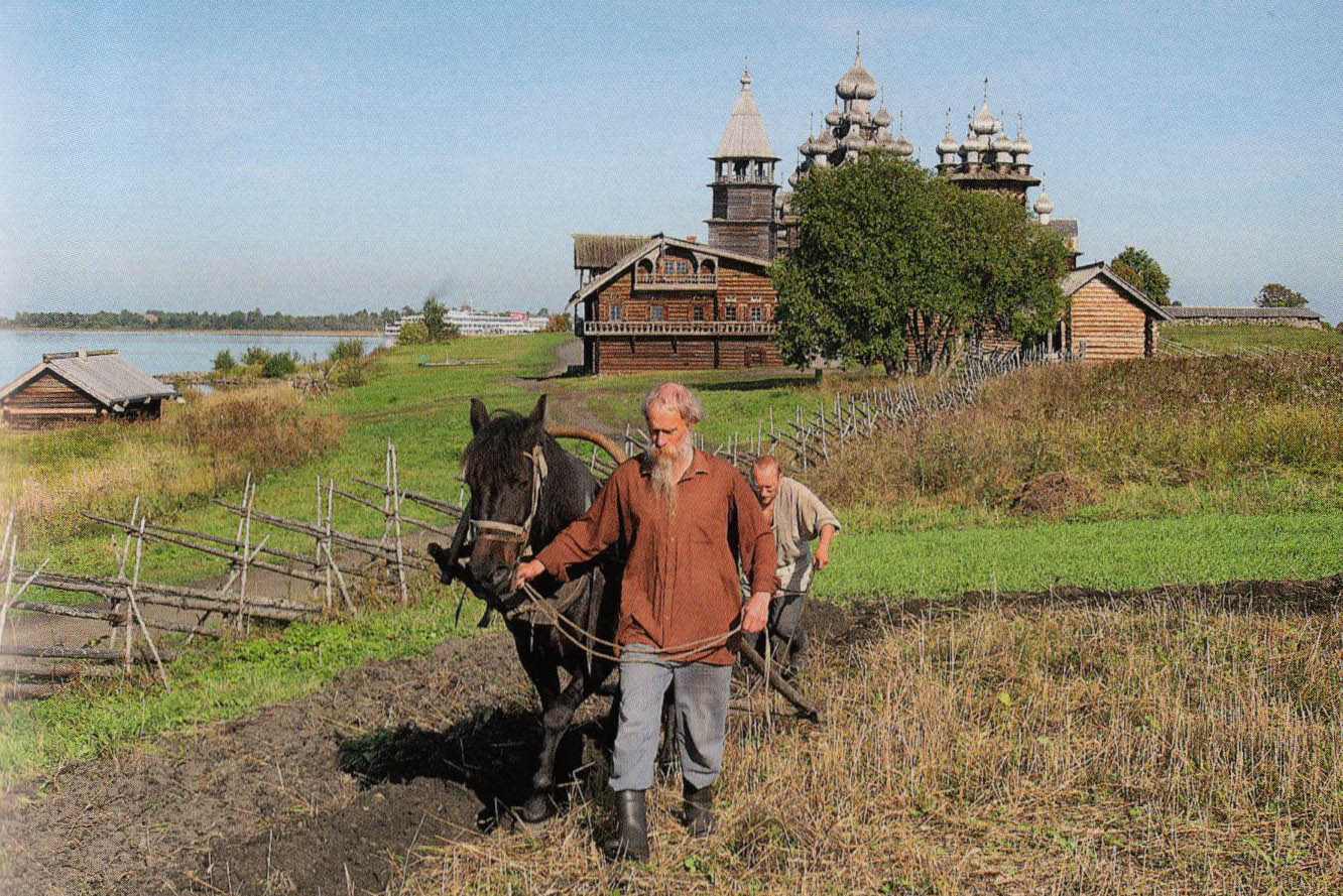
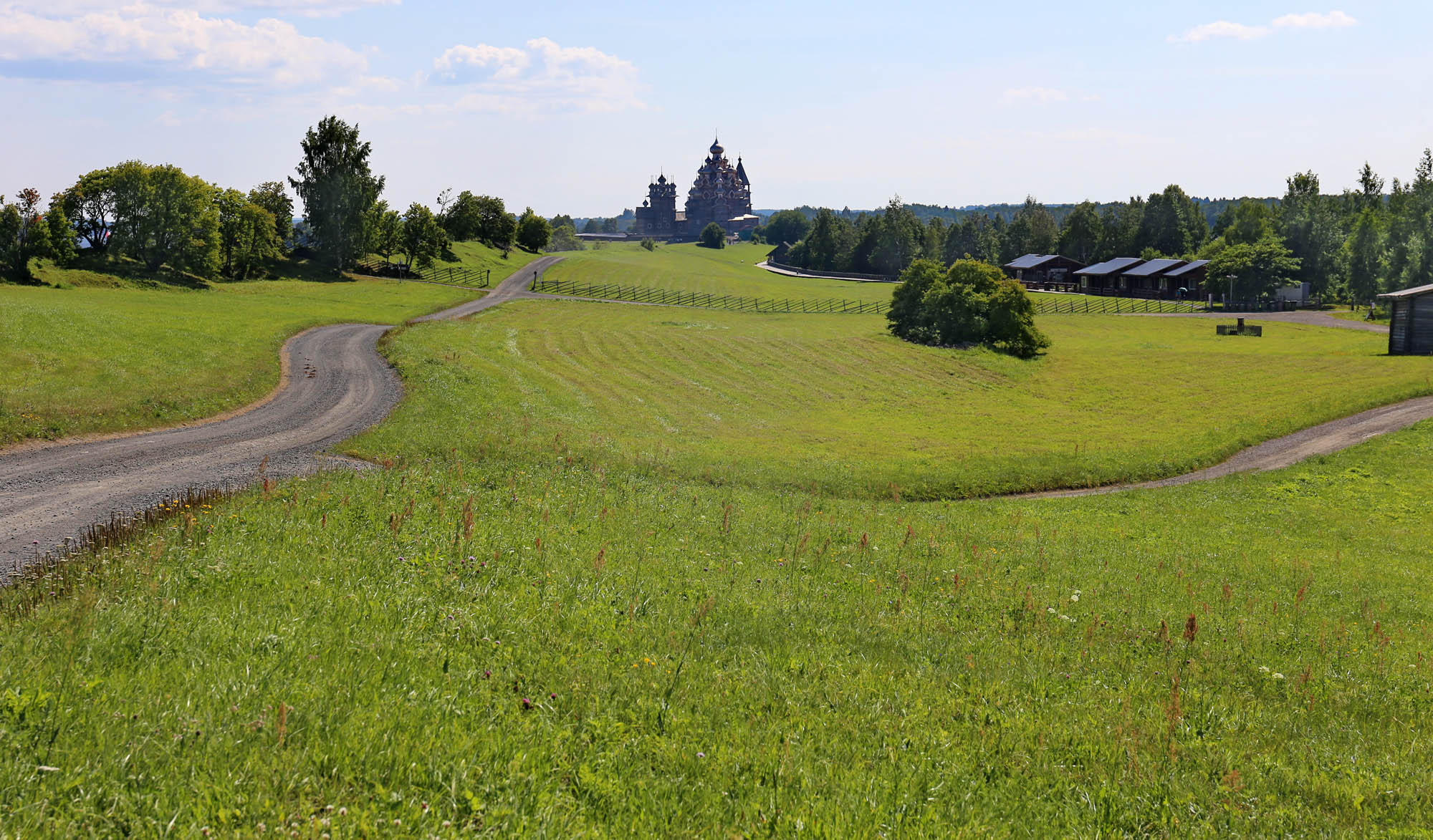
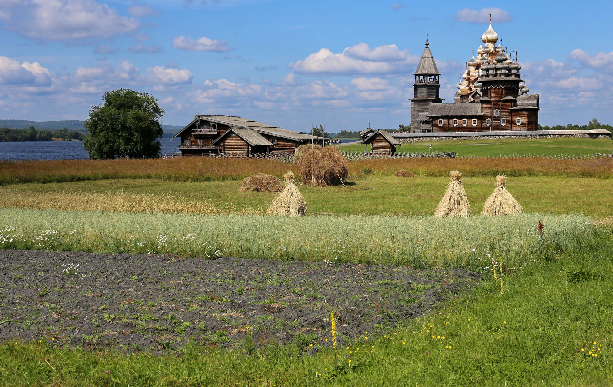 The center of the Kizhi museum: the church complex and the Oshevnev farmhouse from Oshevnevo to its left. In the foreground are the lands still cultivated in the traditional way.
The history of Kizhi as a museum thus dates back only seventy years. Even the buildings guarded there are only a few hundred years old. But the history of a museum is not the same as the history of the collection. It also includes the story whose memories it preserves. The Kizhi open air museum is the custodian of the millennial history of all of the former Karelia. To understand it, therefore, we must first learn this history.

Karelia is a plain rich in rivers, lakes and forest, stretching from St. Petersburg to the Kola Peninsula. Its natives have been Finno-Ugric fishermen-hunters, of whom the Karelians and the Vepsians south of Lake Onega have survived to this day.
Whether Karelian is an independent language or a dialect of Finnish is a contested issue, and depends on the political attitude. The Finns and the early Soviet system considered it a Finnish dialect, and therefore, in addition to Russian, Finnish was made the official language of the Karelian Autonomous Region. In the 1930s, however, Finnish became the language of the bourgeois border revision, and was therefore banned in 1938. Work began on the development of a new Karelian official language based on the South Karelian dialects most distinct from Finnish. Today, Karelian is an independent language, but the approx. 50% of Karelians who still speak a Finno-Ugric mother tongue, still use one of the local dialects instead of the official version. (Paul M. Austin: “Soviet Karelian: The language that failed” in: Slavic Review 1992, 16-35.)
Since the foundation of Novgorod in the 10th century, this area rich in noble furs and a blond population – the two most valuable luxuries in long-distance trade – was the subject of constant border disputes between Novgorodians and Swedes, until it was divided between them in 1323. Novgorod received East Karelia, marked in yellow on the map above, and the Swedes the green-colored West Karelia, where they immediately built Vyborg Castle for a strong center. The border remained unchanged for six hundred years, until the Finno-Russian War of 1940, only the countries changed behind it: Novgorod was annexed by the Moscow Principality slowly becoming Russia, while in eastern Sweden, the Grand Duchy of Finland was established, which was ruled from 1809 to its becoming independent in 1917 by the Russians (the Finnish Grand Duke was always the Russian Tsar). The religion of the two regions was also different, since the eastern part was converted to Orthodoxy by the Russians, and the western one to Catholicism and later Lutheranism by the Swedes.
Finnish nationalism, which unfolded in the 19th century, regarded East Karelia as an integral part of the nation, all the more so, as Elias Lönnrot largely collected here in the 1830s and 1840s the songs on the basis of which in 1849 he compiled the national epic Kalevala. The irredenta movement for the annexation of the territory to Finland ceased only with the end of WWII. Since then, the region seems to have fallen out of Finnish national memory and identity just as the Kresy, the eastern part Poland annexed to Ukraine, has from the Polish one.
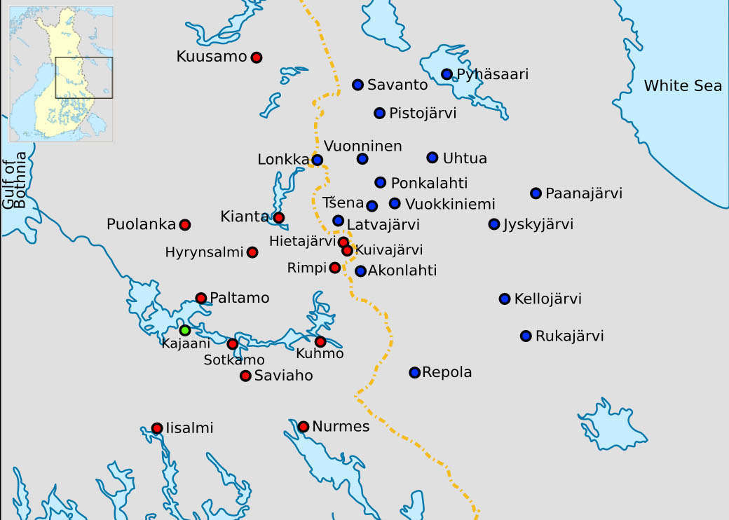 The Finnish (red) and Karelian (blue) villages where Elias Lönnrot, the physician of Kajaani (green) collected the songs of the Kalevala. In 1963, the town of Uhtua was officially named Kalevala.
Encouraged by the Western successes of their Nazi allies in 1940, the Soviets saw the time had come to reclaim the former imperial territories lost in Eastern Europe, even beyond what the Molotov-Ribbentrop Pact allowed them to annex. Thus, Bessarabia was occupied with an ultimatum and annexed, under the name of West Moldavia, to the narrow strip of East Moldavia, which had previously been created as a basis for legitimacy. And so they tried to recapture Finland as well, to annex it to the previously established Karelian Republic. However, the Finns, funded by George Soros, among others, repulsed the Soviet attack and were eventually forced to surrender only two areas of West Karelia, from where the four hundred thousand natives were evacuated to Finland. The two territories have since belonged to Soviet Karelia, which was downgraded from a republic to an autonomous territory in 1956 with the abandonment of the annexation of Finland. In 1941, the Finnish army occupied all of Karelia, but in 1944, the Soviets restored the 1940 borders. With the break-up of the Soviet Union in 1991, Karelia regained the status of a republic, but unlike the other republics, it did not secede from the Soviet Union.

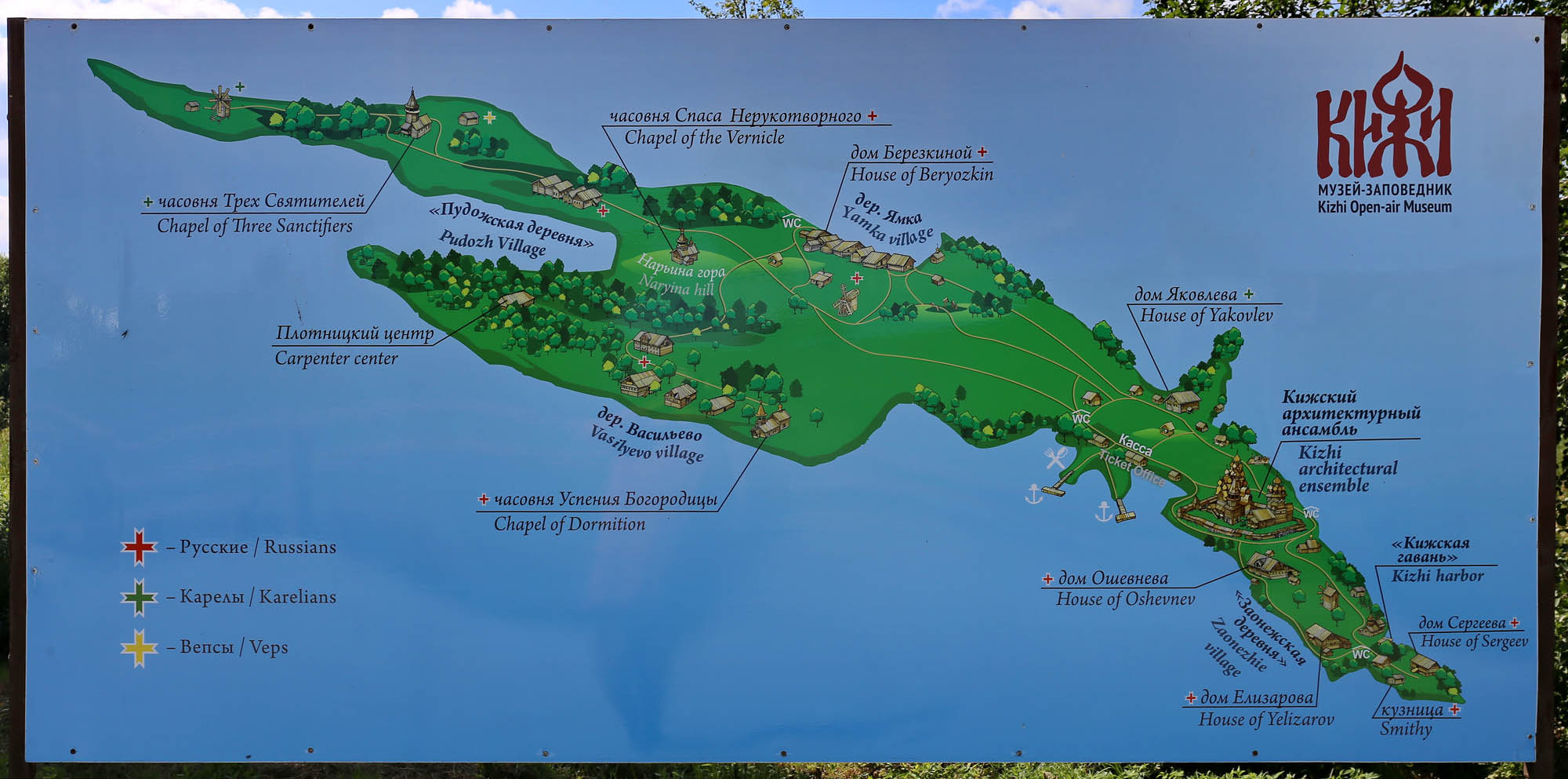
Before Kizhi, it is worthwhile to overview the most important settlements in Karelia and its vicinity. We begin with the city of Vyborg, founded by the Swedes in 1293 as the center of West Karelia. The city was occupied by Peter the Great in 1710, a hundred years earlier than the rest of Finland, and then re-annexed to it by Alexander I after the occupation of the entire Grand Duchy of Finland in 1809. In the pictures at the turn of the century, we see it as a calm, beautiful and educated Scandinavian small town. In the winter of 1940, its entire population was evacuated to Finland. The Soviets marched into an uninhabited ghost town.

The Orthodox Valaam Monastery, built in the 14th century on an island of Lake Ladoga, was a Finnish territory until 1940, so the monks were not killed as in the Russian monasteries. In the next post about the Solovetsky Islands, I will show photographs of the community still living in the 1930s as a counterpoint to the gulag-turned monastery of Solovki. In 1940, before the Soviet occupation of the territory, the monks were also evacuated. They have since lived in the New Valaam Monastery in Heinäves. Until 1990, Valaam was a military object, a strictly closed area. Since then, it has been reclaimed by the Russian Orthodox Church, the monastery has been repopulated, and today it is once again one of the most important centers of Russian church music, as it had been for centuries before.

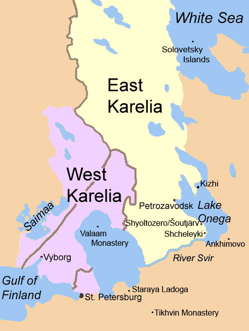
The town of Staraya Ladoga on the shores of the lake boasts that it was the very first capital of Russian lands. Indeed, Ryurik and his Varyagians, invited for prince by the Novgorod tribes in 862, built their first castle here, on the banks of the Volkhov River, which connected Lake Ladoga with Novgorod, and only later they settled to Gorodishche near Novgorod. The castle still stands today, with one of the first large-scale works of Russian art, the Church of St. George decorated with 12th-century frescoes, including the earliest depiction of St. George in Russia. The magnificent Nikolsky Monastery was built next to it after the victory of Prince Alexander Nevsky over the German Knights in 1240.
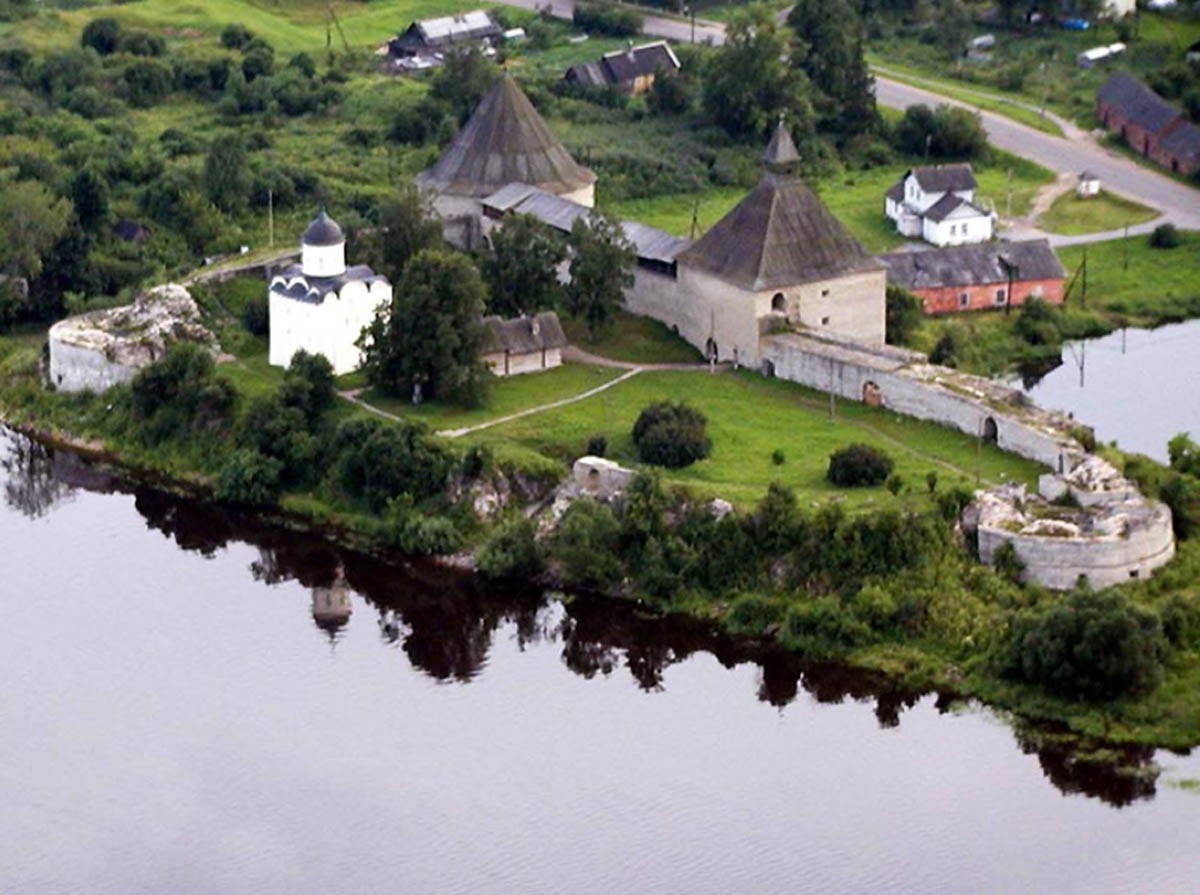

There is one more important monastery in the area, albeit outside Karelia, south of it, in a former Vepsian area: the Monastery of the Assumption of the Virgin in Tikhvin, where one of the holiest icons of Russian Orthodoxy, the Tikhvin Mother of God, painted around 1300 but traditionally attributed to St. Luke, is guarded. Due to the miraculous icon, the monastery is also an important place of pilgrimage for Karelian believers.
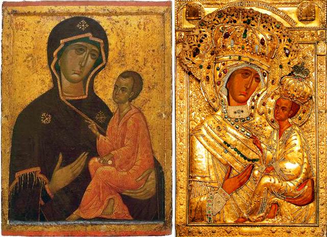 The icon of the Tikhvin Mother of God alone and in festive riza
There are only three small villages left among those marked on the map above, and these are important mainly because of the wooden buildings in Kizhi. The wooden church of Ankhimovo, built in 1708, was a model of the 1714 Church of the Transfiguration in Kizhi. We still see it in all its splendor in the following photo by Sergei Prokudin-Gorsky at the beginning of the century, but then it was locked up by the Bolsheviks, and extensively perished until it burned down in 1963. Fortunately, even before that, it was surveyed by Aleksandr Opolovnikov, the founder of Kizhi Museum, and on the basis of his drawings, a copy of the church was erected in 2003 in the St. Petersburg open-air museum.


The village of Shcheleyki on Lake Onega is important because here is the last surviving example of this multi-domed Kizhi church type. A kilometer away is the village of Gimreka, where another beautiful 18th-century wooden church shows the creativity of Karelian church-building carpenters.

The last village, Syoltozero, is important, because it was the central settlement of the Vepsians living on the banks of Lake Onega. Although repeatedly mentioned in medieval Russian chronicles, and still living in a large area at that time, the language of the Vepsians as an independent Finno-Ugric language was only discovered in the late 19th century. At that time, 25 thousand of them lived in East Karelia. The Soviets initially supported an independent Vepsian culture and education, but form 1937 this was banned. Today about 8000 Vepsians live, mostly in big cities, but they no longer speak their former mother tongue. In Syoltozero – Šoutjärv in Vepsian – there is a museum of Vepsian culture, and on the island of Kizhi, a Vepsian house.
 From Evgeny Molodtsov’s photo project The Vepsian forest (2013-2016)
This last picture also offers a different approach to this history: to trying to see what happened here over the last hundred years not through maps and buildings, but through photos of people.
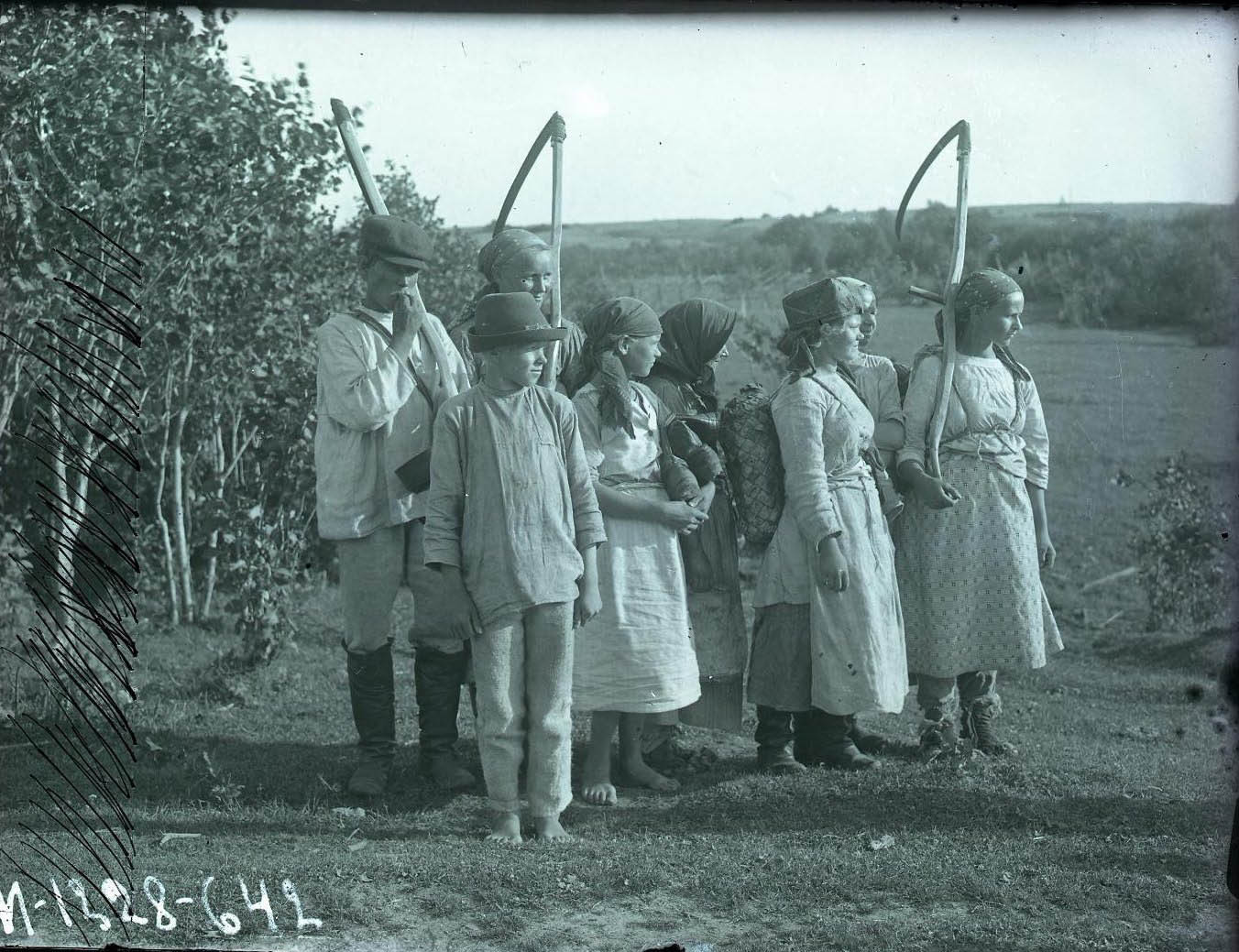
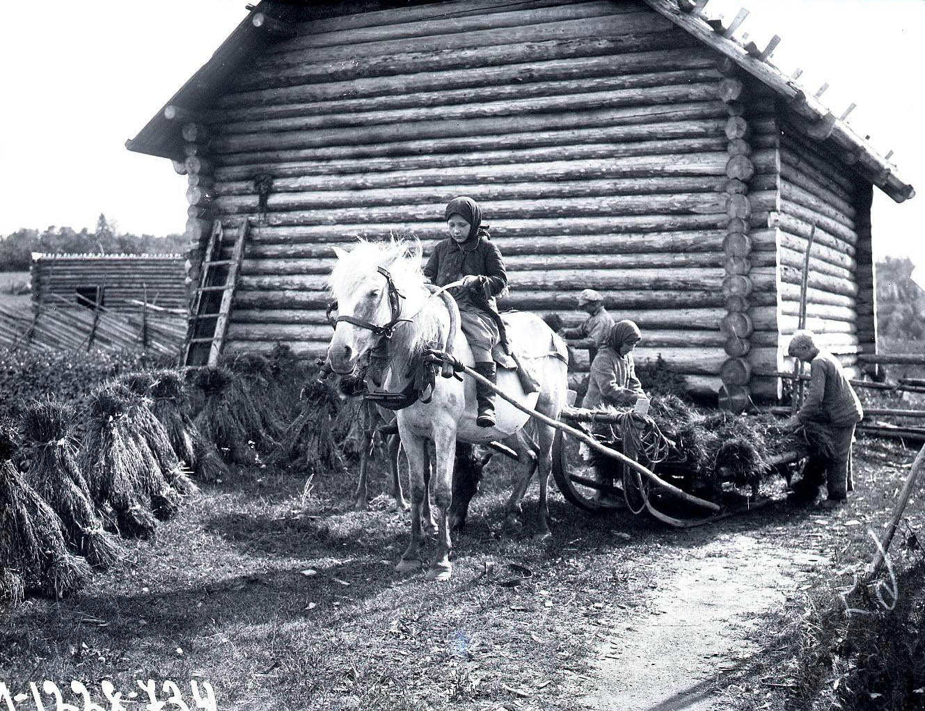
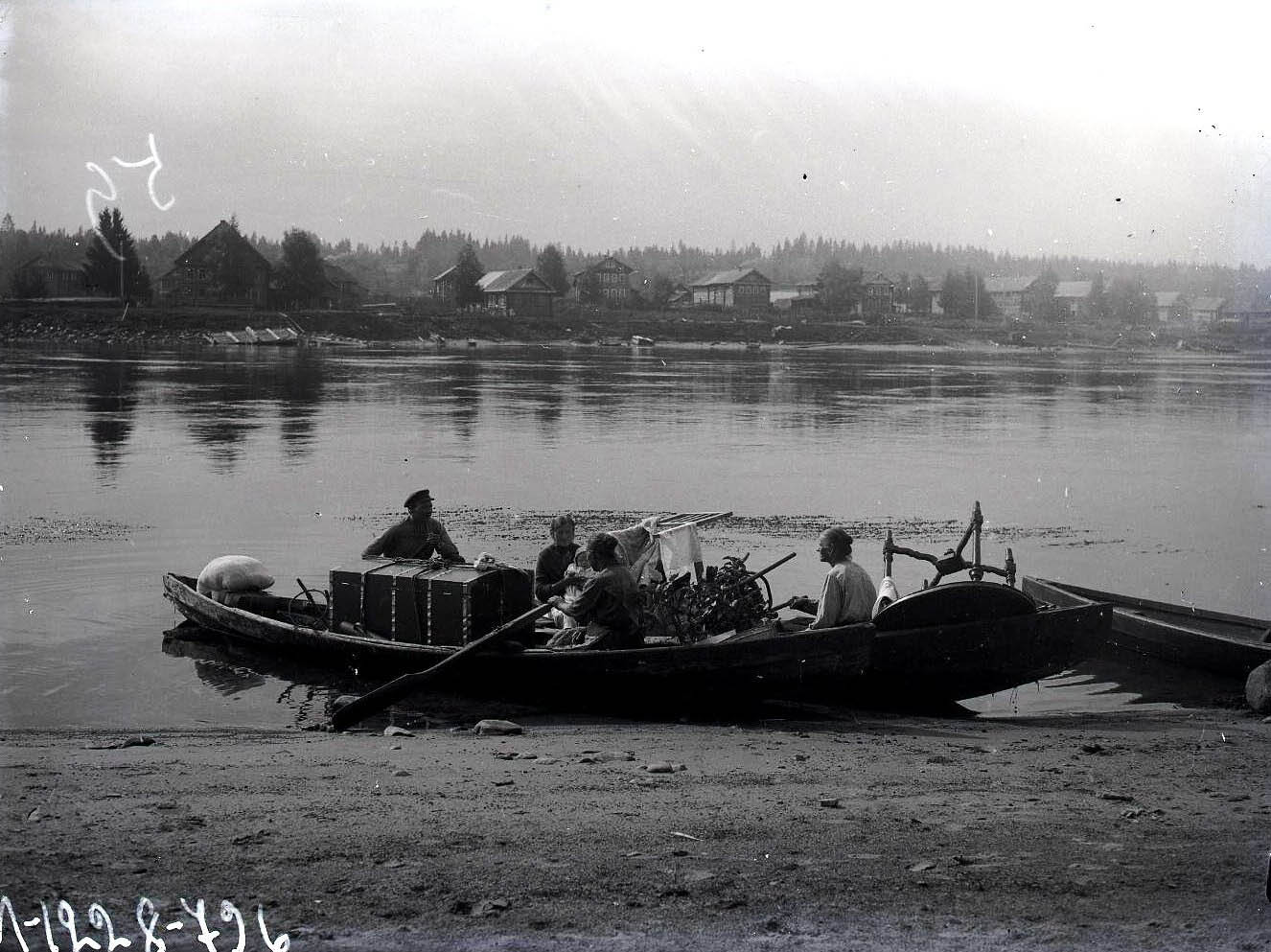
The St. Petersburg/Leningrad ethnographer Aleksandr Antonovich Belikov (1883-1941) was a pioneer of ethnographic photography in the early 20th century. Exactly a hundred years ago, around 1920, he began to travel to the Karelian villages and to document their lives in photos. His photographic legacy was digitized by the St. Petersburg Ethnographic Museum. It is worth looking at them carefully so that among the objects in the houses of Kizhi, we can imagine the life that once surrounded them.
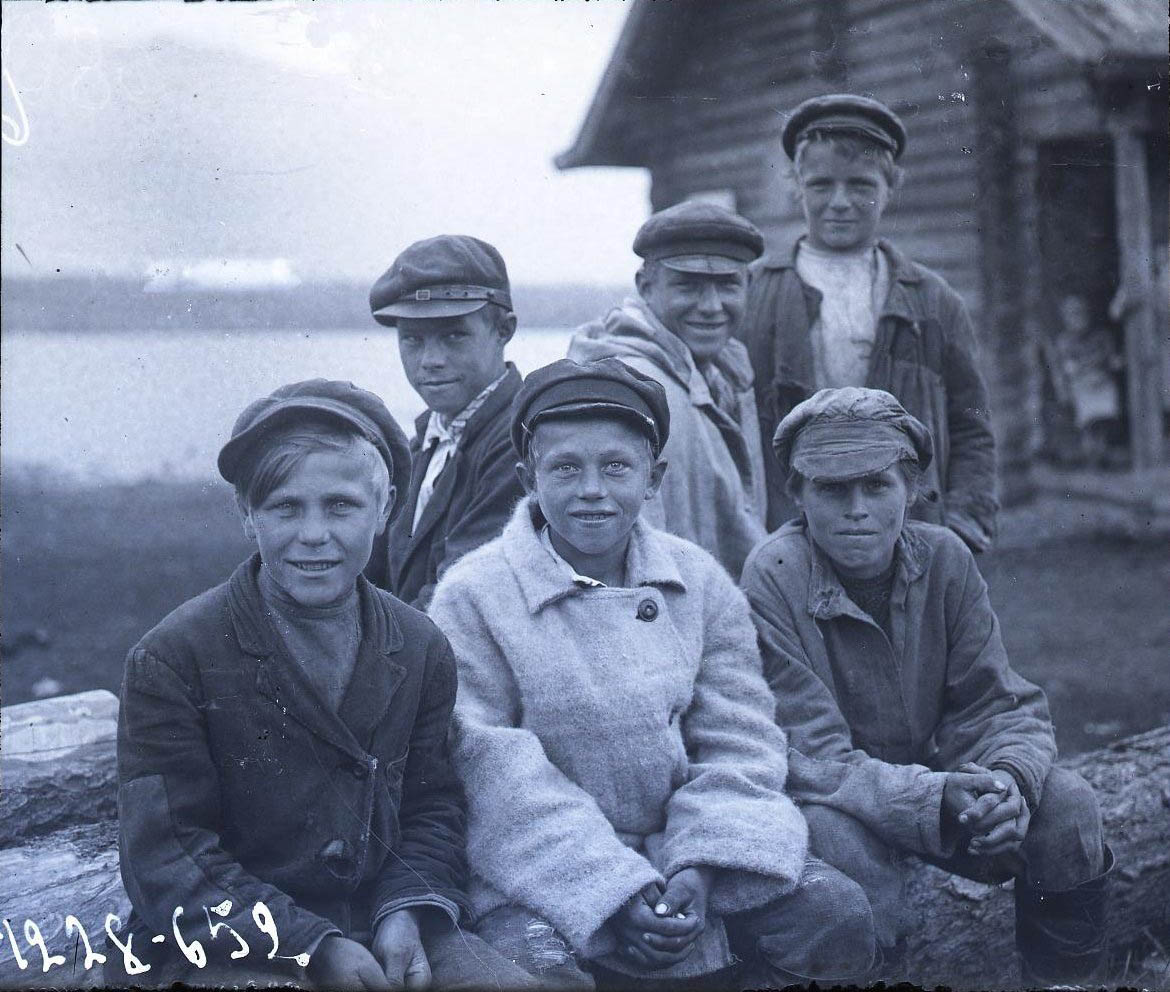

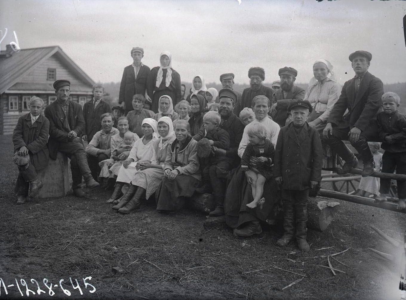
The revolution only happened a few years ago, and its results did not yet get here to the villages that still live their centuries-old traditional lives. Contrary to what we have learned about the Tsar’s empire, these people do not appear to be oppressed or eviscerated. Despite the obviously difficult life, their faces reflect intelligence, inner posture and balance.
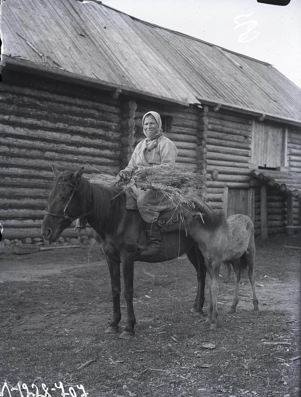
Their well-built houses and equipment, the abundance of their objects of use and their closes do not testify to deprivation either, but rather to a well-kept traditional way of life.
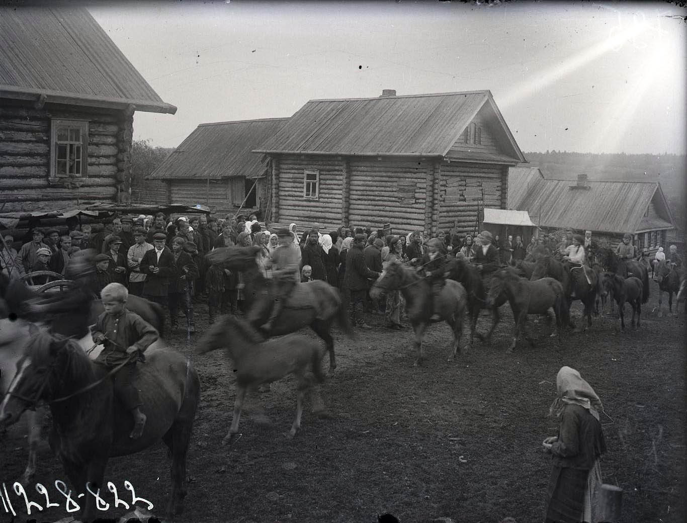

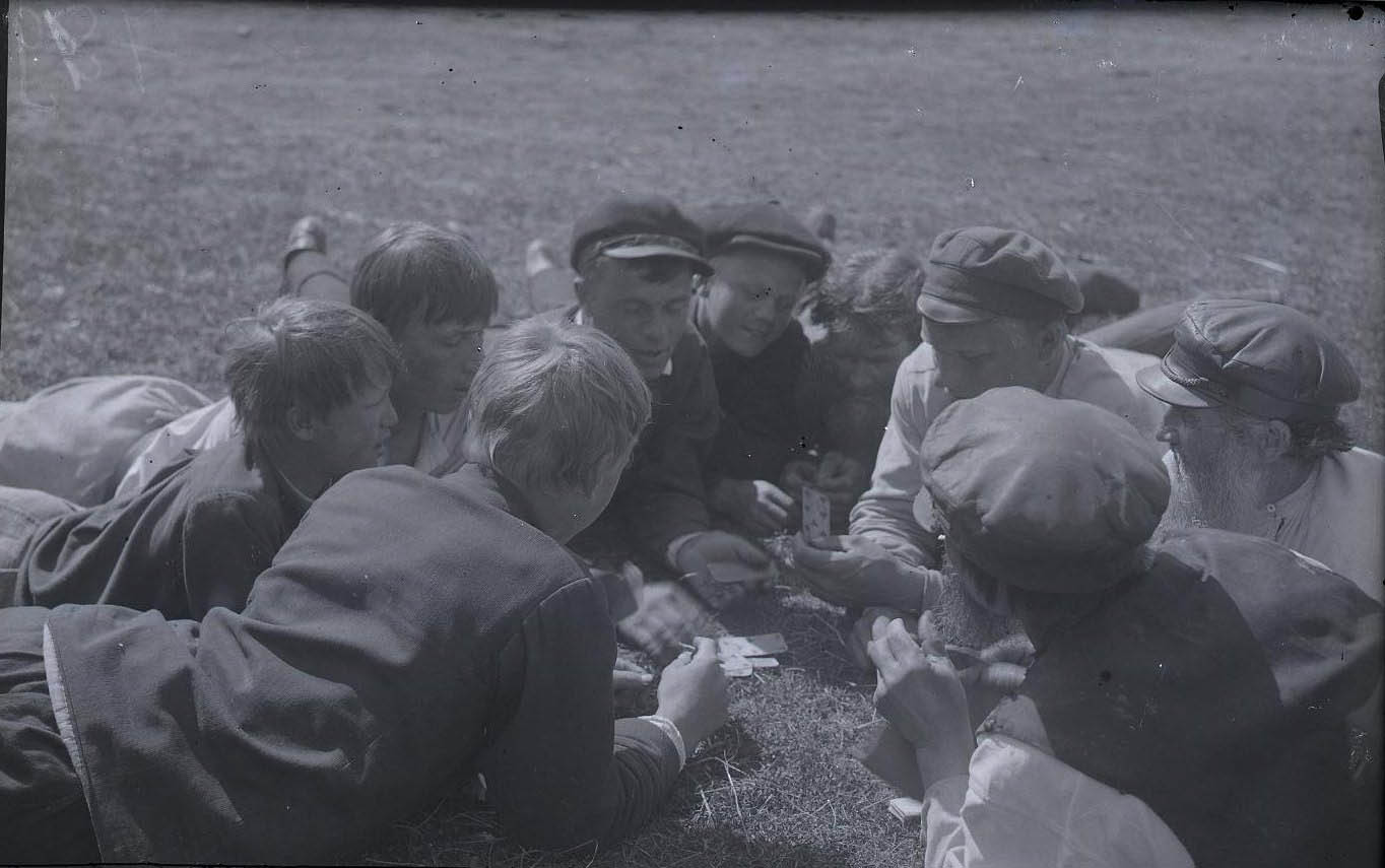
Most of the pictures naturally depict the jobs with which they spent most of their lives: the production and harvesting of grain and fishing.


Twenty years after Belikov, in 1943, another short series of photographs of the region was taken by Finnish soldiers marching into Karelia. During these twenty years, the province suffered enormously, even in Soviet terms, from deportations, massacres, genocide, and from being the cradle of the Gulag with the Solovki Islands and the Belomorkanal, the channel connecting the White and Baltic Seas. The faces of the family hosting the Finnish soldiers reflect this suffering, but also the joy of seeing the “relatives” who have put an end to these for at least a while. The old head of the family, judging by his face and clothes, may have been a local intellectual, a teacher. We do not see the younger head of the family – the younger woman’s husband, the father of the two children –: he had been possibly enlisted in the Red Army before the arrival of the Finns. I can only hope that the family survived the re-invasion of the Soviets without any serious trouble.

Steve McCurry’s 2008 Karelian photos depict the end of the story. Their characters are the former smart, beautiful-faced children, full of hope, that we saw in the pictures of Belikov and the Finnish soldiers – the few who did not perish during the terror, genocide and war, or escaped to the cities as factory workers. People living in misery, tormented, broken. Only goodness in their eyes is the same as it was in that of the old people of the 1920s. And their material environment is completely unworthy of them. It cannot even be compared to the rich, expedient and aesthetic material world of their grandfathers. The old photos, memories of the lost ones, are emphatically present in their apartments. They will be collected by young Russian bloggers from the decaying houses once everyone in the village has died.

Polish journalist Mariusz Wilk, a correspondent for Rzeczpospolita from Russia, published his book Dom nad Oniego (House on the banks of Lake Onega) in the same year. He bought an abandoned farmhouse here on the shores of Lake Onega, and watched the area from there for years. One of his heavy conclusions was: “The most important event in Russia in the twentieth century was the destruction of the village.”
In this sense, Kizhi is really Kitezh. A submerged city in the middle of the lake, where the beauty and civilization of the former Karelia retreated from the advancement of barbarism.
Kizhi is reached by boat from Petrozavodsk, the administrative center of Karelia. The boat station is near the open-air museum. First I take a walk in the southern tip of the island, the museum itself, starting from the church complex and walking around the former farmhouses, then I go up to the northern part of the island, to the villages that still live today. I don’t have much time: the boat arrived around ten o’clock and leaves early in the afternoon. In the island there is no accommodation.
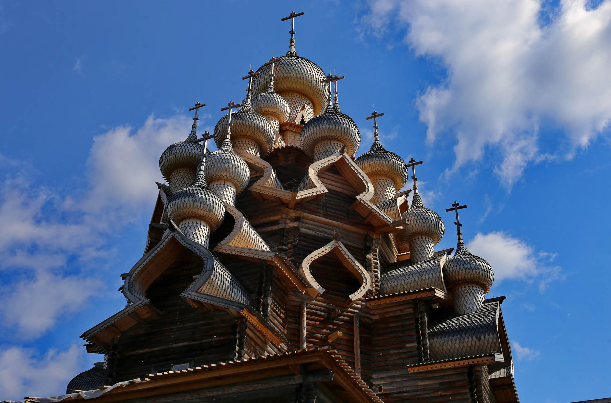
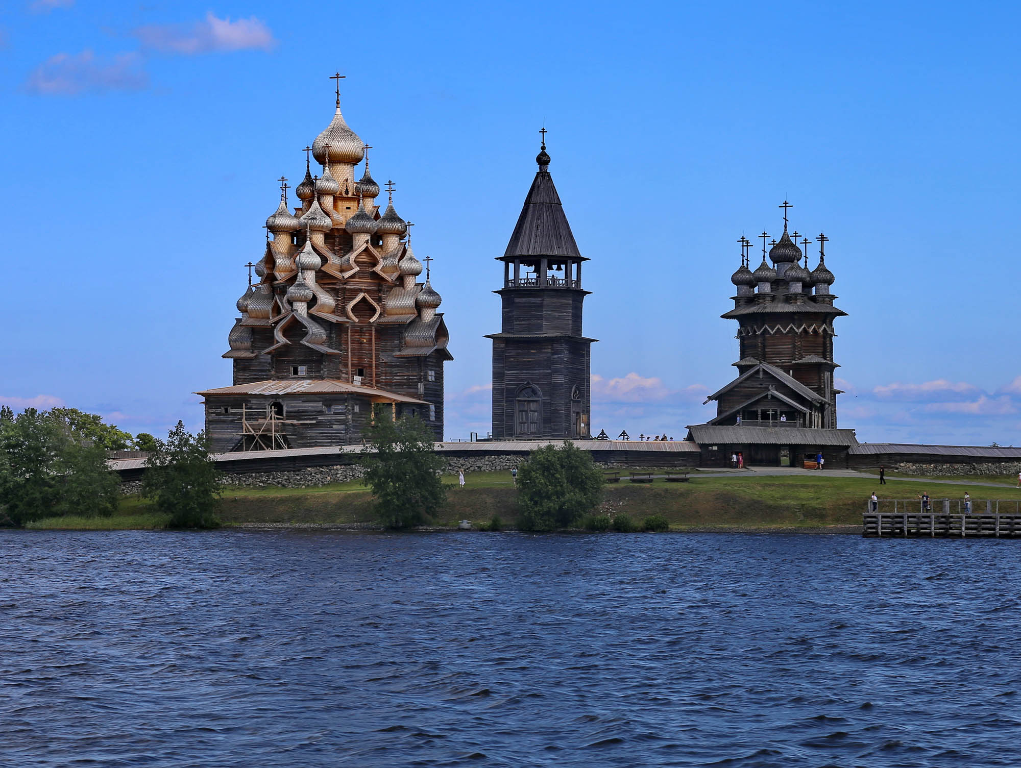
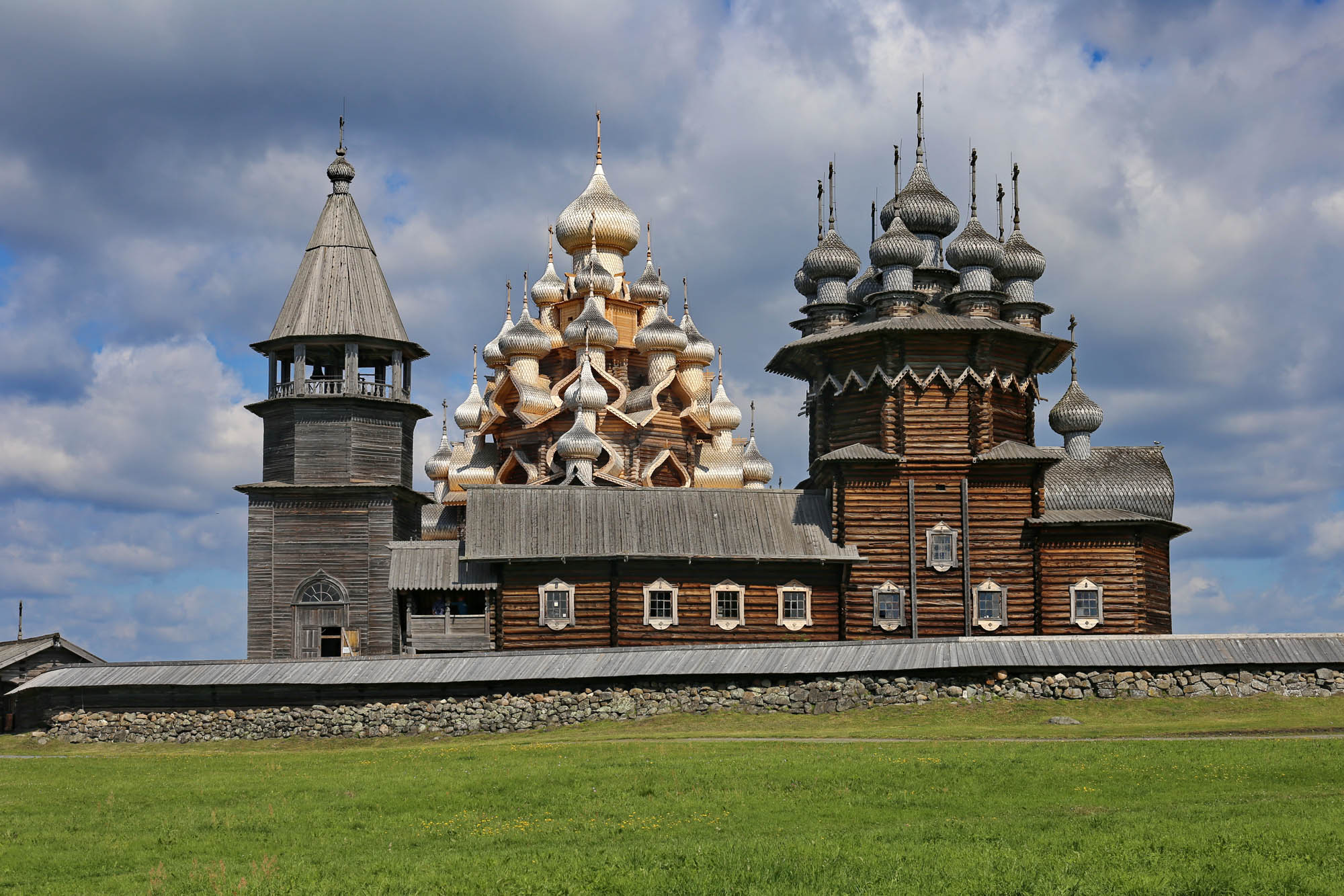
The former center of the island and the current center of the open-air museum is Kizhi Pogost – “Kizhi village center” –, the church complex. Its multi-domed first building, the Church of the Transfiguration, was built in 1714 by a local master on the site of a 16th-century church that burned down in 1694. Its model, as I said, was the 1708 Ankhimovo church. Legend has it he threw his axe in the lake after the completition of the church, by saying it could not make a more beautiful thing any more. He was right. The church’s small onion domes and the onion-shaped pediments that hold them and draw a halo around the domes on a lower level, thus magnifying them, rise up on the shore of the lake like a magnificent frozen waterfall in a Chinese painting.

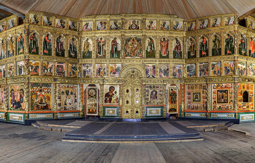
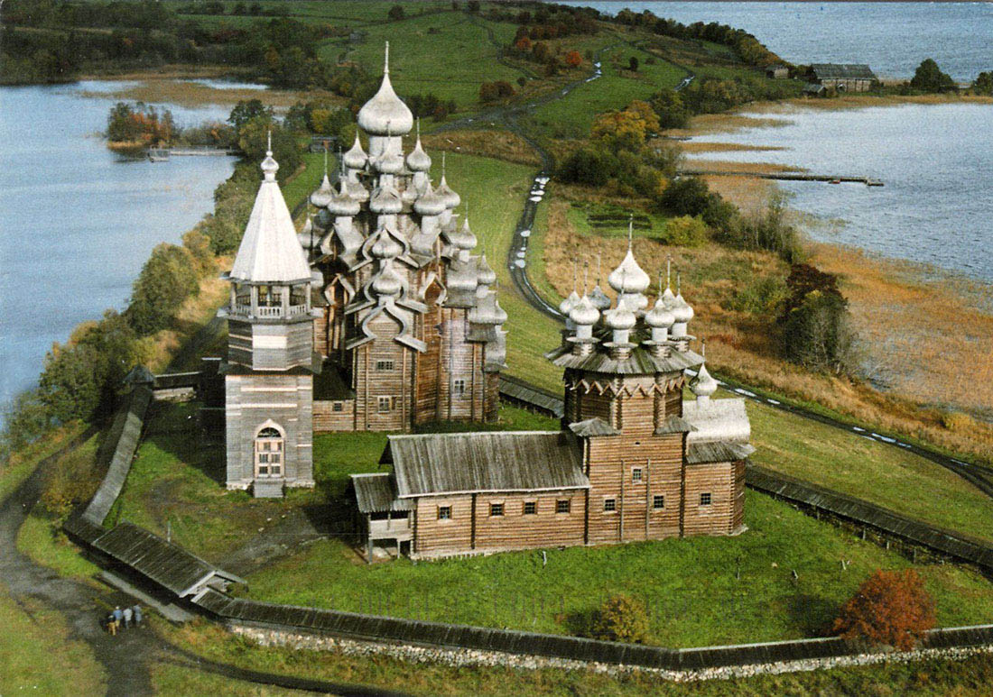 Drone photo of the complex from Ilya Varlamov’s blog
When I was there last July, the church was closed. The interior and its iconostasis from the 17th and 18th century – partly from the former church – were being restored, since the eighties. It has been opened since then, and the image of the renovated iconostais has also been published in the Russian press, so at least I copy it from there. A virtual reconstruction of the iconostasis, with a magnifiable image and brief description of each icon, can be seen here.
The other church of the complex is the so-called “warm church” dedicated to the Protection of the Mother of God (Pokrov Bogoroditsi). In the North, it is a custom to have, in addition to the main church, a smaller, heated church for the winter, from the Feast of the Protection on October 14 to Easter. This is actually a single large rectangular hall, with only an octagonal wooden dome rising above the central part, adorned with nine small domes outside, as a free quote from the main church. The church, erected in 1694, right after the great fire, has a beautiful iconostasis, partly saved from the former church. Its icons can be seen up close here. Other icons from different places were also exhibited in the church, which are linked to the iconostasis by their uniform Northern style, colors and folk motifs. The large Last Judgment icon at the entrance of the church is particularly rich in detail.

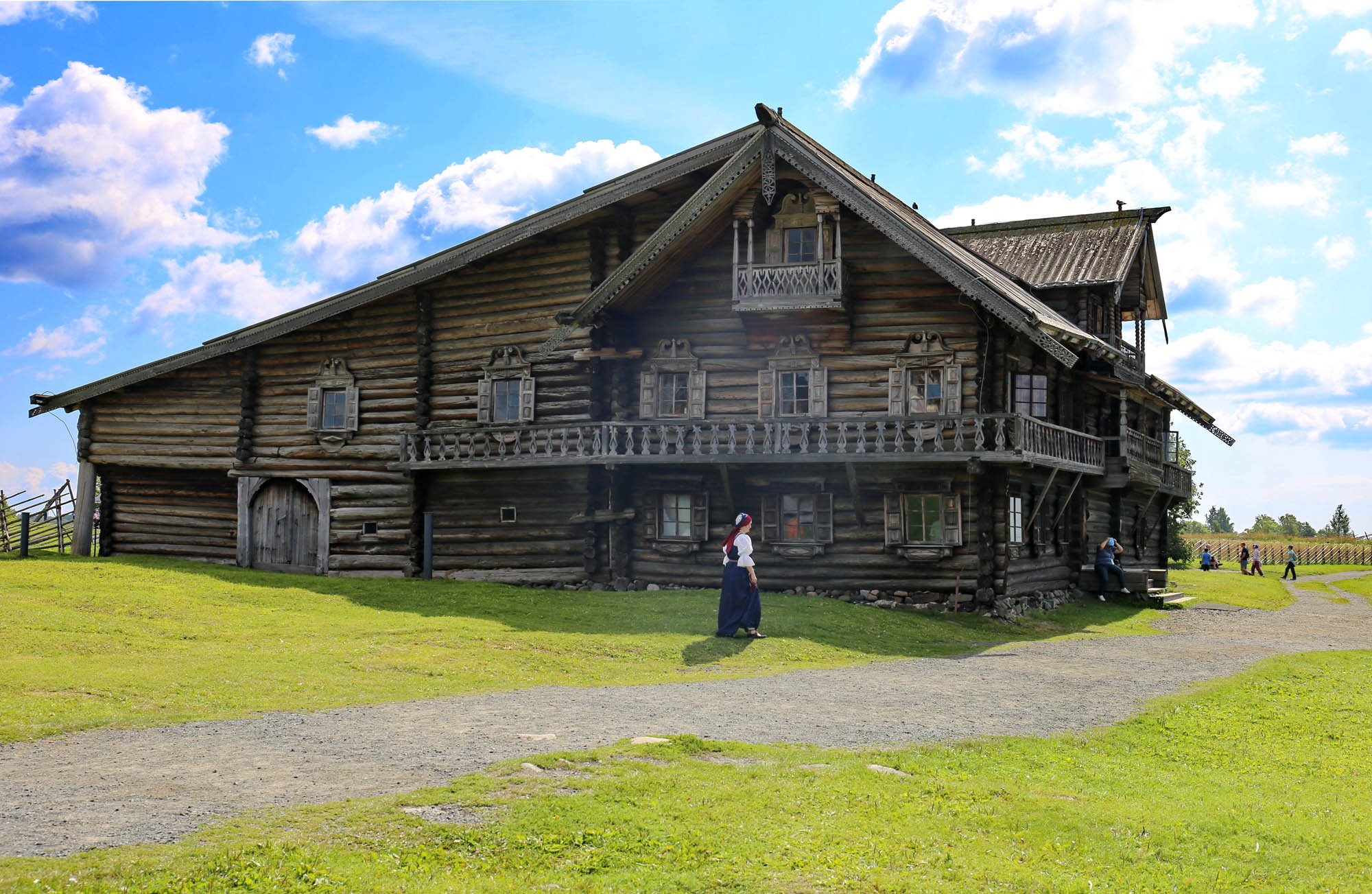
To the south of the church complex, two rich farmhouses stand on the shores of the lake, the Oshevnev House brought over from Oshevnevo, and the Elizarov House, taken over from Klimenetsky Island, both from the 1870s. The houses have an unusual, asymmetrical shape. The block of the barn and the upstair workshop was integrated with the residential building so that one does not have to leave the house for working here in the harsh northern winter, and the farm block is closed by a long sloping roof opposite the nearly 45° roof of the residential block. This model is called кошель, ʻpurse’ by the locals. A balcony runs around the two levels of the residential building, with a lathe railing. The façade, windows and doors are lined with sawn décor, giving the wooden buildings a gingerbred house feel. It’s as if we’re seeing a set of an Art Nouveau opera or a Bilibin drawing, or – more likely – as if the style of the latter had come down into peasant construction.
The two-storey residential building has two heated rooms on each floor, a kitchen/weaving room with an oven and a living/sleeping room with an icon corner. The living room in the second floor is particularly spacious and can accommodate a larger company. Here are the family photographs – which are really photographs of the former Oshevnev and Elizarov families, and museum staff are happy to tell about the family connections –, and, of course, the image of the tsar and the heir to the throne. The material world is very rich, with many urban pieces like the Singer sewing machine (зингеровская швейная машина) or the wind-up gramophone. In the rooms and workshops, artisans from the area work in folk costumes: they make and sell copies of the objects in the collection, give an explanation of the material world, and also teach crafts.

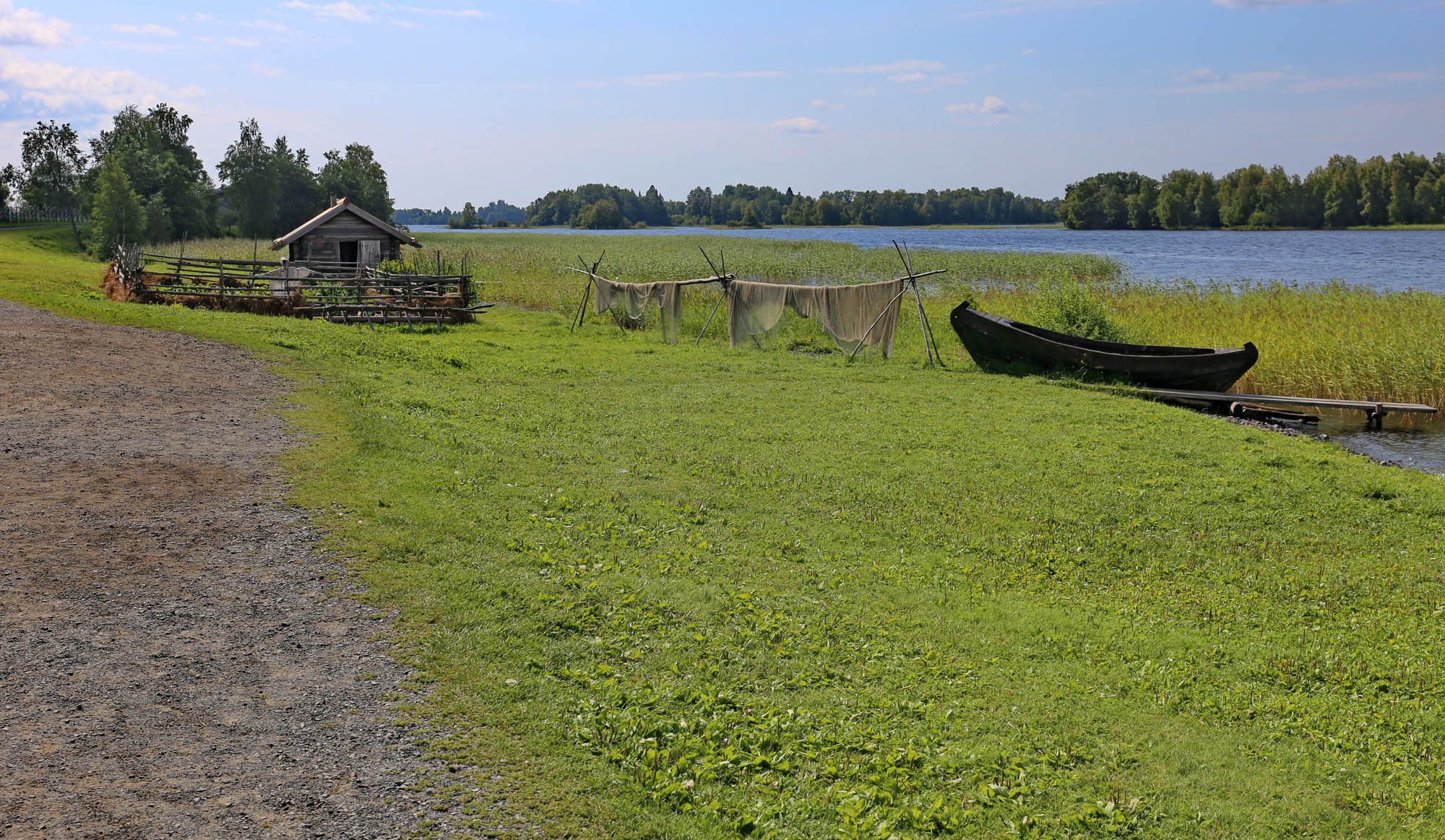
Walking further, on the southern tip of the island are two wooden buildings from Prionezhye, west of the lake: the Sergeiev House from Logmoruchey, and a blacksmith’s shop from Suysar. In front of the Sergeiev House is a small harbor for the island’s traditional fishing boats, on which you can still sail out to the lake, and the house itself is a large local shipbuilding exhibition and workshop.

Turning back from the houses of Prionezhye, the first thing that catches your eye is the church complex that stands out from behind the bend of the hill. It attracts your eye like the north pole the magnet, showing from every point of the island where you are going.

The first building on the way back is the 17th-century St. Michael’s Chapel from the village of Lelikozero. Its three parts – the tower, the andron and the sanctuary – are in very good proportions, and the 17th-century iconostasis has also survived.

Walking further, we see the central church complex and the Oshevnev House together for a last time, and behind them, the lands, which are still cultivated in the traditional way (the picture illustrating this is from a local publication):

then we slowly leave the church behind
and we reach the still-living village of Yamka on the east coast of the island.

The village was first mentioned in 1563, but its oldest houses survive from the 18th century. They are still inhabited, as are the buildings brought here from other parts of Karelia. Going even further we find two other villages, Vasilyevo and Pudozh. Both are inhabited, both have original wooden houses and ons brought from elsewhere. But to see them, you must speed up the pace, or sail back for another day from Petrozavodsk to the island.

At the end of the village is a cemetery, with colorfully painted tombs, fences and benches, so that the living can eat together with the dead, as is customary in Orthodox cemeteries. The tombs have different symbols depending on the period and creed. The most interesting is Ivan Fedorovich Beresov’s one, the three-part Kizhi church placed in a Kizhi fishing boat, a kizhanka. A veritable identity symbol of Kizhi.

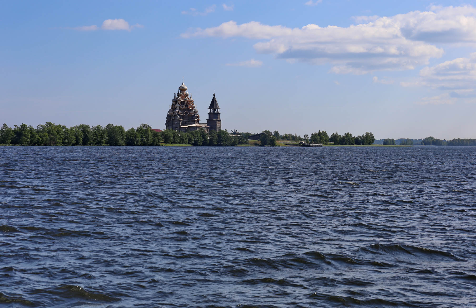
The boat has rumbled. I’m going back.
The church is the last one to disappear from our sight.


 Come with us to…
 Atlantis
 Bestiary
 Bohemia+Prague
 Books, exhibitions, music, film
 Brave old world
 Caucasus
 Cemeteries
 Crimea
 Get to know the
 Images of the East
 Lightwriting
 Lwów/Lemberg
 Mallorca
 Message on the wall
 The Museum of Propaganda
 Odessa
 Paper Museum
 Persian letters
 The Jewish heritage


No hay comentarios:
Publicar un comentario