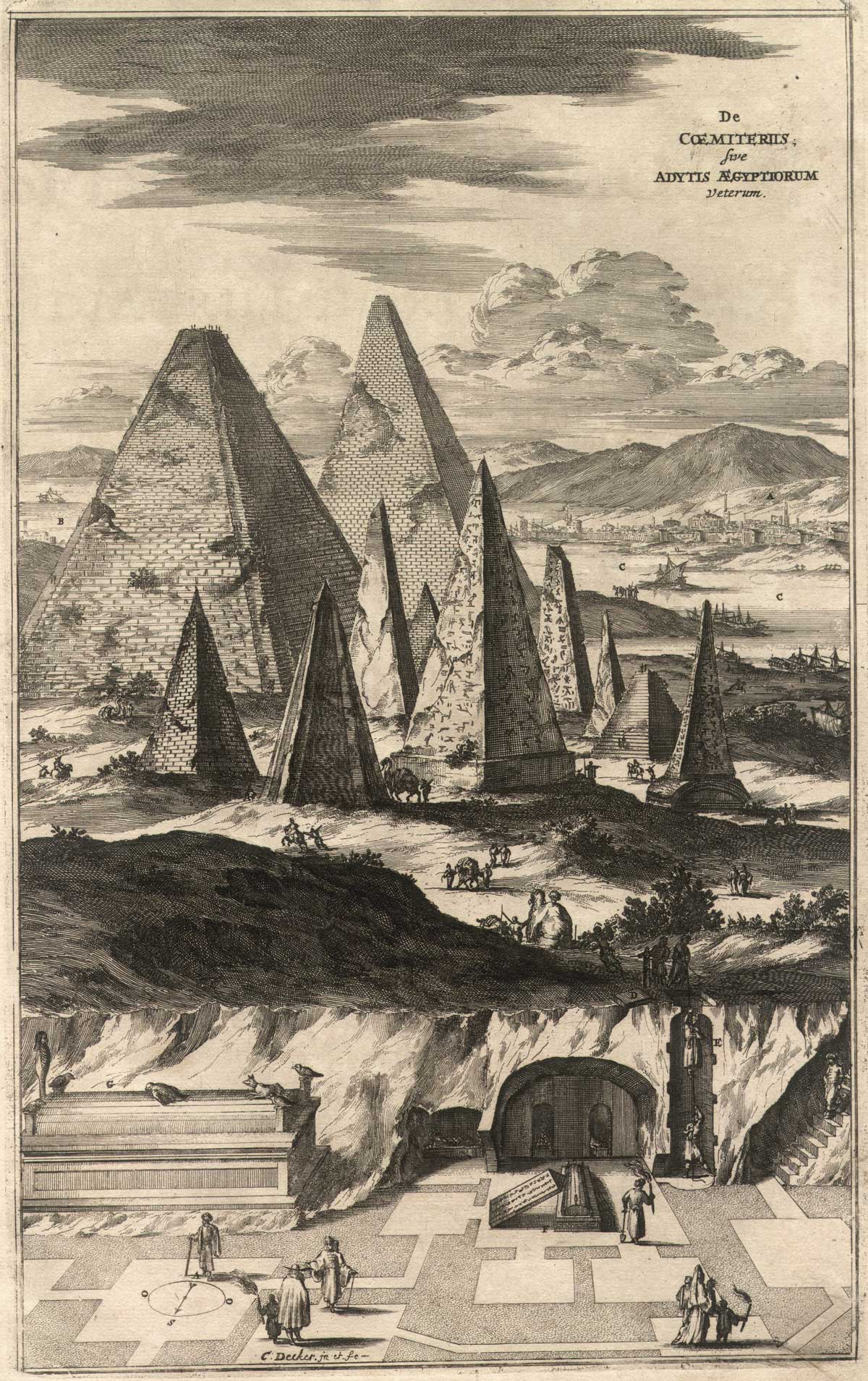
 These pyramids reminiscent of inverted icicles or Surrealist paintings have already appeared twice here at Río Wang. For the first time as the introductory illustration to Wang Wei’s Egyptian journey, cut out from Athanasius Kircher’s Sphynx Mystagoga. And for the second time when we noticed, on the basis of the photos of James Henry Breasted from 1905-1907 that such acute-angled pyramids really existed, although not in Gizeh, where Kircher had imagined them, but more than a thousand miles to the south, over the cataracts of the Nile, in Nubia. But it is now, for the third time that they figure here on their own right, when Ferenc Síkhegyi, research fellow of the Geological Institute of Hungary, having come across the previous two posts, finally presents them not like mere cartographic fancy or vague representation of objects never seen by the artists, but rather as forefathers of a large iconographic genealogy stretching from the shores of the Nile to the shores of the Transylvanian Maros (Mureş), to the 18th-century Reformed College of Nagyenyed (Aiud) and the vicarage of Magyarigen (Ighiu).
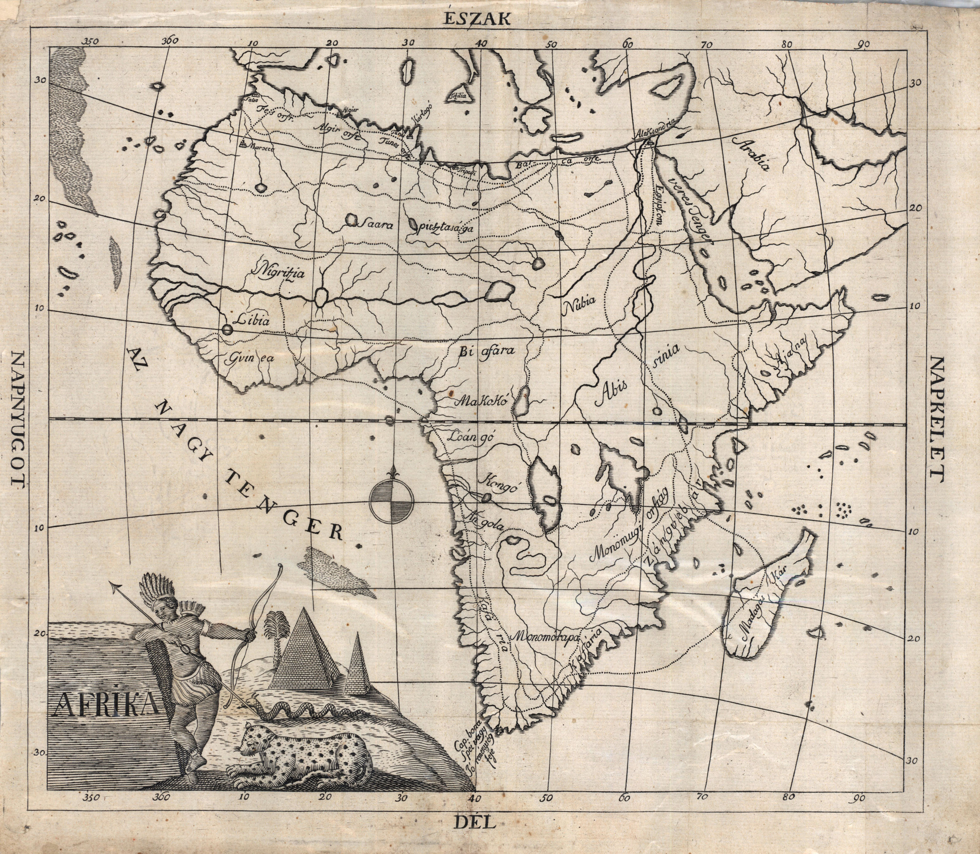 Map of Africa from the book of Péter Bod (full size – 7,5 MB – here)
Around the turn of the millennium some maps of the continents with Hungarian inscriptions appeared on the international antique market. It was obvious at the first glance that they are perhaps the earliest cartographic representation of the Hungarian geographical names of these far away lands.
Their drawings, reflecting the geographical knowledge of a several decades earlier period, their simple, almost childlike design, their style and the almost smile-provoking attempt of Hungarization of the international geographical nomenclature all point to the middle of the 18th century as their probable origin. They were foldouts, as it is attested by the visible traces of folding as well as by the lack of the high-flown Baroque colophons, typical of the single map sheets. The title cartouches are very simple, only that of Africa includes clear references to the continent represented.
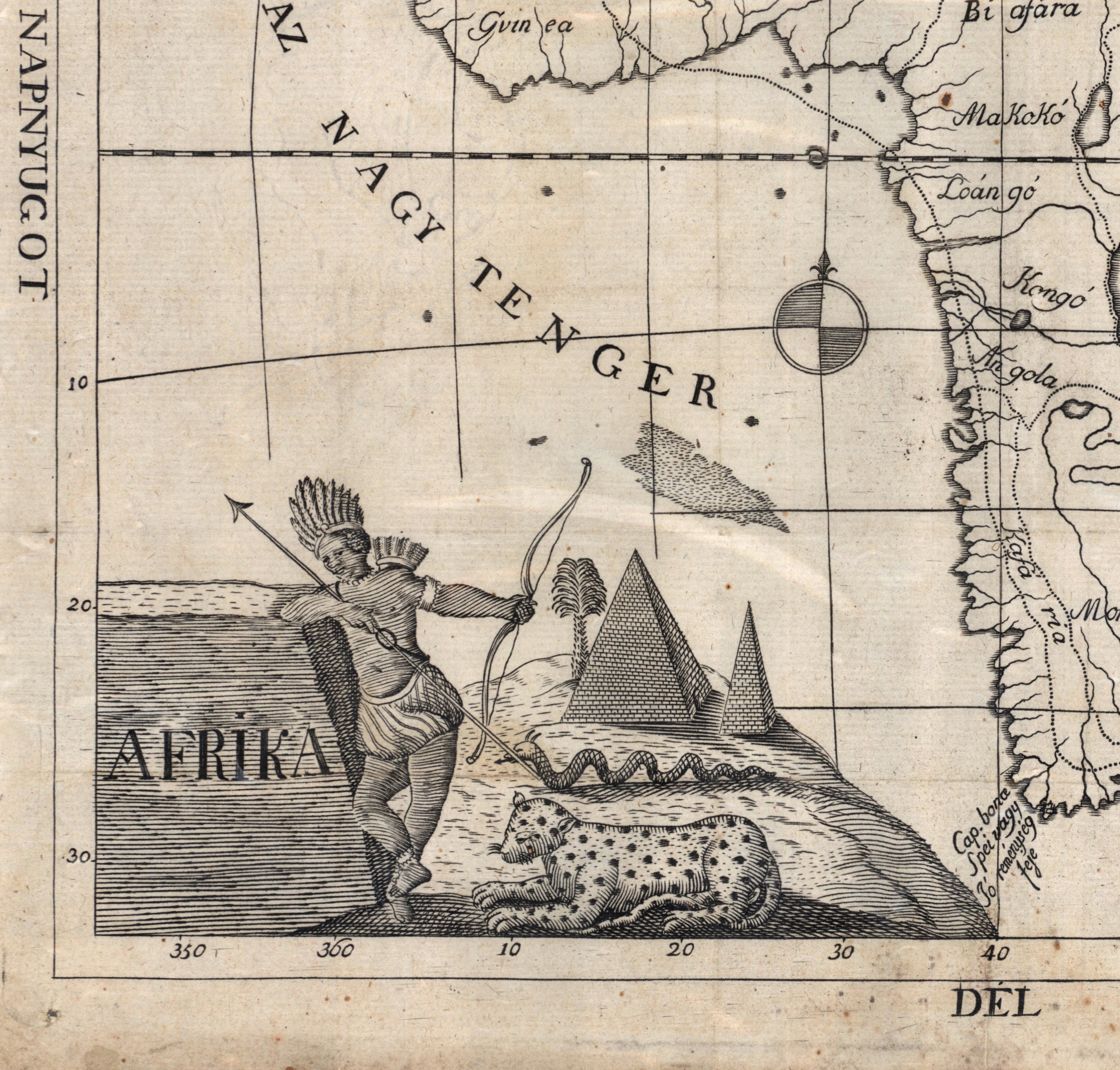 The cartouche of Africa from the previous map
Even on the basis of the first impression it was obvious that these maps were the products of the then emerging Hungarian-language Protestant book publishing. The pointy pyramids, cat-like beast, the snake trotting across the desert and the image of the savage man decorated with feathers do not exclude that the designer compiled only after hearsay the supposedly African motifs, including the pyramids of Gizeh borrowed from the seven ancient marvels. Well, this was the best he could accomplish.
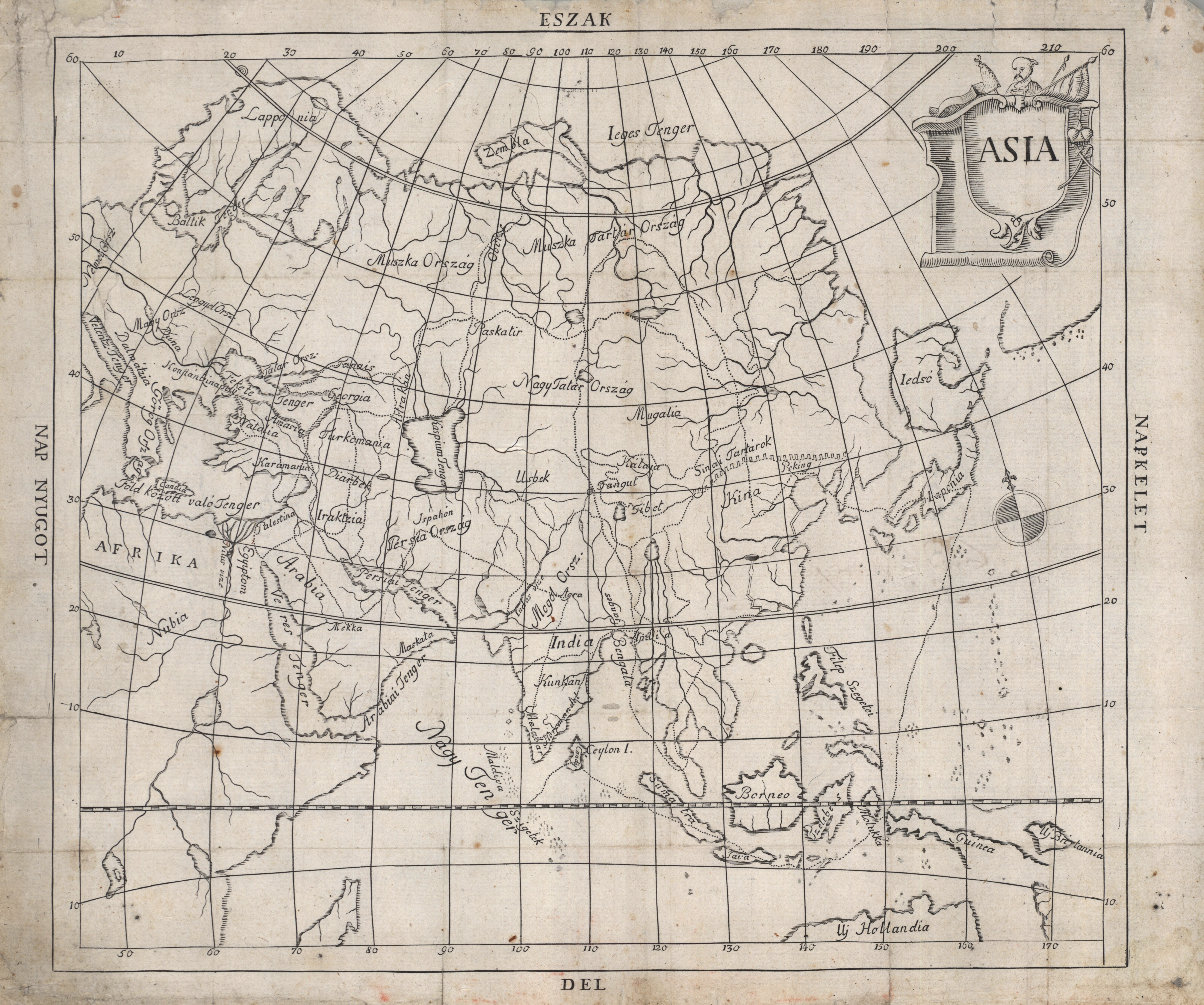
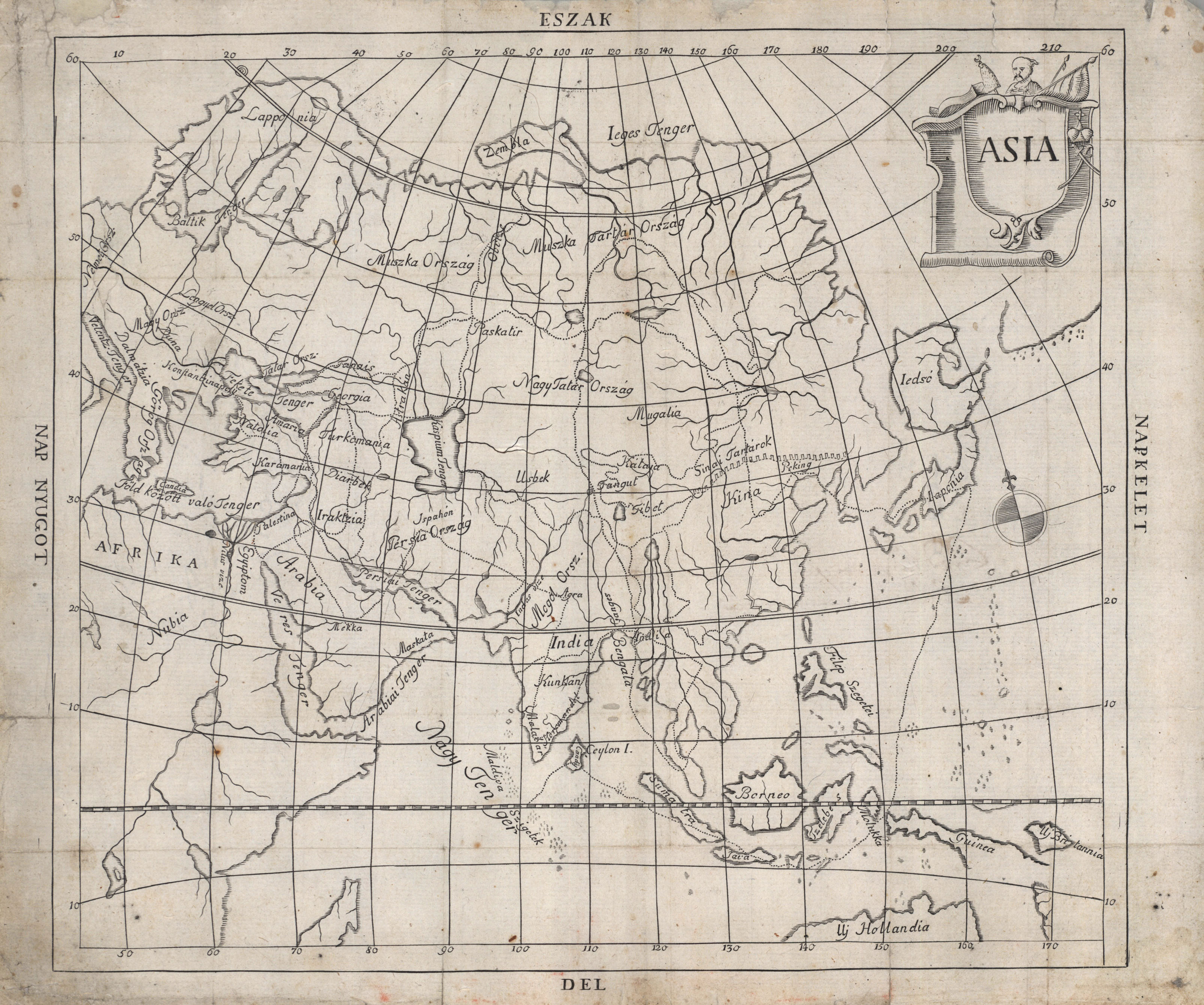 Map of Asia from the book of Péter Bod (full size – 7 MB – here)
The definitive identification of the maps is the merit of the Oxford cartographic historian László Gróf who was led by a lucky computer filtering to the work of the Transylvanian Calvinist pastor Péter Bod preserved in the local library: “Az Isten vitézkedő anyaszentegyháza állapotjának, és világ kezdetéül fogva a jelen időig sokféle változásinak rövid historiája, melly az Isten magyar népének hasznára egyben szedegetetett, és a dolgok nagyobb meg megvilágíttatásáért, a’ világ négy fő mappáival ki adattatott” [A brief history of the conditions of the fighting church of God from the beginning of the world and through its several changes to the present time, compiled and for the greater clearness of the things provided with the four main maps of the world] (1709). The points marked on the maps helped the reader to follow up the description of the book. The book and the maps have an invaluable linguistic significance, as they belong to the earliest attempts of the development of a scientific nomenclature in the Hungarian language.
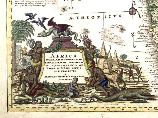 Cartouche of the map of Africa by M. Seutter, c. 1730
 At this point the examination of the maps was divided into two directions, and this is where the story is connected with the Nubian pyramids. László Gróf has also revealed that the maps were copies of some pages of the Atlas Novus published in the second quarter of the 18th century by M. Seutter. The title cartouches of the original are nicely elaborated, and the pyramids of Africa clearly evoke the illustrations of A. Kircher. As the book of Kircher was extremely popular since its publication, and only a few decades had passed since then, we can assume that the strange unit of pyramids were borrowed from there by Seutter.
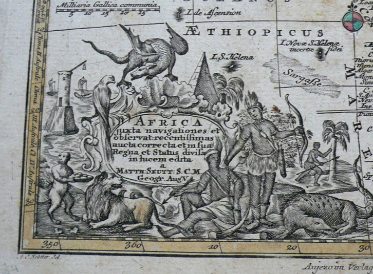 A version of the map of Africa by M. Seutter, c. 1750, detail
However, the line of origins is not yet complete. We still have a small chance to find an illustration which served as a model for Kircher. Nevertheless, this book of his was extremely well-known, popular and influential for the intellectual life of the period, including map-makers.
 Title cartouche of the map of Africa by C. A’llard, c. 1696
 The chain of tradition betwee A. Kircher and M. Seutter also includes some title cartouches with a similar theme. We see the typical pyramids in the background of the map of Africa by a cartographer named C. A’llard (around 1695). A large number of them is to be found on the sheets of J. B. Homann (1707) where also M. Seutter worked before becoming an independent publisher. Could it have offered the idea to these motifs? And so on…
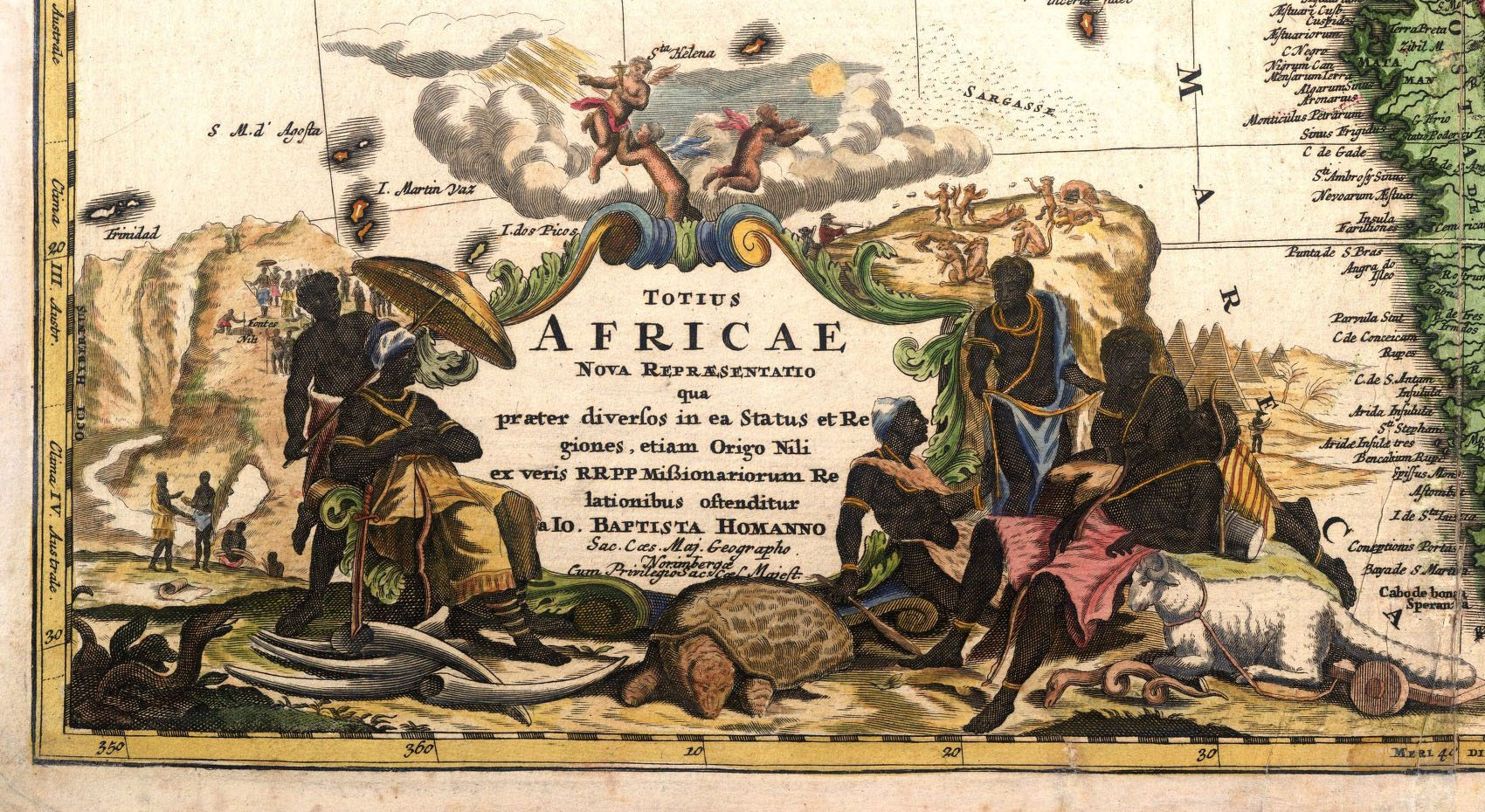 Title cartouche of a similar map of Africa by J. B. Homann, c. 1707
 One thing is sure: that M. Seuttner and his heirs did not only drew on the resources of others, but occasionally also on their own. As an example, we can see two of their maps of Africa from the end of the century with the feather-decorated black man leaning on the cartouche and with the pyramids in the background. To establish when and where was it that these strange pyramids featured on any map for the last time would be an even more difficult task than the research of their first source
 Title cartouche of the map prepared by Lottner who was admitted to the Seuttner family by way of a marriage, c. 1770
 In this age the publishers of maps and books did not consider as a matter of conscience the copyright infringement in the modern sense. They played the game “Who copied whom and what” with a great liberty. Nowadays the unraveling of these threads is similar to the tree of descendence of Homo sapiens. This tree is full of thin-away branches, dotted lines and question marks. Their detection is often supported by good chance, as it happened now through browsing the internet which finally lead us to the shores of Río Wang.
 An even later title cartouche from the Seutter-Lotter family, c. 1778


 Come with us to…
 Atlantis
 Bestiary
 Bohemia+Prague
 Books, exhibitions, music, film
 Brave old world
 Caucasus
 Cemeteries
 Crimea
 Get to know the
 Lightwriting
 Lwów/Lemberg
 Mallorca
 Message on the wall
 The Museum of Propaganda
 Odessa
 Paper Museum
 Persian letters
 The Jewish heritage


2 comentarios:
More than interesting documents.
¡Muchas gracias también en el nombre del autor!
Publicar un comentario