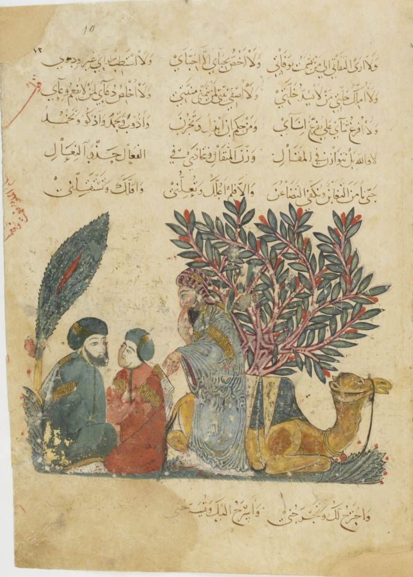
 Aboû Moḥammad al-Qâsim ibn ʿAlî al-Ḥarîrî, Maqâmât, XIIIe siècle. Manuscrit arabe 3929. Paris, Bnf.

Son bâton à la main, il chemine sous les étoiles. Quelque part dans le désert jaune de la page, deux chiens l’ont attaqué. Ce manuscrit des
Maqâmât d’Aboû Moḥammad al-Qâsim ibn ʿAlî al-Ḥarîrî date du XIII
e siècle, il a beaucoup voyagé lui aussi, il a perdu plusieurs de ses cahiers et souffert son destin de livre — être passé de mains en mains et avoir été beaucoup lu.
 Aboû Moḥammad al-Qâsim ibn ʿAlî al-Ḥarîrî, Maqâmât, XIIIe siècle. Manuscrit arabe 3929. Paris, Bnf.
 Aboû Moḥammad al-Qâsim ibn ʿAlî al-Ḥarîrî, Maqâmât, XIIIe siècle. Manuscrit arabe 5847. Paris, Bnf.
Tout compte fait, ce que j’avais trouvé à propos de
ce si discret méridien de Tonnerre m’avait laissé un goût d’inachevé. Toutes ces images médiévales, ces quadrants et ces astrolabes, tout comme
le puits d’Eratosthène, me ramenaient toujours au même souvenir d’une savante exposition sur les sciences arabes, il y a six ou sept ans, à l’Institut du monde arabe à Paris — souvenir au goût d’inachevé lui aussi. Qu’il soit impossible de parler des sciences anciennes sans faire un détour par le monde arabo-musulman, voilà qui me semblait évident — mais ce savoir ne se laissait pas découvrir sans mal.
Il était donc temps de reprendre.
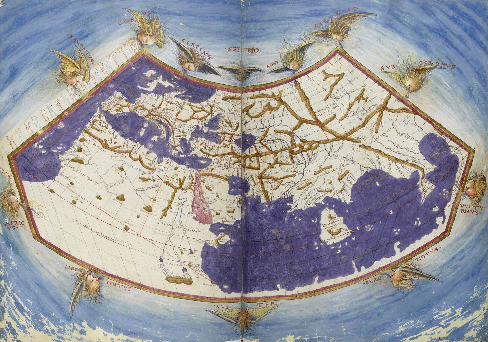
Un — Eratosthène avait établi un premier réseau de coordonnées permettant d’élaborer des techniques de projection cartographique. Il n’est pas seul : Marinos de Tyr, vers la fin du 1
er siècle après J.C., chercha lui aussi à mesurer la Terre mais s’appuya sur d’autres mesures que celles d’Eratosthène pour dresser une carte. Celle-ci sera à son tour le modèle de la
Géographie de Ptolémée, cinquante ans plus tard. A partir d’un méridien d’origine au large de l’Afrique occidentale, Marinos comme Ptolémée tracent un réseau de méridiens et de parallèles équidistants formant des rectangles donnant une projection correcte au niveau du 36° parallèle, celui de l’île de Rhodes, et autour duquel s’organisent les terres de la côte atlantique jusqu’à la Chine.
 Al-Isthari (?-951), Traité de géographie. Manuscrit du XVIe siècle. Paris, Bnf. La carte reprend la projection de Ptolémée, le nord en haut sur cette copie.
 Claude Ptolémée , Cosmographia, Jacobus Angelus interpres. Paris, Bnf.
Cette représentation du monde selon Ptolémée, dessinée à Florence entre 1451 et 1500 intègre le tracé des méridiens.
Deux — tout comme Ptolémée, traduit de nombreuses fois en arabe dès la seconde moitié du VIII
e siècle et dont l’œuvre est redécouverte en Europe à partir du XII
e siècle sous le nom d’
Almageste, Marinos de Tyr est l’objet de traductions en arabe. Tous deux constituent l’une des références du grand géographe du X
e siècle, al-Masûdʿî.
Les bibliothèques princières comme les plus modestes bibliothèques privées se multiplient parallèlement aux « Maisons de sagesse », telle celle que fonde Hârûn al-Rashid à la fin du VIII
e siècle ou les institutions d’enseignement supérieur que seront les madrasas à partir des Seljoukides.

Ces textes, comme l’
Almageste, avec leurs traducteurs et commentateurs, les savants, tous circulent à travers le monde musulman.

Trois — les astronomes arabes et persans, à leur tour, se sont attaqués aux mesures de la Terre et aux mesures du temps.
Ils tracent des cartes et parfois des méridiens. Ils critiquent les stratégies d’observation de Ptolémée et développent ces instruments que reprendront nos astronomes européens : instruments de grande dimension pour des mesures plus précises et astrolabes planisphériques perfectionnées par rapport au modèle grec afin, dans un contexte musulman, de connaître la direction de la prière
(qibla). Les mêmes exigences religieuses sont à l’origine d’une nouvelle discipline, celle de la mesure du temps
(ʿilm al-mîqât) qui aboutit notamment à la réalisation de cadrans solaires. Ces développements de l’observation comme les modèles mathématiques qu’ils entrainent conduisent à la critique de l’astronomie grecque et en particulier de l’
Almageste, et par là, préparent la révolution copernicienne du XVI
e siècle.

On retrouve enfin, non pas le tracé d’un méridien sur le sol, mais celui d’un cadran solaire, essentiel pour régler l’heure des prières.
Et les méridiens ?
La compagnie des astronomes, géographes et mathématiciens est voyageuse. Arabes, Perses, Turkmènes, Kurdes, Turcs, Mongols, ils s’en vont sur les routes, de Damas à Soltaniyeh, de Rey à Samarcande. Ils voyagent, ils se rencontrent, ils discutent, ils observent.
 Aboû Moḥammad al-Qâsim ibn ʿAlî al-Ḥarîrî, Maqâmât, XIIIe siècle. Manuscrit arabe 5847. Paris, Bnf.

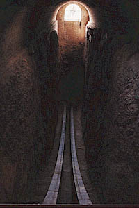
Pour tracer les méridiens, il faut souvent commencer par bâtir un observatoire.
Avant l’usage de la
camera obscura, l’observation du mouvement des étoiles a certes pu se faire par l’utilisation des puits, non pas comme le fit Eratosthène pour mesurer l’ombre du soleil et de là, calculer la mesure du méridien donc la circonférence de la Terre, mais afin, dit-on, de pouvoir observer le mouvement des étoiles même en plein jour sans être gêné par la lumière.
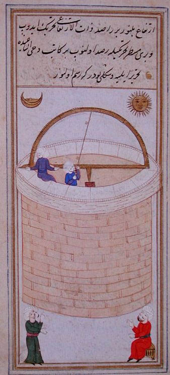
 Taqiy al-Din ibn-Maruf, Le puits d’observation azimutal d’Istanbul : Instruments d’observation pour les tables de Shâhinshâh, Turquie, 1580. Paris, Bnf.
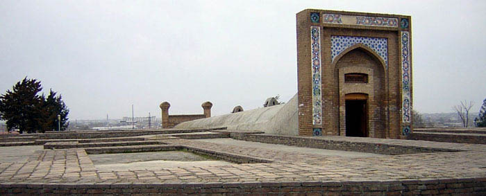
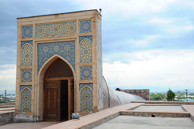
Ulugh Beg, (1394-1449), petit-fils et second successeur de Tamerlan, est resté dans les mémoires moins pour son rôle comme prince de Samarcande qu’en tant qu’astronome, que mathématicien et bâtisseur de l’un des plus anciens observatoires du monde musulman.
Cet observatoire était équipé d’instruments astronomiques fixes et qui employait pour fonctionner une soixantaine d’astronomes au moins, jusqu’à cent peut-être. Leurs observations furent menées sur une longue période, entre 1420 et 1437. Elles ont défini la durée exacte de l’année solaire — 365 jours, 6 heures, 10 minutes and 8 secondes — et établi un catalogue de 1012 étoiles.
Le petit-fils de Temür Beg, Ulugh Beg Mirza, fit bâtir un autre grand édifice : l’observatoire à trois étages construit sur le flanc de la colline de Kuhak et qui est utilisé pour dresser des tables astronomiques. Grâce à cet observatoire, Ulugh Beg Mirza a dressé les Tables Köregeniennes qui sont maintenant en usage dans le monde entier. On utilise rarement d’autres tables astronomiques. Auparavant, on se servait des Tables Elkhaniennes dressées à Maragha par Khaja Nasir Tusï, sous Hülegü Khan qu’on appelle Elkhan. On n’a probablement pas dressé dans le monde plus de sept ou huit tables astronomiques. L’une d’elles est l’œuvre du Calife Mamun, on les appelle Tables Mamuniennes. Ptolémée en dressa aussi.
Babur, Mémoires des événements de l’année 903 (1498), Babur-Nama,
traduction de J.-L. Bacqué-Grammont.
L’observatoire de Samarcande était constitué d’un bâtiment monumental cylindrique, d’une hauteur de 30 mètres pour un diamètre de 46, équipé d’un sextant gigantesque en marbre, le « Sextant de Fakhri », d’un rayon de près de 40 mètres, permettant une très grande précision dans les mesures astronomiques lors du passage du Soleil, de la Lune ou des planètes dans le méridien. Cet arc de 60° comportait des escaliers de chaque côté pour permettre aux assistants chargés des mesures de se déplacer.


Aujourd’hui en partie enterré, le sextant est bien conservé alors que les autres instruments en revanche ont disparu. Ulugh Beg, quant à lui, fut assassiné par son fils.
Pour ce monde qui passe en cinq jours, il assassina un homme aussi savant et âgé que l’était son père. Le chronogramme de la mort d’Ulugh Beg Mirza est le suivant :
Ulugh Beg Mirza, océan de science et de sagesse
Qui fut le soutien du monde et de la religion
A goûté par Abbas le miel du martyre
Ces lettres sont son chronogramme : Abbas a tué.
Babur, Mémoires des événements de l’année 903 (1498), Babur-Nama.
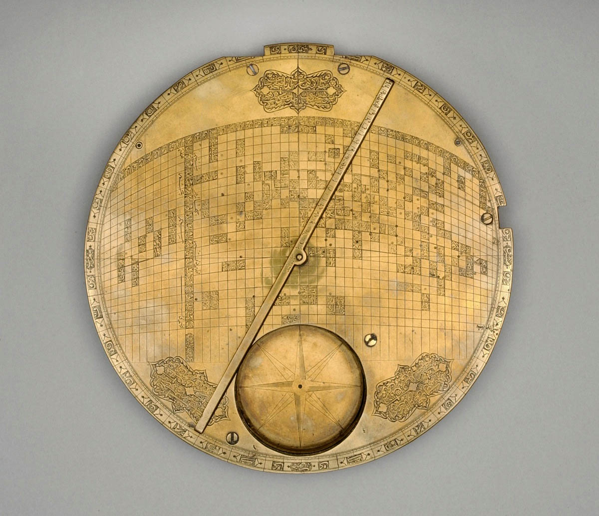
Juste un objet pour finir. Ce n’est pas un astrolabe même s’il est sphérique et traversé d’une réglette mobile, une alidade. Il s’agit d’une représentation mathématique du monde musulman qui permet de repérer les grandes villes et de situer par rapport à La Mecque. La Mecque est au centre et les positions de cent cinquante villes sont indiquées à partir de leurs coordonnées. Le déplacement de l’alidade permet de fournir directement pour chacune de ces villes la direction de La Mecque grâce aux graduations qui entourent la pièce. La distance entre chaque ville et La Mecque est également marquée. Une boussole a été ajoutée au fond de l’objet. L’ensemble repose sur les tables astronomiques compilées à partir des observations d’Ulugh Beg à Samarcande. Il n’existe que deux exemplaires de ce type de cartes, car cet objet est bien une carte, retrouvées celle-ci en 1989 et la seconde en 1995.
 Carte du monde musulman centrée sur la Mecque, Iran, XVIIe siècle. Koweit, collection al-Sabah, Dar al-Athar al-Islamiyyah.
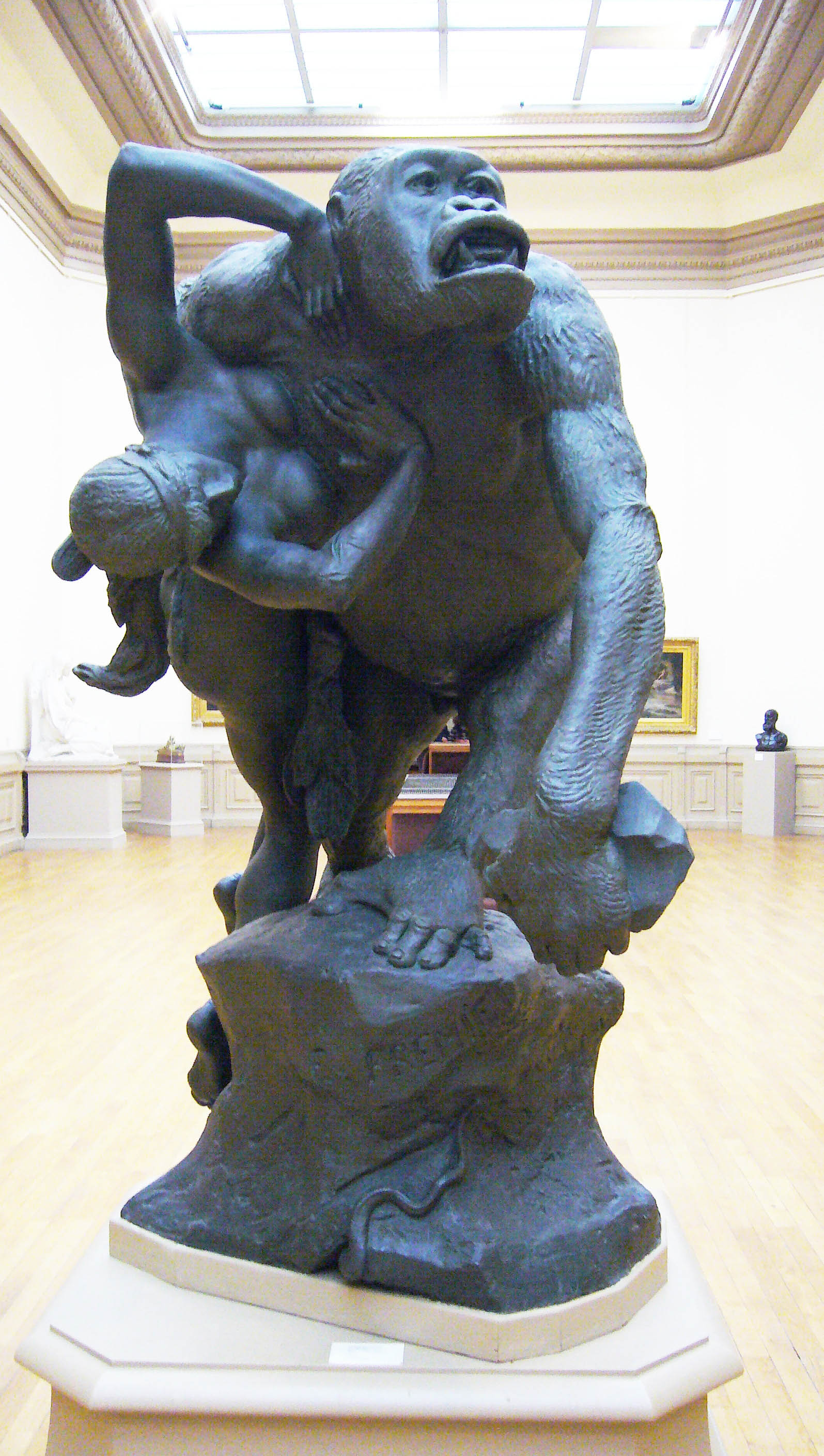
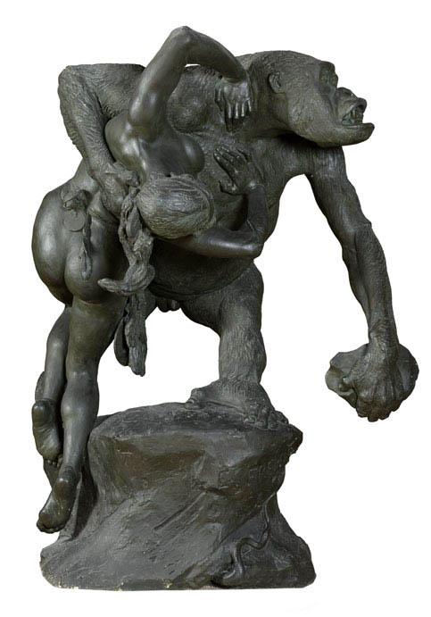
 Emmanuel Fremiet (1824-1910): Gorila raptando a una mujer, segunda versión, 1887 (la primera versión, rechazada por el Salón de París: 1858). Nantes, Musée des Beaux-Arts
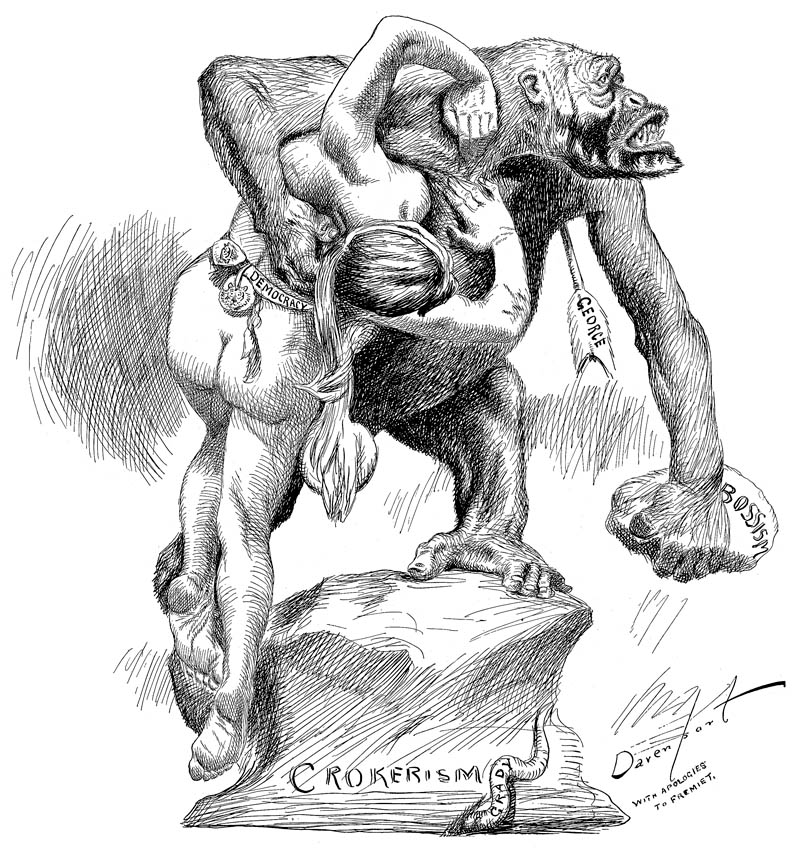 Cartel de Homer Davenport contra el «crokerismo» (influencia de Richard Croker)
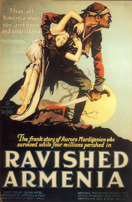 Cartel del film americano Armenia violada (1919)
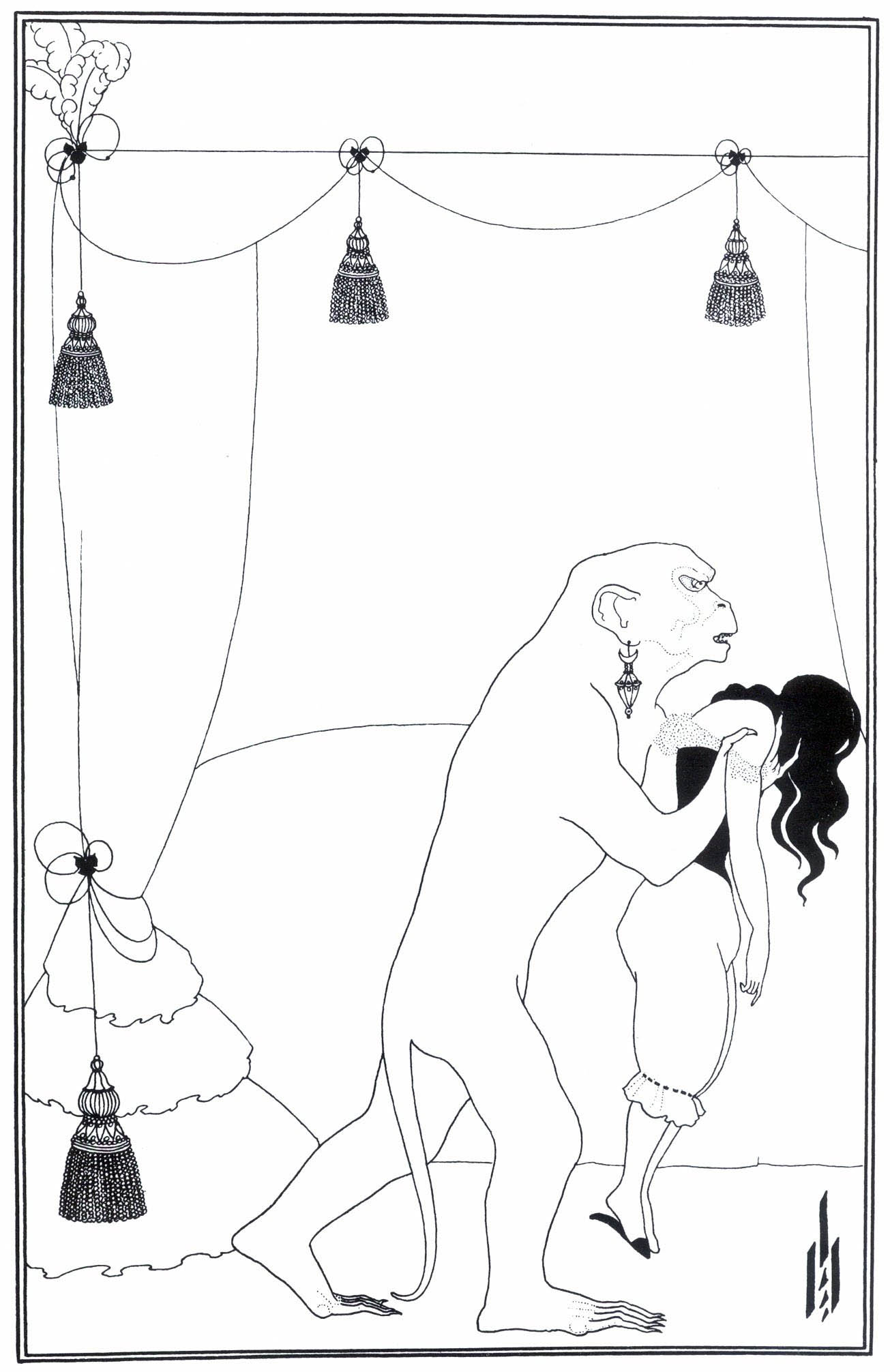
 Ilustración de Aubrey Beardsley (1894-1895) para Los asesinatos de la rue Morgue, de Poe (1841)
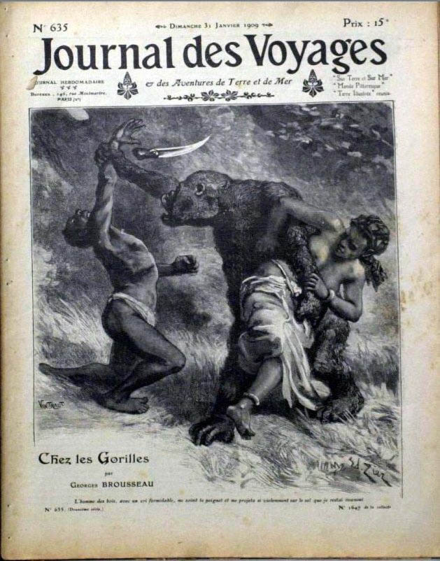
 Journal des Voyages, 31 de enero de 1909. (Un nº anterior, de 1885, aquí, y su modelo –una de las fuentes más importantes para la fascinación gorilesca del s. XIX– aquí y aquí).
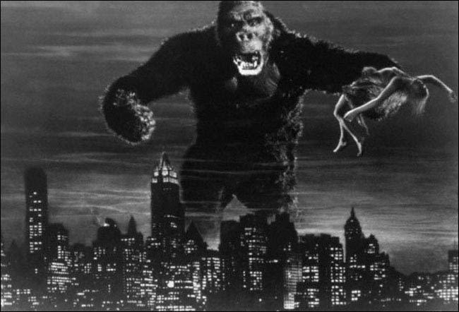 King Kong, 1933
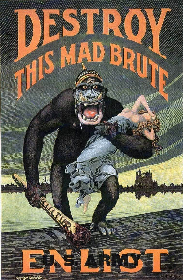 «¡Acabad con esta bestia loca! ¡Alistaos en el ejército americano!» Poster anglo-americano anti-alemán, 1917-1918 (Versión australiana de Norman Lindsay, de 1918 aquí)
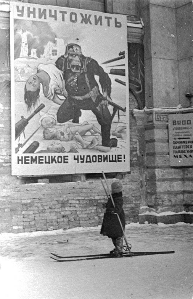 «¡Destruid a la bestia alemana!» Foto de Nikolai Khaldogin, Leningrado, sitiada, diciembre 1941 – febrero 1942. El cartel original no ha sobrevivido, pero en 2011 se preparó esta versión coloreada para una película.
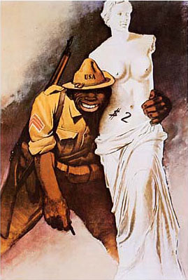 Gino Boccasile: Sello de propaganda fascista que representa a un soldado americano raptando a la Venus de Milo, y el mismo sello estampillado en un sobre de la Italia del norte ocupada por los alemanes, 1944, de aquí


 Come with us to…
 Atlantis
 Bestiary
 Bohemia+Prague
 Books, exhibitions, music, film
 Brave old world
 Caucasus
 Cemeteries
 Crimea
 Get to know the
 Images of the East
 Lightwriting
 Lwów/Lemberg
 Mallorca
 Message on the wall
 The Museum of Propaganda
 Odessa
 Paper Museum
 Persian letters
 The Jewish heritage


