is the walled town of ancient Rome, built on seven hills, with the Forum Romanum and
Colosseum in the valley. Between the western city wall and the Tiber there are
the scattered blocks of great imperial theaters and hippodromes.
The old town of today’s Rome, lying on the big bend of the Tiber, was during the imperial period a party district outside the city walls. The city, built on seven hills, for centuries kept a distance from the flat riverside field, threatened by floods and malaria. As its name, Campus Martius, indicates, it was mainly used as a military training field. Only at the end of the republican era did it become a place for the dictators and emperors to erect a magnificent theater, hippodrome, public bath or temple to increase their popularity.
 The southern part of the Campus Martius, with the monumental public buildings outside the city walls, seen from the east, in Italo Gismondi’s model of Rome (1935-1971). Above, to the left of Tiber Island, is the theatre of Marcellus, and the large square in front of it is the Circus Flaminius. The via publica, public road running to the left of it, in the middle of the picture, is flanked by the portico of Octavia (with its two temples), the portico of Philippus, and the temple of Neptune, and it is closed by the great theater of Pompey. This quarter became, more or less, the ghetto of Rome, and the former public street became the main street of the ghetto, today’s via del Portico d’Ottavia.
Following the decline of Rome and the collapse of the aqueducts, the city’s center of gravity shifted to the river, and the intervals of monumental columns and arcades were walled up by the artisans and small merchants into the swallow’s nests of their tiny dwellings and workshops. The portico of Octavia became the Roman fish market, that of Philippus the house of the Fabi family, and the theater of Marcellus the fort palace of the Orsini. And in the territory of the theater of Pompey, throughout the Middle Ages, there operated the Calcarara, the lime-kiln, where the marble building materials and statues of the ancient palaces were transformed into a much more useful building material.
 The same neighborhood, more or less the area of the ghetto, in Giambattista Nolli’s 1748 map. About the middle of this detail is the built-in long rectangle of the former Circus Flaminius, to the east the former portico of Octavia, now a fish market (1023), and the theatre of Marcellus, now the Orsini Fortress (1022). Above, the former via publica, now Fish Market Street (Strada di Pescaria, 1024), ending in the Jewish Square (Piazza Giudea, 1025). Marked with a red dot, the Manili House, standing in the place of the temple of Neptune.
 One of the swallow’s nests. The cheese-making workshop nested under the arcade of the theater of Marcellus, 1886
Most of the swallow’s nests were eliminated by Fascism in its attempt to clean the monuments of world-conquering Rome from the sediments of two thousand years. The action, as its local designation – “sventramento di Roma”, the disembowelment of Rome – shows, created a sterile and dead zone of ancient monuments in the middle of the city, in the Colosseum – Forum Romanum area. But the secluded places of this quarter still preserve several witnesses to the symbiosis of ancient and medieval monuments,
 such as the Manili House at the beginning of the former Fish market Street, today’s via del Portico d’Ottavia, marked in red on the above map.
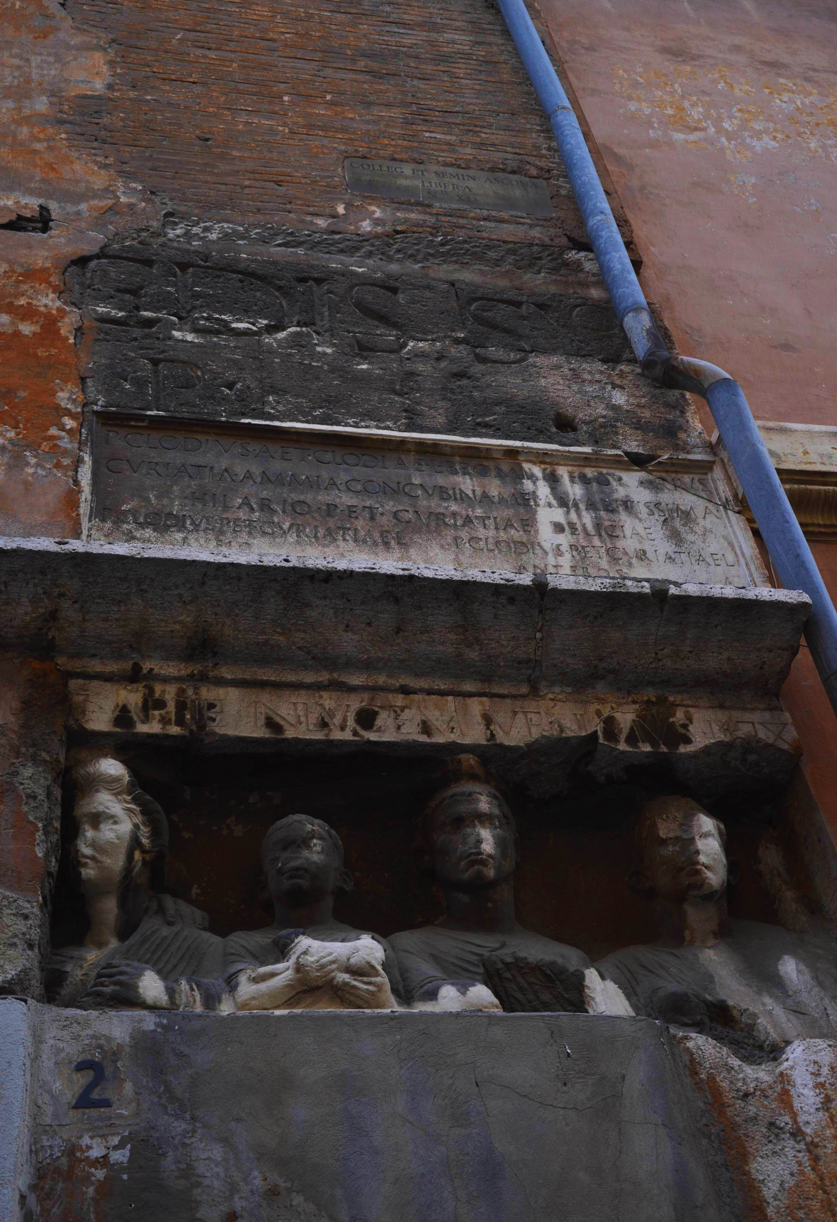
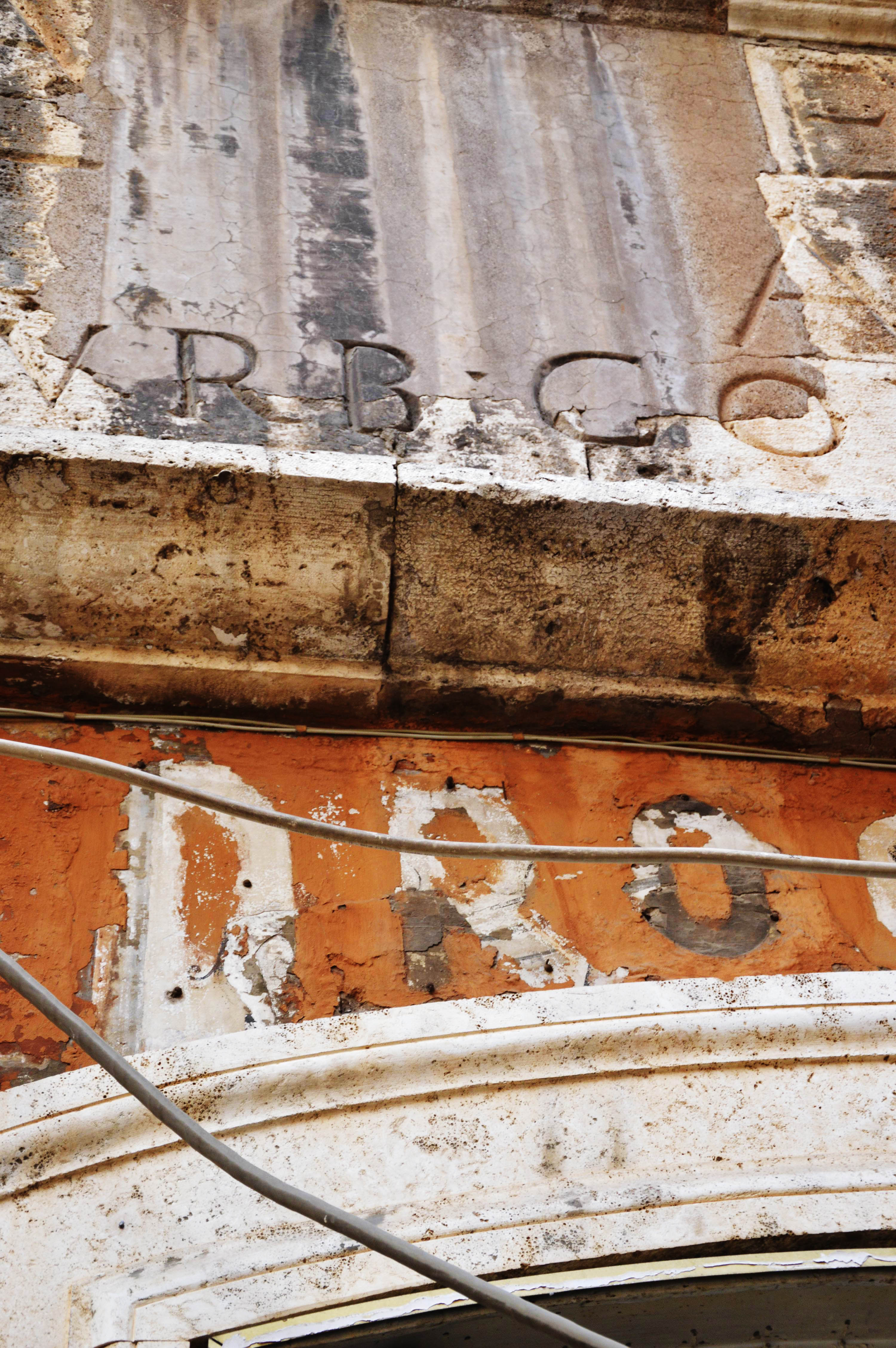
With its huge, fragmented ancient ledge and epigraph, fragments of antique reliefs, and a wide variety of patinae of its stones and colors, this building also looks as if it had been built in between the remains of the temple of Neptune that once stood here. But it is enough to read the inscription running along the entire length of the facade to see that this is something entirely different:
URBE ROMA IN PRISTINAM FORMA(M R)ENASCENTE LAUR. MANLIUS KARITATE ERGA PATRI(AM) (A)EDIS SUO NOMINE MANLIANAS PRO FORT(UN)AR(UM) MEDIOCRITATE AD FOR(UM) IUDEOR(UM) SIBI POSTERISQ(UE) SUIS A FUND(AMENTIS) P(OSUIT). AB URB(E) CON(DITA) M.M.CCXXI L AN(NO) M(ENSE) III D(IE) II P(OSUIT) XI CAL(ENDAS) AUG(USTAS)
“At the time, when the city of Rome was reborn in its ancient form, Laurentius Manlius, for love of his homeland, built up from its foundations this house in the forum of the Jews for himself and for his descendants, within the limits alowed by his mediocre wealth, and called it Manliana after his name, 2221 years after the founding of Rome, at the age of 50 years, 3 months and 2 days, on the eleventh day before the beginning of August.”
This house was thus intentionally built as an ancient ruin. Or rather as an ancient palace, as “Laurentius Manlius” imagined it on the basis of the patchwork buildings to be seen in the neighborhood. All this is a sign of the rebirth of ancient Rome, in 1468, at the dawn of the Renaissance, when Leon Battista Alberti writes his book On Architecture, inspired by the ruins of Rome, and King Matthias builds in Buda the first Renaissance palace north of the Alps. The inscription itself, written in the most elegant classical antiqua typeface – so perfectly, that even in the late 19th century, many antiquarians considered it authentically ancient – is the earliest example of the resurrection of the monumental public inscriptions of the antiquity. This building, built in the “Classical” style by a simple Roman citizen – pharmacist Lorenzo Manei, who Latinized his name as Manlius in an attempt to identify himself with the ancient Gens Manilia – testifies more eloquently than any major work of art to the strength and impact of the emerging Renaissance.
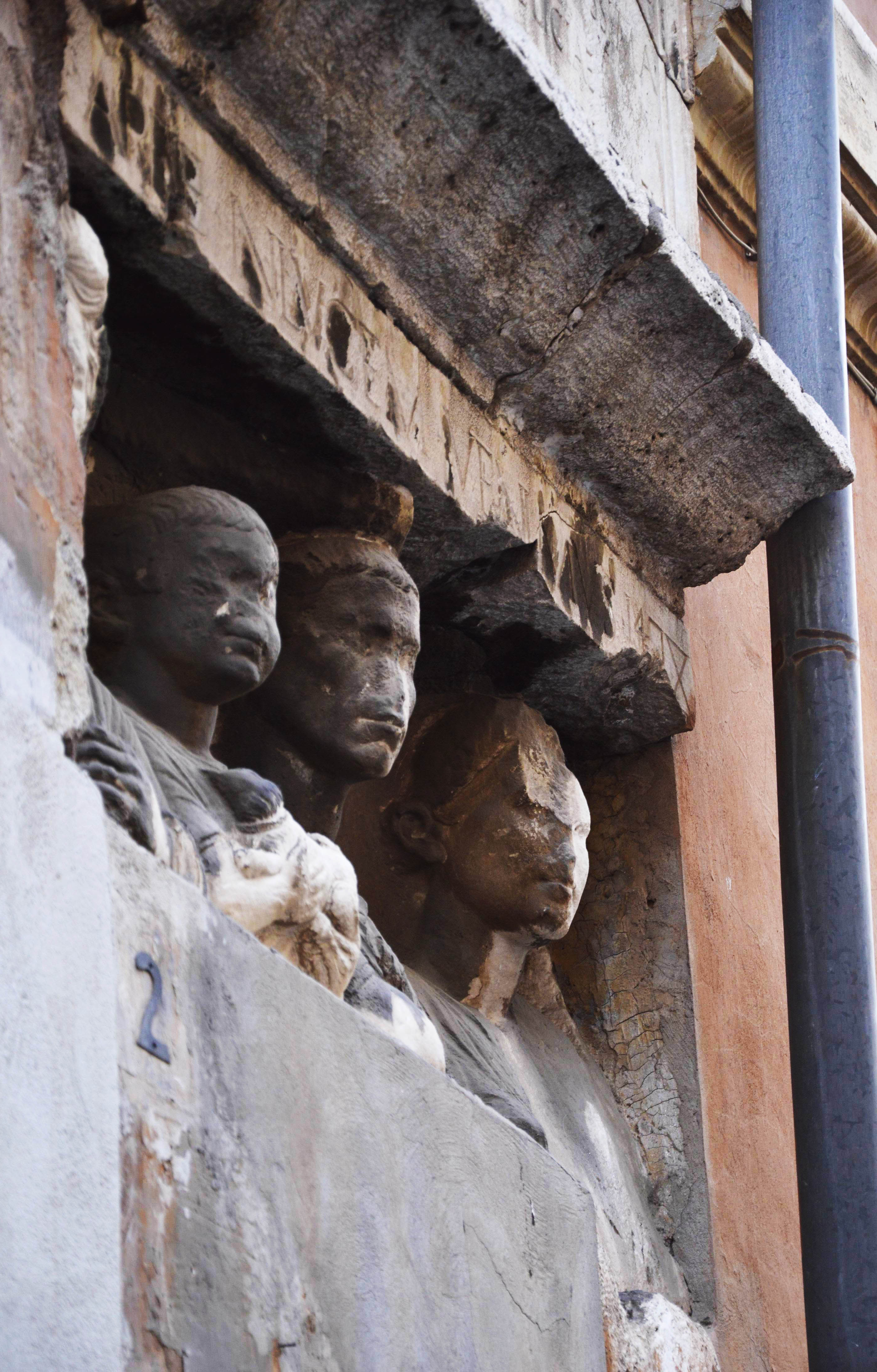
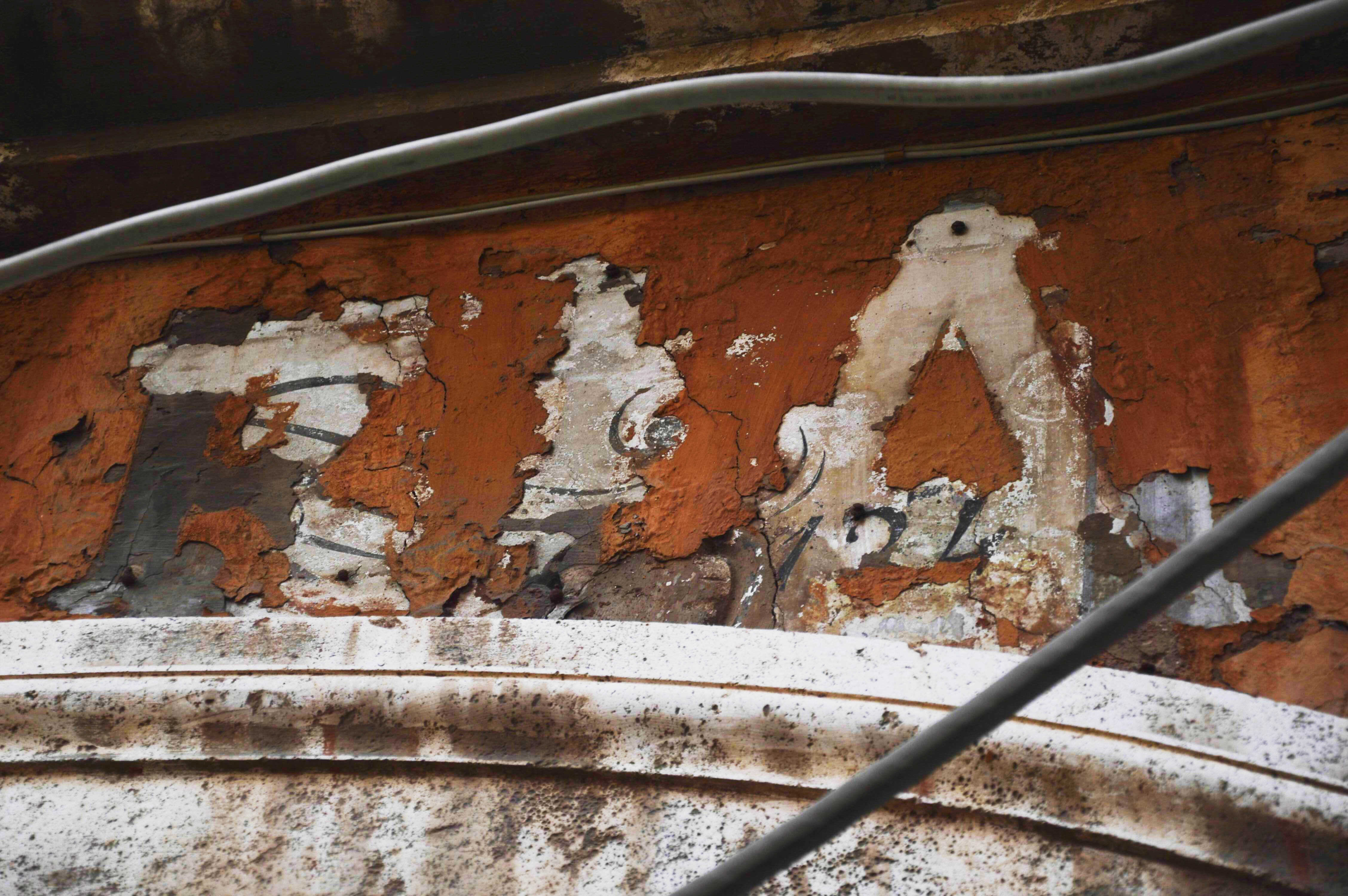
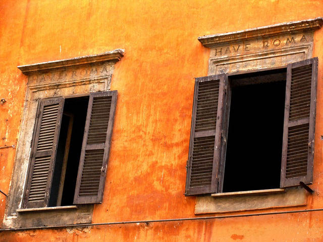 A Classical inscription greeting Rome reborn in the window ledge of the Manili house: (H)AVE ROMA!
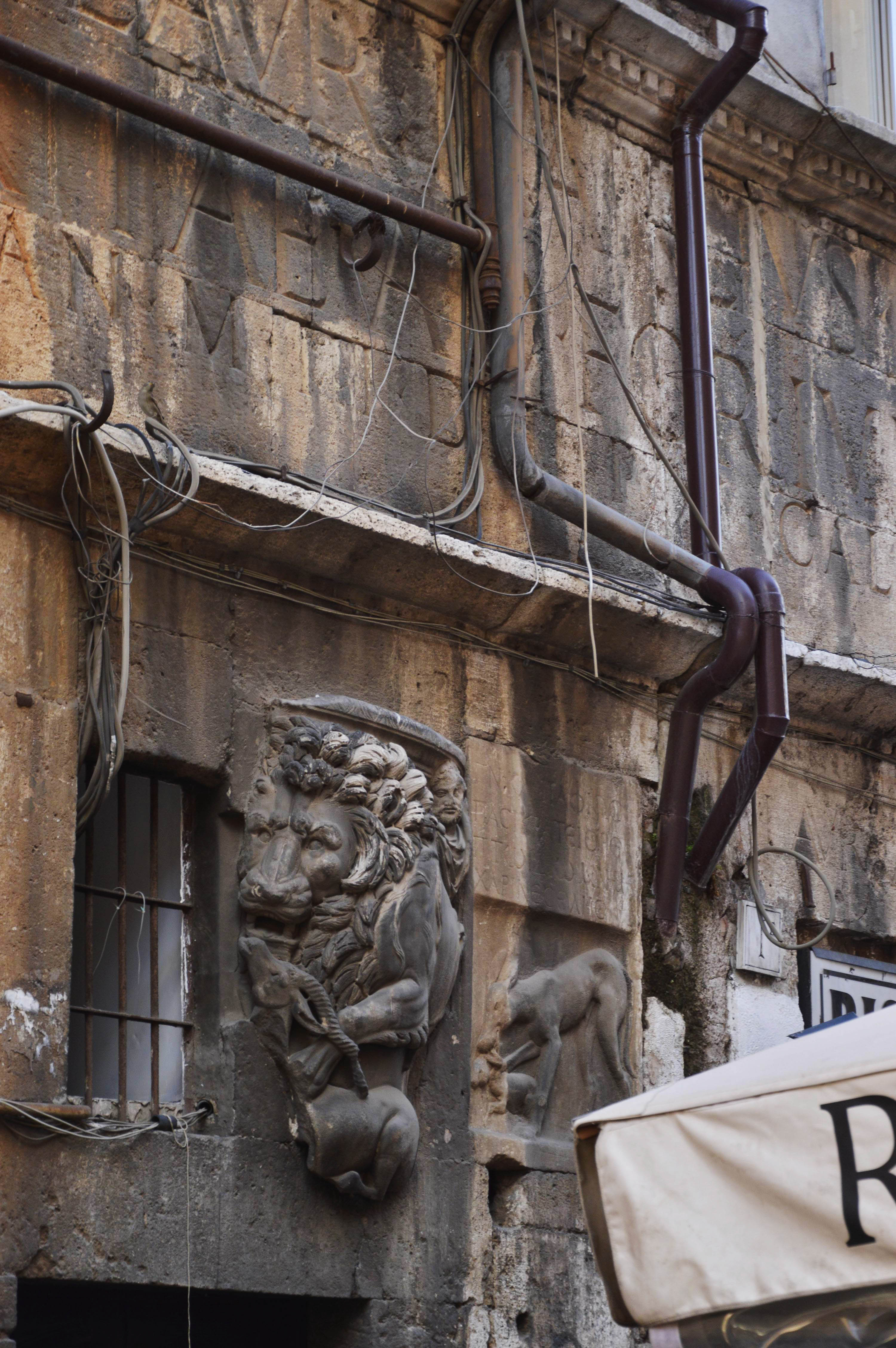
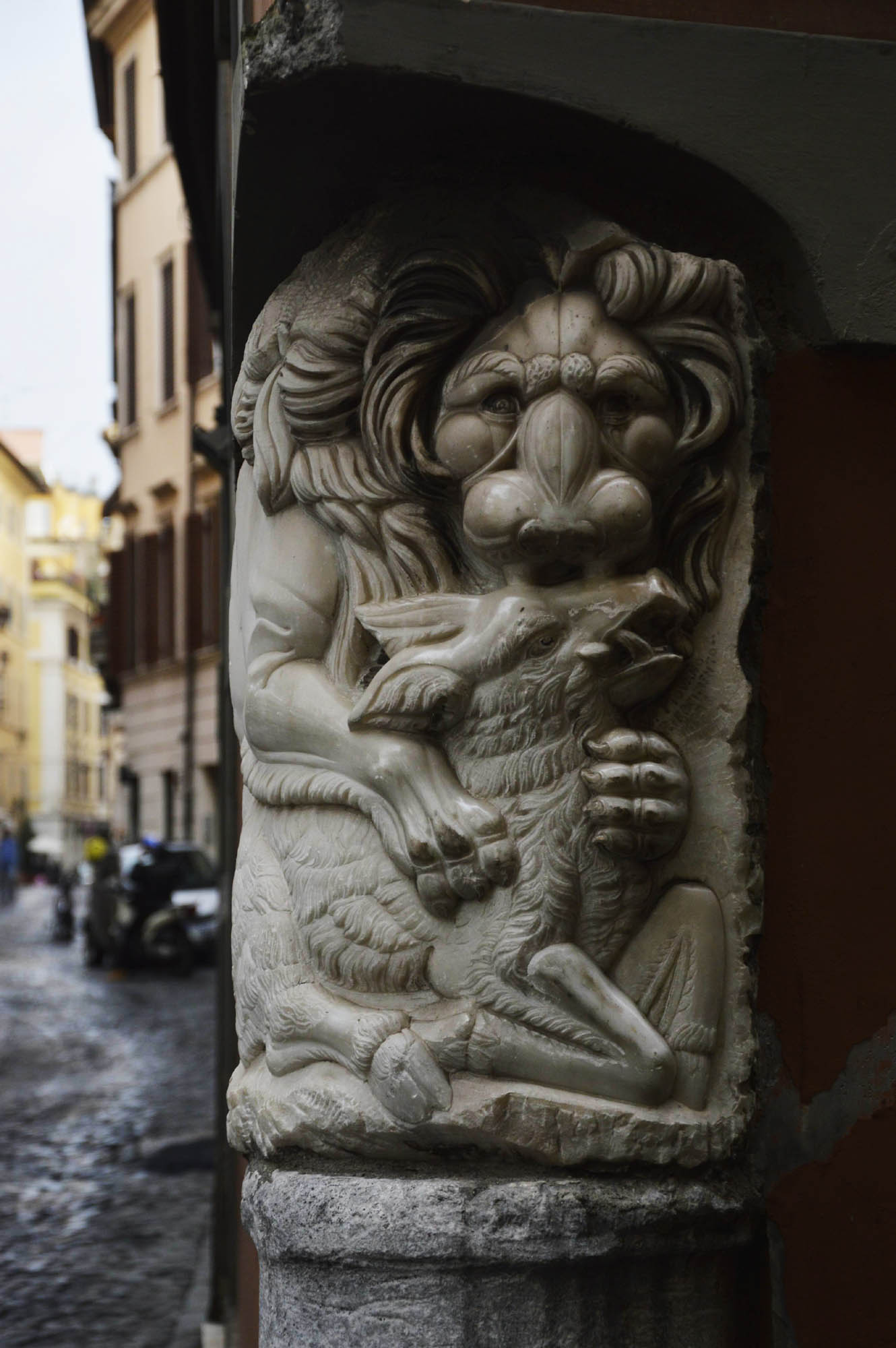
It is worthwhile to look at the ancient fragments walled into the patchwork. The lion catching an antelope, as a symbol of death, was a frequent motif of ancient sarcophagi. A similar sarcophagus fragment can be seen
in the northern part of the old city, in Bear Street – via dell’Orso –, about which we will soon write more.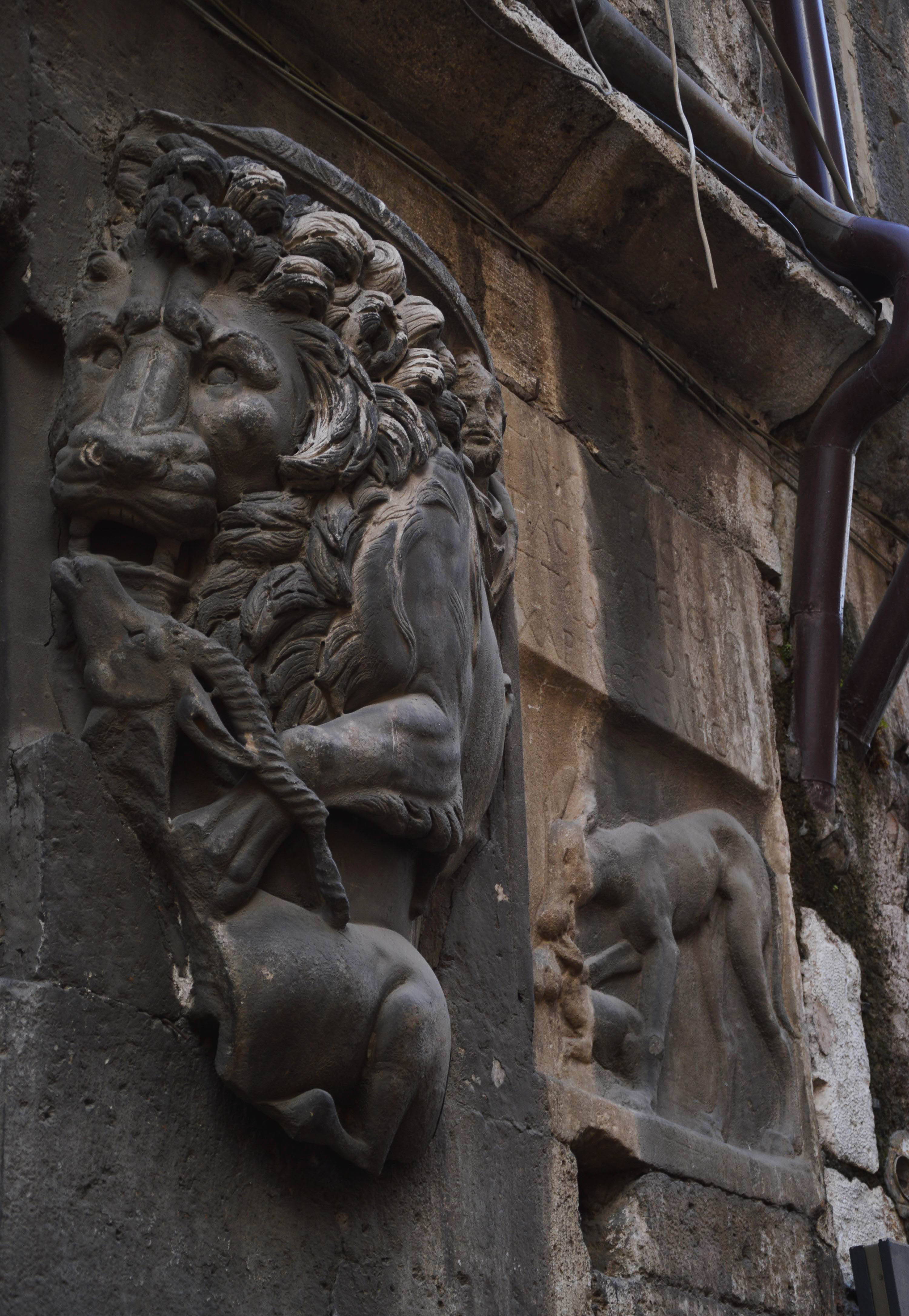
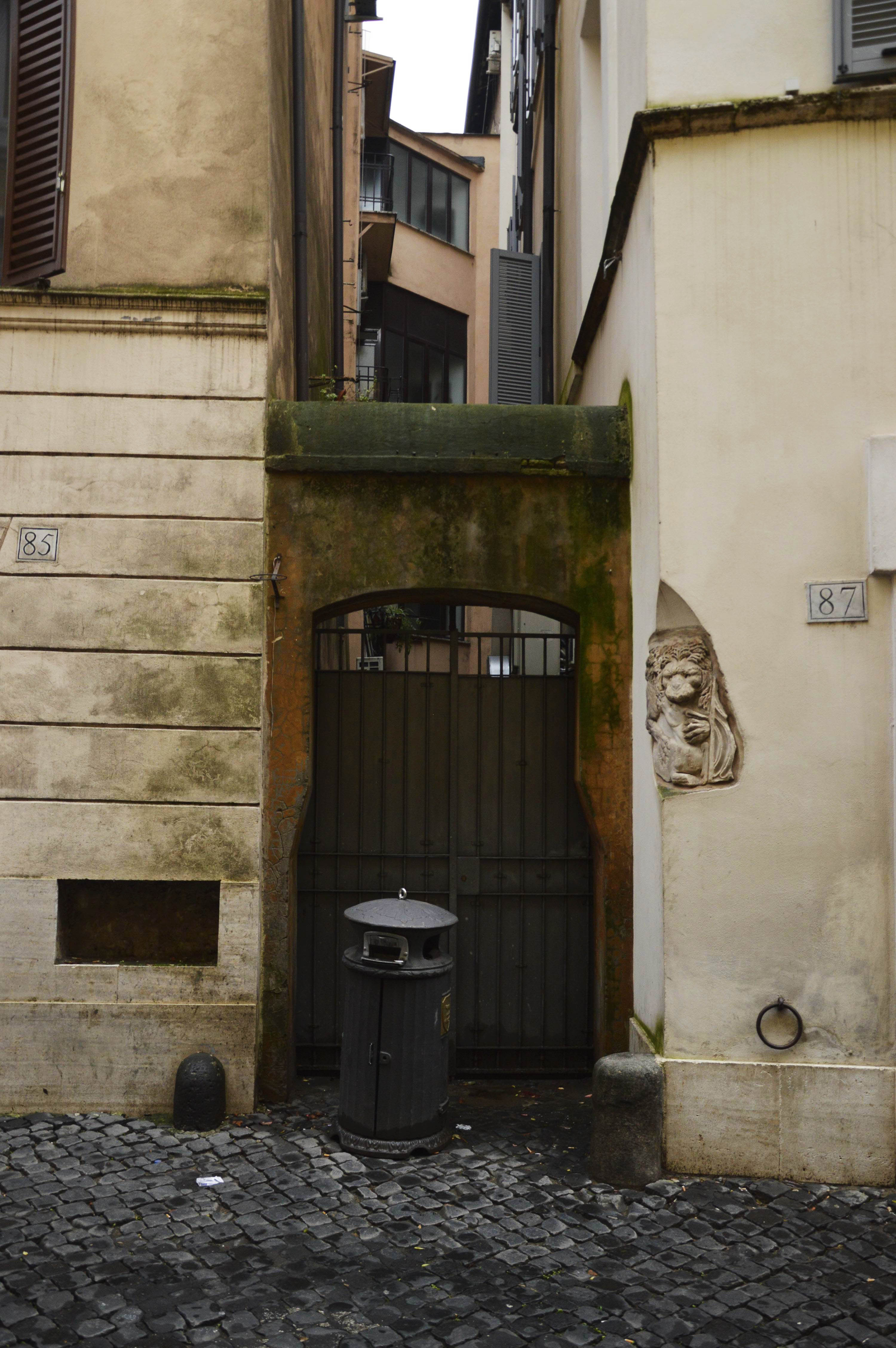 Sarcophagus fragments with lions catching antelope and wild boar on the two corners of via dell’Orso 87.
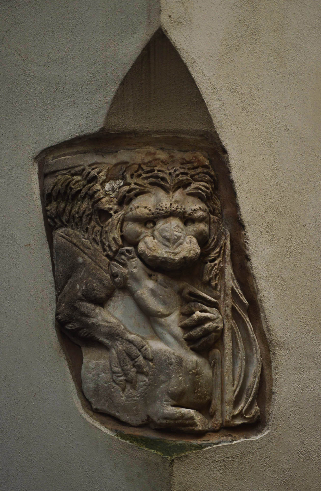
The inscription of 1468 is surrounded by two ancient tomb fragments. A morbid idea for the modern man: who among us would decorate the facade of his or her house with tombstones brought from an old cemetery? But the top gravestone gives an even more morbid lesson about the anthropology of ancient Rome. According to its text, it was erected by the ivory carver Publius Clodius Bromius, a freed slave of Aulus, and his concubine, Curiatia Ammia, on the tomb of Hilarium, their delicia, delight. One would think that Hilarium was their little daughter, but no. As Natalie-Christiane Zidek points out in her Delicati et deliciae. Versuch einer Begriffsbestimmung (2012), the delicati and deliciae, often mentioned in Roman tombstones, were little slave boys and girls kept by their masters for their own delight, either as human pets, child-substitutes, or sexual objects. They had strong emotional ties to them, and bemoaned their death just as sadly, as Catullus’ lover Lesbia that of her sparrow. Among the slaves and freedmen they were the only ones to receive a named headstone. The family gravestone underneath, with the boy holding a small pet, is as if to illustrate this relationship.
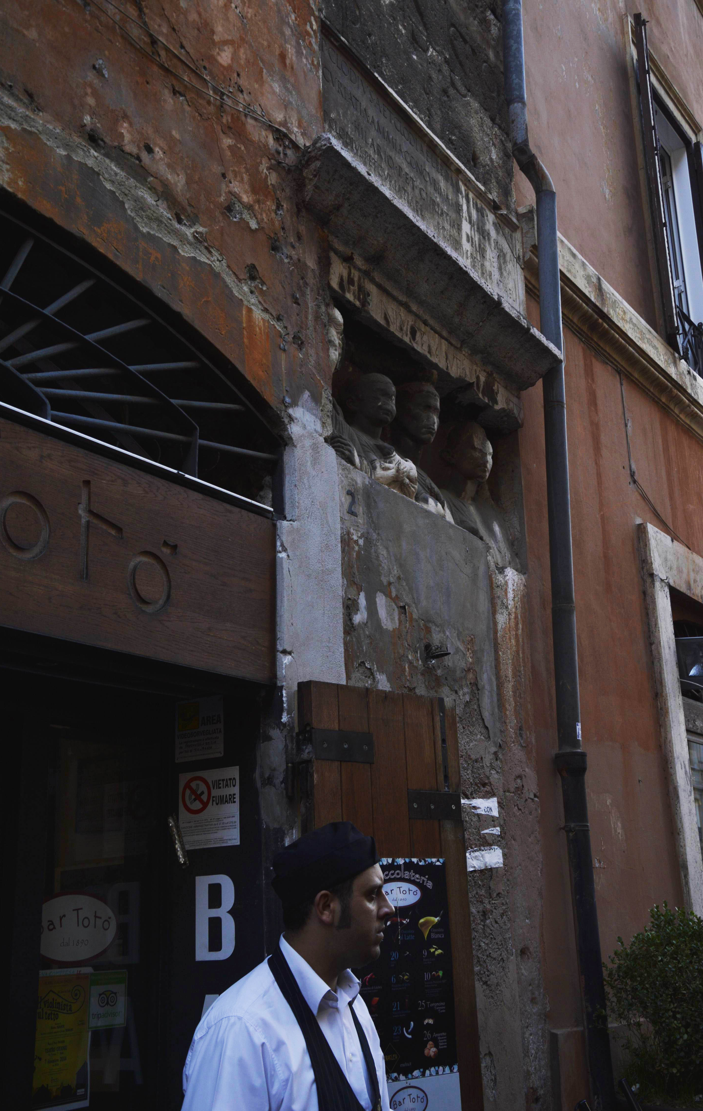
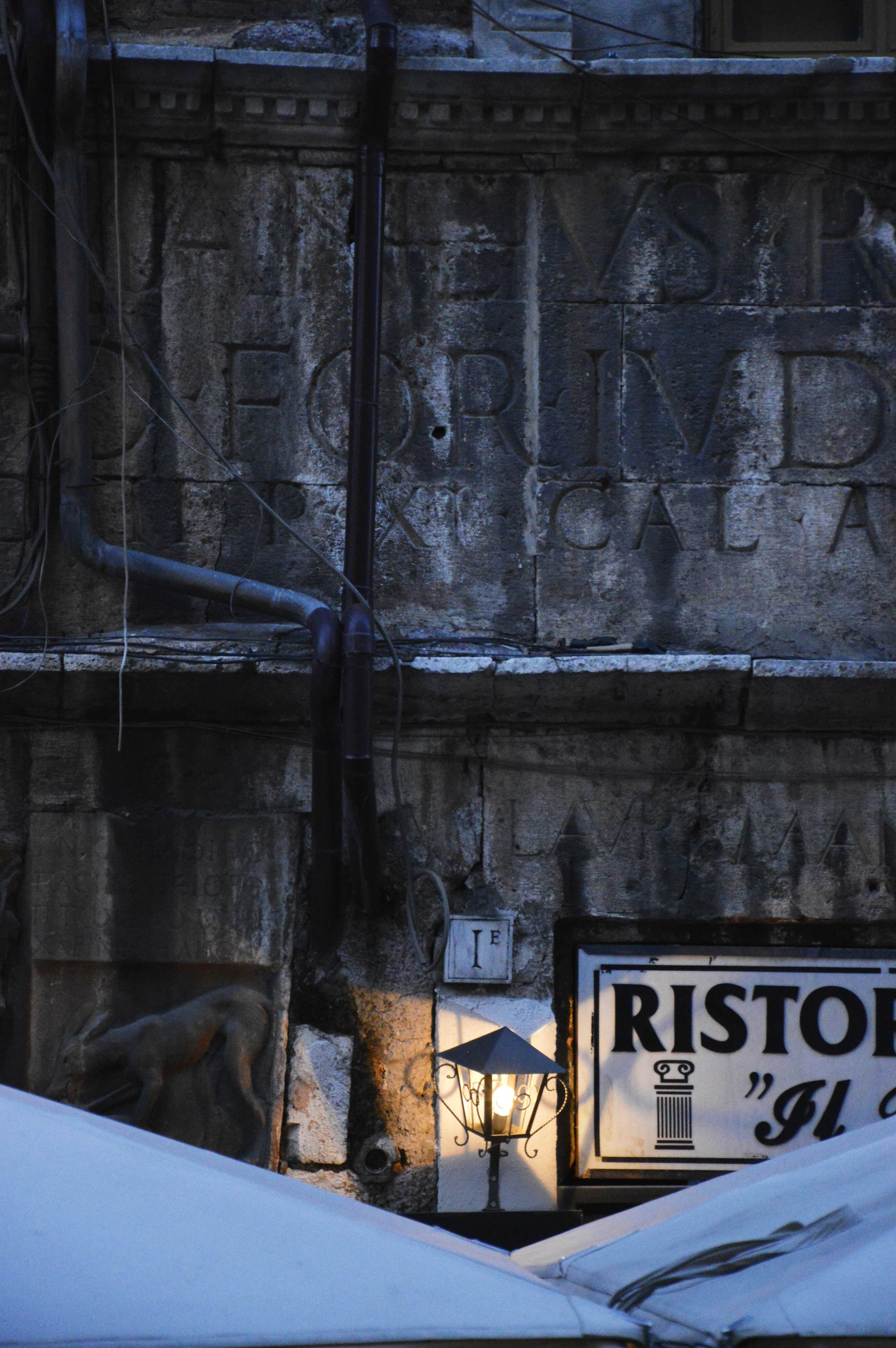
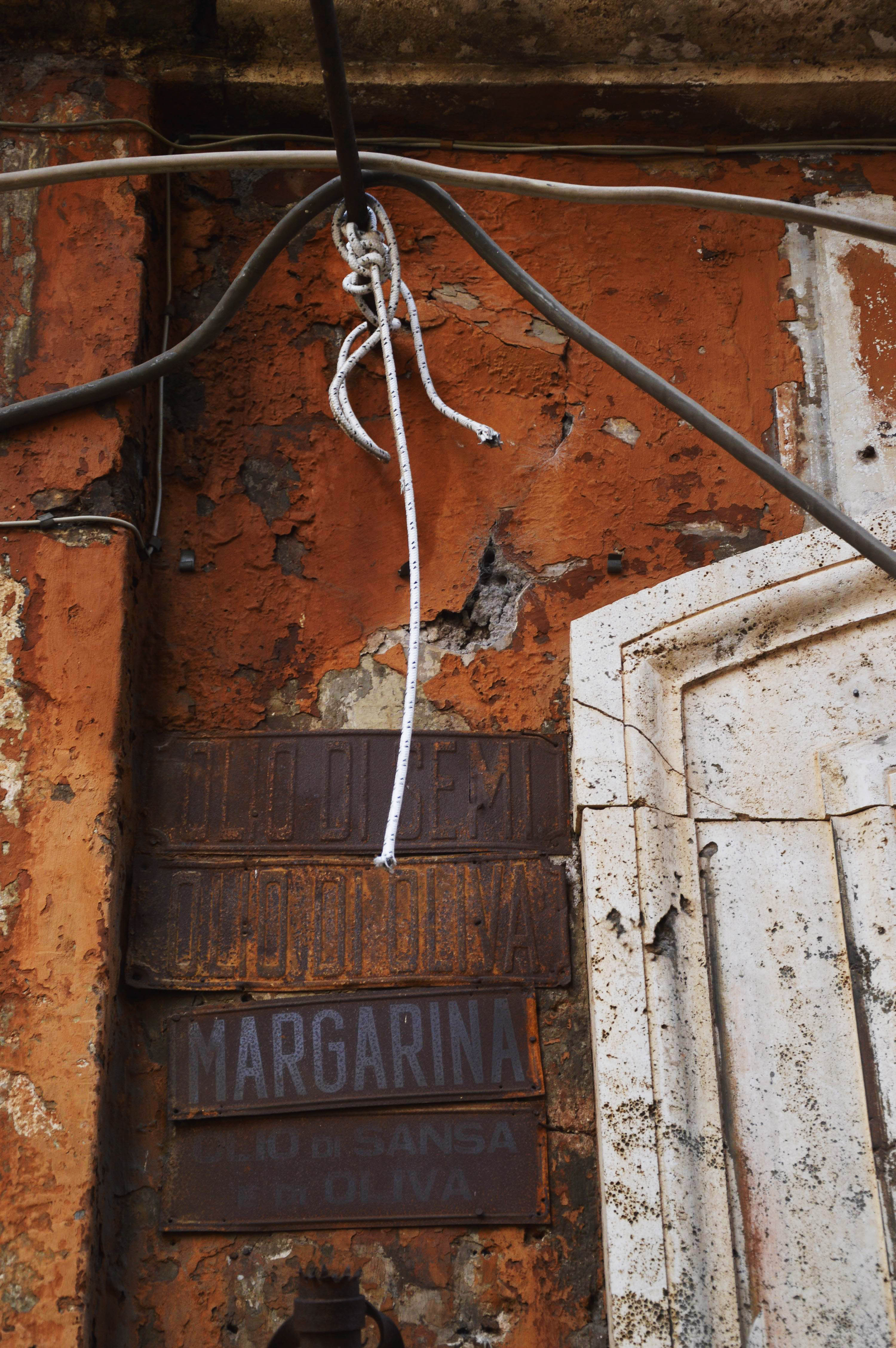
Under the ledge, Bar Totò was a center of the neighborhood’s social life for several decades. I also often came here in the middle of the 1990s. Although the sign did not change, an elegant restaurant has now taken its place under the name of “Ristorante Il Portico”, which refers to the portico of Octavia at the other end of the street as an easy-to-find reference point – we will write about it soon. The drugstore next to it, however, has been closed for many years. The decades-old tin plates next to its door, as well as the ghost signs under its fallen wooden or ceramic letters, offer a glimpse of insight into the layers of the building’s history.
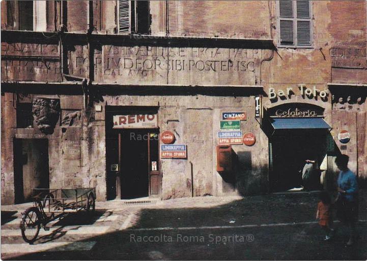 Bar Totò in the 1960s. From the Roma Sparita group (it is worthwhile to read the nostalgic remembrances in the group’s FB page)
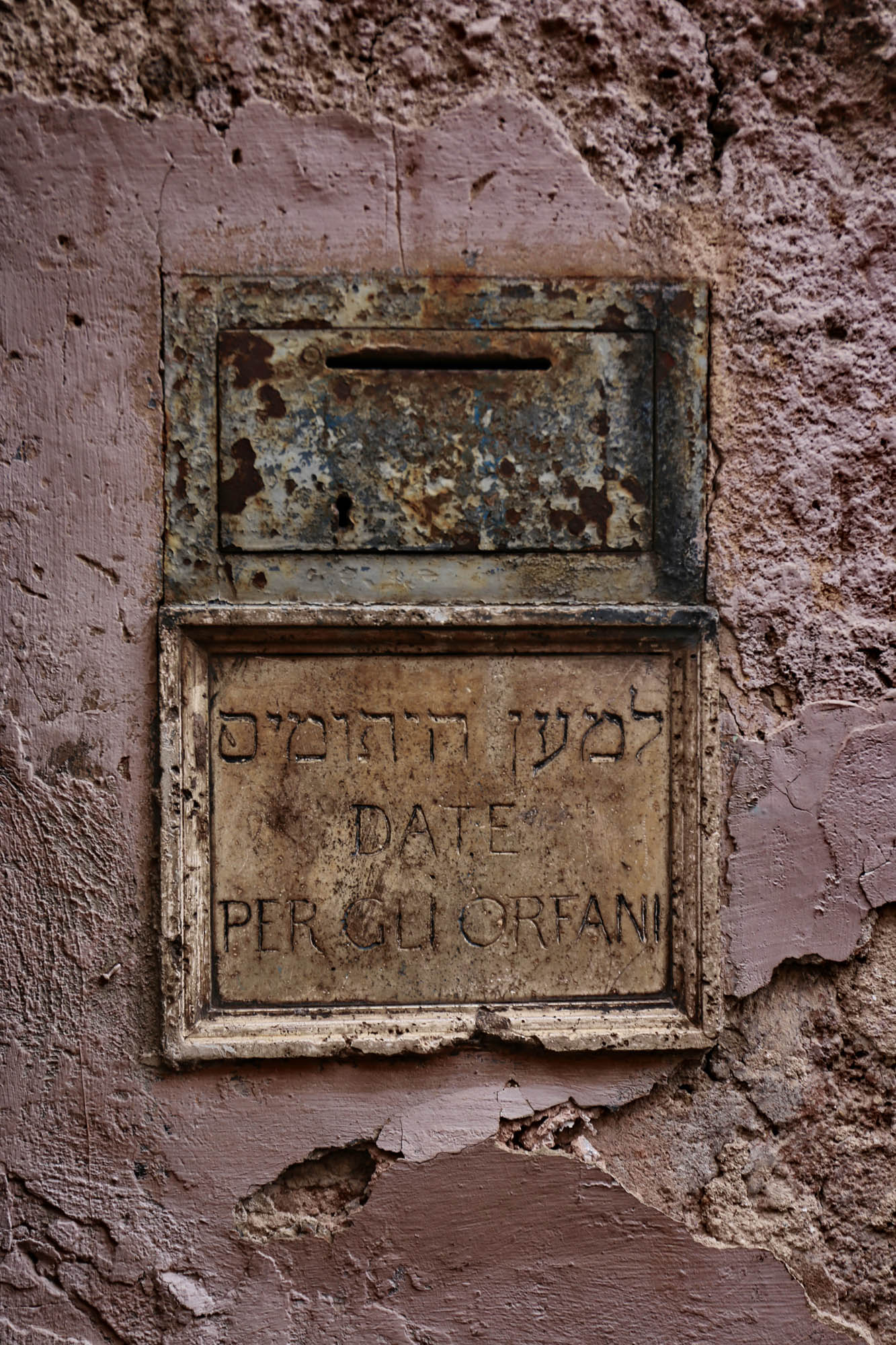
Right below the tombstone, at the height of one’s hands on the wall, as if to counterpoint the vulnerability of ancient children, a fundraising box for Jewish orphans.
The inscription mentions that the house was built on the corner of the Forum Iudeorum, the Jewish Square. However, there were two Jewish Squares here. This was the northern border of the ghetto (the dotted line running over the block marked with the N of ANGE(LI), which then turns down to the left along vicolo de’ Cenci marked with number 752), and one of the ghetto’s five gates that open between the two squares marked with 1025 and 1026, “piazza Giudea fuori del Ghetto” and “piazza Giudea dentro del Ghetto”, the Jewish Square outside and insite the ghetto, respectively.
The ghetto was opened in 1862. Its residents settled in the surrounding streets, opening shops, businesses, restaurants. From this time come the first photos of the Manili House, which represent the area as a fully Jewish neighborhood.
 1910. In the place of the future drugstore, we find the Fornaro (Bakery) di Piazza [Giudea]. Standing in the door, the owner, Attilio Piperno, with his sister and younger brother Romeo.
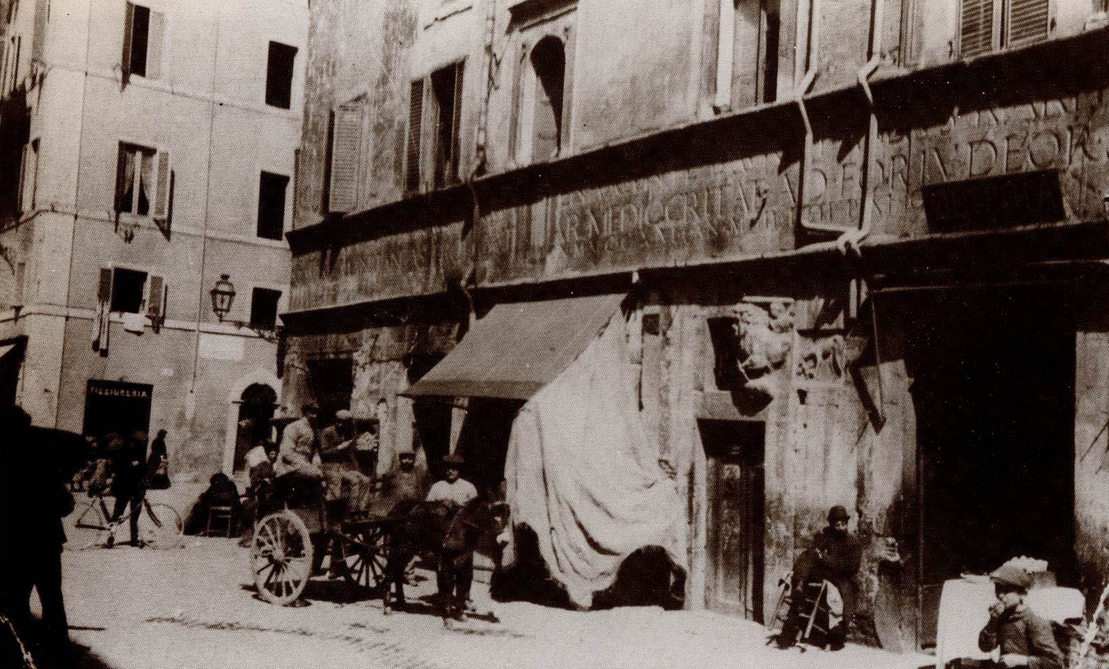 Early 1900s. Donkey-drawn tourist bus. On the left side, the main sight of the quarter: the first cyclist, Alberto Fornari, with his “Durkop” brand British bicycle.
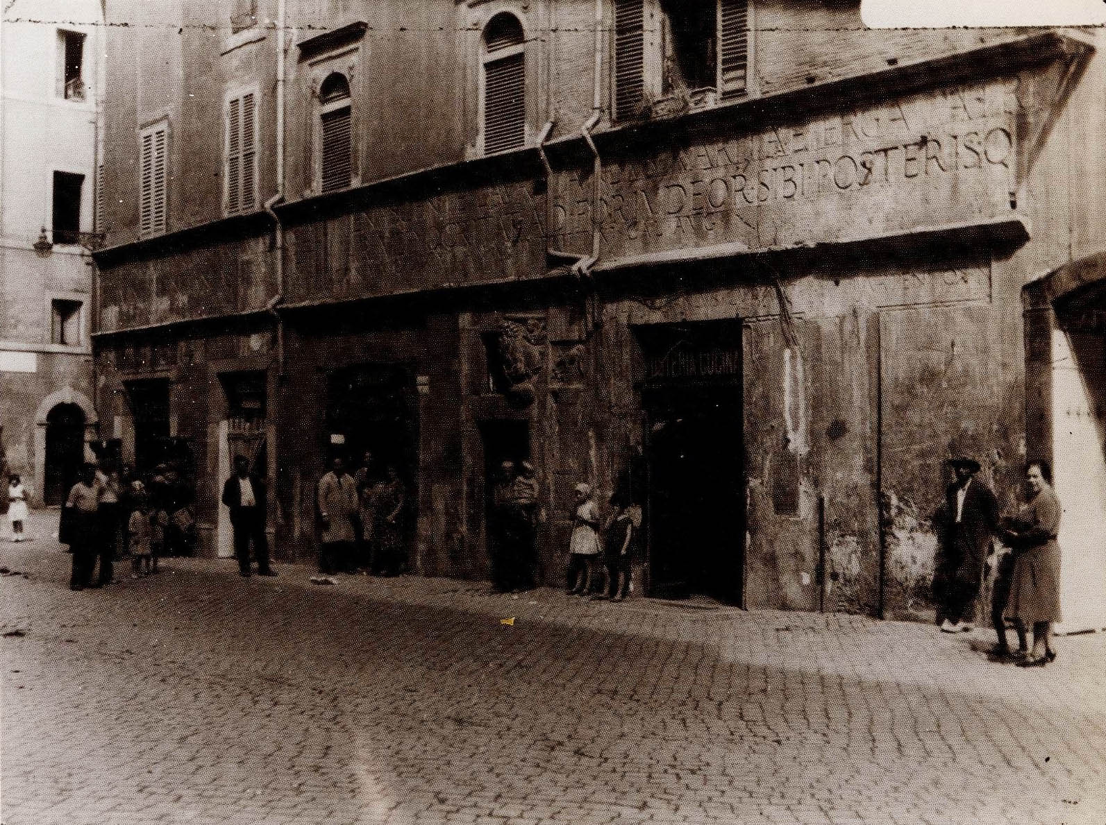
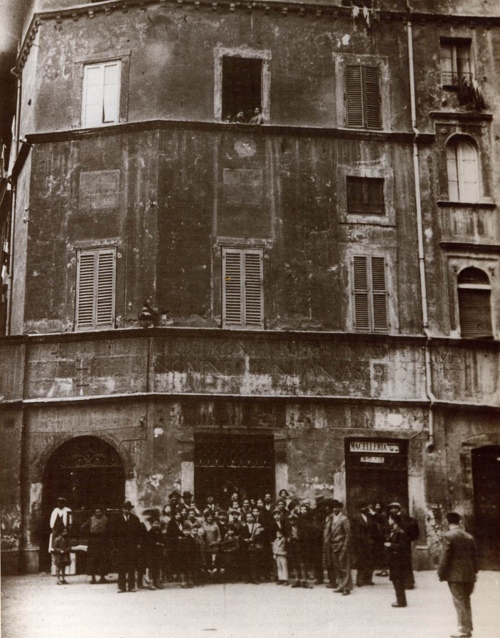 1936. A group photo of the Jewish residents of the street. On the corner, the Jewish bakery and confectionery shop Boccione, in front of which, still today, Romans, both Jewish and non-Jewish, and stranieri, stand in line. Just as I did, only three weeks ago.
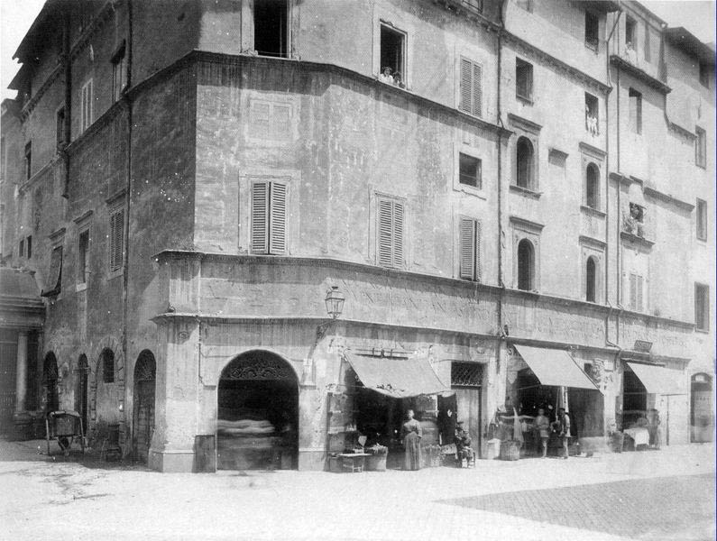 The Manili House at the turn of the century. The bakery on the corner is clearly visible.
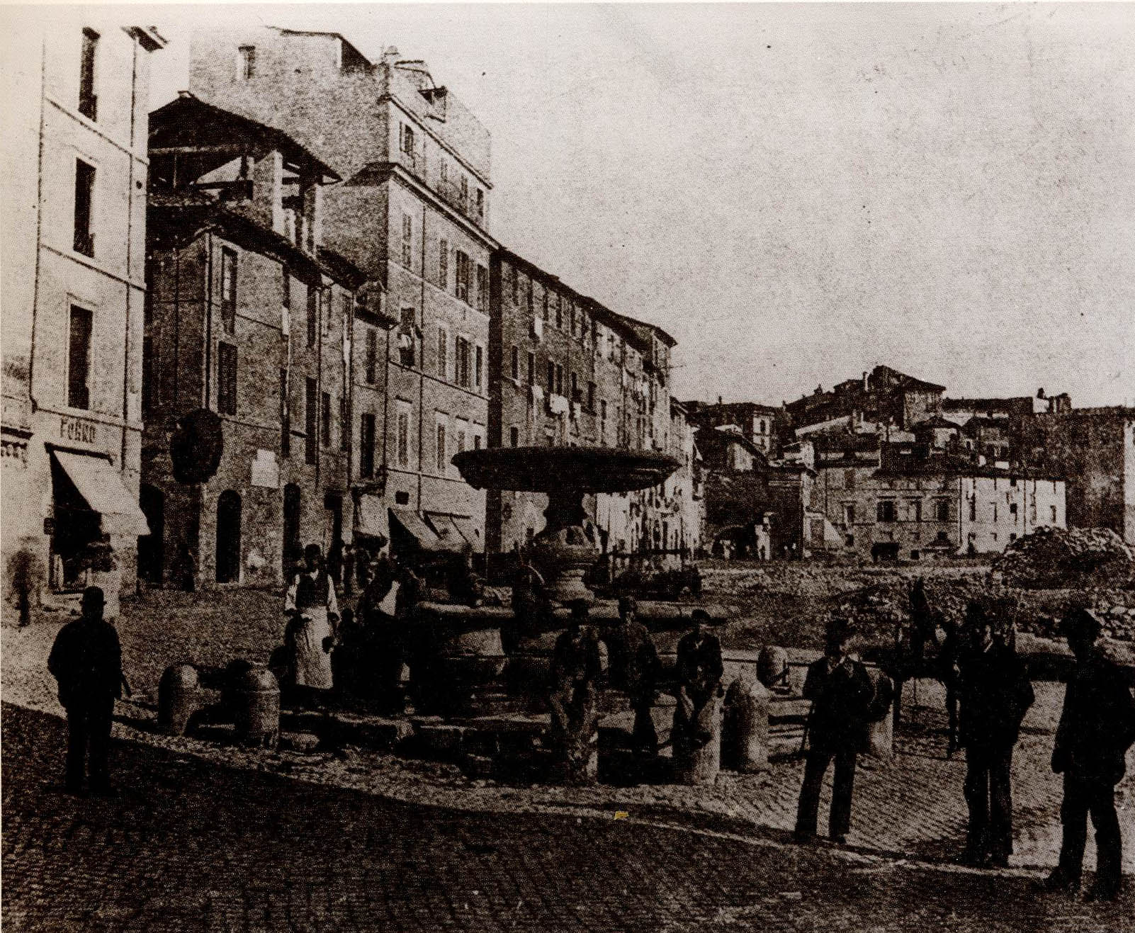
In the last photo, our perspective turns slightly to the right. On the left side we just see the corner of the Manili House. In the background, a few blcks away, the fish market established in the portico of Octavia, about which we will soon write more. It is 1910, and the demolition of the old ghetto has begun. The medieval block of flats has already disappeared from the middle of the photo, but the public high school has not yet been built: now for the first and last time we see it as spacious, as in imperial Rome, when the Circus Flaminius opened in this square. And here we see, for the last time, a Renaissance fountain in the Jewish Square Outside-of-the-Ghetto, which was also marked in the Nolli map in front of the Manili House. As to what was this fountain, who erected it here and why, where it disappeared to, and where you can see it today, it would force this post to burst at the seams. We started to write about only one house, and somehow it has sucked in the two thousand years of Rome. So we will have to dedicate a new post to it. Follow us.


 Come with us to…
 Atlantis
 Bestiary
 Bohemia+Prague
 Books, exhibitions, music, film
 Brave old world
 Caucasus
 Cemeteries
 Crimea
 Get to know the
 Images of the East
 Lightwriting
 Lwów/Lemberg
 Mallorca
 Message on the wall
 The Museum of Propaganda
 Odessa
 Paper Museum
 Persian letters
 The Jewish heritage


No hay comentarios:
Publicar un comentario