
The Georgian military road, built out by the Russian army from 1799 under the leadership of General Yermolov, followed therefore the trace of a much more ancient road, and allowed Russia to conquer and annex Georgia in 1801.
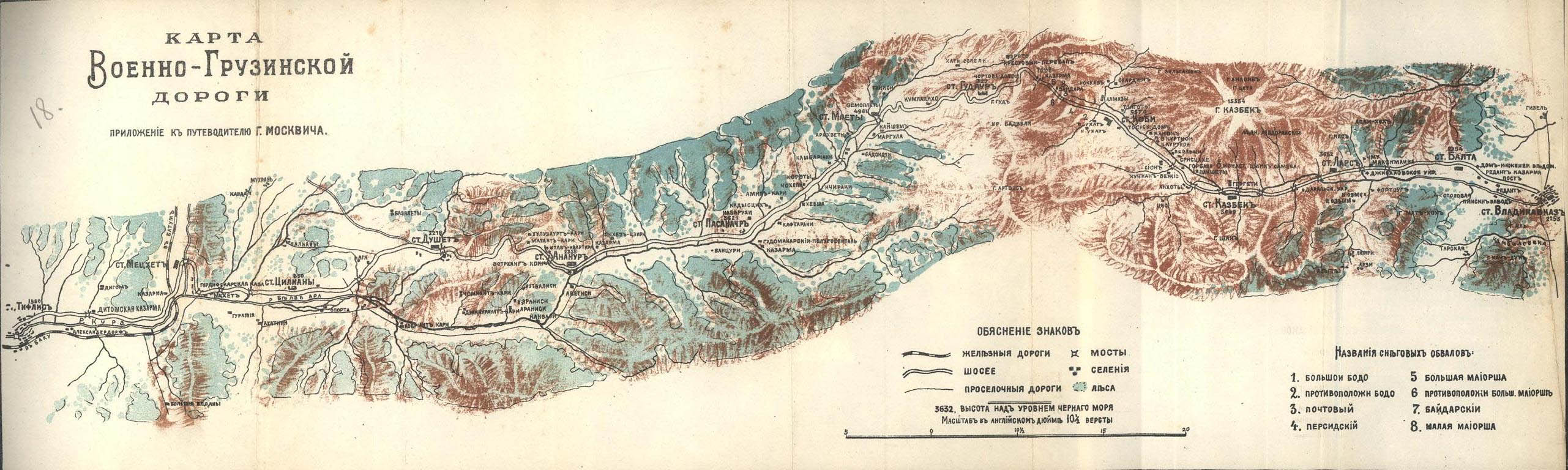 The Georgian military road. Map from Grigory K. Moskvich’s Практический путеводитель по Кавказу (1913)
 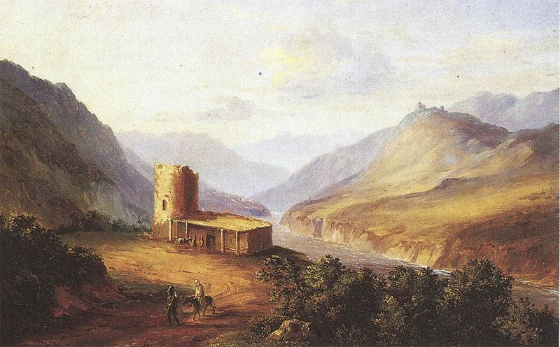 M. I. Lermontov, View of the Georgian military road
At the beginning of A hero of our time, the anonymous narrator arrives after sunset to the Pass of the Cross. He must then hire a team of six oxen and some Ossetians, rather than join a camel caravan, as the ice makes the roads slippery.
| Направо был утес, налево пропасть такая, что целая деревушка осетин, живущих на дне ее, казалась гнездом ласточки; я содрогнулся, подумав, что часто здесь, в глухую ночь, по этой дороге, где две повозки не могут разъехаться, какой-нибудь курьер раз десять в год проезжает, не вылезая из своего тряского экипажа. | To the right, there was the cliff, and to the left, a precipice, so deep that a whole Ossetian village below seemed like a swallow’s nest. I shuddered thinking that on this very road, where two carts could not pass by each other, a messenger travels even ten times a year, often in the darkest of the night, without ever getting out of his shaking cart. |
This is how Lermontov described in 1840 a road he had already traveled several times, as did before him Griboyedov and Pushkin. At the Pass of Jvari or of the Cross, where the narrator and his companion Maxim Maximich come along, in 1824 Ermolov erected a cross of red stone to replace the one built there in the 12th century by the Georgian King David the Builder.
| И точно, дорога опасная: направо висели над нашими головами груды снега, готовые, кажется, при первом порыве ветра оборваться в ущелье; узкая дорога частию была покрыта снегом, который в иных местах проваливался под ногами, в других превращался в лед от действия солнечных лучей и ночных морозов, так что с трудом мы сами пробирались; лошади падали; налево зияла глубокая расселина, где катился поток, то скрываясь под ледяной корою, то с пеною прыгая по черным камням. В два часа едва могли мы обогнуть Крестовую гору – две версты в два часа. | And this is a dangerous road indeed: on our right, masses of snow leaned toward us, which seemed ready to break off and tumble down into the ravine at the first gust of wind; the narrow road was partially covered with snow, which in many places sank under our feet, and in others was changed into ice by the sun in the daytime and the frost at night, so that the horses continuously fell and we could progress only with difficulty. On the left there yawned a deep rift, with a torrent running in its bottom, sometimes hidden under a crust of ice, and sometimes bubbling froth over the black rocks. In two hours we just managed to get beyond the Pass of the Cross – two versts in two hours! |

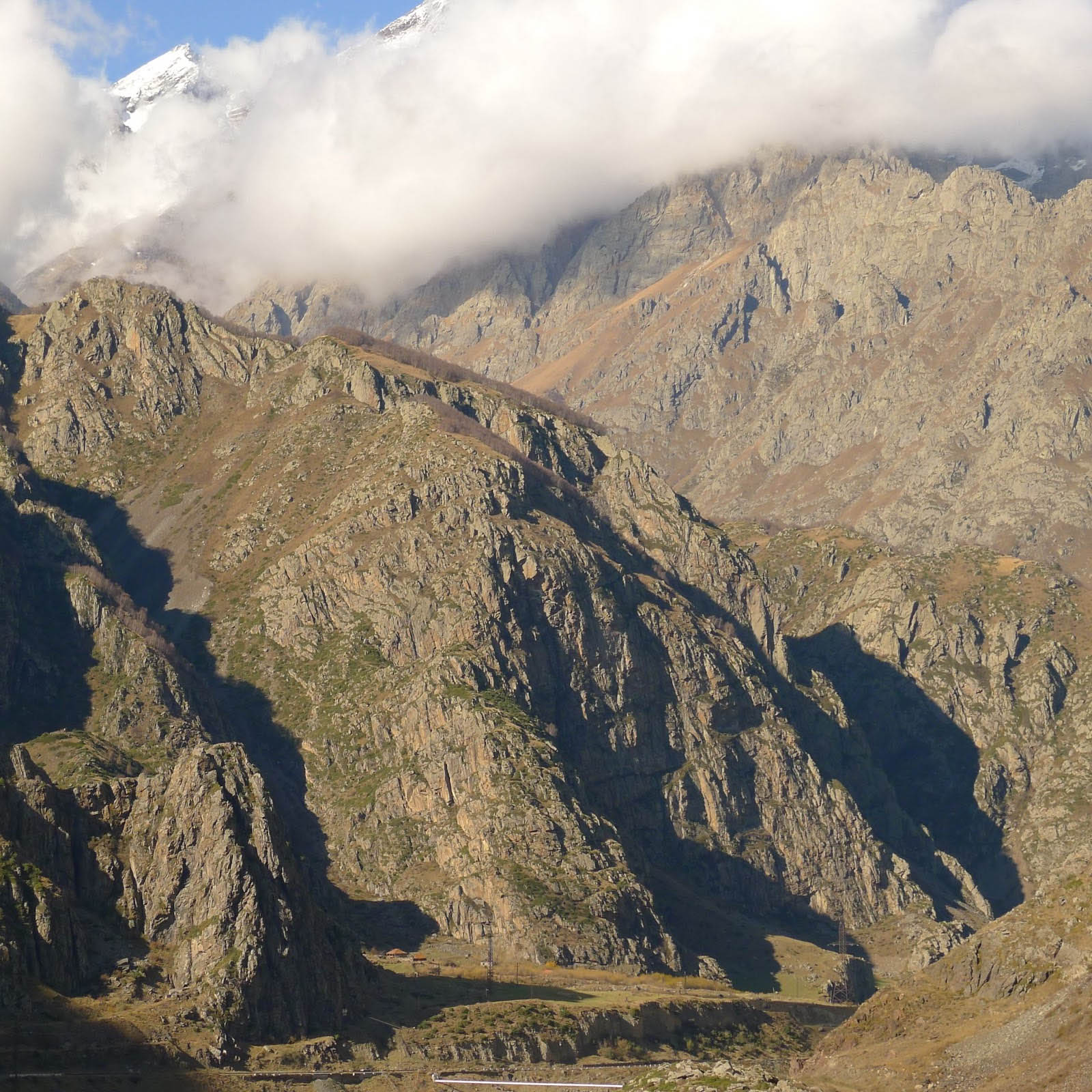
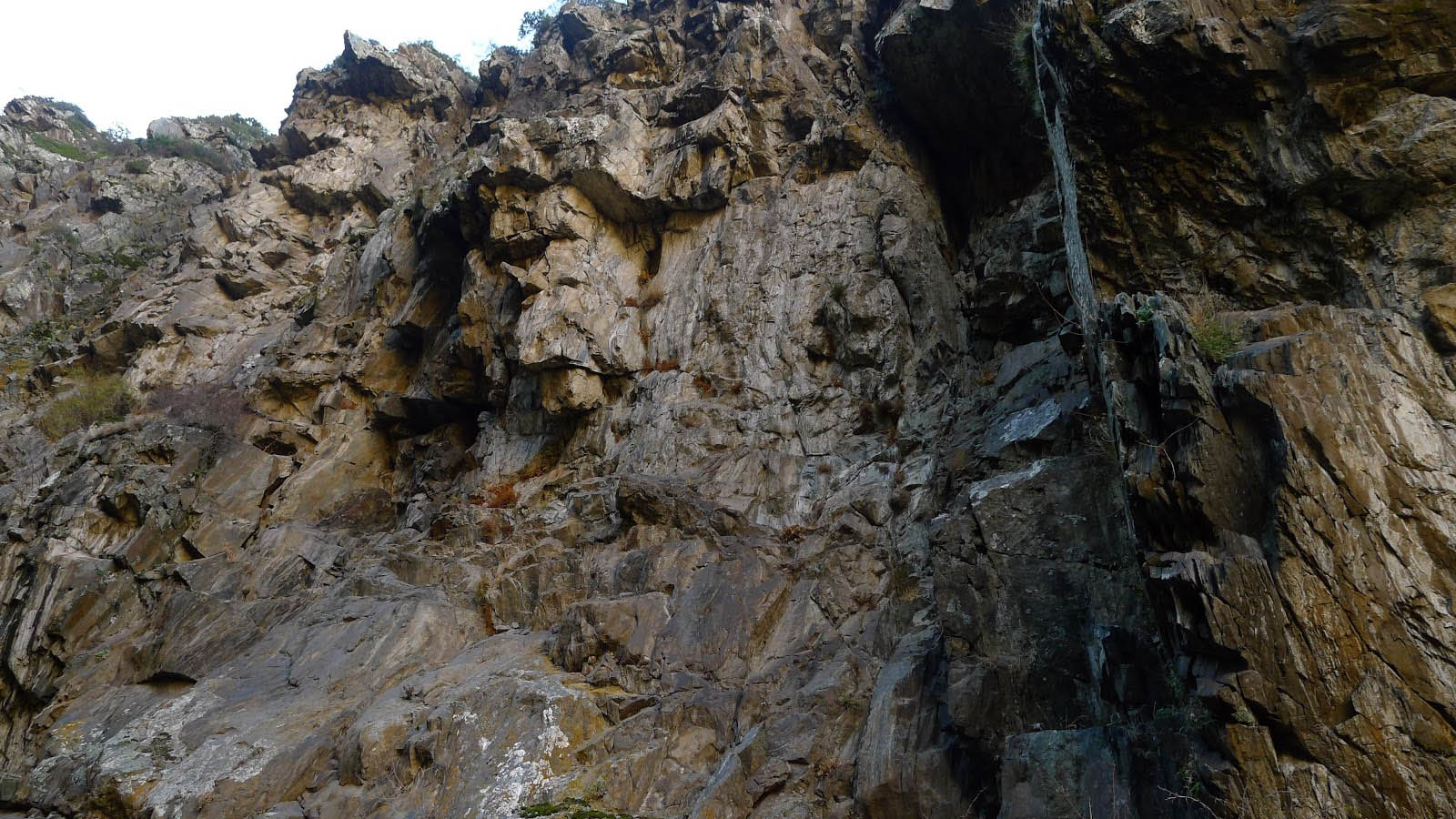
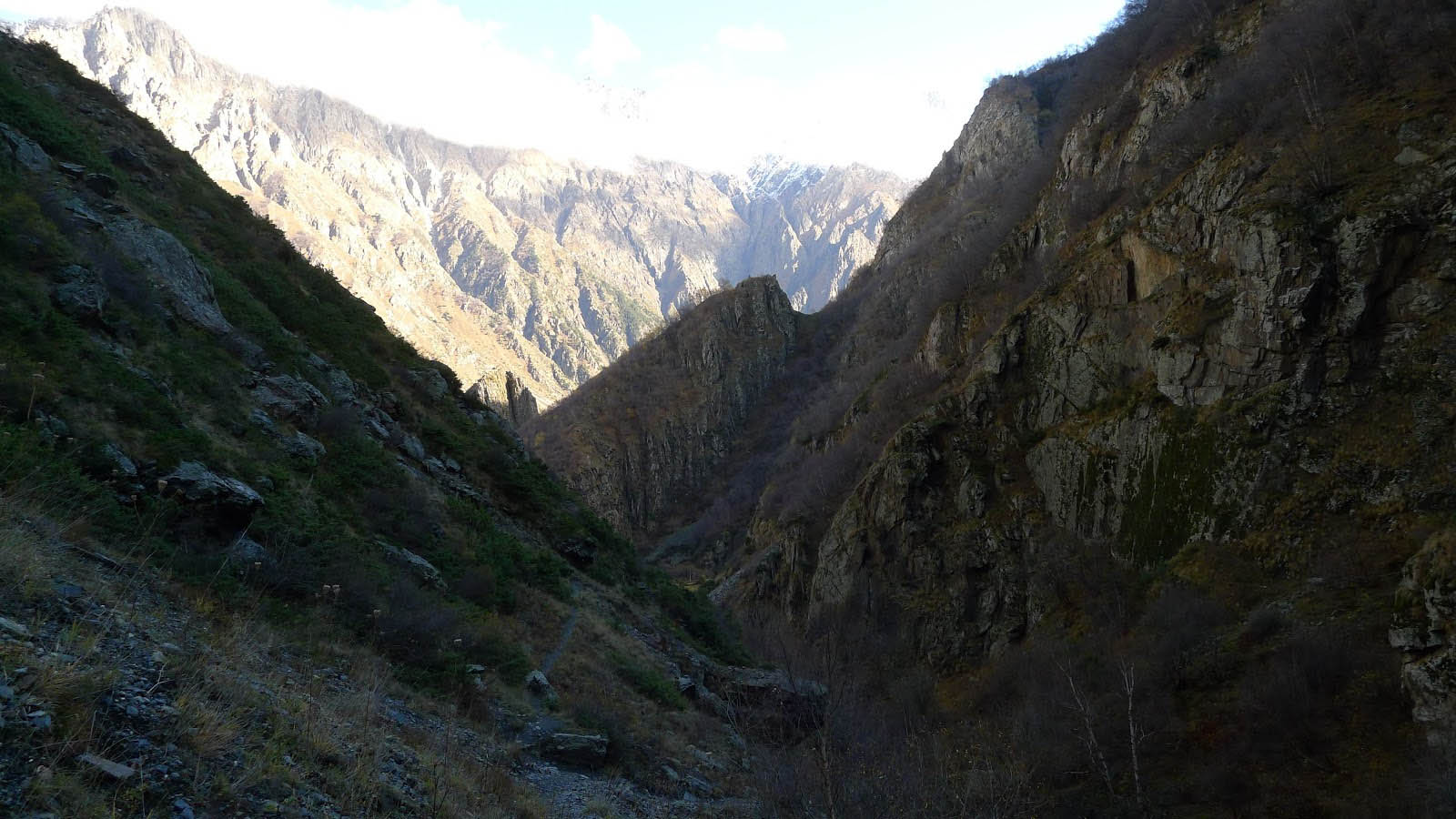
The route covers 208 kilometers from Vladikavkaz to Tbilisi. It was only completed in 1863, and from the beginning it was a road with two or three lanes, as it was photographed by Ermakov more than a century ago. It has been continuously enlarged and repaired, section by section. The traffic, which was halted between 2006 and 2010 because of the tensions and later the war between Georgia and Russia, was recently started again to ease the asphyxia of Armenia. Now it is possible again to cross the Russo-Georgian border, although the waiting time is very long in view of the usual administrative difficulties. The road itself was largely rebuilt in recent years, with the exception of two points: the section which corresponds to the rise and then to the descent of the Pass of the Cross – the Pass of Jvari –, which still suffers from the effects of snow and frost, and the portion before the border station at the Darial Gorge, because they recently built a dam on the Terek river.

In the 19th century the regular change of horses was made possible by the coaching inns, situated where now you pass by a gas station – but from the latter you can find only one between the Pass and the Russian border, as the locals prefer to buy the much cheaper smuggled Russian fuel. Where the old inns still exist, they are certainly the same which Ermakov photographed in the early 20th century.
But just like in the past, even today you can find taverns where both travelers and locals can consume khinkalis or pirozhki.
At the Russian border, next to a power station decorated with the Soviet star, they are building a church: the exterior is still unfinished, but inside a young priest is already selling souvenirs and candles.
We no longer see camels, only cows, everywhere, and often also sheep, like the previous night, when, just before crossing the Pass, the driver of the marshrutka with which I was traveling stopped on the side of the road, shouting and later whistling for a long time in the darkness. Nothing and nobody answered. Then he started again, turning from the road to a gray gravel field where, in my memory, there was absolutely nothing. He drove over a hundred meters to an abandoned building, maybe an old hotel. But what we saw in the headlights was not a hotel, but the white fleece, curved horns and frightened eyes of hundreds of sheep, closely pressed against each other. The driver continued to shout through the open window, counterpointing it with long whistles and honks, while the animals did not move at all. Then the outlines of a figure appeared from the void, a man approaching and waiting for the delivery of some box. They opened all the doors, and took down all the luggage, bags and cardboard boxes until they found the box, and then goodbye, a turn about with the headlights which for a last time swept over the still motionless herd, entranced by the light. We set off again.

On the southern section, coming from Tbilisi, in the valley of the Agvari, the road runs high above the river and the reservoir that lies between Ananauri and Mtskheta. On the northern section, between Sioni and Kazbegi the road runs in the bottom of the valley, on the right bank of the Tergi – the Terek –, only some two meters above the river. Further ahead, between Kazbegi and Tsdo the road passes on the left bank, and goes very high above a precipice, then it descends again and goes back to the right bank towards the Darial Gorge.

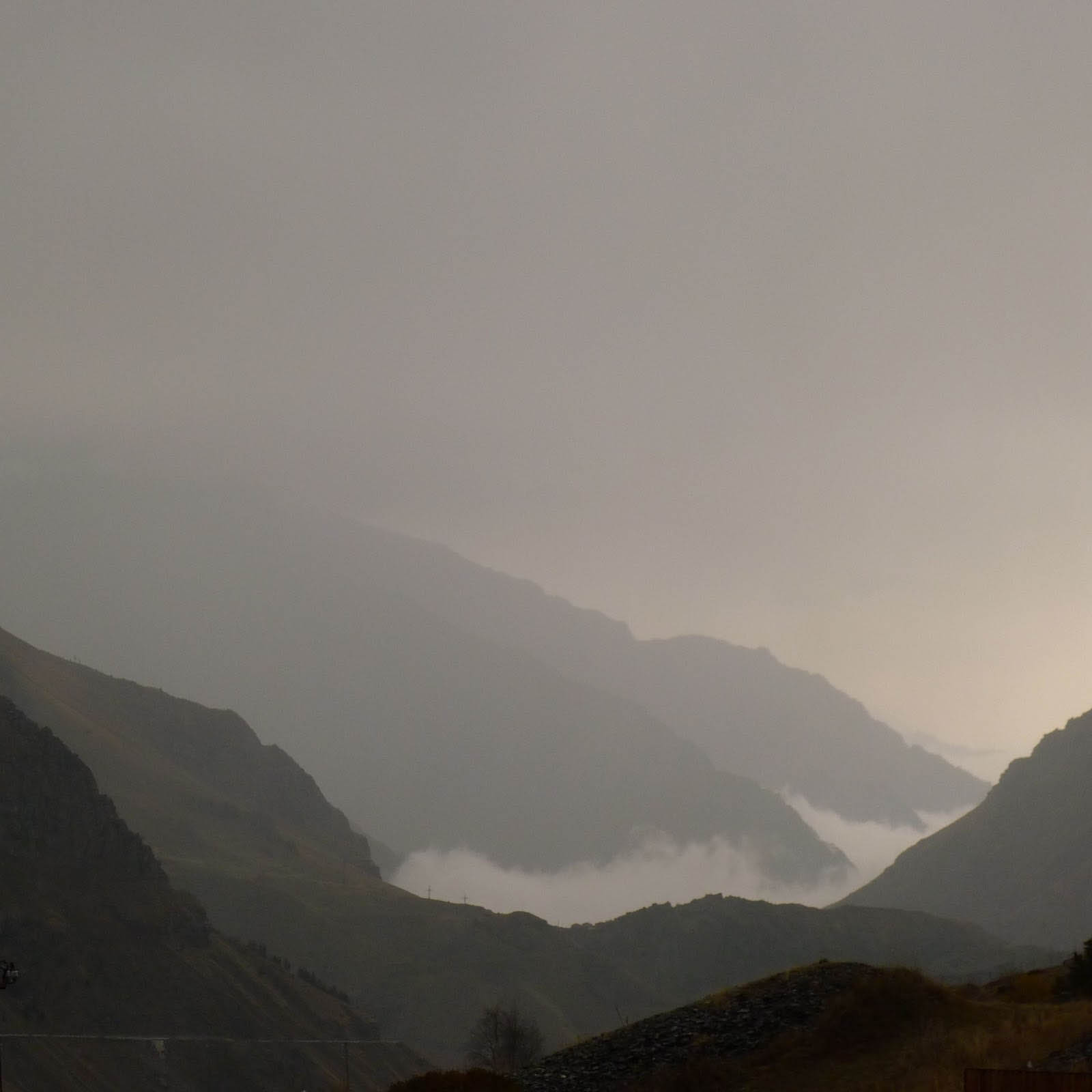
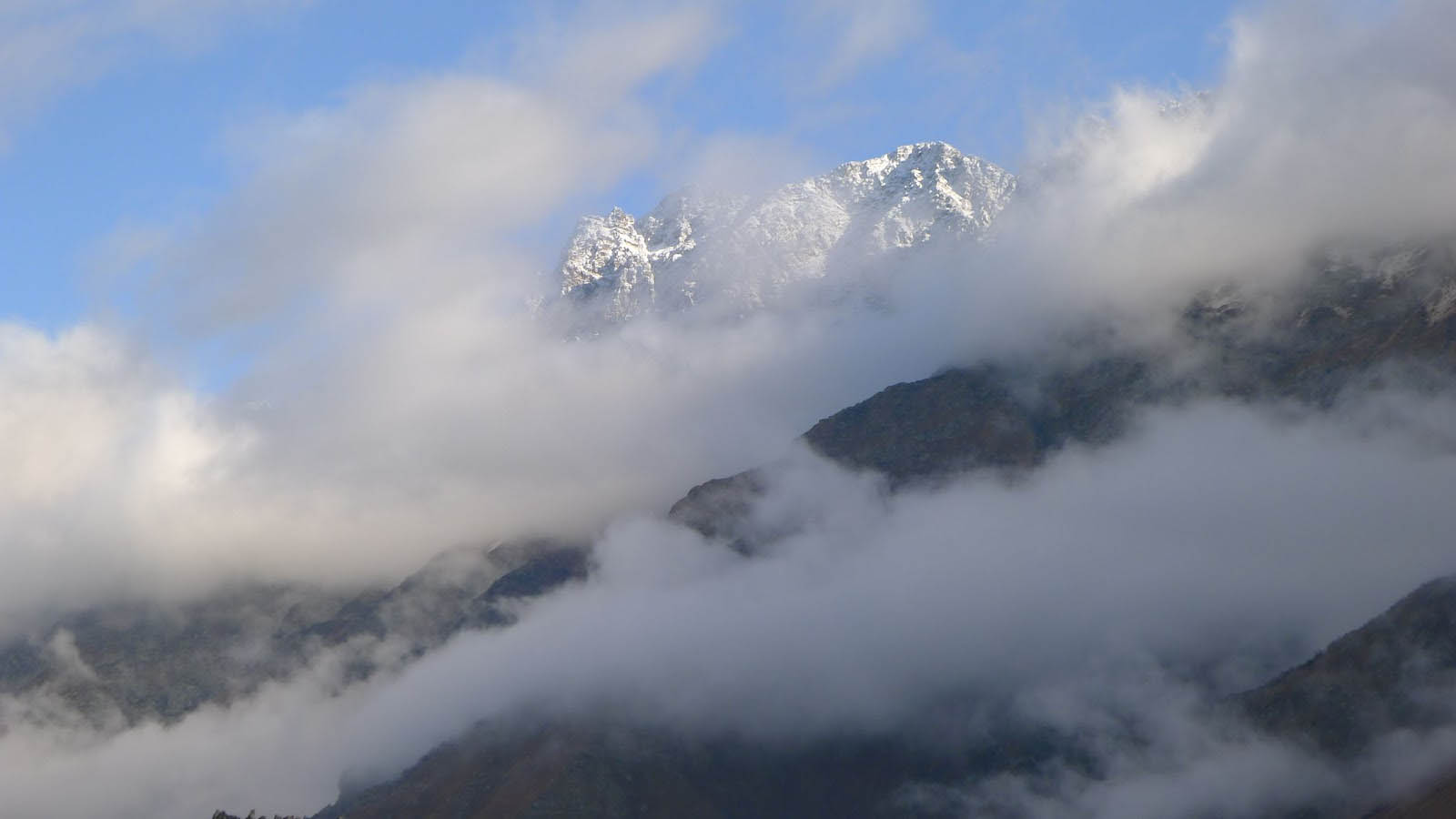
The main problem of the road, except for the border crossing, is the Pass. At this point the road reaches an altitude of 2395 m: fogs are frequent, the rain continuously washes away the road, which here has already lost any pavement, and the snow regularly breaks the winter traffic. Then the trucks and cars must wait in long rows until the snowplows clear the path – and then go slowly between walls of snow, that are known to hide the precipice bordering the road.

But these old photos do not show any village, at most churches and monasteries. True, also Pushkin described the landscape with certain unconcern: “taken by a wild impatience to reach Tiflis, I have passe by the Kazbek with as much indifference as if I were at the feet of the Chatyrdag. It is also true that the cloudy and rainy weather prevented me from seeing its snowy mass which, in the words of a poet, supports the horizon.” We can also certify that the Kazbek often hides indeed.
But villages did exist in these mountains. Villages of shepherds driving their transhumant flocks from the one side of the Caucasus to the other, which were then nationalized in different forms until the end of the URSS. Traditional villages, like in the rest of the Caucasus, composed of dry-stone houses enclosed within high walls. They were always located high above the valleys, and it was only in the 20th century that these villages were extended along the road.
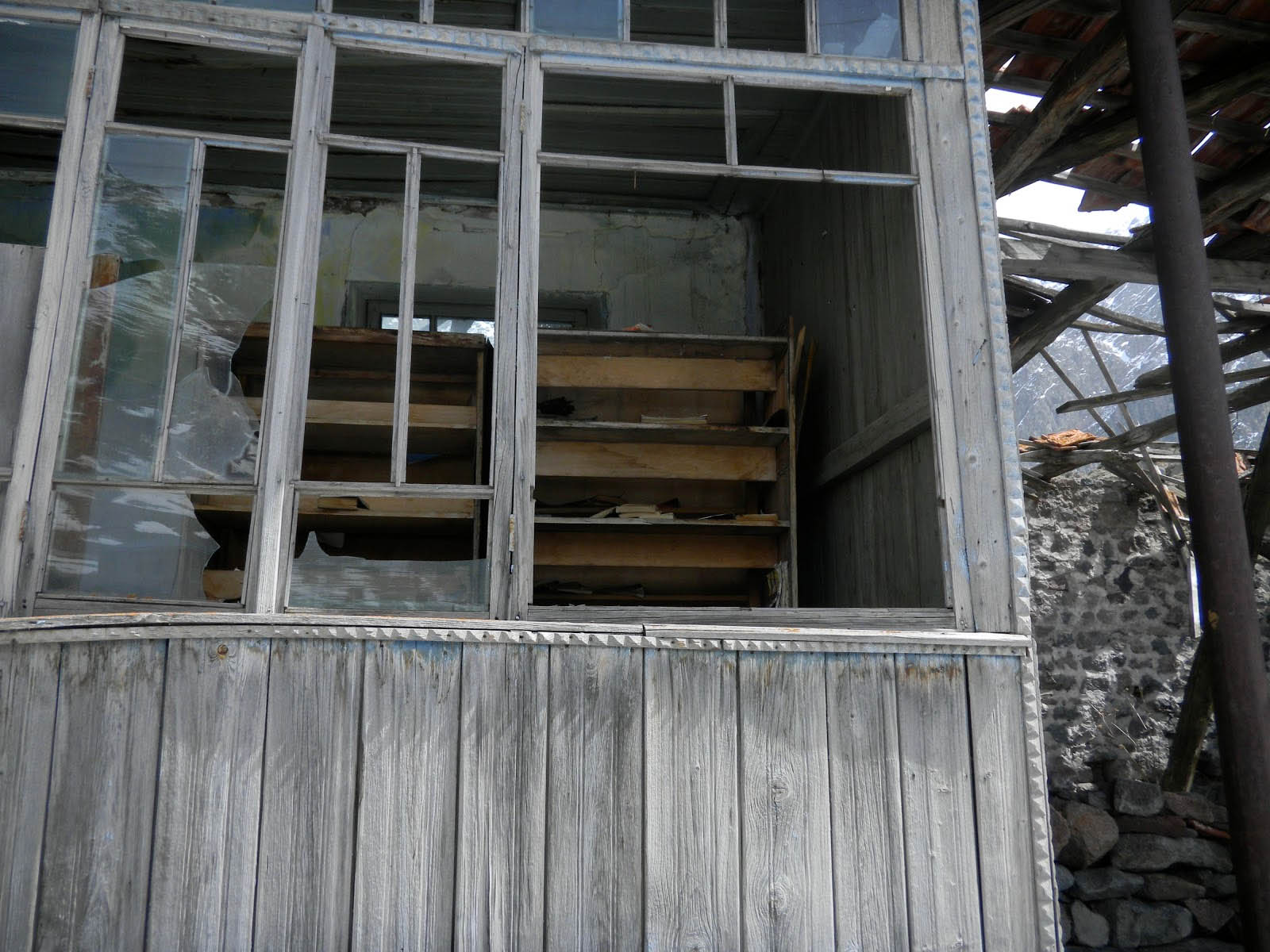
The villages on the mountainside were then gradually depleted and left by their inhabitants, while those in the valley have gained some comfort. In Gergeti above Kazbegi, many homes do not have running water, and have a latrine in the backyard. The stables are adjacent to the houses, and they heap up the hay on the roof as a prevision for the winter. One of two houses is an uninhabited ruin.
In Kazbegi, the central town of the district at the foot of Mount Kazbek, still there is farming and tourism in the summer. However, many people have left the region over the last century, and this phenomenon has become stronger since 1991.
A Tsdo, further north, by the last spring there remained only one house inhabited by an elderly couple. This desolate village, isolated in a terrifying solitude, enjoyed one of the most brilliant academic achievements of the Soviet Union, to the point of being called “the village of doctors” (while Sno, upstream, was “the village of mathematicians”). One of these doctors is the recently elected parliament representative of the district, the others come back sometimes for holidays. Their former school stays abandoned.
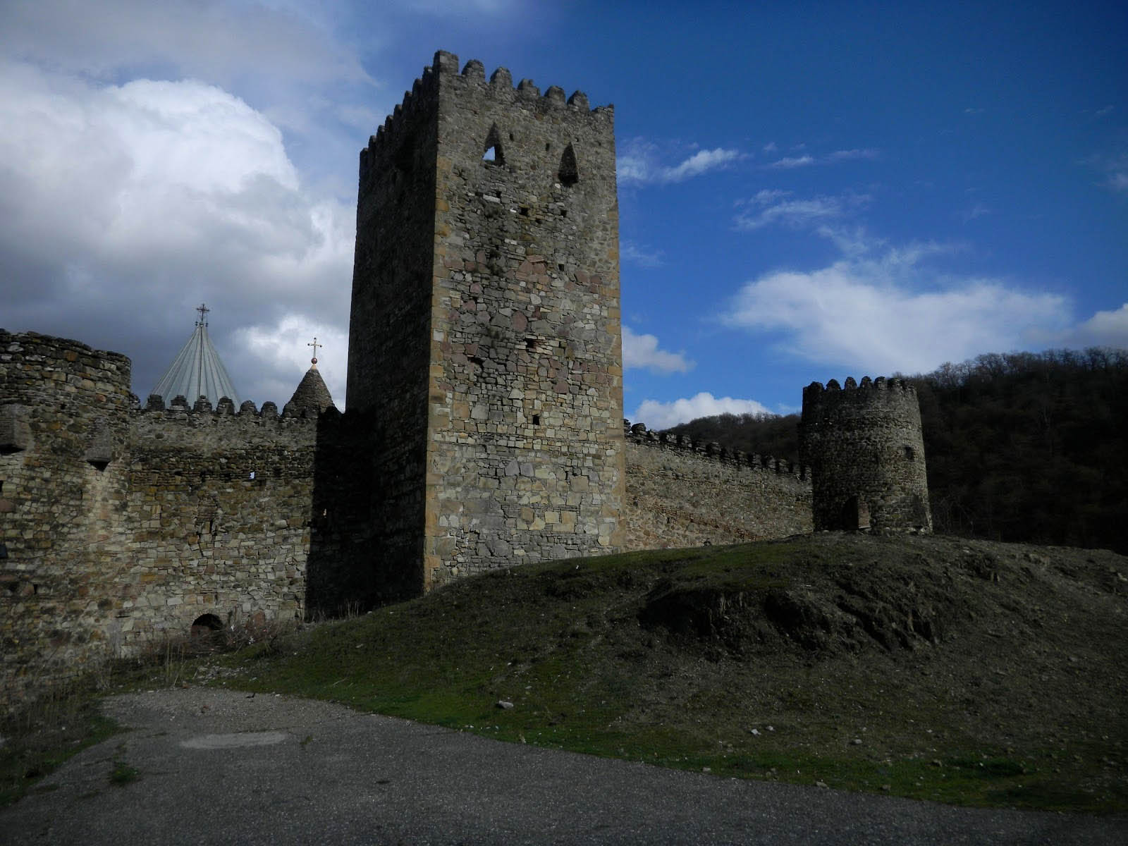 The fortress of Ananuri, to the south of the Pass of Jvari
en français • magyarul •


 Come with us to…
 Atlantis
 Bestiary
 Bohemia+Prague
 Books, exhibitions, music, film
 Brave old world
 Caucasus
 Cemeteries
 Crimea
 Get to know the
 Images of the East
 Lightwriting
 Lwów/Lemberg
 Mallorca
 Message on the wall
 The Museum of Propaganda
 Odessa
 Paper Museum
 Persian letters
 The Jewish heritage


3 comentarios:
Beautiful post, beautiful photos. Thank you, Catherine.
Thanks from me as well, and now I want to reread Lermontov.
don't stop travelling, don't stop telling
Publicar un comentario