  |
Ferkó, that is Dr. Ferenc Síkhegyi, research fellow of the Hungarian Geological Institute, who has already written on the representation of the pyramids on Baroque maps as well as the battlefield postcards of the Second World War, now surprises us with just another great essay on the secondary use of military maps.
Bilingual military phrasebooks could represent important sources of information in the various theaters of war. Nevertheless, the planning and conducting of troop movements was rather based on military maps.
The second half of the 19th century passed both in the Austro-Hungarian Monarchy and in the neighboring countries by covering their own territory as well as those of the neighbors with detailed maps which were suitable for military tasks, thus consciously preparing to “the glorious brawls” (Švejk) of the 20th century.
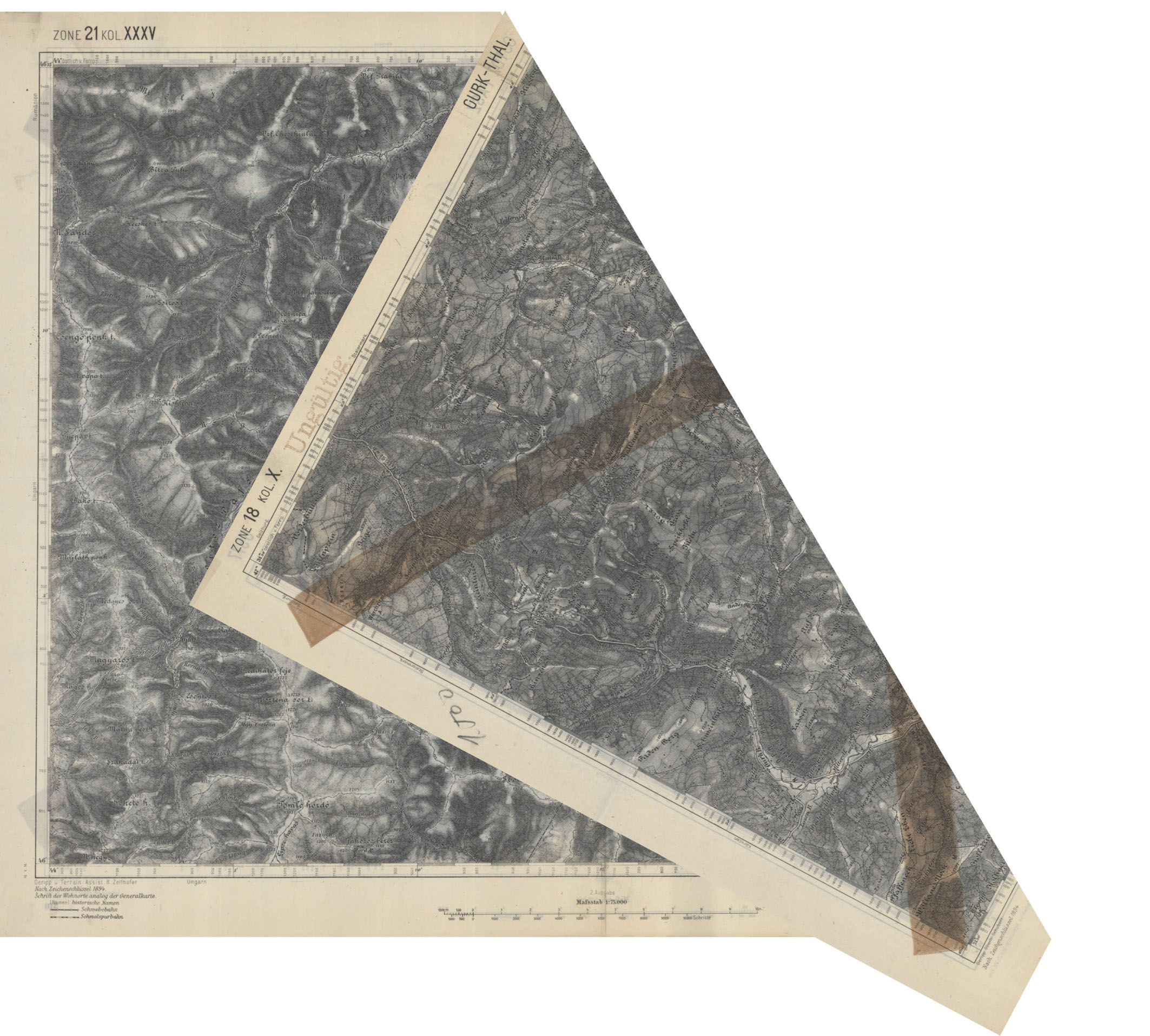
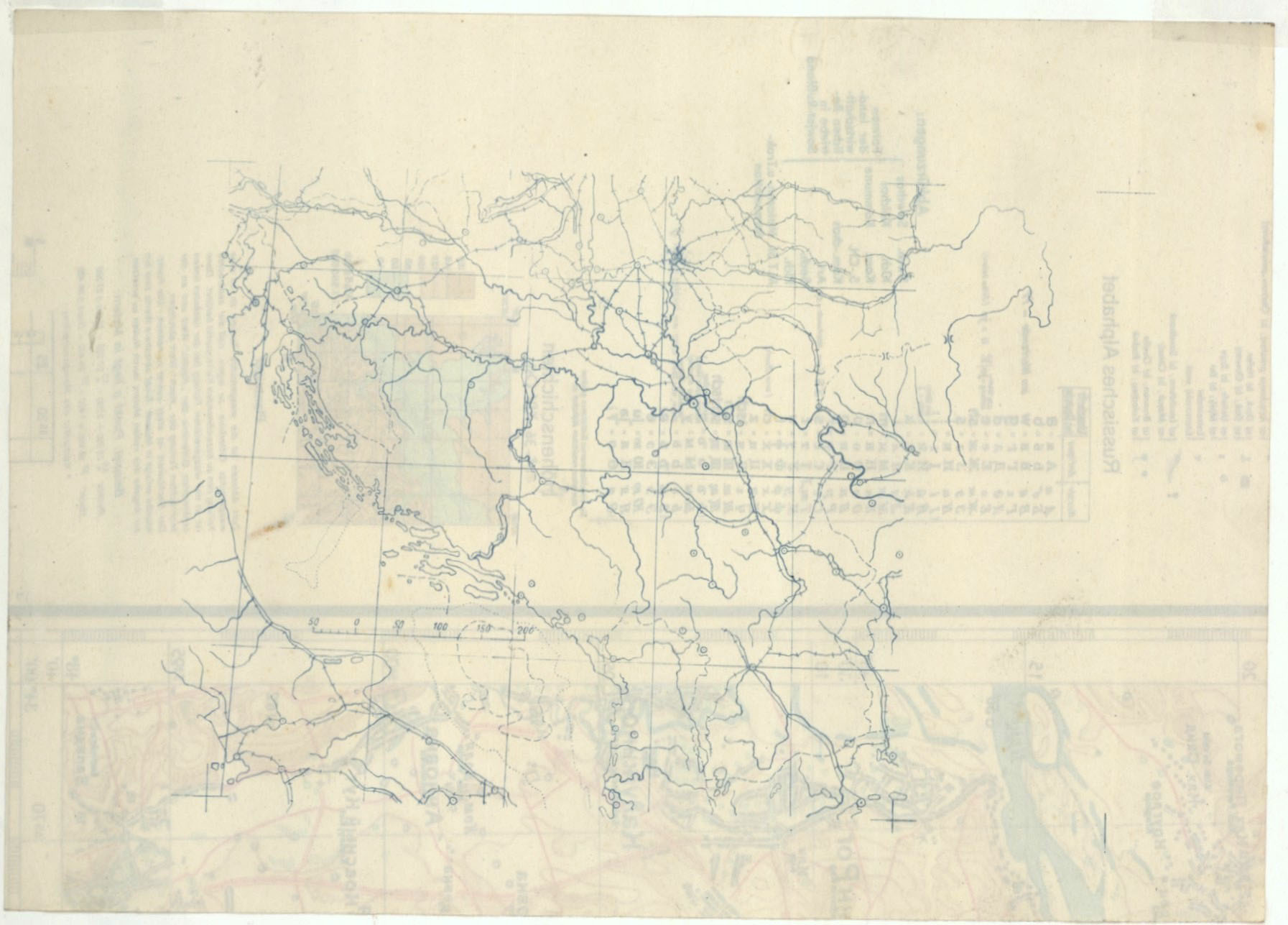
Such military survey maps were used by the Monarchy in the first world war both on the eastern front and in the Northern Italian region. The maps of the potential military operations were printed on the reverse of maps representing already secure areas, at least in the hopes of the military leadership. This original map became Ungültig, invalid, thus it was overprinted with a light gray color. If for any mistake the home territory became a theater of war, the map still would be readable and usable. In the piece below, the Hungarian-Romanian borderland, to the east from Lemhény, was printed on the reverse of the “Ossiacher See N section” of Carinthia’s map
The Second World War, however, was planned with more accuracy. As to the maps, an overprinting of the existing or captured maps seemed to be the most expedient. The German troops occupying Czechoslovakia, for example, received maps on which they printed in violet under the Czech village names their German equivalents. If it had none, they created one. (The same happened to the Hungarian or German names of the villages which after 1920 became part of Romania.)
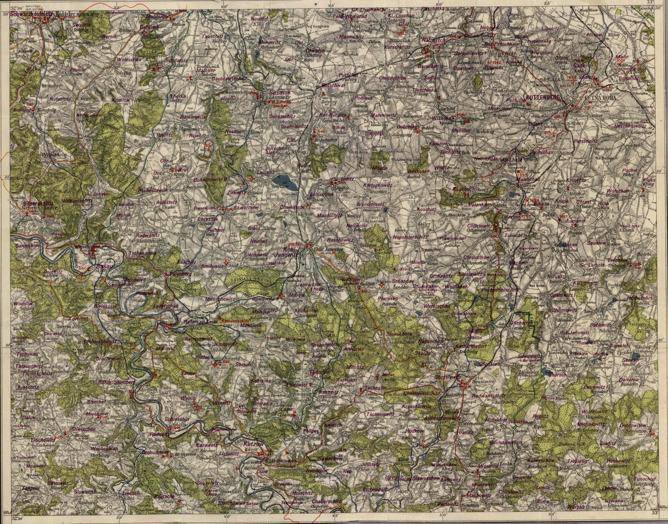
The map below is an overprinted civilian version of a cropped Czech military map for some guidebook, from the period of the Czech-Moravian Protectorate. However, the red overprinting is more interesting than the names of the settlements. They represent with symbols the castles, fortresses and towers, the places and dates of the major battles. The abbreviations accompanying the churches were probably made for the pious art collector, as they refer to the architectural style of the building (Rom., Got., Bar.)
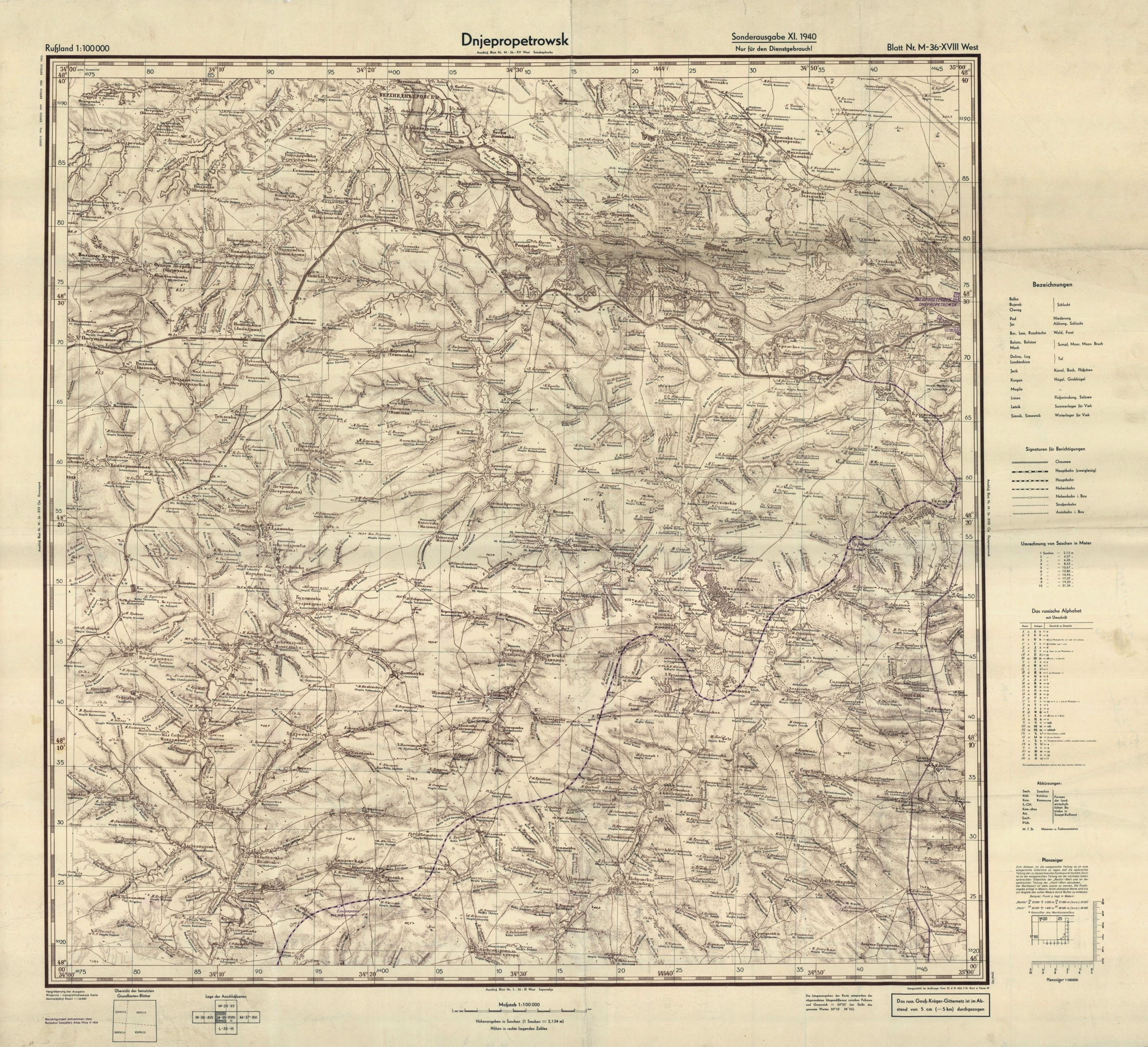
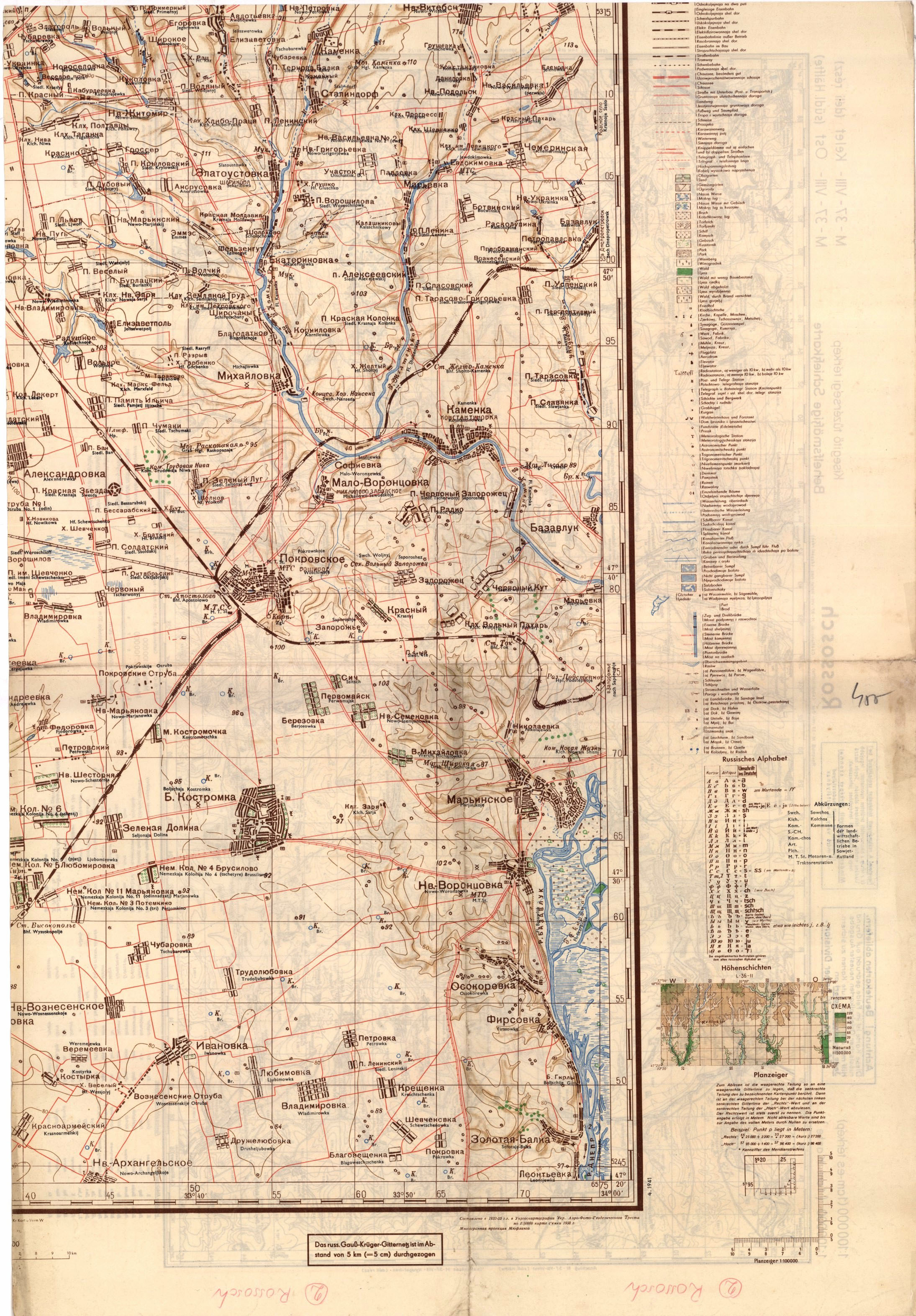
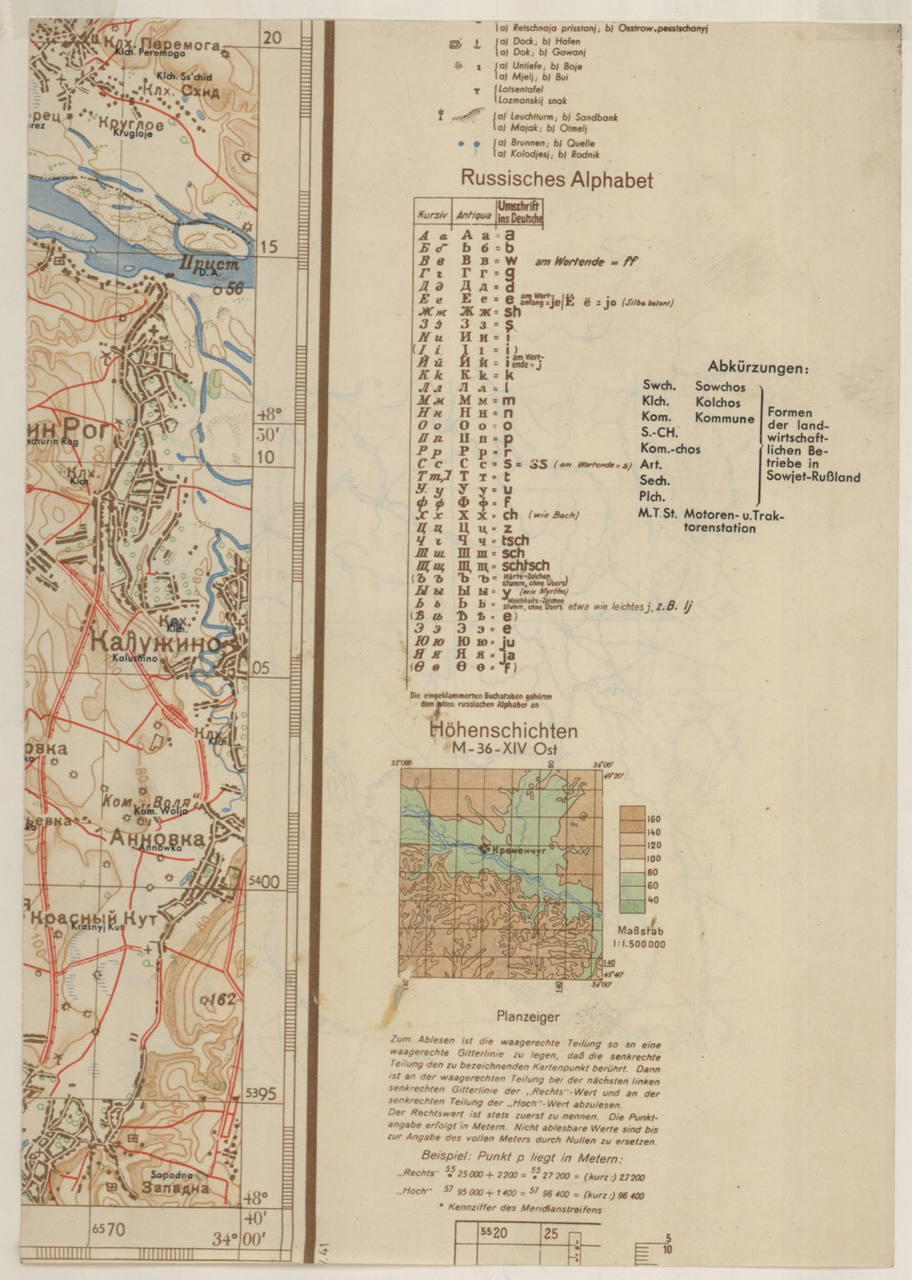
On the originally Soviet maps used to the invasion of the Soviet Union they also printed the German names of settlements and rivers/lakes, but they also added a complete alphabet to the deciphering of the Cyrillic letters, as well as the Romanized transcription of the most important geographical names and their translation. This is shown by a map of Dnepropetrovsk, made for the purposes of the front.
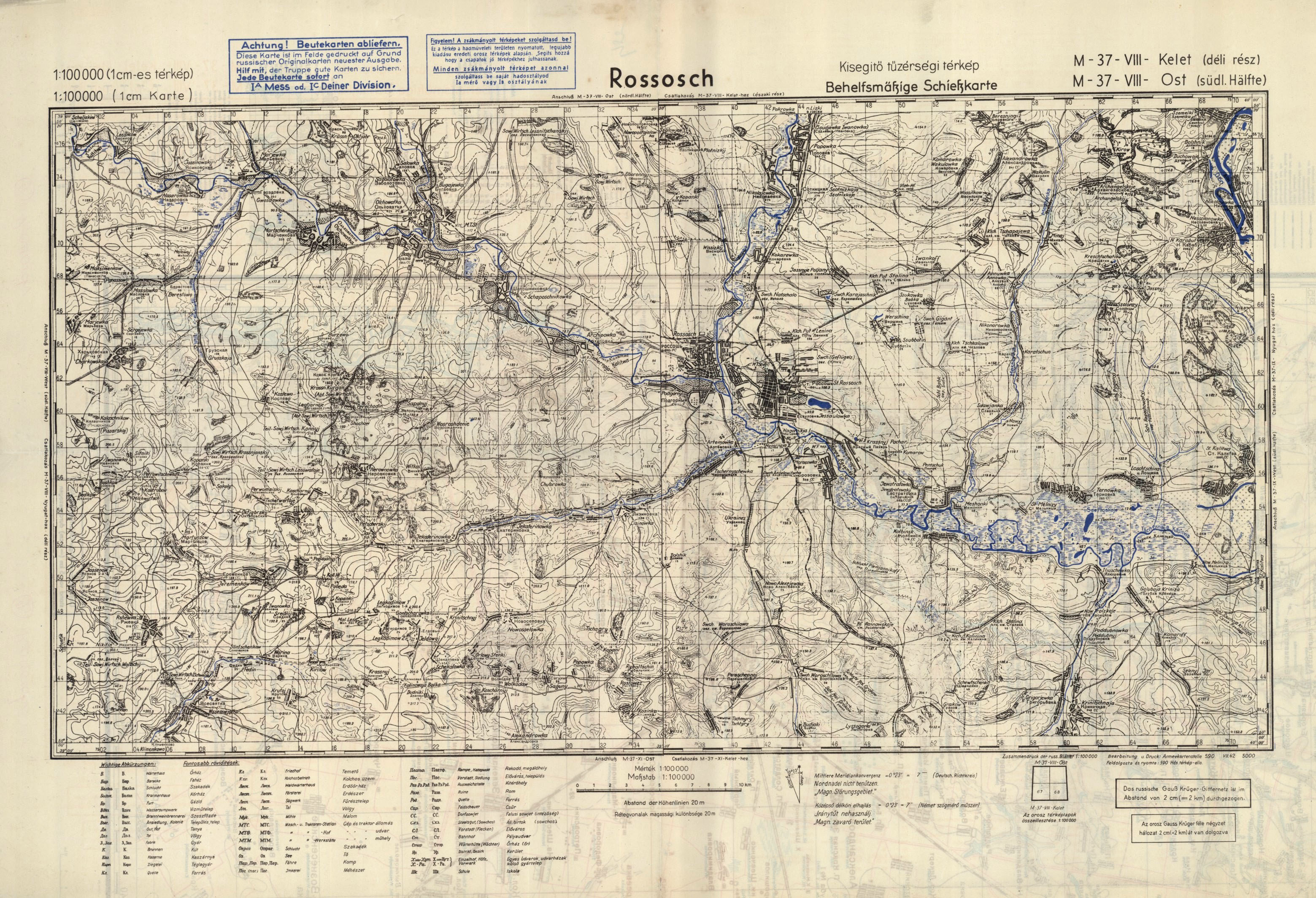
Then, while marching along the fateful path towards the Don, they mounted the necessary maps from the Soviet maps captured on the battlefield. On the middle of the Rossosch (Россошь) section you can clearly see the fitting of the original, captured maps, and the same is suggested by the German and Hungarian-language stamp of encouragement on the top of the pages.
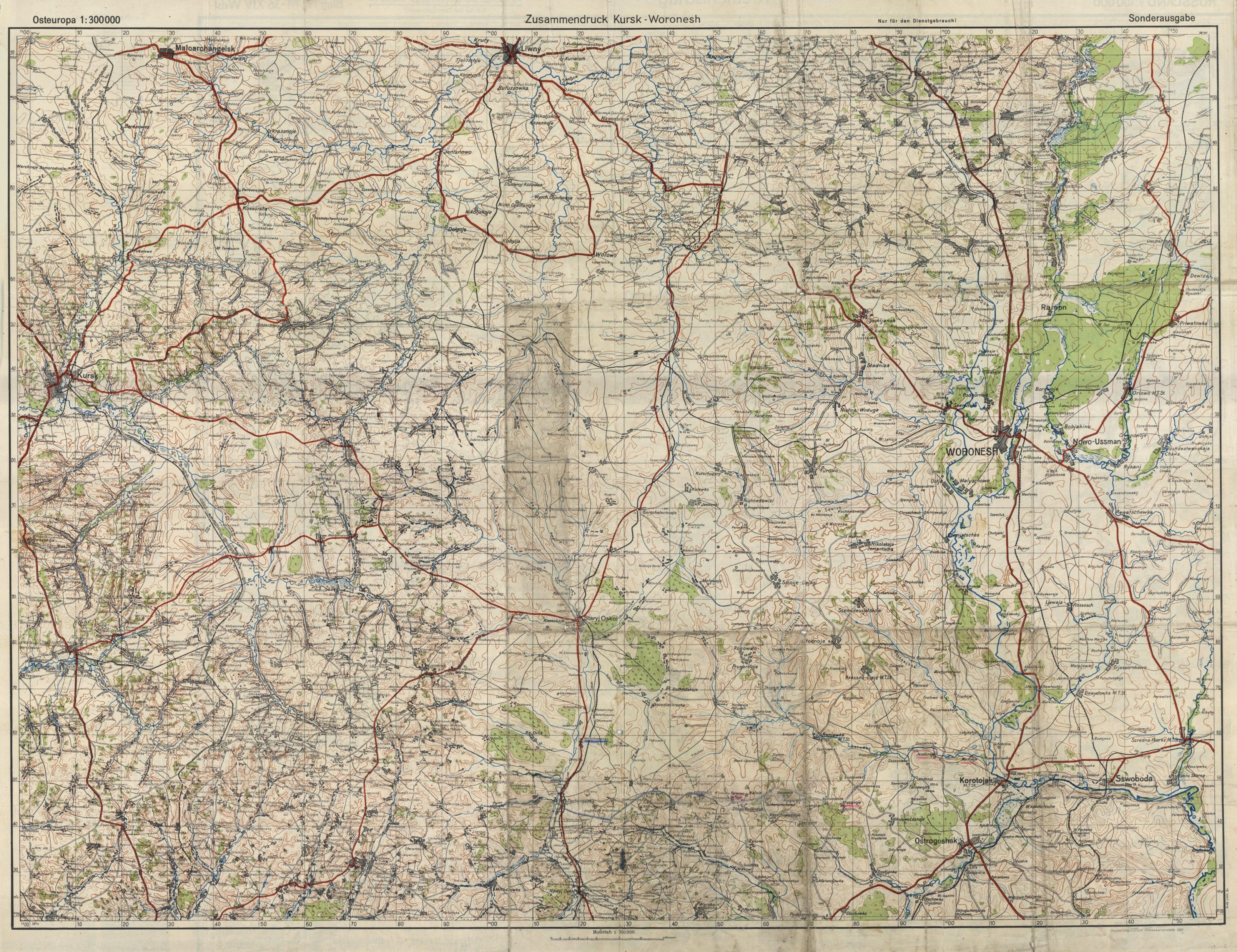
This map was printed, as it became usual, on the reverse of a piece of an earlier Soviet (or Ukrainian) map cut in pieces. The original map which in this way became a reverse, is a complete bilingual legend, but the legend of the full map printed on the reverse which in this way becomes a front side, is already in three languages. It is an excellent opportunity to acquire multilingual skills in the breaks between fighting. In the north-eastern corner of the map you can already see the sinister Don River.
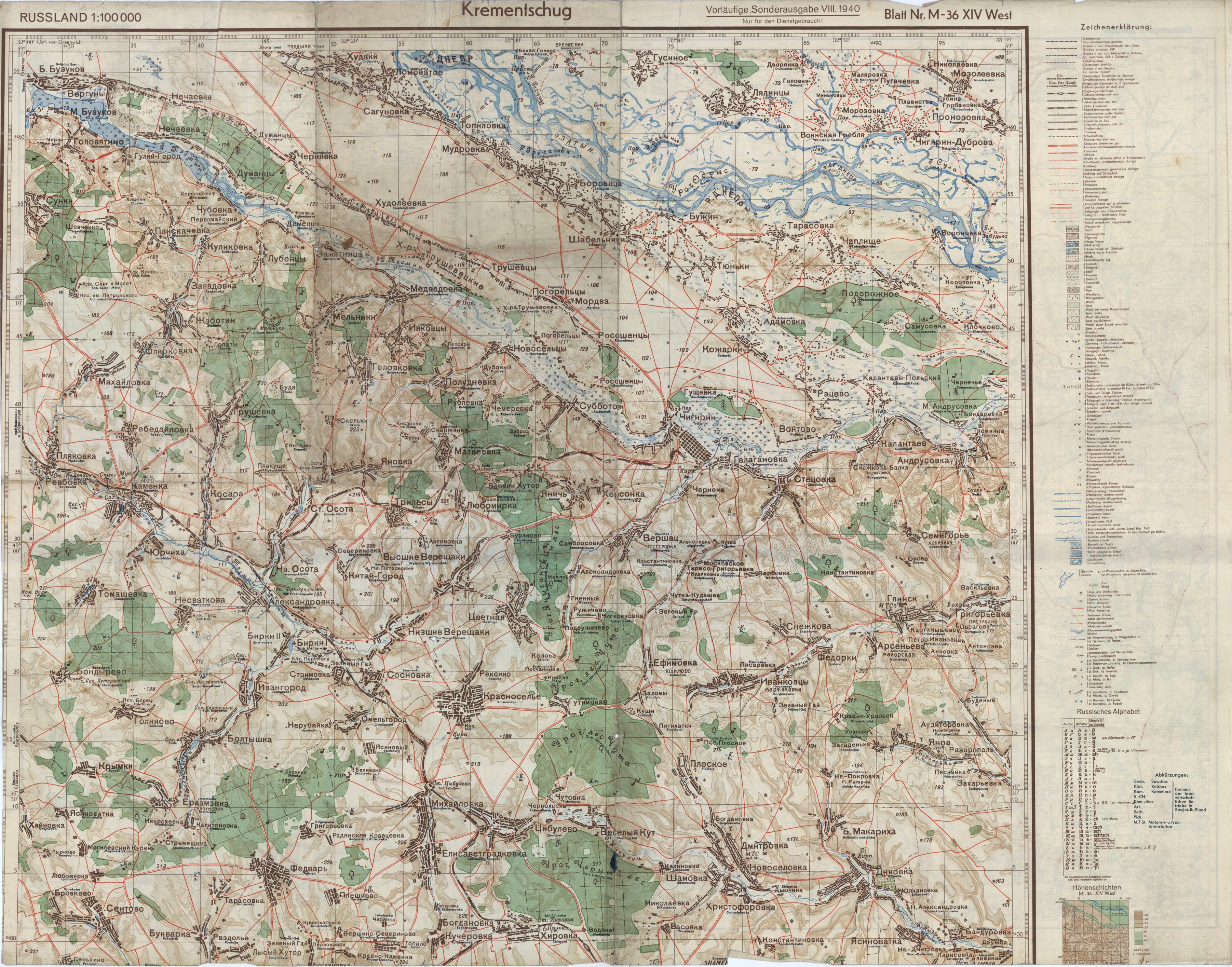
Forward in time and to the east in space: this is a map printed in an overview scale on the reverse of a “fast map” of Kremenchug. The original map became superfluous: the territory it represented was already firmly controlled. We find no alphabet and no bilingual legend. This is the future spot of the next victories of the Blitzkrieg. Details are not important here. This much is enough to wade to forge ahead through the flat hills to the east, to Moscow. On the western edge you can see Kursk, on the eastern one Voronezh.
That is, the empty reverses suitable for drawing Mothers of God are extremely rare.
After the war, most German military maps were smashed or cut in pieces. A good example for this is the following detail of a map which had been cut in small pieces together with its alphabet and phrasebook.
This is the blueprint of the map of Yugoslavia from a pocket atlas planned for after the end of the war. The original map thus has not been completely wasted.
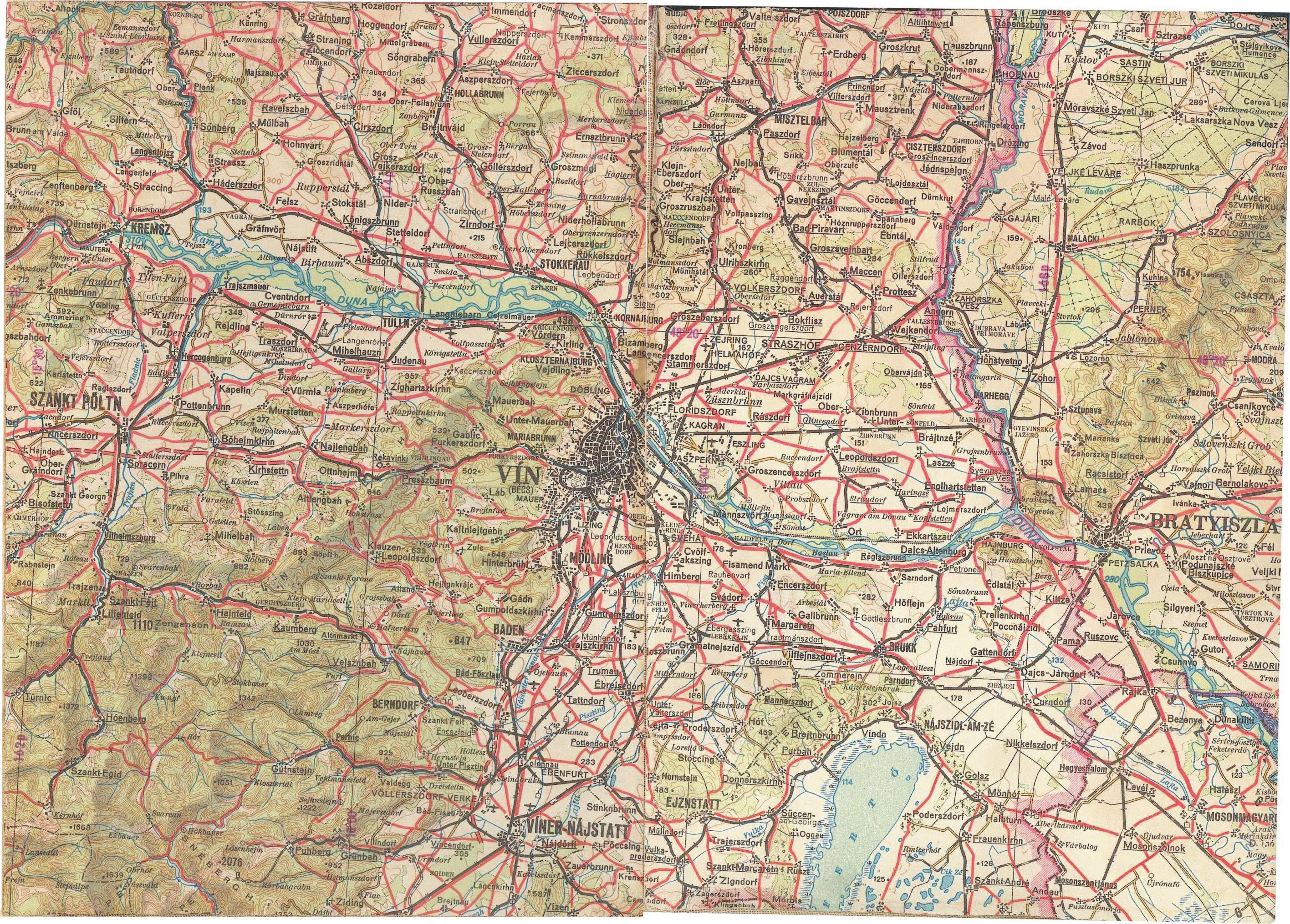
The turn of 180° in seeking new enemies, and the change of doctrines contributed to the perfection of the already well-established methods. Here you can see a detail of a map released by the Warsaw Pact, representing Hungary as well as Vín [Wien], Víner-Nájstatt [Wiener Neustadt] and Szankt-Pöltn.
Who knows whether nowadays they also prepare overprints in the backyards of military cartographers?


 Come with us to…
 Atlantis
 Bestiary
 Bohemia+Prague
 Books, exhibitions, music, film
 Caucasus
 Cemeteries
 Crimea
 Get to know the
 Images of the East
 Lightwriting
 Lwów/Lemberg
 Mallorca
 Message on the wall
 The Museum of Propaganda
 Odessa
 Persian letters
 The Jewish heritage


2 comentarios:
I used to have an WWII German topo of Moscow and environs, but it had a different feel. It retained an Soviet military topography header (Genshtab, late 1920s). The more recent additions such as new neighborhoods, highways, reservoirs and canals have been printed over in bright purple; a German text specified the year when these additions have been current (perhaps 1936)
I think you still get these sorts of maps, digitized, at many Runet locations.
The Hungarian transcriptions are interesting. Southern German does in fact have long consonants as transcribed, but it lacks any trace of [z]...
Publicar un comentario