
 How many children have played building empires, lying on the carpet, and moving their tin soldiers forward on the gardens of wool through the Garden of Eden to the land of Gog and Magog, along the rivers of blue silk, from the Nile to the Indus and from the Danube to the Oxus. Children’s travels, of the size of a room, where the desk and the armchair are the mountain ranges and where the parquet strip between the carpet and the bed teem with crocodiles, from which one can escape within a hair.
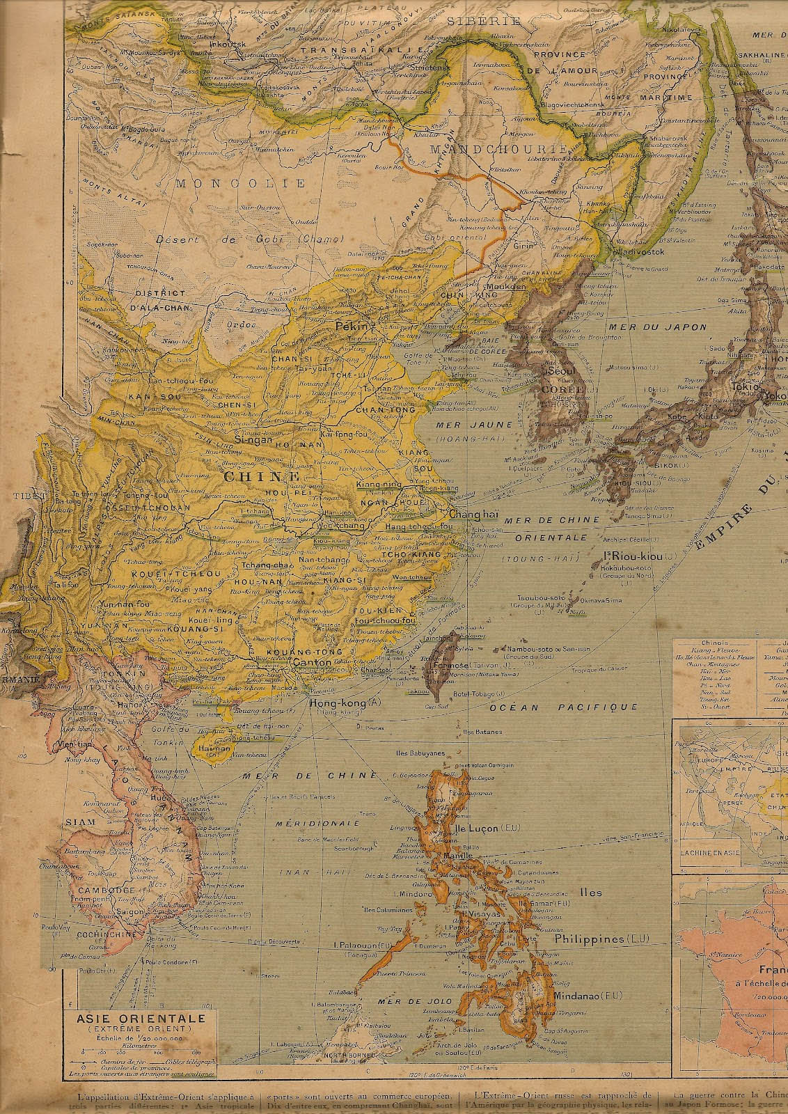 Atlas Vidal-Lablache, edition of 1914
 Jules Verne, Eight hundred leagues on the Amazon, illustrated by Léon Benett, 1881
How many clever children have dreamed above the atlas, sitting at the desk and dreaming about lands to explore, rivers to sail on, forests to explore and people to meet. Having read Jules Verne, they dreamed about descending on the Amazon or into the depths of the Earth, enchanted by the maze of the engravings or by the sweet colors of the pictures.
How many clever teenagers, while preparing for their exams, have been lost in the illustrations of their geography textbooks and have seen themselves climbing up to Tibet on the back of a yak, planting coffee in Ecuador, selling arms in Harare or take the Jesuit cassock in Xi’an.
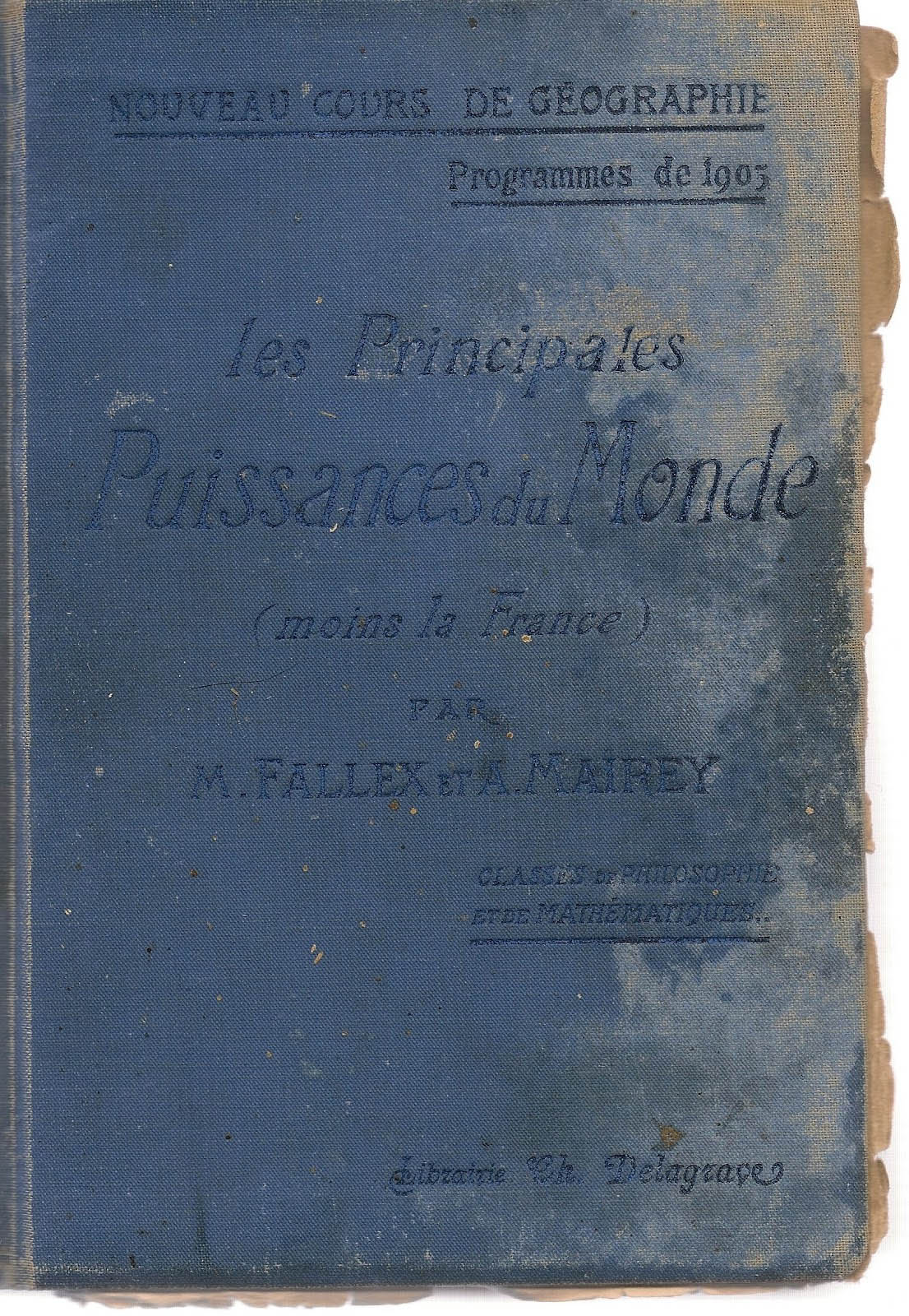
As he began his last school year in a high school in Paris in October 1912, my grandfather had no idea that he would be mobilized three years later and that the intimate geography of his last days would be limited to Verdun and environs.
At most, perhaps, he dreamed of seeking adventure somewhere between Beirut and Damascus, as he in fact did shortly later.
His geography textbook, “the great world powers” described Britain and its colonies, Belgium and Congo, the Netherlands and the Dutch East Indies, the German empire and its “expansionism”, the Austro-Hungarian empire, Italy, the United States, and finally, in a single chapter, China and Japan. A large-format textbook, full of information and commentaries – which prepared the way for future soldiers.
While the atlas and the illustrated travel books did so much to awake the curiosity to travel, this textbook with its gray images looks really distressing. My grandfather underlined almost nothing: just some broken lines in the chapter on Austria-Hungary under the two names of the same city, Lwów and Lemberg. That’s all. Is it the magic of the names, which, afer the pink, pale blue and green of the maps, invites to travel? Lwów and Lemberg, Tomsk, Irkutsk, Arizona, Tashkent et Mandalay, Buenos Ayres, Kyoto et Nagoya, Zangskar, Padang, Calcutta, or this “Evamkoyo, along 3° of the Northern latitude”, not that far (everything is relative) from where Stanley had found Livingstone.
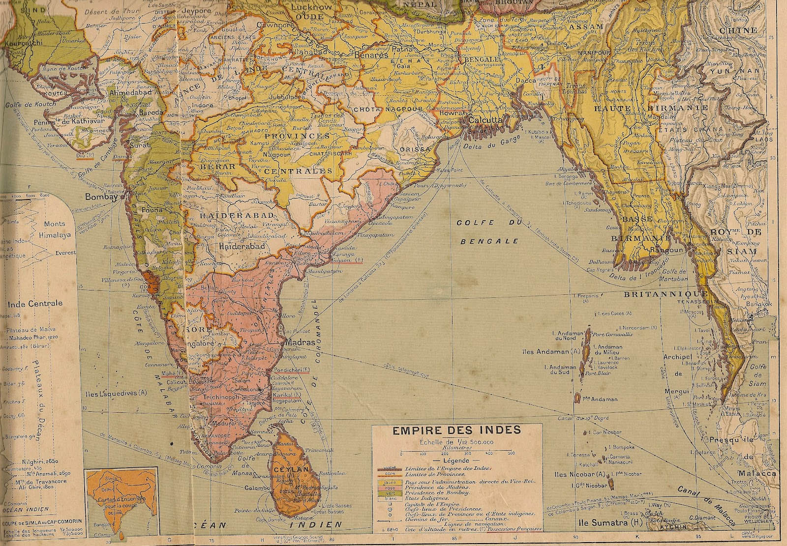 Atlas Vidal-Lablache, edition 1914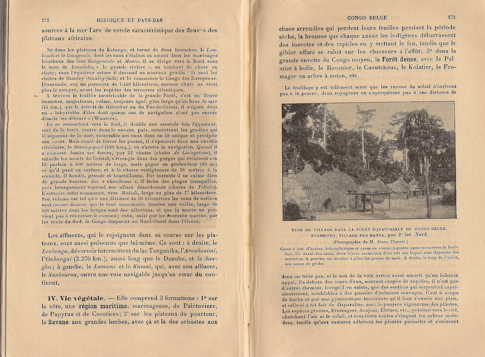
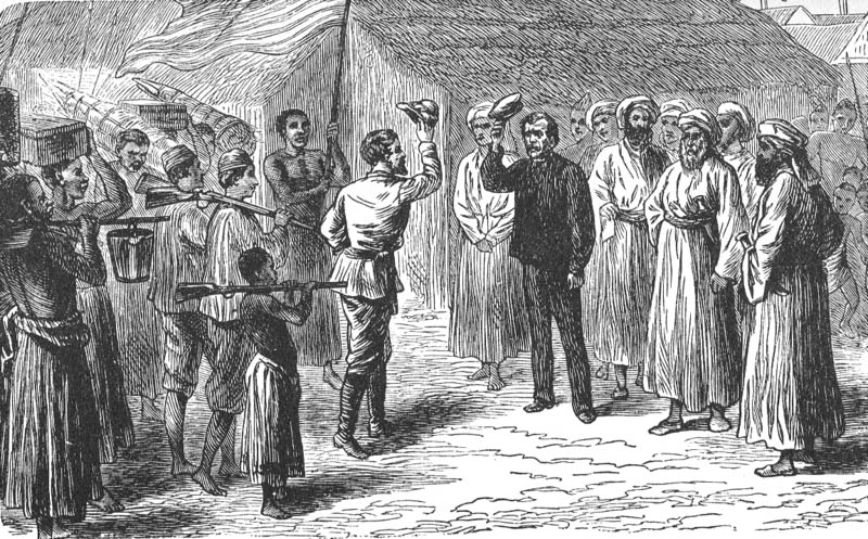 Dr. Livingstone, I presume
The photos from Europe show mostly factories – nothing that really makes you want to go. In contrast, the new countries of the Americas, the colonies of Africa, and especially Asia are represented by the most varied landscapes, cities, ports and railways, exotic means of transportation, men and women at work.
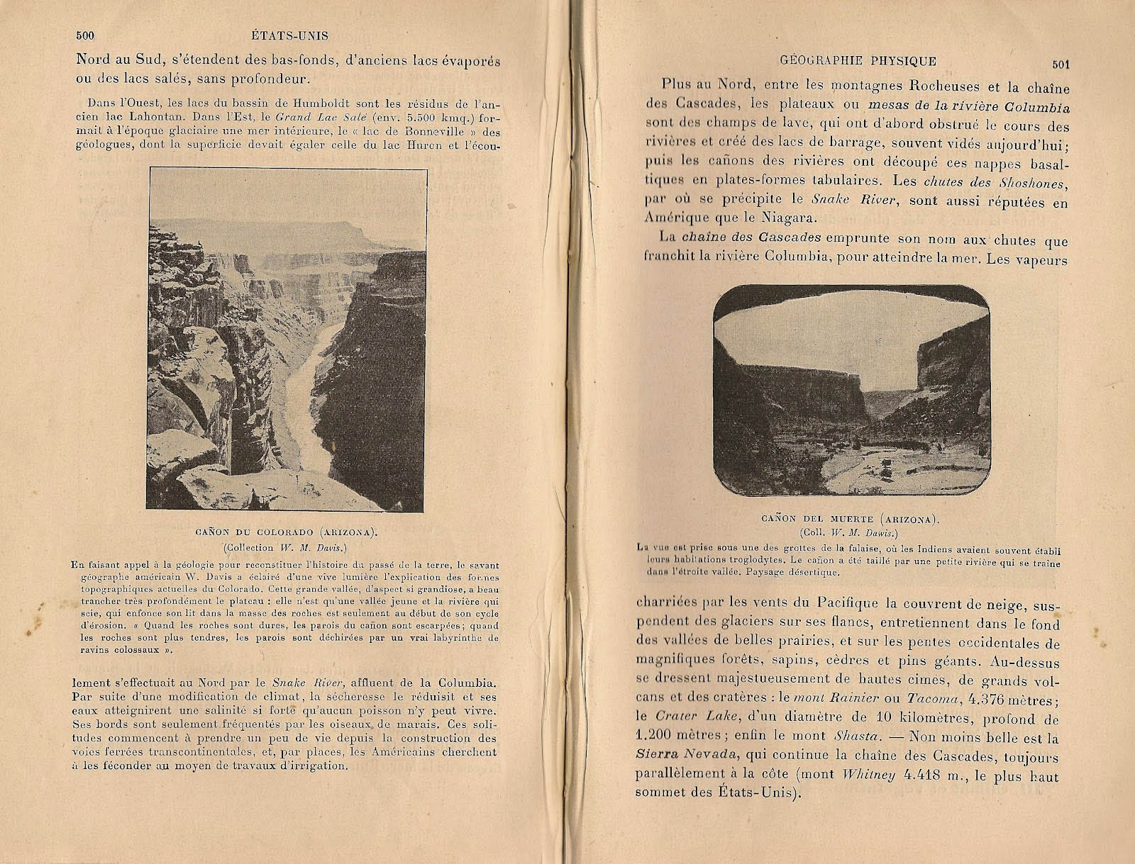
However, it is the captions, more than the pictures, which offer an oasis for the eye wandering in the desert of the text, an occasion for dreaming and a foretaste of the adventures to come. There is the Grand Cañon of Colorado: “this great valley, of a magnificent view, deeply cut into the plateau: it is a young valley, and the river, sawing its bed into the mass of rocks, is only at the beginning of its cycle of erosion”, while, obviously, nothing in the text or in the photo hints to the extraordinary play of colors on the rocks. Or the Cañon del Muerto, seen from “one of the caves of the cliff, where the Indians often established their troglodytic homes” – the Anasazi Indians and their labyrinthine towns clinging to the vertical of the rocks, their petroglyphs, their exodus and mysterious disappearance in the fourteenth century, an entire civilization, of which the photo does not reveal but the absence, and whose history will remain unknown to any schoolboy. Curiously, the comment refers to a “desert landscape”, while the photo, in the crudeness of its contrasts, seems to recall a vivid environment.
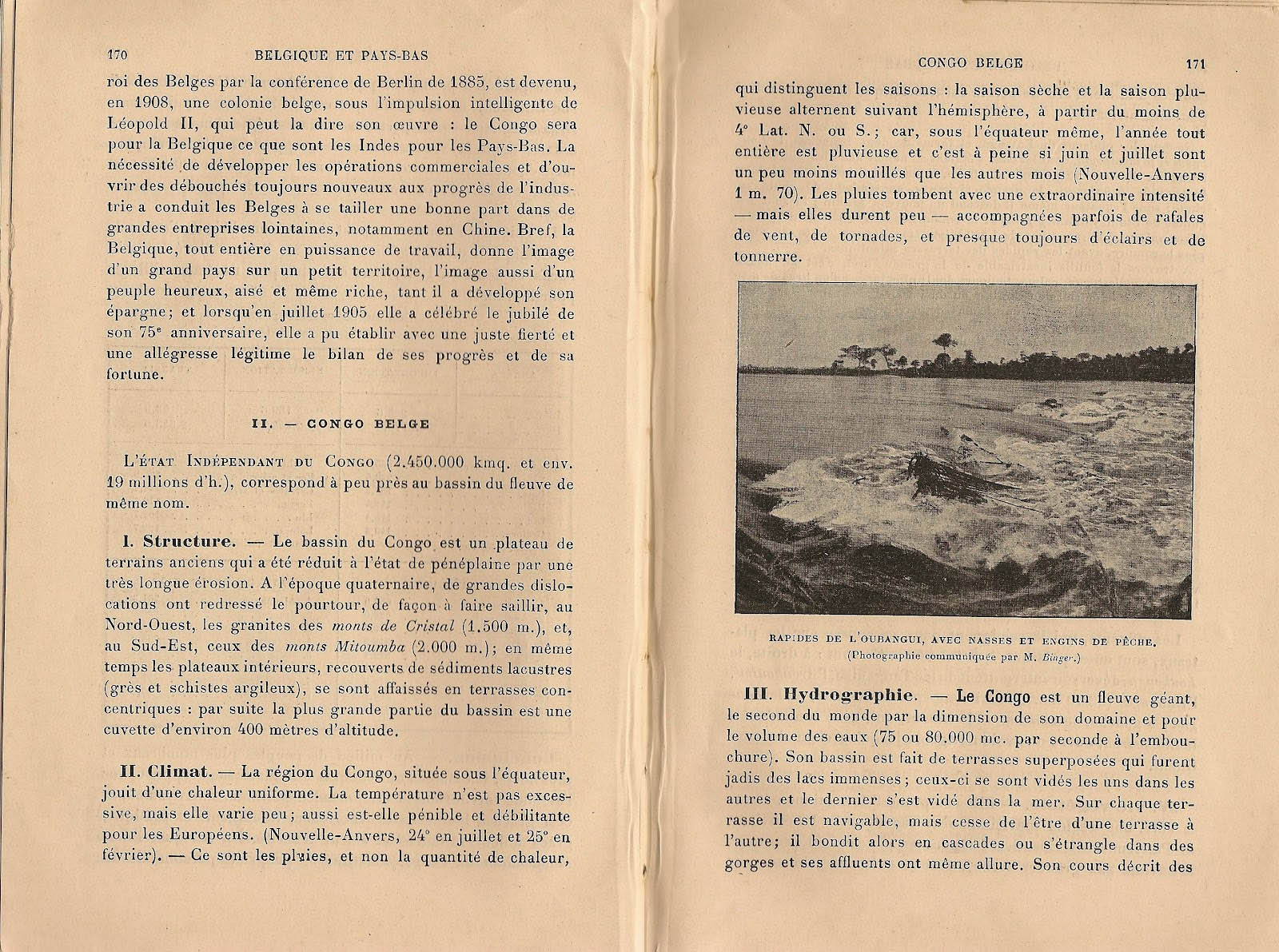
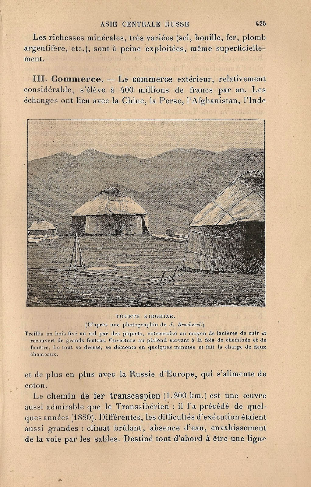
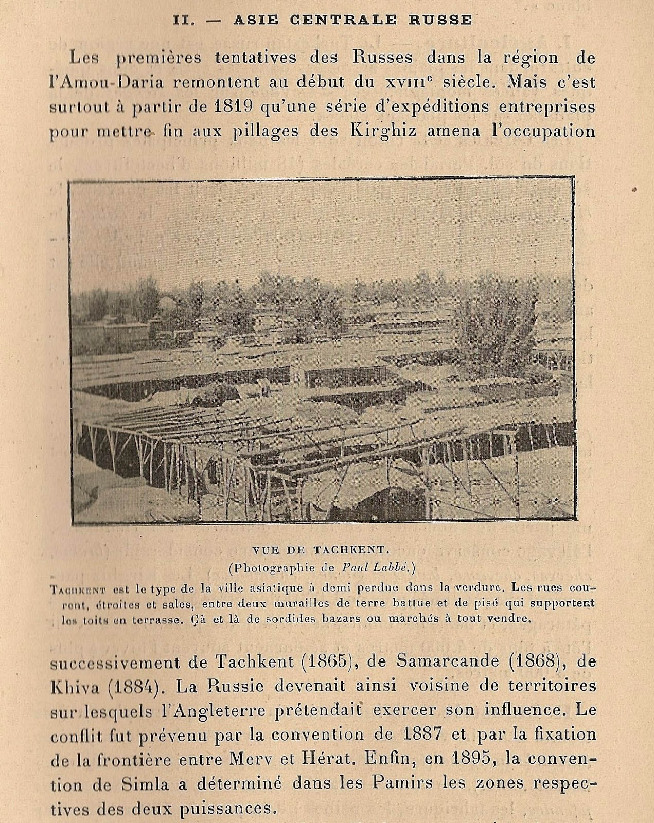
Several other images show from the non-European world only uninviting and desert areas, like the “waterfalls of Oubangui, with the nets and fishing gears”, but without any fishermen before a horizon lined by a few isolated trees which hardly evoke the equatorial rainforest. The Kyrgyz yurtas, gray bubbles before the background of barren mountains, which “are set up in a few minutes, and are borne by two camels”. On Tashkent, nothing but a depressing view on the roofs of earth, “half lost in the countryside” and barely identifiable in the greyness of the page; a town where “the narrow and dirty streets run between walls of dirt and mud”. The only concession to the imagination are “some sordid bazaars or markets here and there, where they sell everything”, and where only a French high school boy, devouring travelogues, is able to see the carpet piles and slaves, the Hungarian dervishes, the bags, weapons and silks, spices and donkeys at the foot of mausoleums and madrasas.
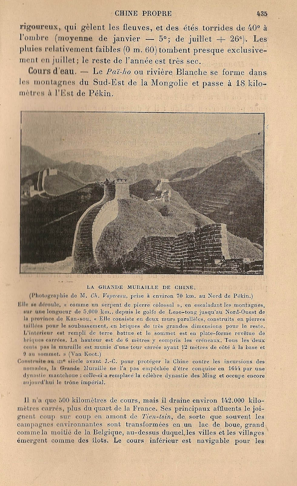
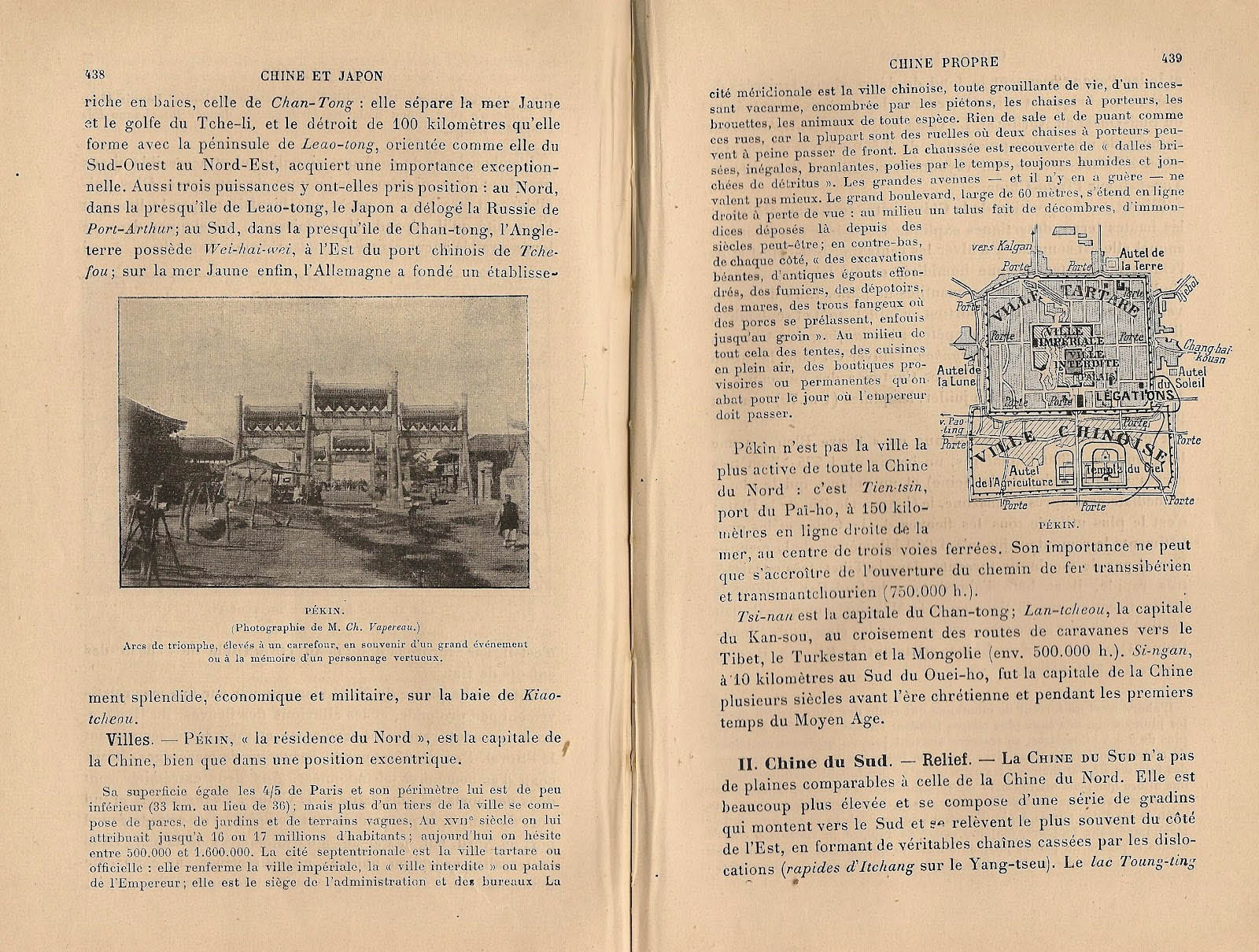
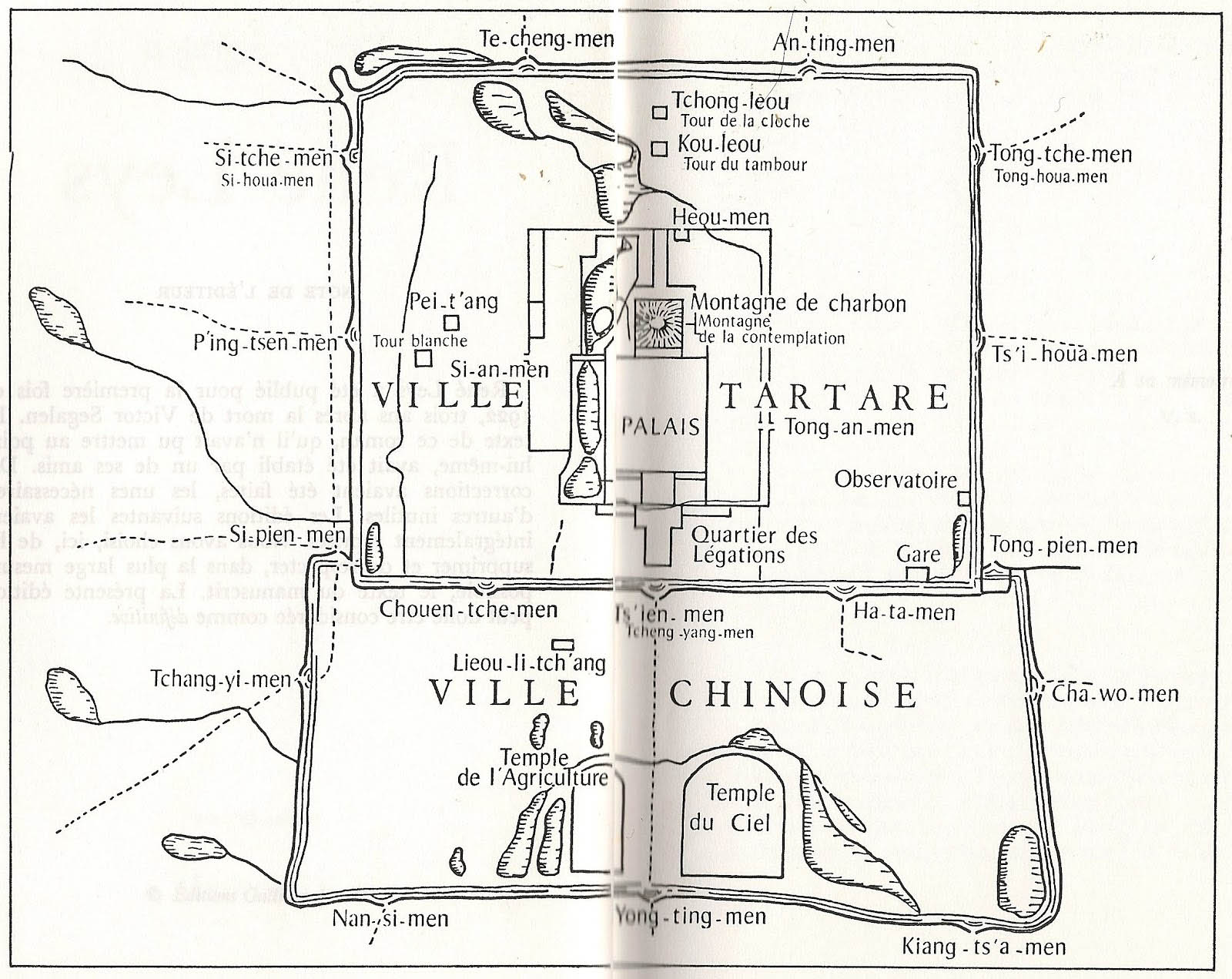
The book also shows the most emblematic buildings of the non-European world, obligatory passages of any description of Asia. For, behold, here appears the Orient: the Great Wall of China, “built in the third century BC to protect China against nomadic incursions, which, however, did not prevent her from being conquered in 1644 by the Manchus: they replaced the famous Ming Dynasty and still hold the imperial throne.”. The textbook is printed around 1907-1908. But in October 1912 nobody holds the imperial throne any more: the last emperor, Puyi abdicated on 12 February of the same year, at the age of six. The book also shows a photo and a map of the Forbidden City – the same map which is also included at the beginning of René Leys, the Chinese novel by Victor Segalen, written between 1913 and 1914, whose protagonist, the polyglot Belgian teenager René Leys, dreams to be a member of the Chinese secret police, an aristocrat and a mandarin, a lover of the Empress, before he finally finds his way into the palace and is overcome by the weight of his imagination. But in the subsequent years no schoolboy will be able to read René Leys in a ceasefire on the front between the Somme and Argonne, because it will be published only in 1922. Their dreams about China will be only fed by these small, depopulated images – unless they had come across the photographs taken by travelers, adventurers and missionaries who, similarly to René Leys, lived in the intimacy of the mandarins.
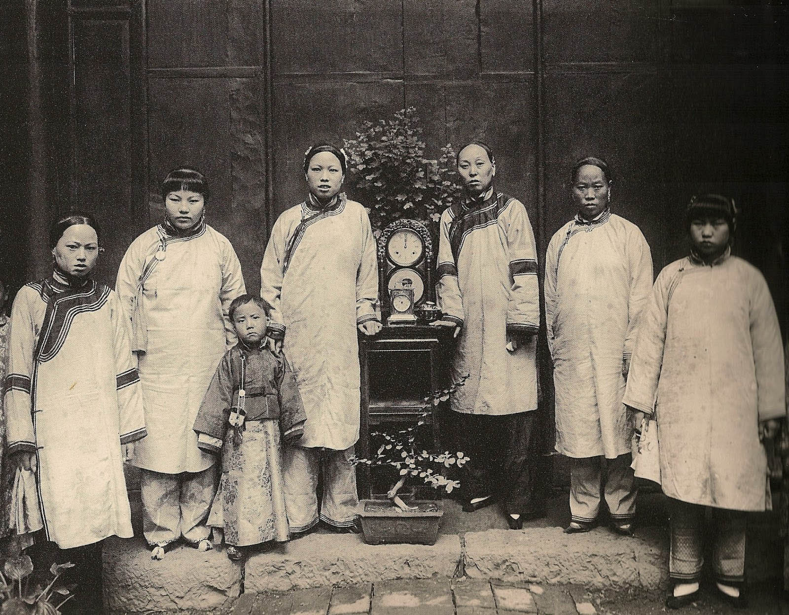 Wives and concubines of an imperial official in Hanzhong. Photography by Leone Nani, ca. 1908
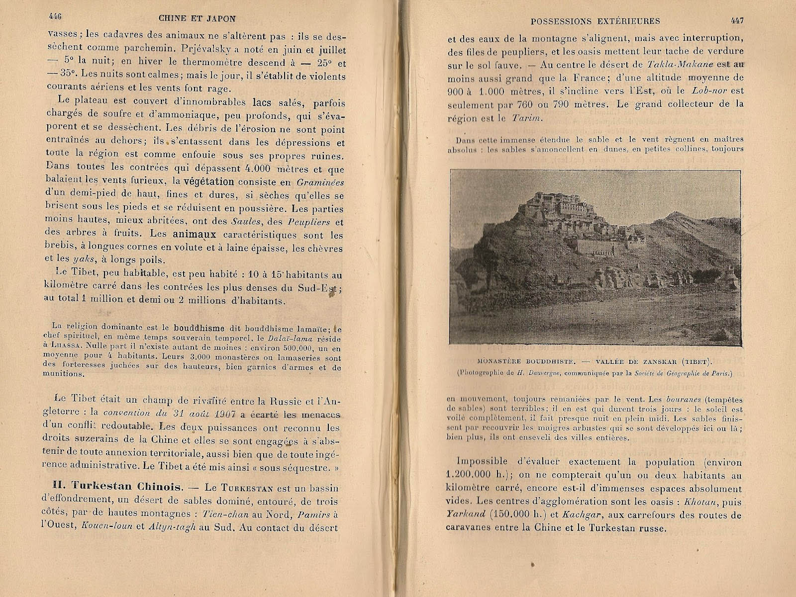
A Tibetan monastery in the valley of Zangskar, in “this vast expanse, where the sand and the winds are the supreme rulers”, and where the hills “are always in motion” under the drive of the bouranes (sandstorms) which create “almost night at noonday”. What regions of the world of then carried more mystery than Tibet or Chinese Turkestan? Sven Hedin traveled there fifteen years earlier; Aurel Stein arrived there for the first time in 1900, and exactly in 1912 he published his Ruins of Desert Cathay: Personal Narrative of Explorations in Central Asia and Westernmost China; Paul Pelliot reached it by train via Moscow, Tashkent and Andijan in 1906, returning through Dunhuang to Paris in 1909.
A Siberian city, Tomsk, with broadwalks, and, a few pages away, the castle of Nagoyaä in Japan, where “before the revolution of 1868 every prince or daïmio had his castle or castles, while the fortress (sirô) in the capital city of the province was almost a city in the city. There resided the prince with his suite, the Kerai (vassals), the Samouraï (armed men) and all his household.”


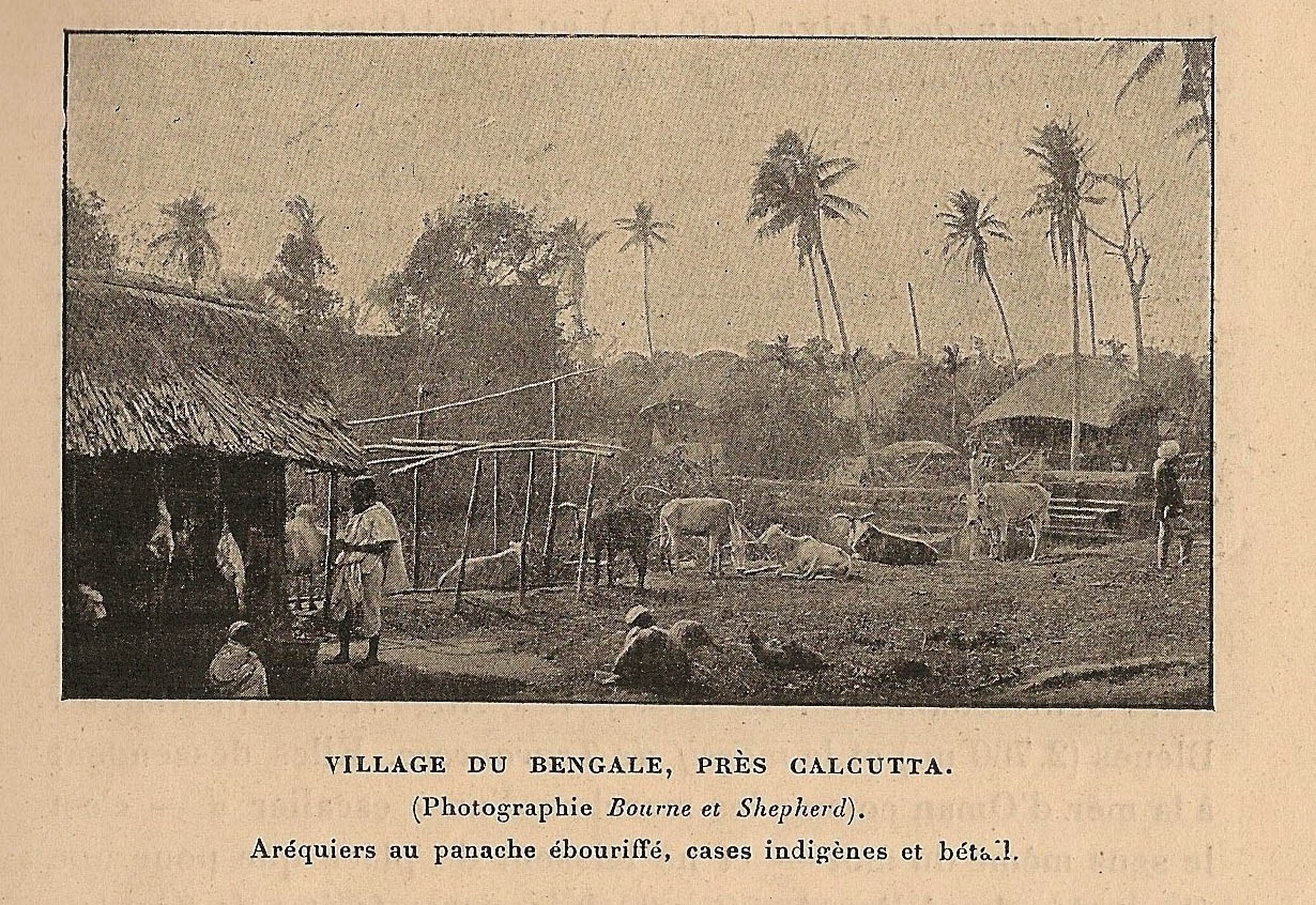
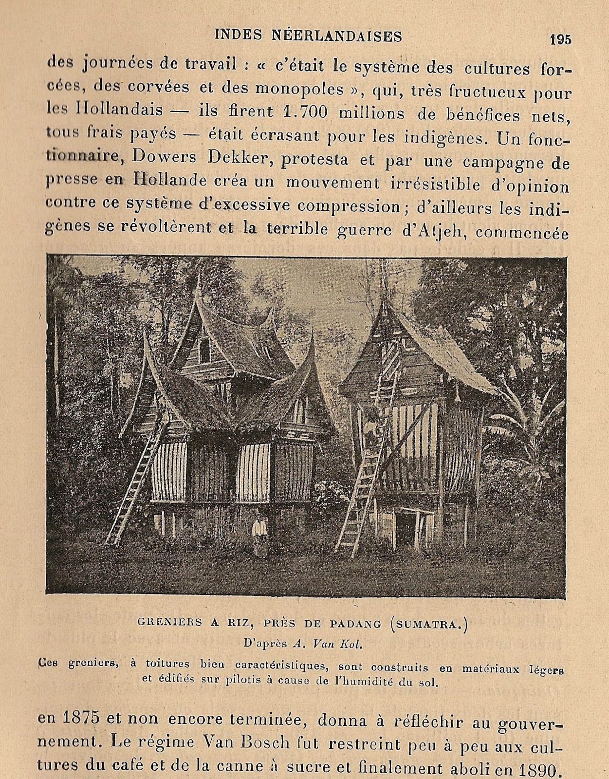
There are also the villages of Bengal and the rice granaries in Sumatra, an idyllic picture inserted in the story of a revolt of the natives against the Dutch oppression (commented with indignation by the French geographer).
And there are so many exotic means of transport! Imagine to be at the train station of Tulun in the province of Irkutsk along the Trans-Siberian Railway, “the fastest route from Europe to the Far East” despite its low speed of 37 km/h “for luxury trains to the west of the Baikal, which drops to 20 in Manchuria” – but is it that much faster now, after all? Elsewhere, an ox cart in Ceylon, a tiny figure under the banyan trees, a “Great Russian sled”, a sedan chair in Japan, an elegant Burmese carriage towed by zebus.
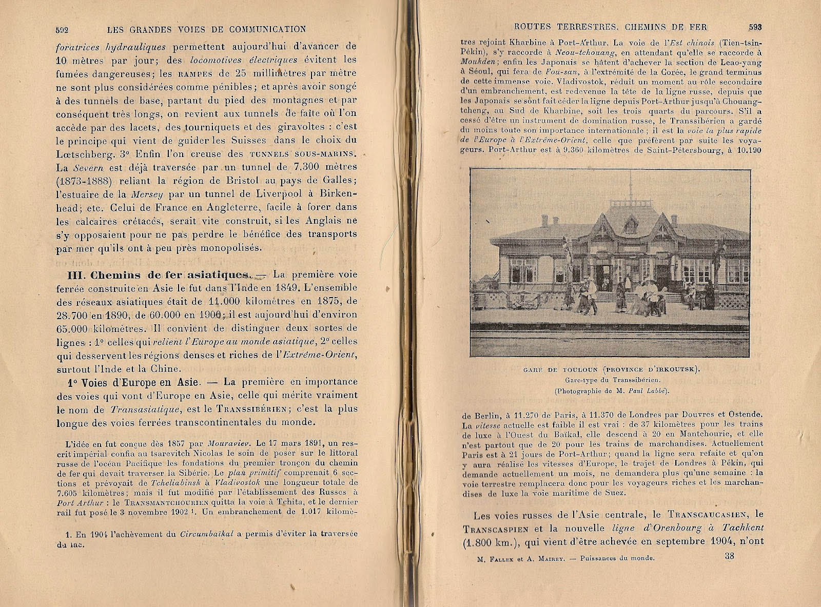
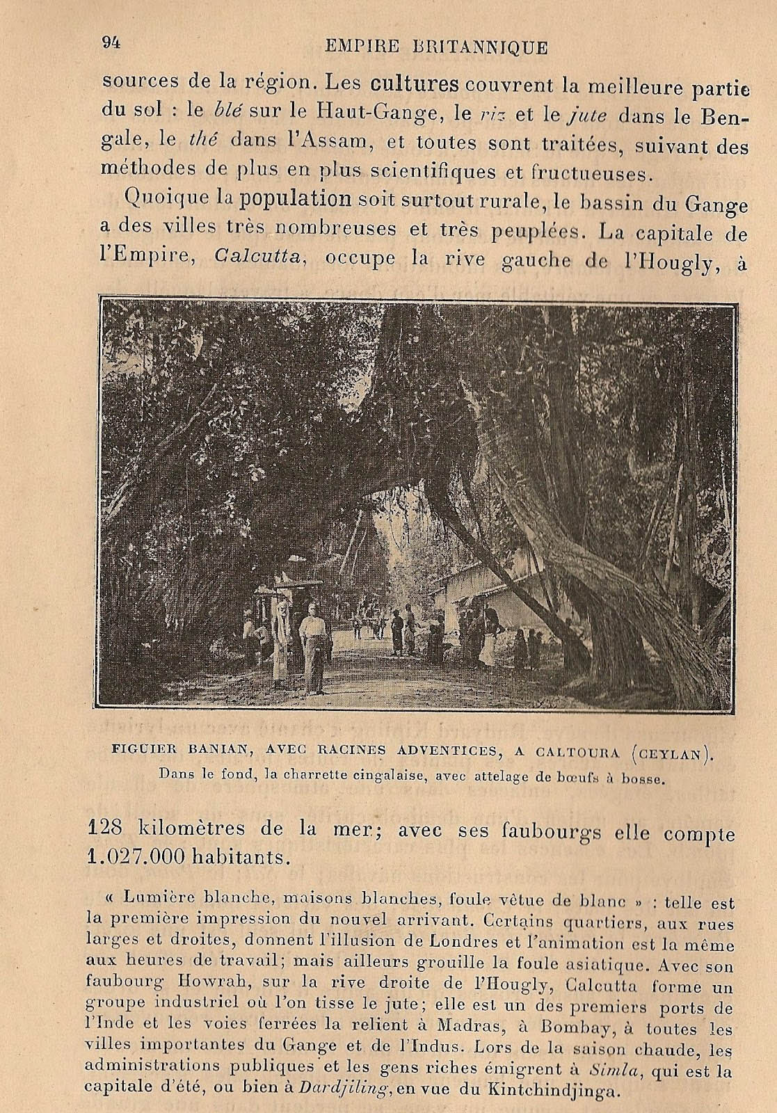

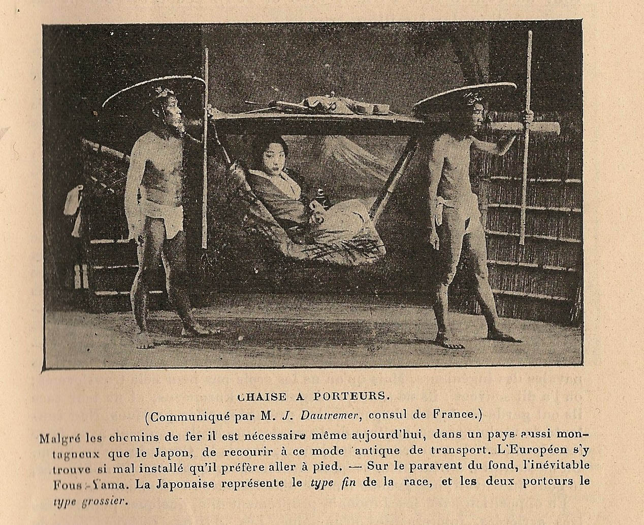
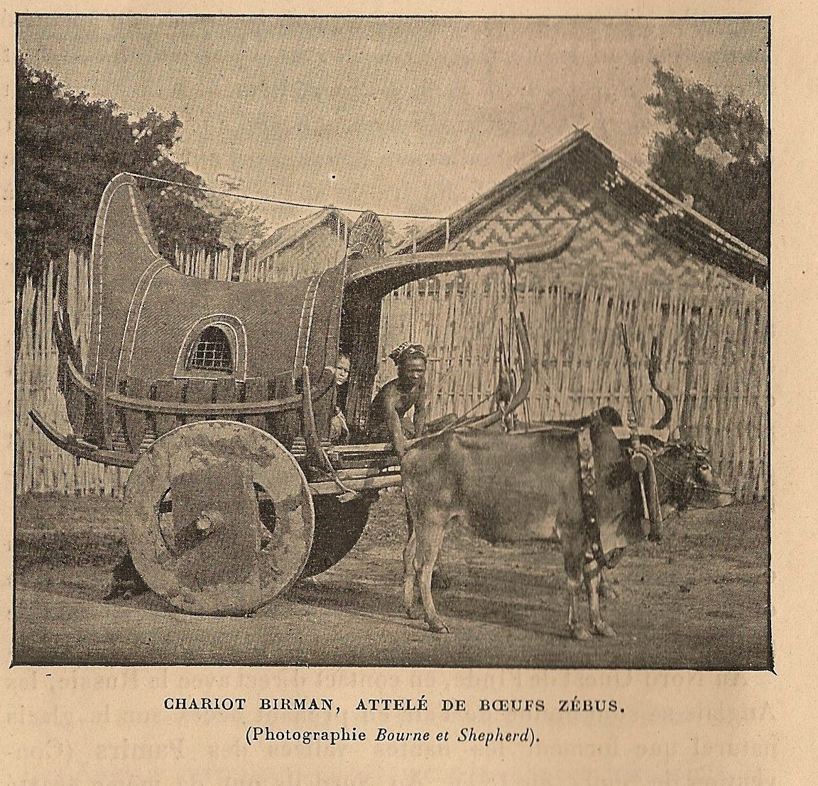
Ah, to be on the road, and meet yaks and zebus…
In those distant countries they pursue some unusual activities: they dry fish in the Sakhalin Islands, and mark the cattle in the pampas. Even more mysterious are the “shamanistic” Siberians sacrificing a sheep. But where are the shamans among these men without drums or bells, watching the photographer by raising their glasses?
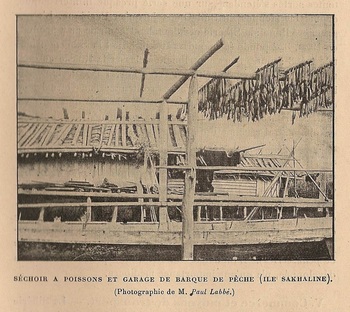
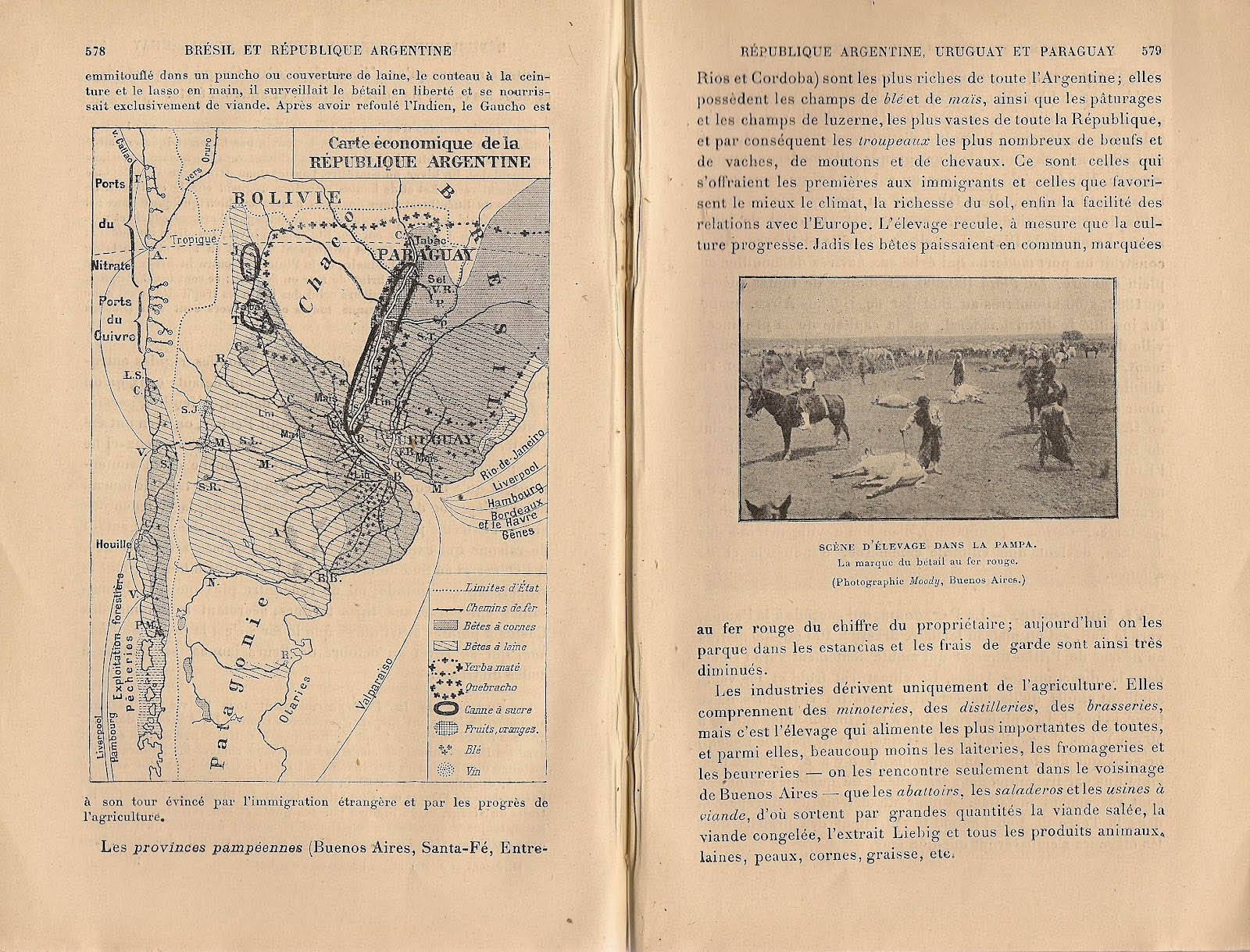
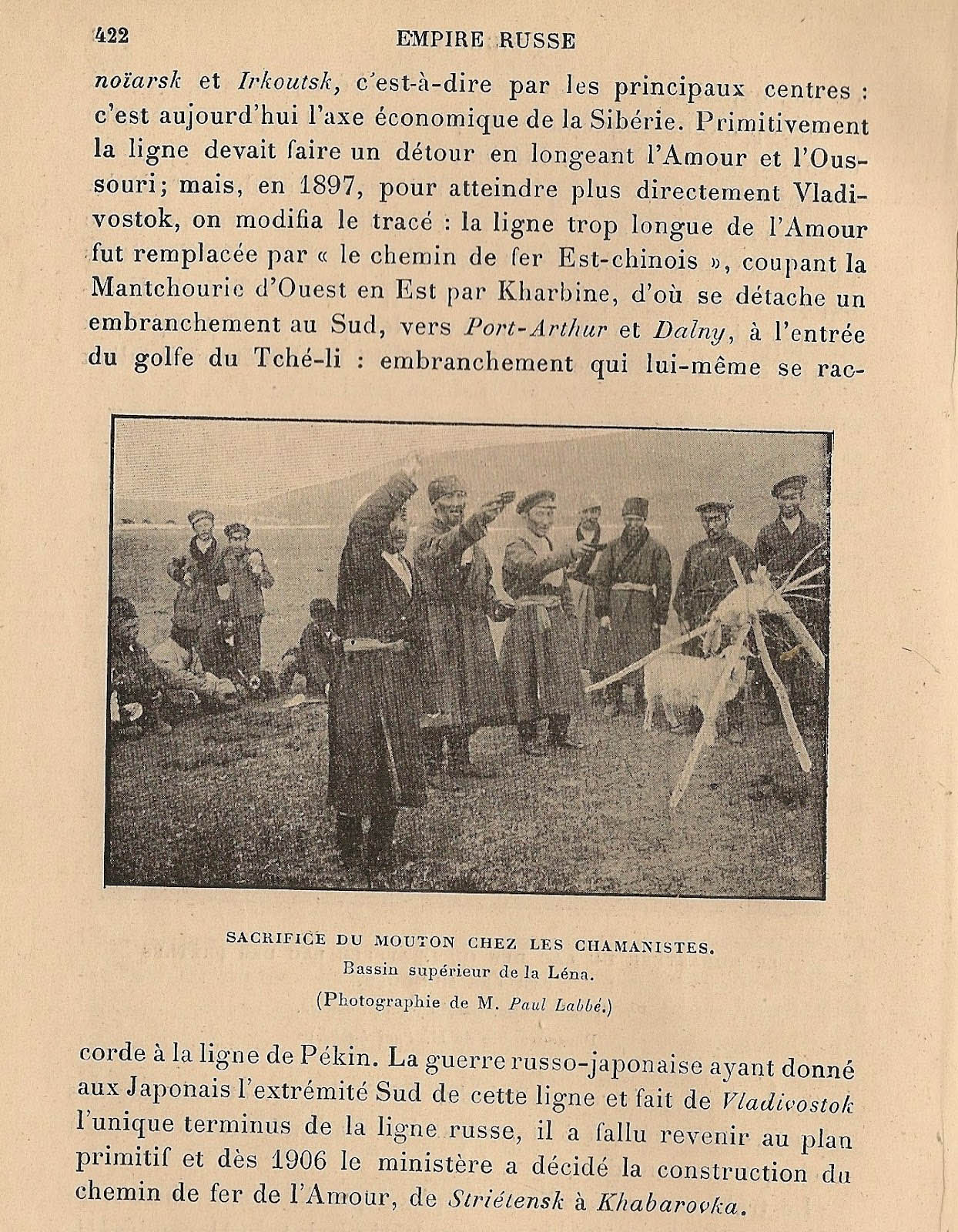
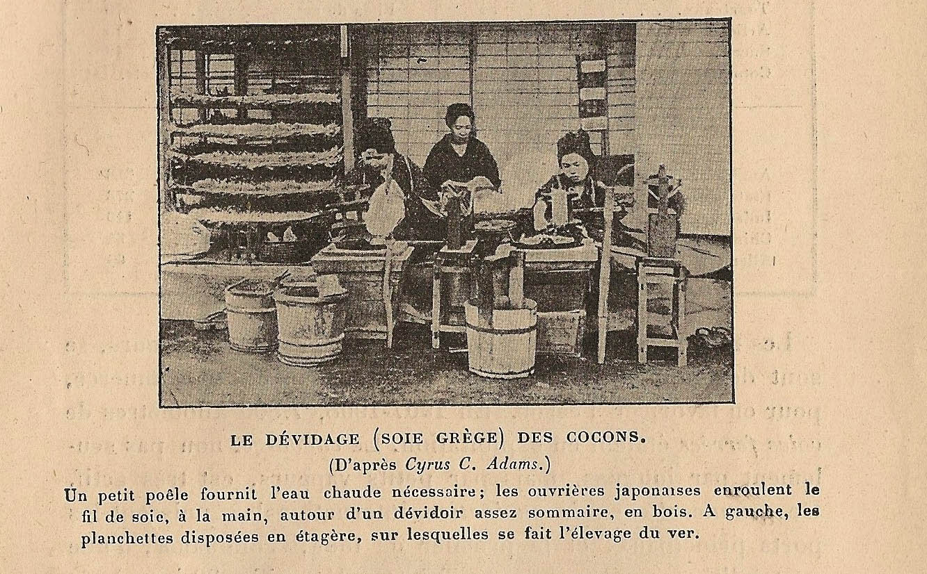
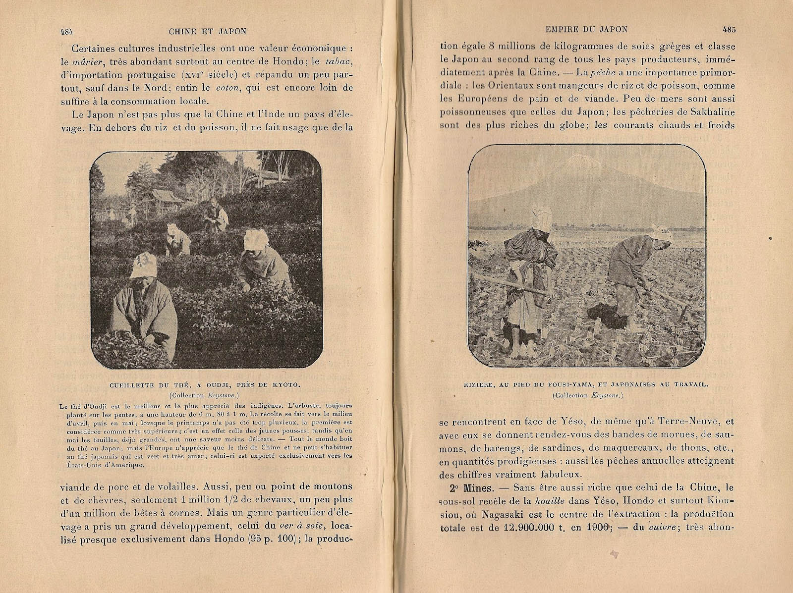
So few faces throughout this book – a Russian, a Burmese carter, and, strangely, a series of Japanese. While the text emphasizes the rapid modernization of Japan, who won Russia in 1905 and are masters of Manchuria, the photos do not reveal anything about the industrialization of the country and only show some traditional activities reserved for women, such as peasant women picking tea leaves – “the tea of Oudji is the best and the most popular among the indigenous people” –, or unwinding cocoons of silkworms. And a “fine type” Japanese woman, with her carriers of “a coarse type” – thus, a woman who does not work, lying in her sedan chair, and two men who work, because they are of an inferior type, and go almost naked: they are the indigenous tea drinkers. We do not know anything about them who converted Japan into a modern nation. Let us add that the only women shown in this book are all Japanese, in harmony with the most conventional exoticism of the early twentieth century, from Pierre Loti to Messager or Puccini. Or La famille Fenouillard, another kind of book for young people…
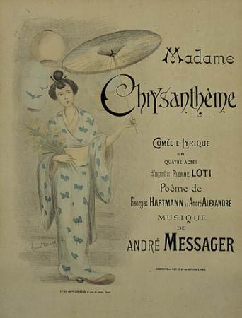
 La Famille Fenouillard, Christophe, 1895
Traveling… “One day, I will also set out!”, sighs the schoolboy, full of enthusiasm.
At the beginning of the school year, on the first of October, 1912, the first cranes already set out to the south. They left a few weeks earlier from Sweden, regrouped in the island of Rügen, and soon they will be in Spain, and later in Morocco. Today they fly above Verdun.


 Combien d’enfants ont joué à se constituer des empires, allongés sur le tapis, déplaçant leurs soldats de plomb sur les jardins de laine depuis le jardin d’Eden jusqu’à Gog et Magog, sur les fleuves de soie bleue, de l’Indus au Nil et du Danube à l’Oxus. Des voyages d’enfants à la dimension d’une chambre où bureau et fauteuil figurent des montagnes, où la bande de parquet entre le tapis et le lit grouille de crocodiles auxquels on n’échappe que de justesse.


 Come with us to…
 Atlantis
 Bestiary
 Bohemia+Prague
 Books, exhibitions, music, film
 Brave old world
 Caucasus
 Cemeteries
 Crimea
 Get to know the
 Images of the East
 Lightwriting
 Lwów/Lemberg
 Mallorca
 Message on the wall
 The Museum of Propaganda
 Odessa
 Paper Museum
 Persian letters
 The Jewish heritage


